8 Oregon Low Elevation Hikes
winter hikes that are under 3,000 feet elevation
Winters in Oregon can vary wildly in weather and snow conditions from year to year. A few years ago the winters (2013-2014 & 2014-2015) were extremely mild and we were still able to hike right around 5,000 ft. elevation even during the coldest months of December, January and February. Other years winter can start early and can provide so much snow that you can barely hike at 2,300 ft. elevation without hitting snow.
See below 10 hikes that are below 3,000 ft. elevation that make for some great winter hiking options.
See below 10 hikes that are below 3,000 ft. elevation that make for some great winter hiking options.
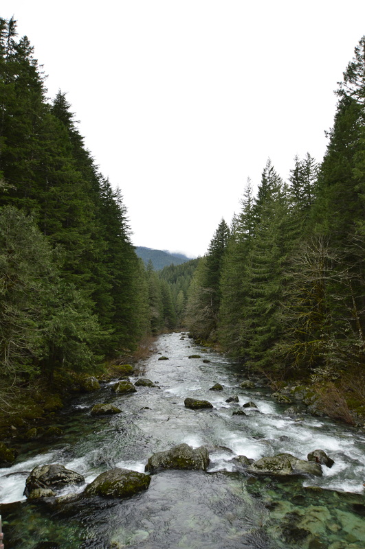
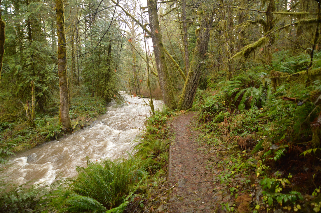
1) Little North Santiam
|
Closest town: Mehama and Lyons
Trail type: Out and back Mileage: 9 miles w/ 2,260 ft. elevation gain Terrain difficulty: Moderate Trail usage in winter: Light on week days, moderate on weekends Highest point of the hike: 1,750 ft. About the hike: This 9 mile hike is absolutely lovely to do in the winter because you won't have to deal with the throngs of people who visit this area in the summer time. The turquoise color of the Little North Santiam River is quite amazing, and the frequently overcast Oregon winter skies make for great pictures! Click here for more information and directions |
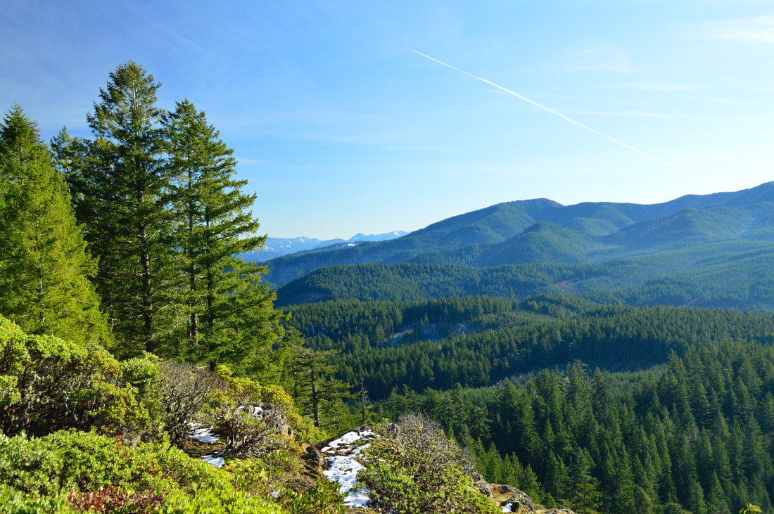
2) Eagle's Rest
|
Closest town: Dexter/Lowell
Trail type: Out and back Mileage: 4.2 miles w/ 1,550 ft. elevation gain Terrain difficulty: Moderate Trail usage in winter: Light Highest point of the hike: 3,040 ft. (it's just a little bit over 3,000 ft. but because the top is exposed to the sun the majority of the day, you will not find a lot of snow there). |
About the hike: This easy hike is very close to Eugene, making it the perfect half day trip out of the Valley. The trail leads you through a beautiful forest, switch backing up to a bare summit where you can see many foothills and the valley below. On a sunny day, it tends to get nice and warm at the summit.
(Click here to read more about this hike and to get directions- this post is for members only, you can purchase the seasonal membership for $9.99)
(Click here to read more about this hike and to get directions- this post is for members only, you can purchase the seasonal membership for $9.99)
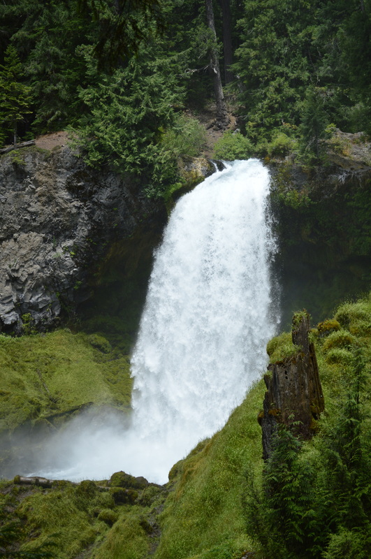
3) Sahalie & Koosah Falls loop
|
Closest town: McKenzie Bridge
Trail type: Loop Mileage: 2.8 miles w/ 455 ft. elevation gain Terrain difficulty: Easy Trail usage in winter: Light on week days, moderate on weekends Highest point of the hike: 3,000 ft. About the hike: Waterfall hikes are always perfect to do in the winter time. This 2.8 mile loop is short and sweet, perfect for the shorter days during this time of year. Both of these waterfalls are quite impressive and a must-see for everyone! This is the perfect hike if you are bringing younger children. It is also great to do on rainy days because you will get some epic waterfall views but don't have to stay out in the rain for too long. (Click here for more information and directions) |
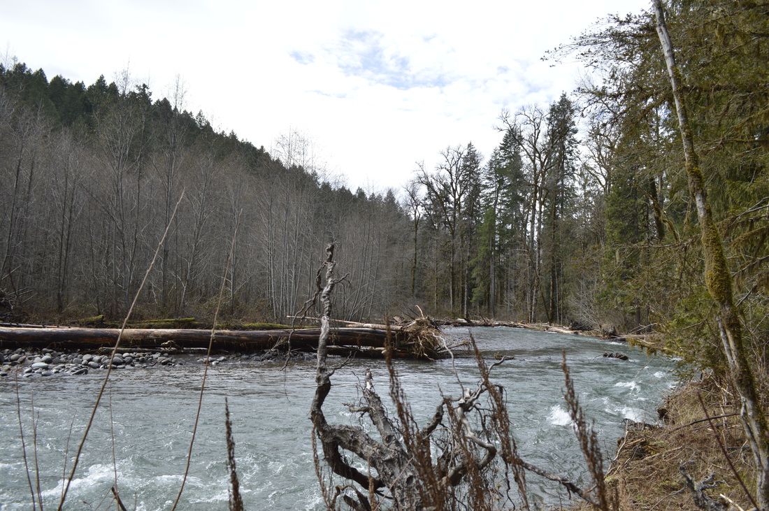
4) Salmon Creek North
|
Closest town: Oakridge Trail type: Out and back Mileage: 7.5 miles w/ 1,190 ft. elevation gain Terrain difficulty: Easy Trail usage in winter: Light Highest point of the hike: 1,475 ft. |
About the hike: This 7.5 mile hike is easy and perfect for folks who don't want the trail to undulate too much. There is almost no elevation change on this hike, and you really just get to enjoy the tranquility of Salmon Creek gurgling (sometimes roaring) next to you.
(Click here for more information and directions)
(Click here for more information and directions)
5) Kentucky Falls

|
Closest town: Mapleton
Trail type: Out and back Mileage: 4.4 miles w/ 800 ft. elevation gain Terrain difficulty: Moderate Trail usage in winter: Light on week days, moderate on weekends Highest point of the hike: 1,550 ft. About the hike: This hike is a hidden gem that is located in the heart of the Coast Range. The trail passes by 3 beautiful waterfalls and you can make the hike longer than 4.4 miles by continuing on the trail past Lower Kentucky Falls. A new bridge was put in recently to make this a 16 mile round trip trail, which would be great for a short winter backpacking trip. (Click here for more information and directions) |
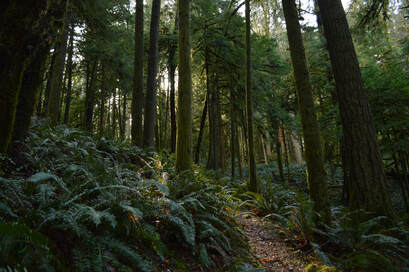
6) Shotgun Creek
|
Closest town: Springfield Trail type: Loop Mileage: 4.7 miles w/ 1,148 ft. elevation gain Terrain difficulty: Easy Trail usage in winter: Light Highest point of the hike: 1,375 ft. |
About the hike: This awesome loop is located in a popular recreation area near Eugene, however in the winter there is hardly anyone there, and the trails are just as beautiful. This trail will take you through a forest with some old growth trees, and down along Shotgun Creek. Here you will see mushrooms, salamanders and many different kinds of trees.
(Click here for more information and directions)
(Click here for more information and directions)
7) South Willamette Trail
|
Closest town: Dexter/Lowell Trail type: Out and back Mileage: 10.6 miles w/ 1,050 ft. elevation gain Terrain difficulty: Easy Trail usage in winter: Light Highest point of the hike: 1,440 ft. |
About the hike: This is one of the pretties low elevation hikes, and you won't believe how close it is to town! Because this trail mostly gets used as a connector trail for mountain bikers, it often gets overlooks as a very beautiful hiking trail that doesn't have a lot of elevation gain. The forest here has large trees and dense fern undergrowth, and there are many little creeks.
(Click here to read more about this hike and to get directions- this post is for members only, you can purchase the seasonal membership for $9.99)
(Click here to read more about this hike and to get directions- this post is for members only, you can purchase the seasonal membership for $9.99)
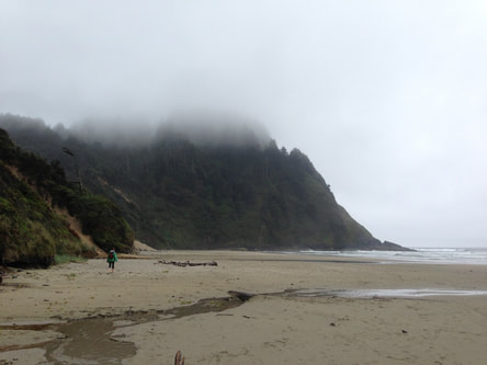
8) Hobbit Beach to Heceta Head
|
Closest town: Florence Trail type: Out and back Mileage: 4.1 miles w/1,043 ft. elevation gain Terrain difficulty: Easy Trail usage in winter: Moderate Highest point of the hike: 475 ft. |
About the hike: Often times when it's bad weather in the Valley, it can be really wonderful weather at the coast. This 4.1 mile hike is really amazing because you get to see the coast from atop a ridge, as well as go down to it and collect shells, look at crabs, and see cool faces etched into the sand banks. This hike is truly a magical experience for children!
(Click here for more information and directions)
(Click here for more information and directions)
*All pictures are taken by Franziska Weinheimer
*Disclaimer: The trail descriptions, mileage, GPS tracks and difficulty ratings depicted on this website are never 100% accurate. Always hike at your own risk, using your own knowledge, equipment and common sense. Franziska Weinheimer/Hike Oregon are not responsible if you or anyone in your party gets injured or lost while attempting one of these or any other hikes.