Pilot Rock
Hike details:
Mileage: 3 miles out and back w/ 1,010 ft. elevation gain
Approximate hike time: 1 hours 18 minutes w/ an average pace of 2.3 mph
Difficulty: Moderate to very difficult
Trail usage: High on weekends, medium on weekdays
Highest elevation: 5,908 ft. Lowest elevation: 4,846 ft.
General location: 28 miles south of Medford - Soda Mountain Wilderness - Siskiyou Mountains
Accessible: April through November
(Best time to go is April, May, early June and late September, October and early November).
Permits required: N/A
Pit toilet at trailhead: Yes
Trail allows: Dogs, camping on the PCT
Possible dangers: Rattlesnakes, level 3-4 rock climbing, steep cliff drop offs
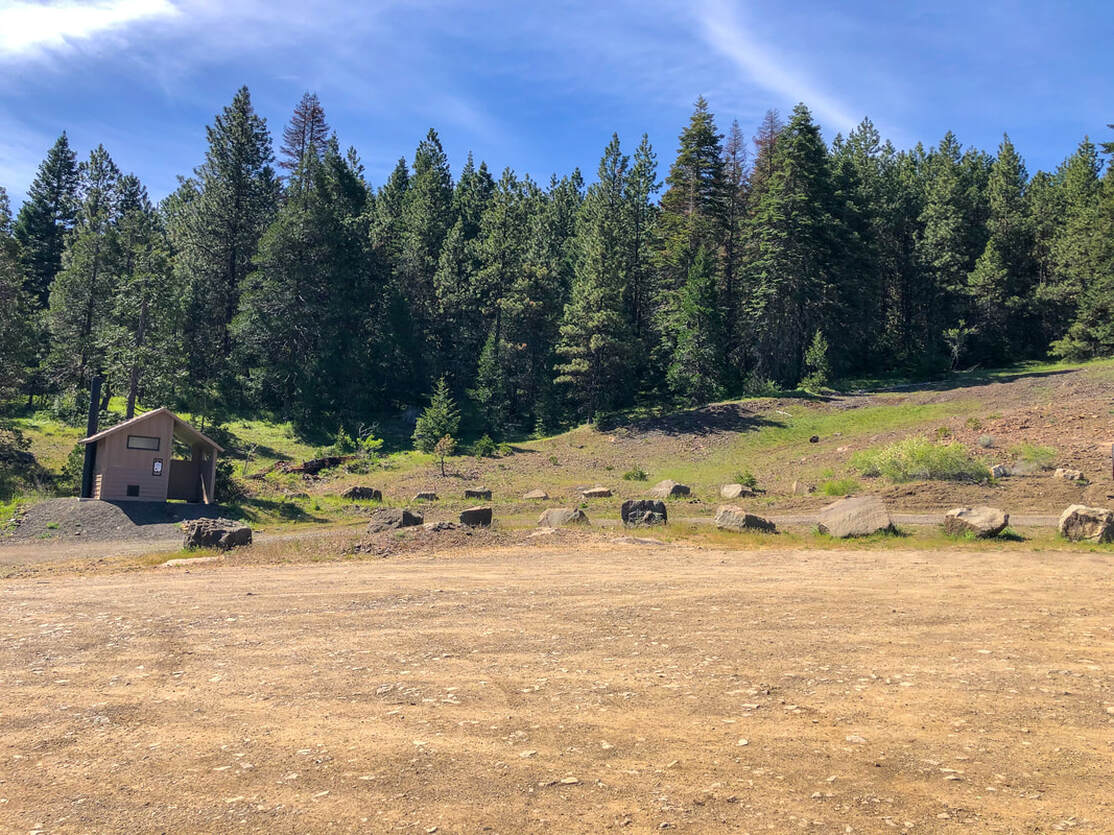
(trailhead parking lot)
|
Description:Pilot Rock is a popular viewpoint hike located just south of Ashland. Most of the hike is family friendly except for the last 200 feet which are a class 3-4 rock climb and definitely not for the faint of heart.
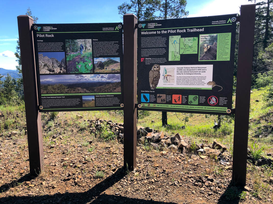
Because this trail is so popular with locals and visitors, the parking lot is very large, with room for about 50 cars. There is a big information kiosk at the start of the trail where you can read about the history, the scramble to the top, and the flora and fauna. |
|
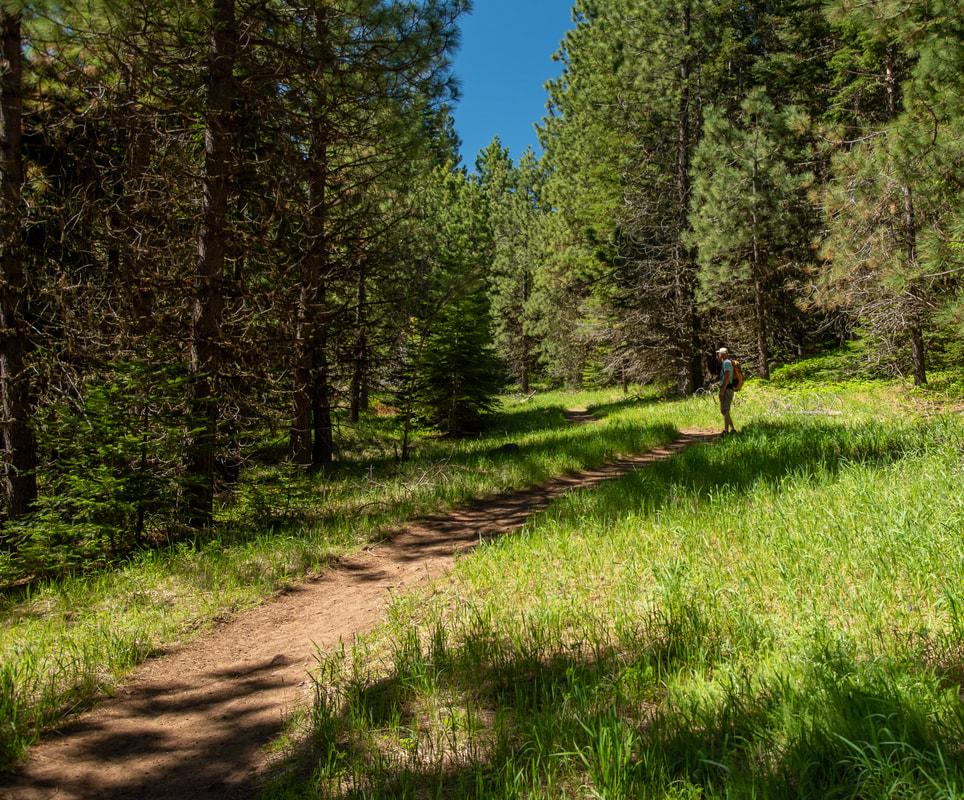
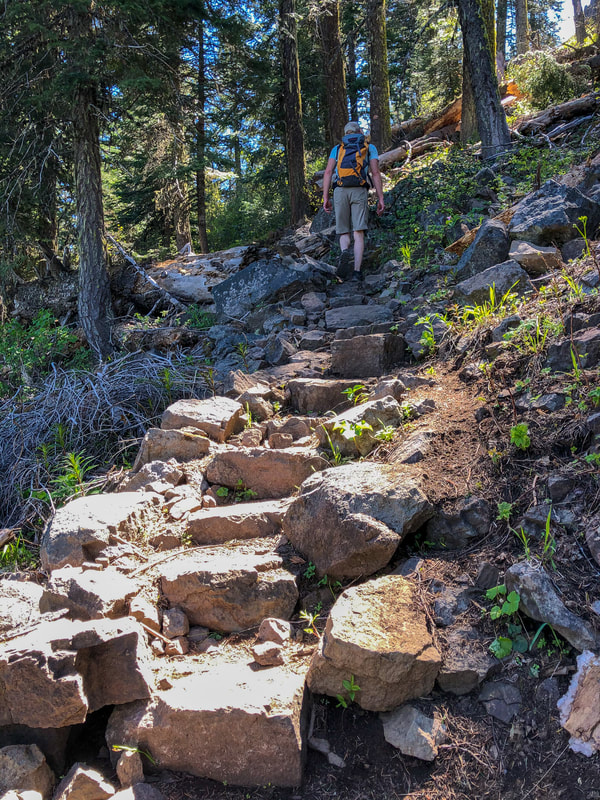
The first part of the trail truly feels like you are walking through a park. The trail is well graded and very wide with no rocks or roots. The trail cuts through gorgeous wildflower meadows and in late May and early June you will see a plethora of Jacob's ladder blooming. If you are an avid birdwatcher, this is a great place to be in late spring. These forests are teaming with many different species of migrating birds, and it is such a joy to hear them sing throughout the hike.
|
|
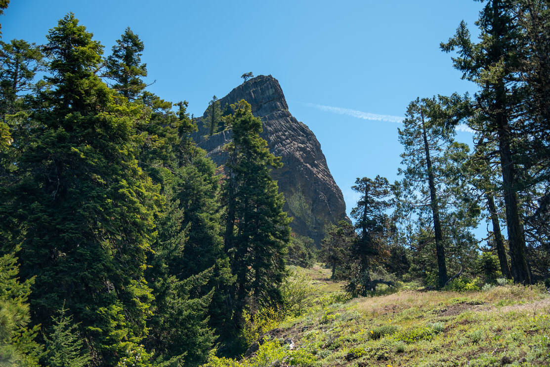
(view of Pilot Rock from the trail)
|
At the 0.75 mile mark you will come to the Pacific Crest Trail junction. Here you will head northbound for not even a quarter of a mile, before the trail for Pilot Rock splits off to the right. From here the trail gets a bit more rocky as you climb up 13 switchbacks. There are a few viewpoints along the way, one of them where you are able to see the top of Pilot Rock from a distance.
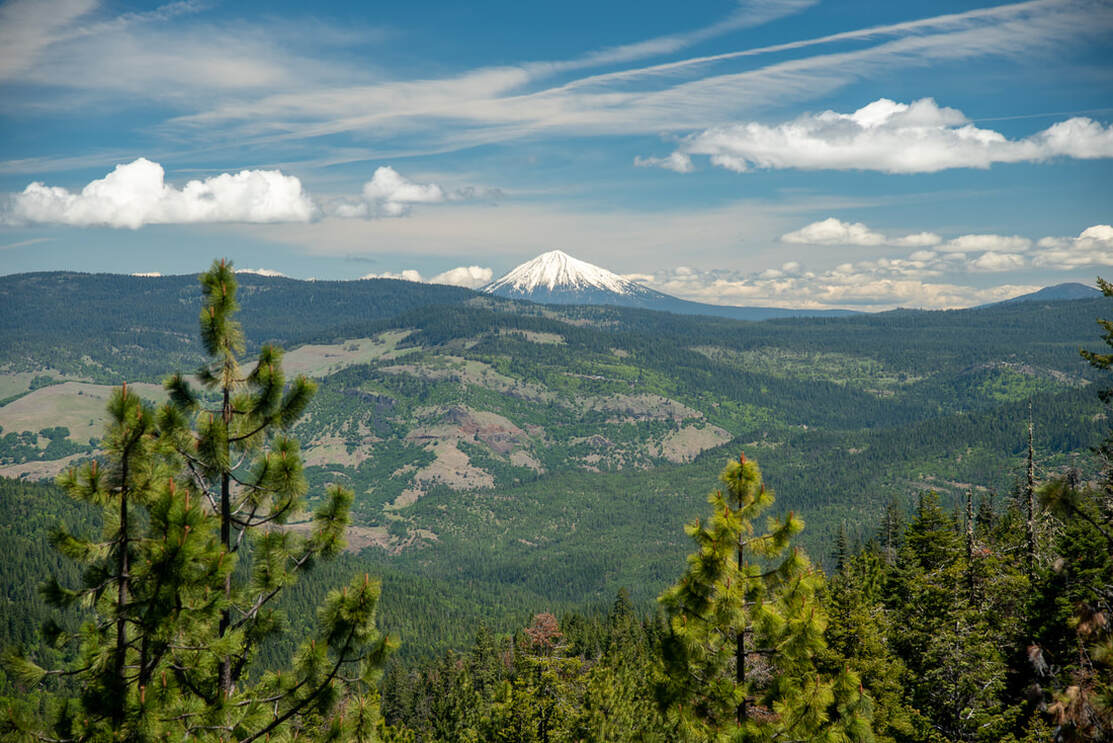
Pilot Rock got its name because it is such a prominent landmark in Southern Oregon and it guided many trappers, pioneers and gold miners toward Siskiyou Pass. This is also the area where in 1891 the last known grizzly bear of Oregon was shot and killed. |
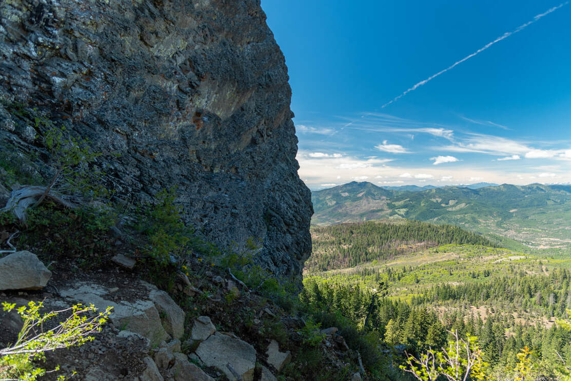
(view to the southwest)
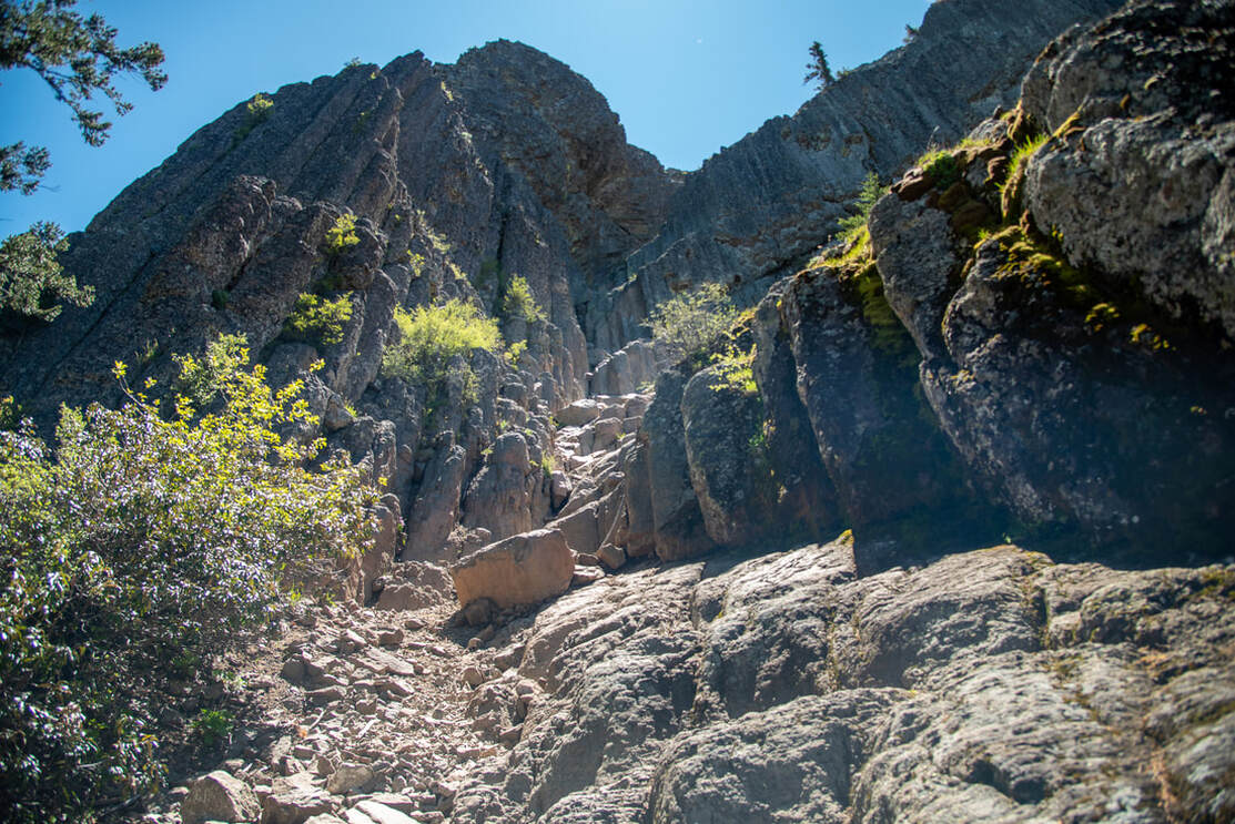
(this is where you start the rock climb up)
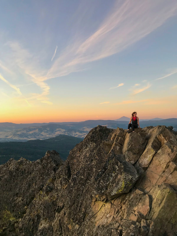
Just before getting to where the rock climbing starts, you will have a great view towards the southwest. If you have decided not to rock climb to the summit, you can end your hike here. If you are climbing to the top, at the base of Pilot Rock make sure to follow the line to the left. The line to the right seems more promising at the beginning, however it dead-ends at a cliff. Continue to the left through two narrow notches, making sure you have 3 points of contact at all times. After the second notch, stay to the right until you are at the top. Keep in mind this is a class 3-4 rock climb, so it is NOT recommended to those who have never rock climbed before. This last part of the hike is definitely not kid friendly and not for the faint of heart or those who are afraid of heights.
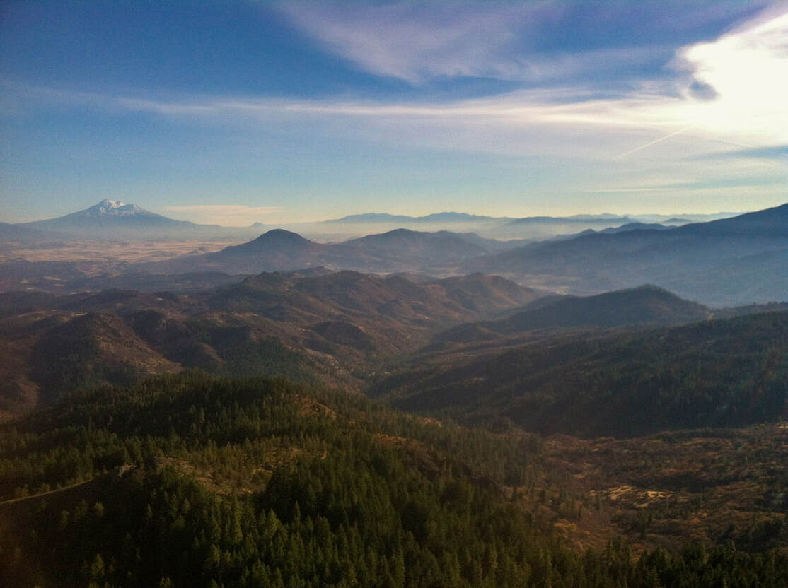
(Mt. Shasta view to the south from Pilot Rock summit picture by Ben Tell)
|
From the summit you will see Mount Shasta and the Trinity Alps to the south. To the west you will see the Siskiyou Mountains and Mount Ashland, and Emigrant Lake to the northeast. Mount McLoughlin (another awesome summit hike), reaches high above the surrounding hills to the north. The summit is quite amazing and quite an accomplishment. Make sure that you get down safely. There are many loose rocks, so one misstep could be detrimental! Also please make sure to watch out for other climbers. Do not descend if you see that someone is trying to come up, as rocks could fall on their head.
Whether you summit or not, make sure to catch a little side trail viewpoint, just half a mile from the trailhead. There is a beautiful flat spot where the trees open up, giving you views of Mount McLoughlin. |
(summit of Pilot Rock picture by Nichole Oxford)
|
(Mt. McLoughlin from side trail viewpoint)
Pilot Rock is a really gorgeous little local hike. Most of it is family friendly since you do not have to do the scary rock climb part to the summit. If you are brave and skilled enough to climb to the top you will be rewarded with breathtaking views. In the springtime, this hike will show off Southern Oregon's many wildflowers and migrating birds. Because it gets so hot down here during the summer months, it is not recommended to do this hike in July and August and early September. During that time views are also frequently obscured by smoke from wildfires.
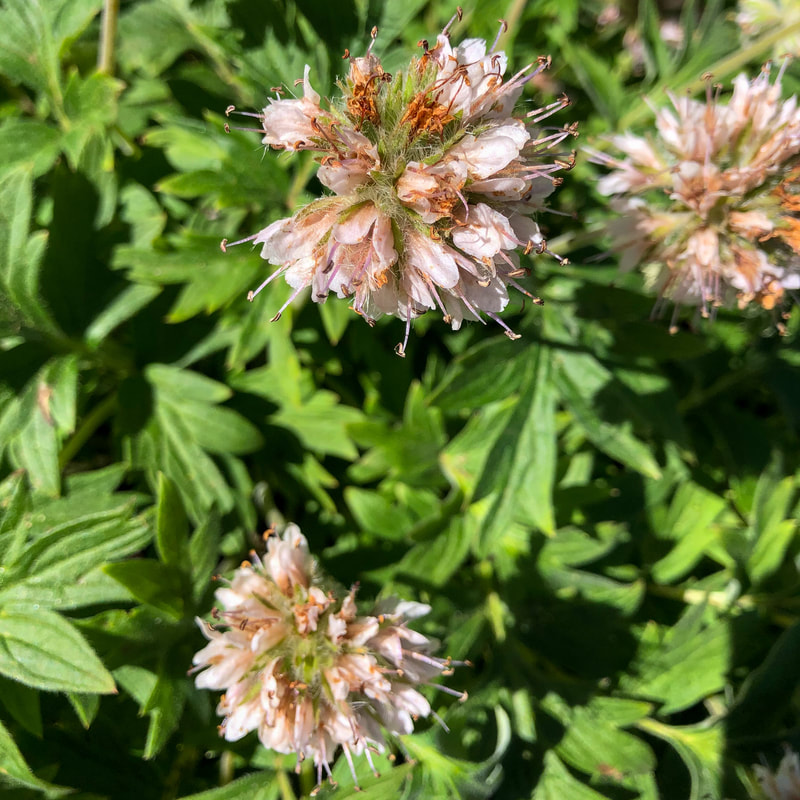
Flowers along the trail:
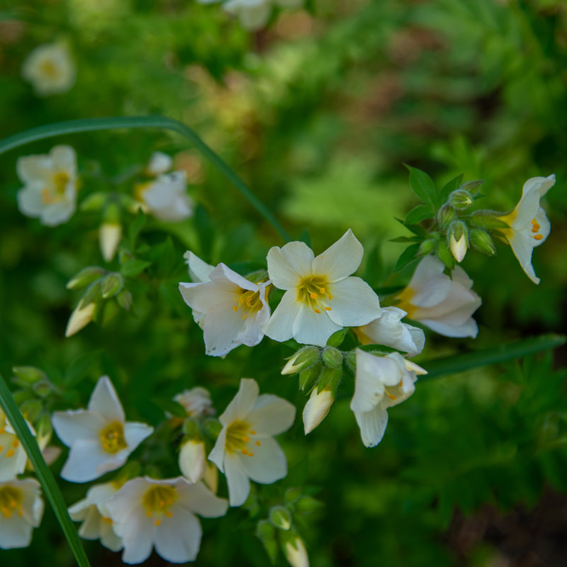
(Jacob's ladder)
|
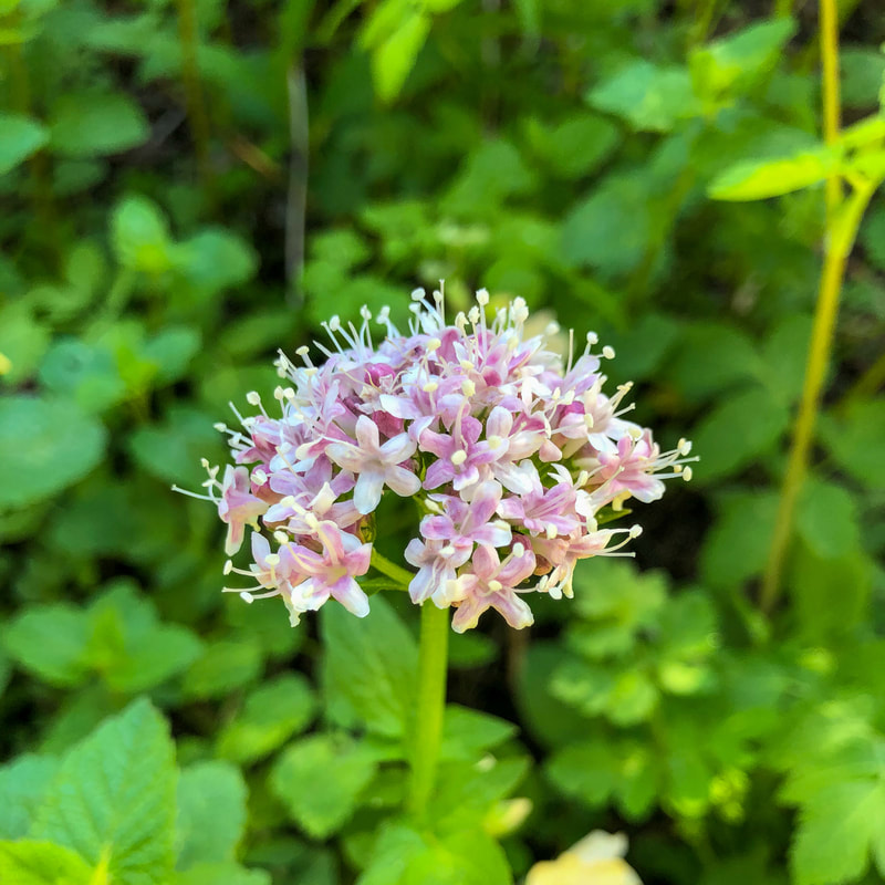
(Sitka valerian)
|
(Pacific waterleaf)
|
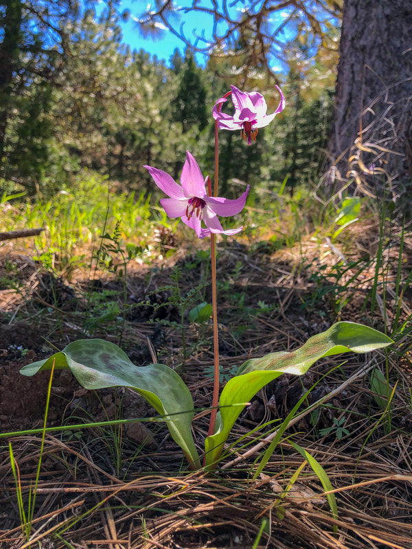
(Henderson's fawn lily)
|
Directions:
From Medford
- Drive I-5 south for a total of 21.3 miles, then take exit 6 toward Mount Ashland. Continue straight onto Old Hwy 99 S for 1.9 miles, then turn left onto 40-2E-33 for 2 miles. At a Y junction stay straight onto 41-2E-3 for 312 ft. and see the large parking lot on your right. (Total of 28 miles)
- Drive US-97 south for a total of 109 miles, then take exit 247 for OR-422 toward Crater Lake. Turn right onto OR-422 W (signs for Ft. Klamath/Crater Lake) and stay on this road for 3 miles, then turn right onto OR-62 W for 5.3 miles. Turn left onto Loosley Rd. for 1.5 miles, then turn right onto Weed Rd. E for 0.5 miles. Turn left onto Sevenmile Rd/Volcanic Legacy Scenic Byway for 21.5 miles, then turn right onto OR-140 W for 5.9 miles. Turn left onto Dead Indian Rd/Dead Indian Memorial Rd. and stay on this road for 36.4 miles. Turn left onto OR-66 E for 0.5 miles, then turn right onto Crowson Rd. for 0.8 miles. Turn left onto OR-99 S for 1.3 miles, then take the ramp onto I-5 S and stay on I-5 for 6.4 miles. Take exit 6 toward Mount Ashland. Continue straight onto Old Hwy 99 S for 1.9 miles, then turn left onto 40-2E-33 for 2 miles. At a Y junction stay straight onto 41-2E-3 for 312 ft. and see the large parking lot on your right. (Total of 197 miles)
- Total of 195 miles via Medford.
- Total of 256 miles via Medford.
- Total of 300 miles via Medford.
-This trail write-up was last updated June, 2022-
*All pictures unless otherwise marked are taken by Franziska Weinheimer
*All pictures unless otherwise marked are taken by Franziska Weinheimer
*Disclaimer: The trail descriptions, mileage, GPS tracks and difficulty ratings depicted on this website are never 100% accurate. Always hike at your own risk, using your own knowledge, equipment and common sense. Franziska Weinheimer/Hike Oregon are not responsible if you or anyone in your party gets injured or lost while attempting one of these or any other hikes.