Top 10 Oregon Summer Hikes
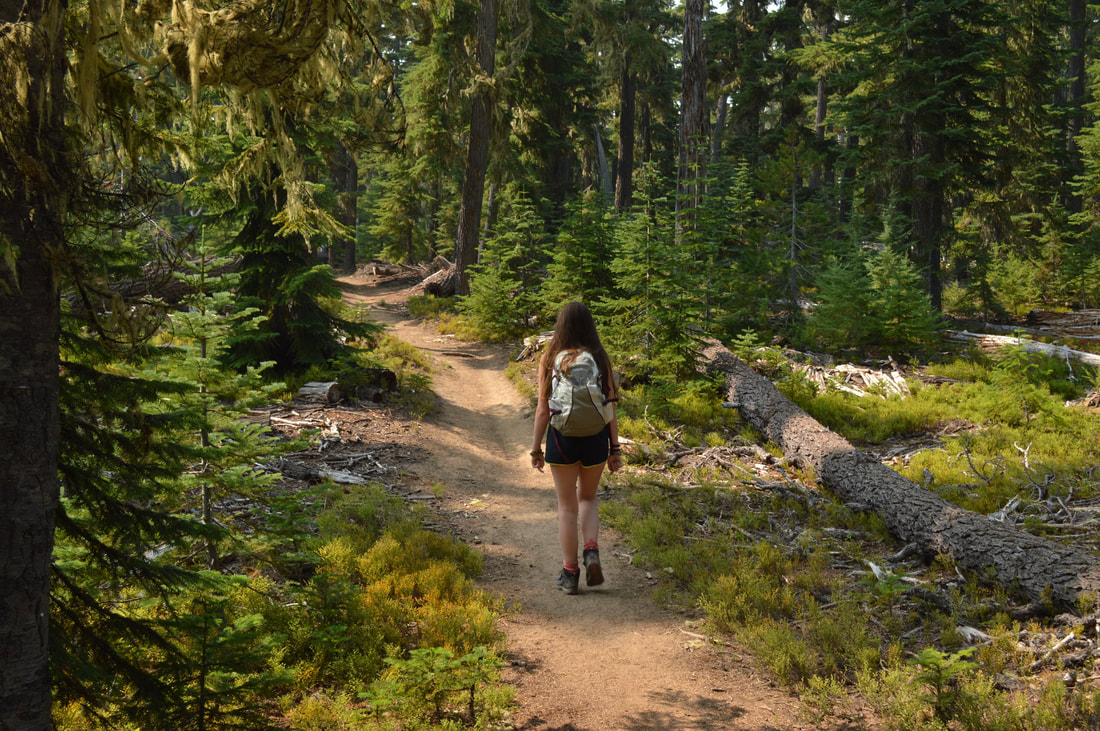
Summertime in Oregon is great for hiking because of the endlessly long daylight hours, the abundant wildflowers, and the many swimmable mountain lakes. Whether you want to do a short hike along the Pacific Crest Trail, experience an easy hike to picnic at the edge of a lake, or you want to climb to the top of a mountain, here is a list of some of the best summer hikes that Oregon has to offer!
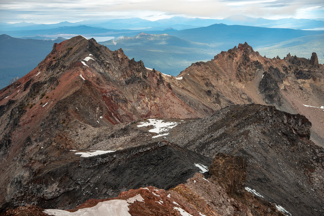
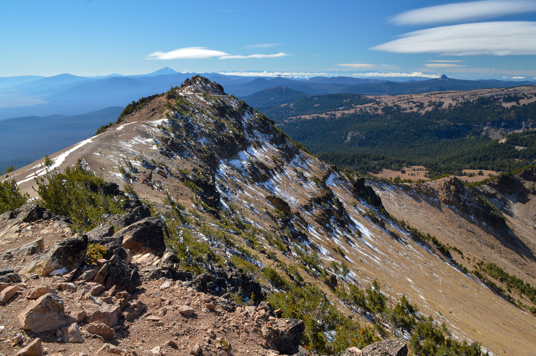
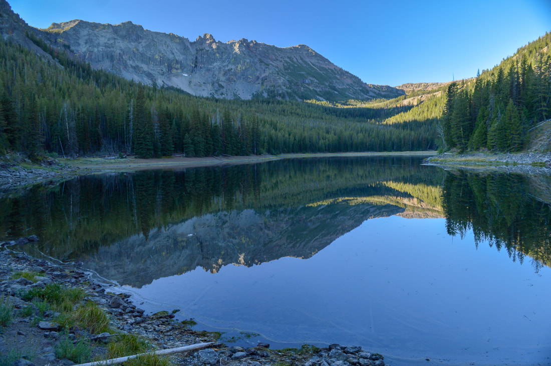
1) Diamond Peak Summit
|
|
Closest town: Oakridge
Trail type: Round trip
Mileage: 11.25 miles round trip w/ 3,190 ft. elevation gain
Difficulty: Very difficult (some route finding is involved)
Trail usage: Low to medium (depending on if it's PCT thru-hiker season - usually early to mid-August)
Best summer months to hike this trail: August & September
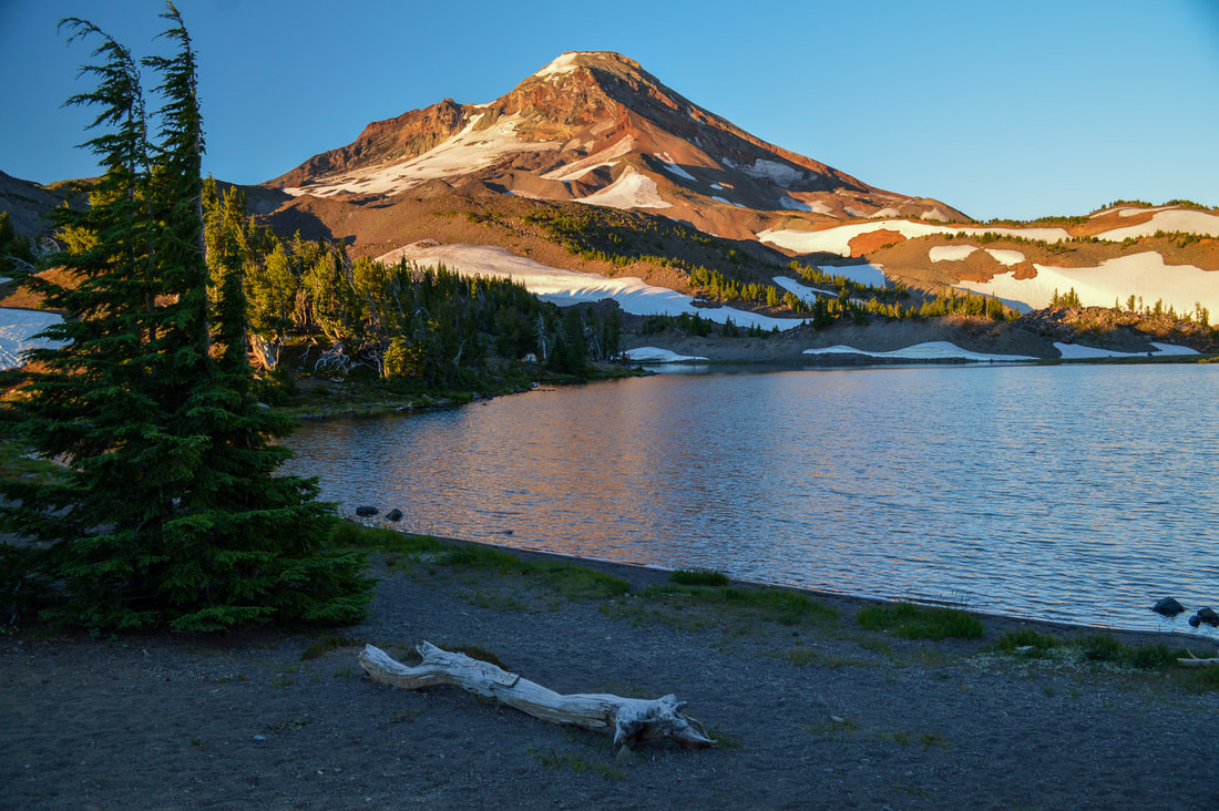
About the hike: Diamond Peak is one of Oregon's most underrated mountains to summit. The majority of the hike is along the Pacific Crest Trail, which is an easy trail leading you through alpine forest and past small lakes. The last 1.5 miles of the hike are pretty grueling and this summit does involve some route finding and making sure you have secure hand and foot holds. This is not a hike for the inexperienced hiker. Once you reach the summit, you can see the very unique wide base of Diamond Peak, and the views span from the Three Sisters down to Mount Thielsen and all the mountains and lakes in between.
(Click here for more information and directions)
Trail type: Round trip
Mileage: 11.25 miles round trip w/ 3,190 ft. elevation gain
Difficulty: Very difficult (some route finding is involved)
Trail usage: Low to medium (depending on if it's PCT thru-hiker season - usually early to mid-August)
Best summer months to hike this trail: August & September
About the hike: Diamond Peak is one of Oregon's most underrated mountains to summit. The majority of the hike is along the Pacific Crest Trail, which is an easy trail leading you through alpine forest and past small lakes. The last 1.5 miles of the hike are pretty grueling and this summit does involve some route finding and making sure you have secure hand and foot holds. This is not a hike for the inexperienced hiker. Once you reach the summit, you can see the very unique wide base of Diamond Peak, and the views span from the Three Sisters down to Mount Thielsen and all the mountains and lakes in between.
(Click here for more information and directions)
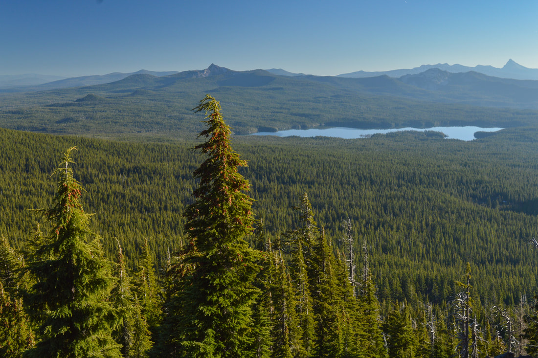
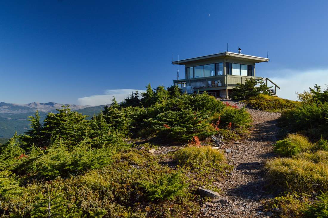
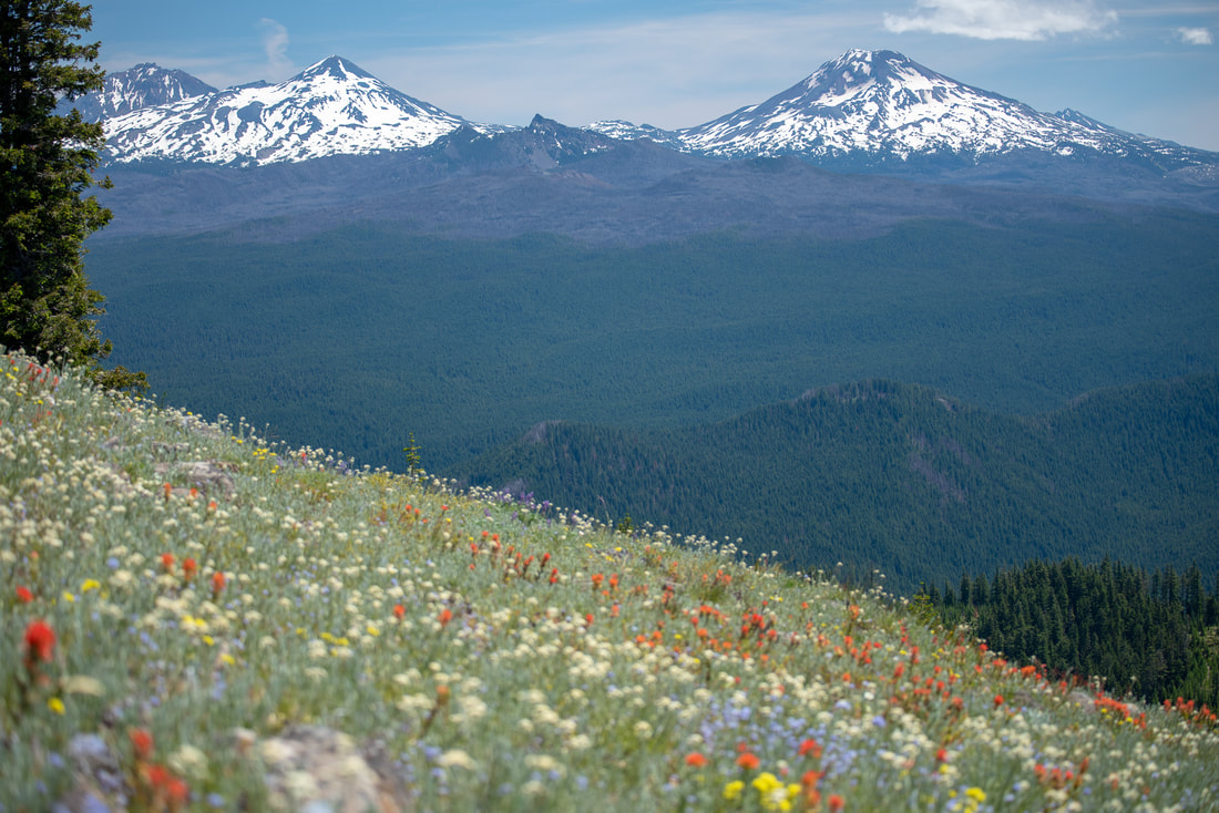
2) Coffin Mountain
|
|
Closest town: Sisters
Trail type: Round trip
Mileage: 2.75 miles w/ 1,100 ft. elevation gain
Difficulty: Moderate
Trail usage: High on weekends during wildflower blooms, low on weekdays and during the fall
Best summer months to hike this trail: July for best wildflower viewing
About the hike: This area (the old Cascade Crest) is one of the best places for wildflower viewing in July. Coffin Mountain, Bachelor Mountain and nearby Cone Peak are all known for epic wildflower blooms. Coffin Mountain has a spectacular view of Mount Jefferson and the Three Sisters as you make your way up to the fire lookout through massive meadows full of bear grass. From the summit you can also see Detroit Lake to the north and the thousands of acres that were burned in the Lionshead and Beachie Creek fires of 2020.
(Click here for more information and directions)
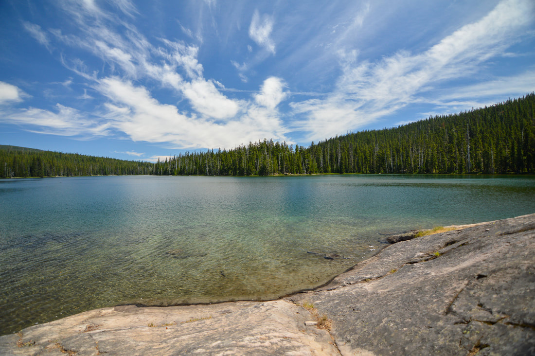
3) Bobby Lake
|
|
Closest town: Oakridge
Trail type: Out and back
Mileage: 5 miles w/ 415 ft. elevation gain
Difficulty: Easy
Trail usage: Low to medium
Best summer months to hike this trail: August, September
About the hike: This easy hike is perfect for the whole family. Pack up the floaties and hike a very easy 2.5 miles through a beautiful forest to a stunning crystal clear lake that is the perfect swimming temperature on hot days in August. A smooth rock on the southeast shore of the lake makes for an easy and clean entry into the water and a perfect shallow play area for smaller kids. There are also plenty of primitive camping spots available near the lake, so this would also make for the perfect first time short backpacking trips for the family.
(Click here to read more about this hike and to get directions- this post is for members only, you can purchase the seasonal membership for $9.99)
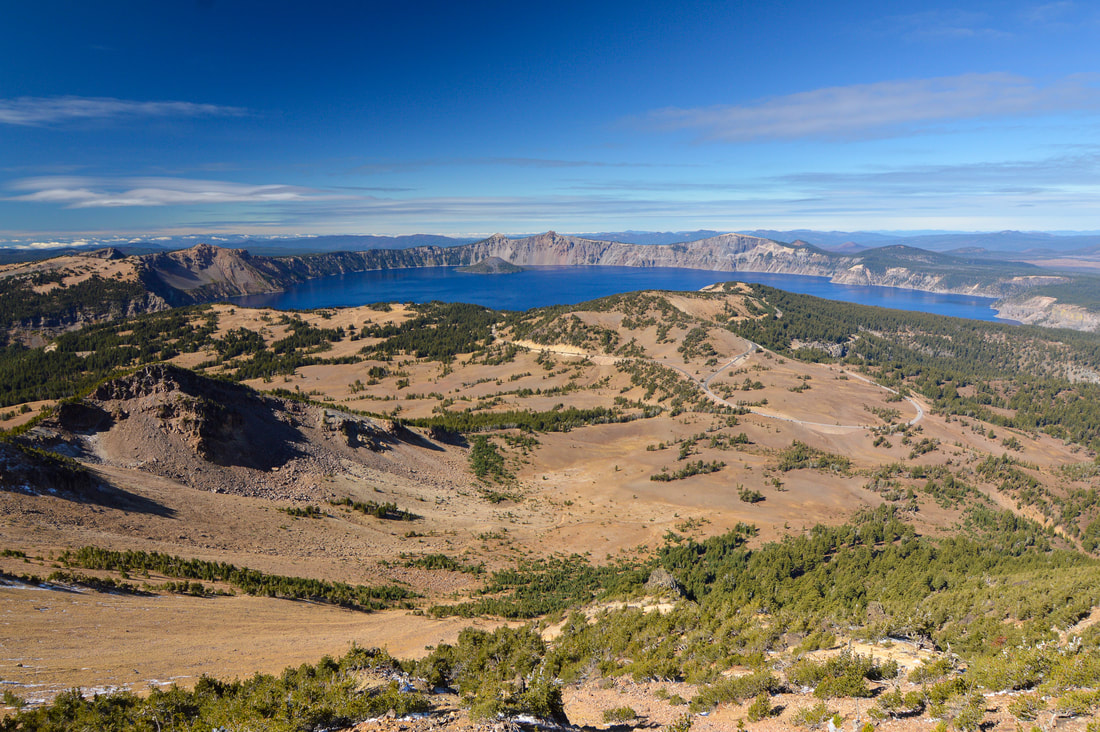
4) Mount Scott
|
|
Closest town: Klamath Falls
Trail type: Out and back
Mileage: 4.5 miles w/ 1,265 ft. elevation gain
Difficulty: Moderate
Trail usage: High to very high
Best summer months to hike this trail: End of July, August, September sometimes early October
About the hike: This hike takes you up to the tallest point inside Crater Lake National Park. It is a short hike, making it the perfect destination to break up the drive around Crater Lake's Rim. From the 8,930 ft. summit you can see the entire National Park as well as Mount McLoughlin to the south and Mount Thielsen to the north.
(Click here for more information and directions)
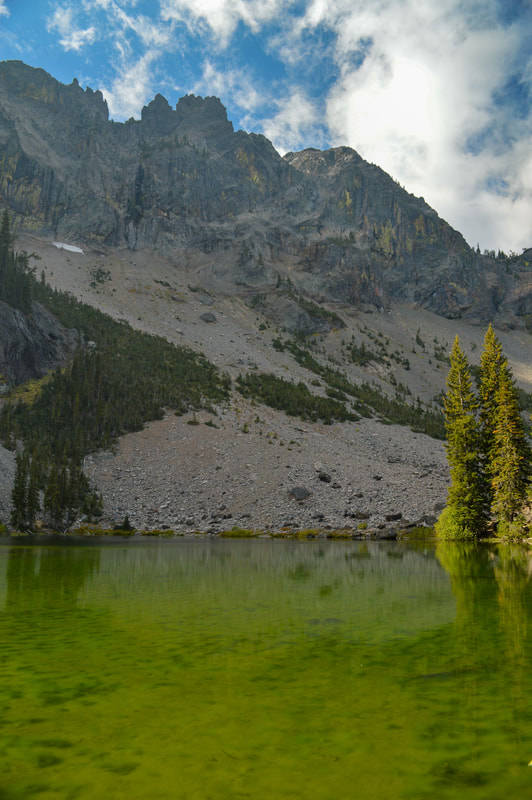
5) Strawberry Lake & Falls
Closest town: John Day
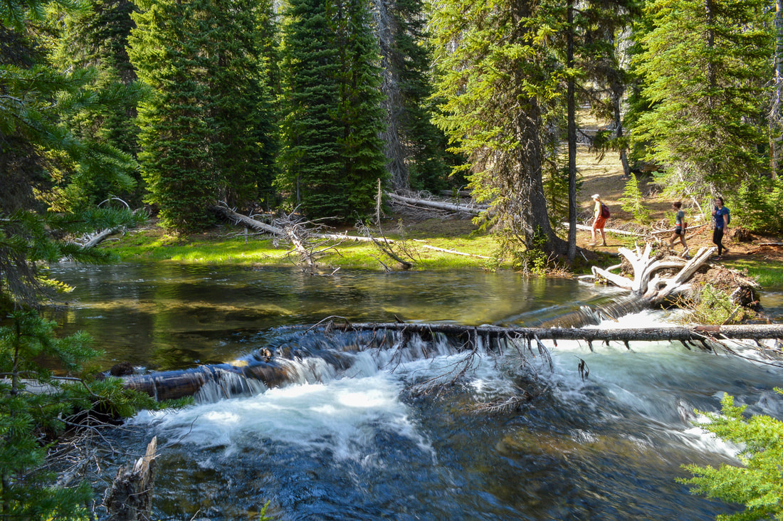
Trail type: Out and back Mileage: 6.2 miles w/ 1,035 ft. elevation gain Difficulty: Moderate Trail usage: Medium Best summer months to hike this trail: End of June, July, August, September About the hike: If you want to see some incredible Eastern Oregon scenery head to Strawberry Lake! The 1.3 mile hike up to Strawberry Lake is relatively easy and backcountry camping options are plentiful around this large lake. From there you can continue hiking up to Strawberry Falls, a cute little 50 foot waterfall plummeting down some mossy rocks. In another 0.8 miles you will reach Little Strawberry Lake, a uniquely electric green colored lake at the base of the Rabbit Ears rock formations. (Click here to read more about this hike and to get directions- this post is for members only, you can purchase the seasonal membership for $9.99) |
|
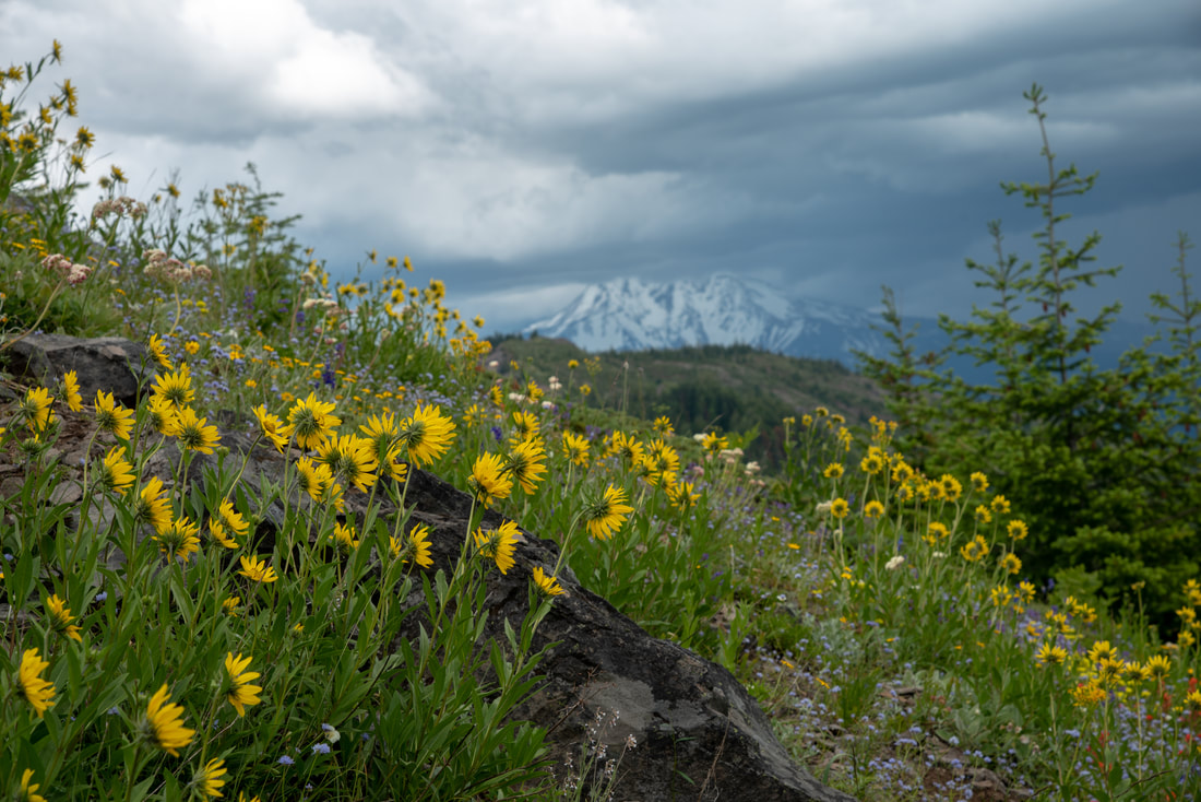
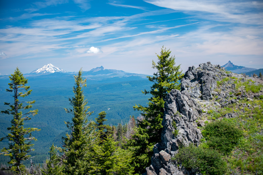
6) Horsepasture Mountain
|
|
Closest town: Blue River
Trail type: Out and back
Mileage: 7 miles w/ 2,380 ft. elevation gain
Difficulty: Difficult
Trail usage: Low to moderate (Saddle trail has very low usage, Horsepasture Mountain has moderate usage in the summer)
Best summer months to hike this trail: July
About the hike: This is one of the best lesser-known wildflower hikes! This beautiful trail takes you through a lovely forest and up through lush wildflower meadows dotted with bear grass and California Corn Lily. The summit of Horsepasture Mountain has meadow slopes that are covered in thousands of wildflowers during the month of July, and the views of the Cascade range from Mount Hood down to Diamond Peak are some of the best you will get in the area!
(Click here for more information and directions)
7) Camp Lake
|
|
Closest town: Sisters
Trail type: Out and back
Mileage: 14.2 miles w/ 2,430 ft. elevation gain
Difficulty: Difficult
Trail usage: Medium
Best summer months to hike this trail: Mid-July, August, early September
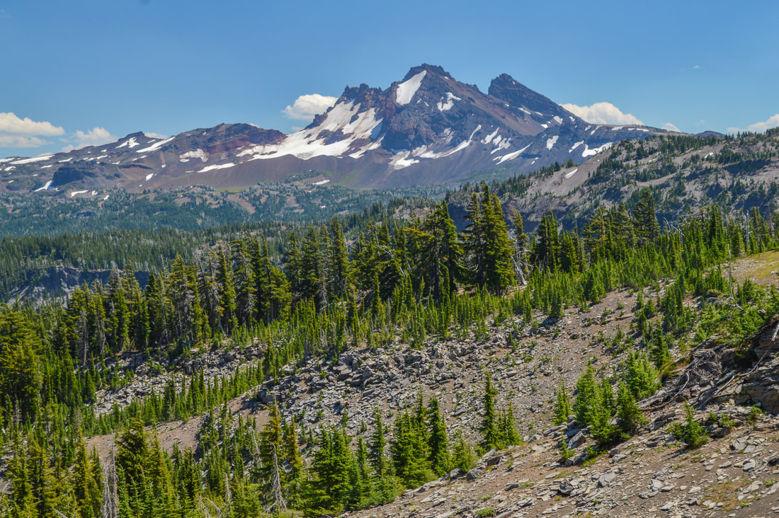
About the hike: This trail takes you from Pole Creek trailhead through an old burn area where glacial creeks and wildflowers are abundant. As you hit the timberline, the views of Broken Top, Middle and North Sister are absolutely incredible and the final destination, Camp Lake is one of the coolest spots to camp. You can do this as a day hike, but to really take in the extraordinary location, and possibly explore the other Chambers Lakes a little higher up, backcountry camping in the shadow of South Sister is the way to go for this awesome summer excursion.
(Click here to read more about this hike and to get directions- this post is for members only, you can purchase the seasonal membership for $9.99)
Trail type: Out and back
Mileage: 14.2 miles w/ 2,430 ft. elevation gain
Difficulty: Difficult
Trail usage: Medium
Best summer months to hike this trail: Mid-July, August, early September
About the hike: This trail takes you from Pole Creek trailhead through an old burn area where glacial creeks and wildflowers are abundant. As you hit the timberline, the views of Broken Top, Middle and North Sister are absolutely incredible and the final destination, Camp Lake is one of the coolest spots to camp. You can do this as a day hike, but to really take in the extraordinary location, and possibly explore the other Chambers Lakes a little higher up, backcountry camping in the shadow of South Sister is the way to go for this awesome summer excursion.
(Click here to read more about this hike and to get directions- this post is for members only, you can purchase the seasonal membership for $9.99)
8) Tumalo Falls to Happy Valley
|
|
Closest town: Bend
Trail type: Out and back or loop
Mileage: 4 - 8.2 miles w/ up to 2,635 ft. elevation gain
Difficulty: Easy to moderate
Trail usage: High to very high
Best summer months to hike this trail: June, July, August, September
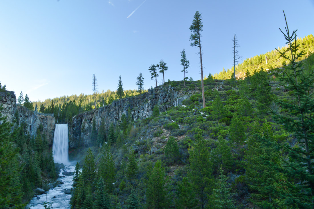
About the hike: Only 30 minutes from Bend, this is one of the most iconic waterfall hikes in all of Central Oregon and for good reason. This hike can be very short (to the viewing platform and back or up to the bridge), or you can make it into an 8 mile loop up to Happy Valley. Even if you're not up for an 8 mile hike, it is worth it to walk up river a bit because 98 foot Tumalo Falls isn't the only waterfall to see here. As you head upstream, there are many no name falls that are just as beautiful as the main attraction. This is a great family friendly hike!
(Click here for more information and directions)
Trail type: Out and back or loop
Mileage: 4 - 8.2 miles w/ up to 2,635 ft. elevation gain
Difficulty: Easy to moderate
Trail usage: High to very high
Best summer months to hike this trail: June, July, August, September
About the hike: Only 30 minutes from Bend, this is one of the most iconic waterfall hikes in all of Central Oregon and for good reason. This hike can be very short (to the viewing platform and back or up to the bridge), or you can make it into an 8 mile loop up to Happy Valley. Even if you're not up for an 8 mile hike, it is worth it to walk up river a bit because 98 foot Tumalo Falls isn't the only waterfall to see here. As you head upstream, there are many no name falls that are just as beautiful as the main attraction. This is a great family friendly hike!
(Click here for more information and directions)
9) Steens Mountain & Wildhorse Lake
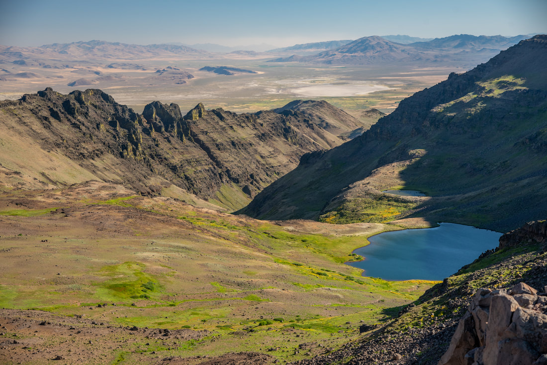
|
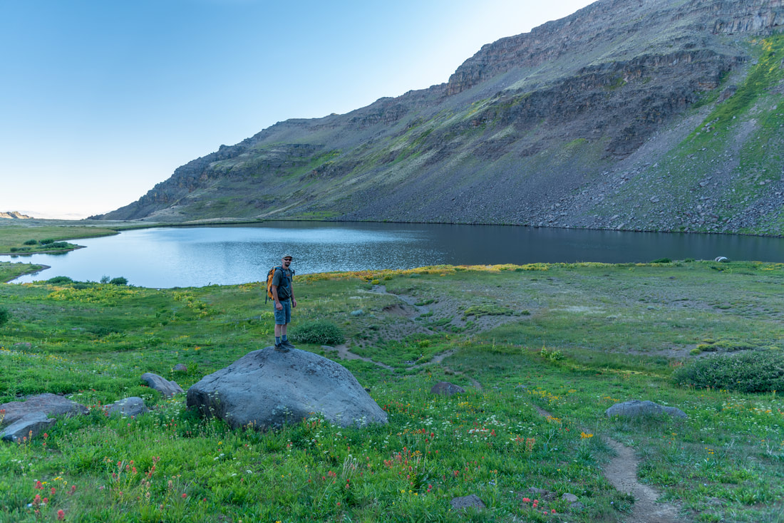
|
Closest town: Frenchglen
Trail type: Out and back
Mileage: 3.9 miles w/ 1,500 ft. elevation gain
Difficulty: Moderate
Trail usage: Low to medium
Best summer months to hike this trail: Mid-July, August
About the hike: Steens Mountain summit trail and Wildhorse Lake trail are actually two different hikes but they both start from the same trailhead. Unless you plan on camping down at Wildhorse Lake, the best way to do these two hikes is to do Wildhorse Lake first and then go up to Steens Mountain summit for sunset. The wildflowers in late July/early August in this lake basin are absolutely stunning and the views from Steens Mountain summit are some of the best views in the entire state. You can even occasionally see herds of wild horses while hiking in this area.
(Information about these two short hikes can be found in the Hike Oregon guidebook 'Oregon's Best Views')
10) Timberline Loop
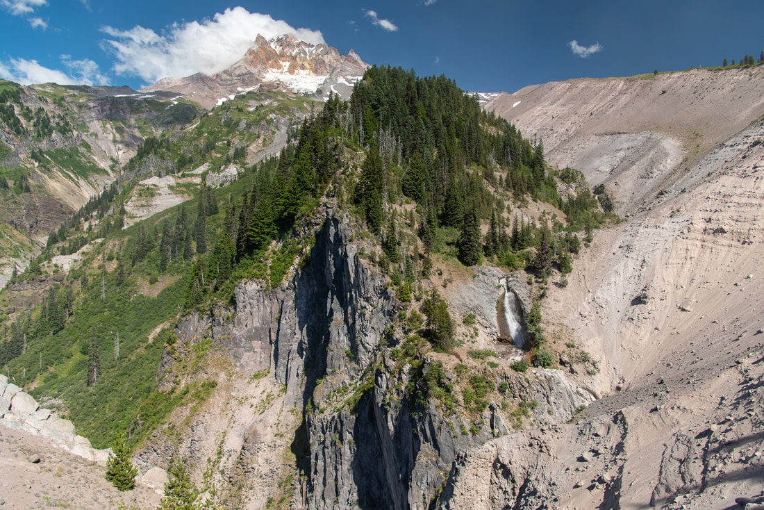
|
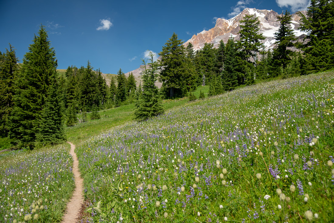
|
Closest town: Sandy
Trail type: Loop
Mileage: 41.4 miles w/ 10,240 ft. elevation gain
Difficulty: Difficult
Trail usage: High
Best summer months to hike this trail: End of July, August, September
About the hike: One of the best backpacking trips in Oregon, the Timberline Trail circumnavigates Mount Hood in 41.4 miles. This is not an easy trail though, there are many river crossings, some that can be dangerous, and there is a lot of elevation gain and loss throughout the hike, making it pretty strenuous. The incredible wildflower meadows, cool glaciers and mountain views, easily make this trek one of the best hikes in Oregon and it will definitely be a life changing experience!
(Click here to get your personalized trip itinerary for this epic backpacking trip!)
*All pictures are taken by Franziska Weinheimer
*Disclaimer: The trail descriptions, mileage, GPS tracks and difficulty ratings depicted on this website are never 100% accurate. Always hike at your own risk, using your own knowledge, equipment and common sense. Franziska Weinheimer/Hike Oregon are not responsible if you or anyone in your party gets injured or lost while attempting one of these or any other hikes.