Hike Oregon
  • Home
  • *Store*
  • About the author
  • How to use this site
  • Resources
    • Wildflowers
    • Videos
  • Best Oregon Hikes
    • Top Fall Foliage Hikes In Oregon
    • Top 10 Oregon Fall Hikes
    • 20 Best Oregon Waterfall Hikes
    • Top 10 Oregon Hikes for Kids
    • Sno-Parks In Central Oregon
    • Top 10 Oregon Winter Hikes
    • Top Low Elevation Winter Hikes
    • 9 Amazing Oregon Summit Hikes
    • 20 Central Oregon Day Hikes
    • 20 Epic Oregon Wildflower Hikes
    • 5 Weekend Backpacking Trips in Oregon
    • Top One Night Backpacking Trips in Oregon
    • Top 10 Oregon Summer Hikes
    • Top 10 Swimming Spots In Oregon
    • Top 10 Oregon Spring Hikes
  • Oregon Sno-Parks
    • Maxwell Sno-Park
    • Potato Hill Sno-Park
    • Ray Benson Sno-Park
      • Brandenburg Shelter
    • Santiam Sno-Park
    • Three Creek Sno-Park
    • Virginia Meissner Sno-Park
      • Meissner Shelter Loop
      • Nordeen Shelter
    • Gold Lake Sno-Park
      • Westview Shelter to Eagle Rock Overlook
      • Marilyn Lakes Loop
  • Southern Washington
    • Hamilton Mountain
    • Dog Mountain
    • Coyote Wall
    • Mount St. Helens
  • Portland
    • Powell Butte
    • Forest Park
    • Latourell Falls
    • Multnomah/Wahkeena Falls
    • Eagle Creek
    • Mitchell Point
    • Table Rock
    • Tamanawas Falls
    • Trillium Lake
    • East Zigzag Mountain (members only)
  • Salem
    • Abiqua Falls
    • Silver Falls State Park
    • Dome Rock
    • Marion Lake to Marion Mountain
    • Jefferson Park
  • Corvallis
    • Marys Peak East Ridge
    • Marys Peak North Ridge
    • Alsea Falls and Green Peak Falls
    • Corvallis to Sea Trail - Sugarbowl Creek segment (members only)
  • Sweet Home
    • Crescent Mountain
    • Iron Mountain
    • McDowell Creek Falls
    • Middle Santiam River (members only)
    • Lower Soda Creek Falls (members only)
    • Rooster Rock (members only)
  • McKenzie Bridge/Blue River
    • Macduff Mountain
    • Proxy Falls
    • Clear Lake
    • Sahalie/Koosah Falls
    • Blue Pool
    • Erma Bell Lakes
    • Olallie Mountain
    • Horsepasture Mountain
    • Tidbits Mountain
    • Castle Rock
    • Lowder Mountain (members only)
    • East Fork Trail (members only)
    • Rainbow Falls Overlook (members only)
    • Frissell Point (members only)
    • Chucksney Mountain (members only)
    • Substitute Point (members only)
  • Sisters/Santiam Pass
    • Coffin Mountain
    • Trappers Butte and Scar Mountain
    • Maxwell Butte
    • Black Butte
    • Whychus Creek Trail
    • Tam McArthur Rim
    • Black Crater
    • Scott Mountain
    • Obsidian Trail
    • Metolius Preserve
    • Three Fingered Jack Loop
    • Square Lake
    • Canyon Creek Meadows
    • Patjens Lakes
    • Craig Lake (members only)
    • Chush Falls (members only)
    • Rockpile Lake (members only)
    • Santiam Lake (members only)
    • Camp Lake (members only)
    • Park Meadow to Golden Lake (members only)
  • Bend/Redmond/LaPine
    • Steins Pillar
    • Chimney Rock
    • Steelhead Falls
    • Tumalo State Park
    • Tumalo Falls
    • Tumalo Mountain
    • No Name Lake
    • Green Lakes
    • Moraine Lake
    • South Sister Summit
    • Horse Lake
    • Muskrat Lake
    • Paulina Peak
    • Peter Skene Ogden Trail (members only)
  • Eugene
    • Ridgeline Trail
    • Mount Pisgah Summit
    • Mount Pisgah Arboretum
    • Shotgun Creek
    • Mount June
    • Lawler
    • Tire Mountain
    • Goodman Creek
    • Brice Creek
    • Trestle Creek Falls
    • Moon Falls
    • Elijah Bristow State Park
    • South Willamette Trail (members only)
    • Eula Ridge (members only)
    • Eagle's Rest (members only)
  • Oakridge
    • Deception Creek
    • North Salmon Creek
    • Grasshopper Ridge
    • Larison Creek
    • Bunchgrass Ridge
    • Salt Creek Falls
    • Waldo Lake Loop
    • South Waldo Loop
    • The Twins
    • Rosary Lakes
    • Yoran Lake
    • Fawn Lake
    • Windy Lakes
    • Divide Lake
    • Diamond Peak Summit
    • Cowhorn Mountain
    • Wall Creek Warm Springs (members only)
    • Moon Point (members only)
    • Bobby Lake (members only)
    • Lillian Falls (members only)
    • Middle Fork Willamette Trail (members only)
    • Pool Creek Falls (members only)
    • Dead Mountain (members only)
    • Larison Rock (members only)
    • Quinn Lakes & Eddeeleo Lakes (members only)
    • Waldo Mountain Lookout (members only)
    • Blair Lake to Spring Prairie (members only)
    • Rigdon Lakes loop (members only)
  • Oregon Coast
    • Cascade Head
    • Drift Creek Falls
    • Sweet Creek Falls
    • Beaver Creek Falls
    • Kentucky Falls
    • Hobbit Trail to Heceta Head
    • Valley Trail to China Creek
    • North Fork Smith River (members only)
    • Cummins Ridge (member's only)
    • Horse Creek (members only)
    • Siltcoos Lake (members only)
  • Southern Oregon
    • Fall Creek Falls
    • Watson Falls
    • Wild Rogue Loop
    • Mt. Thielsen
    • Crater Lake National Park
      • The Watchman
      • Mount Scott
      • The Pinnacles
    • Lower Table Rock
    • Pilot Rock
    • Wagner Butte
    • Mt. McLoughlin
    • Lemolo Falls (members only)
    • Fern Falls (members only)
  • Eastern Oregon
    • Painted Cove
    • Anthony Lake Loop
    • Mount Howard
    • Eagle Cap summit
    • Schneider Cabin (members only)
    • Strawberry Lake & Strawberry Falls (members only)
  • Oregon PCT sections
  • Tips & Tricks
    • Leave No Trace
    • How To Pick The Right Backpacking Tent
    • Top Tips For Hiking With Infants And Toddlers
    • Poison Oak, Ivy and Sumac
    • How to dress for cold weather hikes
    • Outdoorsy Holiday Gift Guide 2022
    • Hiker Holiday Gift Guide 2019
    • Outdoor Holiday Gift Guide 2018
    • Hiking Holiday Gift Guide 2017
  • Reviews/Gear
    • Stay Kühl This Summer
    • Outdoor Herbivore Backpacking Food Review
    • Osprey Aura AG 65 Backpack review
    • Big Agnes Fly Creek UL2 review
    • REI Quarter Dome 1 review
  • Adventure Stories
    • Hiking The Rae Lakes Loop
    • 110 Miles on the PCT
    • Three Fingered Jack Adventures
    • Jefferson Wilderness

Tumalo Falls Loop

​

to Happy Valley

​
Get the printable version of this hike

Hike details:

Mileage: 2 miles round trip w/ 357 ft. elevation gain (to Double Falls)
6 miles round trip w/ 1,062 ft. elevation gain (to Middle Fork Tumalo Falls)

8.2 mile loop w/ 1,552 ft. elevation gain (to do the whole Happy Valley Loop)
WINTER: 5.2 miles round trip w/ 400 ft. elevation gain (from the snow gate to Tumalo Falls overlook)

Approximate hike time: 52 minutes (for the 2 mile round trip hike to Double Falls)
2 hours 36 minutes (for the 6 mile round trip hike to Middle Fork Tumalo Falls)
3 hours 33 minutes (for the 8.2 mile Happy Valley Loop)

Difficulty: Easy to difficult
Trail usage: Very heavy on late spring and summer weekends, medium on weekdays and in the late fall and winter.
Highest elevation: 6,400 ft. Lowest elevation: 4,980 ft.
General location: 14 miles southwest of Bend - Deschutes National Forest
Accessible: Year-round
​(This trail has its perks in the early season (May & early June) because you get to hike without mosquitoes and you will see early wildflowers, but you might also have to hike through some patches of snow up to Happy Valley. In mid-June and July the wildflowers are at their peak, but you also have to deal with some mosquitoes and hoards of people. September and October is when the tourists start to die down and you will get some beautiful late season coloring here but the waterfalls won't have much flow to them).
Permits required: Northwest Forest Pass for parking
Pit toilet at trailhead: Yes
Trail allows: Camping, snowshoeing and cross-country skiing, mountain biking, no dogs allowed on the Bridge Creek Trail which means if you have a dog you will NOT be able to do the Happy Valley Loop hike. 
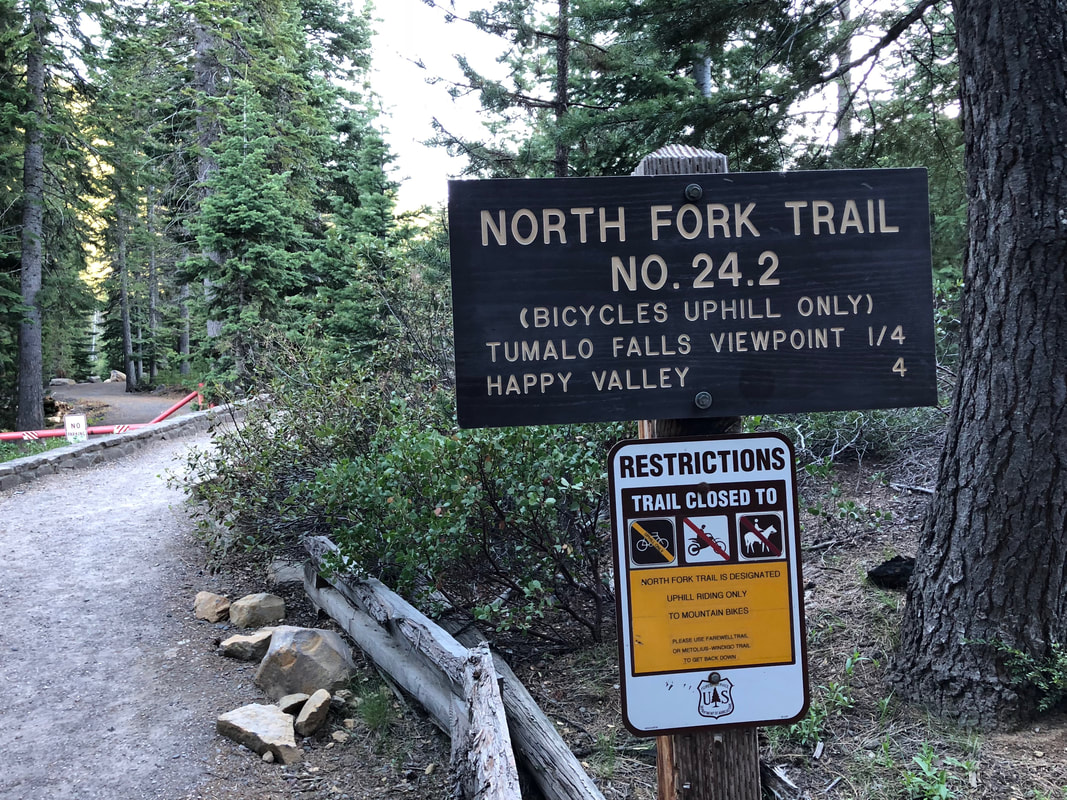
Tumalo Fall trail sign
Tumalo Falls Happy Valley trail sign

Description:

Tumalo Falls is one of the most iconic destinations in Central Oregon and for good reason. Tumalo Creek is located at the base of Broken Top in the Deschutes National Forest and this hike offers a moderate 8.2 mile loop up to Happy Valley, or you can opt to make it a 4 mile out and back hike to one of the upper waterfalls where the bridge crosses Middle Fork Tumalo Creek. Or if you're only looking for something very short but still scenic, take the North Fork Trail 1 mile up to Double Falls.
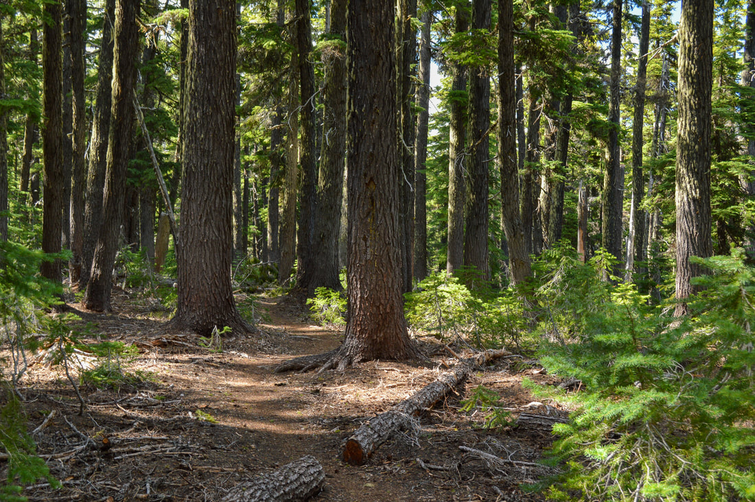
​This hike is not only very popular in the summer, but it is also a scenic winter destination. Once the snow falls there is a gate that closes the access road to the main parking lot so you can cross-country ski or snowshoe 2 miles up to the Tumalo Falls viewpoint. The rest of the trail however, is not recommended in the winter because it is not marked for snow travel.
​Parking can be a serious issue here during the summer season (weekends from May through September), and oftentimes cars are parked a good 1/2 mile or more down the gravel road. The trail starts at the parking lot right by the pit toilets.

Bridge Creek Bend Oregon
Shortly after the parking lot, you will come to a trail split. If you are hiking the loop to Happy Valley, you will take the Bridge Creek Trail to the left. Please adhere to the rule of no dogs allowed on this trail! Dogs are allowed on the other trails but must be kept on leash at all times. The Bridge Creek trail is less crowded and takes you along Bridge Creek where Bend gets its drinking water from. After about 1.3 miles of walking through a young forest and lots of snowbush, ignore the first trail split that crosses the creek to your left and continue straight, shortly after you will come to another trail split. Here the Bridge Creek trail continues straight to Tum Lake (an option), but you will go right and take the Swampy Lakes trail. 
Broken Top from Swampy Lakes trail
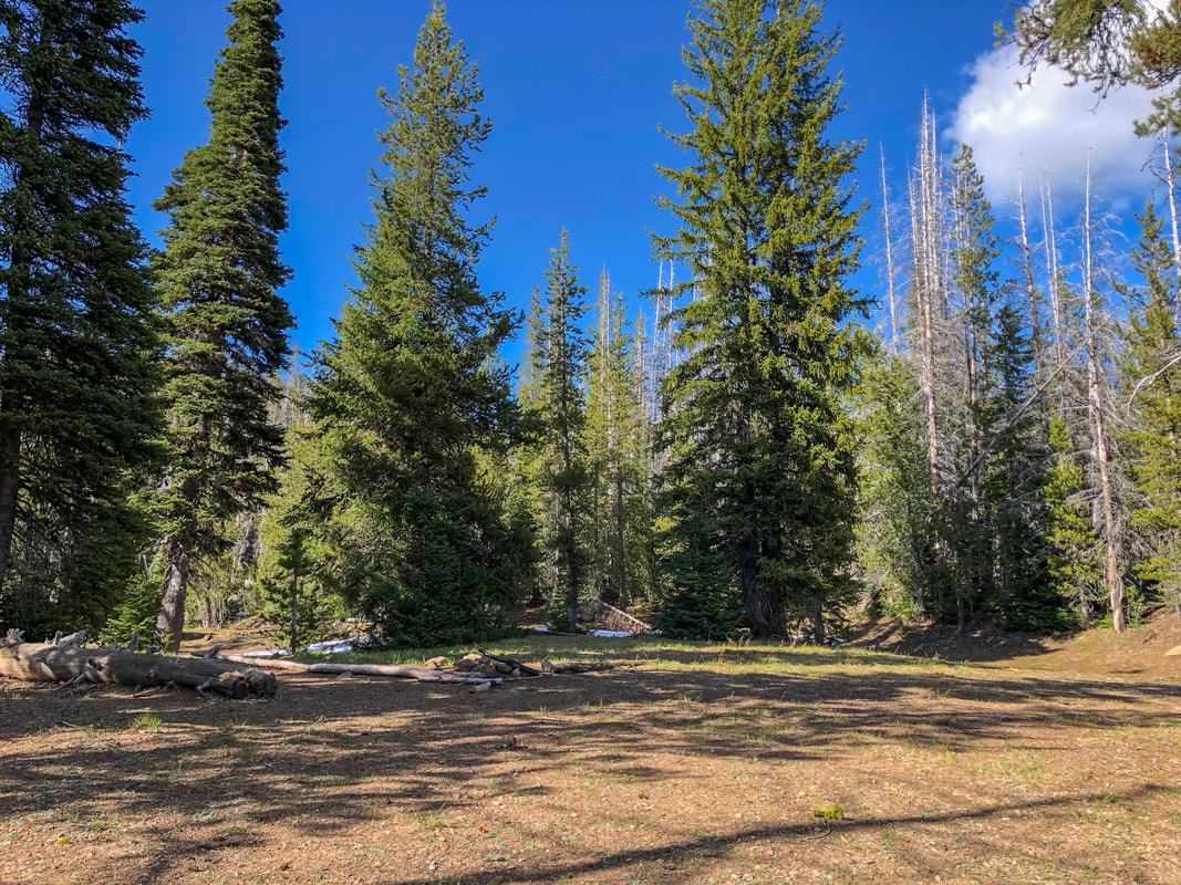
(the base of Broken Top in the clouds)
Swampy Lakes Trail
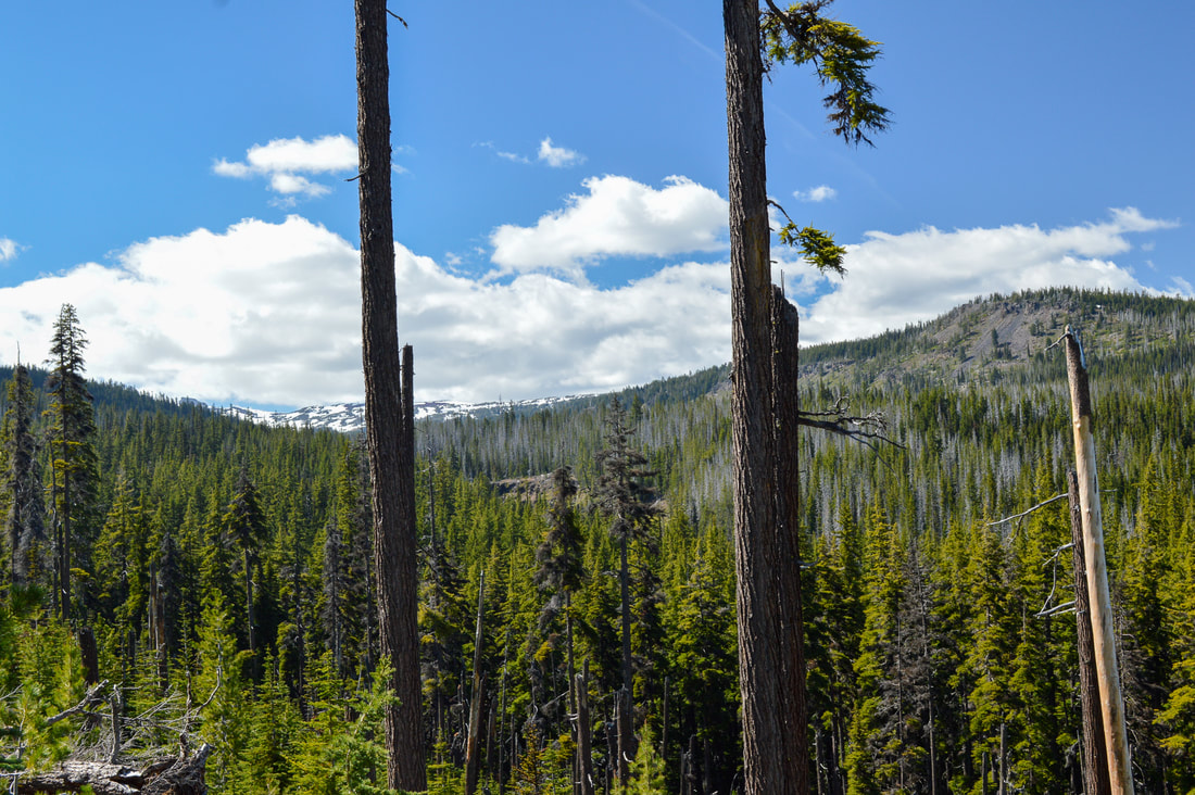
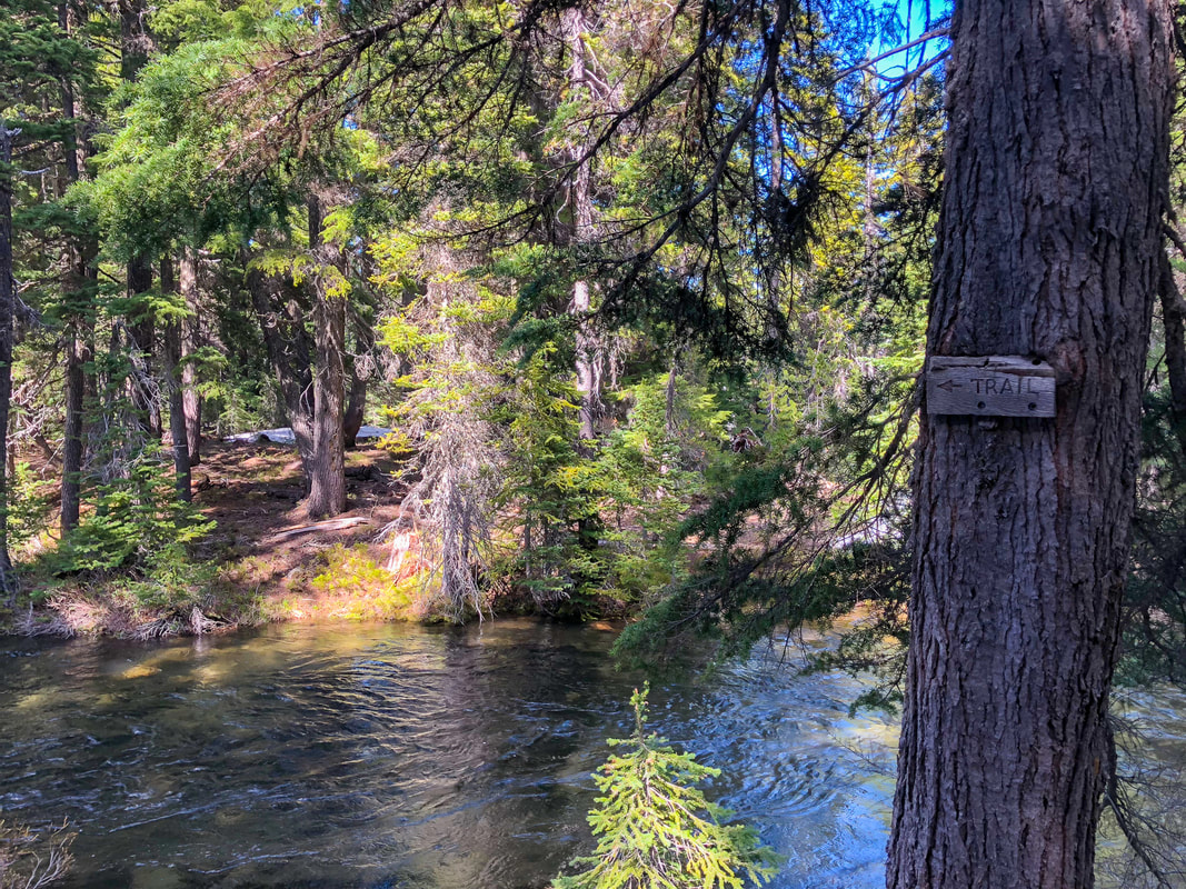
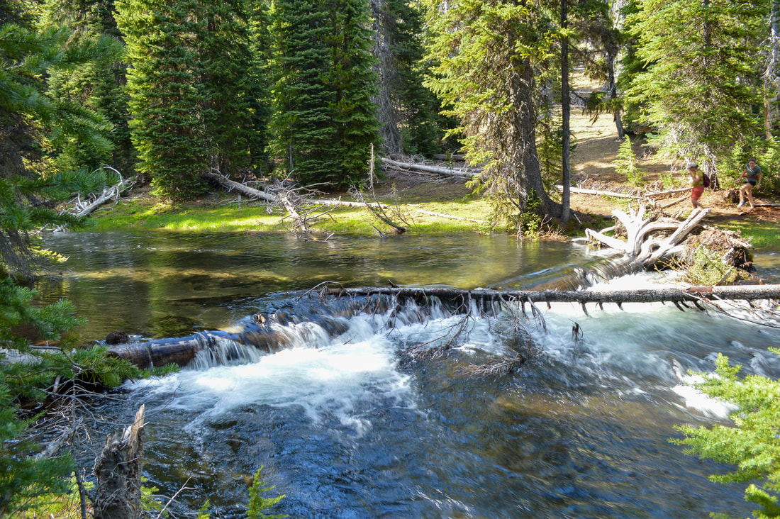
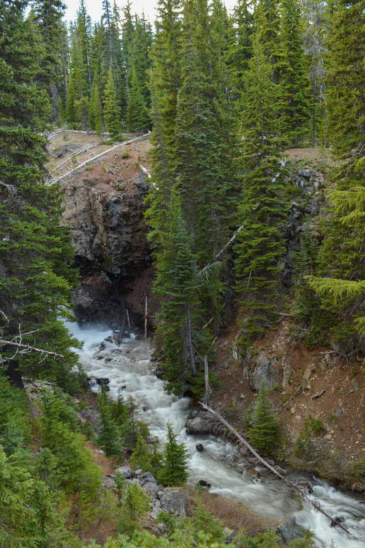
The Swampy Lakes trail takes you along an open ridge for a little while where on a clear day you can catch glimpses of Broken Top straight ahead and the Tumalo Valley to your right. Soon the trail will take you through a dense forest where in late June through mid-July, the mosquitoes are horrendous. After about 2.1 miles you will come to a creek crossing. This is the Middle Fork Tumalo Creek and later in the season (late August, September, early October) you will be able to cross this creek with no issues, however early in the season (May, June, July) you might have to go up or down stream a bit to find a down log where you can cross safely. Please be careful here! This water is swift and very cold!
Middle Fork Tumalo Creek crossing
Middle Fork Tumalo Creek
Crossing the Middle Fork Tumalo Creek
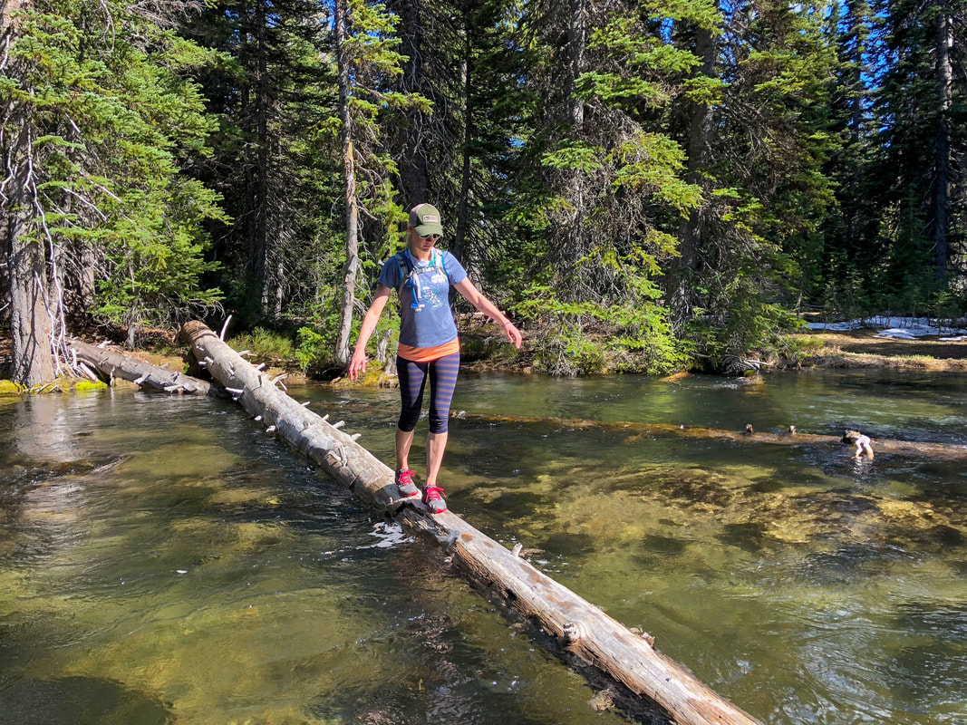
(crossing the Middle Fork Tumalo Creek)
White marsh marigold
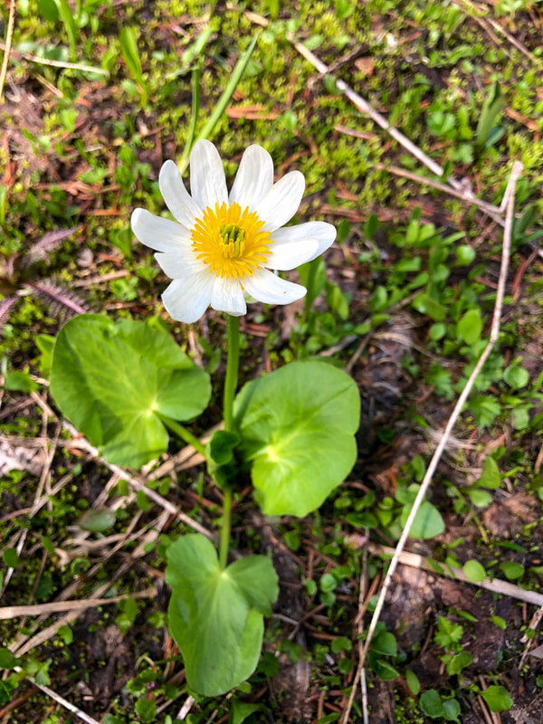
(white marsh marigold in late May)
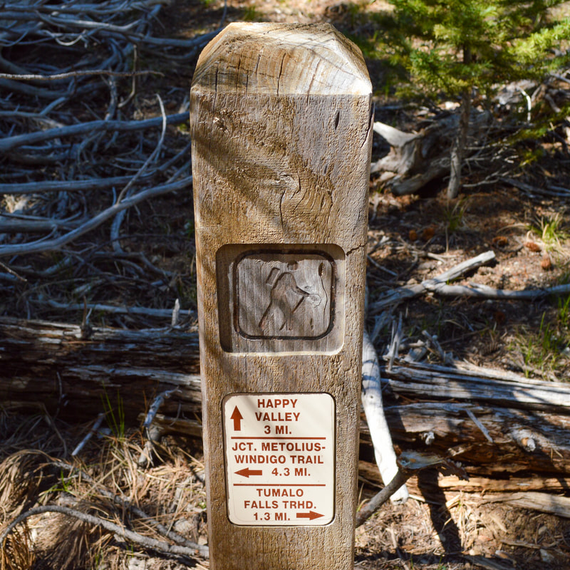
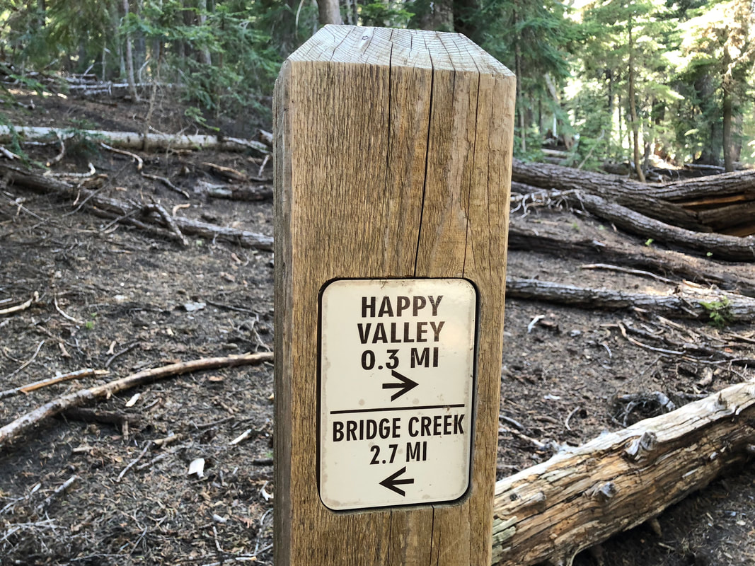
Once you have safely crossed the creek, it is only a few hundred yards to the next trail split. If you would like to check out Happy Valley and possibly camp there, continue on the Swampy Lakes Trail to the left. If you'd like to cut 1.4 miles off the trip, you can complete the loop and take the North Fork Trail to the right.
Happy Valley is aptly named and it is incredibly beautiful with lush meadows and wildflowers blooming in June and July. 
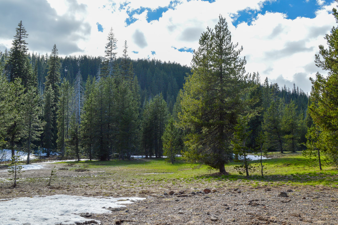
Happy Valley Tumalo Loop
(Happy Valley)
Bridge over North Fork Tumalo Creek
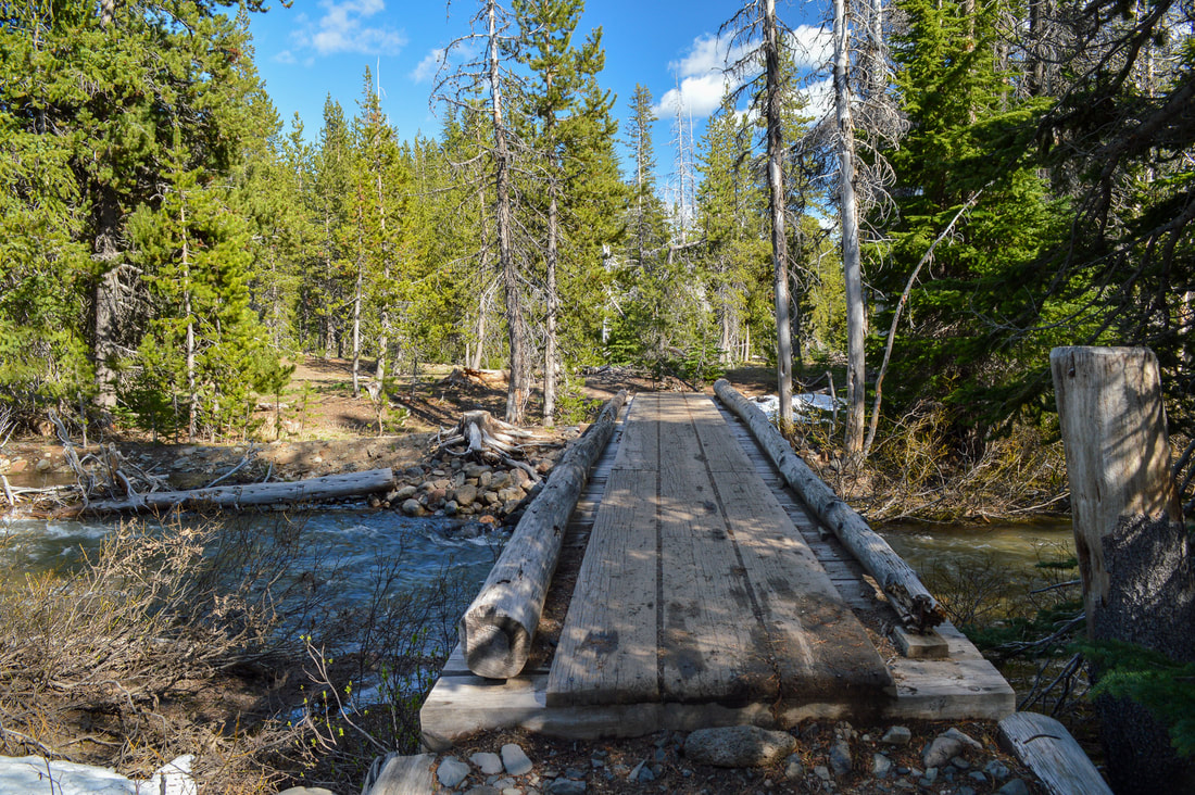
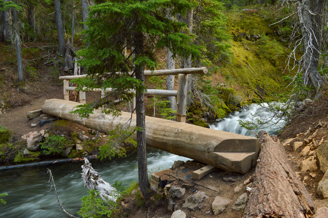
0.7 miles after the trail split there is a wooden bridge that crosses North Fork Tumalo Creek and here you will see a very large camping area. This would be a great first time backpacking trip for you and your kids, or if you're bike-packing or horseback riding the Metolious Windigo Trail which passes right along here as well, this is a wonderful large camp spot.
Happy Valley sign
Campsite at Happy Valley
(camping area at Happy Valley)
Middle Fork Tumalo Falls
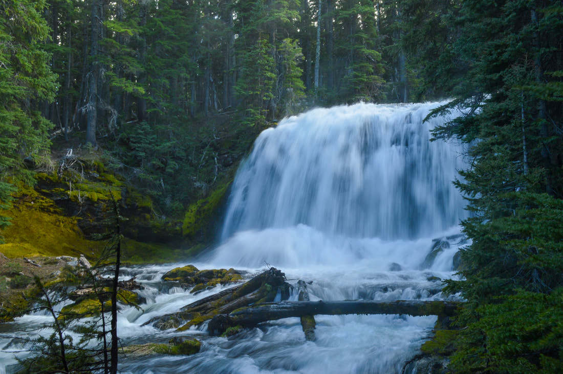
(Middle Fork Tumalo Falls 53 ft.)
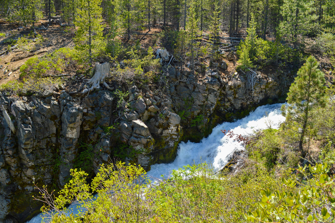
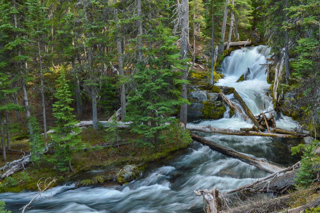
After back-tracking the 0.7 miles from Happy Valley back to the trail split, take the North Fork Trail to complete the loop. Here the forest gets very lush and also darker and a bit cooler if you are doing this hike in the afternoon. The trail skirts the edges of Middle Fork Tumalo Creek and here you will see a series of beautiful waterfalls that are not nearly as talked about as Tumalo Falls, the feature of this area. Middle Fork Tumalo Falls is especially spectacular at 53 feet tall and featuring two large and impressive drops.
Middle Fork Tumalo
(Middle Fork Tumalo Falls)
Water shrew at Tumalo Falls
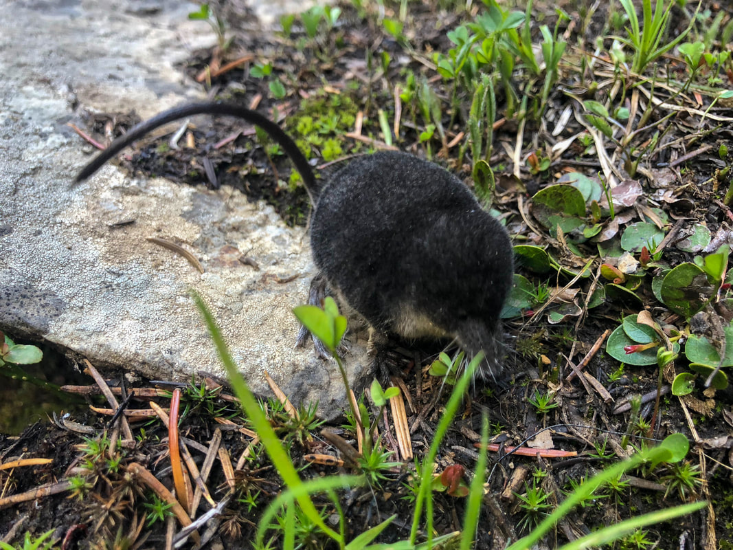
(water shrew at Middle Fork Tumalo Falls)
Lower Middle Fork Tumalo Falls
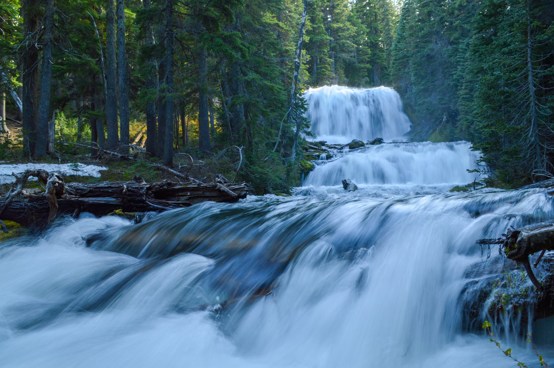
(Lower Middle Fork Tumalo Falls 15 ft.)
North Fork Trail Bend Oregon
North Fork Trail bridge Bend Oregon
After another mile of hiking next to the creek, you will come to a log bridge with only one railing. If you have small children, please be careful here. From here you have about 2 miles to go until you get back to the parking lot. Here the trail gains a little bit of elevation, and you walk at the edge of the canyon, looking down about 200 feet at Tumalo Creek below. 
Another very beautiful waterfall is well-known Double Falls (89 feet tall), featuring two drops with an impressive flow especially early in the season. Looking down on it, you can get many different unique angles, perfect for those folks who love taking waterfall photos. 

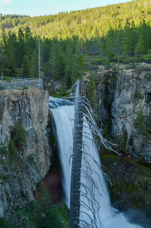
Once you've seen Double Falls it is less than a mile to Tumalo Falls and then only 0.2 to the parking lot. Tumalo Falls has two viewing platforms, one right above the falls, so you can watch the water go over the edge, and one a little bit further down so you can see the falls and a little bit of the creek as well. ​​Tumalo Falls is 98 feet tall and is absolutely beautiful in any season. The valley that the river creates here really adds to the spectacular beauty of the area.
Double Falls overlook
Double Falls Tumalo Falls loop Bend Oregon
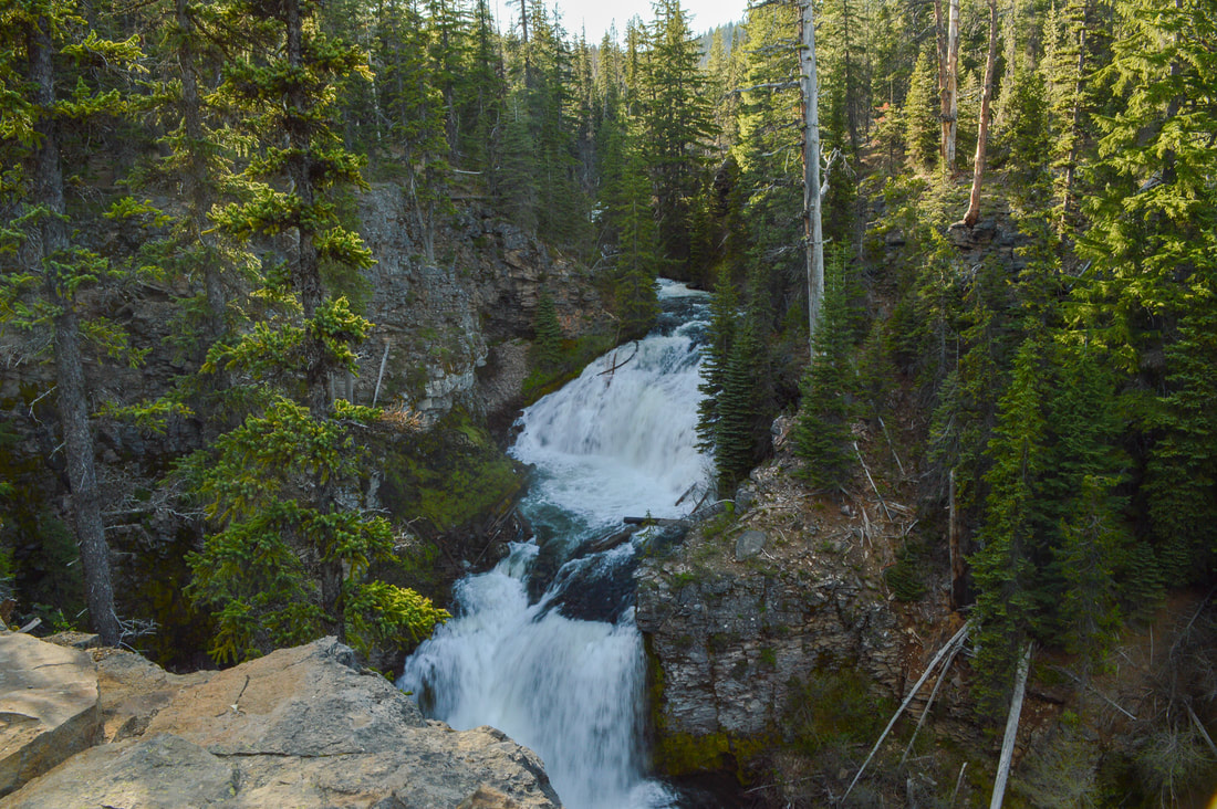
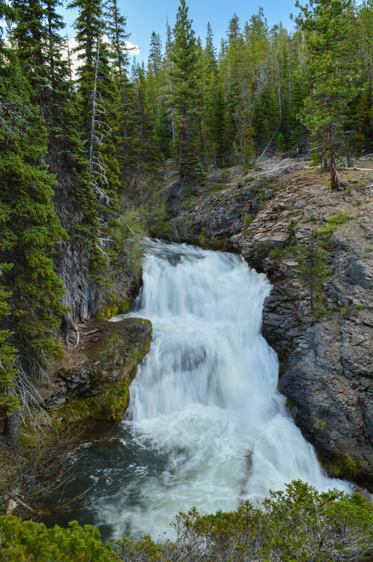
(Double Falls 89 ft.)
Tumalo Falls from viewing platform
The Tumalo Falls to Happy Valley loop hike is absolutely amazing and perfect for those who want to get away from the crowds that swarm the Tumalo Falls lookout platforms. It is rated moderate because of the distance, elevation gain and the slight exposure risk that parts of the trail have, as well as the possible river ford/crossing. If you do this loop with younger children, it is recommended to do it a bit later in the season when the creek is easier to cross. 
Tumalo Falls Bend Oregon
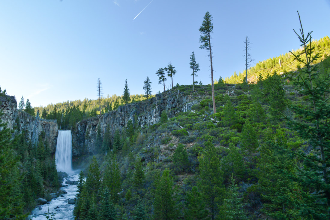
(Tumalo Falls 98 ft.)

​Directions:

From Bend
  • Drive on NW Galveston Ave. which turns into Skyliners Rd. just after NW 17th Ave. Stay on Skyliners Rd. for 8.7 miles then make a slight right onto Tumalo Falls Rd. for 2.6 miles to the parking area. (Total 13.6 miles).
​From Eugene
  • Total of 141 miles via Bend.
​From Salem
  • Total of 145 miles via Bend.
From Portland
  • Total of 187 miles via Bend.
​From Medford
  • Total of 186 miles via Bend.​
*All pictures are taken by Franziska Weinheimer
*Disclaimer: The trail descriptions, mileage, GPS tracks and difficulty ratings depicted on this website are never 100% accurate. Always hike at your own risk, using your own knowledge, equipment and common sense.  Franziska Weinheimer/Hike Oregon are not responsible if you or anyone in your party gets injured or lost while attempting one of these or any other hikes. ​​​​

HIKED HERE RECENTLY? PLEASE LEAVE A TRIP REPORT BELOW:

© Hike Oregon 2023
P.O. Box 41911
​Eugene, OR 97404
Proudly powered by Weebly
  • Home
  • *Store*
  • About the author
  • How to use this site
  • Resources
    • Wildflowers
    • Videos
  • Best Oregon Hikes
    • Top Fall Foliage Hikes In Oregon
    • Top 10 Oregon Fall Hikes
    • 20 Best Oregon Waterfall Hikes
    • Top 10 Oregon Hikes for Kids
    • Sno-Parks In Central Oregon
    • Top 10 Oregon Winter Hikes
    • Top Low Elevation Winter Hikes
    • 9 Amazing Oregon Summit Hikes
    • 20 Central Oregon Day Hikes
    • 20 Epic Oregon Wildflower Hikes
    • 5 Weekend Backpacking Trips in Oregon
    • Top One Night Backpacking Trips in Oregon
    • Top 10 Oregon Summer Hikes
    • Top 10 Swimming Spots In Oregon
    • Top 10 Oregon Spring Hikes
  • Oregon Sno-Parks
    • Maxwell Sno-Park
    • Potato Hill Sno-Park
    • Ray Benson Sno-Park
      • Brandenburg Shelter
    • Santiam Sno-Park
    • Three Creek Sno-Park
    • Virginia Meissner Sno-Park
      • Meissner Shelter Loop
      • Nordeen Shelter
    • Gold Lake Sno-Park
      • Westview Shelter to Eagle Rock Overlook
      • Marilyn Lakes Loop
  • Southern Washington
    • Hamilton Mountain
    • Dog Mountain
    • Coyote Wall
    • Mount St. Helens
  • Portland
    • Powell Butte
    • Forest Park
    • Latourell Falls
    • Multnomah/Wahkeena Falls
    • Eagle Creek
    • Mitchell Point
    • Table Rock
    • Tamanawas Falls
    • Trillium Lake
    • East Zigzag Mountain (members only)
  • Salem
    • Abiqua Falls
    • Silver Falls State Park
    • Dome Rock
    • Marion Lake to Marion Mountain
    • Jefferson Park
  • Corvallis
    • Marys Peak East Ridge
    • Marys Peak North Ridge
    • Alsea Falls and Green Peak Falls
    • Corvallis to Sea Trail - Sugarbowl Creek segment (members only)
  • Sweet Home
    • Crescent Mountain
    • Iron Mountain
    • McDowell Creek Falls
    • Middle Santiam River (members only)
    • Lower Soda Creek Falls (members only)
    • Rooster Rock (members only)
  • McKenzie Bridge/Blue River
    • Macduff Mountain
    • Proxy Falls
    • Clear Lake
    • Sahalie/Koosah Falls
    • Blue Pool
    • Erma Bell Lakes
    • Olallie Mountain
    • Horsepasture Mountain
    • Tidbits Mountain
    • Castle Rock
    • Lowder Mountain (members only)
    • East Fork Trail (members only)
    • Rainbow Falls Overlook (members only)
    • Frissell Point (members only)
    • Chucksney Mountain (members only)
    • Substitute Point (members only)
  • Sisters/Santiam Pass
    • Coffin Mountain
    • Trappers Butte and Scar Mountain
    • Maxwell Butte
    • Black Butte
    • Whychus Creek Trail
    • Tam McArthur Rim
    • Black Crater
    • Scott Mountain
    • Obsidian Trail
    • Metolius Preserve
    • Three Fingered Jack Loop
    • Square Lake
    • Canyon Creek Meadows
    • Patjens Lakes
    • Craig Lake (members only)
    • Chush Falls (members only)
    • Rockpile Lake (members only)
    • Santiam Lake (members only)
    • Camp Lake (members only)
    • Park Meadow to Golden Lake (members only)
  • Bend/Redmond/LaPine
    • Steins Pillar
    • Chimney Rock
    • Steelhead Falls
    • Tumalo State Park
    • Tumalo Falls
    • Tumalo Mountain
    • No Name Lake
    • Green Lakes
    • Moraine Lake
    • South Sister Summit
    • Horse Lake
    • Muskrat Lake
    • Paulina Peak
    • Peter Skene Ogden Trail (members only)
  • Eugene
    • Ridgeline Trail
    • Mount Pisgah Summit
    • Mount Pisgah Arboretum
    • Shotgun Creek
    • Mount June
    • Lawler
    • Tire Mountain
    • Goodman Creek
    • Brice Creek
    • Trestle Creek Falls
    • Moon Falls
    • Elijah Bristow State Park
    • South Willamette Trail (members only)
    • Eula Ridge (members only)
    • Eagle's Rest (members only)
  • Oakridge
    • Deception Creek
    • North Salmon Creek
    • Grasshopper Ridge
    • Larison Creek
    • Bunchgrass Ridge
    • Salt Creek Falls
    • Waldo Lake Loop
    • South Waldo Loop
    • The Twins
    • Rosary Lakes
    • Yoran Lake
    • Fawn Lake
    • Windy Lakes
    • Divide Lake
    • Diamond Peak Summit
    • Cowhorn Mountain
    • Wall Creek Warm Springs (members only)
    • Moon Point (members only)
    • Bobby Lake (members only)
    • Lillian Falls (members only)
    • Middle Fork Willamette Trail (members only)
    • Pool Creek Falls (members only)
    • Dead Mountain (members only)
    • Larison Rock (members only)
    • Quinn Lakes & Eddeeleo Lakes (members only)
    • Waldo Mountain Lookout (members only)
    • Blair Lake to Spring Prairie (members only)
    • Rigdon Lakes loop (members only)
  • Oregon Coast
    • Cascade Head
    • Drift Creek Falls
    • Sweet Creek Falls
    • Beaver Creek Falls
    • Kentucky Falls
    • Hobbit Trail to Heceta Head
    • Valley Trail to China Creek
    • North Fork Smith River (members only)
    • Cummins Ridge (member's only)
    • Horse Creek (members only)
    • Siltcoos Lake (members only)
  • Southern Oregon
    • Fall Creek Falls
    • Watson Falls
    • Wild Rogue Loop
    • Mt. Thielsen
    • Crater Lake National Park
      • The Watchman
      • Mount Scott
      • The Pinnacles
    • Lower Table Rock
    • Pilot Rock
    • Wagner Butte
    • Mt. McLoughlin
    • Lemolo Falls (members only)
    • Fern Falls (members only)
  • Eastern Oregon
    • Painted Cove
    • Anthony Lake Loop
    • Mount Howard
    • Eagle Cap summit
    • Schneider Cabin (members only)
    • Strawberry Lake & Strawberry Falls (members only)
  • Oregon PCT sections
  • Tips & Tricks
    • Leave No Trace
    • How To Pick The Right Backpacking Tent
    • Top Tips For Hiking With Infants And Toddlers
    • Poison Oak, Ivy and Sumac
    • How to dress for cold weather hikes
    • Outdoorsy Holiday Gift Guide 2022
    • Hiker Holiday Gift Guide 2019
    • Outdoor Holiday Gift Guide 2018
    • Hiking Holiday Gift Guide 2017
  • Reviews/Gear
    • Stay Kühl This Summer
    • Outdoor Herbivore Backpacking Food Review
    • Osprey Aura AG 65 Backpack review
    • Big Agnes Fly Creek UL2 review
    • REI Quarter Dome 1 review
  • Adventure Stories
    • Hiking The Rae Lakes Loop
    • 110 Miles on the PCT
    • Three Fingered Jack Adventures
    • Jefferson Wilderness