Hike Oregon
  • Home
  • *Store*
  • About the author
  • How to use this site
  • Resources
    • Wildflowers
    • Videos
  • Best Oregon Hikes
    • Top Fall Foliage Hikes In Oregon
    • Top 10 Oregon Fall Hikes
    • 20 Best Oregon Waterfall Hikes
    • Top 10 Oregon Hikes for Kids
    • Sno-Parks In Central Oregon
    • Top 10 Oregon Winter Hikes
    • Top Low Elevation Winter Hikes
    • 9 Amazing Oregon Summit Hikes
    • 20 Central Oregon Day Hikes
    • 20 Epic Oregon Wildflower Hikes
    • 5 Weekend Backpacking Trips in Oregon
    • Top One Night Backpacking Trips in Oregon
    • Top 10 Oregon Summer Hikes
    • Top 10 Swimming Spots In Oregon
    • Top 10 Oregon Spring Hikes
  • Oregon Sno-Parks
    • Maxwell Sno-Park
    • Potato Hill Sno-Park
    • Ray Benson Sno-Park
      • Brandenburg Shelter
    • Santiam Sno-Park
    • Three Creek Sno-Park
    • Virginia Meissner Sno-Park
      • Meissner Shelter Loop
      • Nordeen Shelter
    • Gold Lake Sno-Park
      • Westview Shelter to Eagle Rock Overlook
      • Marilyn Lakes Loop
  • Southern Washington
    • Hamilton Mountain
    • Dog Mountain
    • Coyote Wall
    • Mount St. Helens
  • Portland
    • Powell Butte
    • Forest Park
    • Latourell Falls
    • Multnomah/Wahkeena Falls
    • Eagle Creek
    • Mitchell Point
    • Table Rock
    • Tamanawas Falls
    • Trillium Lake
    • East Zigzag Mountain (members only)
  • Salem
    • Abiqua Falls
    • Silver Falls State Park
    • Dome Rock
    • Marion Lake to Marion Mountain
    • Jefferson Park
  • Corvallis
    • Marys Peak East Ridge
    • Marys Peak North Ridge
    • Alsea Falls and Green Peak Falls
    • Corvallis to Sea Trail - Sugarbowl Creek segment (members only)
  • Sweet Home
    • Crescent Mountain
    • Iron Mountain
    • McDowell Creek Falls
    • Middle Santiam River (members only)
    • Lower Soda Creek Falls (members only)
    • Rooster Rock (members only)
  • McKenzie Bridge/Blue River
    • Macduff Mountain
    • Proxy Falls
    • Clear Lake
    • Sahalie/Koosah Falls
    • Blue Pool
    • Erma Bell Lakes
    • Olallie Mountain
    • Horsepasture Mountain
    • Tidbits Mountain
    • Castle Rock
    • Lowder Mountain (members only)
    • East Fork Trail (members only)
    • Rainbow Falls Overlook (members only)
    • Frissell Point (members only)
    • Chucksney Mountain (members only)
    • Substitute Point (members only)
  • Sisters/Santiam Pass
    • Coffin Mountain
    • Trappers Butte and Scar Mountain
    • Maxwell Butte
    • Black Butte
    • Whychus Creek Trail
    • Tam McArthur Rim
    • Black Crater
    • Scott Mountain
    • Obsidian Trail
    • Metolius Preserve
    • Three Fingered Jack Loop
    • Square Lake
    • Canyon Creek Meadows
    • Patjens Lakes
    • Craig Lake (members only)
    • Chush Falls (members only)
    • Rockpile Lake (members only)
    • Santiam Lake (members only)
    • Camp Lake (members only)
    • Park Meadow to Golden Lake (members only)
  • Bend/Redmond/LaPine
    • Steins Pillar
    • Chimney Rock
    • Steelhead Falls
    • Tumalo State Park
    • Shevlin Park Loop
    • Tumalo Falls
    • Tumalo Mountain
    • No Name Lake
    • Green Lakes
    • Moraine Lake
    • South Sister Summit
    • Horse Lake
    • Muskrat Lake
    • Paulina Peak
    • Peter Skene Ogden Trail (members only)
  • Eugene
    • Ridgeline Trail
    • Mount Pisgah Summit
    • Mount Pisgah Arboretum
    • Shotgun Creek
    • Mount June
    • Lawler
    • Tire Mountain
    • Goodman Creek
    • Brice Creek
    • Trestle Creek Falls
    • Parker Falls
    • Moon Falls
    • Elijah Bristow State Park
    • South Willamette Trail (members only)
    • Eula Ridge (members only)
    • Eagle's Rest (members only)
  • Oakridge
    • Deception Creek
    • North Salmon Creek
    • Grasshopper Ridge
    • Larison Creek
    • Bunchgrass Ridge
    • Salt Creek Falls
    • Waldo Lake Loop
    • South Waldo Loop
    • The Twins
    • Rosary Lakes
    • Yoran Lake
    • Fawn Lake
    • Windy Lakes
    • Divide Lake
    • Diamond Peak Summit
    • Cowhorn Mountain
    • Wall Creek Warm Springs (members only)
    • Moon Point (members only)
    • Bobby Lake (members only)
    • Lillian Falls (members only)
    • Middle Fork Willamette Trail (members only)
    • Pool Creek Falls (members only)
    • Dead Mountain (members only)
    • Larison Rock (members only)
    • Quinn Lakes & Eddeeleo Lakes (members only)
    • Waldo Mountain Lookout (members only)
    • Blair Lake to Spring Prairie (members only)
    • Rigdon Lakes loop (members only)
  • Oregon Coast
    • Cascade Head
    • Drift Creek Falls
    • Sweet Creek Falls
    • Beaver Creek Falls
    • Kentucky Falls
    • Hobbit Trail to Heceta Head
    • Valley Trail to China Creek
    • Sutton Creek Trail (members only)
    • North Fork Smith River (members only)
    • Cummins Ridge (member's only)
    • Horse Creek (members only)
    • Siltcoos Lake (members only)
  • Southern Oregon
    • Fall Creek Falls
    • Watson Falls
    • Wild Rogue Loop
    • Mt. Thielsen
    • Crater Lake National Park
      • The Watchman
      • Mount Scott
      • The Pinnacles
    • Lower Table Rock
    • Pilot Rock
    • Wagner Butte
    • Mt. McLoughlin
    • Lemolo Falls (members only)
    • Fern Falls (members only)
  • Eastern Oregon
    • Painted Cove
    • Anthony Lake Loop
    • Mount Howard
    • Eagle Cap summit
    • Schneider Cabin (members only)
    • Strawberry Lake & Strawberry Falls (members only)
  • Oregon PCT sections
  • Tips & Tricks
    • Leave No Trace
    • How To Pick The Right Backpacking Tent
    • Top Tips For Hiking With Infants And Toddlers
    • Poison Oak, Ivy and Sumac
    • How to dress for cold weather hikes
    • Outdoorsy Holiday Gift Guide 2022
    • Hiker Holiday Gift Guide 2019
    • Outdoor Holiday Gift Guide 2018
    • Hiking Holiday Gift Guide 2017
  • Reviews/Gear
    • Storing Your Bear Canister When Backpacking
    • Stay Kühl This Summer
    • Outdoor Herbivore Backpacking Food Review
    • Osprey Aura AG 65 Backpack review
    • Big Agnes Fly Creek UL2 review
    • REI Quarter Dome 1 review
  • Adventure Stories
    • Hiking The Rae Lakes Loop
    • 110 Miles on the PCT
    • Three Fingered Jack Adventures
    • Jefferson Wilderness

Erma Bell Lakes

​
Get the printable version of this hike

Hike details:

Mileage: 8.5 mile loop w/ 1,500 ft. elevation gain (just the Erma Bell Lakes Loop) OR 10.4 mile loop w/ 1,770 ft. elevation gain (if you include the out and back to Taylor Burn cabin)
Approximate hike time: 4 hours 30 minutes w/ an average pace of 2.3 mph (for the 10.4 mile route)
Difficulty: Moderate to difficult
Trail usage: Medium
​Highest elevation: 5,220 ft. Lowest elevation: 4,460 ft.
General location: 26 miles southwest of Blue River - Three Sisters Wilderness - Willamette National Forest
Accessible: Late May through November
(Best time to go is late May/early June - depending on the snow year - before the mosquitoes come out. Avoid mid-June through July due to horrendous mosquitoes! September, October and November before the snow falls are amazing months to hike here as well).
Permits required: Day trips - Free self issue wilderness permit June 15 - October 15 available at the trailhead
Overnight trips - Central Cascades Wilderness Permit June 15 - October 15 available at recreation.gov
Northwest Forest Pass for parking​
Pit toilet at trailhead: Yes
Trail allows: Dogs, horses, camping
Erma Bell Lakes trailhead sign
Erma Bell Lakes trail

Description:

The Erma Bell Lakes loop is a wonderful 8.5 or 10.4 mile loop featuring many lakes and waterfalls, perfect for those seeking a quiet day hike or an easy backpacking trip on the west side of the Three Sisters Wilderness. 
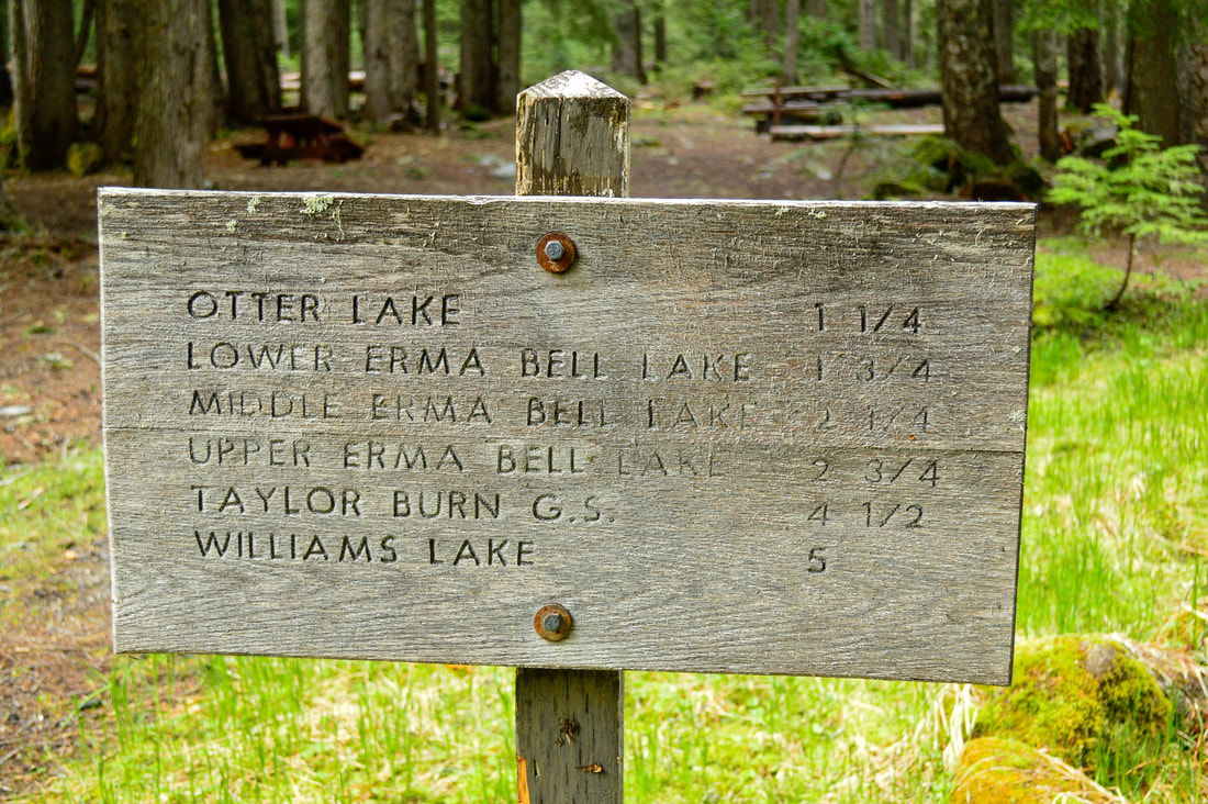
​The trail starts at Skookum campground and right away you will see a sign with a few different hiking trail options. Whichever hike you pick here, you must first hike 0.67 miles until you come to the Otter Lake and Erma Bell Lakes junction. If you take a left here you will have a chance to see Otter Lake and then make another split to Irish Mountain. If you want to do the Erma Bell Lakes loop, continue on trail #3563 to the right.
Lower Erma Bell Lake
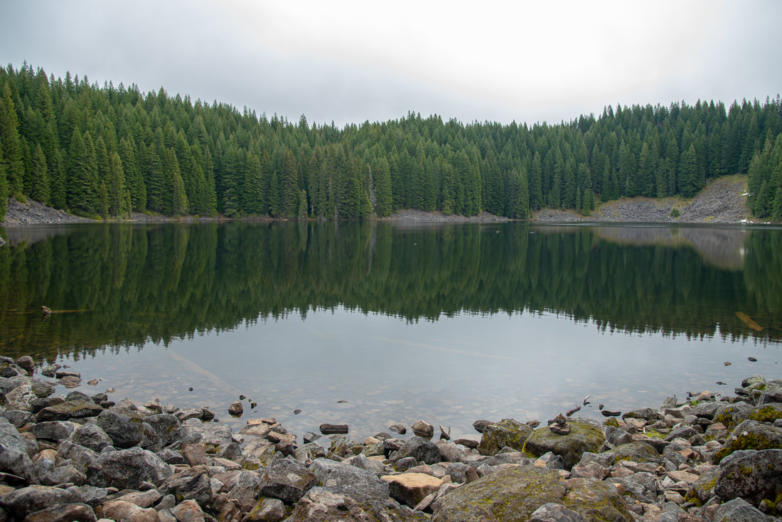
(Lower Erma Bell Lake)
Bald Eagle at Lower Erma Bell Lake
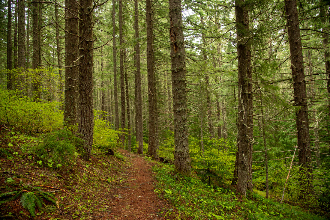
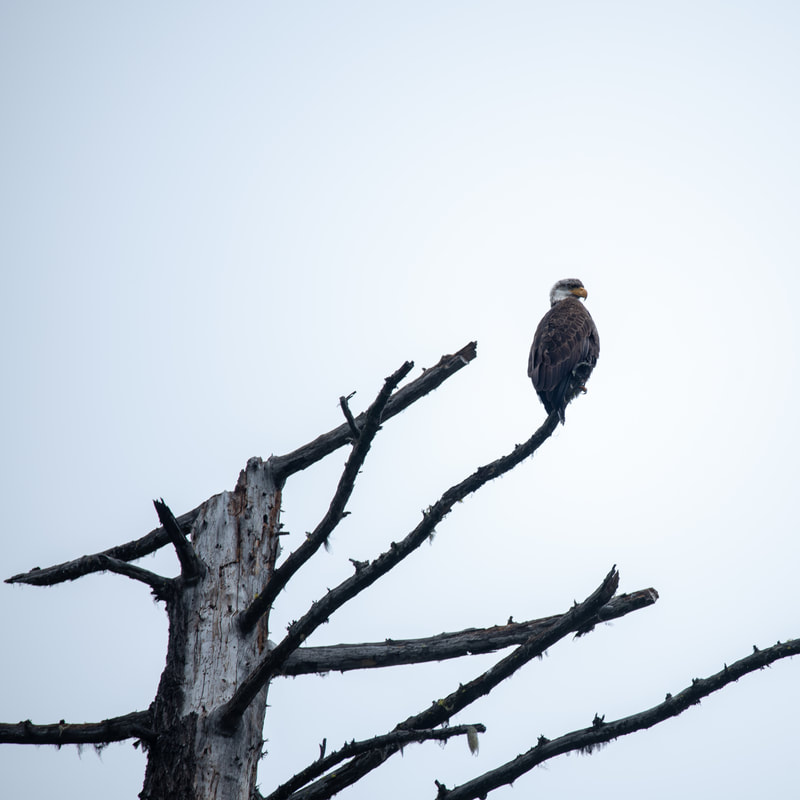
​For the next 1.1 miles you will be going slightly uphill through a beautiful lush green second-growth forest until you come to Lower Erma Bell Lake. ​This lakeshore is rocky and there is no great camping nearby. Frequently you can see bald eagles fishing at this lake. 
There is a creek that spills out of Lower Erma Bell Lake and the creek creates a beautiful little waterfall that cascades down over big mossy rocks and logs. You will hear the waterfall and see a small side trail on your right. It's worth checking out. 
No Name Falls along Erma Bell Lakes Trail
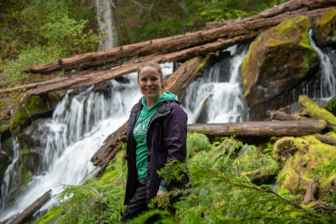
(hidden waterfall that comes out of Lower Erma Bell Lake)
Continue down the trail for another 0.25 miles and you will hear another waterfall. There is a creek that connects Lower and Middle Erma Bell Lakes and this waterfall is on that creek. It is named Erma Bell Falls and there is a small but steep trail that goes down to the bottom of it. The waterfall hasn't been surveyed but it is guessed to be about 25 feet tall and has two beautiful drops. Right after the waterfall you will come to another little side trail that takes you to the shoreline of Middle Erma Bell Lake. There are some nice camping options here. 
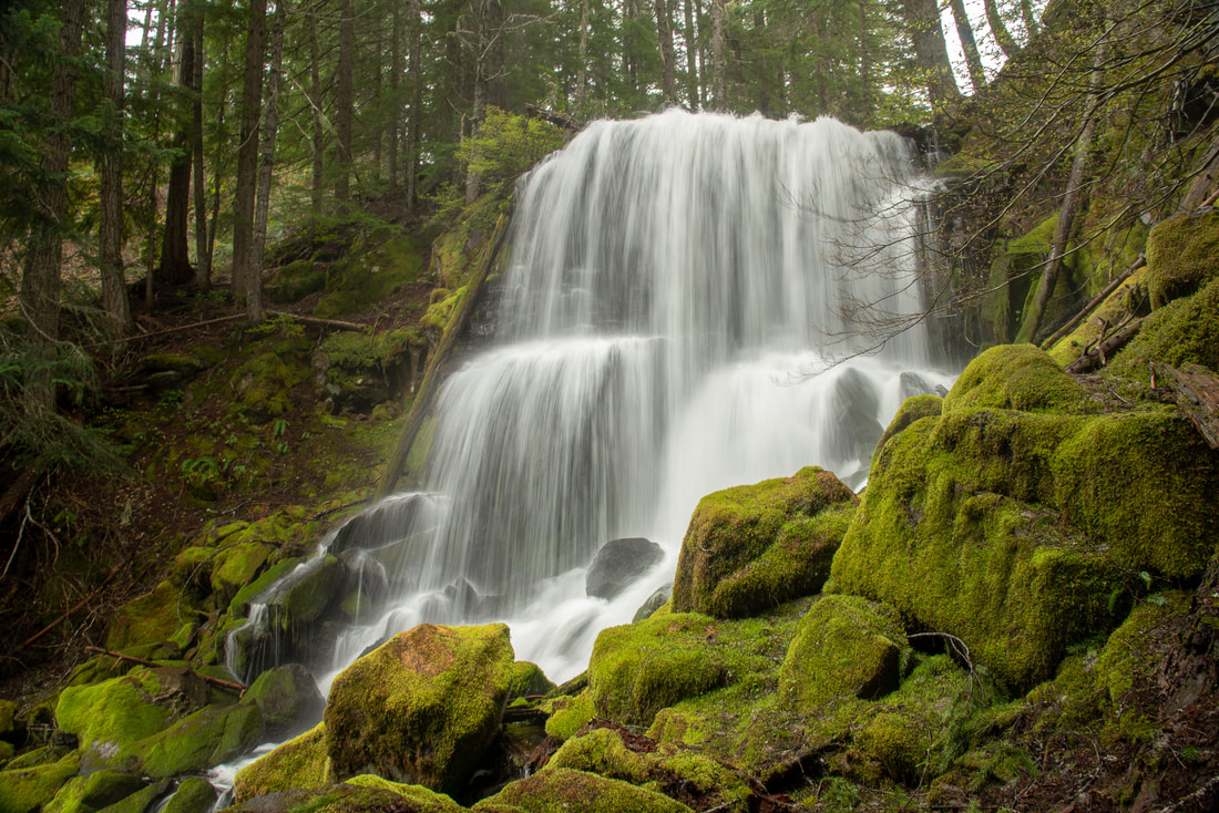
Erma Bell Falls
(Erma Bell Falls)
Middle Erma Bell Lake
(Middle Erma Bell Lake)
Upper Erma Bell Lake
(Upper Erma Bell Lake)
From Middle to Upper Erma Bell Lake it is 0.8 miles, and you will have to follow a small path to your right to get to the Upper Lake. This lake is a bit more secluded and further off the trail than the first two. Here the fish are literally jumping out of the water. Fishing is allowed at all of the Erma Bell Lakes with an Oregon fishing license. Upper Erma Bell Lake is absolutely wonderful and its shoreline is very pleasant with plenty of logs to sit on.
Sign for Judy Lakes trail along the Erma Bell Lakes loop trail
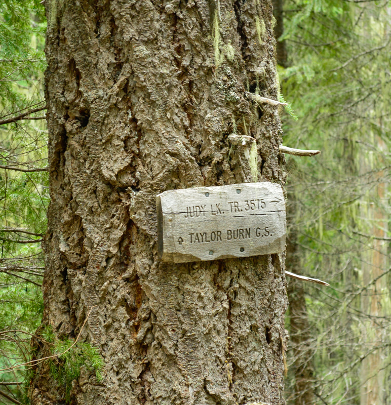
Half a mile from Upper Erma Bell Lake, you will see a split in the trail. If you are backpacking you could go to the right on the Judy Lake trail and check out Mud Lake, Edna Lake and the trail ultimately takes you to Taylor Burn Campground, but this will add some mileage to your hike. To continue on the Erma Bell Lakes Loop, stay to your left.
Sign for Williams Lake trail no. 3589
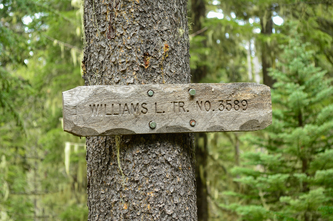
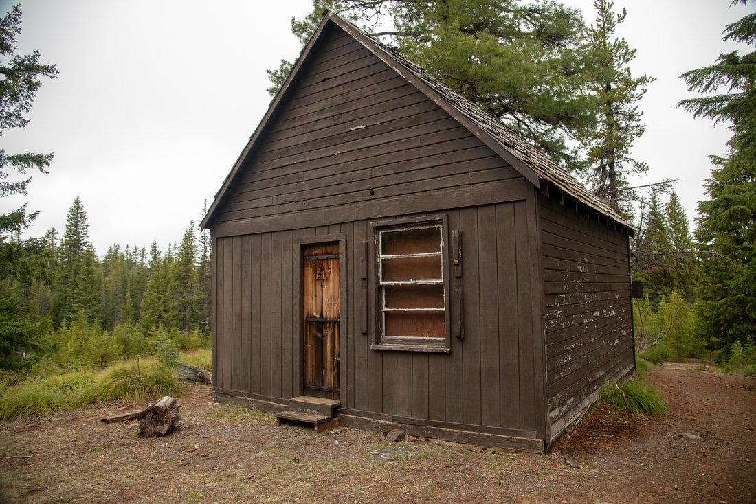
After another 0.8 miles, you will see another trail junction, where the trail you are on continues straight to Taylor Burn and another trail goes to the left. If you just want to do the 8.5 mile Erma Bell Lakes Loop and you have crossed a creek, you have missed this trail junction. You must go left and within a few feet of stepping foot onto this new trail you will see a sign that says Williams Lake trail #3589. If you want to extend your hike and check out the Taylor Burn cabin, you can continue straight here. 
Taylor Burn cabin in meadow
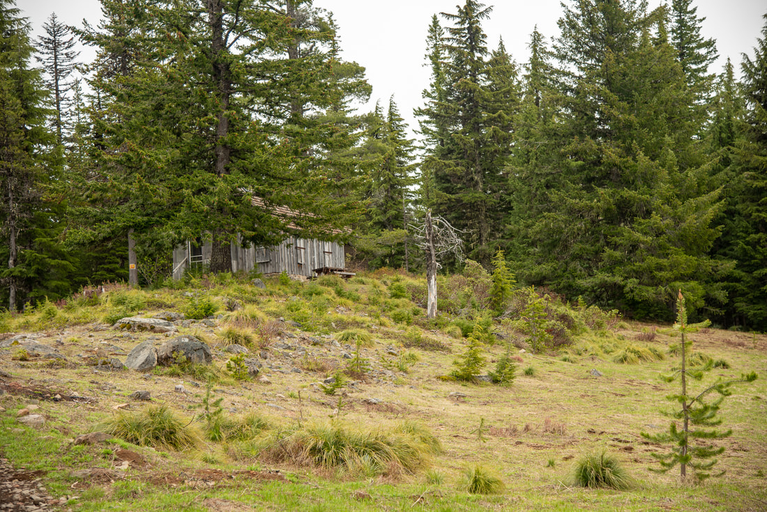
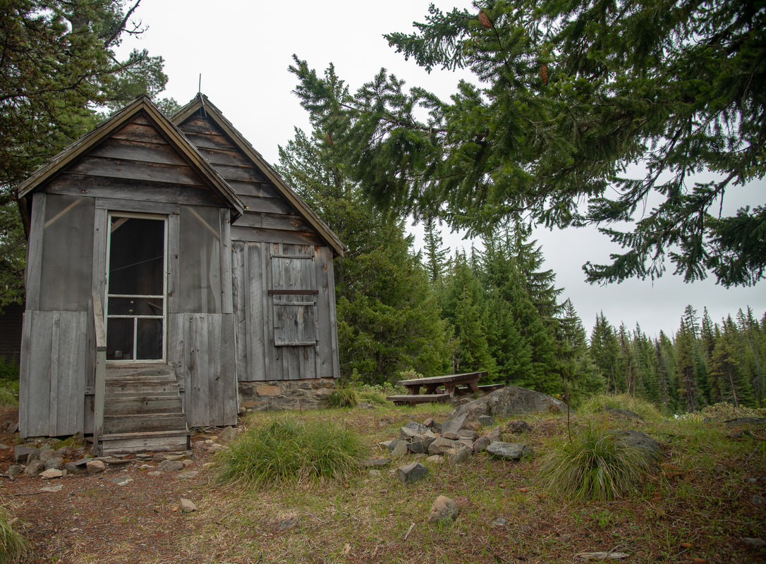
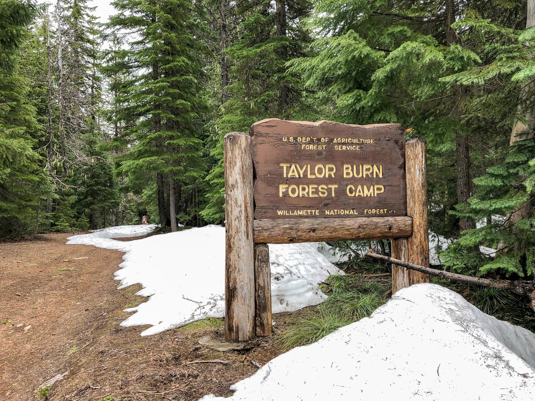
To check out the Taylor Burn cabin continue uphill for just under half a mile until you come to a forest road junction. The forest road to the left goes to the cabin set in a beautiful open meadow and the forest road to the right goes to Taylor Burn Campground, a very remote but really neat place to camp. After checking out the Taylor Burn cabin and campground area (the campground makes for an excellent place to have lunch because there are picnic tables and pit toilets), you will backtrack to the loop and continue right on the Williams Trail #3589.
Taylor Burn Cabin
Taylor Burn cabin2
Taylor Burn campground sign
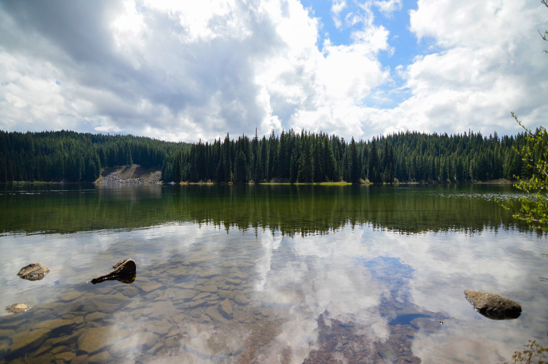
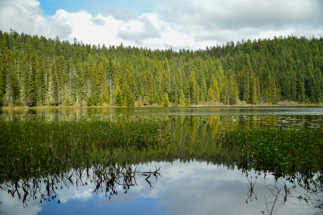
After walking through some very marshy areas (especially in spring during snowmelt it can be easy to lose the trail here because it is sometimes under water), the terrain dries out significantly and becomes very rocky where only lodgepole pines and beargrass seem to want to grow. Within 0.45 mile of the trail junction you will see Williams Lake. This lake is absolutely spectacular and there are many great spots to camp here as well. 
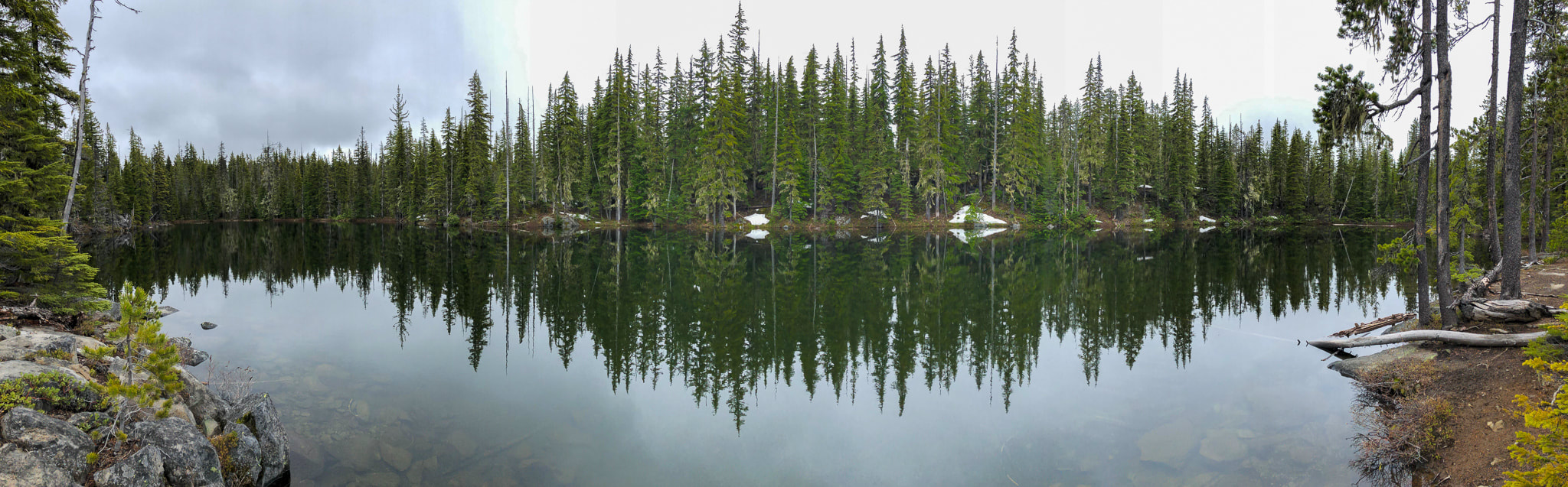
Williams Lake along the Erma Bell Lakes loop on the Williams Lake trail no. 3589
(Williams Lake)
After checking out the glassy waters of Williams Lake, you will make your way up and over a small hill, hiking through sparse lodge pole pine forest for 0.3 miles and then you will come to a creek. During the summer/fall months, this creek should be no problem to cross. During the spring, it can be quite roaring and you might have to use a log farther upstream to cross. If you look downstream, you will actually see another beautiful unnamed waterfall.

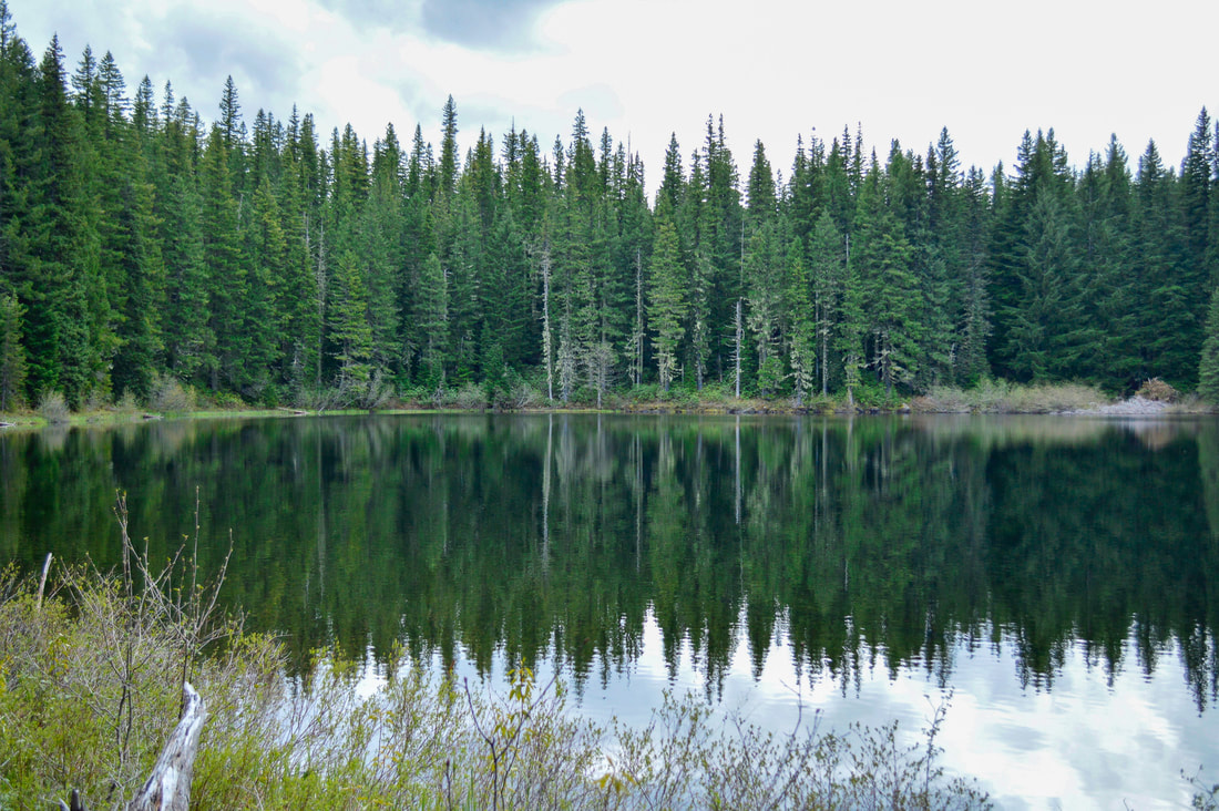
​From the creek crossing, the trek to Otter Lake is 2.3 miles, mostly through the forest. Otter Lake is also quite stunning with a larger area to camp among big trees that shade the lakeshore. In the spring Otter Lake has hundreds of lily pads that do flower with yellow and white blooms in mid-July. From Otter Lake it is another 1.2 miles back to your car at Skookum Campground. 
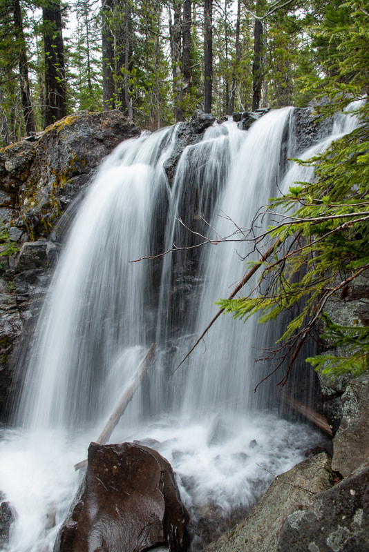
Williams trail no. 3589
(unnamed waterfall)
Creek crossing along Erma Bell Lakes Loop
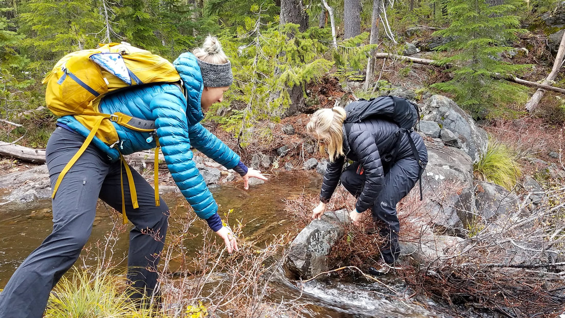
(creek crossing in spring)
Whether you are day hiking, camping or doing a little backpacking loop, there is so much to see in this area. There aren't any parts along this hike where there is a steep cliff, where you would have to watch your footing and have to be really careful, which makes this hike very relaxing and perfect for the whole family. Early in the season you might have to deal with a few blowdowns, however this trail does get yearly maintenance. 
Otter Lake along the Erma Bell Lakes trail
(Otter Lake)

Directions:

From Eugene
  • Drive east on OR-126 for 43.5 miles to Blue River. 5 miles east of Blue River take the Cougar Reservoir turnoff on the right and continue on Aufderheide Rd. 19 for 25.6 miles. After seeing the Box Canyon guard station on the left, turn left onto Rd. 1957 for 3.6 miles to its end at Skookum Campground. (Total of 76.5 miles). Depending on what side of Eugene you are coming from, you can also drive OR-58 31.3 until you see a sign for Westfir. Turn left onto the Westfir-Oakridge Road which eventually becomes Westfir Road. Continue through the town and then continue straight (by the red covered bridge) where Westfir Road becomes Aufderheide Road 19. Drive along Road 19 for 34.4 miles then turn right onto Rd. 1957 for 3.6 miles to its end at Skookum Campground.
From Bend
  • Drive south US-97 for 47 miles to the Crescent Cutoff Road. Take a right and continue on for 12 miles until you merge with Hwy. 58 west for another 39 miles until you see a sign for Westfir. Turn right onto the Westfir-Oakridge Road which eventually becomes Westfir Road. Continue through the town and then continue straight at the red covered bridge where Westfir Road becomes Aufderheide Road 19. Drive along Road 19 for 34.4 miles then turn right onto Rd. 1957 for 3.6 miles to its end at Skookum Campground. (Total of 137 miles).​
From Salem
  • It is a total of 138 miles via Eugene.
From Portland
  • It is a total of 183 miles via Eugene.
From Medford
  • It is a total of 229 miles via Eugene.
*All pictures are taken by Franziska Weinheimer
*Disclaimer: The trail descriptions, mileage, GPS tracks and difficulty ratings depicted on this website are never 100% accurate. Always hike at your own risk, using your own knowledge, equipment and common sense.  Franziska Weinheimer/Hike Oregon are not responsible if you or anyone in your party gets injured or lost while attempting one of these or any other hikes. 

HIKED HERE RECENTLY? PLEASE LEAVE A TRIP REPORT BELOW:

© Hike Oregon 2023
P.O. Box 41911
​Eugene, OR 97404
Proudly powered by Weebly
  • Home
  • *Store*
  • About the author
  • How to use this site
  • Resources
    • Wildflowers
    • Videos
  • Best Oregon Hikes
    • Top Fall Foliage Hikes In Oregon
    • Top 10 Oregon Fall Hikes
    • 20 Best Oregon Waterfall Hikes
    • Top 10 Oregon Hikes for Kids
    • Sno-Parks In Central Oregon
    • Top 10 Oregon Winter Hikes
    • Top Low Elevation Winter Hikes
    • 9 Amazing Oregon Summit Hikes
    • 20 Central Oregon Day Hikes
    • 20 Epic Oregon Wildflower Hikes
    • 5 Weekend Backpacking Trips in Oregon
    • Top One Night Backpacking Trips in Oregon
    • Top 10 Oregon Summer Hikes
    • Top 10 Swimming Spots In Oregon
    • Top 10 Oregon Spring Hikes
  • Oregon Sno-Parks
    • Maxwell Sno-Park
    • Potato Hill Sno-Park
    • Ray Benson Sno-Park
      • Brandenburg Shelter
    • Santiam Sno-Park
    • Three Creek Sno-Park
    • Virginia Meissner Sno-Park
      • Meissner Shelter Loop
      • Nordeen Shelter
    • Gold Lake Sno-Park
      • Westview Shelter to Eagle Rock Overlook
      • Marilyn Lakes Loop
  • Southern Washington
    • Hamilton Mountain
    • Dog Mountain
    • Coyote Wall
    • Mount St. Helens
  • Portland
    • Powell Butte
    • Forest Park
    • Latourell Falls
    • Multnomah/Wahkeena Falls
    • Eagle Creek
    • Mitchell Point
    • Table Rock
    • Tamanawas Falls
    • Trillium Lake
    • East Zigzag Mountain (members only)
  • Salem
    • Abiqua Falls
    • Silver Falls State Park
    • Dome Rock
    • Marion Lake to Marion Mountain
    • Jefferson Park
  • Corvallis
    • Marys Peak East Ridge
    • Marys Peak North Ridge
    • Alsea Falls and Green Peak Falls
    • Corvallis to Sea Trail - Sugarbowl Creek segment (members only)
  • Sweet Home
    • Crescent Mountain
    • Iron Mountain
    • McDowell Creek Falls
    • Middle Santiam River (members only)
    • Lower Soda Creek Falls (members only)
    • Rooster Rock (members only)
  • McKenzie Bridge/Blue River
    • Macduff Mountain
    • Proxy Falls
    • Clear Lake
    • Sahalie/Koosah Falls
    • Blue Pool
    • Erma Bell Lakes
    • Olallie Mountain
    • Horsepasture Mountain
    • Tidbits Mountain
    • Castle Rock
    • Lowder Mountain (members only)
    • East Fork Trail (members only)
    • Rainbow Falls Overlook (members only)
    • Frissell Point (members only)
    • Chucksney Mountain (members only)
    • Substitute Point (members only)
  • Sisters/Santiam Pass
    • Coffin Mountain
    • Trappers Butte and Scar Mountain
    • Maxwell Butte
    • Black Butte
    • Whychus Creek Trail
    • Tam McArthur Rim
    • Black Crater
    • Scott Mountain
    • Obsidian Trail
    • Metolius Preserve
    • Three Fingered Jack Loop
    • Square Lake
    • Canyon Creek Meadows
    • Patjens Lakes
    • Craig Lake (members only)
    • Chush Falls (members only)
    • Rockpile Lake (members only)
    • Santiam Lake (members only)
    • Camp Lake (members only)
    • Park Meadow to Golden Lake (members only)
  • Bend/Redmond/LaPine
    • Steins Pillar
    • Chimney Rock
    • Steelhead Falls
    • Tumalo State Park
    • Shevlin Park Loop
    • Tumalo Falls
    • Tumalo Mountain
    • No Name Lake
    • Green Lakes
    • Moraine Lake
    • South Sister Summit
    • Horse Lake
    • Muskrat Lake
    • Paulina Peak
    • Peter Skene Ogden Trail (members only)
  • Eugene
    • Ridgeline Trail
    • Mount Pisgah Summit
    • Mount Pisgah Arboretum
    • Shotgun Creek
    • Mount June
    • Lawler
    • Tire Mountain
    • Goodman Creek
    • Brice Creek
    • Trestle Creek Falls
    • Parker Falls
    • Moon Falls
    • Elijah Bristow State Park
    • South Willamette Trail (members only)
    • Eula Ridge (members only)
    • Eagle's Rest (members only)
  • Oakridge
    • Deception Creek
    • North Salmon Creek
    • Grasshopper Ridge
    • Larison Creek
    • Bunchgrass Ridge
    • Salt Creek Falls
    • Waldo Lake Loop
    • South Waldo Loop
    • The Twins
    • Rosary Lakes
    • Yoran Lake
    • Fawn Lake
    • Windy Lakes
    • Divide Lake
    • Diamond Peak Summit
    • Cowhorn Mountain
    • Wall Creek Warm Springs (members only)
    • Moon Point (members only)
    • Bobby Lake (members only)
    • Lillian Falls (members only)
    • Middle Fork Willamette Trail (members only)
    • Pool Creek Falls (members only)
    • Dead Mountain (members only)
    • Larison Rock (members only)
    • Quinn Lakes & Eddeeleo Lakes (members only)
    • Waldo Mountain Lookout (members only)
    • Blair Lake to Spring Prairie (members only)
    • Rigdon Lakes loop (members only)
  • Oregon Coast
    • Cascade Head
    • Drift Creek Falls
    • Sweet Creek Falls
    • Beaver Creek Falls
    • Kentucky Falls
    • Hobbit Trail to Heceta Head
    • Valley Trail to China Creek
    • Sutton Creek Trail (members only)
    • North Fork Smith River (members only)
    • Cummins Ridge (member's only)
    • Horse Creek (members only)
    • Siltcoos Lake (members only)
  • Southern Oregon
    • Fall Creek Falls
    • Watson Falls
    • Wild Rogue Loop
    • Mt. Thielsen
    • Crater Lake National Park
      • The Watchman
      • Mount Scott
      • The Pinnacles
    • Lower Table Rock
    • Pilot Rock
    • Wagner Butte
    • Mt. McLoughlin
    • Lemolo Falls (members only)
    • Fern Falls (members only)
  • Eastern Oregon
    • Painted Cove
    • Anthony Lake Loop
    • Mount Howard
    • Eagle Cap summit
    • Schneider Cabin (members only)
    • Strawberry Lake & Strawberry Falls (members only)
  • Oregon PCT sections
  • Tips & Tricks
    • Leave No Trace
    • How To Pick The Right Backpacking Tent
    • Top Tips For Hiking With Infants And Toddlers
    • Poison Oak, Ivy and Sumac
    • How to dress for cold weather hikes
    • Outdoorsy Holiday Gift Guide 2022
    • Hiker Holiday Gift Guide 2019
    • Outdoor Holiday Gift Guide 2018
    • Hiking Holiday Gift Guide 2017
  • Reviews/Gear
    • Storing Your Bear Canister When Backpacking
    • Stay Kühl This Summer
    • Outdoor Herbivore Backpacking Food Review
    • Osprey Aura AG 65 Backpack review
    • Big Agnes Fly Creek UL2 review
    • REI Quarter Dome 1 review
  • Adventure Stories
    • Hiking The Rae Lakes Loop
    • 110 Miles on the PCT
    • Three Fingered Jack Adventures
    • Jefferson Wilderness