Top 15 One Night Backpacking Trips in Oregon
There are many places to backpack in Oregon, however it isn't always easy for folks to be able to take multiple days off work to go on an extensive backpacking trip. Here are the top 15 hikes in Oregon where you can hike in, spend the night and hike out the next day, and still be able to experience some of the hidden gems that the Oregon wilderness has to offer!
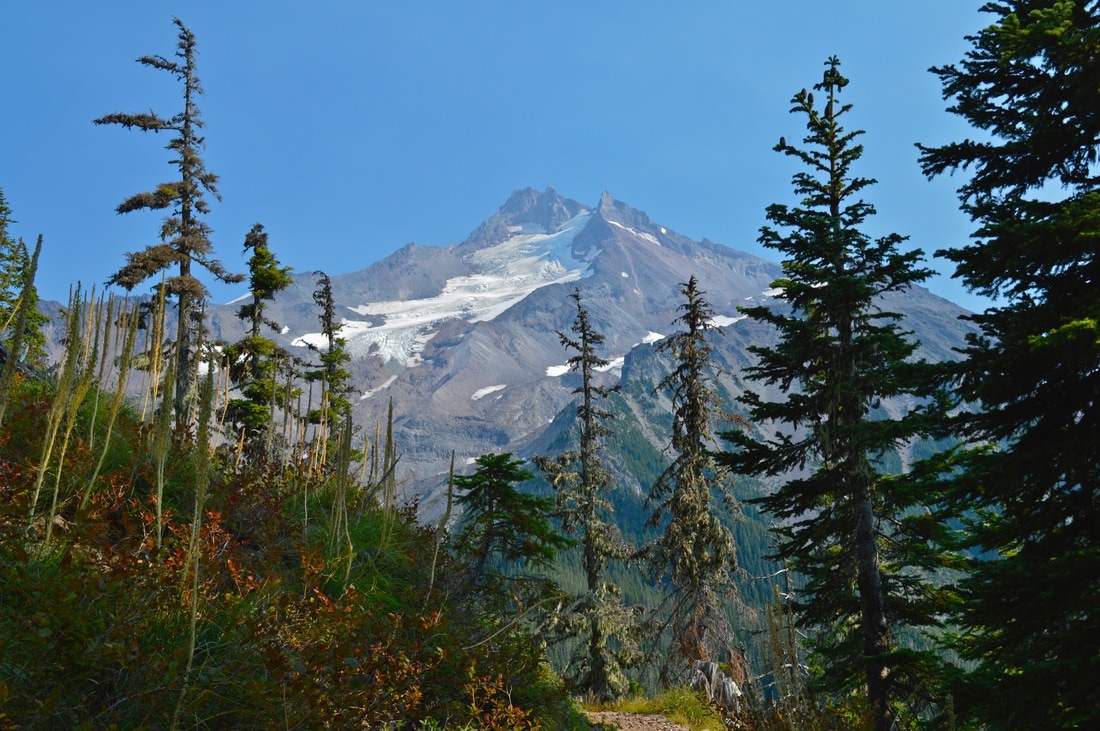
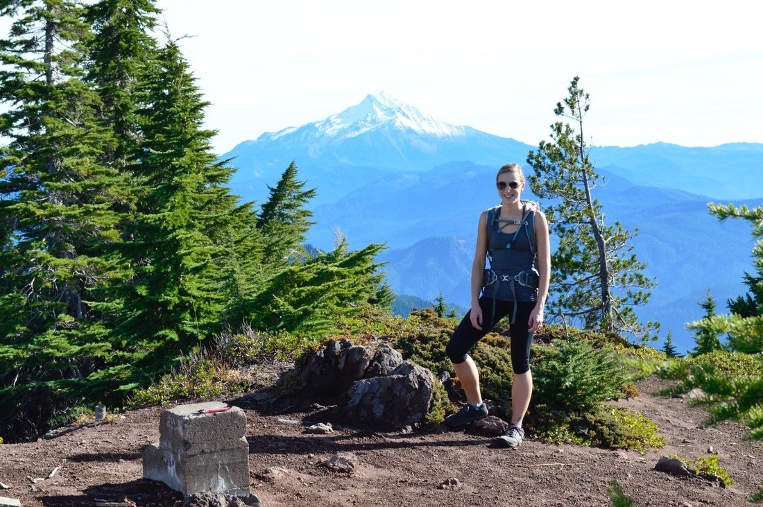
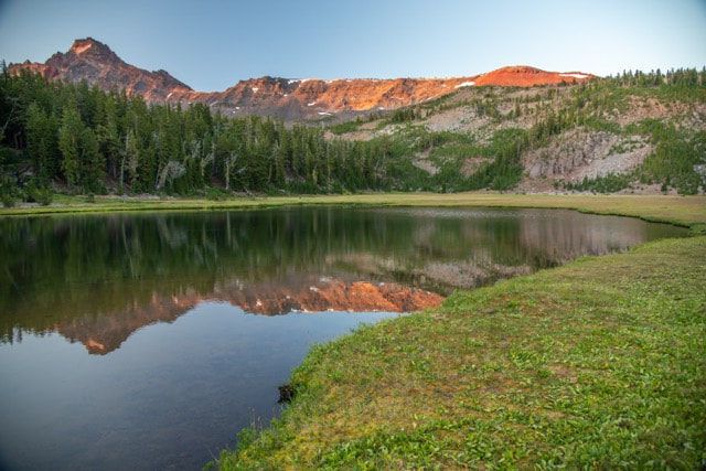
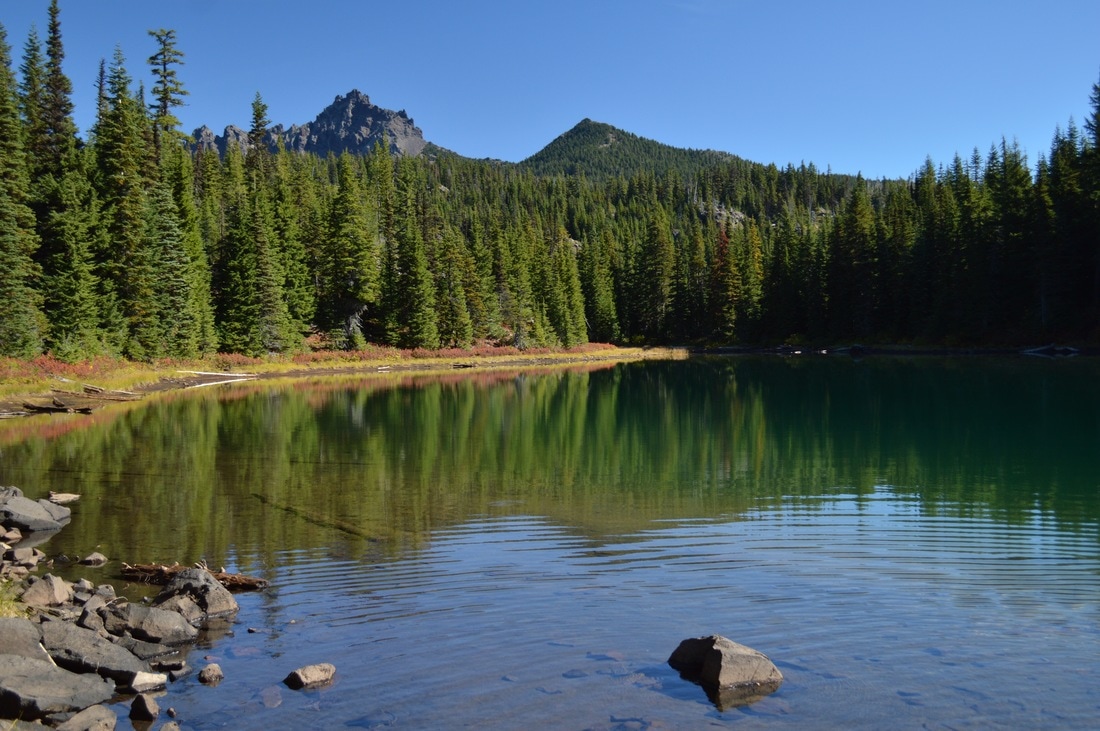
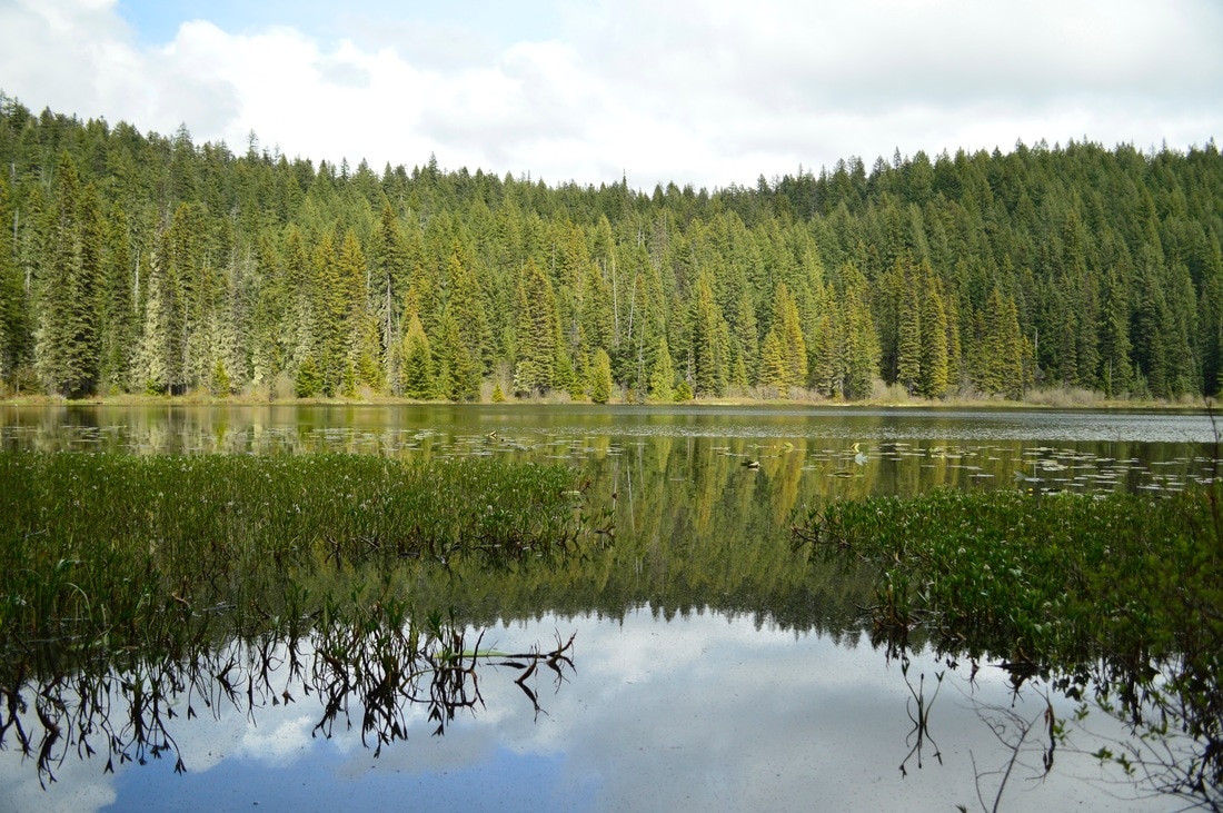
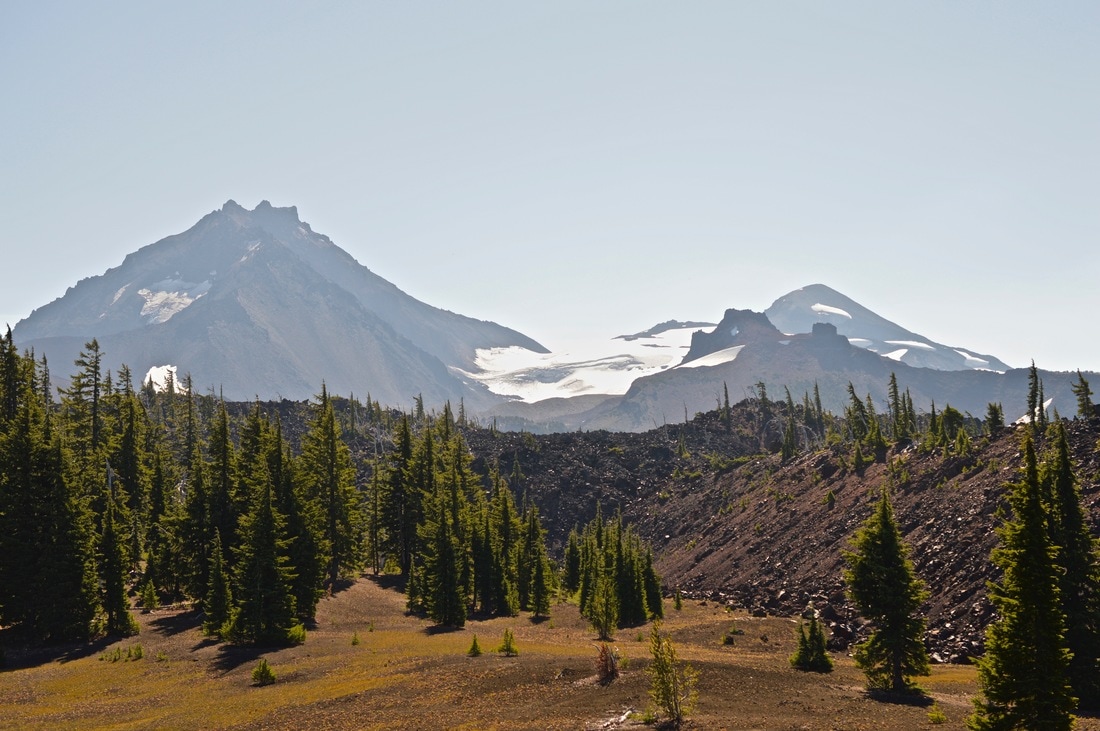
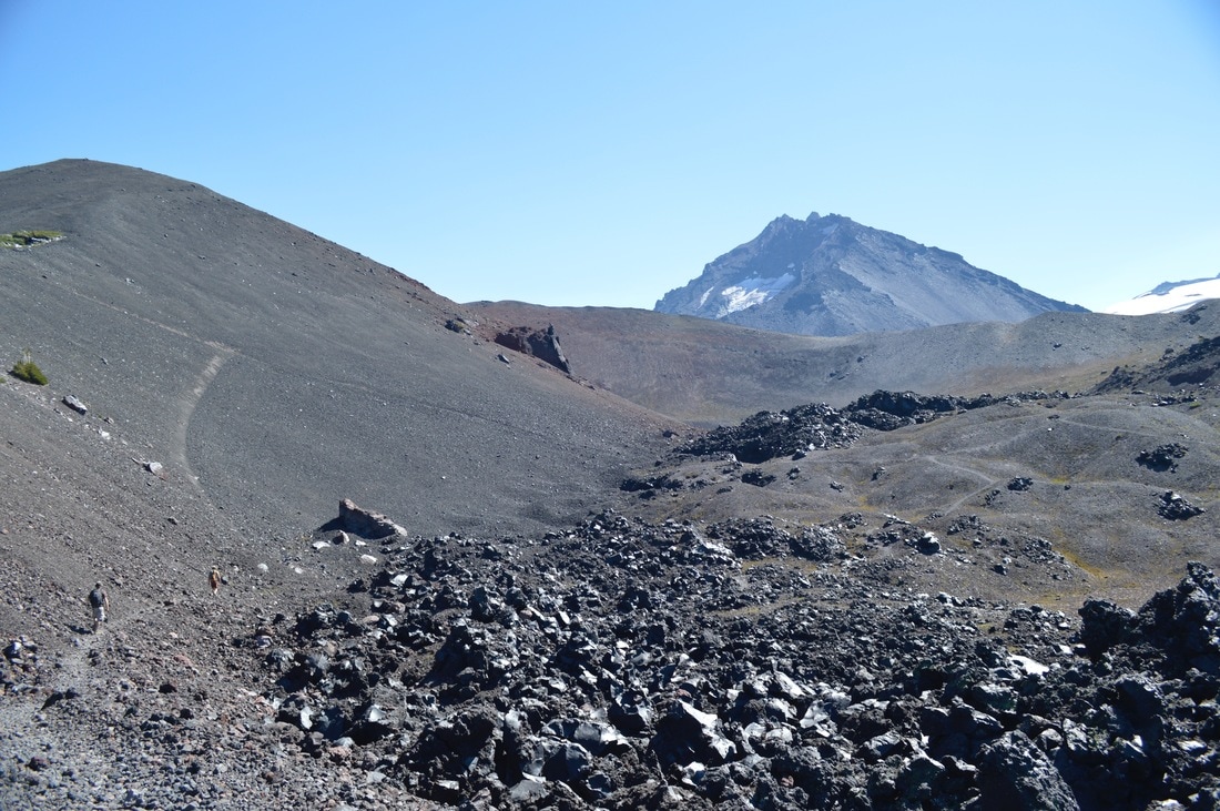
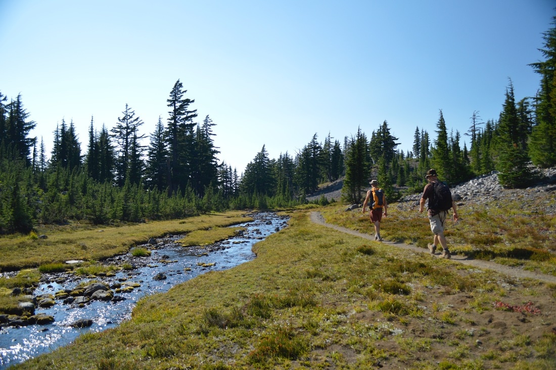
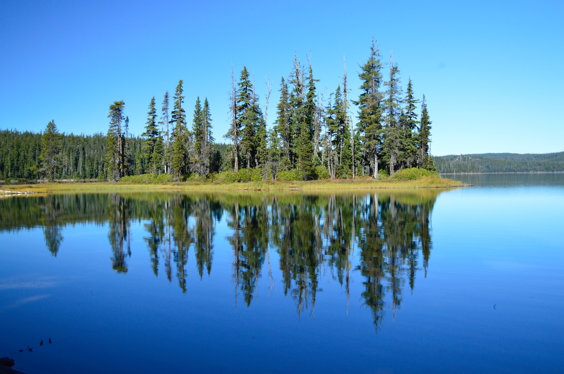
1) Russell Lake at Jefferson Park
|
|
|
Closest town: Detroit
Trail type: Out and back
Mileage: 12.5 round trip w/ 2,600 ft. elevation gain
Terrain difficulty: Moderate (large rocks on the Whitewater trail with some exposure).
Trail usage: Heavy
Central Cascades Wilderness Permit needed: YES
Where to set up your tent: Russell Lake (there are 4 designated campsites around the lake. If they are full, head over to Scout Lake or Bays Lake where you will find 20 campsites around those two lakes).
About the hike: This 6.25 mile hike to Russell Lake from the Whitewater trailhead, does gain significant elevation on a rocky trail. Once the Whitewater trail connects with the Pacific Crest Trail, the hike gets easier, and you can enjoy the beautiful vast views of lakes and Mt. Jefferson. At Russell Lake you can pick from 4 very private camp sites, and enjoy watching the sun set and the moon rise over the mountain.
(The Whitewater Trail is still currently closed due to wildfire damage but you can head into Jefferson Park via Woodpecker Ridge Trailhead which does add mileage.)
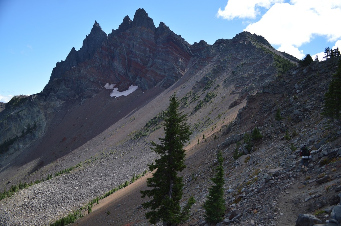
2) Battle Ax Mountain to Twin Lakes
|
|
Closest town: Detroit
Trail type: Out and back with a small loop
Mileage: 12.7 miles round trip w/ 3,480 ft. elevation gain
Terrain difficulty: Moderate (parts of the trail are rocky with extreme side-hill exposure).
Trail usage: Low
Central Cascades Wilderness Permit needed: NO
Where to set up your tent: Upper Twin Lake (there is only room for 2-3 tents at the lake).
About the hike: This 6.3 mile hike to Upper Twin Lake, will take you up to the scenic viewpoint of Battle Ax Mountain, where you get 360 degree views of the Cascade mountains and the valley. Then the trail takes you down to beautiful Upper Twin Lake, where you can spend the night and watch the sunset on the surrounding hills.
(Click here to read more about this hike and to get directions- this post is for members only, you can purchase the seasonal membership for $9.99)
3) Green Lakes
|
|

|
Closest town: Bend
Trail type: Out and back with a small loop
Mileage: 11.25 miles round trip w/ 1,660 ft. elevation gain
Terrain difficulty: Easy (the majority of the trail is even and dusty, with minimal rocks and roots, no steep grade and no exposure).
Trail usage: Heavy!
Central Cascades Wilderness Permit needed: YES
Where to set up your tent: Any of the three Green Lakes have spots for camping. The upper Green Lake is very beautiful and has plenty of spots for camping.
About the hike: This hike is very easy and perfect for a small backpacking trip with your kids, or for experiencing backpacking for the first time. The trail is not technical, not steep and it offers amazing views. You can choose to set up your tent at any of the three lakes. The lower one is quite small and not very private. The largest lake has a few semi-private spots, however the top lake is small, but it has the most private camp sites. Once you set up your camp, you can explore around the lakes, check out the hidden waterfall coming from the SE flanks of South Sister, or just go for an afternoon swim.
(Click here to read more about the hike and to get directions)
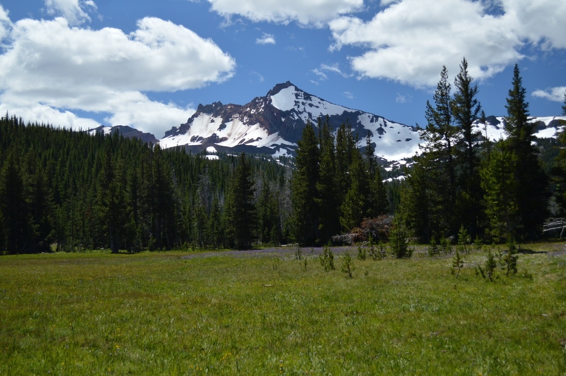
4) Park Meadow to Golden Lake
|
|
Closest town: Sisters
Trail type: Out and back
Mileage: 13.4 miles round trip w/ 2,010 ft. elevation gain
Terrain difficulty: Easy to moderate (the trail is very dusty due to a fire that burned this area a few years ago. There are no rocks or roots until you begin your short climb up to Golden Lake. There is no exposure).
Trail usage: Moderate on weekends, low on weekdays
Central Cascades Wilderness Permit needed: YES
Where to set up your tent: Golden Lake (there are plenty of different places you can set up your tent near Golden Lake. Do not camp on the meadow as it is very fragile).
About the hike: From the trailhead it is 6.4 miles up to Golden Lake. You will pass through the Pole Creek burn area, Park Meadow with a creek crossing, and then head up to Golden Lake. If you camp at the lake in late July you will be greeted by a gorgeous sight of a yellow flowering meadow with the lake in the middle, however during this time you will also get swarmed by mosquitoes. The best time to backpack to Golden Lake is end of August or in the month of September.
(Click here to read more about this hike and to get directions- this post is for members only, you can purchase the seasonal membership for $9.99)
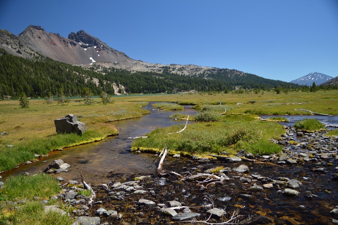
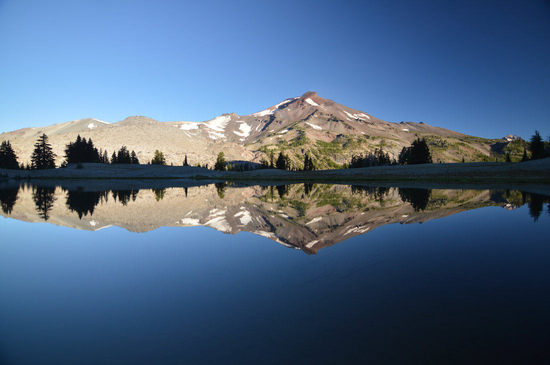
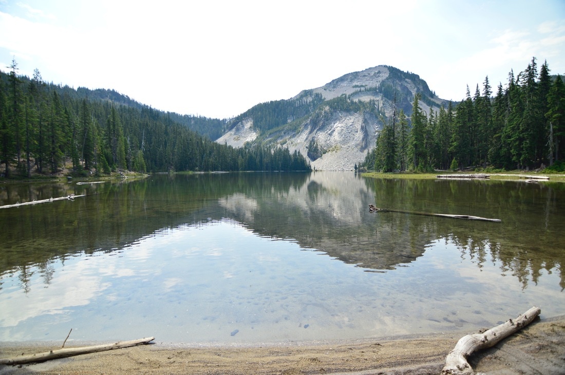
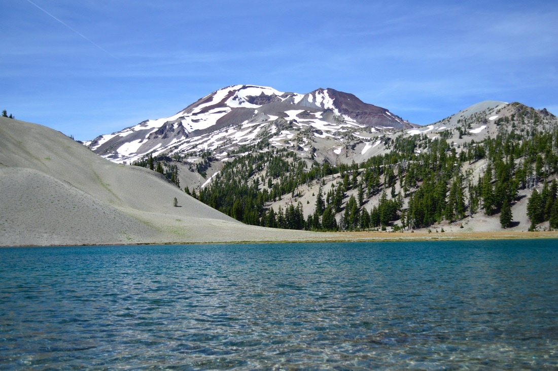
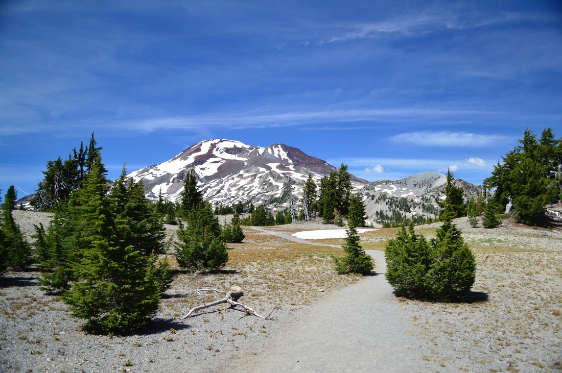
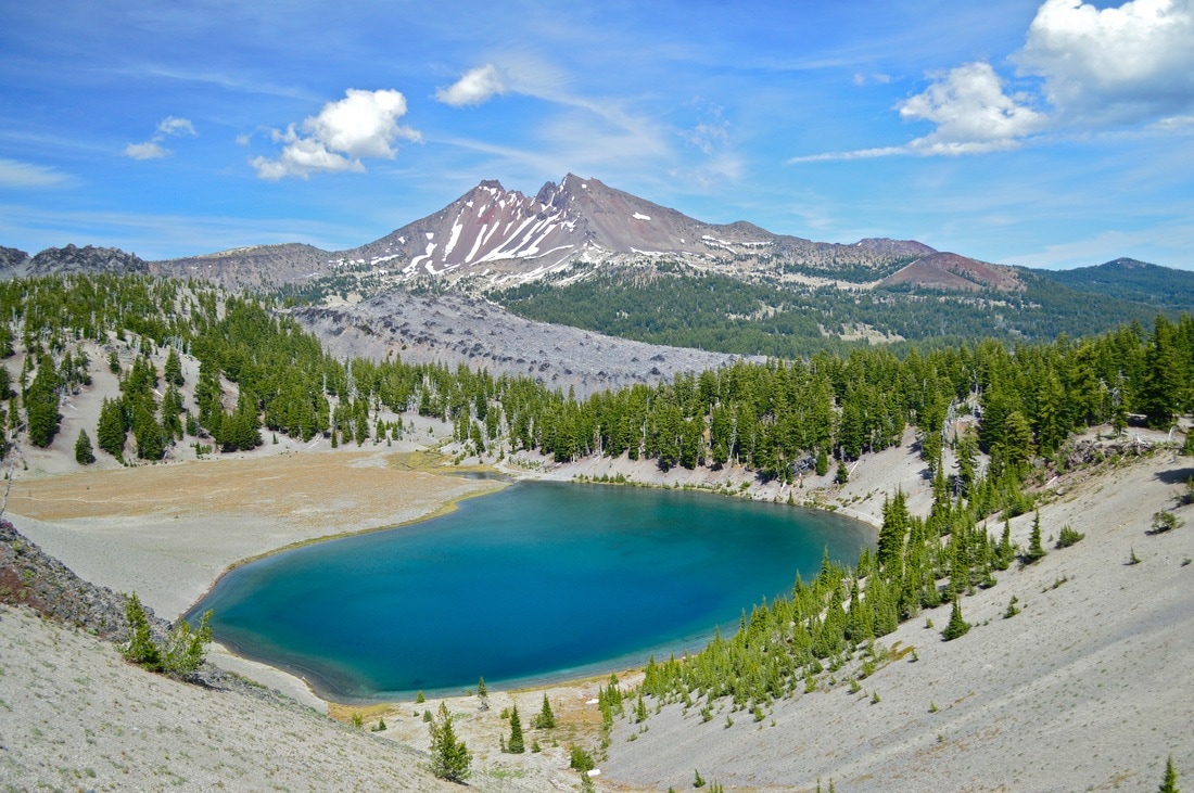
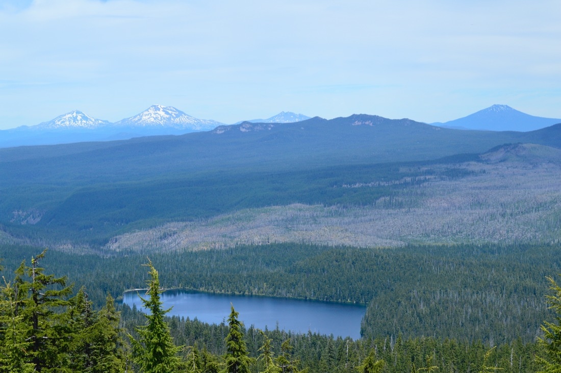
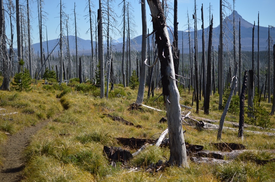
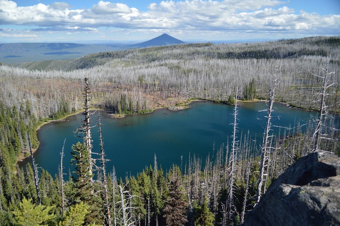
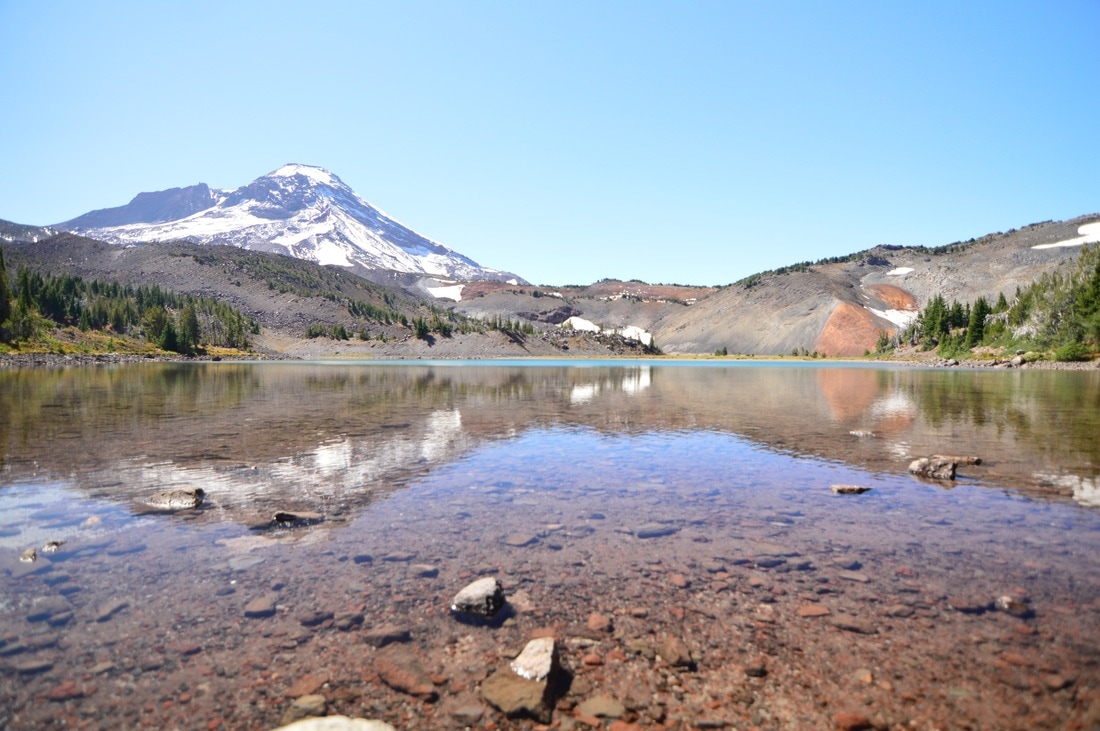
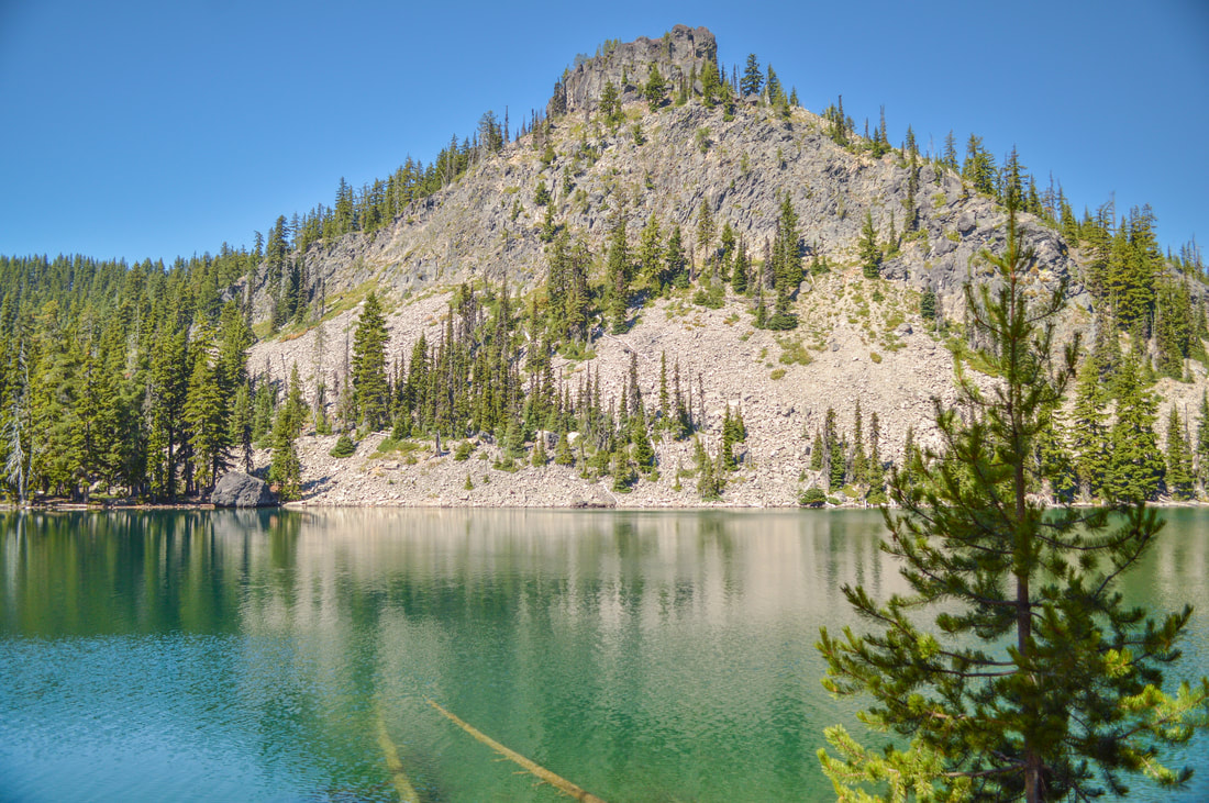
5) Timpanogas Lake to Cowhorn Mountain Loop
|
|
|
Closest town: Crescent
Trail type: Loop Mileage: 12.2 miles round trip w/ 3,040 ft. elevation gain Terrain difficulty: Moderate (the trail through the forest is fairly easy, however once you get up near Cowhorn Mountain the terrain is rocky and if you climb Cowhorn, there will be steep exposure on both sides of the ridge). Trail usage: Low Central Cascades Wilderness Permit needed: NO Where to set up your tent: Indigo Lake or up near Sawtooth Mountain (Indigo Lake has designated camping spots, however it is only a few miles into the hike. If you are wanting to hike a bit further and get a view, back-country camp up near Sawtooth Mountain). About the hike: This loop offers a variety of terrain from forested lakes, to the peaks of Sawtooth Mountain and Cowhorn Mountain. If you choose to take the side trip off the loop trail up the spine of Cowhorn Mountain, you will get 360 degree views of the Diamond Peak Wilderness and the many lakes below. (Click here to read more about the hike and to get directions) |
|
6) Moraine Lake
|
|
|
Closest town: Bend
Trail type: Out and back
Mileage: 6.25 miles round trip w/ 1,845 ft. elevation gain
Terrain difficulty: Easy (the entire trail is a dusty dry terrain, there are a few roots during the first mile with some steep grade, but there is zero exposure on this hike).
Trail usage: Heavy
Central Cascades Wilderness Permit needed: YES
Where to set up your tent: Moraine Lake (There are a few campsites in the trees on the hill right above the lake. Do not put your tent on the grass right by the lake, as this is a very fragile landscape).
About the hike: This is the perfect hike to take your kids on, especially if it is their first backpacking trip. It is only 3.1 miles to Moraine Lake where you will set up camp. From here you can swim in the lake on a hot summer day, or you can go down the trail and explore if you want to get a few extra miles in. This area is absolutely breathtaking, and watching the sun set to the left of South Sister is amazing!
(Click here to read more about the hike and to get directions)
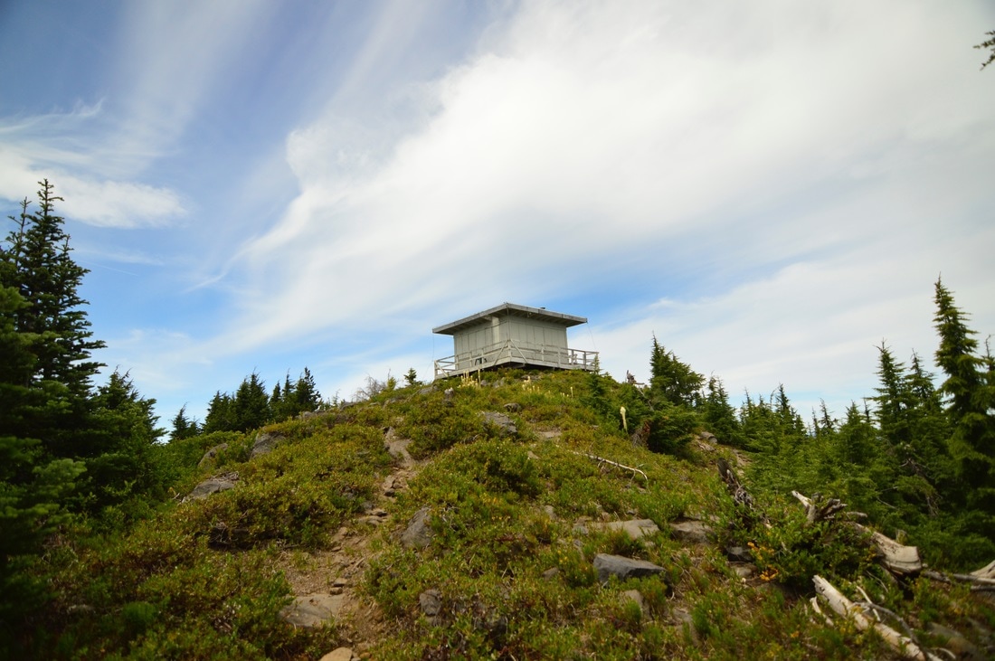
7) Waldo Mountain Lookout
|
|
|
Closest town: Oakridge
Trail type: Loop
Mileage: 8.8 miles round trip w/ 2,520 ft. elevation gain
Terrain difficulty: Easy to moderate (the majority of the trail is very easy, however the last mile to the lookout hut is rocky and there is some side exposure).
Trail usage: Low
Central Cascades Wilderness Permit needed: NO
Where to set up your tent: You can sleep inside the hut if it is open, or you can set up your tent next to the lookout hut.
About the hike: This loop hike is for the person who wants to be in a more isolated area. You will not see many people on this hike! It is almost exactly 4.4 miles to the top of Waldo Mountain where you can sleep inside the hut, or set up your tent nearby. On the way to the hut you can take a side trip and check out some lakes, and walk through beautiful wildflower meadows. From the top of Waldo Mountain you will get great views of Waldo Lake and the Three Sisters.
(Click here to read more about this hike and to get directions- this post is for members only, you can purchase the seasonal membership for $9.99)
8) Broken Top and No Name Lake
|
|
Closest town: Bend
Trail type: Out and back
Mileage: 13.25 miles round trip w/ 2,430 ft. elevation gain
Terrain difficulty: Moderate (the trail is mostly dusty, no roots or large rocks until about 2 miles from the lake. There you start to encounter rocks on the trail, and there is a creek bed that you have to hike up through in order to get up to the lake).
Trail usage: Heavy!
Central Cascades Wilderness Permit needed: YES
Where to set up your tent: While you are not allowed to camp within a 1/4 mile of the lake itself, there are plenty of spots to camp anywhere nearby the lake. You can set up your tent on the small hills surrounding the lake. Please do not put your tent on top of any wild flowers that grow in this fragile alpine environment.
About the hike: This is one of the most unique hikes in Oregon, and also one of the most popular trails. There is a shorter trail that leads to the Broken Top crater, which means you get all of the people who are just up there to put their flamingo floaties in the water and take some pictures for Instagram. So take the longer trail up, make a day of it, and arrive a bit later once the crowds have dispersed. Once it is evening and you have set up your tent, there won't be any people up there anymore, and you will get epic views of that blue-green water, and the star filled sky!
(Click here to read more about the hike and to get directions)
9) Santiam Lake
|
|

|
Closest town: Sisters
Trail type: Out and back with small loop around the lake
Mileage: 12.5 miles round trip w/ 1,400 ft. elevation gain
Terrain difficulty: Easy (the trail has no big rocks or roots and zero exposure).
Trail usage: Low to moderate
Central Cascades Wilderness Permit needed: YES
Where to set up your tent: Santiam Lake (there are many spots by the lake for setting up camp).
About the hike: This is a perfect easy trip to take with your kids. It is a very easy 6 miles to Santiam Lake. Once at the lake you will have amazing views of Three Finger Jack, and plenty of camp site choices. If you wanted to make this a longer weekend trip, there are many trails that you can take from Santiam Lake that you can explore and head to other lakes like Duffy and Mowich Lake and Marion Lake.
(Click here to read more about this hike and to get directions- this post is for members only, you can purchase the seasonal membership for $9.99)
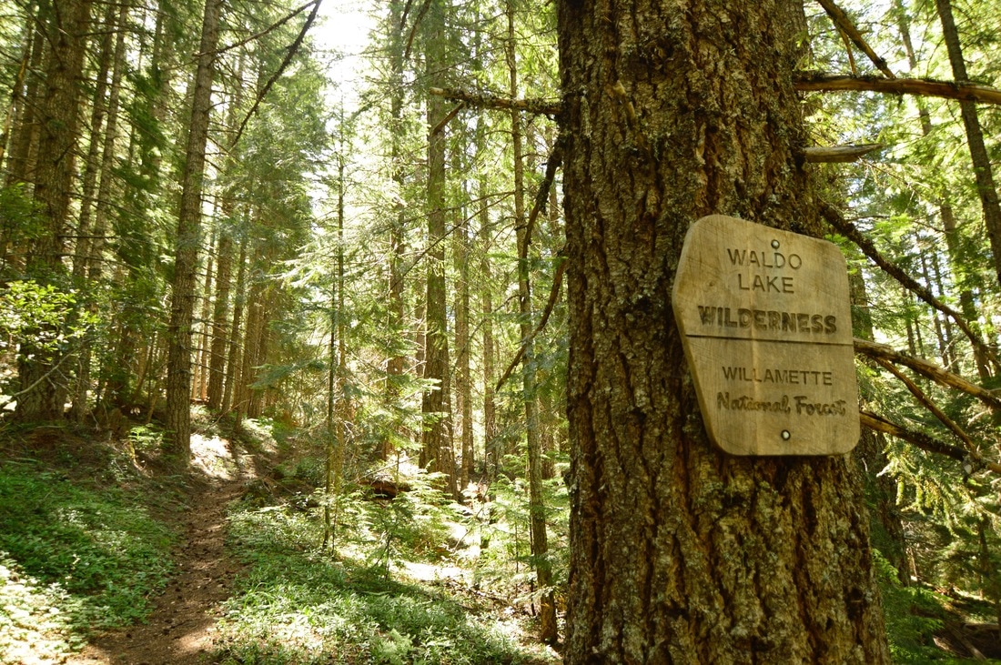
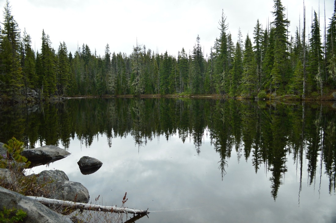
10) Erma Bell Lakes Loop
|
|
|
Closest town: McKenzie Bridge or Oakridge (it is the same distance between the two)
Trail type: Loop
Mileage: 9 miles round trip w/ 1,920 ft. elevation gain
Terrain difficulty: Easy to moderate (most of the trail is even grade, little to no rocks, some small creek crossings, no exposure).
Trail usage: Moderate on weekends, low during the week
Central Cascades Wilderness Permit needed: YES
Where to set up your tent: Any of the lakes (all of the lakes have places to set up your tent, however Williams Lake is the best camping spot and the prettiest lake).
About the hike: This is a great loop to take for someone who loves to fish. All of the Erma Bell Lakes and Williams Lake have abundant fish. These forested lakes are all very beautiful, tucked away in the Waldo Lake Wilderness. From your camp you can take a little excursion and head a few miles up Irish Mountain to catch a sunrise view of the Cascade Mountains.
(Click here to read more about the hike and to get directions)
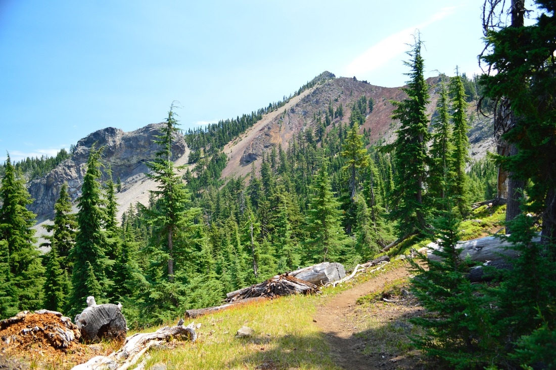
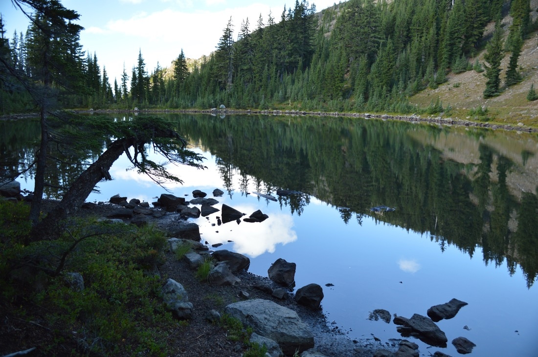
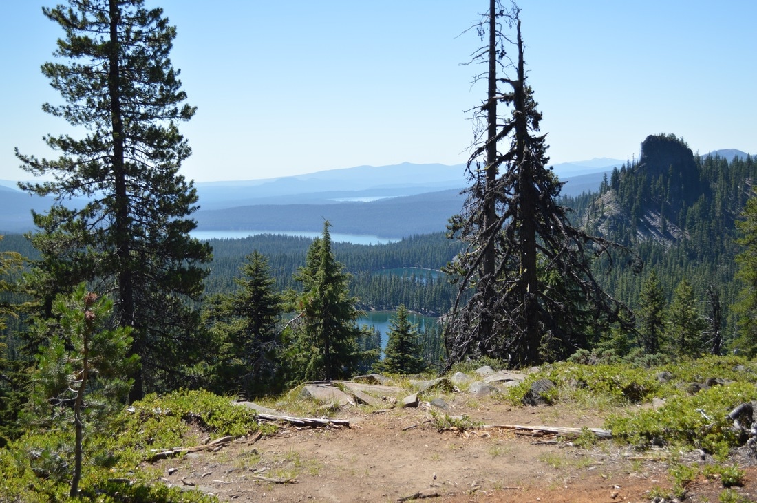
11) PCT- Santiam Pass to Rockpile Lake
|
|
|
Closest town: Sisters
Trail type: Out and back
Mileage: 26.6 miles round trip w/ 2,850 ft. elevation gain
Terrain difficulty: Difficult (most of the trail is rocky and if the blow downs haven't been cleared yet, you will likely be stepping over quite a few logs. There is side exposure on a few sections of this hike).
Trail usage: Medium on weekends, light on weekdays
Central Cascades Wilderness Permit needed: YES
Where to set up your tent: Rockpile Lake (there are a few different areas around the lake where you can set up your tent. There is enough flat ground for about 10 tents).
About the hike: This 13.3 mile section is one of the most scenic parts of the Oregon Pacific Crest Trail. You will hike through some burned forest, green forest, on a ridge right at the tree-line, and past beautiful turquoise lakes. You will also be able to see vast wild valleys below, and then you will get to Rockpile Lake, which is nicely tucked away along a hillside.
(Click here to read more about the hike and to get directions)
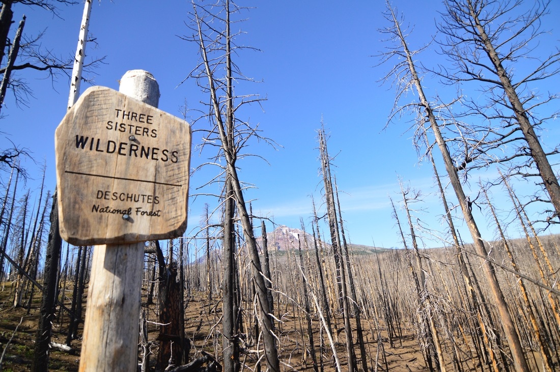
12) Scott Trail to Obsidian Loop
|
|
|
Closest town: Sisters
Trail type: Loop
Mileage: 17.4 miles round trip w/ 3,570 ft. elevation gain
Terrain difficulty: Moderate to difficult (there are many sections on this hike that go through lava flows which are extremely difficult to hike through and some are also very steep. There is limited exposure on this hike).
Trail usage: Heavy
Central Cascades Wilderness Permit needed: YES
Where to set up your tent: There are multiple places along this loop where you can set up your tent and spend the night. The most magical place to stay is at Sister Spring, however it is in the middle of the Obsidian Limited Entry Area, so if you choose to sleep here, you will need to first purchase a permit online).
About the hike: This loop is one of the most popular backpacking loops in the Three Sisters area, and for good reason. The views of the mountains are endless, and you will get to experience hiking over lava flows and some obsidian. You will see a few fresh springs that offer refreshing water and lush green meadows. Once you are in the Obsidian Limited Entry Area, you will even get to see a rare alpine waterfall.
(Click here to read more about the hike and to get directions)
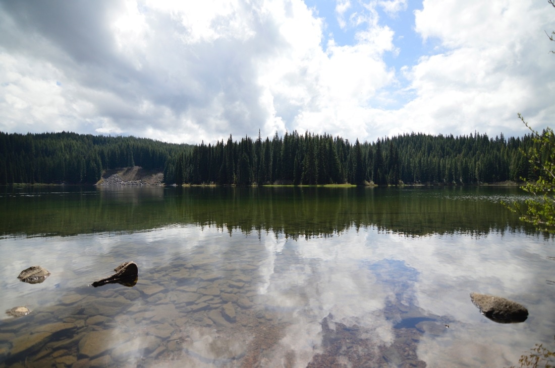
13) South Waldo Lake - currently CLOSED due to Cedar Creek Fire
|
|
Closest town: Oakridge
Trail type: Loop
Mileage: 10.2 miles round trip w/ 2,130 ft. elevation gain
Terrain difficulty: Easy (most of the hike is in the woods and through meadows, no rocks, steep grade or exposure).
Trail usage: Low
Central Cascades Wilderness Permit needed: NO
Where to set up your tent: At the shelter or in one of the many beautiful meadows
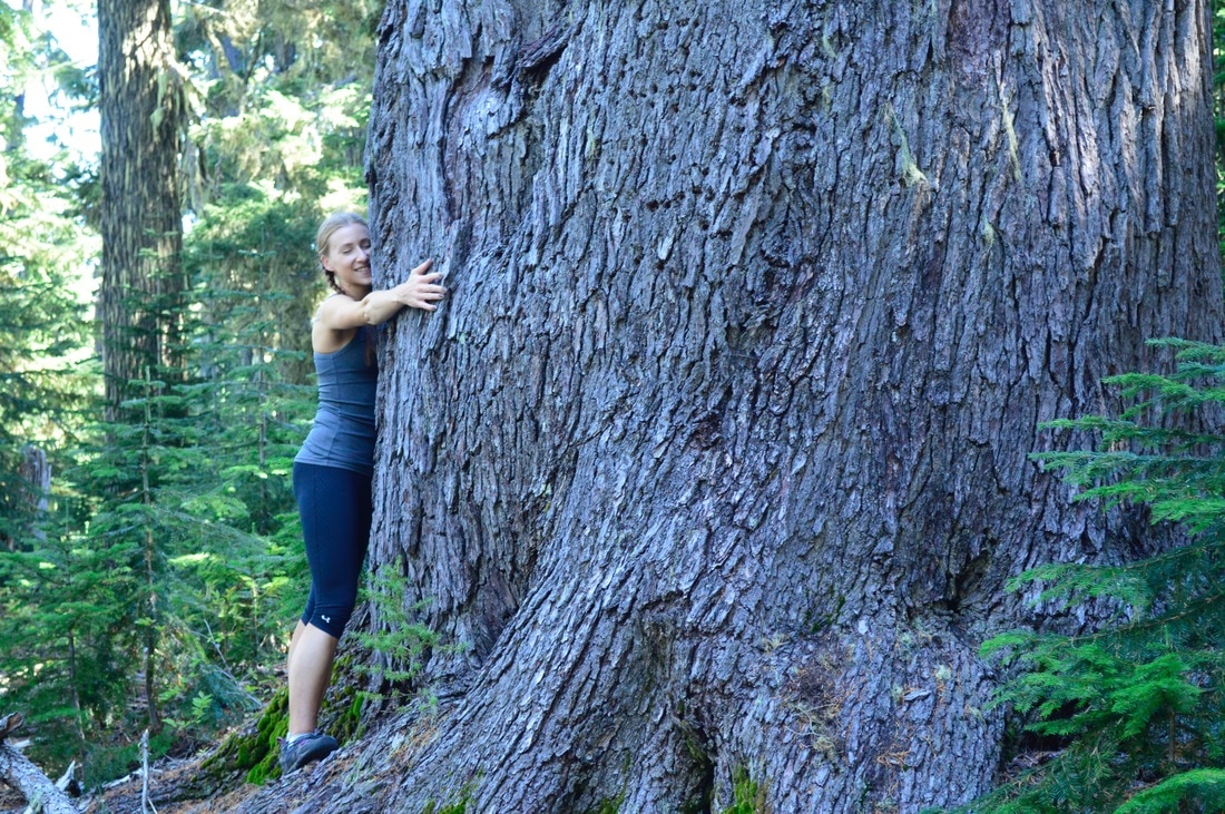
About the hike: This hike is a fairly easy lollipop loop. You can make this an extremely short hike by only hiking in 1.7 miles to the shelter and camping there and spend the day swimming at the nearby shores of Waldo Lake. This is perfect if you have small children. The entire loop offers beautiful forests, with a few very large old growth trees, and many vast golden meadows. This hike is great for late summer and early fall.
(Click here to read more about the hike and to get directions)
Trail type: Loop
Mileage: 10.2 miles round trip w/ 2,130 ft. elevation gain
Terrain difficulty: Easy (most of the hike is in the woods and through meadows, no rocks, steep grade or exposure).
Trail usage: Low
Central Cascades Wilderness Permit needed: NO
Where to set up your tent: At the shelter or in one of the many beautiful meadows
About the hike: This hike is a fairly easy lollipop loop. You can make this an extremely short hike by only hiking in 1.7 miles to the shelter and camping there and spend the day swimming at the nearby shores of Waldo Lake. This is perfect if you have small children. The entire loop offers beautiful forests, with a few very large old growth trees, and many vast golden meadows. This hike is great for late summer and early fall.
(Click here to read more about the hike and to get directions)
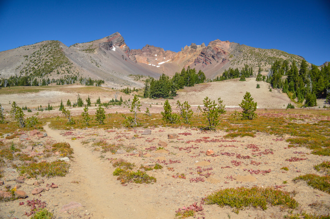
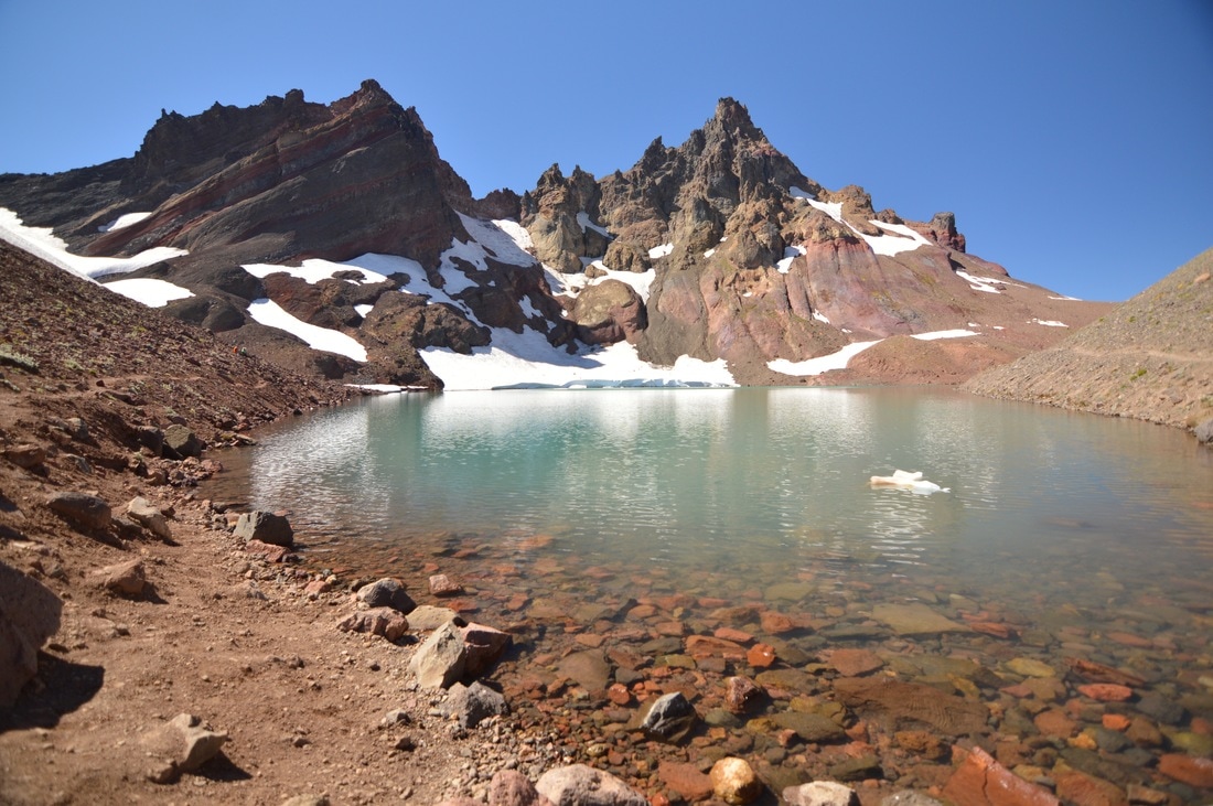
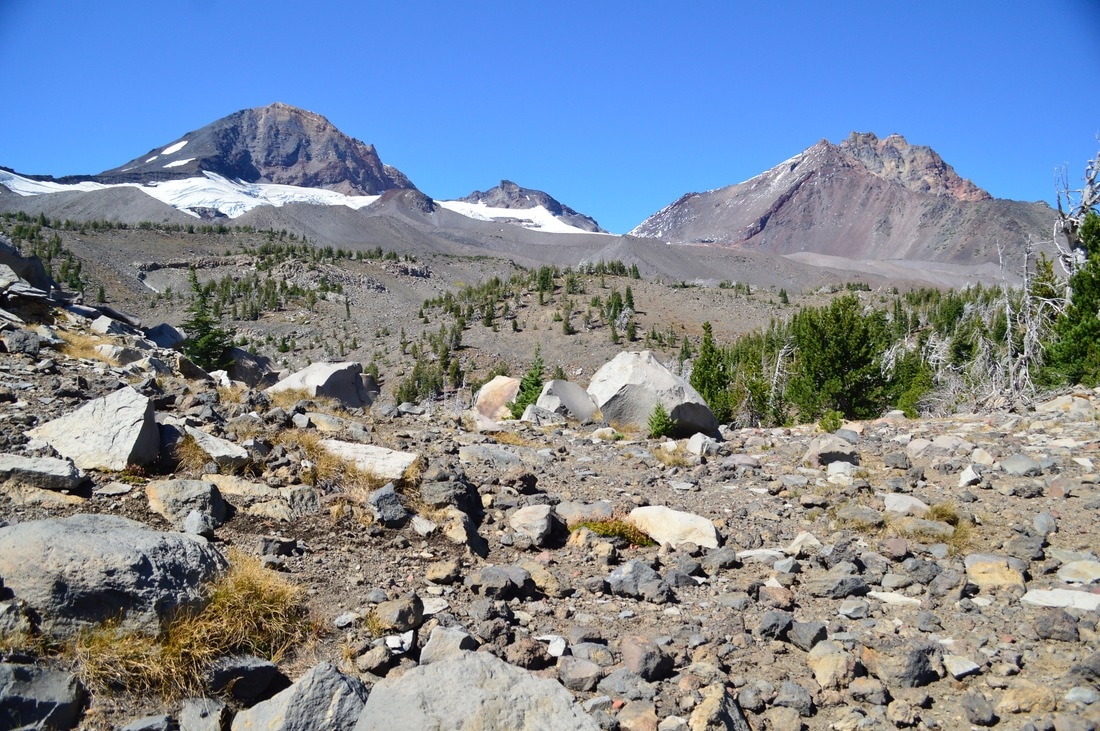
14) Camp Lake
|
|
|
Closest town: Sisters
Trail type: Out and back
Mileage: 14 miles round trip w/ 2,430 ft. elevation gain
Terrain difficulty: Moderate to difficult (the trail at first is very sandy, then you will hike through a forest, and as you get higher in elevation the trail becomes very rocky and there is one river crossing that you have to navigate).
Trail usage: Medium
Central Cascades Wilderness Permit needed: YES
Where to set up your tent: Camp Lake (there are multiple flat spots without rocks where you can camp around the lake).
About the hike: This is one of the best hikes in the Three Sisters area but not nearly as popular as some of the others due to the terrain being a bit more difficult. Most of the trail is fairly rocky and there are a few large creek crossings that you must do before getting to the plateau from which you can see expansive views of all three of the Sisters. Camp Lake is one of the smaller Chambers Lakes, but it offers a sandy beach and an ice cave on the opposite side.
(Click here to read more about this hike and to get directions- this post is for members only, you can purchase the seasonal membership for $9.99)
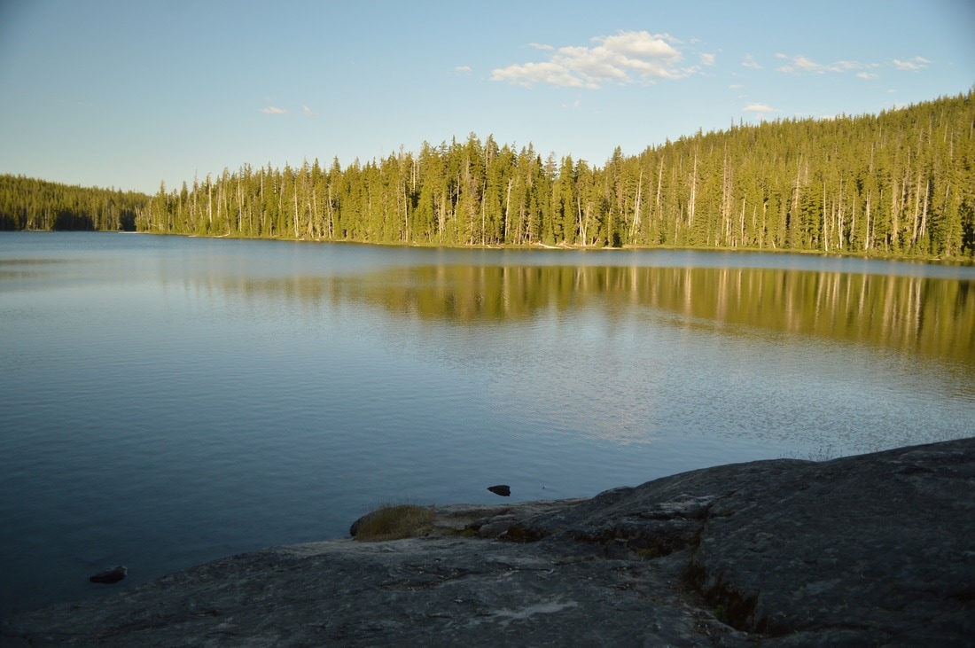
15) PCT- Willamette Pass to Bobby Lake
|
|
|
Closest town: Oakridge
Trail type: Out and back
Mileage: 20 miles round trip w/ 1,520 ft. elevation gain
Terrain difficulty: Easy (the entire trail is a gentle grade mostly through trees. There is one spot that offers a bit of exposure and a view, but you will not be navigating any large rocks in the trail).
Trail usage: Medium
Central Cascades Wilderness Permit needed: NO
Where to set up your tent: Bobby Lake (there are a few camp spots at Bobby Lake. The best site is closest to the swimming rock if you head around the lake to the right and hike about 1/4 of a mile).
About the hike: This is one of the easiest Pacific Crest Trail access points in Oregon, and many people utilize it as a gateway to get to some of the most beautiful alpine lakes. This 10 mile section of trail takes you past all three Rosary Lakes, Pulpit Rock, and then up and over a crest where you can see as far as Summit Lake. After passing Maiden Peak Ski Shelter, you will be in a green tunnel of trees for a while before coming to the Bobby Lake turn-off. Once you see Bobby Lake, you will never want to leave!
Directions: From the town of Eugene take Hwy. 58 60 miles to Willamette Pass. Turn at the Pacific Crest Trail sign where you will see a large parking lot with a pit toilet next to the snow plow building.
(Click here to read more about the hike)
*All pictures are taken by Franziska Weinheimer
*Disclaimer: The trail descriptions, mileage, GPS tracks and difficulty ratings depicted on this website are never 100% accurate. Always hike at your own risk, using your own knowledge, equipment and common sense. Franziska Weinheimer/Hike Oregon are not responsible if you or anyone in your party gets injured or lost while attempting one of these or any other hikes.