Wild Rogue Loop
Hike details:
Mileage: 29.1 mile loop w/ 5,600 ft. elevation gain
Approximate hike time: 12 hours 40 minutes w/ an average pace of 2.3 mph
Difficulty: Difficult
Trail usage: Low on most of the loop until you get down to the Rogue River Trail
Highest elevation: 3,848 ft. Lowest elevation: 190 ft.
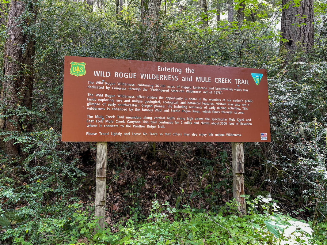
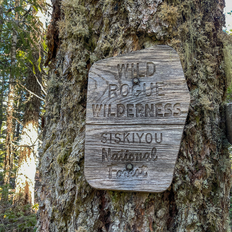
General location: 60 miles southeast of Portland - Wild Rogue Wilderness - Siskiyou National Forest
Accessible: April to December
(Best time to go is late April to mid-May when wildflowers are blooming and water at campsites).
Permits required: N/A
Pit toilet at trailhead: Yes
Trail allows: Dogs, camping
Possible dangers: creek crossings, incredibly narrow trail with steep drop offs, bold black bear, poison oak, ticks, rattlesnakes
Approximate hike time: 12 hours 40 minutes w/ an average pace of 2.3 mph
Difficulty: Difficult
Trail usage: Low on most of the loop until you get down to the Rogue River Trail
Highest elevation: 3,848 ft. Lowest elevation: 190 ft.
General location: 60 miles southeast of Portland - Wild Rogue Wilderness - Siskiyou National Forest
Accessible: April to December
(Best time to go is late April to mid-May when wildflowers are blooming and water at campsites).
Permits required: N/A
Pit toilet at trailhead: Yes
Trail allows: Dogs, camping
Possible dangers: creek crossings, incredibly narrow trail with steep drop offs, bold black bear, poison oak, ticks, rattlesnakes
|
Description:The Wild Rogue Loop was restored by the Siskiyou Mountain Club in 2015 and connects four major trails to make one beautiful backpackable loop. This loop is scenic and wild but the terrain is not easy, so it is not recommended for the faint of heart or beginner backpackers. Campsites that have water are extremely limited along this loop, so you won't have much wiggle room when it comes to mileage between sites. The most scenic and relaxing way to do this loop is 4 days 3 nights, but it can also be done in 3 days 2 nights depending on your hiking abilities.
The easiest place to begin this loop is from the Tucker Flat Campground day use area. The trail meanders along Mule Creek and in the spring is lined with a plethora of wildflowers. After 0.4 miles you will cross Mule Creek via a large bridge. |
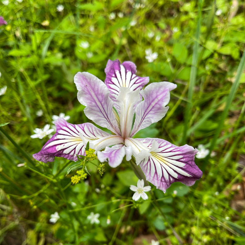
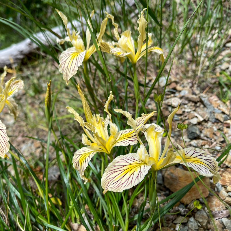
(Rainbow irises appear in purple, violet, white, yellow and fuschia).
|
|

|
(Mule Creek bridge)
|
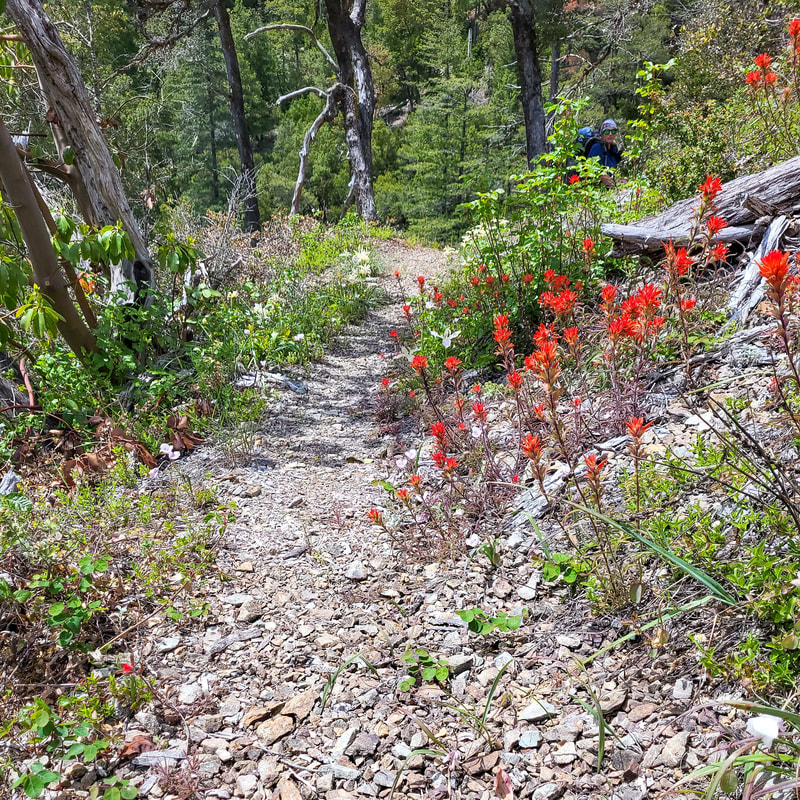
(paintbrush along the trail - picture taken by Holly Voltin)
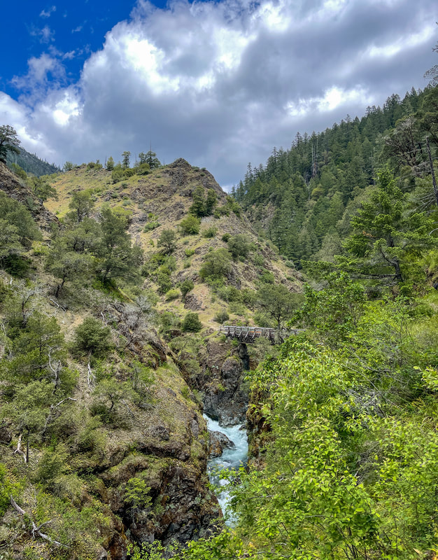
After the bridge, the trail continues along the West Fork Mule Creek canyon. The trail is rocky and has little tree cover so it can get hot here even early in the season. At the 1.3 mile mark you will come to your first crossing of the West Fork Mule Creek. This crossing and the next crossing do not have bridges and must be forded. Keep in mind that early in the season these crossings can be swift and dangerous. The second crossing is just half a mile up the trail, so if you're wearing water shoes, it's almost not worth it to take them off between these two crossings.
|
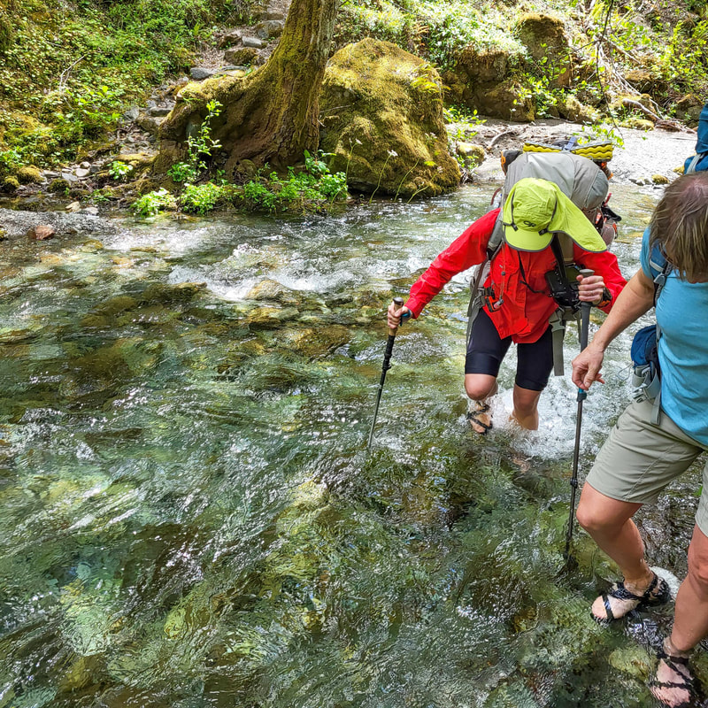
(first crossing of West Fork Mule Creek - picture taken by Holly Voltin)
|
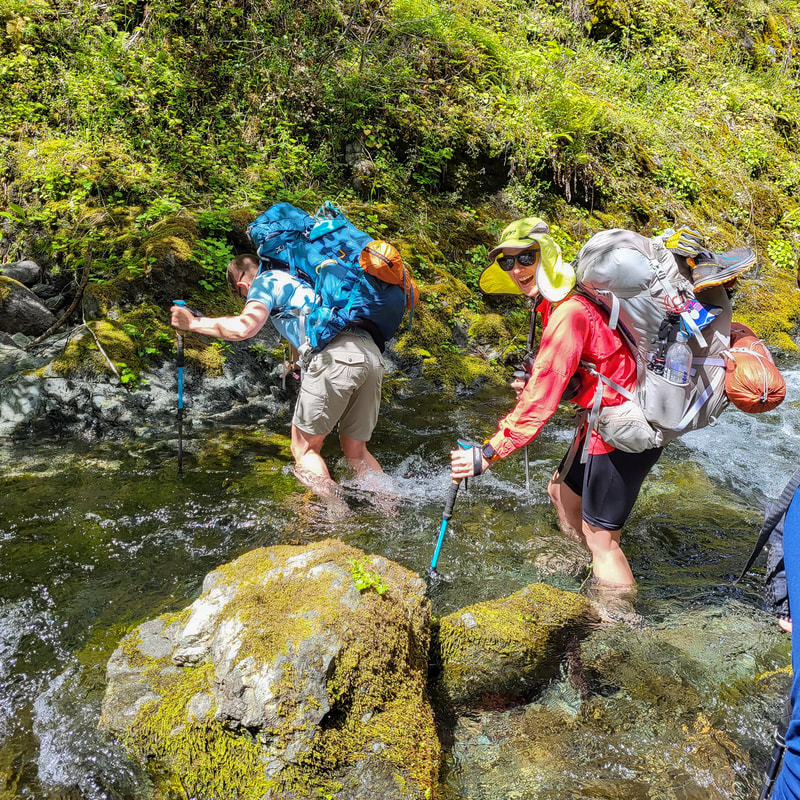
(second crossing of West Fork Mule Creek - picture taken by Holly Voltin)
|
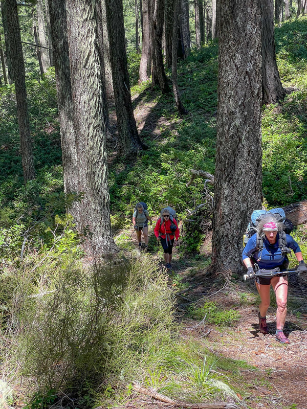
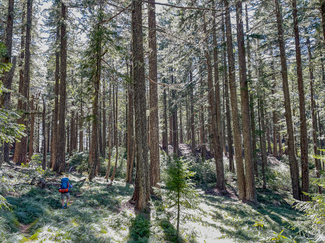
After the two creek crossings, make sure to take some time to really dry your feet. Putting on socks and shoes on even slightly damp feet will almost surely result in blisters, especially on this steep terrain. The trail continues gaining elevation as you tower above the creek on canyon cliffsides. The trail is extremely narrow in some spots as you navigate rockslides and crumbling trail tread. This section is hard on the feet, ankles and knees because of the awkward sidehill slope of the trail. At mile point 4.2 the difficult trail tread ends and the last 1.1 miles to your camp is walking on an old mining road. This is a very pleasant walk, although it is still quite steep.
(odd campsite at West Fork Mule Creek - picture taken by Holly Voltin)
|
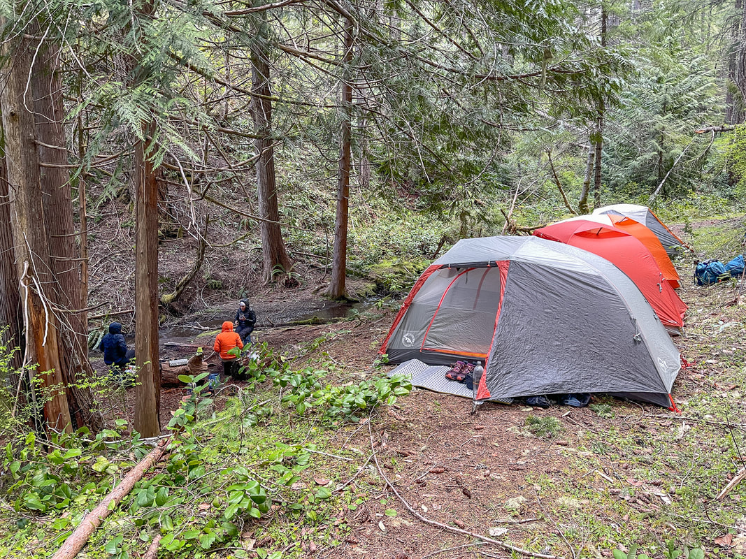
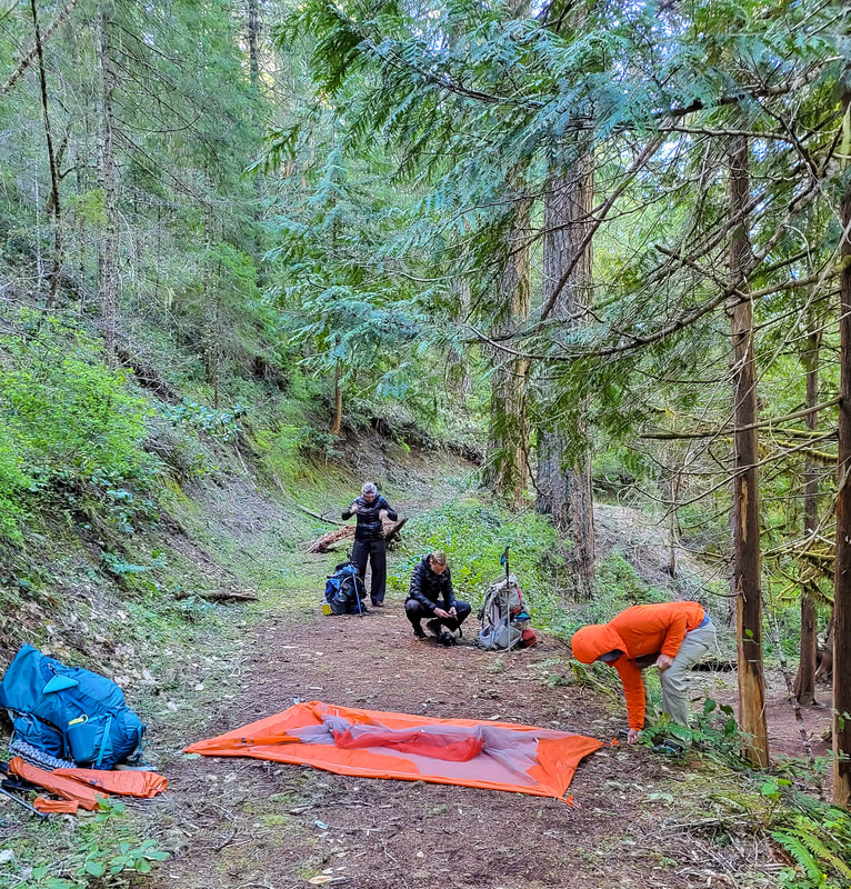
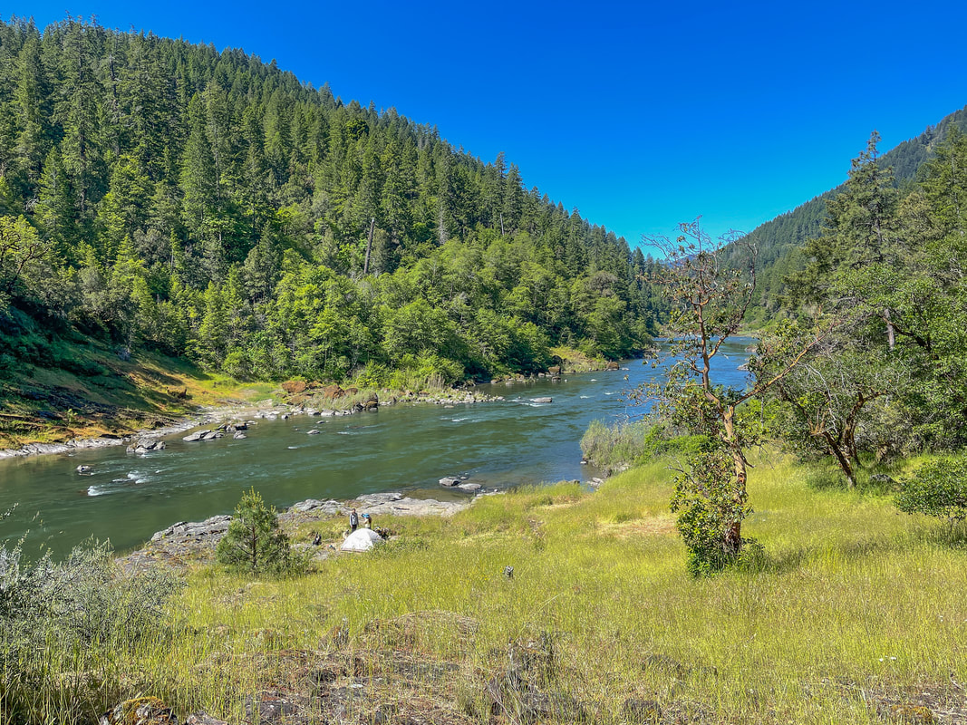
The spot that is deemed a "campsite" at the edge of West Fork Mule Creek at mile point 5.3 is pretty terrible and doesn't follow the Leave No Trace Principles because it is WAY too close to the creek. We decided to be more responsible and set up camp on the trail, which is also not good trail etiquette, but since you are in a steep canyon, there is nowhere else you could set up tents.
|
Because this is the last perennial water source until Thomas homestead at mile point 17.1, this is where most people camp when doing the loop. Keep in mind that because you are in a creek canyon, even on warm days, it will be pretty cold here even though you are only at 2,850 feet elevation. (On May 19, 2022 it got down to 38 degrees while camping here).
(roadside campsite at mile 7.1)
From this campsite the trail crosses West Fork Mule Creek and continues uphill a bit through the forest. At the 7.1 mile mark you will come to a gravel road where there is a nice open area/possible campsite with room for lots of tents. This is definitely a nicer camp option for the first night, if you are willing to carry up a lot of water for the night of camping and then the next day as well. If you do camp here, you can always set up camp and walk down the road 0.7 miles to where the road crosses Buck Creek to get water. This creek usually has water until later in the season.
You will hike to the south along this road for about 400 feet and then you will see a trailhead sign where the trail heads uphill steeply once again through the forest. In the next 1.25 miles you will gain 1,065 feet of elevation, so take this section slow to conserve your energy for the rest of this challenging day of hiking.
You will hike to the south along this road for about 400 feet and then you will see a trailhead sign where the trail heads uphill steeply once again through the forest. In the next 1.25 miles you will gain 1,065 feet of elevation, so take this section slow to conserve your energy for the rest of this challenging day of hiking.
(picture taken by Holly Voltin)
|
|
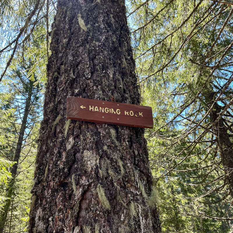
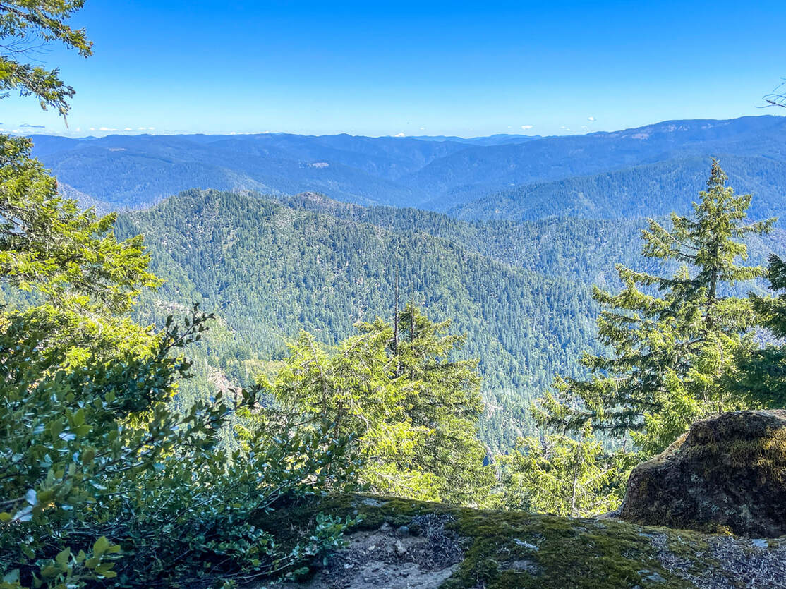
At mile point 8 you will come to another possible spot to camp early in the season. There is a small creek here and room for 2 large tents or 3 small one person tents. Depending on the year and weather conditions, this small stream likely dries up between the end of April and mid-May, so don't rely on it having water if you're going any later than that. At mile point 8.9 you will see a small sign on a tree on the left side of the trail that indicates the side trail to Hanging Rock. This is a 0.3 mile side trip to the most spectacular viewpoint along this entire loop. This is a great spot to take a rest and a snack or lunch break. Hanging Rock is the high point of this loop and from here you can see the entire Rogue River Valley below as well as Mount McLoughlin in the distance.
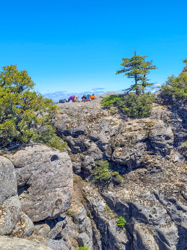
(lunch break at Hanging Rock - picture taken by Holly Voltin)
|
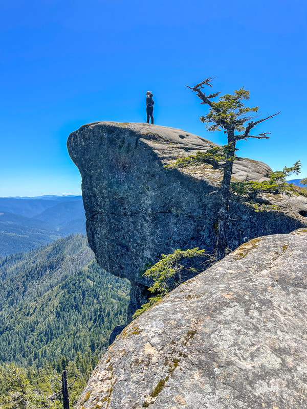
(Hanging Rock)
|
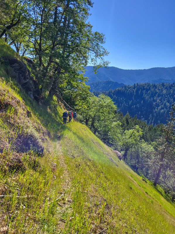
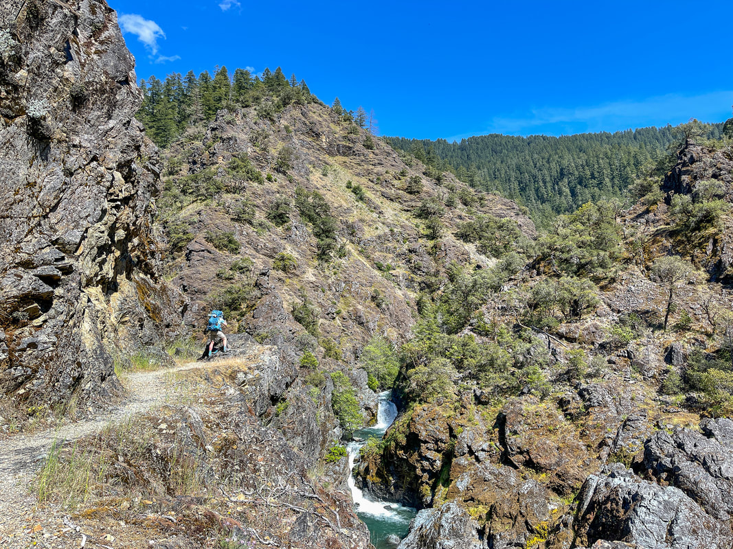
(hiking up the steep Panther Ridge Trail - picture taken by Tonya Stein)
|
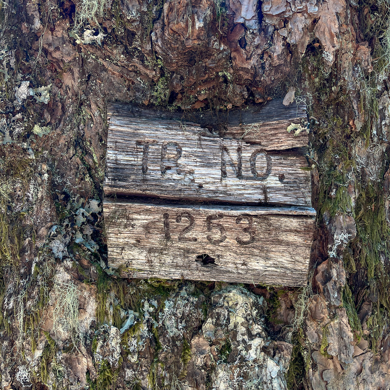
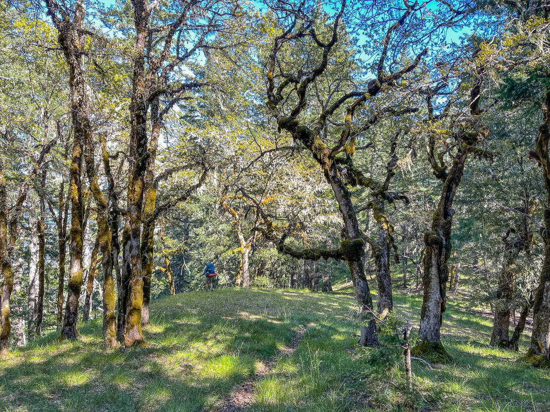
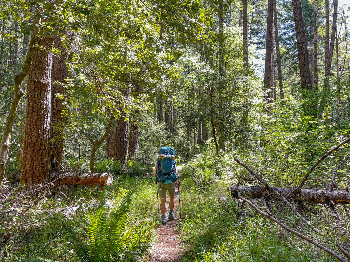
Once you have checked out Hanging Rock, go back down to the trail junction and continue on the Panther Ridge Trail #1253 as it meanders up and down through a mixed forest. There are many sections that are heavily overgrown with rhododendron bushes and salal, sometimes getting so tall that you are wading through shoulder height brush.
Pro tip: bring long pants that you can throw over while hiking through this section! |
(view of Mount McLoughlin in the distance from Panther Ridge)
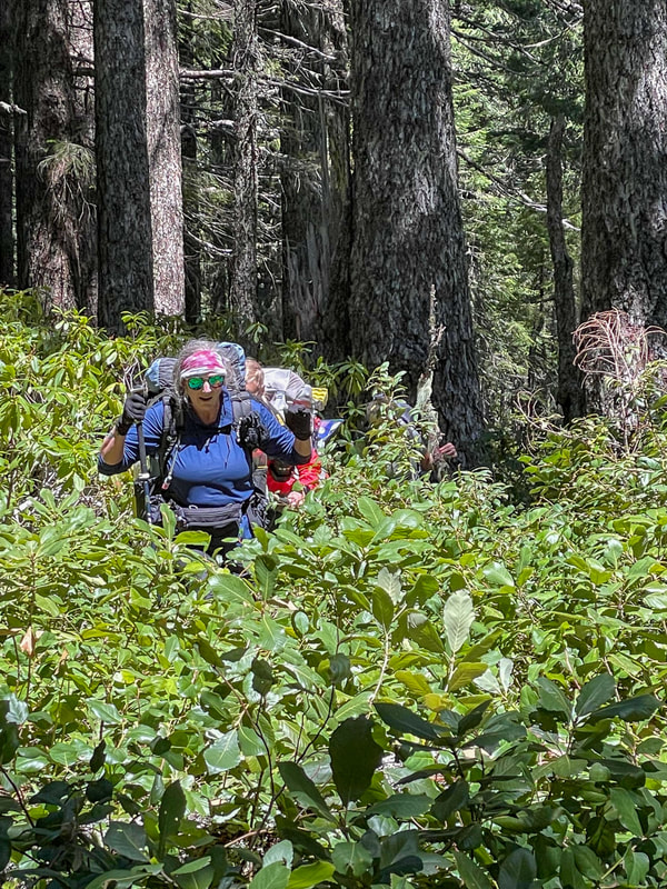
(overgrown Panther Ridge Trail - picture taken by Tonya Stein)
|
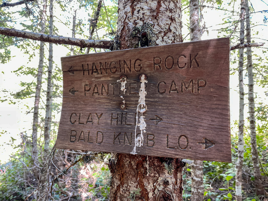
There are a few viewpoints along Panther Ridge, but it is mostly just walking through the forest for 4.8 miles from the Hanging Rock junction. There is a confusing trail split just before you get into the Clay Hill Trail, and the sign with pointing arrows really doesn't help, but just remember to stay left at all trail junctions along the Panther Ridge Trail.
At mile point 14.7 you will see the Clay Hill Trail #1160A go steeply down the hill to the left. Take this trail through an incredible forest of hemlock, alder and madrone trees as you loose a whopping 2,300 feet of elevation in just 2.3 miles. If you need a rest, Clay Hill is a beautiful flat grassy spot to sit among the trees and eat a snack. |
(Clay Hill)
(meadow at Thomas homestead - picture taken by Holly Voltin)
|
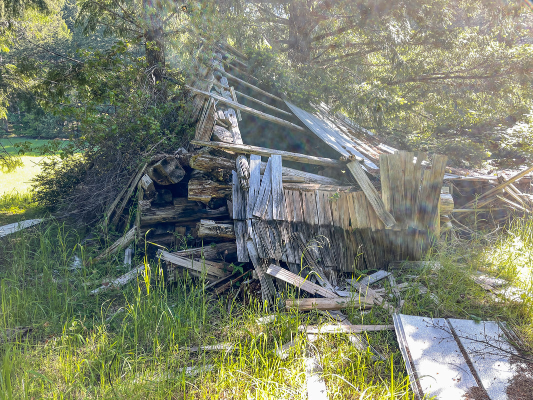
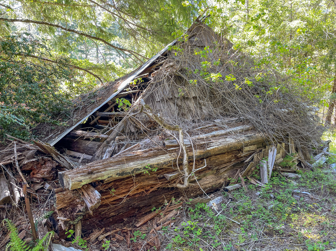
(remnants of the cabin built in 1914)
|
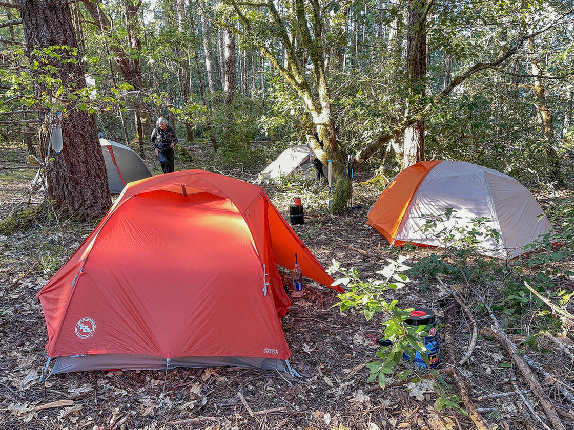
(camping at Thomas homestead)
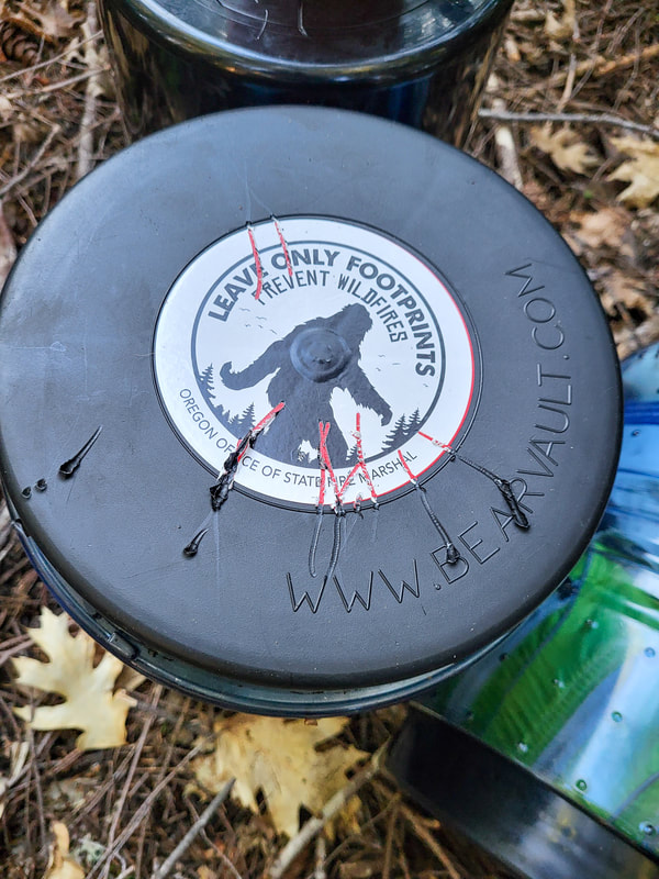
(chewed up bear can - picture taken by Holly Voltin)
|
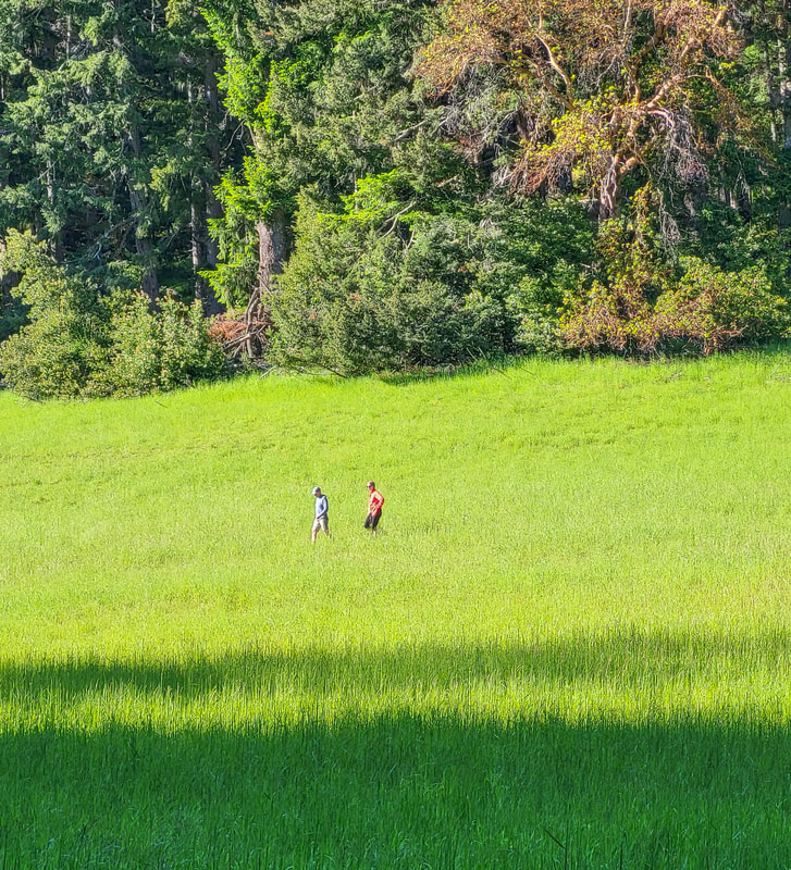
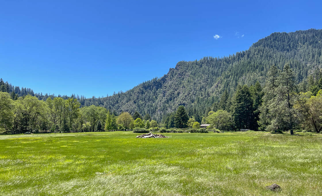
At mile point 17.2 at a switchback you will see a creek on your right and the stunning green of a meadow through the trees. Leave the Clay Hill trail and cross the creek. This is the location of the old Thomas homestead. The cabin was built by George Thomas in 1914 and is still there today. Immediately after crossing the creek, you will see a foot path leading up to the left to a flat area up above the creek. You can tell others have camped here and it is nice and flat. Because you are on the edge of a hill, it can get a little windy at this spot. If you are wanting to be more tucked away, the forest behind the cabin has plenty of flat spots to set up camp as well. Be careful walking around near the remnants of the cabin because there are nails and broken glass. As inviting as the sunny meadow is, it is not flat and you cannot really set up a tent on the tall lump grass. In mid-May, 2022 the creek at the homestead was already flowing pretty low and looking quite scummy, so beware that this water source can be dried up later in the season.
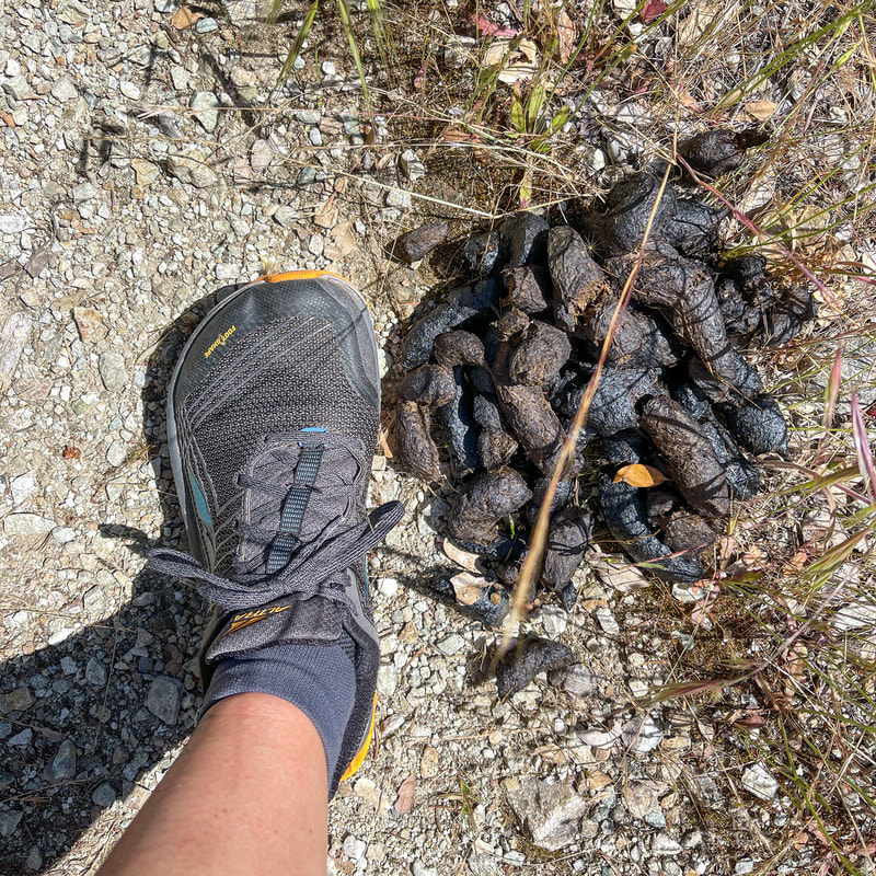
Also beware that there is an extremely large black bear (at least 500 pounds) that lives here. The enormous piles of scat should be an indicator of how large this animal is, but we were not aware, until we saw him, how bold this bear is. He has clearly gotten human food many times, because he is not scared of people at all and he messed with the stowed away bear cans that contained all of our food, trash and toiletry items for the entire night. He managed to roll one bear can away entirely and we were not able to find it in the morning. He was not interested in our camp though and he never came near our tents. |
(Clay Hill Trail - picture taken by Holly Voltin)
|
(hiker campsites along the Rogue River Trail)
After spending the night at the old Thomas homestead, you will continue down the Clay Hill Trail for 1.1 miles until you come to the junction with the Rogue River Trail. It is likely that you will not have seen any other hikers this entire time, but once you are on the Rogue River Trail, you will see many other hikers and campers. To continue on the loop, you will take a left on the RRT and from here on the trail feels like an easy stroll compared to the terrain you have hiked so far. Enjoy the forest, wildflowers and river views, all of which are plentiful.
|
Tate Creek is 0.7 miles from the RRT junction and is a must stop. Set your pack down and take the very short foot path down to the bottom of an incredible waterfall. Your next little side trip is the Brushy Bar Guard Station, which is another 2.3 miles down the trail. This is a cute off-grid Forest Service cabin where a volunteer stays from early June to early October. They are there to answer questions, take hiker reports, help with trail maintenance, etc. 2.8 miles from the guard station you will come across another gem, Paradise Lodge. Right at Paradise Creek is an incredibly inviting swimming hole that you can enjoy on a hot day. 1.2 miles from Paradise Lodge is Blossom Bar. These are some of the most beautiful campsites along this stretch of the river, and would be an excellent place to camp if you are taking 3 nights to do this loop. If you are not spending the night at Blossom Bar, it is the perfect lunch spot because after this, the trail hugs steep cliffsides and there aren't any good places to sit and eat.
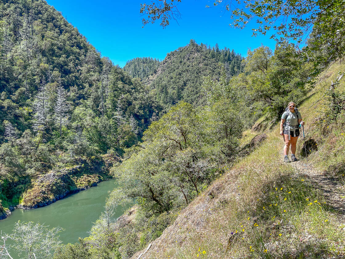
1.3 miles from Blossom Bar you will be hiking along the most beautiful section of the Rogue River Trail and you will come across Stair Case Falls. Be very careful along this section of trail, the drop offs are incredibly steep! After admiring Stair Case Falls from Inspiration Point, continue another 1.4 miles to Marial Trailhead and from here you will walk along a gravel road for the last mile, cross Mule Creek and then you are back at Tucker Flat Campground.
(bear scat on the Rogue River Trail)
|
(Stair Case Falls)
|
The Wild Rogue Loop is just that, wild! It is scenic and a little bit rough, but definitely an epic backpacking adventure especially for those wanting to get out early in the season when the Cascades are still fully buried in snow. The best time to hike this loop is in April to early May (most years you should not go later than mid-May due to lack of water and the trail can get extremely hot). With the rugged trail tread, creek crossings and massive elevation gain and loss, trekking poles are a must on this trail! Doing this trip in 4 days and 3 nights will make it more relaxing and enjoyable, but depending on your backpacking and hiking abilities, 3 days and 2 nights is also very doable.
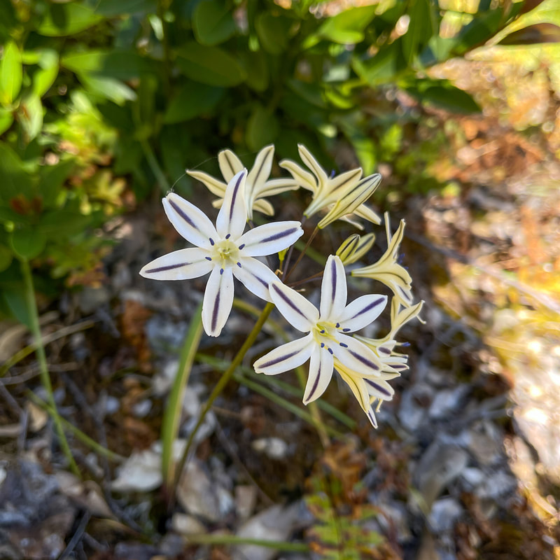
(Henderson's Star)
|
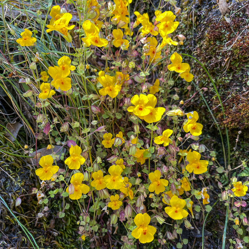
(Monkeyflower)
|
Directions:
From the north (Portland, Salem, Eugene)
- Drive I-5 S and shortly after Canyonville, take exit 80 towards Glendale. Drive on Sether Ave. for 2.6 miles, then take a right on Reuben Road, which turns into Cow Creek Rad for 12.1 miles. After you see Skull Creek Campground on your left, keep an eye out for Dutch Henry Road and take a left. Stay on this winding road for 12.7 miles (eventually this road turns into Kelsey Mule Rd. but there is no turn off or anything). At a road split, stay to the left on Kelsey Mule Rd. for just 0.25 miles, then turn left onto Mariel Rd. for 13.4 miles (after the first 4 miles it turns into a narrow gravel road). Turn right at a sign for Tucker Flat Campground and find the day use parking area at the very end of the campground road.
- Drive I-5 N and take exit 61 towards Merlin. Drive west on the Merlin-Galice Road 23 miles. Continue across The Grave Creek Bridge and onto the Mt. Reuben Road until it junctions with the Kelsey Mule Road, take a left for 0.25 miles, then turn left onto Mariel Rd. for 13.4 miles (after the first 4 miles it turns into a narrow gravel road). Turn right at a sign for Tucker Flat Campground and find the day use parking area at the very end of the campground road.
|
Watch the YouTube video to get a more in-depth and personal view of this hike.
|
-This trail write-up was last updated June, 2022-
*All pictures unless otherwise marked are taken by Franziska Weinheimer *Disclaimer: The trail descriptions, mileage, GPS tracks and difficulty ratings depicted on this website are never 100% accurate. Always hike at your own risk, using your own knowledge, equipment and common sense. Franziska Weinheimer/Hike Oregon are not responsible if you or anyone in your party gets injured or lost while attempting one of these or any other hikes.
|