Mount Howard
Hike details:
Mileage: 0.5 miles out and back w/ 130 ft. elevation gain OR 2.5 mile loop w/ 400 ft. of elevation gain
Approximate hike time: 1 hour 5 minutes w/ an average pace of 2.3 mph
Difficulty: Easy
Trail usage: High during the summer
Highest elevation: 8,240 ft. Lowest elevation: 7,940 ft.
General location: 6 miles south of Joseph - Wallowa Whitman National Forest
Accessible: June through September
(The tramway is open June 1 - September 27. The best time to go is mid to late July when the wildflowers are blooming).
Permits required: N/A
Pit toilet at trailhead: Yes
Trail allows: NO DOGS!
Possible dangers: Elevation sickness
|
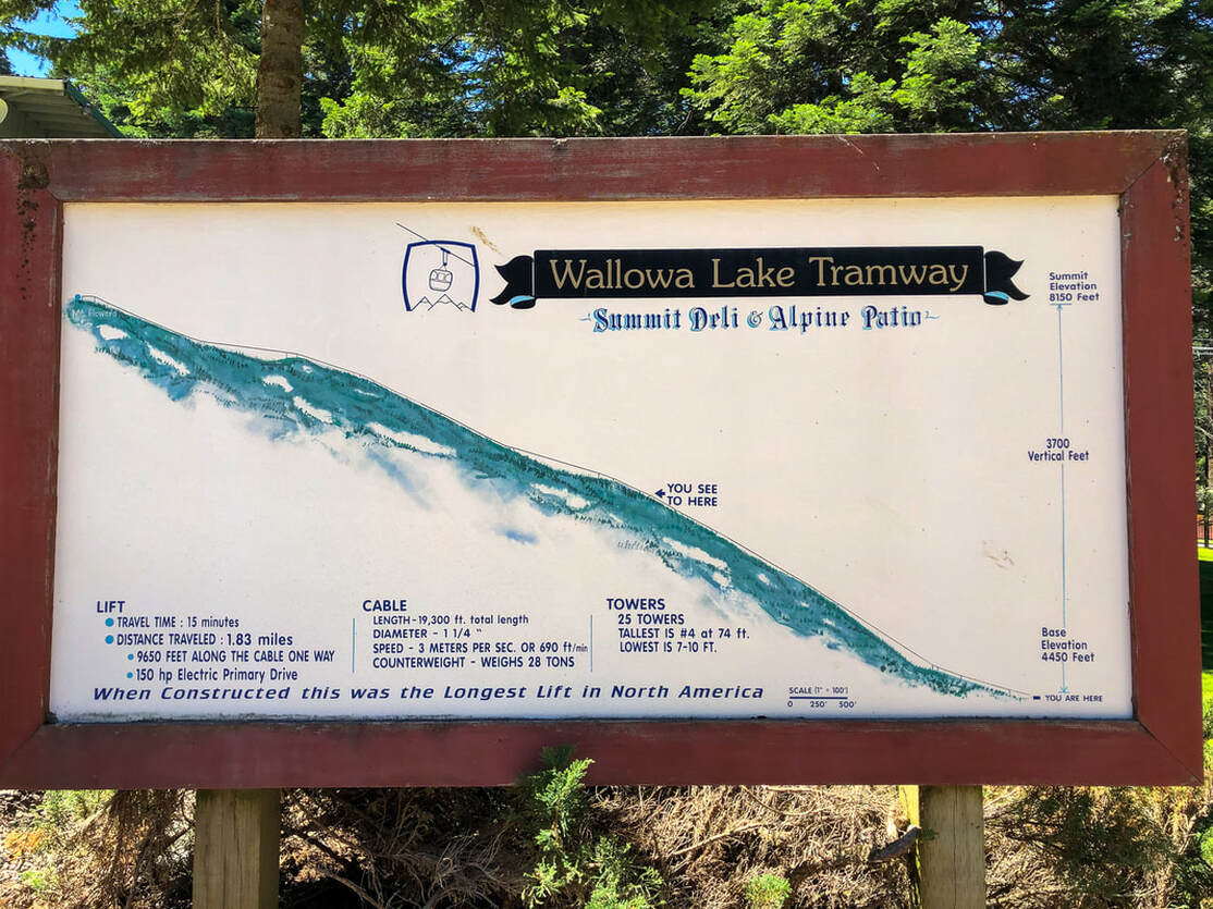
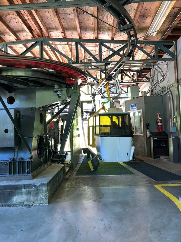
Description:Mount Howard is an 8,255 ft. peak next to Wallowa Lake. The only way to access the many easy and family friendly trails at the top, is to take the Wallowa Lake Tramway. When it was constructed in 1970, it was the longest lift in North America, gaining a total of 3,700 vertical feet. The gondola ride takes 15 minutes and travels 1.8 miles up Mount Howard. It is a bit dizzying, and not great for those who are afraid of heights. When visiting the Wallowa Lake area, it is definitely an experience one shouldn't miss out on, but unfortunately the rates for the tramway are insanely expensive, ranging from youth rates at $26 per person to adult rates at $36 per person!
|
|
Each gondola can seat 4 people. As you travel up the mountain, you will see Wallowa Lake and the fields beyond to the north, and the large granite peaks of the Wallowa mountains to the south.
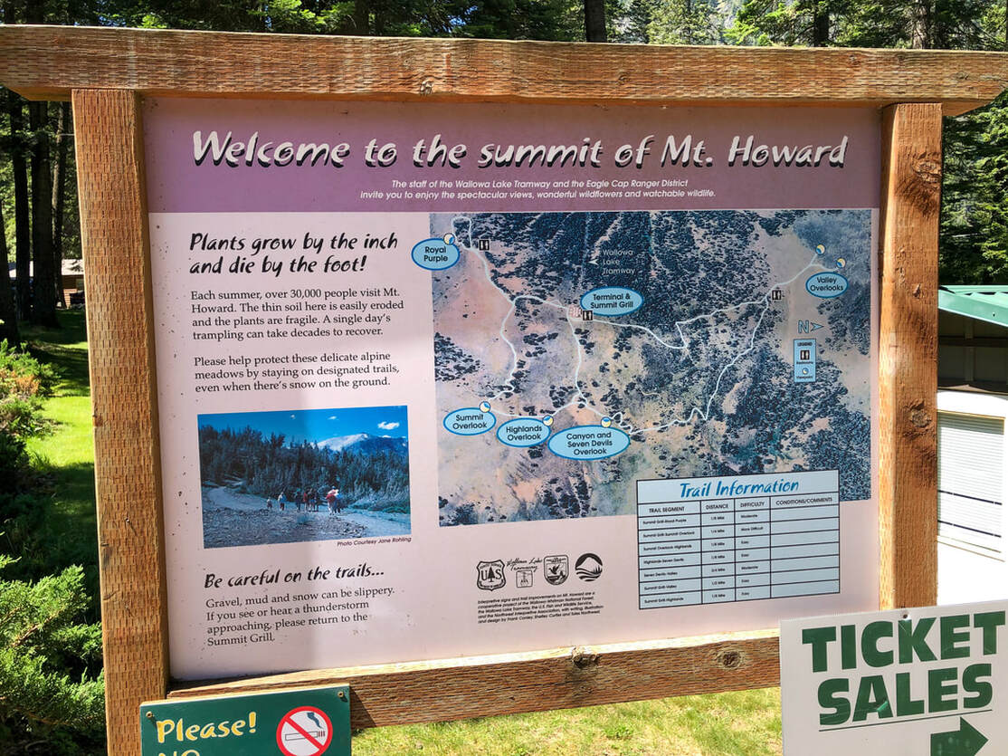
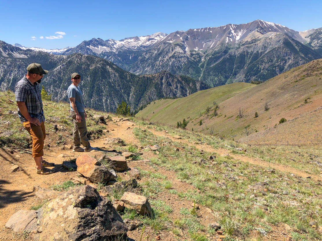
The tramway drops you off at the Summit Grill & Patio where you can enjoy an overpriced lunch and a drink with one of the most spectacular views. To make the most of the pricey ride up, make sure to explore up to 2.5 miles of trails that take you to various different viewpoints. The full loop is 2.5 miles, but you can do a shorter loop or various out and back hikes, depending on how much time you have and your fitness level. All of these trails are very easy and well-groomed, but you are at elevation, so that can make it a bit more strenuous for some. |
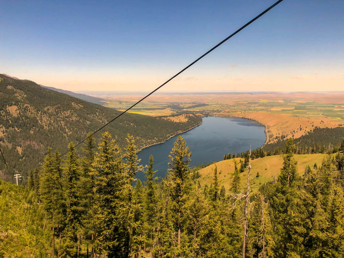
(Wallowa Lake from the tram)

It is a total of 0.25 miles from the tramway to the Royal Purple viewpoint. Here you will see amazing views of Bonneville Mountain straight in front of you and Matterhorn in the distance. From the Royal Purple viewpoint you can continue 0.25 miles up to Summit overlook. In the month of July, on the way there you will see meadows of wildflowers. The flowers up here are rare and delicate, so please stay on the trail and do not trample the wildflowers.

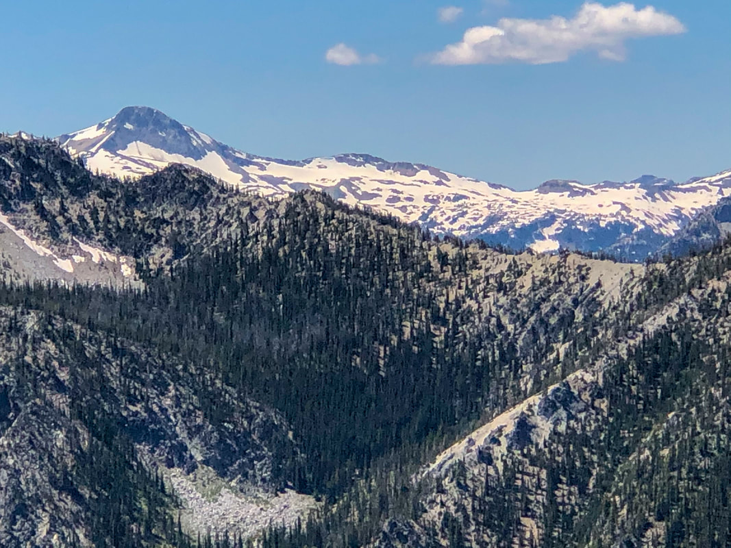
(Matterhorn)
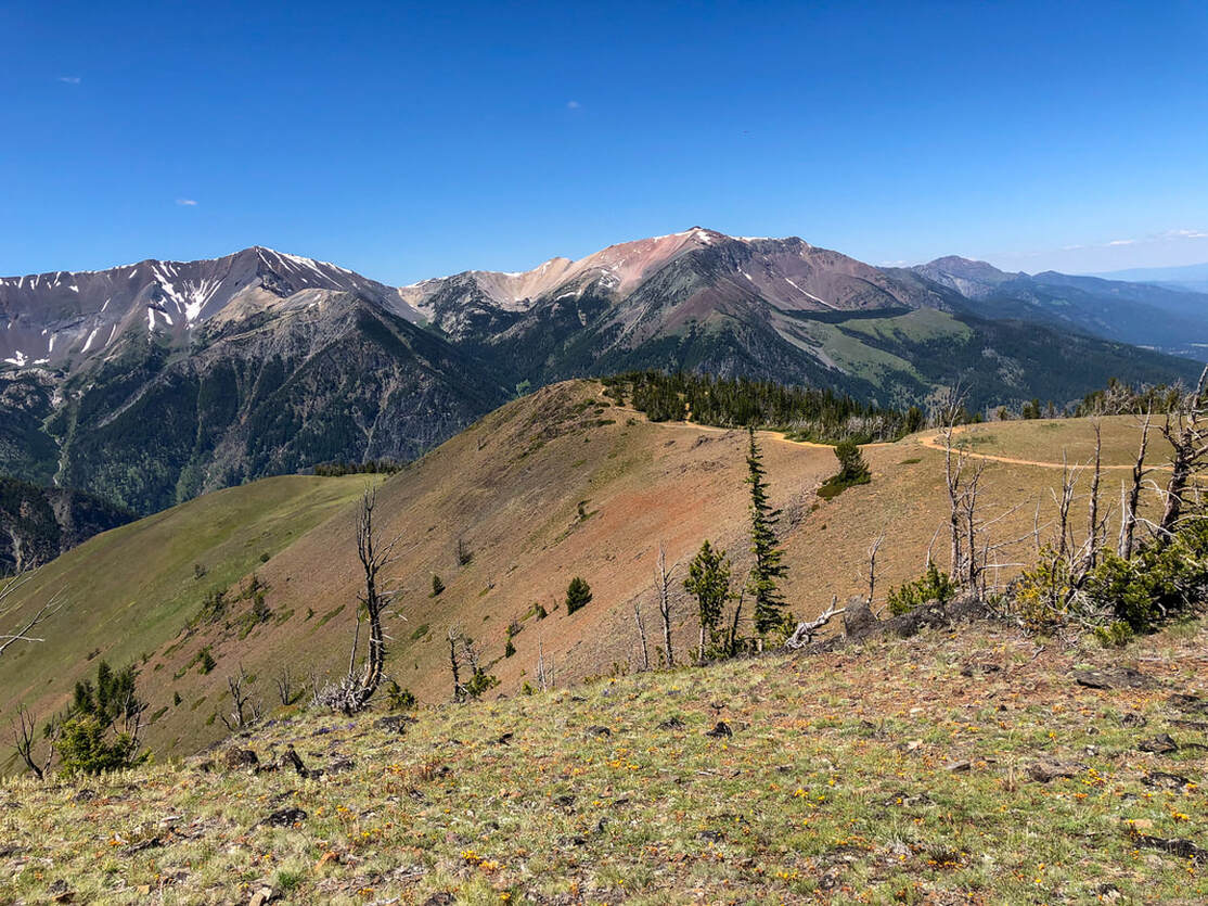
From Summit overlook it is another 1/8th of a mile to the next viewpoint, Highlands Overlook. Here you will see the backside of the Wallowa mountains over to Idaho. The landscape is just absolutely breathtaking and awe-inspiring. From here, continue on 0.75 miles to the Snake River Country overlook and View of Seven Devils.
|
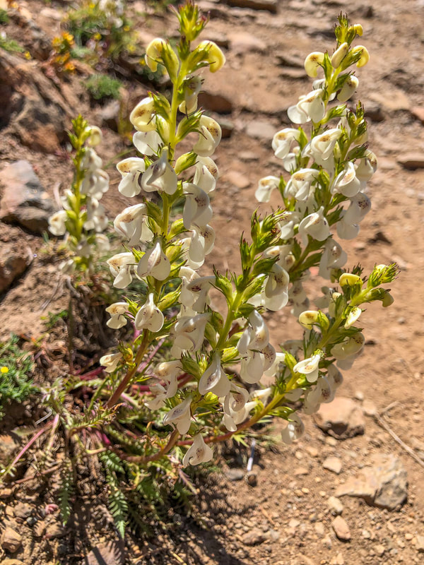
(curved-beak lousewort flower)
|
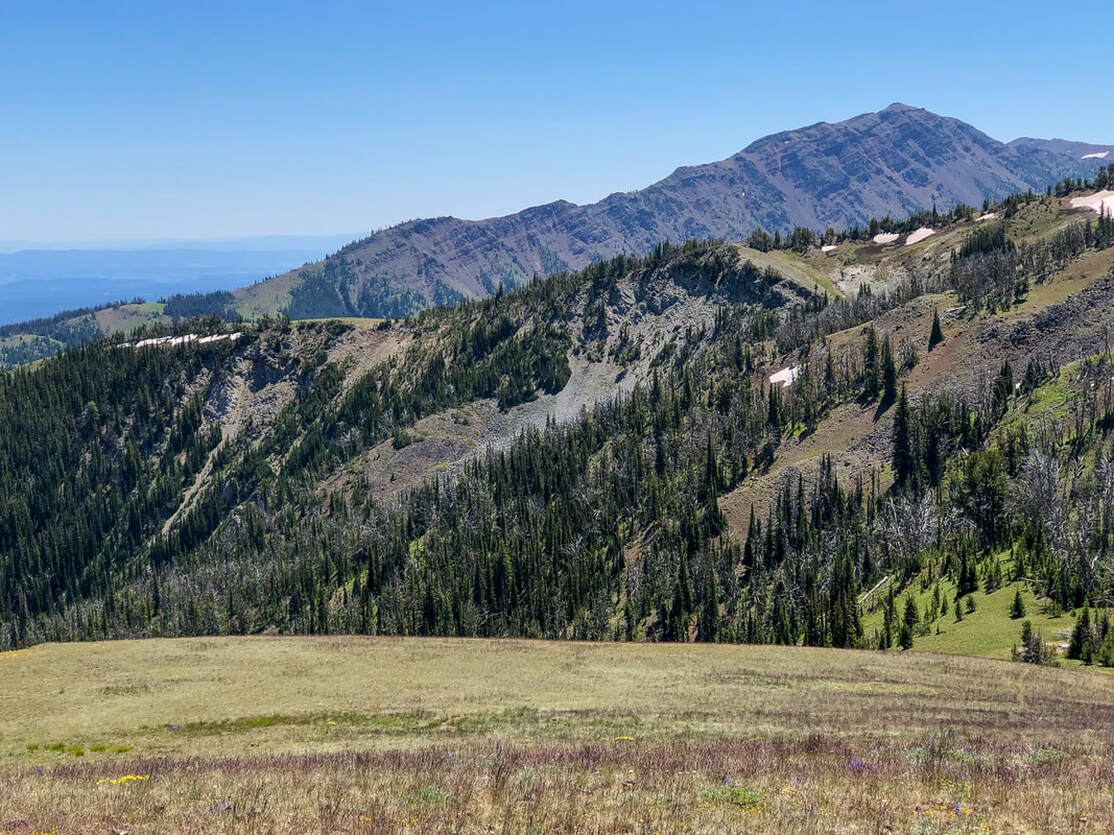
From here you can see the mountain of Idaho to the east, as well as into Washington state to the north. To continue the loop, head over another 0.75 miles to the Valley overlook. Here you will see Wallowa Lake below as well as the town of Joseph and the many fields beyond. After checking out this last viewpoint, walk back the 0.65 miles to the tramway.
Overall, the trail network on Mount Howard is an amazing place to take the whole family. The trails offer an easy look at the epic Wallowa Mountain range without having to hike or backpack deep into the wilderness. These trails are perfect for the whole family, from toddlers to great grandma. Most of the trails are wide and packed dirt, making them easy to navigate with sneakers or even sturdy sandals. Even though the tramway is expensive, it is worth the trip up to these incredible viewpoints!
Directions:
From Portland
- Drive on I-84 east for a total of 258 miles, then take exit 261 for OR-82 toward La Grande/Elgin. Turn right onto OR-82 E/Island Ave. for 1.6 miles, then turn left onto OR-82 E/B St/N McAlister Rd. for 17.7 miles. Turn right onto OR-82 E/Albany St. for 44.2 miles. In the town of Enterprise, turn right onto OR-82 E/N River St. for 6.3 miles, then continue onto OR-351 S/Main St. through the town of Joseph. Past Wallowa Lake Lodge continue onto Power House Rd. for 0.6 miles, then find the parking for the tramway on your left. (Total of 340 miles)
- Drive US-97 north for a total of 41.2 miles, then in the town of Madras US-97 N turns right and becomes SW 5th St/S Adams Dr. for 1.5 miles. Turn right onto US-97 N/NE 6th St. for 24.9 miles, then at a Y junction keep right to stay on US-97 N for a total of 57.7 miles. Just before Wasco, turn right onto Clark St. for 1.2 miles, then continue straight to stay on Clark St. for 0.3 miles through the town of Wasco. Continue onto Scott Canyon Rd/Wasco-Rufus Rd. for 8.9 miles, then in the town of Rufus turn right onto Murray St. for 0.3 miles. Turn right toward 1st St. and then immediately merge onto 1st St. for 0.2 miles. Turn left onto John Day Dam Rd/Sullivan Ln. and then merge onto I-84 E/US-30 E toward Pendleton for 152 miles. Take exit 261 for OR-82 toward La Grande/Elgin. Turn right onto OR-82 E/Island Ave. for 1.6 miles, then turn left onto OR-82 E/B St/N McAlister Rd. for 17.7 miles. Turn right onto OR-82 E/Albany St. for 44.2 miles. In the town of Enterprise, turn right onto OR-82 E/N River St. for 6.3 miles, then continue onto OR-351 S/Main St. through the town of Joseph. Past Wallowa Lake Lodge continue onto Power House Rd. for 0.6 miles, then find the parking for the tramway on your left. (Total of 365 miles)
- Total of 381 miles via Portland.
- Total of 445 miles via Portland.
- Total of 537 miles via Bend.
-This trail write-up was last updated June, 2022-
*All pictures are taken by Franziska Weinheimer
*All pictures are taken by Franziska Weinheimer
*Disclaimer: The trail descriptions, mileage, GPS tracks and difficulty ratings depicted on this website are never 100% accurate. Always hike at your own risk, using your own knowledge, equipment and common sense. Franziska Weinheimer/Hike Oregon are not responsible if you or anyone in your party gets injured or lost while attempting one of these or any other hikes.