Green Lakes
Hike details:
Mileage: 9.2 miles round trip w/ 1,273 ft. elevation gain (to the first two lakes)
11.2 mile lollipop loop w/ 1,350 ft. elevation gain (for the lollipop loop around the Green Lakes basin)
Approximate hike time: 3 hours 54 minutes w/ an average pace of 2.3 mph (for the 9.2 mile route)
4 hours 53 minutes w/ an average pace of 2.3 mph (for the 11.2 mile lollipop loop)
Difficulty: Moderate to difficult
Trail usage: High from July to mid-September, medium foot traffic during the fall
Highest elevation: 6,560 ft. Lowest elevation: 5,375 ft.
General location: 25 miles west of Bend - Three Sisters Wilderness - Deschutes National Forest
Accessible: Late June through November
(Best time to go is late July and early August for wildflowers and September and October for beautiful weather).
Permits required: Day trips & overnight trips - Central Cascades Wilderness Permit June 15 - October 15 available via recreation.gov
Northwest Forest Pass for parking
Pit toilet at trailhead: Yes
Trail allows: Dogs, horses, camping
Possible dangers: N/A
|
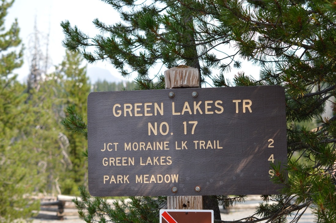
Description:The Green Lakes Trail is one of the most popular day hikes and backpacking destinations in Central Oregon, and for good reason. This area can be accessed from various different trailheads (Soda Springs, Todd Lake, Park Meadow and Moraine Lake), however the most popular way to go is the official Green Lakes/Soda Creek trailhead right off of the Cascade Lakes Highway. The parking lot is fairly large, with room for horse trailers as well, but it does get busy in the summer, so get here early (by 9am or earlier) if you want to find a parking spot.
|
|
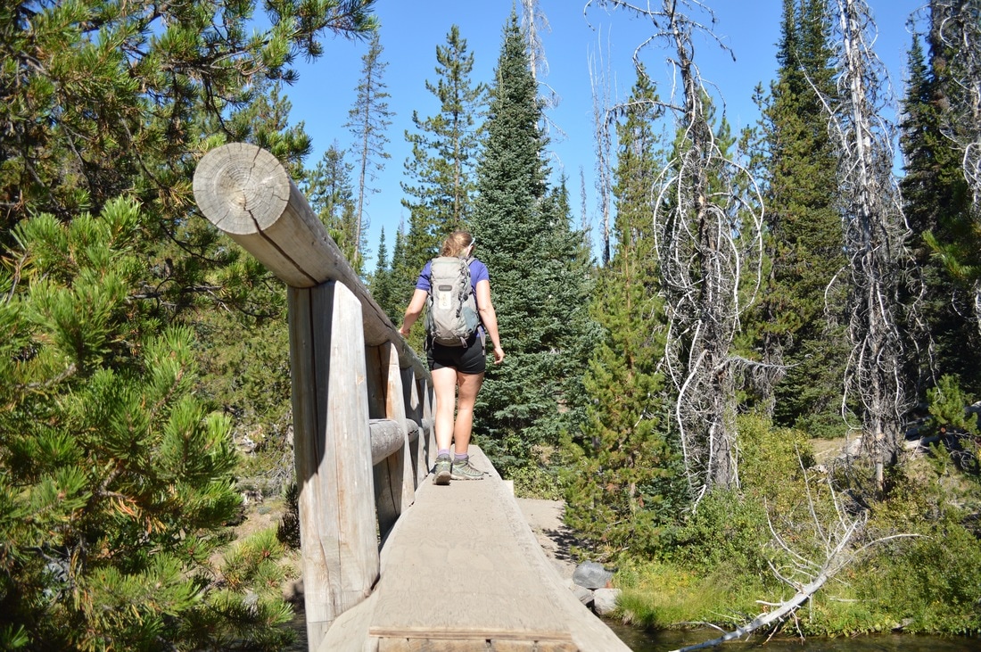
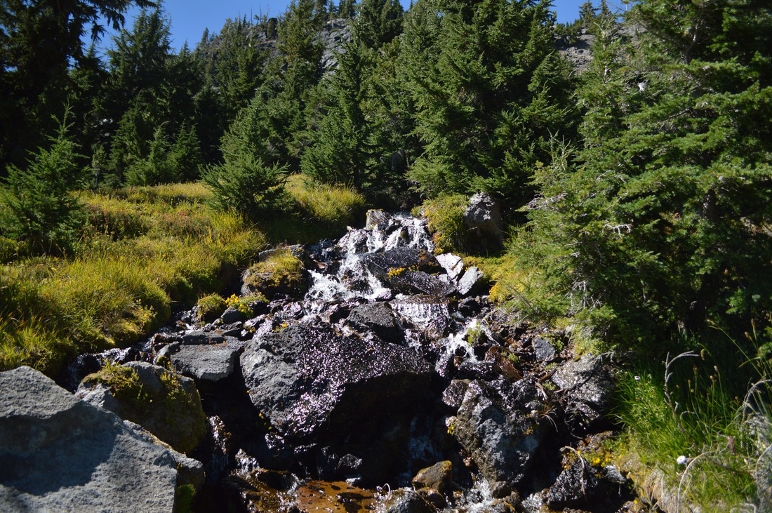
The first 2.1 miles of the hike are through the forest along the banks of Fall Creek. You will see Fall Creek Falls 0.6 miles into the hike. This waterfall is usually raging, especially early in the season, since Fall Creek is fed by the three Green Lakes and the glaciers that melt into them. At the 2 mile mark, you will see a sign to Moraine Lake to the left. If you wanted to make this a longer day, or if you are doing the Three Sisters Loop, you can hike the 2.5 miles over to Moraine Lake and camp there.
|
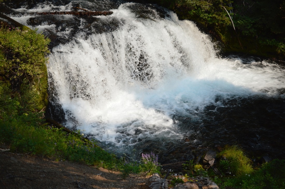
(Fall Creek Falls)
|
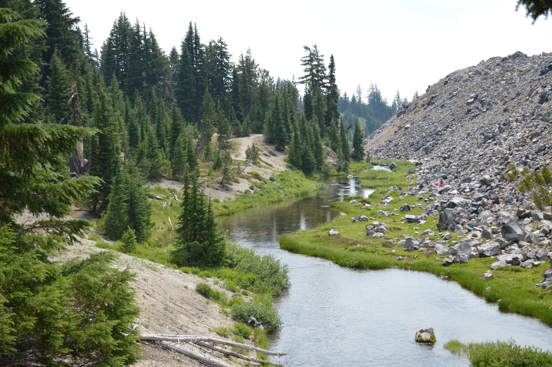
(Fall Creek next to the lava flow)
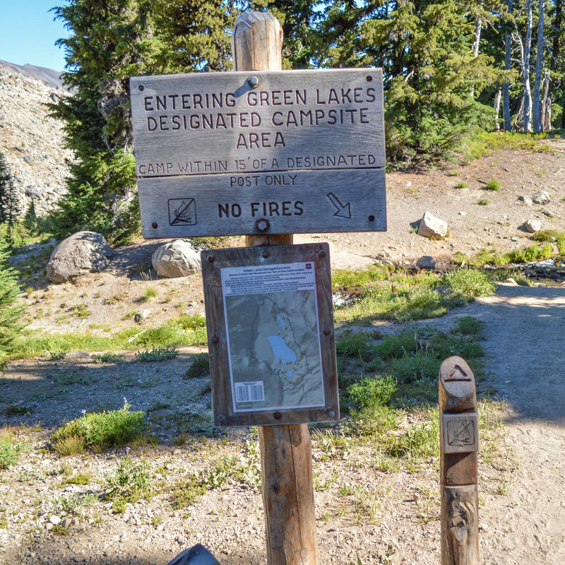
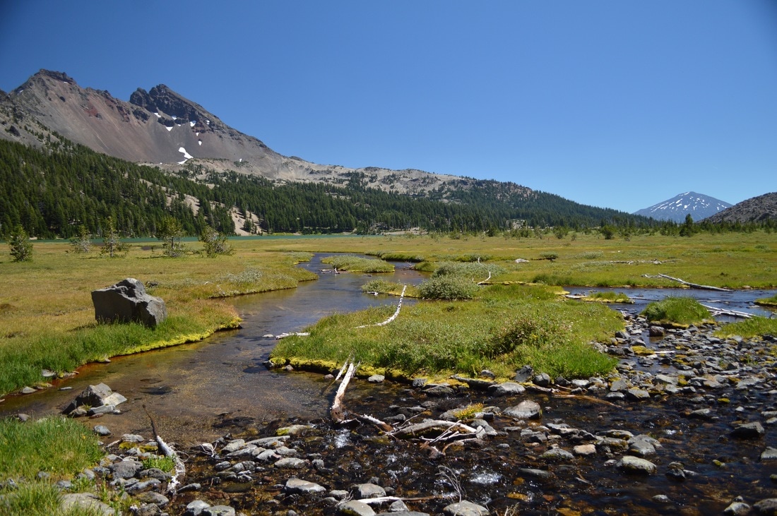
The next 2.3 miles trend uphill a bit more and include a few switchbacks. Shortly after the Moraine Lake trail split, you will cross Fall Creek, and the next few miles take you along the right side of the creek, with a massive lava flow on the left side. In late July and early August you will see beautiful wildflowers blooming along the creek. After a total of 4.2 miles you will come to a sign marking the boundary of the Green Lakes Management Area. You will see a map that shows all of the designated camping spots. There are a total of 28 designated campsites in the Green Lakes basin, and if you decide to camp within this boundary, you MUST camp at one of these sites.
|
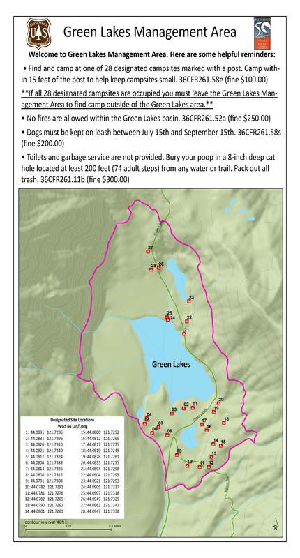
(Click picture to enlarge the map)
|
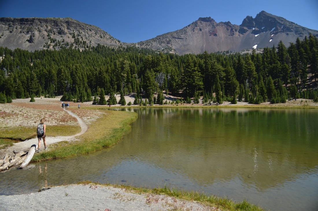
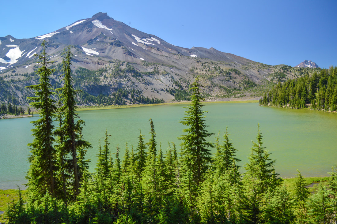
(the first of the Green Lakes and Broken Top)
(the other side of the first Green Lake with a reflection of South Sister)
The campsites are marked by a post that has the site number on it. Do not make your own campsite, as this area is extremely fragile and please always adhere to the 7 Leave No Trace Principles when backcountry camping. For the shorter 9.2 mile round trip hike, you would enjoy the lake and views here and then turn back the way you came. For the longer lollipop loop, continue across the creek that connects two of the lakes and continue on the trail around the east side of the largest Green Lake. This lake is actually green in color and offers spectacular views of South Sister.
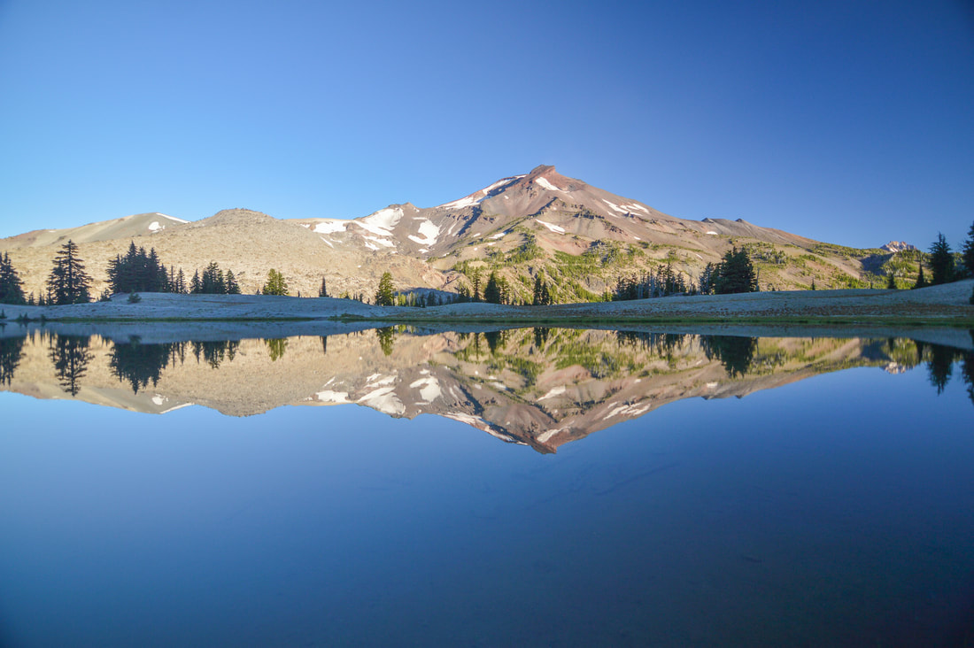
(the largest Green Lake and South Sister)
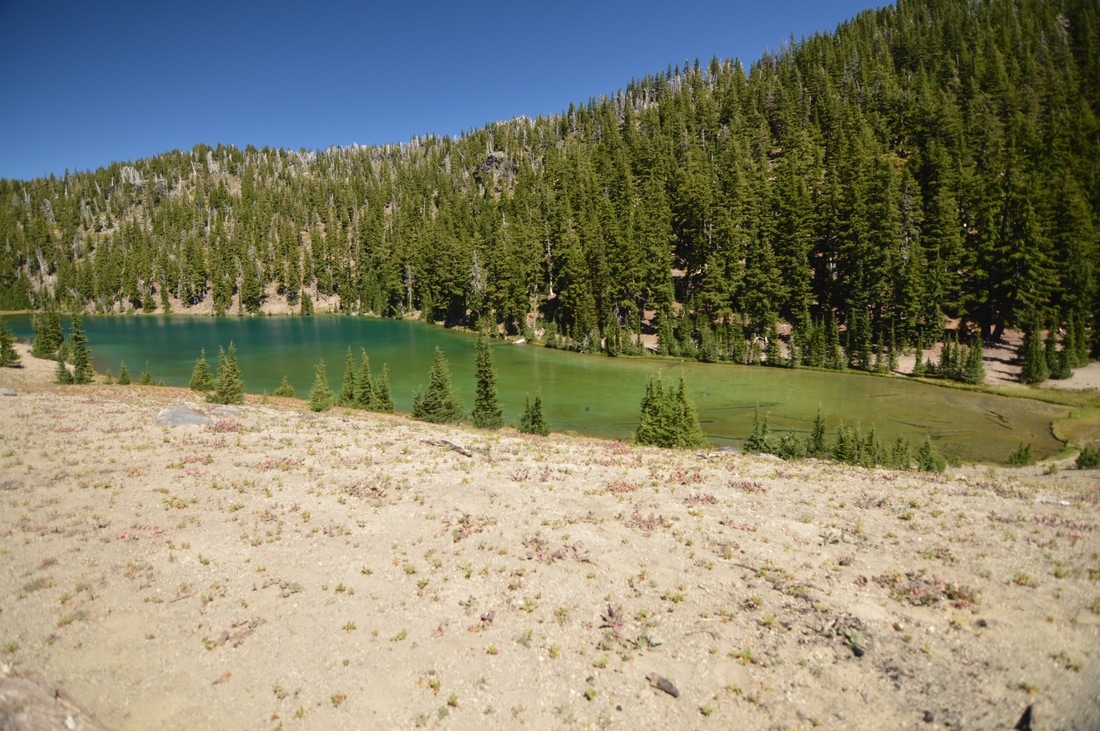
(the third of the Green Lakes)
The third Green Lake is the best one for swimming because it is deep and has a nice sandy shoreline. Even though this lake doesn't have a great view of Broken Top or South Sister, it is more secluded than the other two and also has some more private camping spots.
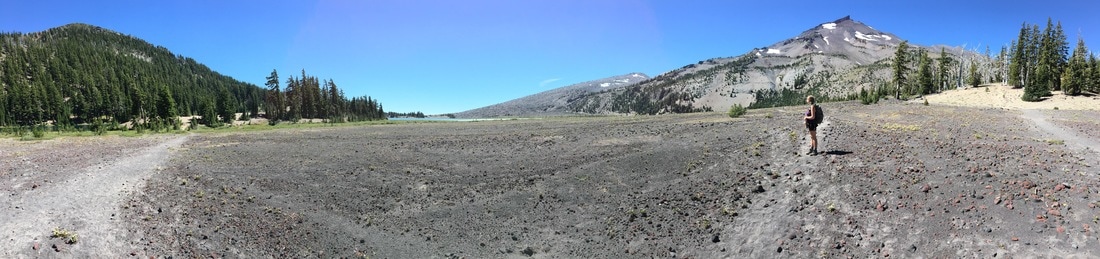
(Green Lakes flood basin and South Sister)
If you are on the lollipop loop, you don't want to miss the footpath that goes off to the left right before campsite #27. The trail becomes washed out the further out into the flood plain you get. From here you can see vast views of South Sister, Mount Bachelor and Broken Top. Stay on the footpath along the base of South Sister and continue heading south, you will get back to Green Lakes.
(Broken Top and Mount Bachelor)
|
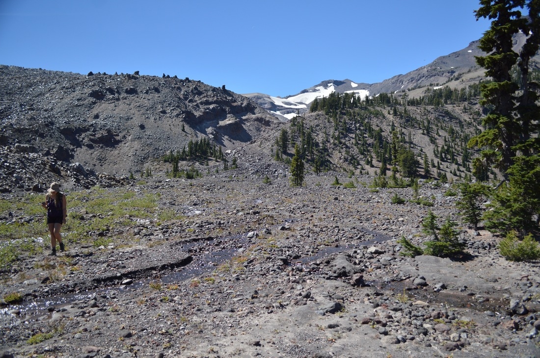
At the flanks of South Sister you will see the spring that feeds the lakes erupting out of the side of the mountain. It is pretty neat to see. The farther on you go, the more the trail becomes elusive through large rocks. Stay as close as you can to the side of the mountain and all of a sudden you will come to a huge waterfall that is formed by one of the many streams coming off the Lewis Glacier. Once you get to the waterfall, you will follow the stream down to where it meets the largest of the Green Lakes. Here you will have to cross some water. There is usually some wood and some rocks placed here to make the crossing easier. If you are worried about this crossing, you could do the lollipop loop the other way so that you hit this creek crossing first and if you can't cross it, avoid doing the loop. Once you cross the creek, and you will again be on the main trail and on your way back to the car.
|
(springs)
|
The Green Lakes Trail is one of the most popular hikes in the area, but it is absolutely worth braving the crowds and trying to get a limited entry permit to visit. The terrain is not difficult, there is not much elevation gain, and you get the best of both worlds, mountain views and alpine lakes! This is a hike that any age and fitness level can easily and safely do, provided you take it slow, and it is perfect if you are a beginner backpacker wanting to try out a short trip. Keep in mind, this trail still has lingering snow in the forest typically until early July and the lakes can be frozen over easily until late June. The mosquitoes are pretty heavy in the month of July and sometimes early August, but don't let that deter you from going on this amazing hike.
Directions:
From Bend
- Drive 26 miles west of Bend on the Cascade Lakes Highway. After you see the turn off for Sparks Lake, keep your eyes open for the Green Lakes Trail parking lots on the right. (Total of 26 miles)
- Drive on OR-58 E for a total of 79 miles to the Cascade Lakes National Scenic Byway/Crescent Cutoff Rd/NF-61. Turn left here and follow this road for 3.2 miles and then turn left at a sign for Cascade Lakes National Scenic Byway. Stay on this scenic road for 41.6 miles and turn right into the Devils Lake Campground. (Total of 127 miles)
- Total of 157 miles via Bend.
- Total of 188 miles via Bend.
- Total of 183 via Sunriver.
|
-This trail write-up was last updated in August 2018-
*All pictures are taken by Franziska Weinheimer *Disclaimer: The trail descriptions, mileage, GPS tracks and difficulty ratings depicted on this website are never 100% accurate. Always hike at your own risk, using your own knowledge, equipment and common sense. Franziska Weinheimer/Hike Oregon are not responsible if you or anyone in your party gets injured or lost while attempting one of these or any other hikes.
|
To get a more in-depth and personal view of this hike, watch the YouTube video.
|