Hike Oregon
  • Home
  • *Store*
  • About the author
  • How to use this site
  • Resources
    • Wildflowers
    • Videos
  • Best Oregon Hikes
    • Best Rainy Day Hikes In Oregon
    • Top 10 Oregon Fall Hikes
    • Underrated Fall Foliage Hikes In Oregon
    • 20 Best Oregon Waterfall Hikes
    • Sno-Parks In Central Oregon
    • Top 10 Oregon Winter Hikes
    • Top Low Elevation Winter Hikes
    • Easy Hikes in Oregon
    • Top 10 Oregon Hikes for Kids
    • Top 10 Oregon Spring Hikes
    • Top One Night Backpacking Trips in Oregon
    • 5 Weekend Backpacking Trips in Oregon
    • 20 Epic Oregon Wildflower Hikes
    • 9 Amazing Oregon Summit Hikes
    • Top 10 Oregon Summer Hikes
    • Top 10 Swimming Spots In Oregon
    • 20 Central Oregon Day Hikes
  • Oregon Sno-Parks
    • Maxwell Sno-Park
    • Potato Hill Sno-Park
    • Ray Benson Sno-Park
      • Brandenburg Shelter
    • Santiam Sno-Park
    • Three Creek Sno-Park
    • Virginia Meissner Sno-Park
      • Meissner Shelter Loop
      • Nordeen Shelter
    • Gold Lake Sno-Park
      • Westview Shelter to Eagle Rock Overlook
      • Marilyn Lakes Loop
    • Ikenick Sno-Park (members only)
  • Southern Washington
    • Hamilton Mountain
    • Dog Mountain
    • Coyote Wall
    • Mount St. Helens
  • Portland
    • Powell Butte
    • Forest Park
    • Latourell Falls
    • Multnomah/Wahkeena Falls
    • Eagle Creek
    • Mitchell Point
    • Table Rock
    • Tamanawas Falls
    • Trillium Lake
    • East Zigzag Mountain (members only)
  • Salem
    • Abiqua Falls
    • Silver Falls State Park
    • Dome Rock
    • Marion Lake to Marion Mountain
    • Jefferson Park via Whitewater Trail
  • Corvallis
    • William Finley Wildlife Refuge
      • Campbell Boardwalk
      • Woodpecker Loop
      • Mill Hill Loop
      • Beaver Pond Loop
    • Marys Peak East Ridge
    • Marys Peak North Ridge
    • Alsea Falls and Green Peak Falls
    • Corvallis to Sea Trail - Sugarbowl Creek segment (members only)
  • Sweet Home
    • Crescent Mountain
    • Iron Mountain
    • McDowell Creek Falls
    • Middle Santiam River (members only)
    • Lower Soda Creek Falls (members only)
    • Rooster Rock (members only)
  • McKenzie Bridge/Blue River
    • Macduff Mountain
    • Proxy Falls
    • Clear Lake
    • Sahalie/Koosah Falls
    • Blue Pool
    • Erma Bell Lakes
    • Olallie Mountain
    • Horsepasture Mountain
    • Tidbits Mountain
    • Castle Rock
    • Separation Lake (members only)
    • Lowder Mountain (members only)
    • East Fork Trail (members only)
    • Rainbow Falls Overlook (members only)
    • Frissell Point (members only)
    • Substitute Point (members only)
  • Sisters/Santiam Pass
    • Coffin Mountain
    • Trappers Butte and Scar Mountain
    • Maxwell Butte
    • Black Butte
    • Whychus Creek Trail
    • Tam McArthur Rim
    • Black Crater
    • Scott Mountain
    • Obsidian Trail
    • Metolius Preserve
    • Three Fingered Jack Loop
    • Square Lake
    • Canyon Creek Meadows
    • Patjens Lakes
    • Craig Lake (members only)
    • Chush Falls (members only)
    • Rockpile Lake (members only)
    • Santiam Lake (members only)
    • Camp Lake (members only)
    • Park Meadow to Golden Lake (members only)
  • Bend/Redmond/LaPine
    • Steins Pillar
    • Chimney Rock
    • Steelhead Falls
    • Tumalo State Park
    • Shevlin Park Loop
    • Tumalo Falls
    • Tumalo Mountain
    • No Name Lake
    • Green Lakes
    • Moraine Lake
    • South Sister Summit
    • Horse Lake
    • Muskrat Lake
    • Paulina Peak
    • The Badlands - Flatiron Rock Trail
    • Peter Skene Ogden Trail (members only)
  • Eugene
    • Ridgeline Trail
    • Mount Pisgah Summit
    • Mount Pisgah Arboretum
    • Shotgun Creek
    • Mount June
    • Lawler
    • Tire Mountain
    • Hardesty Mountain
    • Goodman Creek
    • Brice Creek
    • Trestle Creek Falls
    • Parker Falls
    • Moon Falls
    • Elijah Bristow State Park
    • South Willamette Trail (members only)
    • Eula Ridge (members only)
    • Eagle's Rest (members only)
  • Oakridge
    • Deception Butte
    • North Salmon Creek
    • Sourgrass Mountain
    • Grasshopper Ridge
    • Larison Creek
    • Bunchgrass Ridge
    • Salt Creek Falls
    • Waldo Lake Loop
    • South Waldo Loop
    • The Twins
    • Rosary Lakes
    • Yoran Lake
    • Fawn Lake
    • Windy Lakes
    • Divide Lake
    • Diamond Peak via Rockpile Lake Trailhead
    • Diamond Peak via Summit Lake
    • Cowhorn Mountain
    • Klovdahl Bay (members only)
    • Verdun Trail (members only)
    • Heckletooth Mountain (members only)
    • Wall Creek Warm Springs (members only)
    • Moon Point (members only)
    • Bobby Lake (members only)
    • Lillian Falls (members only)
    • Middle Fork Willamette Trail (members only)
    • Pool Creek Falls (members only)
    • Dead Mountain (members only)
    • Larison Rock (members only)
    • Quinn Lakes & Eddeeleo Lakes (members only)
    • Waldo Mountain Lookout (members only)
    • Blair Lake to Spring Prairie (members only)
    • Rigdon Lakes loop (members only)
  • Oregon Coast
    • Cascade Head
    • Drift Creek Falls
    • Sweet Creek Falls
    • Beaver Creek Falls
    • Kentucky Falls
    • Hobbit Trail to Heceta Head
    • Valley Trail to China Creek
    • Sutton Creek Trail (members only)
    • North Fork Smith River (members only)
    • Cummins Ridge (member's only)
    • Horse Creek (members only)
    • Siltcoos Lake (members only)
  • Southern Oregon
    • Fall Creek Falls
    • Watson Falls
    • Wild Rogue Loop
    • Mt. Thielsen
    • Crater Lake National Park
      • The Watchman
      • Mount Scott
      • The Pinnacles
    • Lower Table Rock
    • Pilot Rock
    • Wagner Butte
    • Mt. McLoughlin
    • Lemolo Falls (members only)
    • Fern Falls (members only)
  • Eastern Oregon
    • Painted Cove
    • Anthony Lake Loop
    • Mount Howard
    • Eagle Cap summit
    • Schneider Cabin (members only)
    • Strawberry Lake & Strawberry Falls (members only)
  • Northern California
    • Taylor & Hogan Lake (members only)
  • Oregon PCT sections
    • PCT: CA border to Callahan's
  • Tips & Tricks
    • Leave No Trace
    • Safety Tips for Solo Hiking & Backpacking
    • Nutrition On The Trail
    • How Much Water To Carry When Backpacking
    • Storing Your Bear Canister When Backpacking
    • How To Pick The Right Backpacking Tent
    • Top Tips For Hiking With Infants And Toddlers
    • Poison Oak, Ivy and Sumac
    • How to dress for cold weather hikes
  • Reviews and Gear
    • Choosing and Using Trekking Poles
    • A Guide to Choosing the Perfect Backpacking Pack
    • Hiking Pants and Leggings
    • Jackets for Hiking and Backpacking
    • Long Sleeved Shirts For Cold Weather Hiking
    • Stay Kühl This Summer
    • Outdoor Herbivore Backpacking Food Review
    • Osprey Aura AG 65 Backpack review
    • Big Agnes Fly Creek UL2 review
    • REI Quarter Dome 1 review
    • Hike Oregon's Gear Favorites
    • Outdoorsy Holiday Gift Guide 2022
    • Hiker Holiday Gift Guide 2019
    • Outdoor Holiday Gift Guide 2018
    • Hiking Holiday Gift Guide 2017
  • Adventure Stories
    • Hiking The Rae Lakes Loop
    • 110 Miles on the PCT
    • Three Fingered Jack Adventures
    • Jefferson Wilderness

Cascade Head

​
Get the printable version of this hike

Hike details​:

Mileage: 5 miles round trip w/ 1,200 ft. elevation gain from lower trailhead 
2 miles round trip w/ 167 ft. elevation gain from upper trailhead
Approximate hike time: 2 hours 10 minutes w/ an average pace of 2.3 mph (via lower trailhead)
52 minutes w/ an average pace of 2.3 mph (via upper trailhead)
Difficulty: Moderate from lower trailhead, easy from upper trailhead
Trail usage: High on weekends, low on weekdays
Highest elevation: 1,280 ft. Lowest elevation: 13 ft.
General location: 56 miles west of Salem - Cascade Head Scenic Research Area - Siuslaw National Forest
Suggested seasons: Spring, summer, fall, winter 
​The upper trailhead is closed from January 1 - July 15.
(Best time to go is May and June for prime wildflowers, December and January for often incredibly warm weather).
Permits required: N/A
Pit toilet at trailhead: Yes at the lower trailhead, no pit toilet at the upper trailhead
Trail allows: NO DOGS
Possible dangers: Narrow trail
Cascade Head trailhead parking
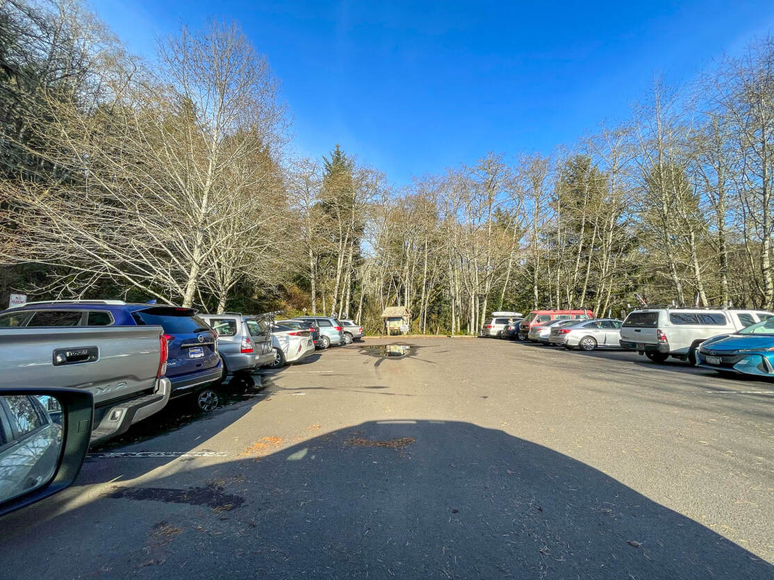
(Cascade Head lower trailhead parking)
Cascade Head trail wooden stairs

Description:

Cascade Head is one of the most popular trails along the northern Oregon coast, and for good reason. The views from this hike are stunning, and there is an abundance of flora and fauna found in this nature conservancy as well. 
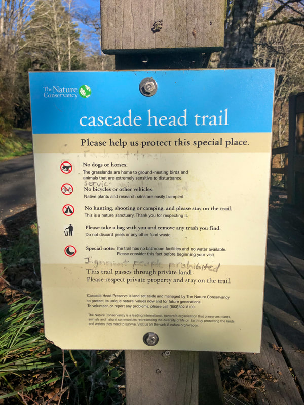
The trail from the lower trailhead starts at the Knight Park Day Use Area and there are no passes or fees required to park here for the day. You will walk on a trail along the road for almost half a mile, then when the road splits, you will cross the road and start going uphill. This trail follows another road for 0.2 miles, then you will cross the road one final time before coming to a large Cascade Head trail sign. 
Cascade Head Trail sign
Cascade Head trail signage
Here you will enter the Nature Conservancy which means there are no dogs or bikes allowed. Make sure to pack out any trash as well as toilet paper. 
mushrooms along Cascade Head trail
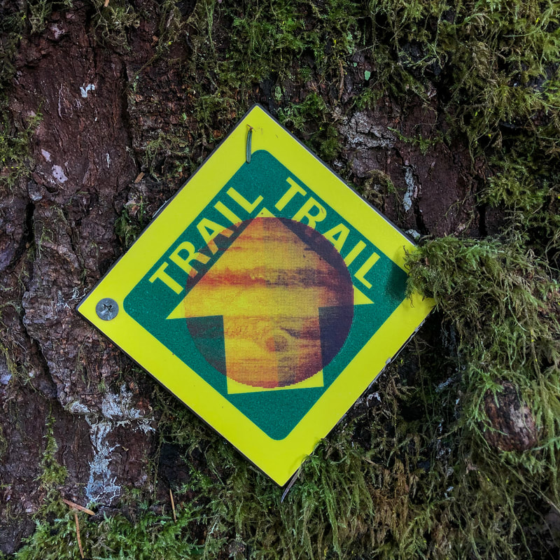
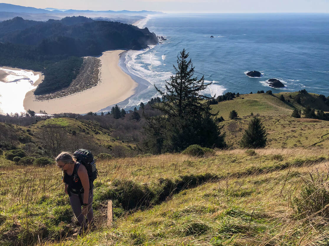
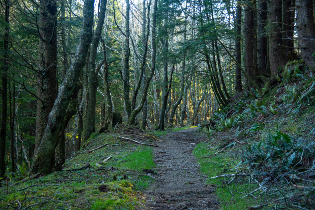
The trail ambles through a beautiful forest for about half a mile, where you will see an abundance of ferns, mosses and mushrooms. Then the trail cuts along the side of the hill, through some very tall bushes and over a large creek via a very sturdy bridge. Once you leave the bushes, the views open up and you can see Cascade Head towering above you as well as the blue Pacific Ocean beyond. 
Cascade Head view of ocean
(The Penacle)
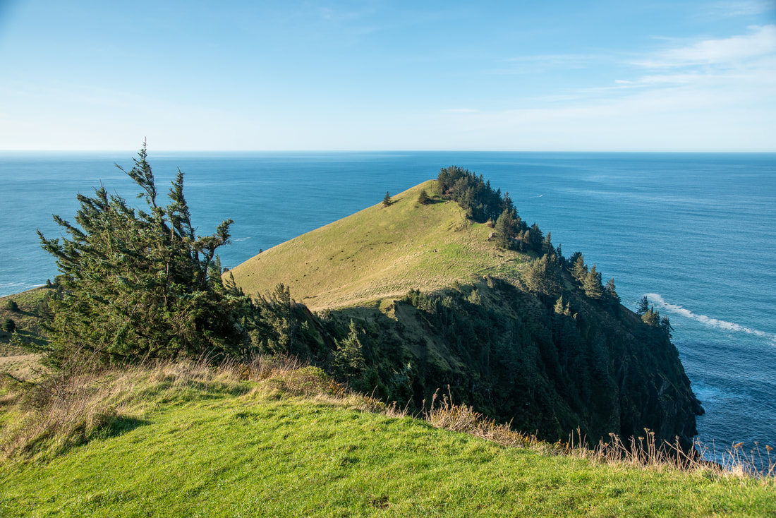
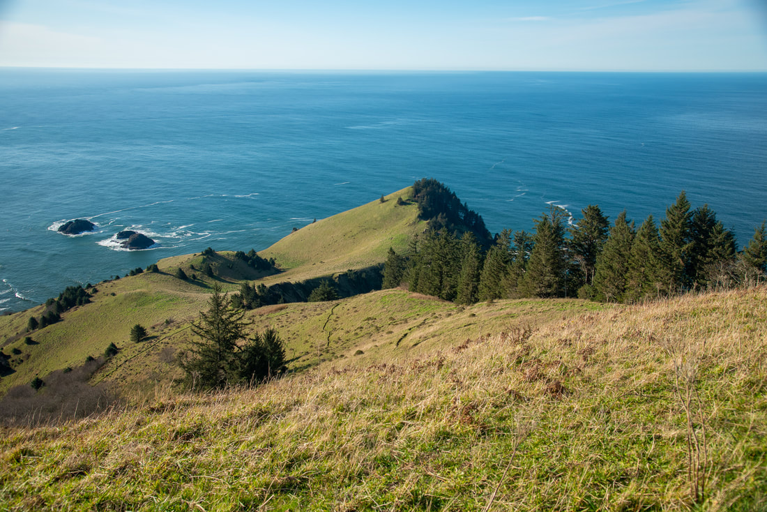
At the 1.8 mile mark, you will see a small user trail that goes off to the left over to what is called The Penacle. The main trail continues up the hill as you start the switchbacks. There are a total of 14 switchbacks over the next 0.75 miles, as you gain 300 feet of elevation. In May and June this whole hillside will be covered in a variety of wildflowers and if you catch this hike early in the morning, you can frequently see a herd of elk grazing. 
Hiking up Cascade Head
(view to the south)
Salmon River from Cascade Head
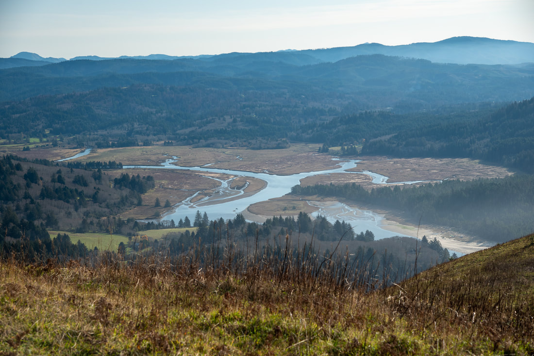
(Salmon River estuary)
Fragile habitat at Cascade Head
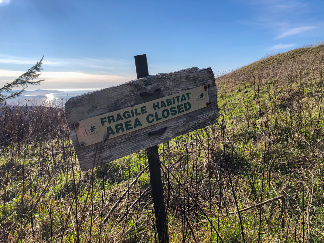
When you arrive at the summit, you can sit on the grassy knoll and enjoy the views and oftentimes during the winter months, some glorious sunshine. Please do not stray off the main trail, as this is fragile habitat to many critters as well as plants. 
If you want to do the shorter trail, you will start from the upper trailhead. There is not a lot of parking here, maybe room for 3-4 cars. There is an informational sign and off you go through ​the forest.
Cascade Head upper trailhead
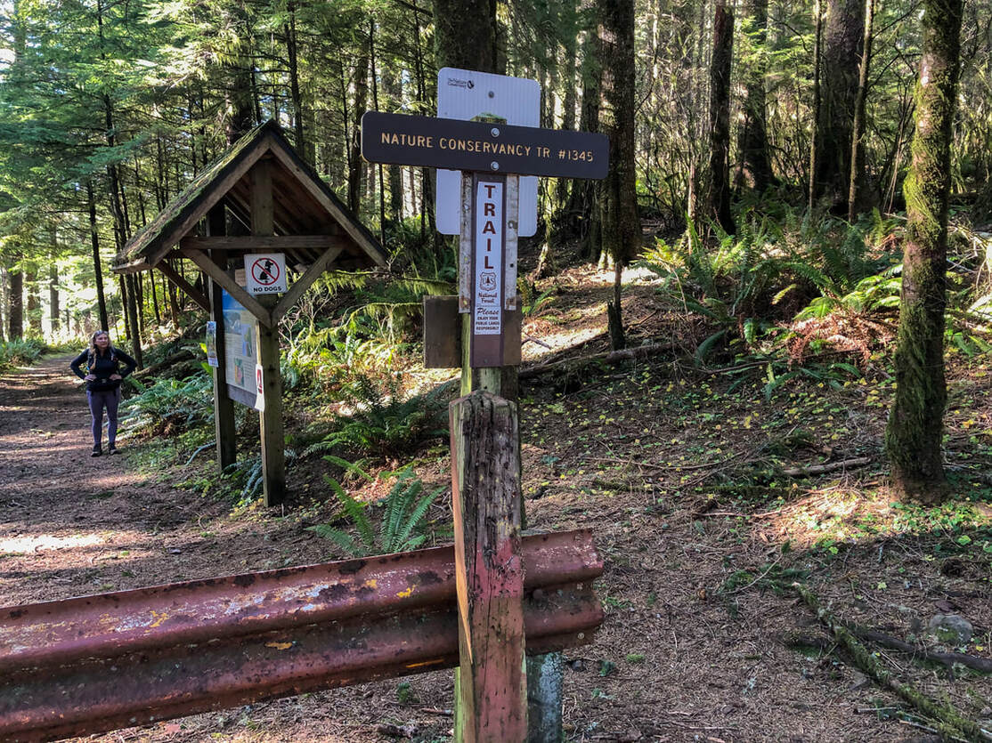
(Cascade Head upper trailhead)
The entire trail is almost completely level and very wide, as you walk through a stunning forest with lots of ferns and some wildflowers in the spring. This shorter trail to the summit is very different than the longer trail because it is entirely in the forest until you get to the top, whereas the longer trail offers a partially forest trail and then takes you through the beautiful meadows with lots of ocean views. The shorter trail is definitely more family friendly though and is perfect if you are hiking with little kids. The longer trail is very steep, can be muddy and slippery and the trail is also very narrow. From the upper trailhead it is exactly 1 mile to the summit of Cascade Head. 
Cascade Head trail from the upper trailhead
(trail from the upper trailhead)
Cascade Head offers one of the most spectacular views on the entire northern Oregon Coast. Whether you do the short or long trail, this hike will not disappoint, especially if you go on a clear day. The expansive views of the Pacific Ocean, make you feel like you're on top of the world, and you can see for miles down the coastline. In late spring you will find an abundance of flowers along the hillside and you can also frequently see elk and other animals here because this area is a Nature Conservancy. 
The longer trail is rated as moderate due to the elevation gain and because the trail is narrow, steep and can be slippery at times. The short trail is rated as easy and is extremely family friendly.
​**Remember to leave your pup at home when hiking at Cascade Head. 
Cascade Head Trail

Directions:

From Salem to lower trailhead
  • ​Drive on OR-22 W for a total of 25.6 miles, then merge onto OR-18 W/OR-22 W for another 26.3 miles. **Merge onto US-101 N via the ramp to Tillamook/Astoria for 1.2 miles, then turn left onto N 3 Rocks Rd. for 2.3 miles and find the trailhead parking on your left. (Total of 56.6 miles)
From Salem to upper trailhead (only open July 16 - December 31)
  • **Merge onto US-101 N for a total of 3.9 miles, then turn left onto Cascade Head Rd./NF-1861 for 2.5 miles and find the very small trailhead on your left. (Total of 59.2 miles)
From Portland to lower trailhead
  • Drive I-5 S for a total of 6.3 miles, then take exit 294 to merge onto OR-99W S/SW Barbur Blvd/Pacific Hwy W toward Tigard/Newberg for 5.3 miles. In Sherwood keep right to stay on OR-99W S/Pacific Hwy W for 9.5 miles, then turn left onto N Springbrook Rd. for 1 mile. Use the left 2 lanes to turn left onto OR-219 S then turn right onto OR-18/Newberg Dundee Bypass for 4.1 miles. Use the right 2 lanes to turn slightly right onto the State Hwy 18/State Hwy 99W for 3.2 miles. Turn left onto OR-18 W/OR-233 S for 52.1 miles, then **merge onto US-101 N via the ramp to Tillamook/Astoria for 1.2 miles, then turn left onto N 3 Rocks Rd. for 2.3 miles and find the trailhead parking on your left. (Total of 86.5 miles)
From Portland to upper trailhead (only open July 16 - December 31)
  • **Merge onto US-101 N for a total of 3.9 miles, then turn left onto Cascade Head Rd./NF-1861 for 2.5 miles and find the very small trailhead on your left. (Total of 89.1 miles)
From Eugene to lower trailhead
  • Total of 122 miles via Salem.
From Eugene to upper trailhead (only open July 16 - December 31)
  • Total of 125 miles via Salem.
From Bend to lower trailhead
  • Total of 188 miles via Salem.
From Bend to upper trailhead (only open July 16 - December 31)
  • Total of 191 miles via Salem.
From Medford to lower trailhead
  • Total of 286 miles via Salem.
From Medford to upper trailhead (only open July 16 - December 31)
  • Total of 288 miles via Salem.
-This trail write-up was last updated May, 2022-
*All pictures are taken by Franziska Weinheimer
*Disclaimer: The trail descriptions, mileage, GPS tracks and difficulty ratings depicted on this website are never 100% accurate. Always hike at your own risk, using your own knowledge, equipment and common sense. Franziska Weinheimer/Hike Oregon are not responsible if you or anyone in your party gets injured or lost while attempting one of these or any other hikes.

HIKED HERE RECENTLY? PLEASE LEAVE A TRIP REPORT BELOW:

© Hike Oregon 2025
P.O. Box 41911
​Eugene, OR 97404
Proudly powered by Weebly
  • Home
  • *Store*
  • About the author
  • How to use this site
  • Resources
    • Wildflowers
    • Videos
  • Best Oregon Hikes
    • Best Rainy Day Hikes In Oregon
    • Top 10 Oregon Fall Hikes
    • Underrated Fall Foliage Hikes In Oregon
    • 20 Best Oregon Waterfall Hikes
    • Sno-Parks In Central Oregon
    • Top 10 Oregon Winter Hikes
    • Top Low Elevation Winter Hikes
    • Easy Hikes in Oregon
    • Top 10 Oregon Hikes for Kids
    • Top 10 Oregon Spring Hikes
    • Top One Night Backpacking Trips in Oregon
    • 5 Weekend Backpacking Trips in Oregon
    • 20 Epic Oregon Wildflower Hikes
    • 9 Amazing Oregon Summit Hikes
    • Top 10 Oregon Summer Hikes
    • Top 10 Swimming Spots In Oregon
    • 20 Central Oregon Day Hikes
  • Oregon Sno-Parks
    • Maxwell Sno-Park
    • Potato Hill Sno-Park
    • Ray Benson Sno-Park
      • Brandenburg Shelter
    • Santiam Sno-Park
    • Three Creek Sno-Park
    • Virginia Meissner Sno-Park
      • Meissner Shelter Loop
      • Nordeen Shelter
    • Gold Lake Sno-Park
      • Westview Shelter to Eagle Rock Overlook
      • Marilyn Lakes Loop
    • Ikenick Sno-Park (members only)
  • Southern Washington
    • Hamilton Mountain
    • Dog Mountain
    • Coyote Wall
    • Mount St. Helens
  • Portland
    • Powell Butte
    • Forest Park
    • Latourell Falls
    • Multnomah/Wahkeena Falls
    • Eagle Creek
    • Mitchell Point
    • Table Rock
    • Tamanawas Falls
    • Trillium Lake
    • East Zigzag Mountain (members only)
  • Salem
    • Abiqua Falls
    • Silver Falls State Park
    • Dome Rock
    • Marion Lake to Marion Mountain
    • Jefferson Park via Whitewater Trail
  • Corvallis
    • William Finley Wildlife Refuge
      • Campbell Boardwalk
      • Woodpecker Loop
      • Mill Hill Loop
      • Beaver Pond Loop
    • Marys Peak East Ridge
    • Marys Peak North Ridge
    • Alsea Falls and Green Peak Falls
    • Corvallis to Sea Trail - Sugarbowl Creek segment (members only)
  • Sweet Home
    • Crescent Mountain
    • Iron Mountain
    • McDowell Creek Falls
    • Middle Santiam River (members only)
    • Lower Soda Creek Falls (members only)
    • Rooster Rock (members only)
  • McKenzie Bridge/Blue River
    • Macduff Mountain
    • Proxy Falls
    • Clear Lake
    • Sahalie/Koosah Falls
    • Blue Pool
    • Erma Bell Lakes
    • Olallie Mountain
    • Horsepasture Mountain
    • Tidbits Mountain
    • Castle Rock
    • Separation Lake (members only)
    • Lowder Mountain (members only)
    • East Fork Trail (members only)
    • Rainbow Falls Overlook (members only)
    • Frissell Point (members only)
    • Substitute Point (members only)
  • Sisters/Santiam Pass
    • Coffin Mountain
    • Trappers Butte and Scar Mountain
    • Maxwell Butte
    • Black Butte
    • Whychus Creek Trail
    • Tam McArthur Rim
    • Black Crater
    • Scott Mountain
    • Obsidian Trail
    • Metolius Preserve
    • Three Fingered Jack Loop
    • Square Lake
    • Canyon Creek Meadows
    • Patjens Lakes
    • Craig Lake (members only)
    • Chush Falls (members only)
    • Rockpile Lake (members only)
    • Santiam Lake (members only)
    • Camp Lake (members only)
    • Park Meadow to Golden Lake (members only)
  • Bend/Redmond/LaPine
    • Steins Pillar
    • Chimney Rock
    • Steelhead Falls
    • Tumalo State Park
    • Shevlin Park Loop
    • Tumalo Falls
    • Tumalo Mountain
    • No Name Lake
    • Green Lakes
    • Moraine Lake
    • South Sister Summit
    • Horse Lake
    • Muskrat Lake
    • Paulina Peak
    • The Badlands - Flatiron Rock Trail
    • Peter Skene Ogden Trail (members only)
  • Eugene
    • Ridgeline Trail
    • Mount Pisgah Summit
    • Mount Pisgah Arboretum
    • Shotgun Creek
    • Mount June
    • Lawler
    • Tire Mountain
    • Hardesty Mountain
    • Goodman Creek
    • Brice Creek
    • Trestle Creek Falls
    • Parker Falls
    • Moon Falls
    • Elijah Bristow State Park
    • South Willamette Trail (members only)
    • Eula Ridge (members only)
    • Eagle's Rest (members only)
  • Oakridge
    • Deception Butte
    • North Salmon Creek
    • Sourgrass Mountain
    • Grasshopper Ridge
    • Larison Creek
    • Bunchgrass Ridge
    • Salt Creek Falls
    • Waldo Lake Loop
    • South Waldo Loop
    • The Twins
    • Rosary Lakes
    • Yoran Lake
    • Fawn Lake
    • Windy Lakes
    • Divide Lake
    • Diamond Peak via Rockpile Lake Trailhead
    • Diamond Peak via Summit Lake
    • Cowhorn Mountain
    • Klovdahl Bay (members only)
    • Verdun Trail (members only)
    • Heckletooth Mountain (members only)
    • Wall Creek Warm Springs (members only)
    • Moon Point (members only)
    • Bobby Lake (members only)
    • Lillian Falls (members only)
    • Middle Fork Willamette Trail (members only)
    • Pool Creek Falls (members only)
    • Dead Mountain (members only)
    • Larison Rock (members only)
    • Quinn Lakes & Eddeeleo Lakes (members only)
    • Waldo Mountain Lookout (members only)
    • Blair Lake to Spring Prairie (members only)
    • Rigdon Lakes loop (members only)
  • Oregon Coast
    • Cascade Head
    • Drift Creek Falls
    • Sweet Creek Falls
    • Beaver Creek Falls
    • Kentucky Falls
    • Hobbit Trail to Heceta Head
    • Valley Trail to China Creek
    • Sutton Creek Trail (members only)
    • North Fork Smith River (members only)
    • Cummins Ridge (member's only)
    • Horse Creek (members only)
    • Siltcoos Lake (members only)
  • Southern Oregon
    • Fall Creek Falls
    • Watson Falls
    • Wild Rogue Loop
    • Mt. Thielsen
    • Crater Lake National Park
      • The Watchman
      • Mount Scott
      • The Pinnacles
    • Lower Table Rock
    • Pilot Rock
    • Wagner Butte
    • Mt. McLoughlin
    • Lemolo Falls (members only)
    • Fern Falls (members only)
  • Eastern Oregon
    • Painted Cove
    • Anthony Lake Loop
    • Mount Howard
    • Eagle Cap summit
    • Schneider Cabin (members only)
    • Strawberry Lake & Strawberry Falls (members only)
  • Northern California
    • Taylor & Hogan Lake (members only)
  • Oregon PCT sections
    • PCT: CA border to Callahan's
  • Tips & Tricks
    • Leave No Trace
    • Safety Tips for Solo Hiking & Backpacking
    • Nutrition On The Trail
    • How Much Water To Carry When Backpacking
    • Storing Your Bear Canister When Backpacking
    • How To Pick The Right Backpacking Tent
    • Top Tips For Hiking With Infants And Toddlers
    • Poison Oak, Ivy and Sumac
    • How to dress for cold weather hikes
  • Reviews and Gear
    • Choosing and Using Trekking Poles
    • A Guide to Choosing the Perfect Backpacking Pack
    • Hiking Pants and Leggings
    • Jackets for Hiking and Backpacking
    • Long Sleeved Shirts For Cold Weather Hiking
    • Stay Kühl This Summer
    • Outdoor Herbivore Backpacking Food Review
    • Osprey Aura AG 65 Backpack review
    • Big Agnes Fly Creek UL2 review
    • REI Quarter Dome 1 review
    • Hike Oregon's Gear Favorites
    • Outdoorsy Holiday Gift Guide 2022
    • Hiker Holiday Gift Guide 2019
    • Outdoor Holiday Gift Guide 2018
    • Hiking Holiday Gift Guide 2017
  • Adventure Stories
    • Hiking The Rae Lakes Loop
    • 110 Miles on the PCT
    • Three Fingered Jack Adventures
    • Jefferson Wilderness