Lawler Trail
mid-section to Rock Knob
Hike details:
Mileage: 5.6 miles round trip w/ 1,560 ft. elevation gain
Approximate hike time: 2 hours 26 minutes w/ an average pace of 2.3 mph
Difficulty: Moderate
Trail usage: Low (except on weekends during late May to October when it's mountain biking season)
Highest elevation: 3,250 ft. Lowest elevation: 1,693 ft.
General location: 33 miles east of Eugene - Willamette National Forest
Accessible: April to mid-December
(Best time to go is April and early May, as well as late October and November to avoid the high traffic mountain bike season. This is a very popular mountain bike shuttle trail. In April and early May you will see wildflowers).
Permits required: N/A
Pit toilet at trailhead: No
Trail allows: Dogs, mountain biking, camping
Possible dangers: N/A
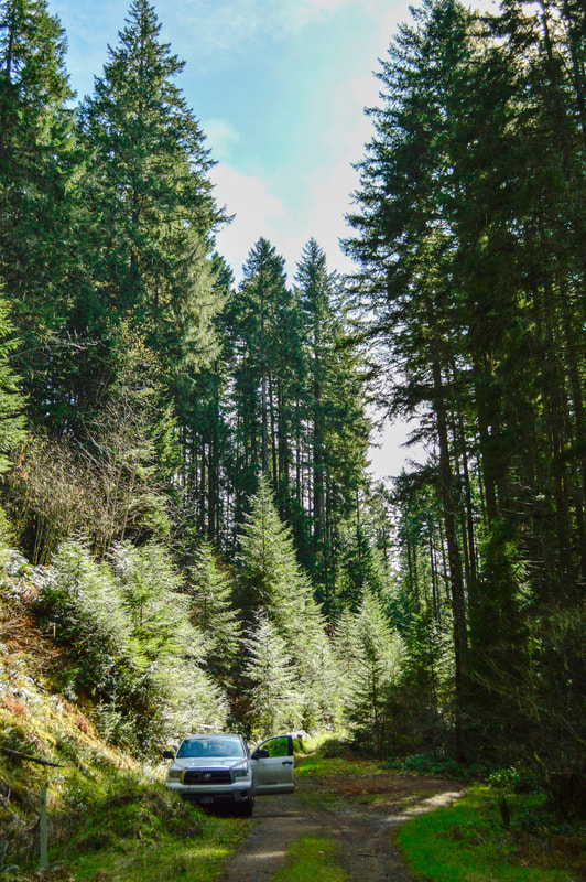
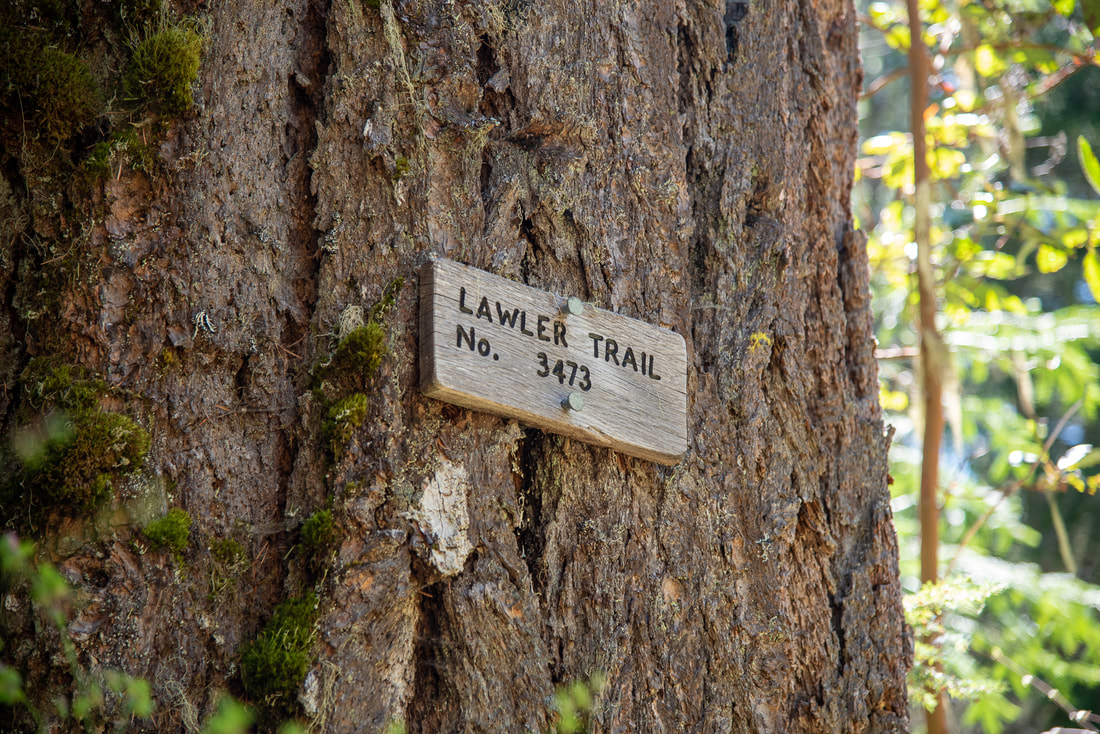
(Lawler midsection trailhead)
|
Description:Lawler is a trail that covers just over 10 miles from the bottom trailhead at Highway 58 all the way up to the top of Patterson Mountain. The entire length of trail is very popular with downhill mountain bikers who shuttle to the top and then bike down. But you don't have to hike the entire thing to see the best of what this trail has to offer. The midsection of the Lawler Trail goes through a beautiful old growth forest, featuring large rock formations, wildflowers in the spring and it goes to two beautiful lookout points, one of them being Rock Knob.
The trailhead parking is at the end of a very narrow forest road. The trail was recently rerouted for mountain bikers, so if you are hiking, start the hike by heading down the spur road continuation for the first 0.3 miles until you meet up with the trail. Then continue uphill to the left. |
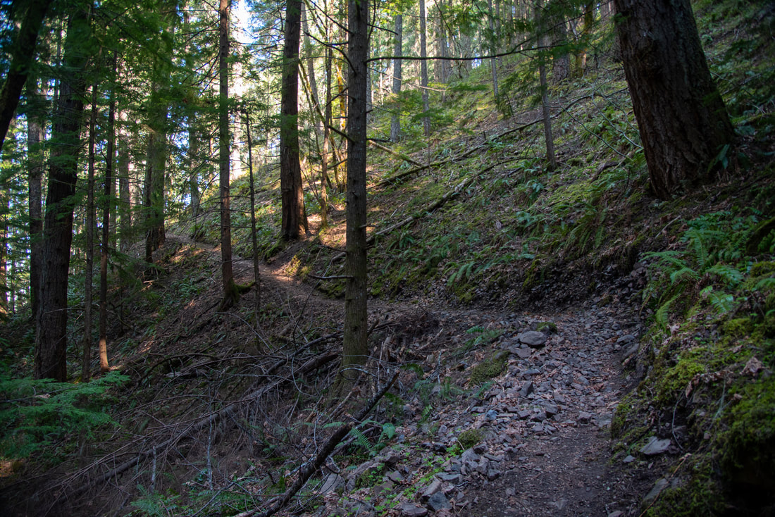
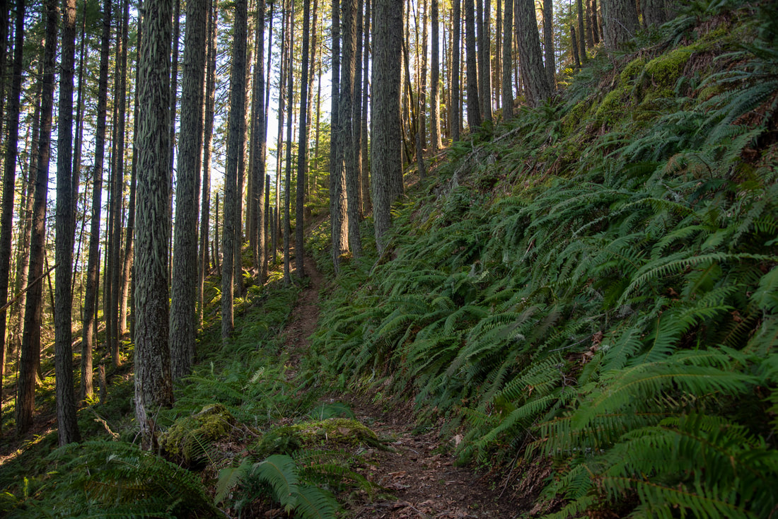
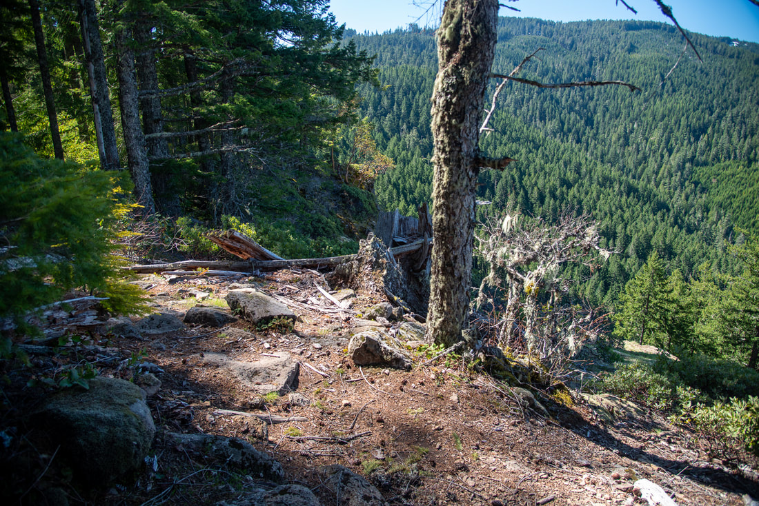
(example of the trail tread along this section of trail)
|
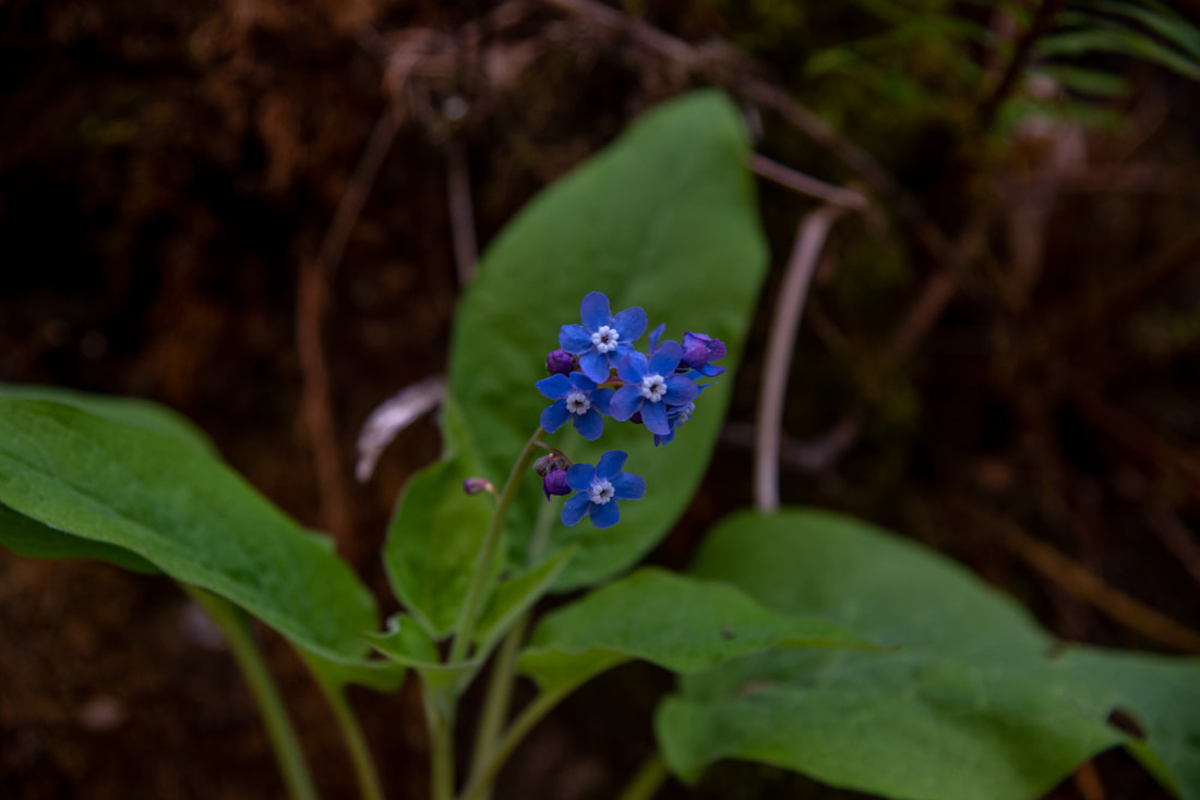
(Manyflower Stickseed)
|
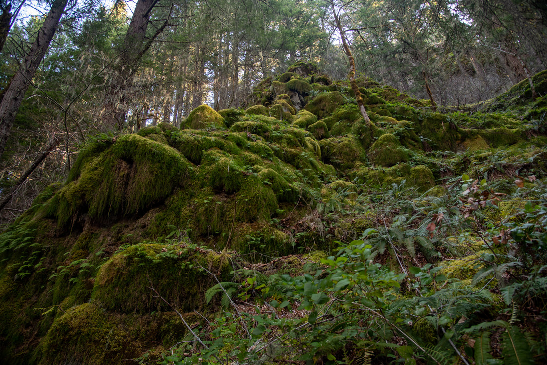
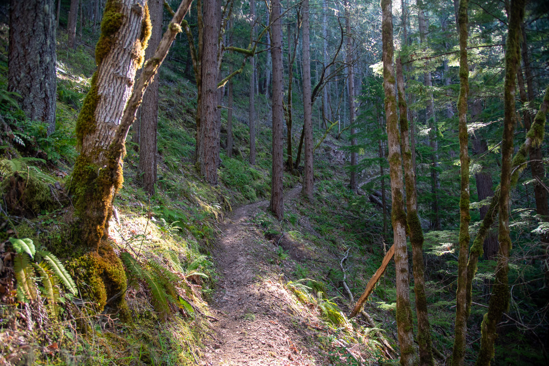
The trail is not particularly easy. There is quite a bit of elevation gain in the 2.8 miles up to Rock Knob and the trail tread has some spots with loose rocks and off camber sections. The 1.7 miles to the first viewpoint after the spur road connects with the trail are spectacular. In the month of April you will see a plethora of wildflowers along the trail, white Trillium, Manyflower Stickseed, Calypso Orchids and many more. There are also large rock formations that you will see along the way that are covered in moss and create a magical distraction to how steep the trail is.
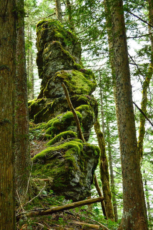
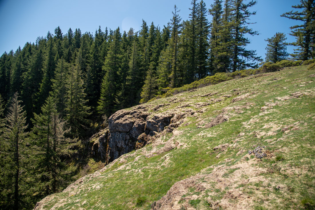
(rock formations along the trail)
|
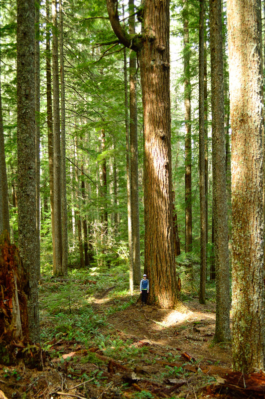
(huge trees along the trail)
|
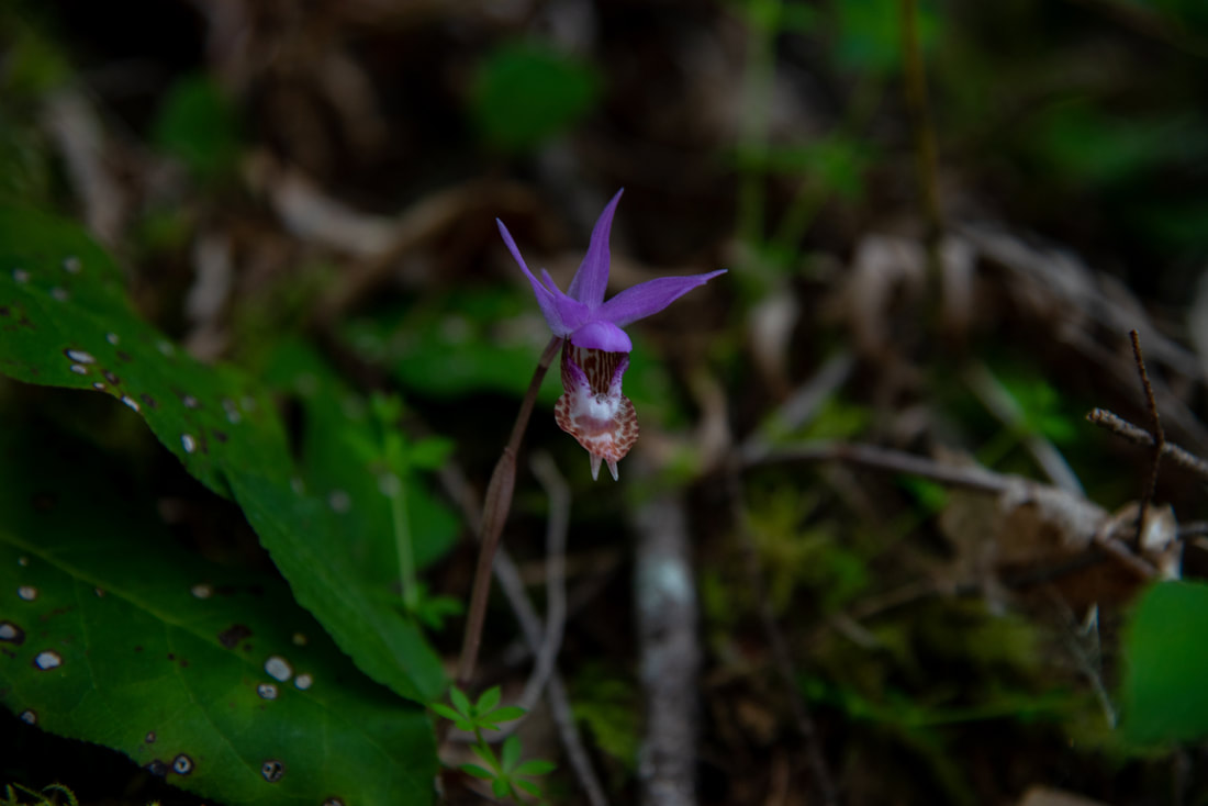
(Calypso orchid)
|
|
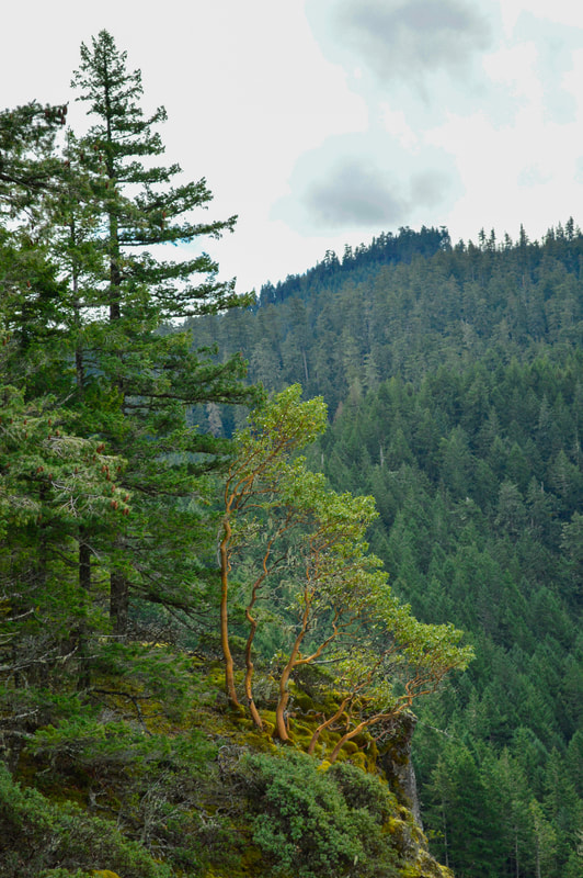
Thousands of Swordferns blanket the forest floor, and huge trees line the trail. After 2.1 miles you will come up a ridge and suddenly the forest looks a lot different. You will see snowbush, madrone trees and a beautiful meadow to your left. You can go out onto the meadow and check out the view of the Oakridge valley. You will see all of the prominent hills that surround the town of Oakridge, like Lookout Point, TV Butte, Buckhead Mountain and Tire Mountain and even the snowy hills beyond like Bunchgrass Ridge and Fuji Mountain.
(first viewpoint toward Oakridge)
After the first viewpoint, you will continue on the trail for another 0.7 miles until you come to a spot where Lawler Trail turns to the left and you will see lots of large rocks in the trail. To the right, you will catch a glimpse of a meadow through the bushes, but once you come to where the trail turns, that is where you will see a faint foot path heading to the right to the meadow and Rock Knob.
(turn right here for Rock Knob)
|
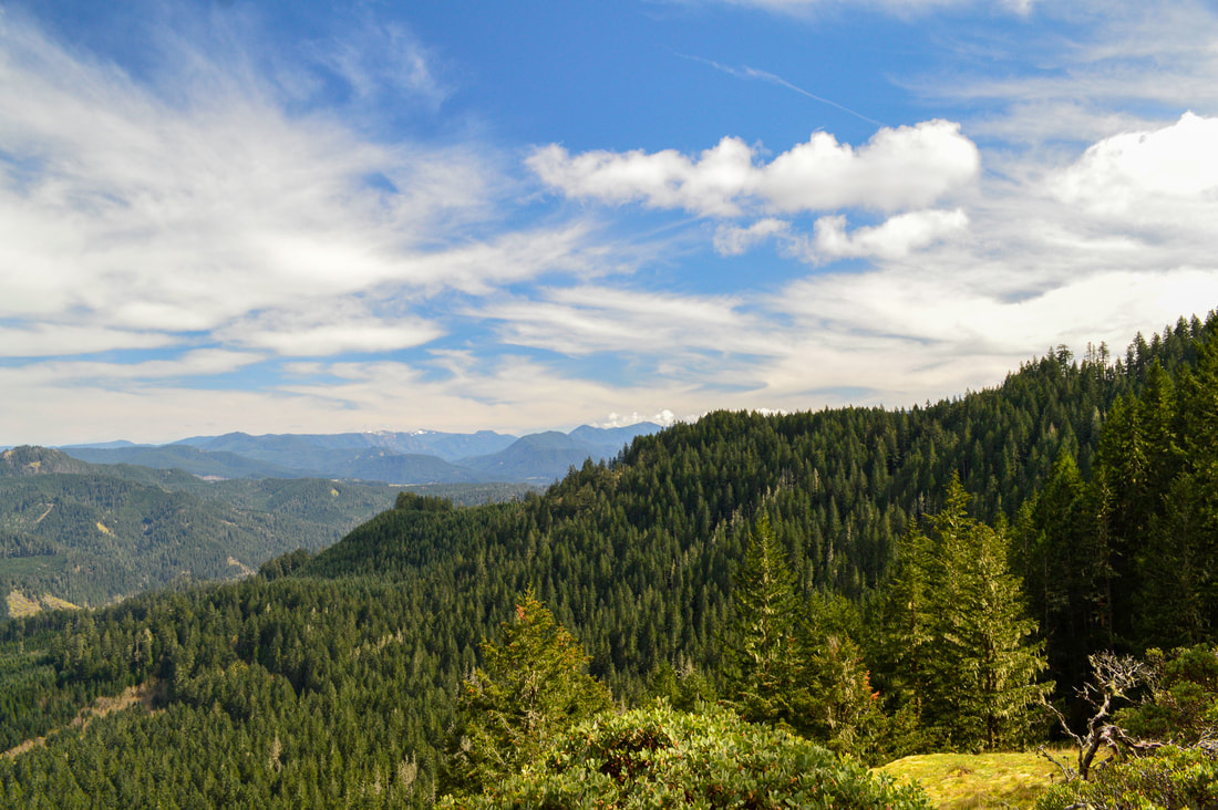
The view from Rock Knob is one of the most unique in this area. You look out into the narrow valley of Duval Creek where you will see Patterson Mountain Road winding up through some clearcuts. Directly across from Rock Knob you will see Hardesty Mountain (which is also the top of the Eula Ridge Trail). Mount June peaks out behind Hardesty on the left and the big hill to the left is Patterson Mountain. To the right you will see Eagles Rest, Taylor Butte, Prairie Mountain and on a very clear day you can see all the way to Marys Peak. Lookout Reservoir is the prominent water feature that you see down below and it can be dark blue or a blueish-green color, depending on the recent rains and the season.
|
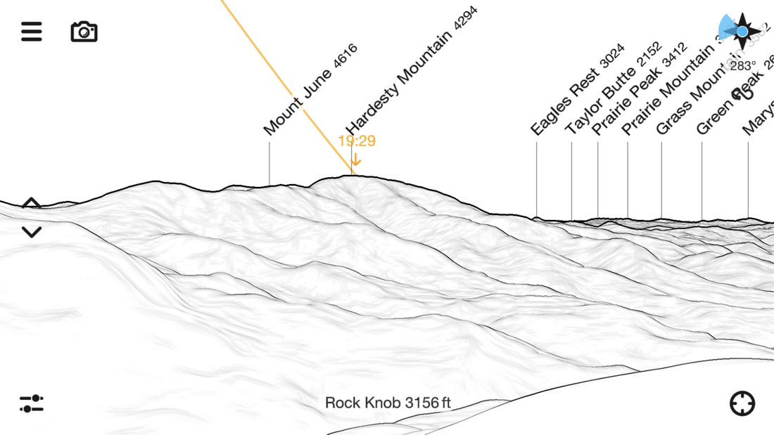
(names of all the hills you see from Rock Knob)
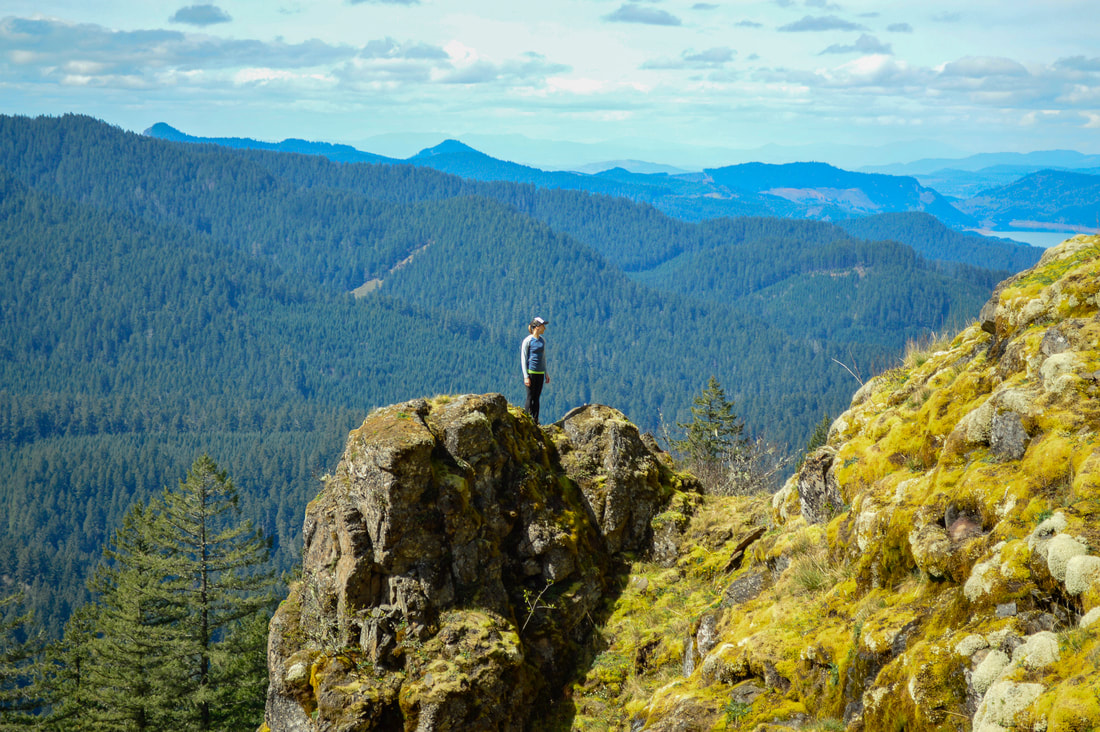
(Rock Knob)
The meadow at Rock Knob is very large and in April and early May is dotted with small yellow and white wildflowers and succulents. This is the perfect place to sit and have a picnic. The sun shines onto this meadow for the majority of the day and the valley really retains the heat, so the meadow is almost always a nice warm place to sit.
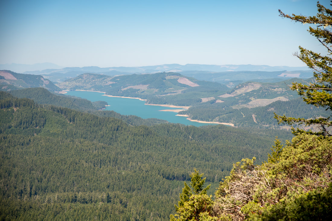
(Lookout Reservoir)
This section of the Lawler Trail is a spectacular viewpoint hike in the Willamette Valley. It is rated moderate because of the elevation gain and the rocky tread of the trail in some sections. It is very close to Eugene and is the perfect hike to do if you don't have all day to be out but still want to get your legs moving out in the woods. It is not recommended to hike this trail after late May through October because of the mountain bikers that come barreling down this steep trail.
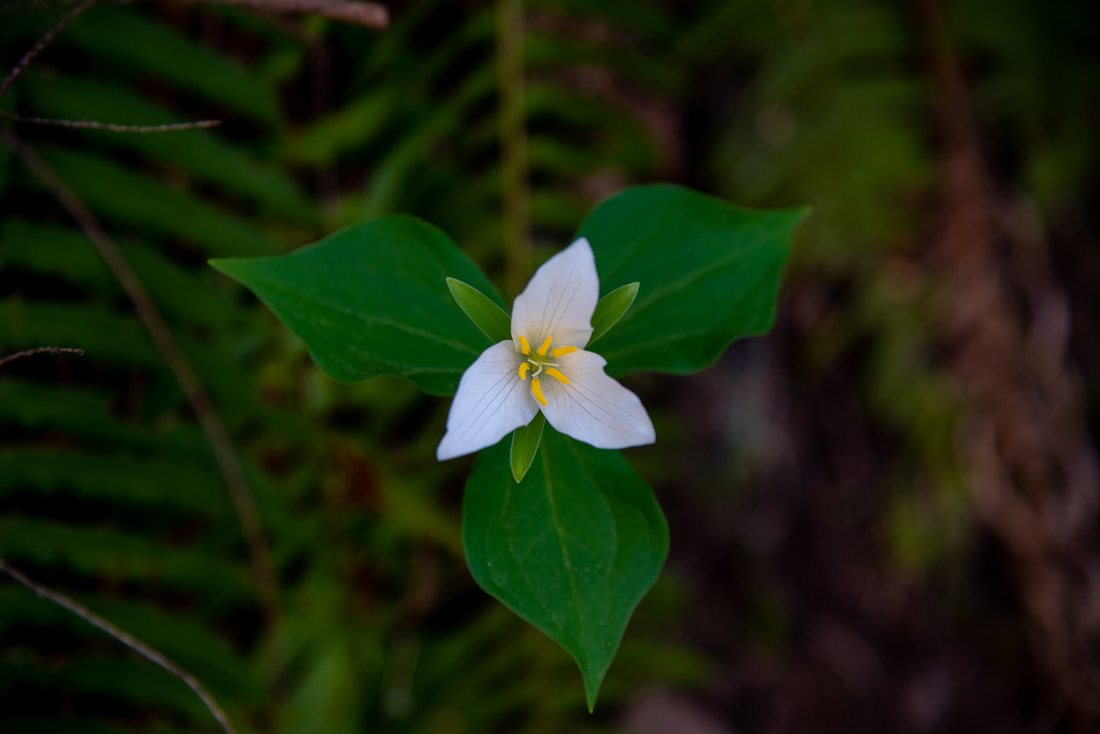
(Trillium flower)
Directions:
From Eugene
- Drive OR-58 east toward Oakridge for 24.6 miles then turn right onto Patterson Mountain Road/Road 5840. Stay on this road for 0.4 miles, then fork left onto a wide well maintained gravel road for 1.8. Take a right fork onto a one lane gravel road, not often used. This road gets very narrow, so take a car that you don't mind possibly getting scratched up a bit. Follow this road for 1.2 miles to the trailhead at its end. (Total of 28 miles)
- Drive US-97 south for 46.9 miles then turn right onto Crescent Cutoff Road for 12 miles until you T into OR-58. Turn right and stay on OR-58 west for 48.1 miles. Turn left onto Patterson Mountain Road/Road 5840. Stay on this road for 0.4 miles, then fork left onto a wide well maintained gravel road for 1.8. Take a right fork onto a one lane gravel road, not often used. This road gets very narrow, so take a car that you don't mind possibly getting scratched up a bit. Follow this road for 1.2 miles to the trailhead at its end. (Total of 108 miles)
- Total of 93.5 miles via Eugene.
- Total of 136 miles via Eugene.
- Total of 183 miles via Eugene.
|
-This trail write-up was last updated in May 2023-
*All pictures are taken by Franziska Weinheimer *Disclaimer: The trail descriptions, mileage, GPS tracks and difficulty ratings depicted on this website are never 100% accurate. Always hike at your own risk, using your own knowledge, equipment and common sense. Franziska Weinheimer/Hike Oregon are not responsible if you or anyone in your party gets injured or lost while attempting one of these or any other hikes
|
To get a more in-depth and personal view of this hike, watch the YouTube video.
|