William L. Finley Wildlife Refuge
Beaver Pond Loop
Hike details:
Mileage: 2.3 mile lollipop loop w/ 100 ft. elevation gain
Approximate hike time: 1 hour w/ an average pace of 2.3 mph
Difficulty: Easy
Trail usage: Medium on nice weather weekends, low traffic otherwise
Highest elevation: 312 ft. Lowest elevation: 217 ft.
General location: 14 miles south of Corvallis - William L. Finley Wildlife Refuge
Accessible: Year-round
(Best time to go is April and May for wildflowers and October for fall foliage).).
Permits required: N/A
Pit toilet at trailhead: No
Trail allows: NO DOGS! Dogs are not allowed at William Finley Wildlife Refuge
Possible dangers: N/A
|
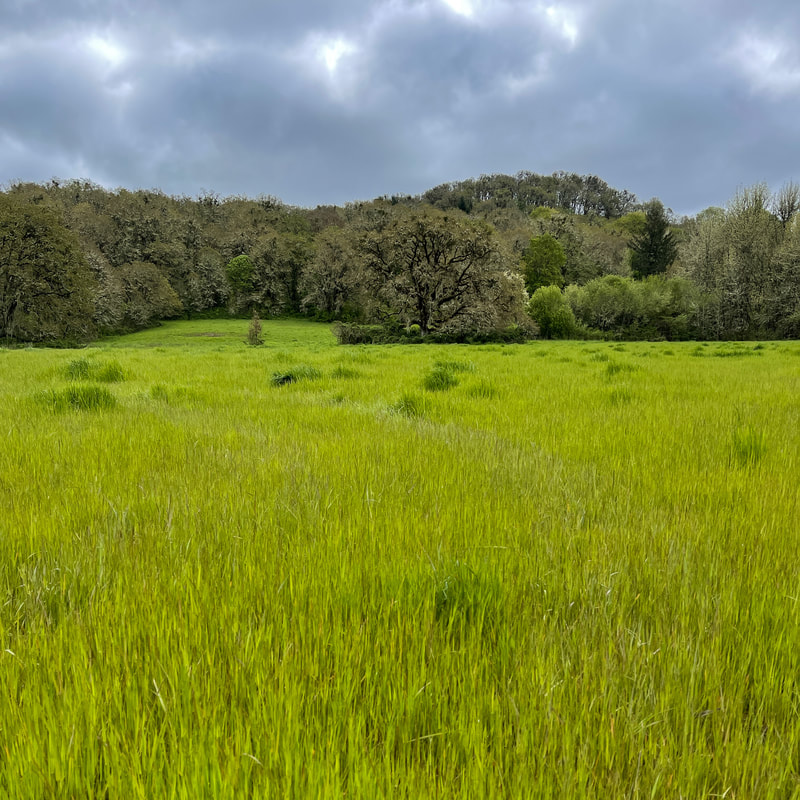
Description:William L. Finley National Wildlife Refuge was established in 1964 with the primary goal to provide a habitat for the Dusky Canada goose to winter. During the winter months you will see geese, swans and many other birds as well as Roosevelt elk. If your goal is to see wildflowers, visiting in the spring (April and May) is the best. There are a plethora of trails and loops in the refuge, each featuring something different like vista views, wildflower meadows or marshes.
The Beaver Pond Loop can be one of the muddiest trails at William Finley, so it's best to avoid this trail right after many days of rain (there can sometimes be up to 6 inches of standing water and mud on this loop hike). To begin this hike, walk down an old road lined with trees for half a mile until to come to a trail junction. This is where the loop portion of the hike starts. Take a left on the Beaver Pond Trail and within 0.4 miles you will see Beaver Pond on your left. Hike past Beaver Pond for another 0.1 miles and then turn right onto another old road which is the continuation of Beaver Pond Trail. After 0.2 miles of walking past some splendidly green meadows and oak trees, you will see the Cattail Pond Trail split off |
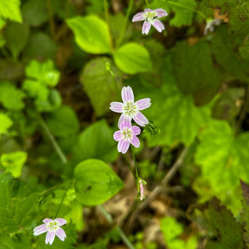
(candy flower)
|
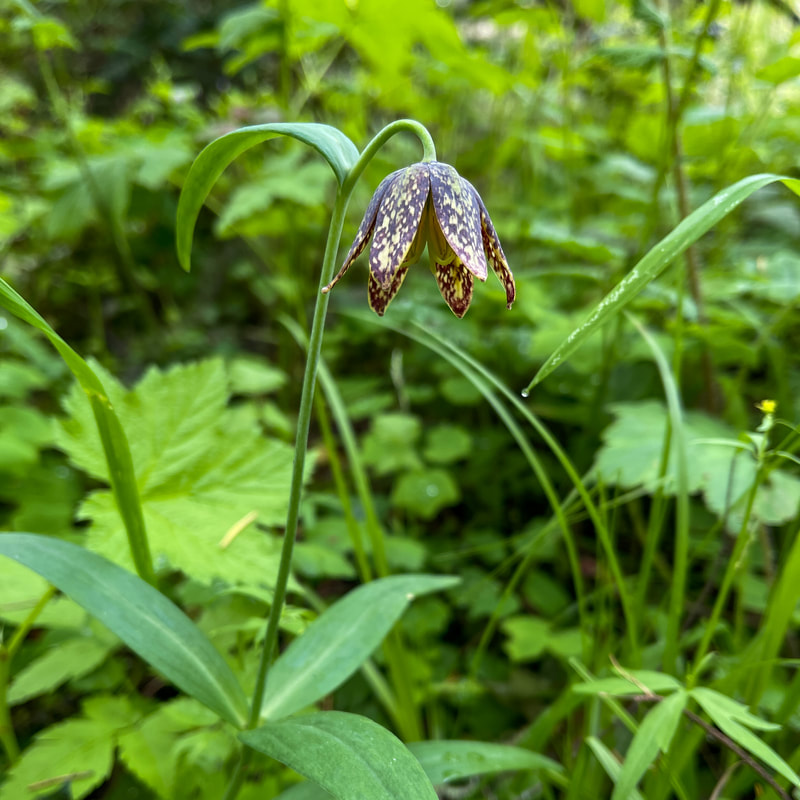
(chocolate lily)
|
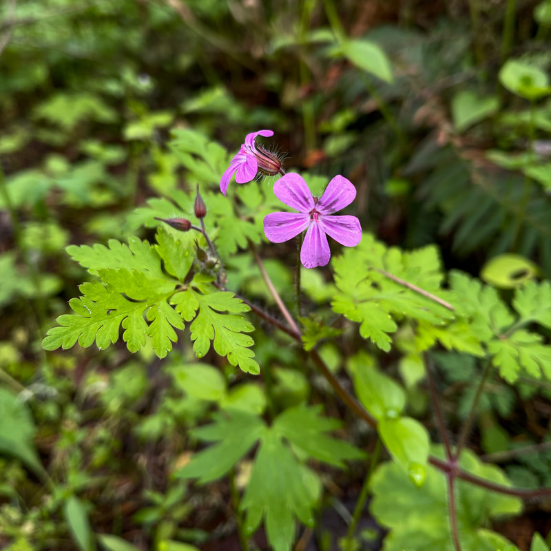
(herb Robert/stinky Bob)
|
to the right. After passing Cattail Pond, the trail heads back into the woods, and this is where it can get really muddy. Continue hiking for 0.6 miles until arrive back at the beginning of the loop. Go straight to hike back to the car on the old road. Out of all the trails at William Finley Wildlife Refuge, this one has the most wildflowers blooming in the month of May. You will see everything from native pine violets and chocolate lilies to non-native tiny pink shining geranium flowers. At the ponds you will likely see lots of geese and ducks and in the large meadows that you pass by you might see deer, elk, fox and bunnies. The Beaver Pond Loop is really amazing, especially for bird watchers and wildflower enthusiasts.
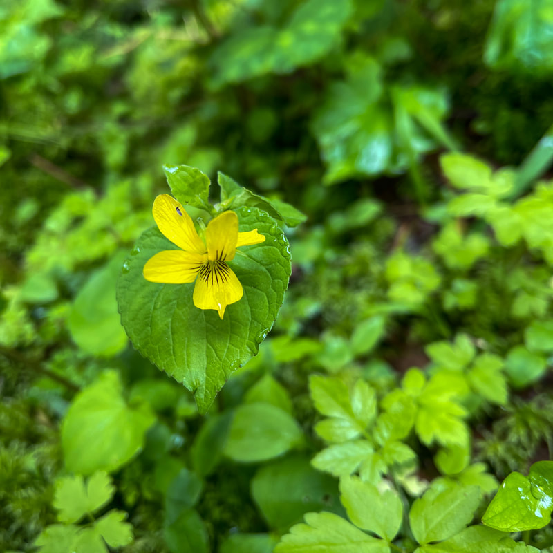
(pine violet)
|
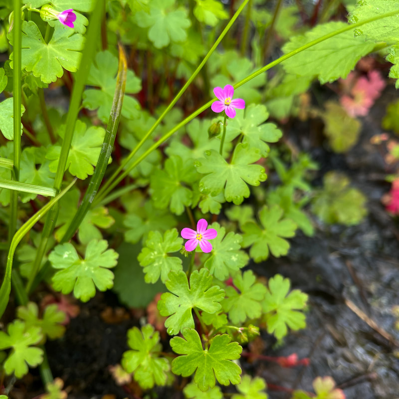
(shining geranium - not native)
|
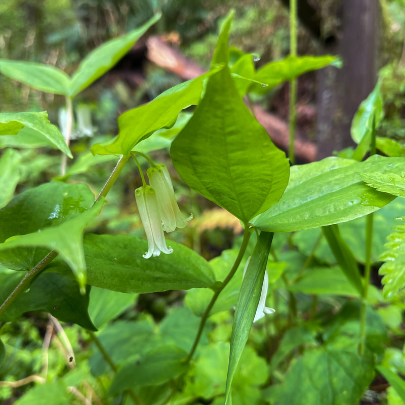
(Smith's fairy bells)
|
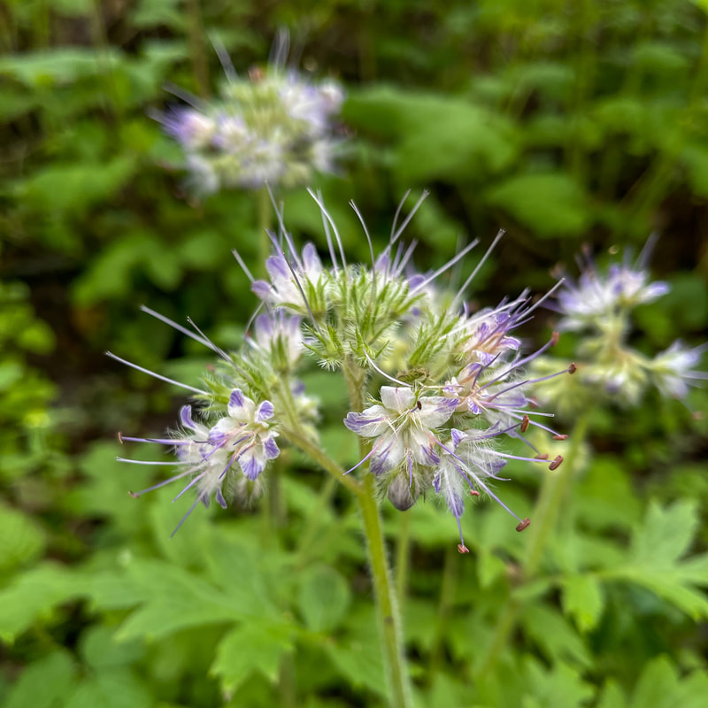
(western waterleaf)
|
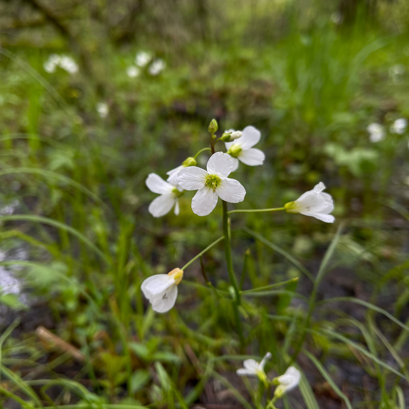
(Willamette Valley bittercress)
|
Directions:
From Corvallis
- Drive on OR-99W/Pacific Hwy. W for a total of 11.6 miles. Turn right onto Bruce Rd. for 2 miles and find the trailhead parking on your right. (Total of 14 miles)
- Take 6th Ave./OR-99 N for a total of 15.2 miles. Drive through Junction City and then turn left onto OR-99 W N/Pacific Hwy. W for 13.1 miles. Turn left onto Bruce Rd. for 2 miles and find the trailhead parking on your right. (Total of 30 miles)
- Total of 54 miles via Corvallis.
- Total of 98 miles via Corvallis.
- Total of 145 miles via Corvallis.
- Total of 198 miles via Eugene.
|
To get a more in-depth view of this hike, watch the YouTube video.
|
-This trail write-up was last updated May, 2023-
*All pictures are taken by Franziska Weinheimer *Disclaimer: The trail descriptions, mileage, GPS tracks and difficulty ratings depicted on this website are never 100% accurate. Always hike at your own risk, using your own knowledge, equipment and common sense. Franziska Weinheimer/Hike Oregon are not responsible if you or anyone in your party gets injured or lost while attempting one of these or any other hikes.
|