Hike Oregon
  • Home
  • *Store*
  • About the author
  • How to use this site
  • Resources
    • Wildflowers
    • Videos
  • Best Oregon Hikes
    • Top Fall Foliage Hikes In Oregon
    • Top 10 Oregon Fall Hikes
    • 20 Best Oregon Waterfall Hikes
    • Top 10 Oregon Hikes for Kids
    • Sno-Parks In Central Oregon
    • Top 10 Oregon Winter Hikes
    • Top Low Elevation Winter Hikes
    • 9 Amazing Oregon Summit Hikes
    • 20 Central Oregon Day Hikes
    • 20 Epic Oregon Wildflower Hikes
    • 5 Weekend Backpacking Trips in Oregon
    • Top One Night Backpacking Trips in Oregon
    • Top 10 Oregon Summer Hikes
    • Top 10 Swimming Spots In Oregon
    • Top 10 Oregon Spring Hikes
  • Oregon Sno-Parks
    • Maxwell Sno-Park
    • Potato Hill Sno-Park
    • Ray Benson Sno-Park
      • Brandenburg Shelter
    • Santiam Sno-Park
    • Three Creek Sno-Park
    • Virginia Meissner Sno-Park
      • Meissner Shelter Loop
      • Nordeen Shelter
    • Gold Lake Sno-Park
      • Westview Shelter to Eagle Rock Overlook
      • Marilyn Lakes Loop
  • Southern Washington
    • Hamilton Mountain
    • Dog Mountain
    • Coyote Wall
    • Mount St. Helens
  • Portland
    • Powell Butte
    • Forest Park
    • Latourell Falls
    • Multnomah/Wahkeena Falls
    • Eagle Creek
    • Mitchell Point
    • Table Rock
    • Tamanawas Falls
    • Trillium Lake
    • East Zigzag Mountain (members only)
  • Salem
    • Abiqua Falls
    • Silver Falls State Park
    • Dome Rock
    • Marion Lake to Marion Mountain
    • Jefferson Park
  • Corvallis
    • Marys Peak East Ridge
    • Marys Peak North Ridge
    • Alsea Falls and Green Peak Falls
    • Corvallis to Sea Trail - Sugarbowl Creek segment (members only)
  • Sweet Home
    • Crescent Mountain
    • Iron Mountain
    • McDowell Creek Falls
    • Middle Santiam River (members only)
    • Lower Soda Creek Falls (members only)
    • Rooster Rock (members only)
  • McKenzie Bridge/Blue River
    • Macduff Mountain
    • Proxy Falls
    • Clear Lake
    • Sahalie/Koosah Falls
    • Blue Pool
    • Erma Bell Lakes
    • Olallie Mountain
    • Horsepasture Mountain
    • Tidbits Mountain
    • Castle Rock
    • Lowder Mountain (members only)
    • East Fork Trail (members only)
    • Rainbow Falls Overlook (members only)
    • Frissell Point (members only)
    • Chucksney Mountain (members only)
    • Substitute Point (members only)
  • Sisters/Santiam Pass
    • Coffin Mountain
    • Trappers Butte and Scar Mountain
    • Maxwell Butte
    • Black Butte
    • Whychus Creek Trail
    • Tam McArthur Rim
    • Black Crater
    • Scott Mountain
    • Obsidian Trail
    • Metolius Preserve
    • Three Fingered Jack Loop
    • Square Lake
    • Canyon Creek Meadows
    • Patjens Lakes
    • Craig Lake (members only)
    • Chush Falls (members only)
    • Rockpile Lake (members only)
    • Santiam Lake (members only)
    • Camp Lake (members only)
    • Park Meadow to Golden Lake (members only)
  • Bend/Redmond/LaPine
    • Steins Pillar
    • Chimney Rock
    • Steelhead Falls
    • Tumalo State Park
    • Tumalo Falls
    • Tumalo Mountain
    • No Name Lake
    • Green Lakes
    • Moraine Lake
    • South Sister Summit
    • Horse Lake
    • Muskrat Lake
    • Paulina Peak
    • Peter Skene Ogden Trail (members only)
  • Eugene
    • Ridgeline Trail
    • Mount Pisgah Summit
    • Mount Pisgah Arboretum
    • Shotgun Creek
    • Mount June
    • Lawler
    • Tire Mountain
    • Goodman Creek
    • Brice Creek
    • Trestle Creek Falls
    • Moon Falls
    • Elijah Bristow State Park
    • South Willamette Trail (members only)
    • Eula Ridge (members only)
    • Eagle's Rest (members only)
  • Oakridge
    • Deception Creek
    • North Salmon Creek
    • Grasshopper Ridge
    • Larison Creek
    • Bunchgrass Ridge
    • Salt Creek Falls
    • Waldo Lake Loop
    • South Waldo Loop
    • The Twins
    • Rosary Lakes
    • Yoran Lake
    • Fawn Lake
    • Windy Lakes
    • Divide Lake
    • Diamond Peak Summit
    • Cowhorn Mountain
    • Wall Creek Warm Springs (members only)
    • Moon Point (members only)
    • Bobby Lake (members only)
    • Lillian Falls (members only)
    • Middle Fork Willamette Trail (members only)
    • Pool Creek Falls (members only)
    • Dead Mountain (members only)
    • Larison Rock (members only)
    • Quinn Lakes & Eddeeleo Lakes (members only)
    • Waldo Mountain Lookout (members only)
    • Blair Lake to Spring Prairie (members only)
    • Rigdon Lakes loop (members only)
  • Oregon Coast
    • Cascade Head
    • Drift Creek Falls
    • Sweet Creek Falls
    • Beaver Creek Falls
    • Kentucky Falls
    • Hobbit Trail to Heceta Head
    • Valley Trail to China Creek
    • North Fork Smith River (members only)
    • Cummins Ridge (member's only)
    • Horse Creek (members only)
    • Siltcoos Lake (members only)
  • Southern Oregon
    • Fall Creek Falls
    • Watson Falls
    • Wild Rogue Loop
    • Mt. Thielsen
    • Crater Lake National Park
      • The Watchman
      • Mount Scott
      • The Pinnacles
    • Lower Table Rock
    • Pilot Rock
    • Wagner Butte
    • Mt. McLoughlin
    • Lemolo Falls (members only)
    • Fern Falls (members only)
  • Eastern Oregon
    • Painted Cove
    • Anthony Lake Loop
    • Mount Howard
    • Eagle Cap summit
    • Schneider Cabin (members only)
    • Strawberry Lake & Strawberry Falls (members only)
  • Oregon PCT sections
  • Tips & Tricks
    • Leave No Trace
    • How To Pick The Right Backpacking Tent
    • Top Tips For Hiking With Infants And Toddlers
    • Poison Oak, Ivy and Sumac
    • How to dress for cold weather hikes
    • Outdoorsy Holiday Gift Guide 2022
    • Hiker Holiday Gift Guide 2019
    • Outdoor Holiday Gift Guide 2018
    • Hiking Holiday Gift Guide 2017
  • Reviews/Gear
    • Stay Kühl This Summer
    • Outdoor Herbivore Backpacking Food Review
    • Osprey Aura AG 65 Backpack review
    • Big Agnes Fly Creek UL2 review
    • REI Quarter Dome 1 review
  • Adventure Stories
    • Hiking The Rae Lakes Loop
    • 110 Miles on the PCT
    • Three Fingered Jack Adventures
    • Jefferson Wilderness

Macduff Mountain

​
Get the printable version of this hike

Hike details:

Mileage: 10 miles out and back w/ 2,760 ft. elevation gain from the gate OR 4.2 miles w/ 1,200 ft. elevation gain from the top trailhead.
Approximate hike time: 5 hours w/ an average pace of 2 mph
Difficulty: Easy OR difficult (depending on where you start)
Trail usage: Low
​
Highest elevation: 5,050 ft. Lowest elevation: 2,394 ft.
General location: 55 miles east of Eugene - Willamette National Forest
Accessible: May through December
(Best time to go is May and June for some wildflowers, October and November for cooler weather).
Permits required: N/A
Pit toilet at trailhead: No
Trail allows: ​Dogs, mountain biking, camping
Possible dangers: Steep drop off at the summit
Forest trail Macduff Mountain

Description:

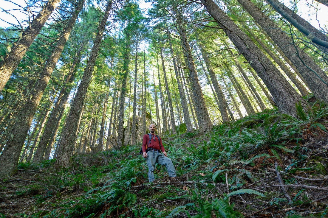
Macduff Mountain can be an easy hike or a difficult hike, depending on what you want to see and which trailhead you start at. There is a 4.2 mile round trip option as well as a 10 mile round trip option. Both will take you to the amazing Macduff Mountain summit viewpoint, but on the 10 mile hike you will also have the privilege of seeing some incredible rock formations as well as some views across Cougar Reservoir. This trail is very underrated and you will likely not see any other hikers here, especially if you do the longer hike. This trail is popular with mountain bikers and therefore it does get cleared and maintained very well most years. 
Macduff Mountain trail switchbacks
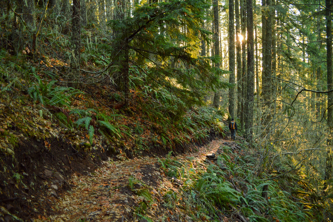
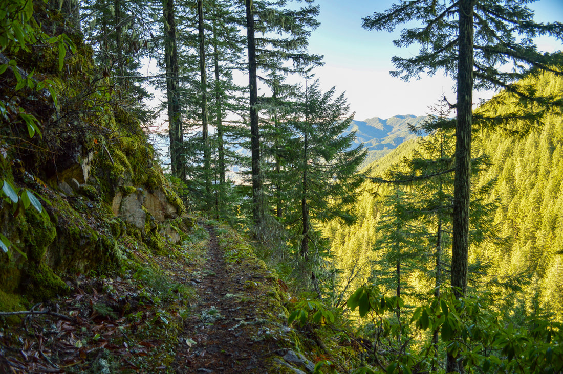
If you are doing the 10 mile hike, you can either start the hike at a Y junction which is the official trailhead for O'Leary Mountain and then it breaks off for Castle Rock and Echo Trail. You can also cut off a little bit of unnecessary mileage by continuing driving just a bit further up road 600 to the right and park at a seasonal gate. You will see the trail heading uphill on the right side of the road. This is where we parked when we hiked this trail twice. You will hike on the O'Leary Mountain Trail #3321 and the switchbacks will start right away. From the gate, the first 1.3 miles have a total of 13 pretty tight switchbacks, gaining 840 feet of elevation. 
Rock formations on the Macduff Mountain trail
Macduff Trail
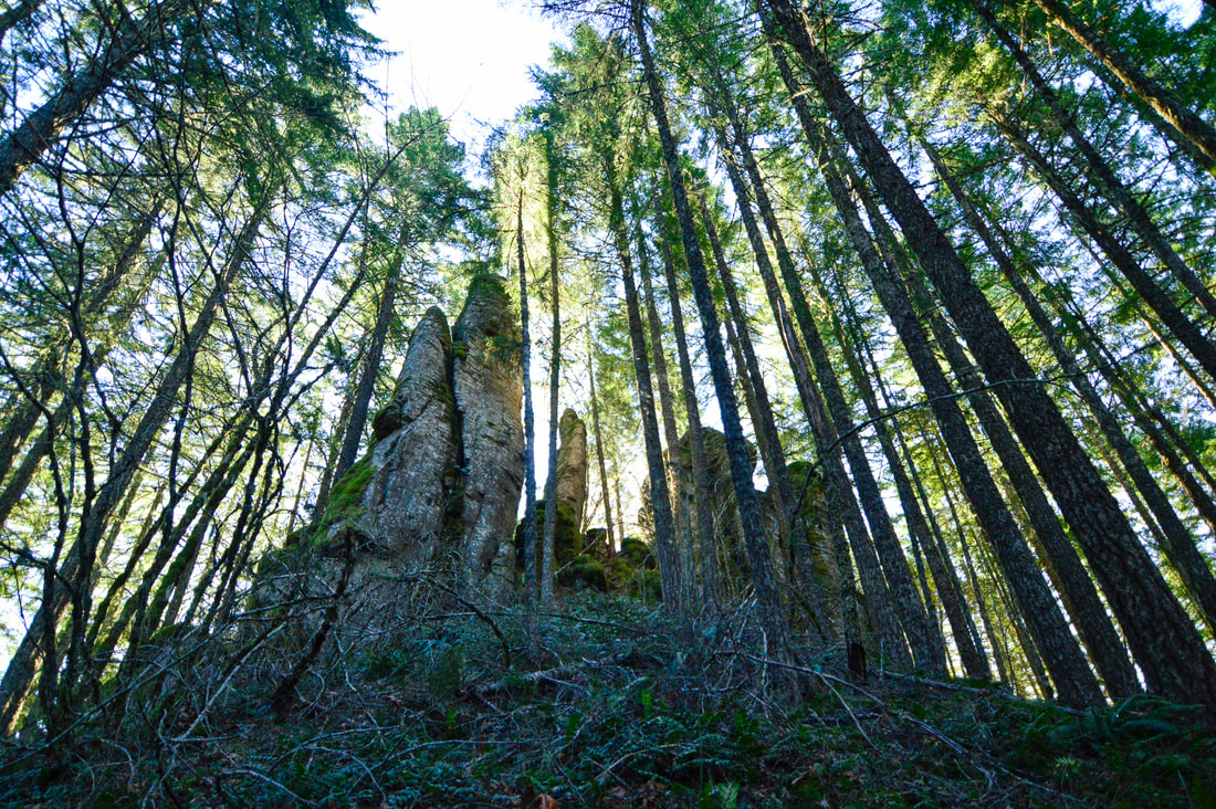
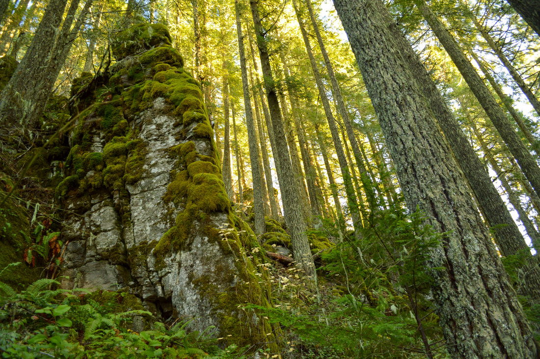
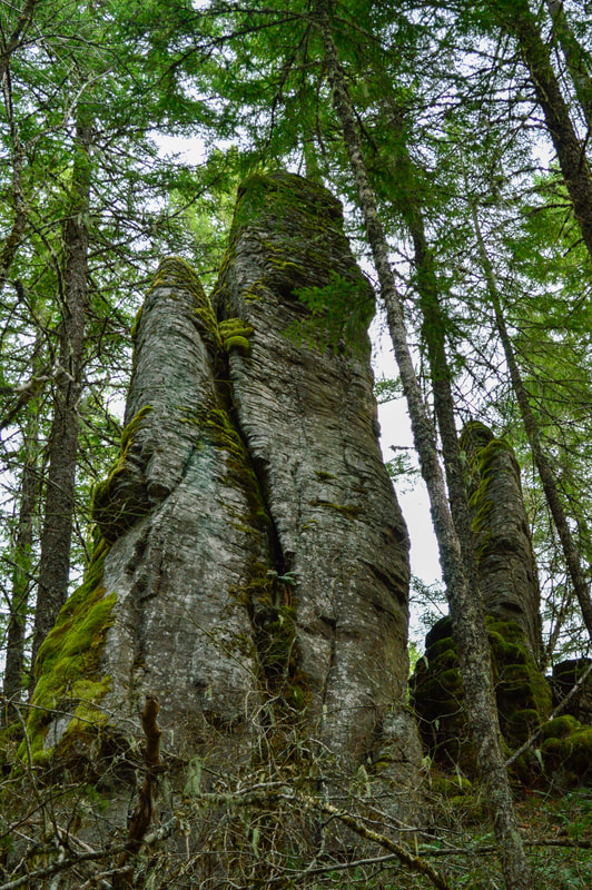
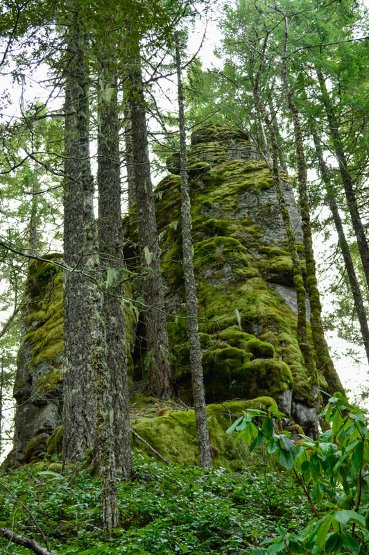
At 1.4 miles you will start seeing large pinnacle rock formations through the trees that look like moss covered castle ruins. These formations are really cool and unexpected in these steep open woods. The way the morning light comes through the trees and hits the moss on the rocks is spectacular! 
Rocks along Macduff Mountain trail
Rock formations Macduff Mountain
Rock pinnacles at Macduff Mountain
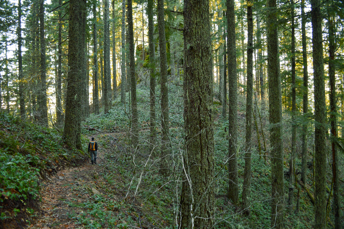
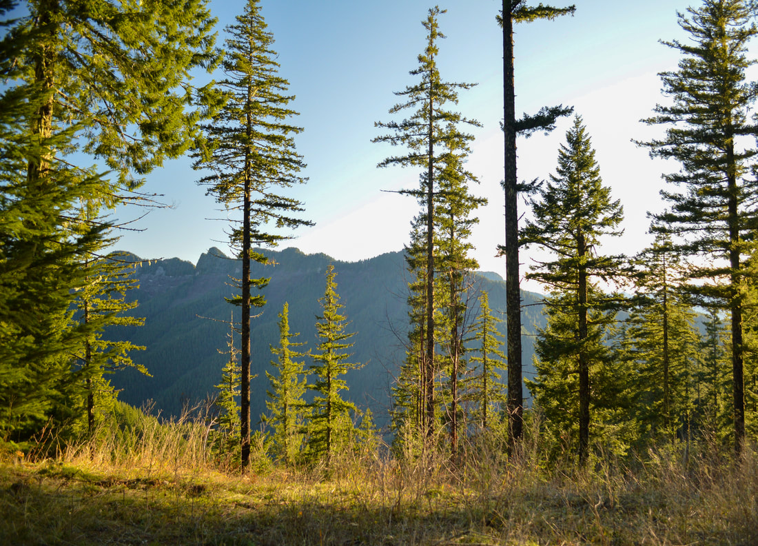
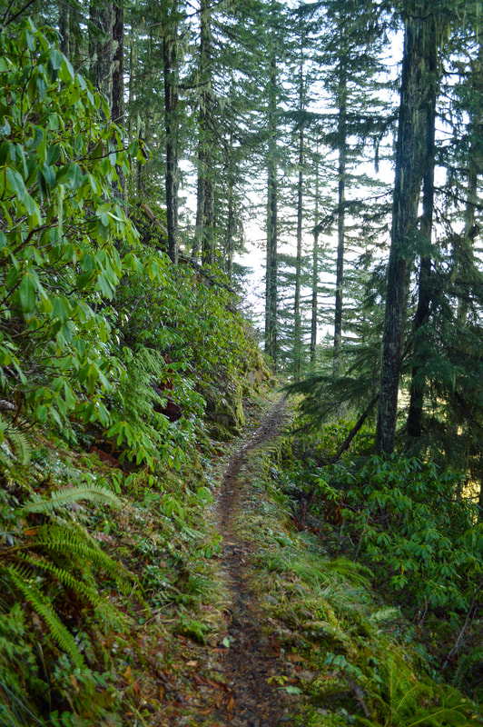
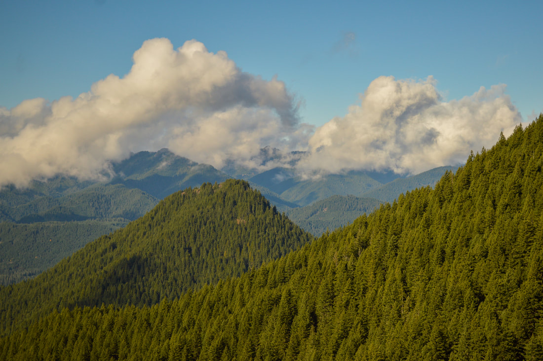
Once you pass the rock formations, the trail mellows out for the next 1.4 miles. There are no switchbacks as you follow a gradual ridgeline. You will see some views of the adjacent aptly named Sawtooth Ridge to the south. At 2.87 miles you will cross gravel road 600. This is where you can park and start if you want to do the shorter 4.2 mile out and back section of the hike. Cross the road and continue the trail as it starts getting steep again.
Macduff Mountain
Macduff Mountain trail view
Macduff Mountain trail
From here until the summit you will have another 10 switchbacks as you now climb up the northern side of the hill. On this side, the trail is a lot wetter and more green and this is the only section where the trail is extremely narrow and a little bit rocky.
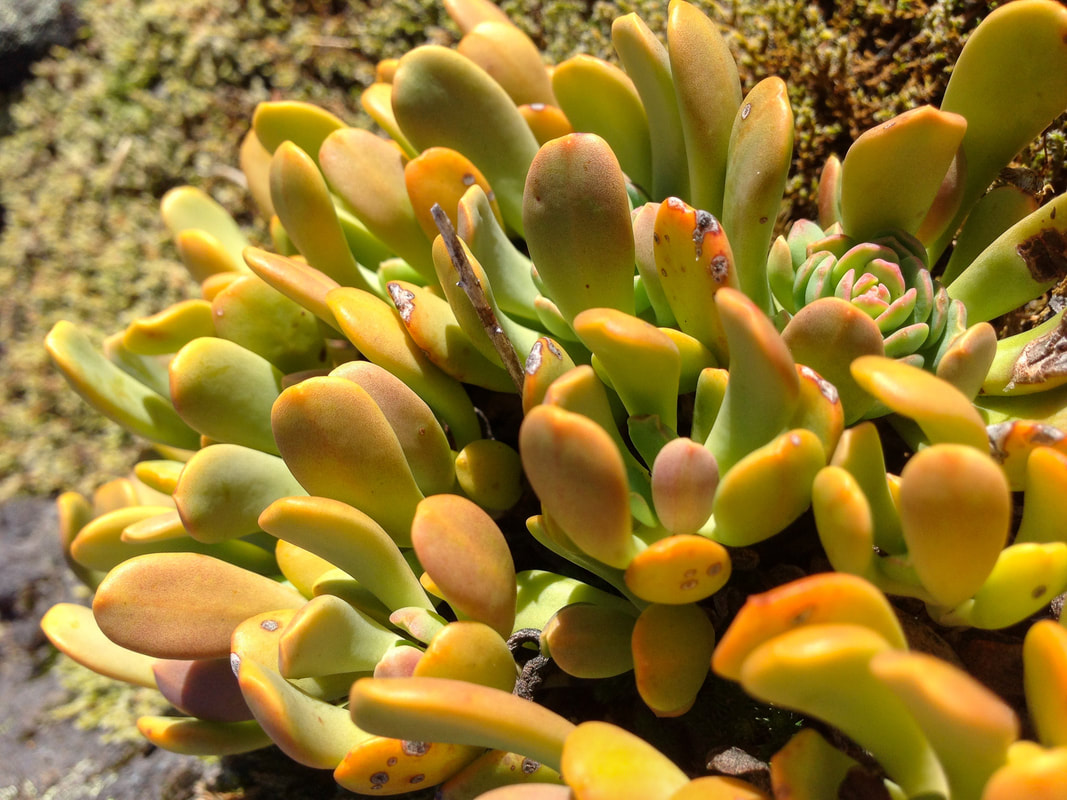
At 4.85 miles (or at 2 miles if you're doing the shorter hike), you will come to an open side hill where you will see the hill on your left that has rocks and some colorful succulents on it. The top of this is Macduff Mountain summit. You can choose to climb up the steep rocks, or you can keep going on the trail until you get into the forest again and from there you can go up a much less steep hill and double back on the ridge to the summit of Macduff (see map or YouTube video for a better visual). 
Macduff Mountain plaque
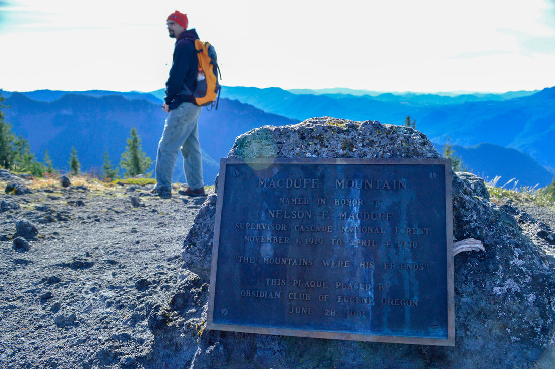
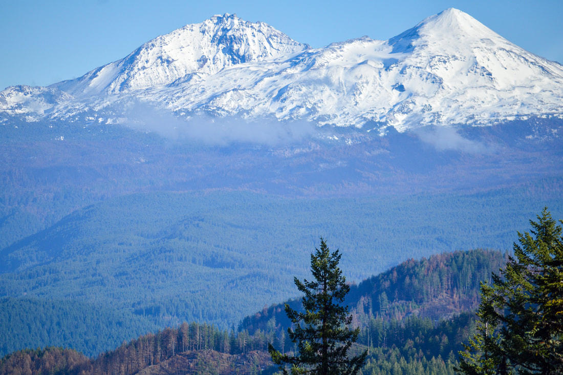
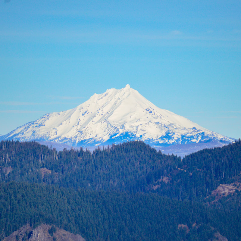
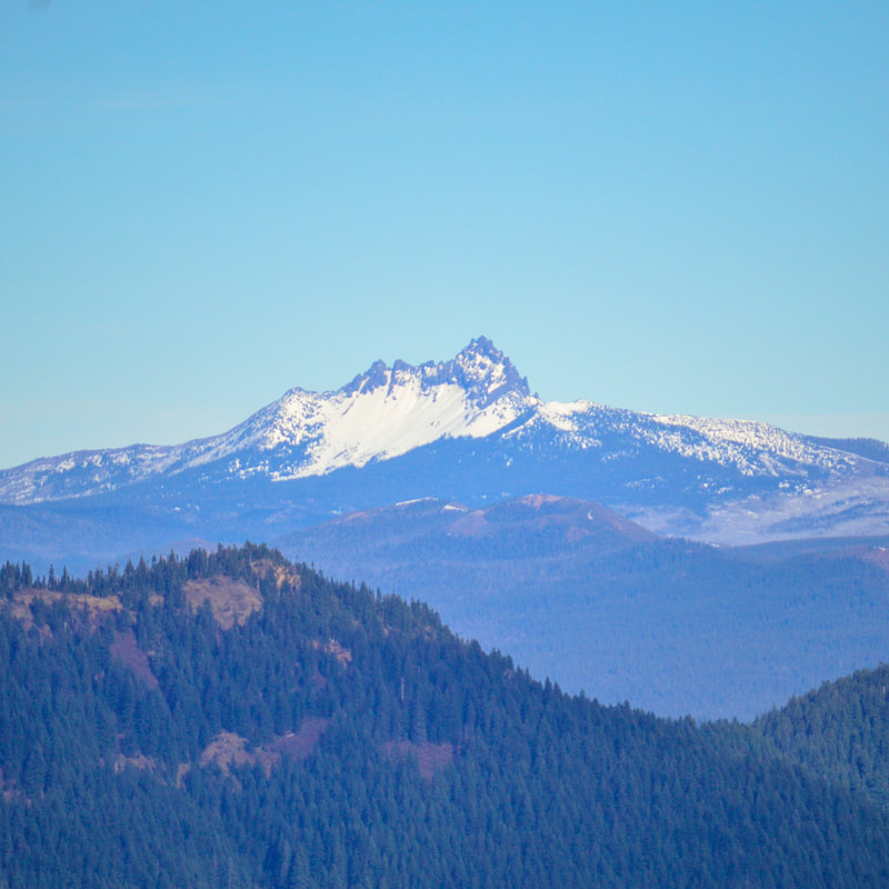
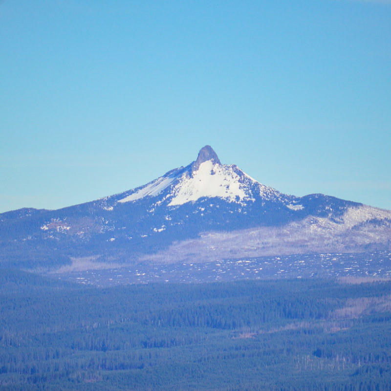
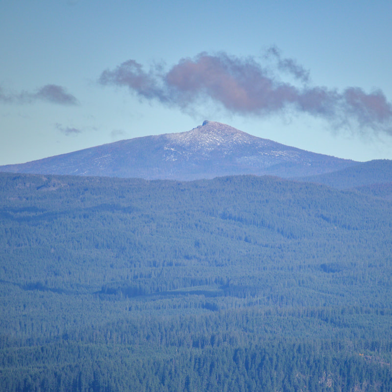
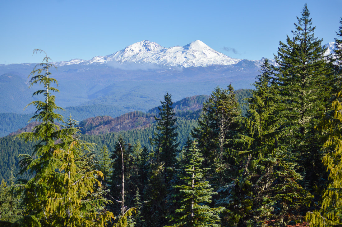
The summit of Macduff Mountain is at 5,040 ft. and offers an absolutely spectacular view. Middle and North Sister are the closest mountains to Macduff to the east, and South Sister is not very visible hidden behind trees. From North Sister you can see all of the mountains in the Cascade chain heading north, Black Crater, Mt. Washington, Three Fingered Jack and Mt. Jefferson. You will likely also notice a lot of new burn areas. This all happened in the summer of 2017, the Avenue and Roney complex being the burn patches closest to Macduff, and the Separation and Nash complex at the base of the Three Sisters. The O'Leary Mountain trail does continue from this point on to McLennon Mountain, O'Leary Mountain and it also connects with Horsepasture Mountain and the Olallie Mountain Trail. 
North and Middle Sister from Macduff Mountain
North and Middle Sister
Mt. Jefferson from Macduff Mountain
Mt. Jefferson
Three Fingered Jack from Macduff Mountain
Three Fingered Jack
Mt. Washington from Macduff Mountain
Mt. Washington
Black Crater from Macduff Mountain
Black Crater
Succulants at Macduff Mountain
Three Sisters from Macduff Mountain
Overall, this is an amazing trail that is not talked about much and it is a very underrated gem. Whether you want to go on the shorter hike and catch the views on a sunny afternoon, or you want to get a good workout in and also see a beautiful forest and the rock formations, you can opt to do the longer hike, there is definitely something here for everyone. The trail is well maintained but it can be narrow and it is rocky only in that one section on the northern side of the hill. 
Views from Macduff Mountain trail

Directions:

From Eugene
  • ​Drive OR-126 east towards Blue River for 45.7 miles. Shortly after the town of Blue River, turn right onto Cougar Dam Rd/NF-19 for 0.5 miles then continue straight onto NF-410 for 2.1 miles to the bottom of Cougar Reservoir. Here turn left onto NF-411 and continue approximately 3 miles up to a Y junction where you will see a large road side parking area and the sign for O'Learly/Castle Rock trailhead. To skip a little bit of the mileage, you can continue up the NF-600 just a little further to the gate. To go to the upper trailhead, continue on gravel road NF-600 approximately 3 miles up until you see a trail post marker on your right. (Total of 55-ish miles)
From Bend
  • ​Drive on US-97 north and take exit 135A to merge onto US-20 west towards Sisters for 20 miles. In the town of Sisters at the roundabout take the 2nd exit and stay on US-20 west for another 25.1 miles. Keep left to stay on US-20 W for 3.3 miles, then turn onto OR-126 E for 29.3 miles. Turn left onto Cougar Dam Rd/NF-19 for 0.5 miles then continue straight onto NF-410 for 2.1 miles to the bottom of Cougar Reservoir. Here turn left onto NF-411 and continue approximately 3 miles up to a Y junction where you will see a large road side parking area and the sign for O'Learly/Castle Rock trailhead. To skip a little bit of the mileage, you can continue up the NF-600 just a little further to the gate. To go to the upper trailhead, continue on gravel road NF-600 approximately 3 miles up until you see a trail post marker on your right. (Total of 84-ish)
From Salem
  • It is a total of 112-ish miles via Eugene.
From Portland
  • It is a total of 154-ish miles via Eugene.
From Medford
  • It is a total of 214-ish miles via Eugene.​​
To get a more in-depth and personal view of this hike, watch the YouTube video.
​*All pictures are taken by Franziska Weinheimer
*Disclaimer: The trail descriptions, mileage, GPS tracks and difficulty ratings depicted on this website are never 100% accurate. Always hike at your own risk, using your own knowledge, equipment and common sense. Franziska Weinheimer/Hike Oregon are not responsible if you or anyone in your party gets injured or lost while attempting one of these or any other hikes.

HIKED HERE RECENTLY? PLEASE LEAVE A TRIP REPORT BELOW:

© Hike Oregon 2023
P.O. Box 41911
​Eugene, OR 97404
Proudly powered by Weebly
  • Home
  • *Store*
  • About the author
  • How to use this site
  • Resources
    • Wildflowers
    • Videos
  • Best Oregon Hikes
    • Top Fall Foliage Hikes In Oregon
    • Top 10 Oregon Fall Hikes
    • 20 Best Oregon Waterfall Hikes
    • Top 10 Oregon Hikes for Kids
    • Sno-Parks In Central Oregon
    • Top 10 Oregon Winter Hikes
    • Top Low Elevation Winter Hikes
    • 9 Amazing Oregon Summit Hikes
    • 20 Central Oregon Day Hikes
    • 20 Epic Oregon Wildflower Hikes
    • 5 Weekend Backpacking Trips in Oregon
    • Top One Night Backpacking Trips in Oregon
    • Top 10 Oregon Summer Hikes
    • Top 10 Swimming Spots In Oregon
    • Top 10 Oregon Spring Hikes
  • Oregon Sno-Parks
    • Maxwell Sno-Park
    • Potato Hill Sno-Park
    • Ray Benson Sno-Park
      • Brandenburg Shelter
    • Santiam Sno-Park
    • Three Creek Sno-Park
    • Virginia Meissner Sno-Park
      • Meissner Shelter Loop
      • Nordeen Shelter
    • Gold Lake Sno-Park
      • Westview Shelter to Eagle Rock Overlook
      • Marilyn Lakes Loop
  • Southern Washington
    • Hamilton Mountain
    • Dog Mountain
    • Coyote Wall
    • Mount St. Helens
  • Portland
    • Powell Butte
    • Forest Park
    • Latourell Falls
    • Multnomah/Wahkeena Falls
    • Eagle Creek
    • Mitchell Point
    • Table Rock
    • Tamanawas Falls
    • Trillium Lake
    • East Zigzag Mountain (members only)
  • Salem
    • Abiqua Falls
    • Silver Falls State Park
    • Dome Rock
    • Marion Lake to Marion Mountain
    • Jefferson Park
  • Corvallis
    • Marys Peak East Ridge
    • Marys Peak North Ridge
    • Alsea Falls and Green Peak Falls
    • Corvallis to Sea Trail - Sugarbowl Creek segment (members only)
  • Sweet Home
    • Crescent Mountain
    • Iron Mountain
    • McDowell Creek Falls
    • Middle Santiam River (members only)
    • Lower Soda Creek Falls (members only)
    • Rooster Rock (members only)
  • McKenzie Bridge/Blue River
    • Macduff Mountain
    • Proxy Falls
    • Clear Lake
    • Sahalie/Koosah Falls
    • Blue Pool
    • Erma Bell Lakes
    • Olallie Mountain
    • Horsepasture Mountain
    • Tidbits Mountain
    • Castle Rock
    • Lowder Mountain (members only)
    • East Fork Trail (members only)
    • Rainbow Falls Overlook (members only)
    • Frissell Point (members only)
    • Chucksney Mountain (members only)
    • Substitute Point (members only)
  • Sisters/Santiam Pass
    • Coffin Mountain
    • Trappers Butte and Scar Mountain
    • Maxwell Butte
    • Black Butte
    • Whychus Creek Trail
    • Tam McArthur Rim
    • Black Crater
    • Scott Mountain
    • Obsidian Trail
    • Metolius Preserve
    • Three Fingered Jack Loop
    • Square Lake
    • Canyon Creek Meadows
    • Patjens Lakes
    • Craig Lake (members only)
    • Chush Falls (members only)
    • Rockpile Lake (members only)
    • Santiam Lake (members only)
    • Camp Lake (members only)
    • Park Meadow to Golden Lake (members only)
  • Bend/Redmond/LaPine
    • Steins Pillar
    • Chimney Rock
    • Steelhead Falls
    • Tumalo State Park
    • Tumalo Falls
    • Tumalo Mountain
    • No Name Lake
    • Green Lakes
    • Moraine Lake
    • South Sister Summit
    • Horse Lake
    • Muskrat Lake
    • Paulina Peak
    • Peter Skene Ogden Trail (members only)
  • Eugene
    • Ridgeline Trail
    • Mount Pisgah Summit
    • Mount Pisgah Arboretum
    • Shotgun Creek
    • Mount June
    • Lawler
    • Tire Mountain
    • Goodman Creek
    • Brice Creek
    • Trestle Creek Falls
    • Moon Falls
    • Elijah Bristow State Park
    • South Willamette Trail (members only)
    • Eula Ridge (members only)
    • Eagle's Rest (members only)
  • Oakridge
    • Deception Creek
    • North Salmon Creek
    • Grasshopper Ridge
    • Larison Creek
    • Bunchgrass Ridge
    • Salt Creek Falls
    • Waldo Lake Loop
    • South Waldo Loop
    • The Twins
    • Rosary Lakes
    • Yoran Lake
    • Fawn Lake
    • Windy Lakes
    • Divide Lake
    • Diamond Peak Summit
    • Cowhorn Mountain
    • Wall Creek Warm Springs (members only)
    • Moon Point (members only)
    • Bobby Lake (members only)
    • Lillian Falls (members only)
    • Middle Fork Willamette Trail (members only)
    • Pool Creek Falls (members only)
    • Dead Mountain (members only)
    • Larison Rock (members only)
    • Quinn Lakes & Eddeeleo Lakes (members only)
    • Waldo Mountain Lookout (members only)
    • Blair Lake to Spring Prairie (members only)
    • Rigdon Lakes loop (members only)
  • Oregon Coast
    • Cascade Head
    • Drift Creek Falls
    • Sweet Creek Falls
    • Beaver Creek Falls
    • Kentucky Falls
    • Hobbit Trail to Heceta Head
    • Valley Trail to China Creek
    • North Fork Smith River (members only)
    • Cummins Ridge (member's only)
    • Horse Creek (members only)
    • Siltcoos Lake (members only)
  • Southern Oregon
    • Fall Creek Falls
    • Watson Falls
    • Wild Rogue Loop
    • Mt. Thielsen
    • Crater Lake National Park
      • The Watchman
      • Mount Scott
      • The Pinnacles
    • Lower Table Rock
    • Pilot Rock
    • Wagner Butte
    • Mt. McLoughlin
    • Lemolo Falls (members only)
    • Fern Falls (members only)
  • Eastern Oregon
    • Painted Cove
    • Anthony Lake Loop
    • Mount Howard
    • Eagle Cap summit
    • Schneider Cabin (members only)
    • Strawberry Lake & Strawberry Falls (members only)
  • Oregon PCT sections
  • Tips & Tricks
    • Leave No Trace
    • How To Pick The Right Backpacking Tent
    • Top Tips For Hiking With Infants And Toddlers
    • Poison Oak, Ivy and Sumac
    • How to dress for cold weather hikes
    • Outdoorsy Holiday Gift Guide 2022
    • Hiker Holiday Gift Guide 2019
    • Outdoor Holiday Gift Guide 2018
    • Hiking Holiday Gift Guide 2017
  • Reviews/Gear
    • Stay Kühl This Summer
    • Outdoor Herbivore Backpacking Food Review
    • Osprey Aura AG 65 Backpack review
    • Big Agnes Fly Creek UL2 review
    • REI Quarter Dome 1 review
  • Adventure Stories
    • Hiking The Rae Lakes Loop
    • 110 Miles on the PCT
    • Three Fingered Jack Adventures
    • Jefferson Wilderness