Paulina Peak
Hike details:
Mileage: 4.2 miles round trip w/ 1,415 ft. elevation gain
Approximate hike time: 1 hour 50 minutes w/ an average pace of 2.3 mph
Difficulty: Moderate
Trail usage: Medium on weekends, low on weekdays (it is always busy at the summit because you can drive up but the trail itself isn't very busy).
Highest elevation: 7,930 ft. Lowest elevation: 6,524 ft.
General location: 37 miles south of Bend - Newberry National Volcanic Monument - Deschutes National Forest
Accessible: late June through November
(Best time to go is late June through early November. The first snow usually falls up at Paulina Peak mid to late October).
Permits required: Northwest Forest Pass for parking
Pit toilet at trailhead: No - but there are plenty of pit toilets and restrooms at the day use areas and campgrounds nearby. There is also a pit toilet at the summit.
Trail allows: Dogs on leash
Possible dangers: Steep drop offs at the summit.
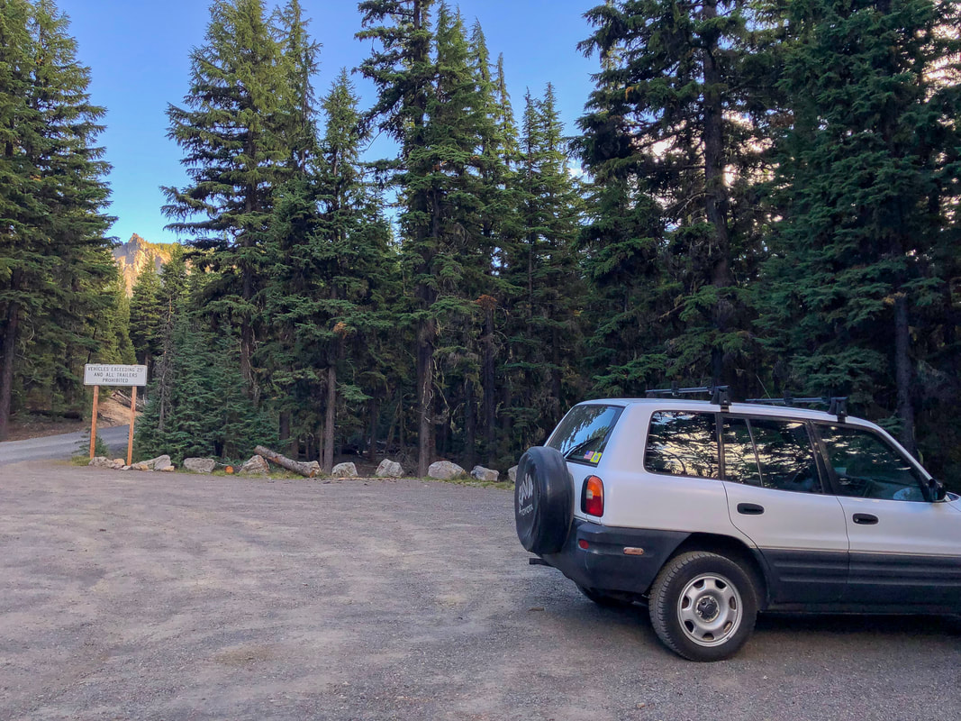
(trailhead parking)
Description:
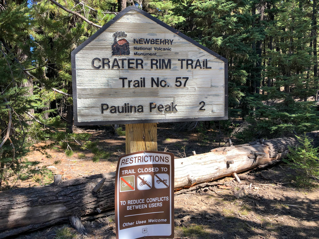
The Paulina Peak Trail is a moderate hike that leads up to one of the most beautiful viewpoints in Central Oregon! The trailhead is fairly large with room for about 8-10 cars. To start the trail you will cross the gravel road from the trailhead and see a sign for Crater Rim Trail and Paulina Peak. It is 2.1 miles up to the top.
The dusty and dry trail immediately starts heading steeply up the hill through a sparse forest. You will encounter your first switchback after 0.56 miles. There are not a lot of switchbacks on this hike, which is what makes this hike so steep. After another 0.3 miles you will switchback again.
|
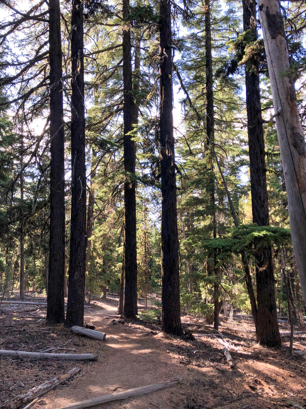
(a great example of what the trail tread looks like)
|
|
|
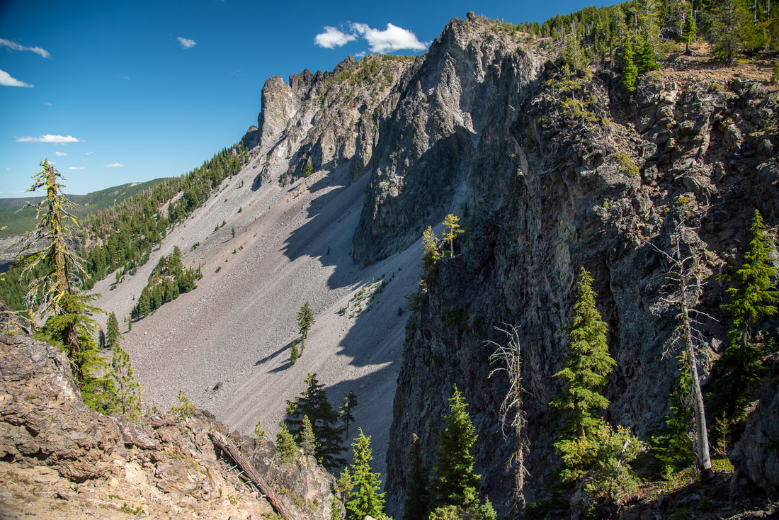
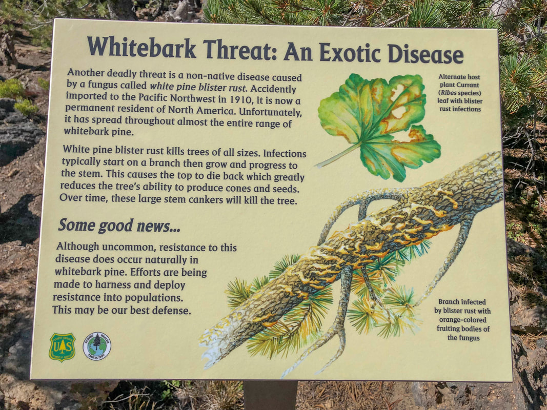
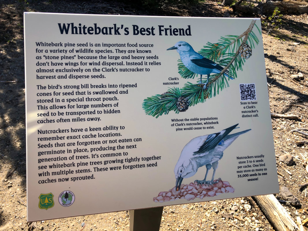
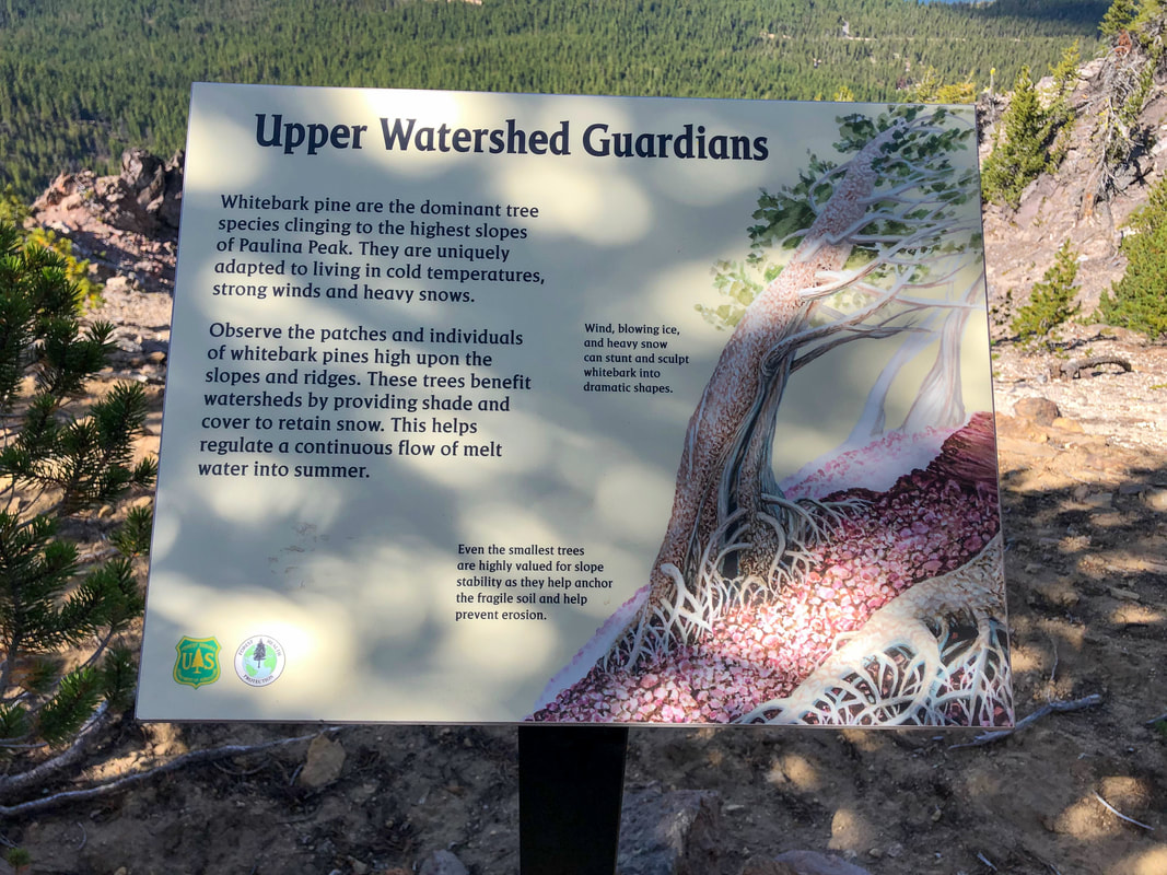
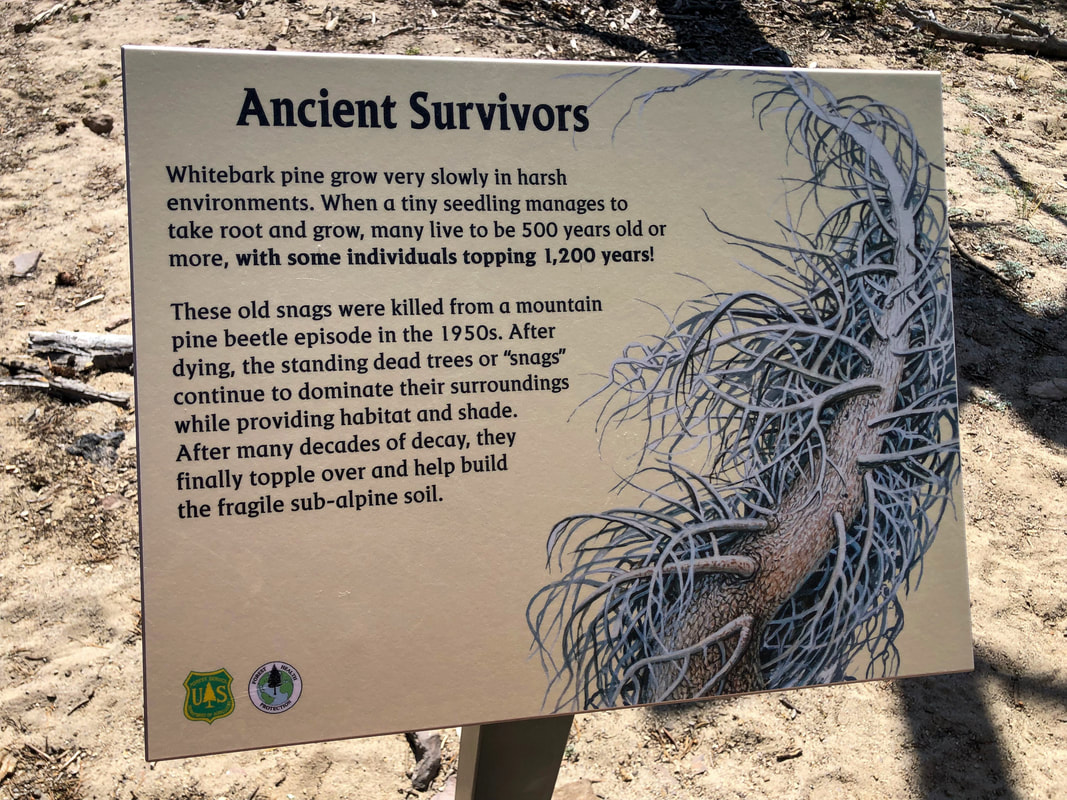
You will come to a point where the trail breaks through the forest and you can see Paulina Peak from a little viewpoint. There is a steep drop off here, so if you are hiking with small children, please hold their hand if you want to experience the viewpoint. After a total of 1.25 miles you will start seeing some interesting signs placed along the trail by the Forest Service. These signs tell the story about the unique local flora and fauna.
|
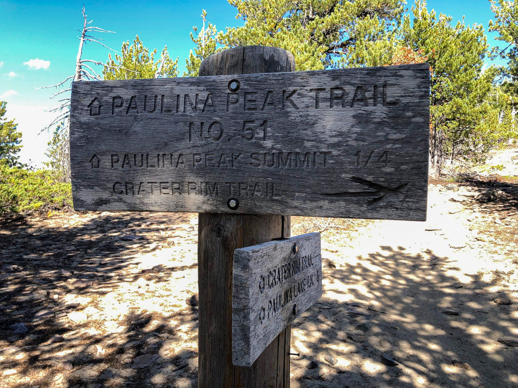
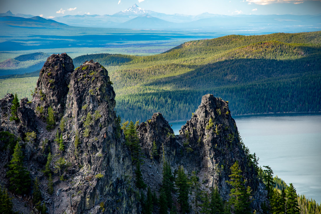
After 1.7 miles you will come to a trail split. The trail to the right is the Crater Rim Trail, which is about 20 miles long and it goes around the entire rim of the Newberry National Volcanic Monument and both lakes. You will continue on the trail to the left up to Paulina Peak, which is just a little over a 1/4 of a mile away.
|
|
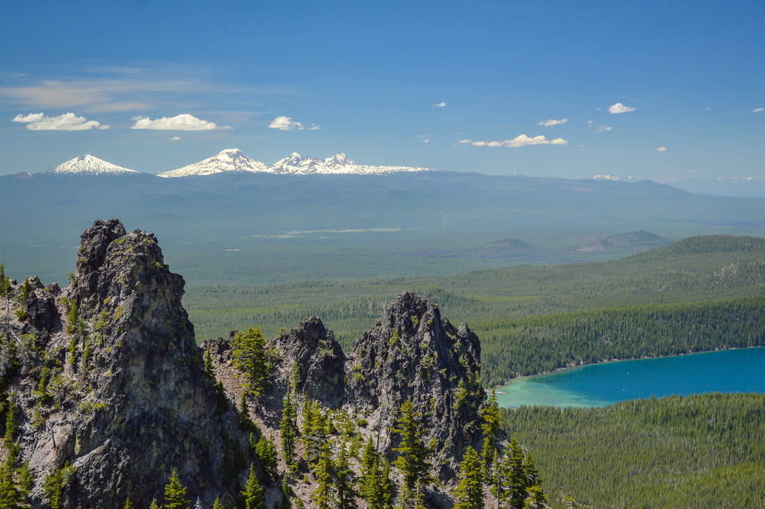
(view of Three Fingered Jack and Mount Jefferson in the distance)
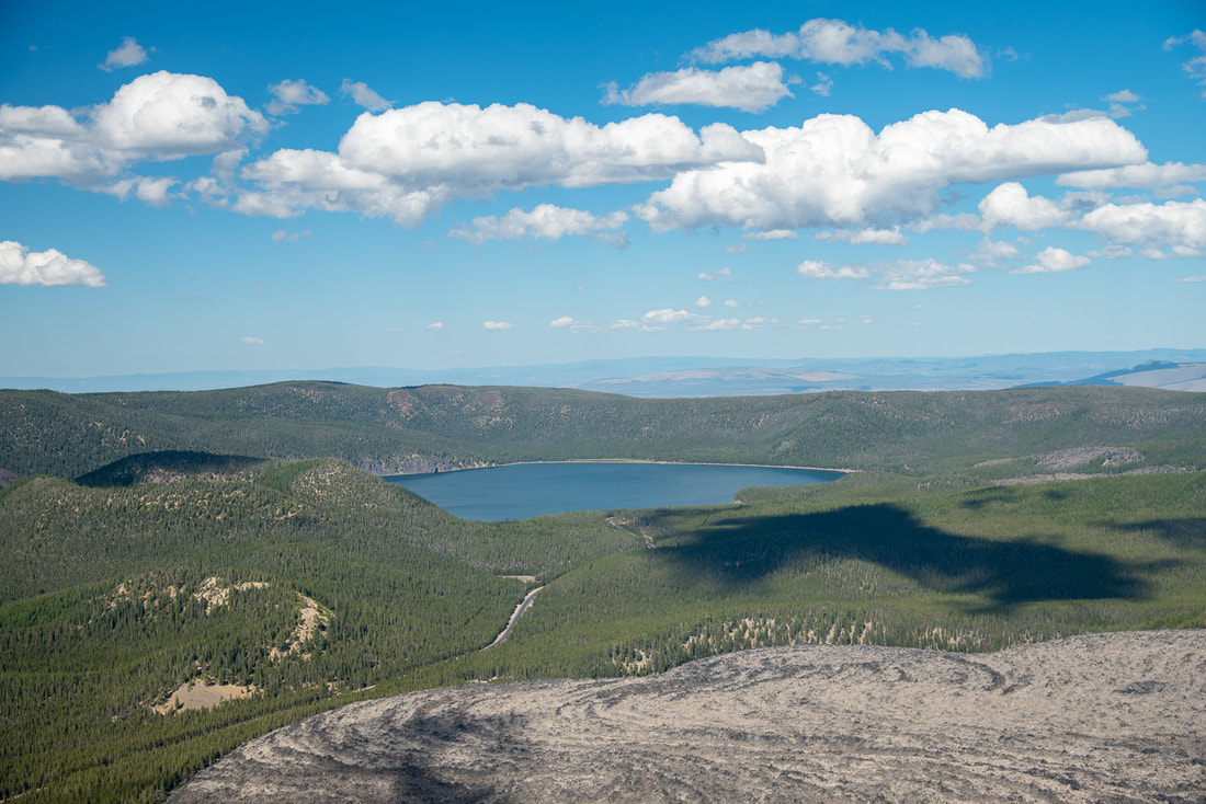
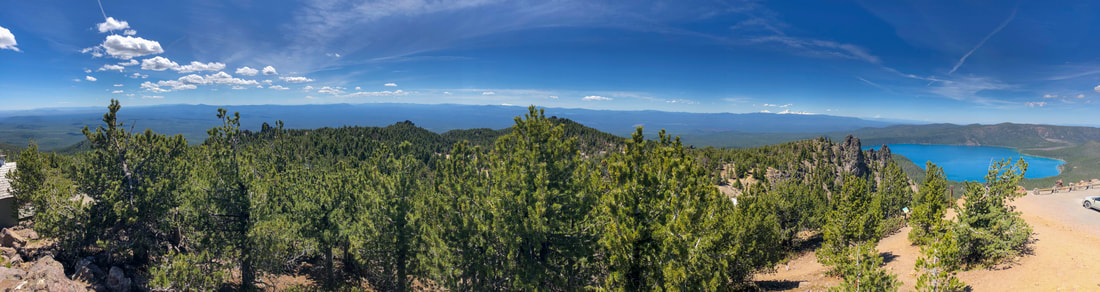
The summit of Paulina Peak stands at 7,984 ft. high and there are various viewpoints up there. The views are absolutely incredible! From the Three Sisters to the west all the way up to Mt. Hood, over to eastern Oregon and down to Mt. Thielsen and Bailey, you feel like you can see almost all of Oregon on a clear day. Below you are the turquoise colored Paulina Lake and East Lake and from above you can really see the big lava flows that created this unique landscape.
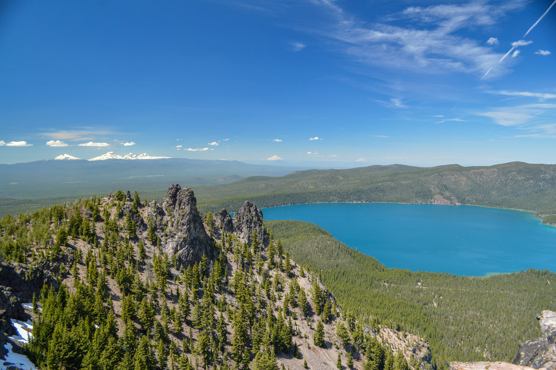
(Paulina Lake, Three Sisters, Mount Jefferson and Mount Hood from Paulina Peak)
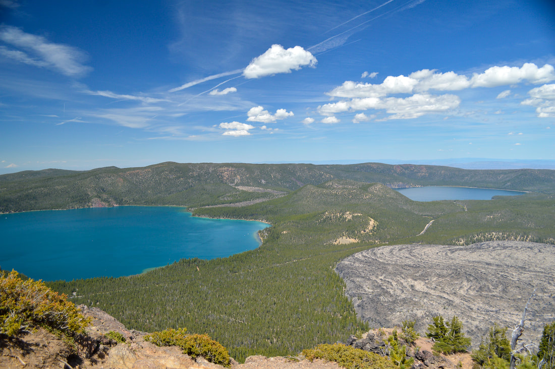
(Paulina Lake, East Lake and Big Obsidian Flow)
(East Lake & Big Obsidian Flow)
The hike up to Paulina Peak is a great moderate hike that is perfect for an a summer afternoon hike (the sunset from the summit is absolutely incredible!) You can drive to the top of Paulina Peak, but you definitely gain a better perspective and appreciation of the area and landscape if you hike up. The trail is well maintained and primarily dusty, the only part that gets rocky is the last 1/4 mile near the summit. The hike is rated moderate only because of the 1,415 feet of elevation that you gain in just 2.1 short miles. This is pretty steep up as well as down. Trekking poles will help immensely during this hike.
Directions:
From Bend
- Drive US-97 south towards La Pine for 23.2 miles. Turn left onto Paulina Lake Rd. and stay on this road for a total of 12.9 miles. Turn right onto NF-500 for 0.7 miles and find the trailhead on your right. (Total of 37.4 miles)
- Drive OR-58 east towards Oakridge/Klamath Falls for a total of 72.7 miles. Turn left onto Cascade Lakes National Scenic Byway/Crescent Cutoff Rd. for 12 miles, then turn left onto US-97 north. Stay on US-97 for 23.6 miles, then turn right onto Paulina Lake Rd. and stay on this road for a total of 12.9 miles. Turn right onto NF-500 for 0.7 miles and find the trailhead on your right. (Total of 130 miles)
- Take OR-62 east towards Crater Lake for 49.5 miles then take a slight left onto OR-230 north for 23.8 miles. Near Diamond Lake turn right onto OR-138 east for 17.7 miles until it T’s into highway 97. Turn left onto US-97 north for 51.3 miles, then turn right onto Paulina Lake Rd. and stay on this road for a total of 12.9 miles. Turn right onto NF-500 for 0.7 miles and find the trailhead on your right. (Total of 163 miles)
- Total of 168 miles via Bend.
- Total of 211 miles via Salem and Bend.
-This trail write-up was last updated in November 2019-
*All pictures are taken by Franziska Weinheimer
*All pictures are taken by Franziska Weinheimer
*Disclaimer: The trail descriptions, mileage, GPS tracks and difficulty ratings depicted on this website are never 100% accurate. Always hike at your own risk, using your own knowledge, equipment and common sense. Franziska Weinheimer/Hike Oregon are not responsible if you or anyone in your party gets injured or lost while attempting one of these or any other hikes.