Hike Oregon
  • Home
  • *Store*
  • About the author
  • How to use this site
  • Resources
    • Wildflowers
    • Videos
  • Best Oregon Hikes
    • 20 Epic Oregon Wildflower Hikes
    • Top 10 Oregon Spring Hikes
    • 20 Best Oregon Waterfall Hikes
    • Top 10 Oregon Hikes for Kids
    • 5 Weekend Backpacking Trips in Oregon
    • Top One Night Backpacking Trips in Oregon
    • Top Fall Foliage Hikes In Oregon
    • Top 10 Oregon Summer Hikes
    • Top 10 Swimming Spots In Oregon
    • Top 10 Oregon Fall Hikes
    • Sno-Parks In Central Oregon
    • Top 10 Oregon Winter Hikes
    • Top Low Elevation Winter Hikes
  • Oregon Sno-Parks
    • Maxwell Sno-Park
    • Potato Hill Sno-Park
    • Ray Benson Sno-Park
      • Brandenburg Shelter
    • Santiam Sno-Park
    • Three Creek Sno-Park
    • Virginia Meissner Sno-Park
      • Meissner Shelter Loop
      • Nordeen Shelter
    • Gold Lake Sno-Park
      • Westview Shelter to Eagle Rock Overlook
      • Marilyn Lakes Loop
  • Portland
    • Powell Butte
    • Forest Park
    • Hamilton Mountain
    • Latourell Falls
    • Multnomah/Wahkeena Falls
    • Dog Mountain
    • Coyote Wall
    • Mitchell Point
    • Table Rock
    • Tamanawas Falls
    • Trillium Lake
    • East Zigzag Mountain (members only)
  • Salem
    • Abiqua Falls
    • Silver Falls State Park
    • Marion Lake to Marion Mountain
    • Jefferson Park
  • Sweet Home
    • Crescent Mountain
    • Iron Mountain
    • McDowell Creek Falls
    • Middle Santiam River (members only)
    • Lower Soda Creek Falls (members only)
    • Rooster Rock (members only)
  • McKenzie Bridge/Blue River
    • Macduff Mountain
    • Proxy Falls
    • Clear Lake
    • Sahalie/Koosah Falls
    • Blue Pool
    • Erma Bell Lakes
    • Olallie Mountain
    • Horsepasture Mountain
    • Tidbits Mountain
    • Castle Rock
    • East Fork Trail (members only)
    • Rainbow Falls Overlook (members only)
    • Frissell Point (members only)
    • Chucksney Mountain (members only)
    • Substitute Point (members only)
  • Sisters/Santiam Pass
    • Coffin Mountain
    • Trappers Butte and Scar Mountain
    • Black Butte
    • Tam McArthur Rim
    • Black Crater
    • Scott Mountain
    • Obsidian Trail
    • Three Fingered Jack Loop
    • Square Lake
    • Canyon Creek Meadows
    • Patjens Lakes
    • Craig Lake (members only)
    • Chush Falls (members only)
    • Rockpile Lake (members only)
    • Santiam Lake (members only)
    • Camp Lake (members only)
    • Park Meadow to Golden Lake (members only)
  • Bend/Redmond/LaPine
    • Steins Pillar
    • Chimney Rock
    • Steelhead Falls
    • Tumalo State Park
    • Tumalo Falls
    • Tumalo Mountain
    • No Name Lake
    • Green Lakes
    • Moraine Lake
    • South Sister Summit
    • Muskrat Lake
    • Paulina Peak
    • Peter Skene Ogden Trail (members only)
  • Eugene
    • Ridgeline Trail
    • Mount Pisgah Summit
    • Mount Pisgah Arboretum
    • Shotgun Creek
    • Mount June
    • Lawler
    • Tire Mountain
    • Goodman Creek
    • Brice Creek
    • Trestle Creek Falls
    • Moon Falls
    • Elijah Bristow State Park
    • South Willamette Trail (members only)
    • Eula Ridge (members only)
    • Eagle's Rest (members only)
  • Oakridge
    • Deception Creek
    • North Salmon Creek
    • Grasshopper Ridge
    • Larison Creek
    • Bunchgrass Ridge
    • Salt Creek Falls
    • Waldo Lake Loop
    • South Waldo Loop
    • The Twins
    • Rosary Lakes
    • Fawn Lake
    • Windy Lakes
    • Divide Lake
    • Diamond Peak Summit
    • Cowhorn Mountain
    • Wall Creek Warm Springs (members only)
    • Moon Point (members only)
    • Bobby Lake (members only)
    • Lillian Falls (members only)
    • Middle Fork Willamette Trail (members only)
    • Pool Creek Falls (members only)
    • Dead Mountain (members only)
    • Larison Rock (members only)
    • Eddeeleo Lakes (members only)
    • Waldo Mountain Lookout (members only)
    • Blair Lake to Mule Mountain (members only)
    • Rigdon Lakes loop (members only)
  • Oregon Coast
    • Cascade Head
    • Drift Creek Falls
    • Sweet Creek Falls
    • Alsea Falls
    • Kentucky Falls
    • Marys Peak North Ridge
    • Marys Peak East Ridge
    • Cape Perpetua Loops
    • Hobbit Trail to Heceta Head
    • North Fork Smith River (members only)
    • Cummins Ridge (member's only)
    • Horse Creek (members only)
    • Siltcoos Lake (members only)
    • William Finley Wildlife Refuge (members only)
  • Southern Oregon
    • Fall Creek Falls
    • Watson Falls
    • Wild Rogue Loop
    • Mt. Thielsen
    • The Watchman
    • Mount Scott
    • The Pinnacles
    • Lower Table Rock
    • Pilot Rock
    • Wagner Butte
    • Mt. McLoughlin
    • Lemolo Falls (members only)
    • Fern Falls (members only)
  • Eastern Oregon
    • Painted Cove
    • Mount Howard
    • Anthony Lake Loop
    • Schneider Cabin (members only)
    • Strawberry Lake & Falls (members only)
  • Oregon PCT sections
    • PCT: OR-58 to Charlton Lake
    • PCT: Santiam Pass to Rockpile Lake
  • Tips & Tricks
    • Leave No Trace
    • Top Tips For Hiking With Infants And Toddlers
    • Poison Oak, Ivy and Sumac
    • How to dress for cold weather hikes
    • Hiker Holiday Gift Guide 2019
    • Outdoor Holiday Gift Guide 2018
    • Hiking Holiday Gift Guide 2017
  • Reviews
    • Outdoor Herbivore Backpacking Food Review
    • Osprey Aura AG 65 Backpack review
    • Big Agnes Fly Creek UL2 review
    • REI Quarter Dome 1 review
  • Adventure Stories
    • Hiking The Rae Lakes Loop
    • 110 Miles on the PCT
    • The Loop Around Three Fingered Jack
    • Jefferson Wilderness

Black Crater

​
Get the printable version of this hike

Hike details:

Mileage: 7.1 miles out and back w/ 2,270 ft. elevation gain
Approximate hike time: 3 hours 5 minutes w/ an average pace of 2.3 mph
Difficulty: Difficult 
Trail usage: Medium to high on summer weekends, low on weekdays
Highest elevation: 7,250 ft. Lowest elevation: 4,900 ft.
General location: ​11 miles west of Sisters - Three Sisters Wilderness - Deschutes National Forest
Accessible: Mid-June to mid-November (the snow gates along Highway 242 open and close at different times each year)
(Best time to go is any clear day from July through mid-November or whenever the snow gate closes).
Permits required: Day trips - Free self issue wilderness permit June 15 - October 15 available at the trailhead
Overnight trips - Central Cascades Wilderness Permit June 15 - October 15 available via recreation.gov
Northwest Forest Pass for parking
Pit toilet at trailhead: No
Trail allows: Dogs, horses (although since the 2017 wildfire, horses are not recommended on the fragile trail).
Possible dangers: Steep drop offs at the top
Black Crater Trailhead
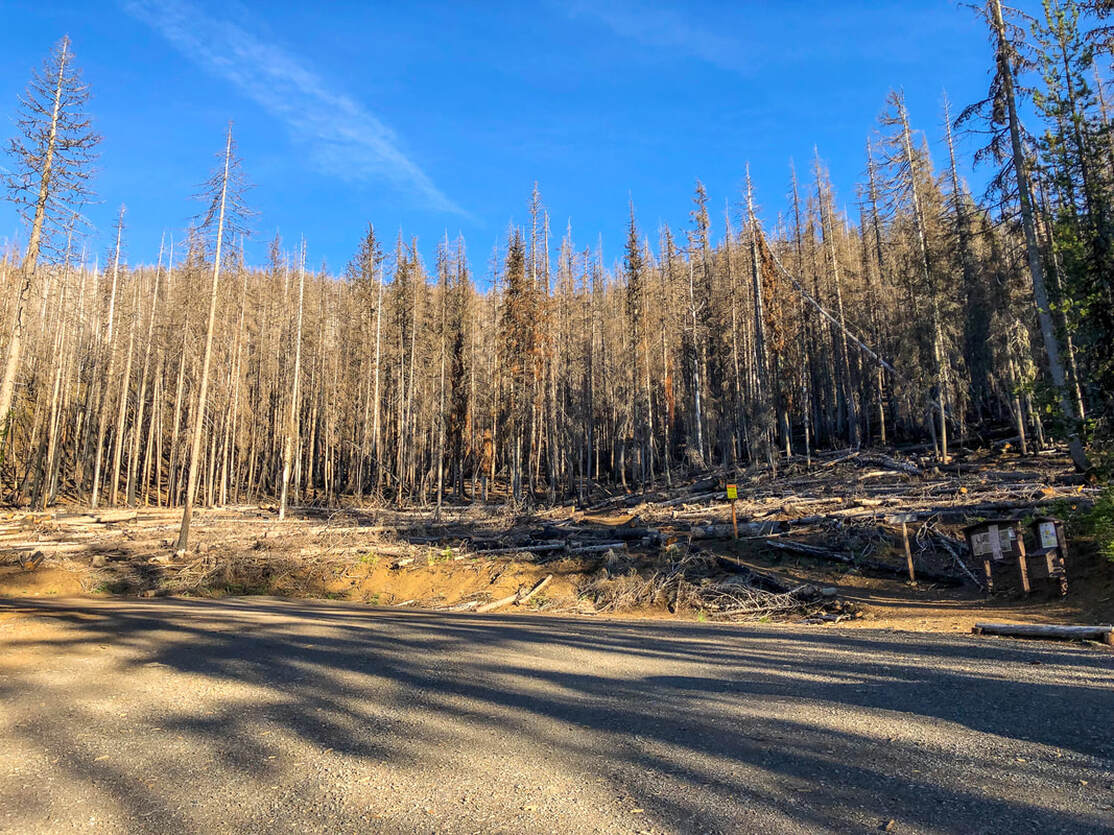
(trailhead parking area after the Milli fire)

Description:

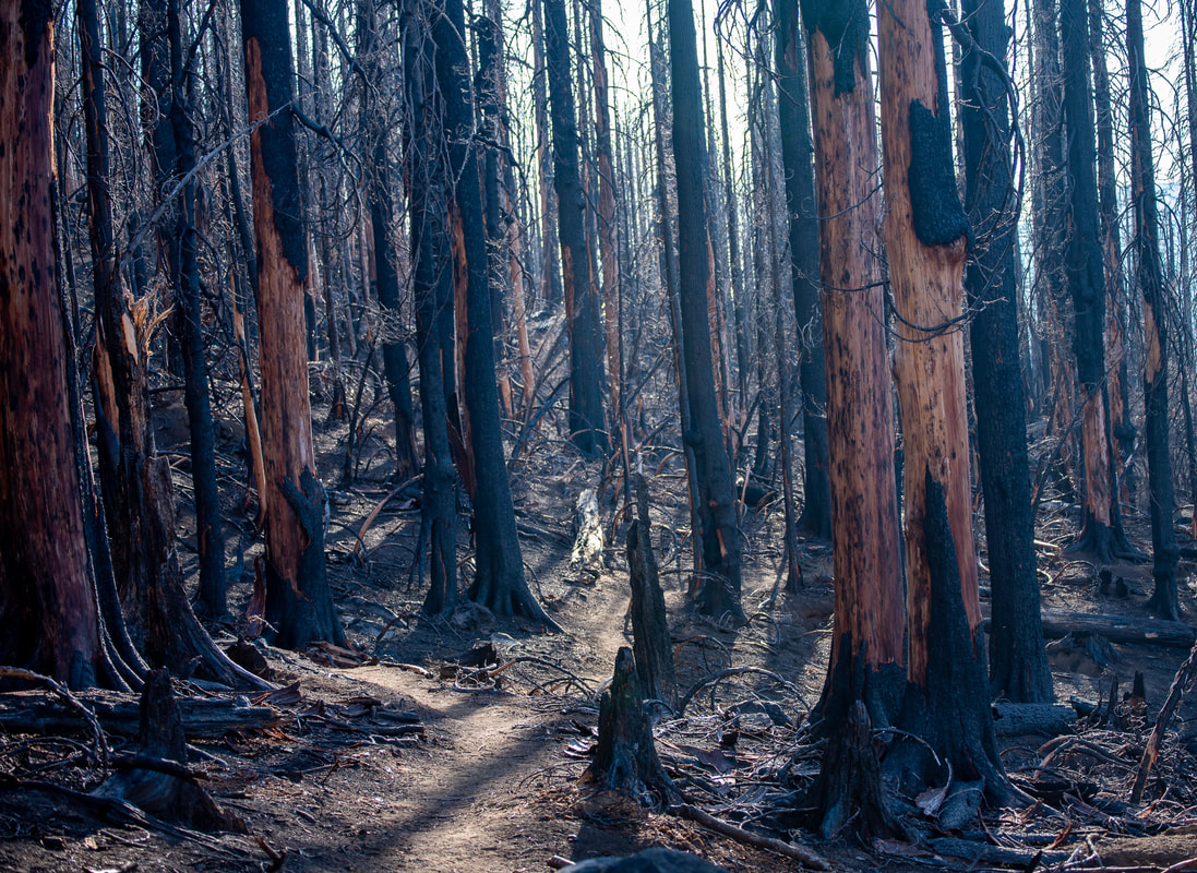
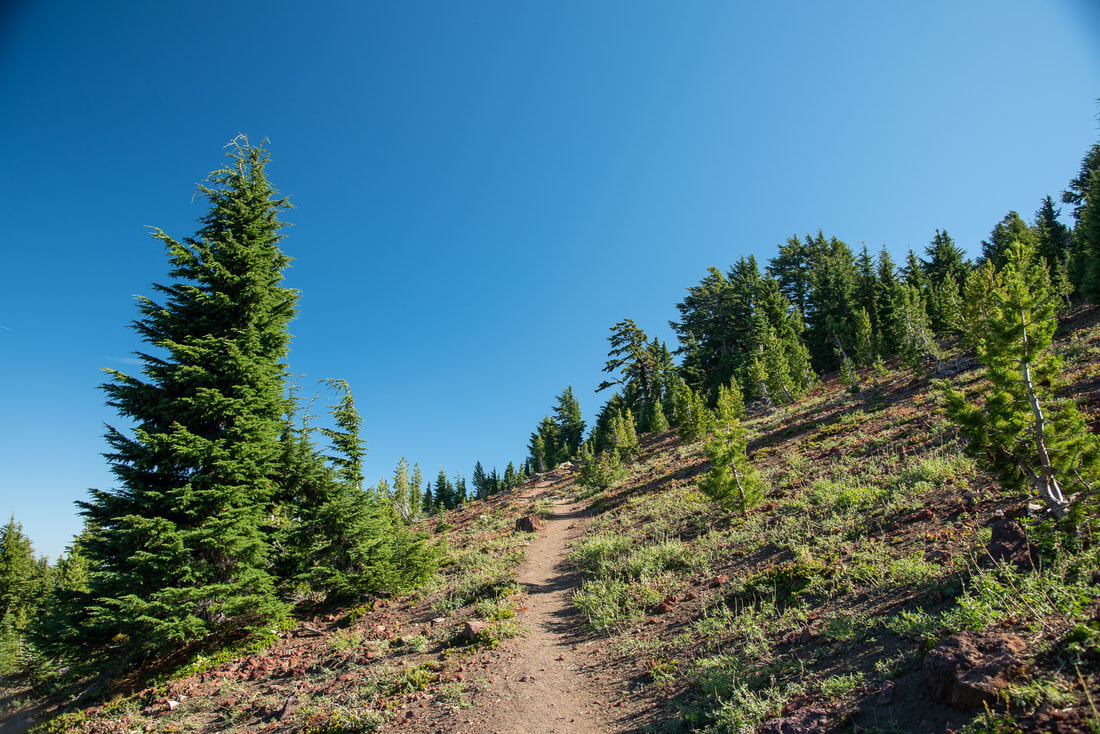
Black Crater is a difficult hike that leads up to some of the best views in the Central Oregon Cascades! This hike has always been a little bit underrated and even though there are thousands of cars that drive up and down the Old McKenzie Scenic Highway 242 daily in the summer, it is rare that you will see a lot of cars at the trailhead like you will see at other trailheads along this road. In 2017 the Milli Fire consumed over 24,000 acres of forest, unfortunately including the entirety of Black Crater. The parking lot looks a bit eerie with all of the blackened dead trees and the fire has definitely made the trail more fragile to walk on.
Mt. Washington view from Black Crater trailhead
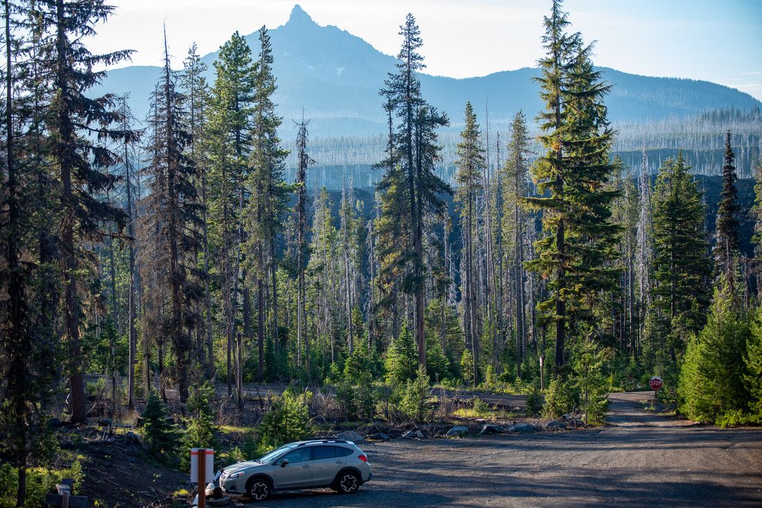
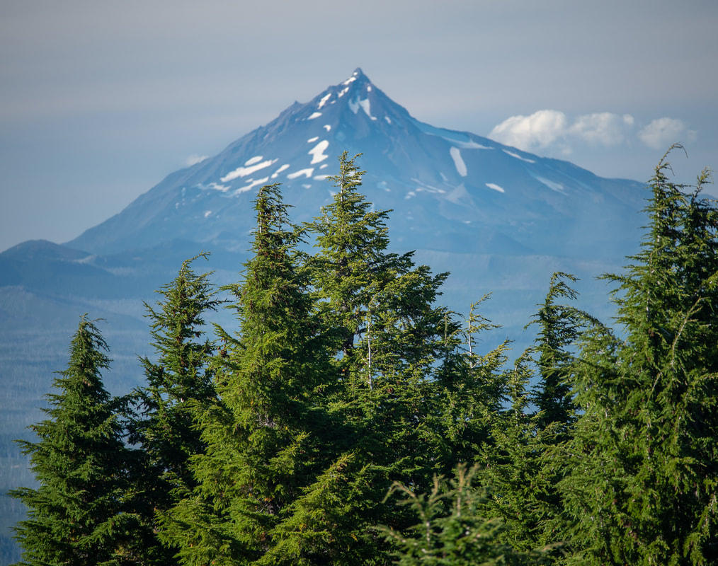
(view of Mt. Washington from the trailhead)
Black Crater Trail sign
Milli Fire burned forest on Black Crater Trail
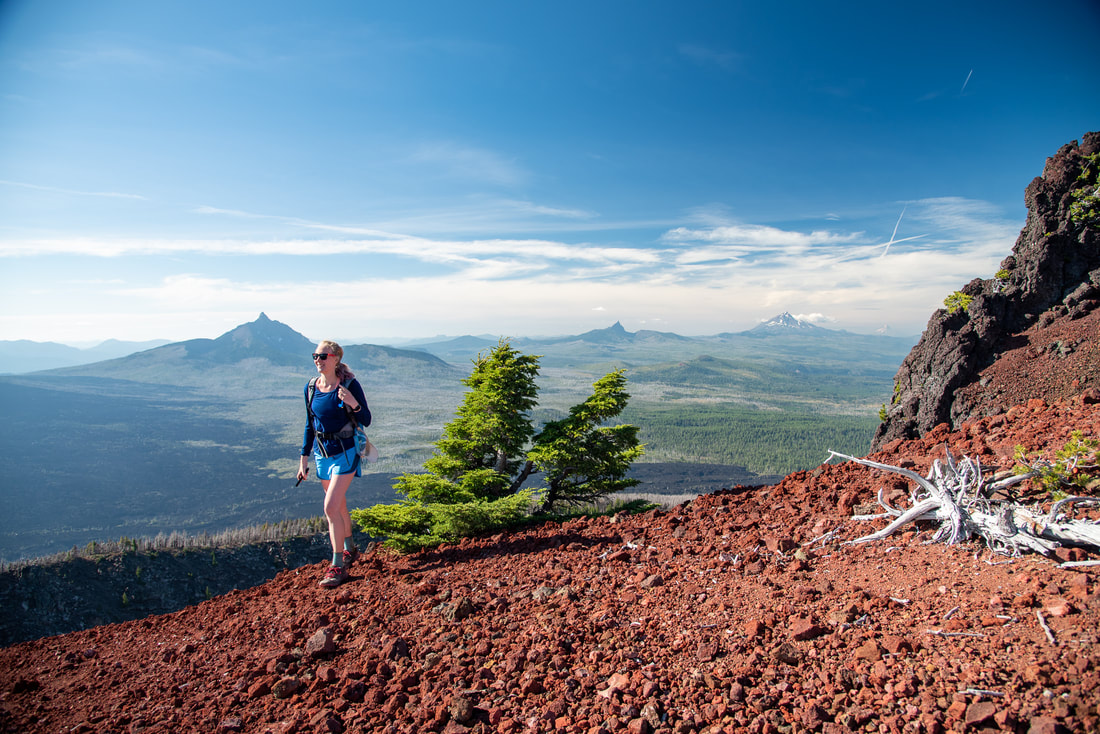
Most of the trees here are burned and dead. The fire burned so hot that there is very little ground cover growing back. It might be many years before we see any greenery in the burn areas on Black Crater. The trail goes steadily uphill the entire way as the trail curls its way around the eastern side of the hill. Here the fire didn't decimate all of the trees and you will see some greenery and seasonal wildflowers among the red cinder. The trail is generally well maintained and there are no areas with exposure or difficult footing (unless you decide to climb up to the actual summit).
Trees along the Black Crater Trail
Snow on the Black Crater Trail
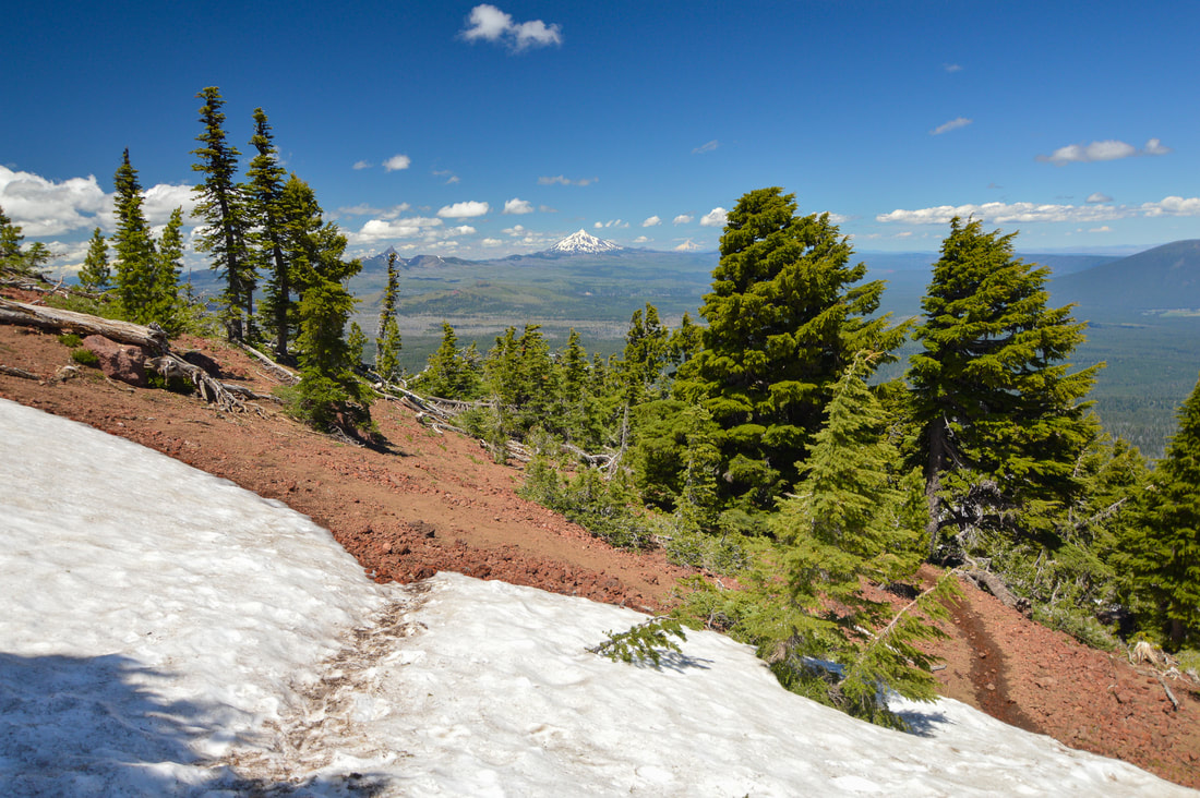
(snow can linger into on the trail until July)
Black Crater Trail
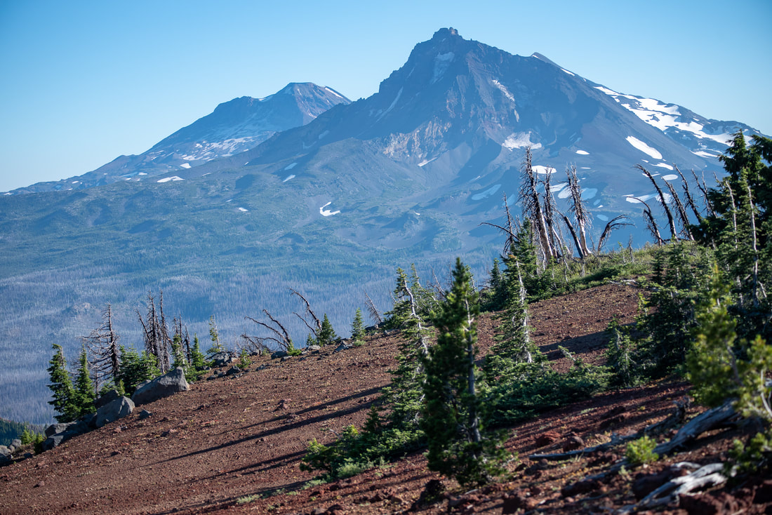
Because of the elevation of this hike, keep in mind that snow can linger on the trail until mid-July. At 2.8 miles you will start going up 6 short switchbacks before coming to a barren plateau. At this elevation whitebark pines are the only things that grow. They are also known as krumholz ​which means crooked wood in German. This is a fitting name since many of the pines are twisted and laid over due to the intense winds that blow up there in the winter. 
Black Crater
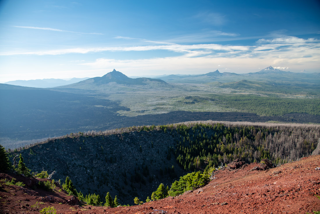
(the crater and Mount Washington, Three Fingered Jack, Mount Jefferson and Mount Hood)
Lava flow from Black Crater
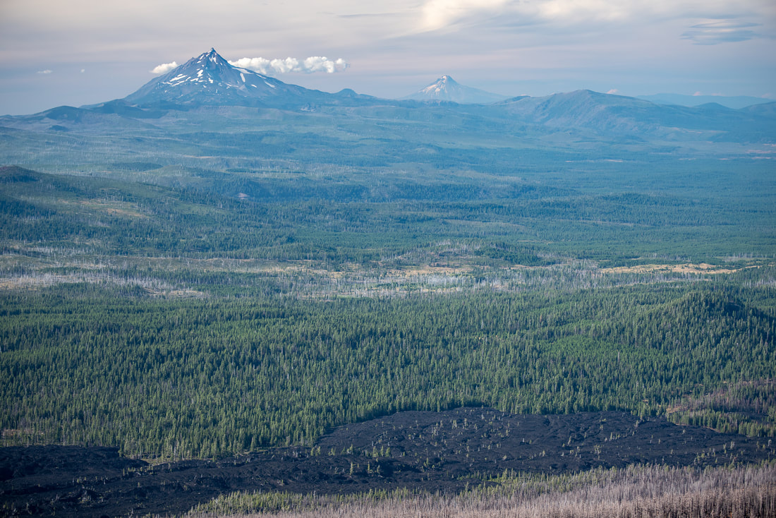
(lava flow, Mount Jefferson, Mount Hood and Mount Adams)
North Sister from Black Crater
(North and Middle Sister)
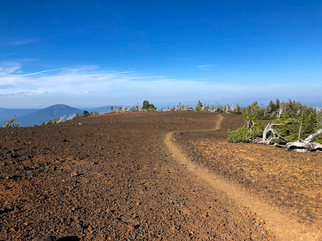
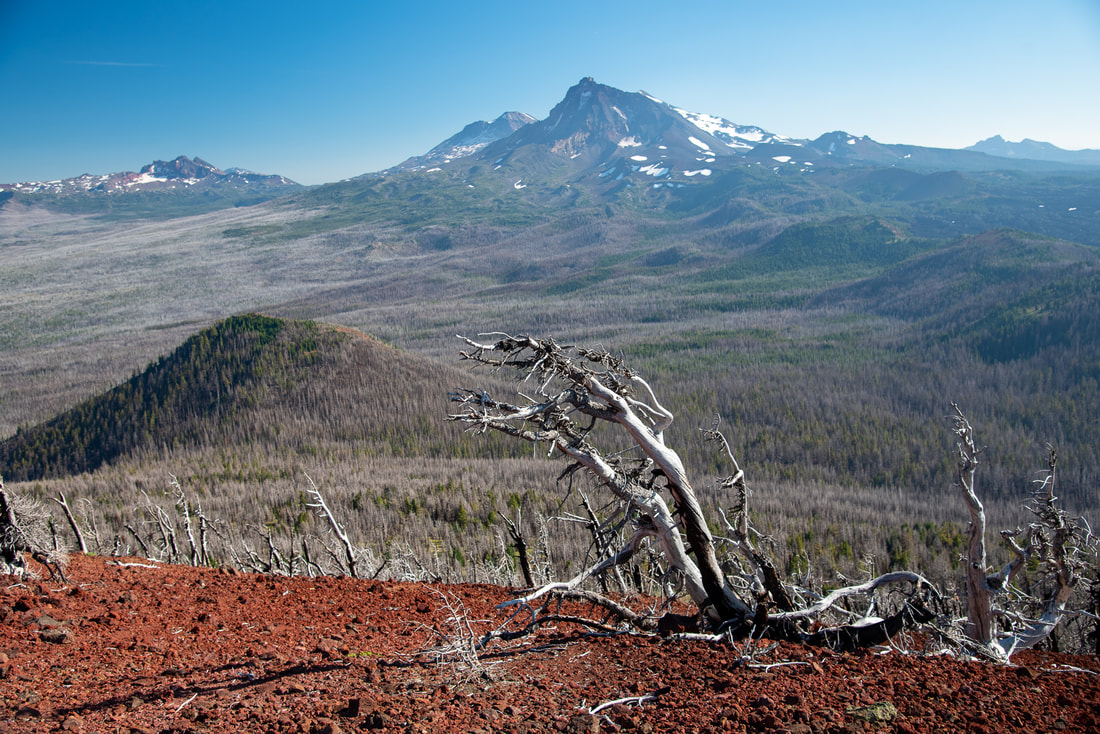
At the summit you will see the large crater that Black Crater is named for, it was formed by Ice Age glaciers. You will also have incredible views of the Three Sisters and Broken Top to the south and all of the damage from the 2017 Milli Fire and massive 2012 Pole Creek burn. Mount Washington, Three Fingered Jack, Mount Jefferson, Mount Hood and even Mount Adams are visible on a clear day to the north. You will also see the McKenzie Highway stretching to the west until it disappears off in the distance. 
Mt. Jefferson from Black Crater
(Mount Jefferson)
Three Sisters from Black Crater
(an example of krumholz)
Black Crater is one of the best hikes along the McKenzie Scenic Highway! It is close to the town of Sisters and Bend and it is the perfect length for a view-filled day hike. Because of the sun exposure and lack of water sources it is recommended to start early in the day, bring lots of sunscreen and a hat for sun protection. Bringing your dog on this trail in the mid-summer heat is probably not a good idea as the trail tread itself can get extremely hot and hurt dog's paw pads. It can also be very windy at the summit so a light jacket or long sleeve layer even in the summer is not a bad idea. The hike is rated as 'difficult' because of the the elevation gain. The trail itself is fairly well maintained with the only rocks on the trail being some of the small red cinder rocks near the top.
View from Black Crater

Directions:

From Sisters
  • ​Drive on McKenzie Highway 242 west for about 11.5 miles then turn left into the Black Crater parking lot (there is a sign on the right side of the highway pointing you into the parking lot). (Total of 12 miles)
From Eugene
  • Drive on OR-126 east towards McKenzie Bridge for about 55 miles. At the sign for Scenic Highway 242 turn right and stay on this road for about 25 very windy miles. After you see Dee Wright Observatory, continue another 3 miles, then turn right into the Black Crater parking lot (there is a sign on the right side of the highway pointing you into the parking lot). (Total of 83 miles)
​From Bend
  • Total of 34 miles via Sisters​.
From Salem
  • Total of 120 miles via Sisters.
From Portland
  • Total of 164 miles via Sisters.
*All pictures are taken by Franziska Weinheimer
*Disclaimer: The trail descriptions, mileage, GPS tracks and difficulty ratings depicted on this website are never 100% accurate. Always hike at your own risk, using your own knowledge, equipment and common sense. Franziska Weinheimer/Hike Oregon are not responsible if you or anyone in your party gets injured or lost while attempting one of these or any other hikes. 

HIKED HERE RECENTLY? PLEASE LEAVE A TRIP REPORT BELOW:

© Hike Oregon 2022
P.O. Box 41911
​Eugene, OR 97404
Proudly powered by Weebly
  • Home
  • *Store*
  • About the author
  • How to use this site
  • Resources
    • Wildflowers
    • Videos
  • Best Oregon Hikes
    • 20 Epic Oregon Wildflower Hikes
    • Top 10 Oregon Spring Hikes
    • 20 Best Oregon Waterfall Hikes
    • Top 10 Oregon Hikes for Kids
    • 5 Weekend Backpacking Trips in Oregon
    • Top One Night Backpacking Trips in Oregon
    • Top Fall Foliage Hikes In Oregon
    • Top 10 Oregon Summer Hikes
    • Top 10 Swimming Spots In Oregon
    • Top 10 Oregon Fall Hikes
    • Sno-Parks In Central Oregon
    • Top 10 Oregon Winter Hikes
    • Top Low Elevation Winter Hikes
  • Oregon Sno-Parks
    • Maxwell Sno-Park
    • Potato Hill Sno-Park
    • Ray Benson Sno-Park
      • Brandenburg Shelter
    • Santiam Sno-Park
    • Three Creek Sno-Park
    • Virginia Meissner Sno-Park
      • Meissner Shelter Loop
      • Nordeen Shelter
    • Gold Lake Sno-Park
      • Westview Shelter to Eagle Rock Overlook
      • Marilyn Lakes Loop
  • Portland
    • Powell Butte
    • Forest Park
    • Hamilton Mountain
    • Latourell Falls
    • Multnomah/Wahkeena Falls
    • Dog Mountain
    • Coyote Wall
    • Mitchell Point
    • Table Rock
    • Tamanawas Falls
    • Trillium Lake
    • East Zigzag Mountain (members only)
  • Salem
    • Abiqua Falls
    • Silver Falls State Park
    • Marion Lake to Marion Mountain
    • Jefferson Park
  • Sweet Home
    • Crescent Mountain
    • Iron Mountain
    • McDowell Creek Falls
    • Middle Santiam River (members only)
    • Lower Soda Creek Falls (members only)
    • Rooster Rock (members only)
  • McKenzie Bridge/Blue River
    • Macduff Mountain
    • Proxy Falls
    • Clear Lake
    • Sahalie/Koosah Falls
    • Blue Pool
    • Erma Bell Lakes
    • Olallie Mountain
    • Horsepasture Mountain
    • Tidbits Mountain
    • Castle Rock
    • East Fork Trail (members only)
    • Rainbow Falls Overlook (members only)
    • Frissell Point (members only)
    • Chucksney Mountain (members only)
    • Substitute Point (members only)
  • Sisters/Santiam Pass
    • Coffin Mountain
    • Trappers Butte and Scar Mountain
    • Black Butte
    • Tam McArthur Rim
    • Black Crater
    • Scott Mountain
    • Obsidian Trail
    • Three Fingered Jack Loop
    • Square Lake
    • Canyon Creek Meadows
    • Patjens Lakes
    • Craig Lake (members only)
    • Chush Falls (members only)
    • Rockpile Lake (members only)
    • Santiam Lake (members only)
    • Camp Lake (members only)
    • Park Meadow to Golden Lake (members only)
  • Bend/Redmond/LaPine
    • Steins Pillar
    • Chimney Rock
    • Steelhead Falls
    • Tumalo State Park
    • Tumalo Falls
    • Tumalo Mountain
    • No Name Lake
    • Green Lakes
    • Moraine Lake
    • South Sister Summit
    • Muskrat Lake
    • Paulina Peak
    • Peter Skene Ogden Trail (members only)
  • Eugene
    • Ridgeline Trail
    • Mount Pisgah Summit
    • Mount Pisgah Arboretum
    • Shotgun Creek
    • Mount June
    • Lawler
    • Tire Mountain
    • Goodman Creek
    • Brice Creek
    • Trestle Creek Falls
    • Moon Falls
    • Elijah Bristow State Park
    • South Willamette Trail (members only)
    • Eula Ridge (members only)
    • Eagle's Rest (members only)
  • Oakridge
    • Deception Creek
    • North Salmon Creek
    • Grasshopper Ridge
    • Larison Creek
    • Bunchgrass Ridge
    • Salt Creek Falls
    • Waldo Lake Loop
    • South Waldo Loop
    • The Twins
    • Rosary Lakes
    • Fawn Lake
    • Windy Lakes
    • Divide Lake
    • Diamond Peak Summit
    • Cowhorn Mountain
    • Wall Creek Warm Springs (members only)
    • Moon Point (members only)
    • Bobby Lake (members only)
    • Lillian Falls (members only)
    • Middle Fork Willamette Trail (members only)
    • Pool Creek Falls (members only)
    • Dead Mountain (members only)
    • Larison Rock (members only)
    • Eddeeleo Lakes (members only)
    • Waldo Mountain Lookout (members only)
    • Blair Lake to Mule Mountain (members only)
    • Rigdon Lakes loop (members only)
  • Oregon Coast
    • Cascade Head
    • Drift Creek Falls
    • Sweet Creek Falls
    • Alsea Falls
    • Kentucky Falls
    • Marys Peak North Ridge
    • Marys Peak East Ridge
    • Cape Perpetua Loops
    • Hobbit Trail to Heceta Head
    • North Fork Smith River (members only)
    • Cummins Ridge (member's only)
    • Horse Creek (members only)
    • Siltcoos Lake (members only)
    • William Finley Wildlife Refuge (members only)
  • Southern Oregon
    • Fall Creek Falls
    • Watson Falls
    • Wild Rogue Loop
    • Mt. Thielsen
    • The Watchman
    • Mount Scott
    • The Pinnacles
    • Lower Table Rock
    • Pilot Rock
    • Wagner Butte
    • Mt. McLoughlin
    • Lemolo Falls (members only)
    • Fern Falls (members only)
  • Eastern Oregon
    • Painted Cove
    • Mount Howard
    • Anthony Lake Loop
    • Schneider Cabin (members only)
    • Strawberry Lake & Falls (members only)
  • Oregon PCT sections
    • PCT: OR-58 to Charlton Lake
    • PCT: Santiam Pass to Rockpile Lake
  • Tips & Tricks
    • Leave No Trace
    • Top Tips For Hiking With Infants And Toddlers
    • Poison Oak, Ivy and Sumac
    • How to dress for cold weather hikes
    • Hiker Holiday Gift Guide 2019
    • Outdoor Holiday Gift Guide 2018
    • Hiking Holiday Gift Guide 2017
  • Reviews
    • Outdoor Herbivore Backpacking Food Review
    • Osprey Aura AG 65 Backpack review
    • Big Agnes Fly Creek UL2 review
    • REI Quarter Dome 1 review
  • Adventure Stories
    • Hiking The Rae Lakes Loop
    • 110 Miles on the PCT
    • The Loop Around Three Fingered Jack
    • Jefferson Wilderness