Table Rock
Hike details:
Mileage: 7.5 miles round trip w/ 1,780 ft. elevation gain
Approximate hike time: 3 hours 15 minutes w/ an average pace of 2.3 mph
Difficulty: Moderate w/ one small difficult section
Trail usage: High on weekends, low on weekdays
Highest elevation: 4,879 ft. Lowest elevation: 3,400 ft.
General location: 60 miles southeast of Portland - Bureau of Land Management - Table Rock Wilderness
Accessible: May to December
(Best time to go is September, October and early November when the fall colors are beautiful and the mountains have a little bit of snow on them).
Permits required: N/A
Pit toilet at trailhead: Yes
Trail allows: Dogs, horses (although I would not suggest riding a horse on this trail because of the rock/boulder section.
Possible dangers: Steep drop offs at the top.
Description:
Table Rock is a popular view-filled hike located near Molalla in the Table Rock Wilderness. On a clear day this hike offers views of the Cascade Mountains from Mount Adams to the Three Sisters.
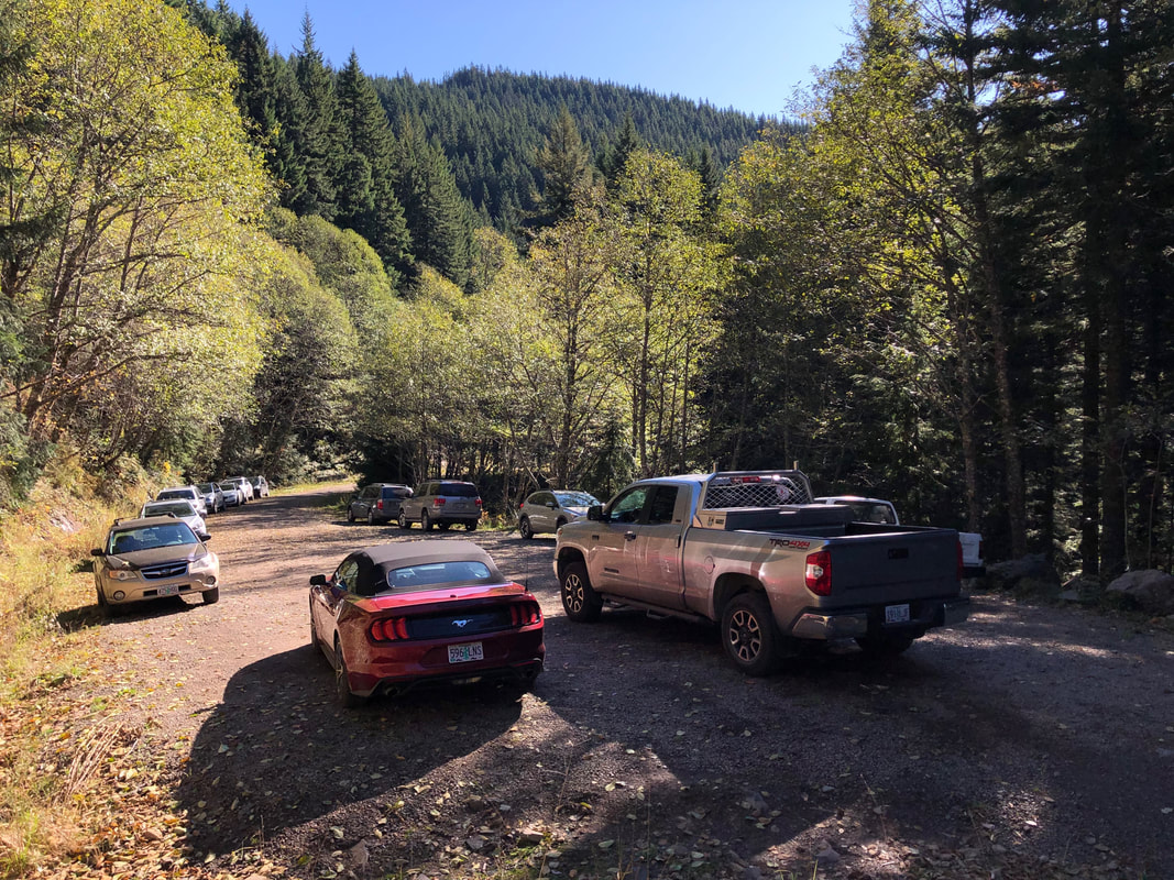
The trailhead is fairly easy to get to, however, the last few miles of gravel road are steep and the road has a few sharp rocks, so make sure you're not driving up there with really old tires that could easily get punctured. The gravel road dead ends into the trailhead, so there isn't much of an official parking area. You can park on both sides of the gravel road, just make sure to be courteous and not block anyone in.
The trailhead is fairly easy to get to, however, the last few miles of gravel road are steep and the road has a few sharp rocks, so make sure you're not driving up there with really old tires that could easily get punctured. The gravel road dead ends into the trailhead, so there isn't much of an official parking area. You can park on both sides of the gravel road, just make sure to be courteous and not block anyone in.
|
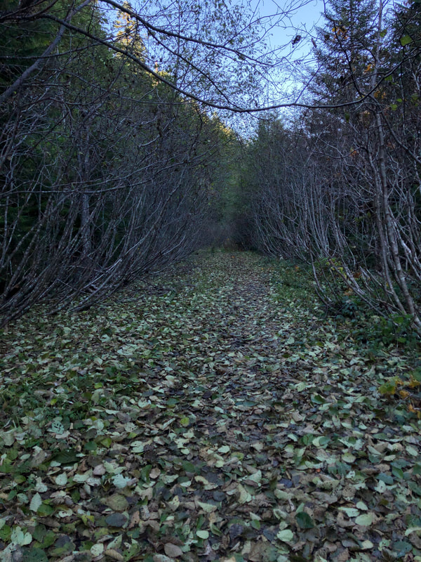
The trail starts off on what is the continuation of the gravel road you came in on. Quite some time ago a couple of landslides left the road unrepairable and the trail was 2 miles shorter than it is now.
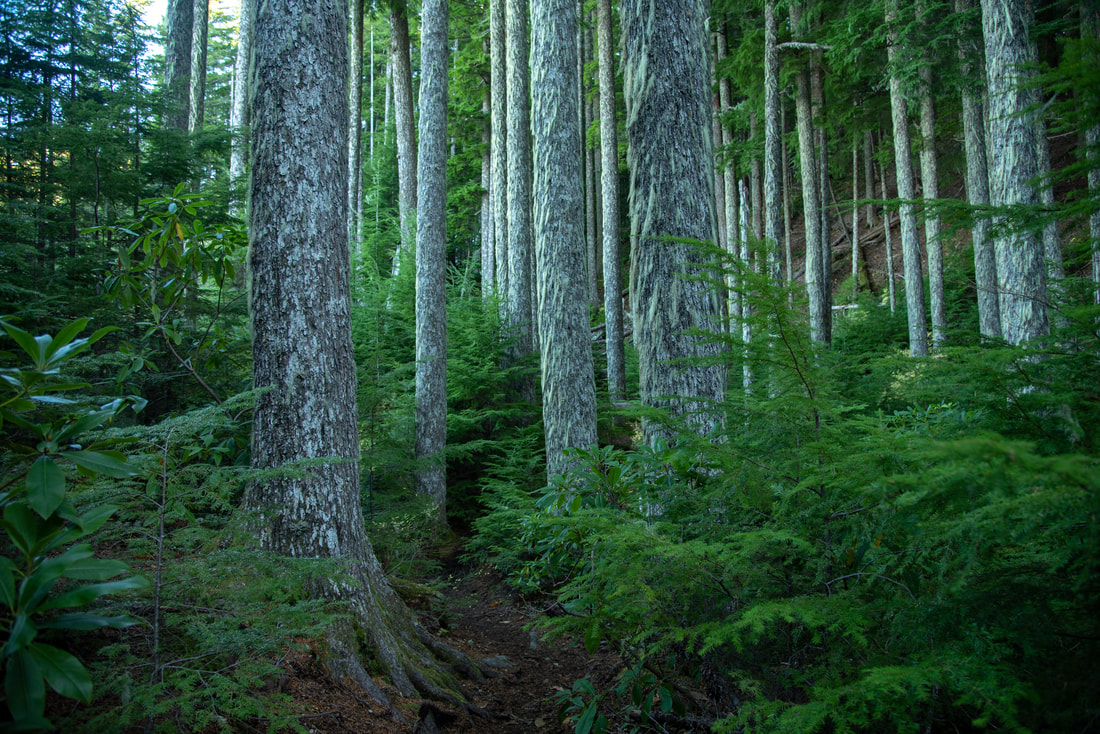
Continue down the old gravel road lined thick with trees and bushes for 1.4 miles. Then the trail disappears to the right into a beautiful hemlock and fir forest. At one point the forest opens up a bit and you will see part of Table Rock's cliffs towering above. |
|
|
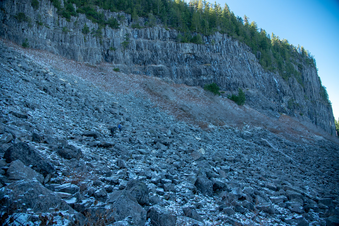
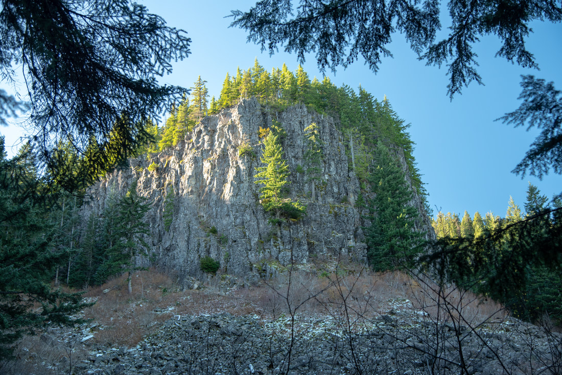
After a total of 2.25 miles, you will come to a very rocky section of trail. This is a rockslide from Table Rock's northern cliffside that the trail now traverses over. Some of these rocks are lose and some of the boulders are quite large. Because this area is almost always in the rock's shadow, snow can linger here until July and the rocks can be slippery and icy, so use caution. Even though technically horses are allowed on this trail, it is probably not advised due to this section of trail. The rockslide exposed a cutaway view of seven basalt lava flows, which range from 16 to 25 million years old.
|
From the rock section of trail you can look toward the north and get your first view of Mount Hood. At certain times of the year this view of the mountain makes it look like there is a face carved into it.
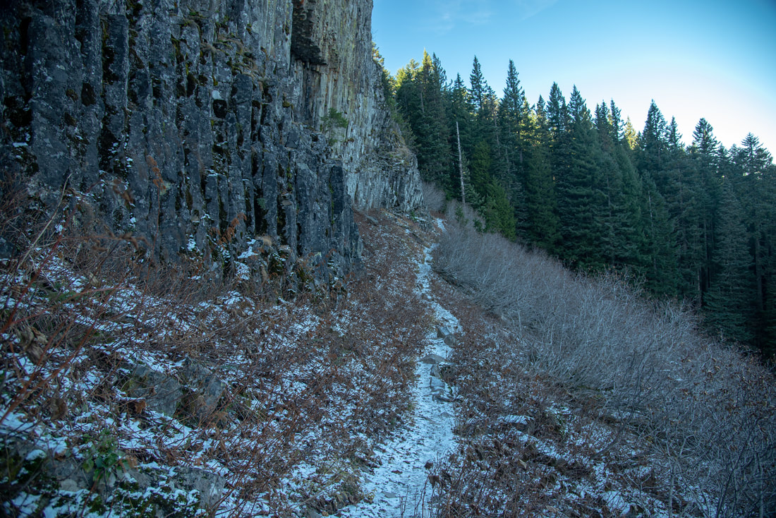
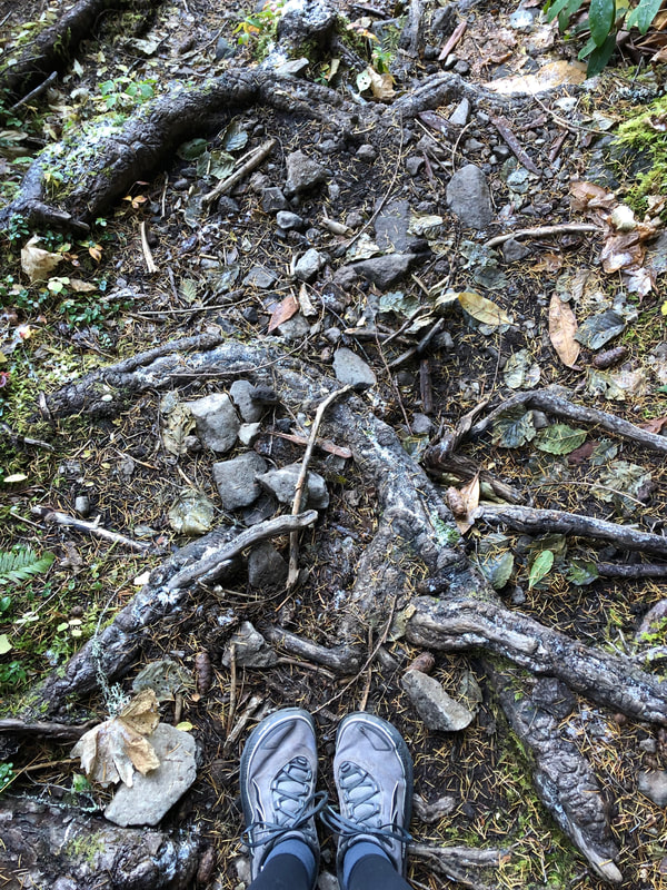
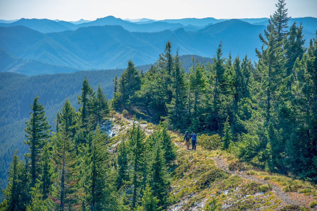
After you have safely traversed the rockslide, the trail keeps climbing uphill through the forest. The tread of the trail is littered with rocks and sizable roots, so watch your footing. After another 0.6 miles, you will come to a trail junction. The trail to the right is Saddle Trail and it will take you 1.5 miles to an awesome viewpoint of Rooster Rock. To continue to the summit of Table Rock, take the trail to the left for another 0.6 miles. There will be 3 long switchbacks until you reach the ridgeline. |
|
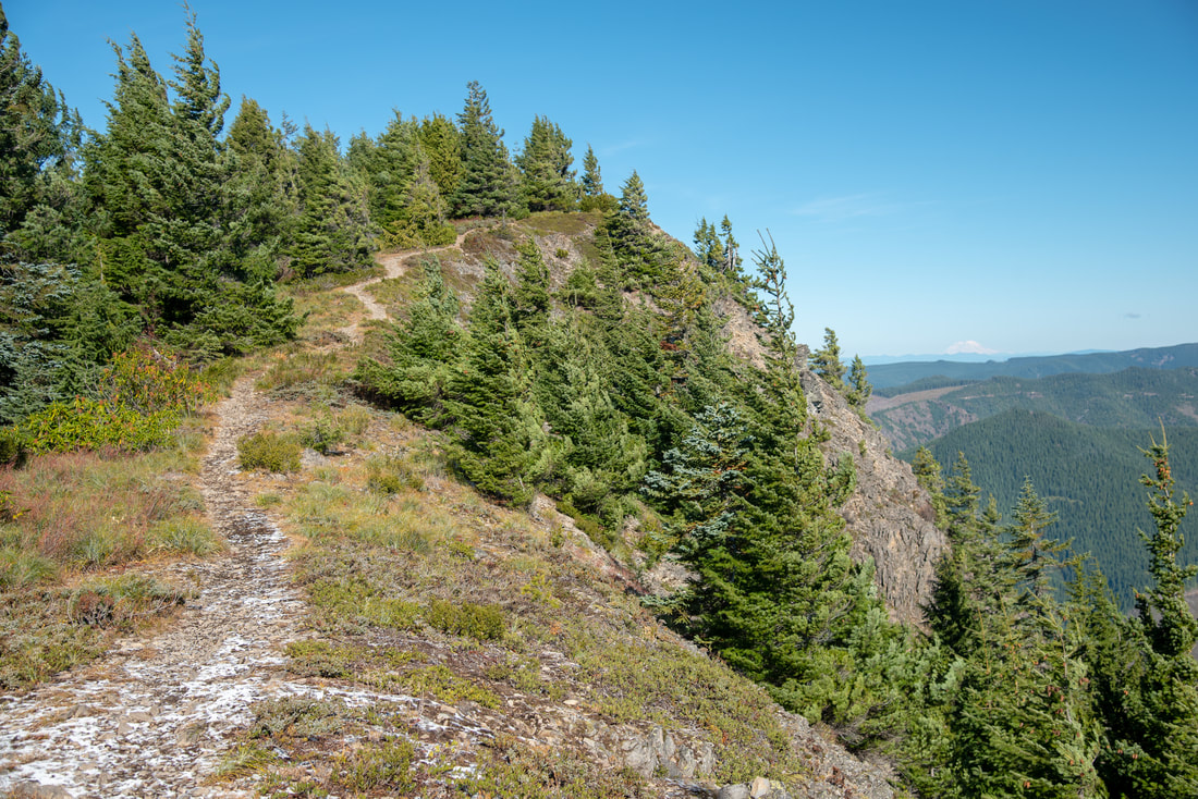
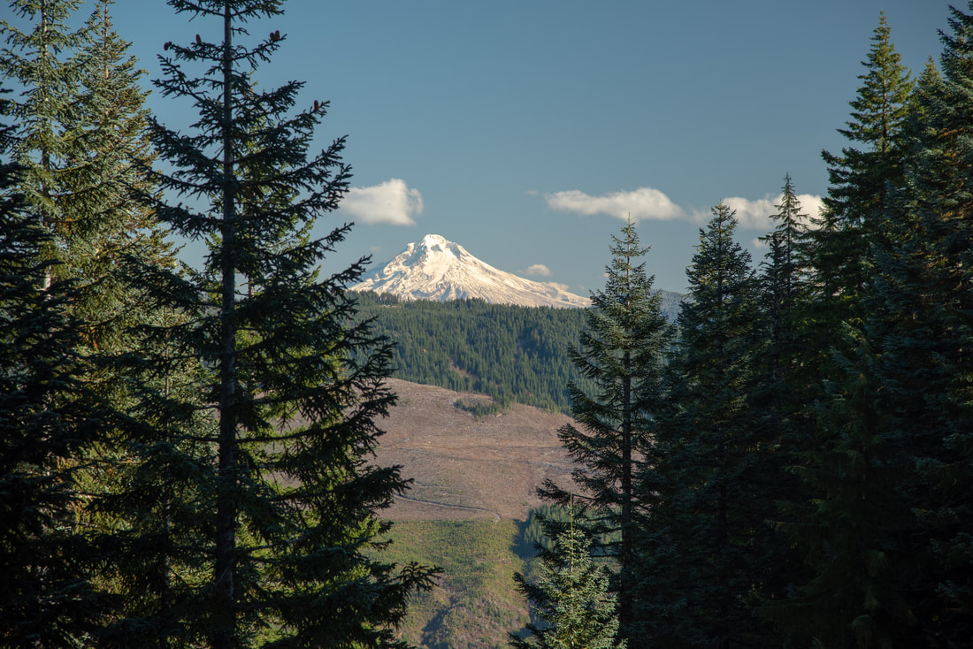
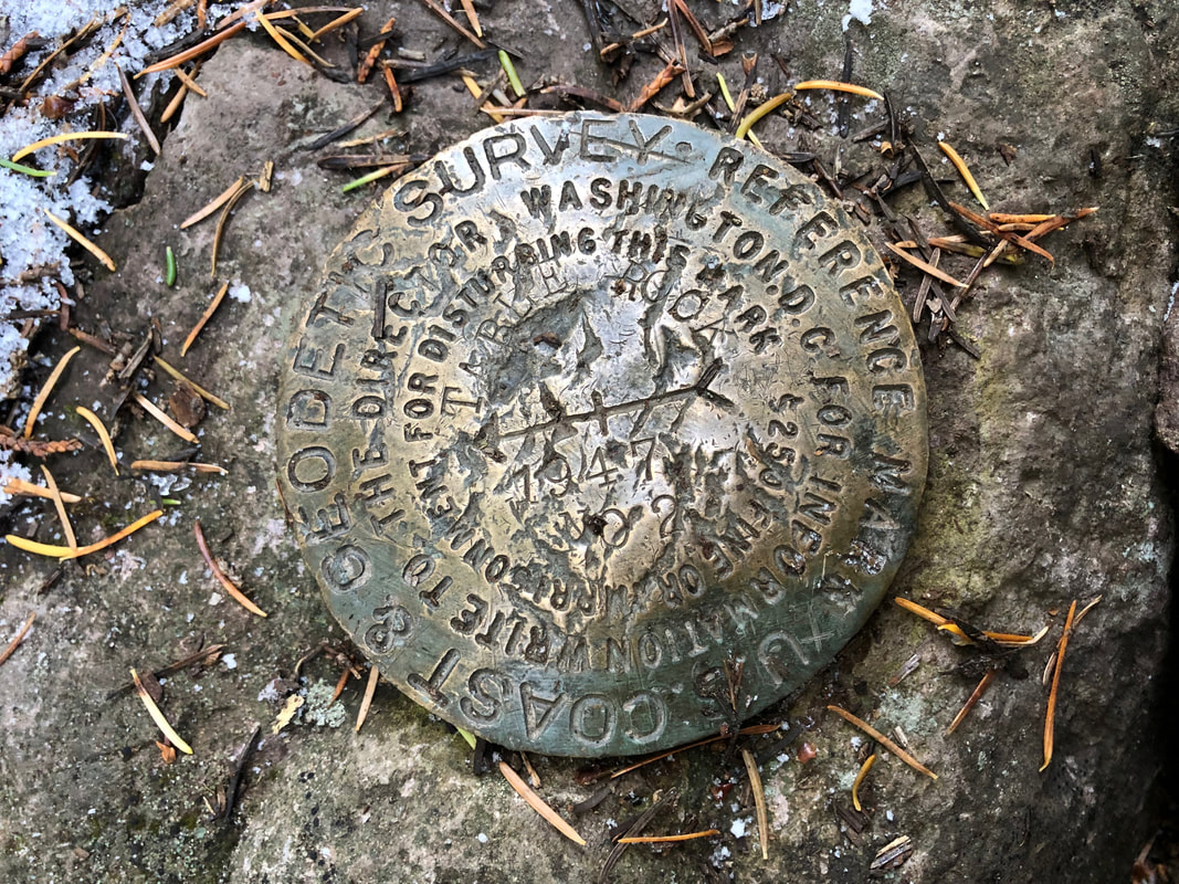
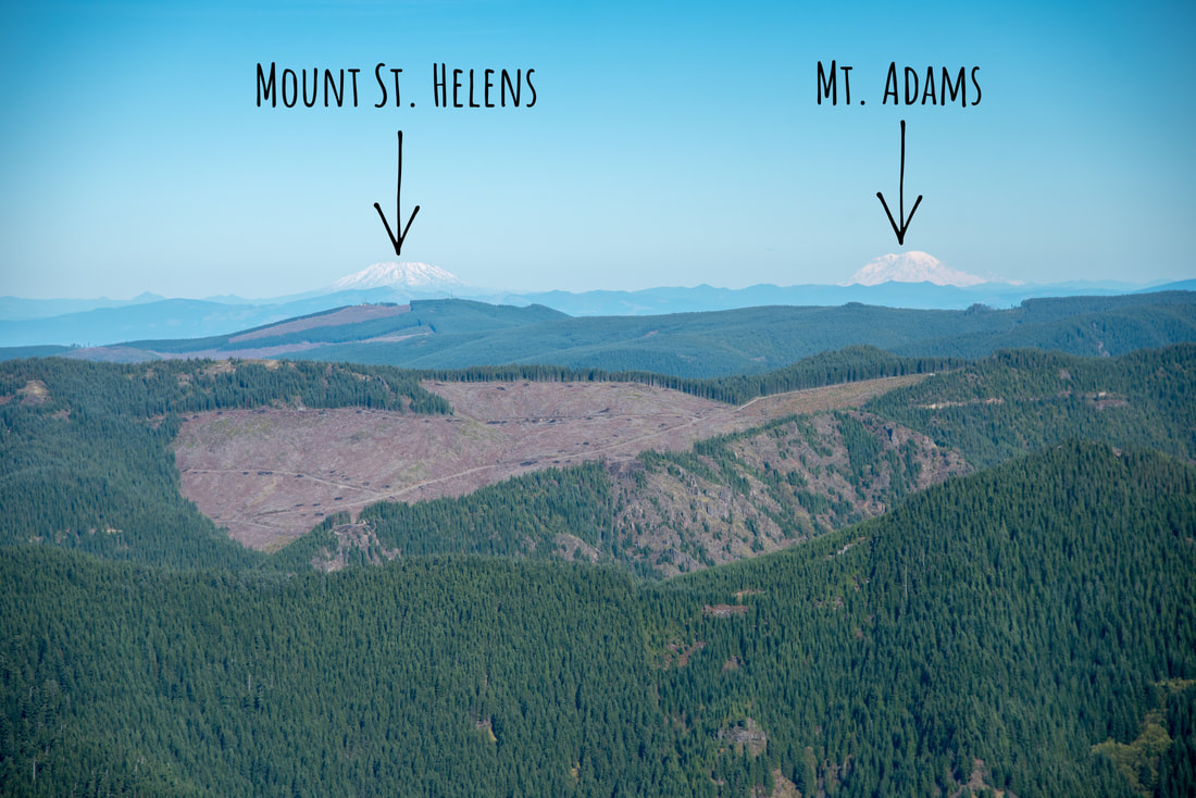
The ridgeline is very windswept. On certain days, the winds can easily reach 30mph up there! The summit of Table Rock is at 4,879 ft. and from there you can see Mount Hood, Mount Adams, Mount St. Helens and to the south Mount Jefferson and on a very clear day you can see the Three Sisters. If it is a windy day when you're up there, there is a nice sheltered place to eat lunch in the trees, just a few yards from the summit. It's nice and flat and the perfect spot to sit and have a picnic or even set up a hammock.
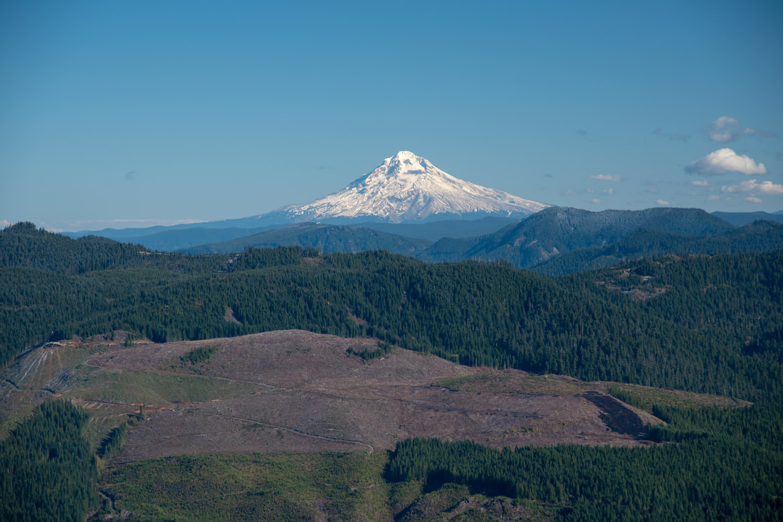
(Mount Hood)
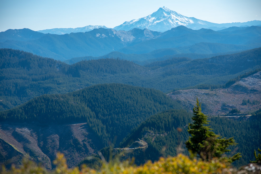
(Mount Jefferson)
Table Rock is a wonderful hike and it is popular for good reason. It is rated moderate not only because of the mileage and elevation gain, but also because of the tread of the trail, and honestly, the boulder/rockslide section would generally be classified as difficult by Hike Oregon but the rest of the hike is not difficult, so it has been overall rated as moderate. This hike is great to do on a clear day when you can really appreciate those epic views.
Directions:
From Portland
- Drive I-5 south for 16.9 miles then take exit 282A toward Canby/Hubbard. Continue onto Portland-Hubbard Hwy for 1.1 miles then use the left 2 lanes to turn left onto Arndt Rd NE. Stay on Arndt Rd. for 1.8 miles and then turn right onto S Arndt Rd. After half a mile turn right onto S Barlow Rd. for a total of 2 miles. Turn left onto S Lone Elder Rd. for 2.1 miles and then Turn right onto Canby-Marquam Hwy. After 1 mile, turn left onto S Macksburg Rd. After 0.9 miles turn left to stay on S Macksburg Rd. for a total of 7.7 miles. Turn left onto OR-211 N for just 0.7 miles, then turn right onto S Wright Rd. for 1.7 miles and then turn right onto S Feyrer Park Rd. for half a mile. This road turns into S Dickey Prairie Rd. and you will stay on this road for 5.3 miles then turn right and cross the Molalla River then immediately turn left onto S Molalla Forest Rd. for 10.9 miles. Make a slight left onto Upper Molalla Rd. and stay on this road for 1.6 miles. Continue straight onto Middlefork Rd. for 2.6 miles and then turn right at a sign for Table Rock trailhead. After another 2 miles, veer left at a fork and continue the final 2.4 miles to the trailhead. (Total of 60.7 miles)
- Drive OR-213 toward Silverton. From the town of Silverton continue on OR-213 for 10.3 miles. Turn right onto S Thomas Rd. for 2.8 miles and then turn left onto S Without Rd. and immediately turn right onto S Herman Rd. for 0.8 miles. Turn right at the 1st cross street onto S Sawmill Rd. for 4.2 miles and then continue straight onto Guernsey Rd/S Trout Creek Rd. for 3.2 miles. Turn right onto S Molalla Forest Rd. for 7.6 miles then make a slight left onto Upper Molalla Rd. and stay on this road for 1.6 miles. Continue straight onto Middlefork Rd. for 2.6 miles and then turn right at a sign for Table Rock trailhead. After another 2 miles, veer left at a fork and continue the final 2.4 miles to the trailhead. (Total of 52.5 miles)
- Drive Hwy. 97 north and then merge west onto US-20 towards Sisters. At the Santiam Junction merge right onto OR-22 and continue past the town of Mehama. Take exit 13 toward Stayton/Sublimity then turn right onto Cascade Hwy SE/S Center St. for 12.7 miles. Continue onto W Main St. for 1.1 miles and then turn left onto N 1st St/Cascade Hwy NE and immediately turn turn right at the 1st cross street onto OR-213 N/Oak St. for 10.3 miles. Turn right onto S Thomas Rd. for 2.8 miles and then turn left onto S Without Rd. and immediately turn right onto S Herman Rd. for 0.8 miles. Turn right at the 1st cross street onto S Sawmill Rd. for 4.2 miles and then continue straight onto Guernsey Rd/S Trout Creek Rd. for 3.2 miles. Turn right onto S Molalla Forest Rd. for 7.6 miles then make a slight left onto Upper Molalla Rd. and stay on this road for 1.6 miles. Continue straight onto Middlefork Rd. for 2.6 miles and then turn right at a sign for Table Rock trailhead. After another 2 miles, veer left at a fork and continue the final 2.4 miles to the trailhead. (Total of 169 miles)
- Total of 116 miles via Salem.
- Total of 284 miles via Salem.
-This trail write-up was last updated October 2019-
*All pictures are taken by Franziska Weinheimer
*All pictures are taken by Franziska Weinheimer
*Disclaimer: The trail descriptions, mileage, GPS tracks and difficulty ratings depicted on this website are never 100% accurate. Always hike at your own risk, using your own knowledge, equipment and common sense. Franziska Weinheimer/Hike Oregon are not responsible if you or anyone in your party gets injured or lost while attempting one of these or any other hikes.