Whychus Creek Trail
Hike details:
Mileage: 6.4 miles round trip w/ 660 ft. elevation gain
Approximate hike time: 2 hours 46 minutes w/ an average pace of 2.3 mph
Difficulty: Moderate
Trail usage: Medium
Highest elevation: 3,890 ft. Lowest elevation: 3,491 ft.
General location: 4.3 miles south of Sisters - Deschutes National Forest
Accessible: Year-round
(Best time to go is April and May when there are wildflowers blooming and everything is green and lush).
Permits required: N/A
Pit toilet at trailhead: No but there is one at the Whychus Creek Overlook trailhead just 1.1 miles up the road.
Trail allows: Dogs
Possible dangers: N/A
|
Description:The Whychus Creek Trail is a short but sweet underrated gem located very close to the town of Sisters, and is the perfect trail to enjoy pretty much year-round. The easiest way to hike this trail is to start at the official Whychus Creek Trail trailhead, which is about a mile short of the Whychus Creek Overlook trailhead (this trailhead tends to get packed with folks who are just there to go to the viewpoint, and there is only room for about 6 cars).
|
|
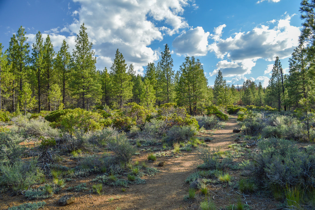
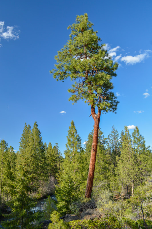
The trail starts out meandering through lodgepole pines, sagebrush and manzanita bushes, which have delicate pink sweet smelling flowers in the spring. In May you will also see desert lilies growing out of the dry dusty ground. The Central Oregon spring rains really bring out the many different shades of green along this trail, and with the sun shining through the trees in the afternoon, this is truly an idyllic hike.
After a while, you will see the burn scar from the 2017 Milli Fire, which came dangerously close to Sisters. At this point a lot of green understory has grown back among the blackened trees and the ground has seemingly recovered well from the burn over the past 5 years. |
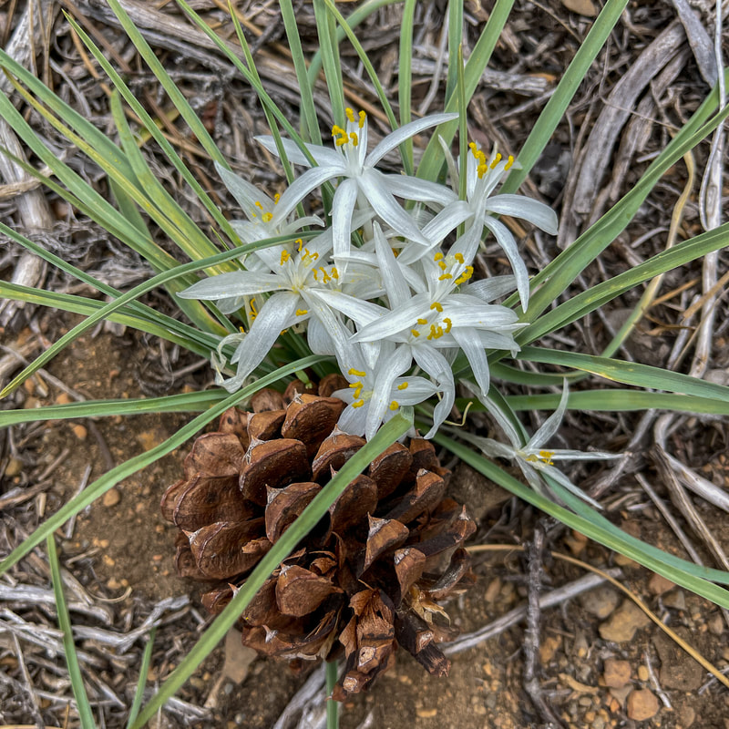
(desert lilies)
|
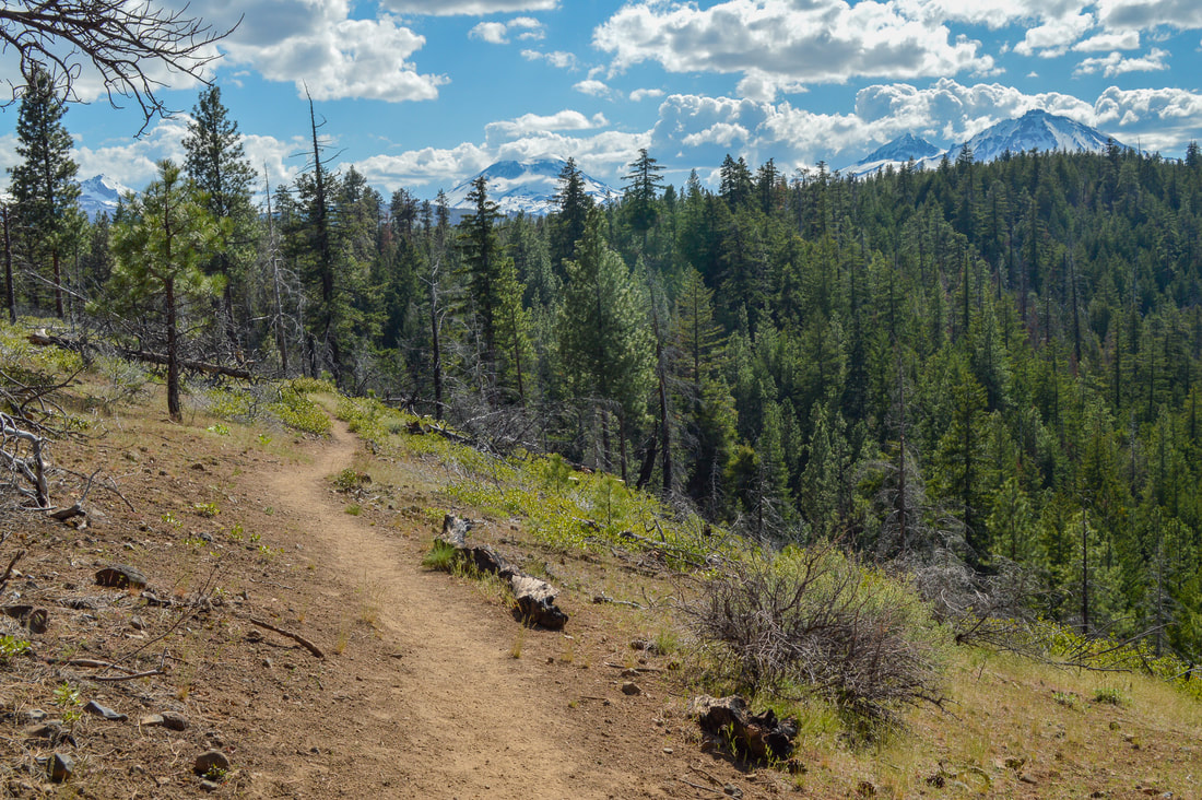
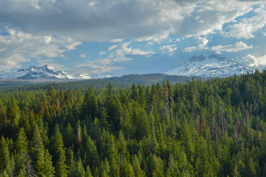
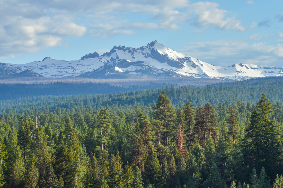
(view of the Three Sisters from the trail)
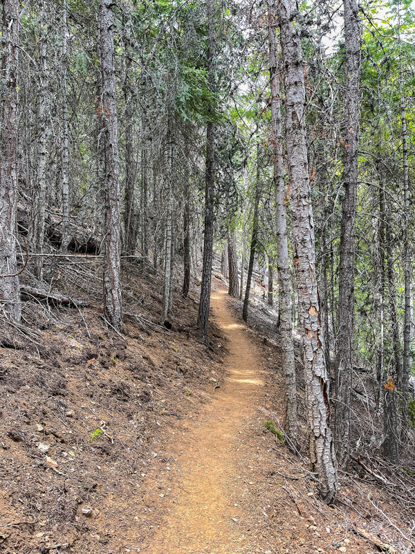
(example of the trail tread heading down to the creek)
|
|
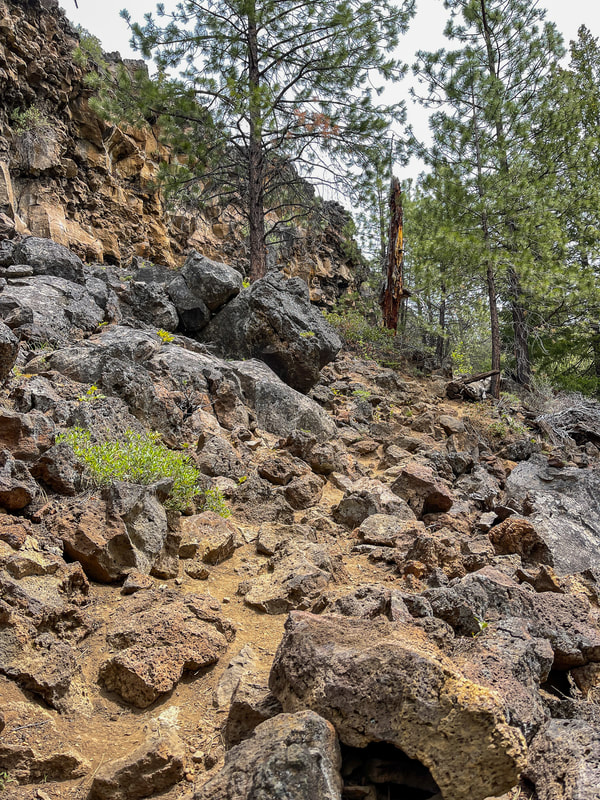
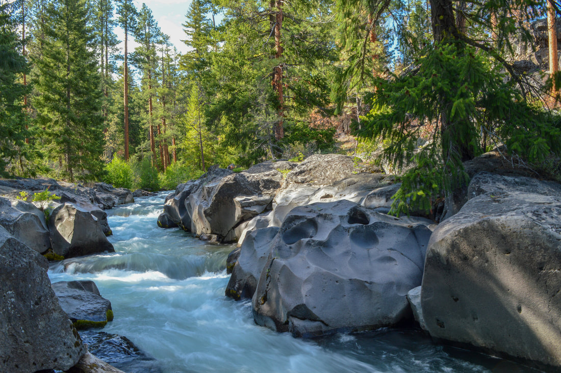
1.4 miles into the hike, the trail begins to go down steeply towards the creek via some lava rocks. The trail itself is difficult to see among the rocks and it is imperative that you be careful with your footing here. This section of the trail is the only thing slightly difficult about the hike and it is relatively short. Once you are down by the creek you will get some great views of the water as well as see a little waterfall.
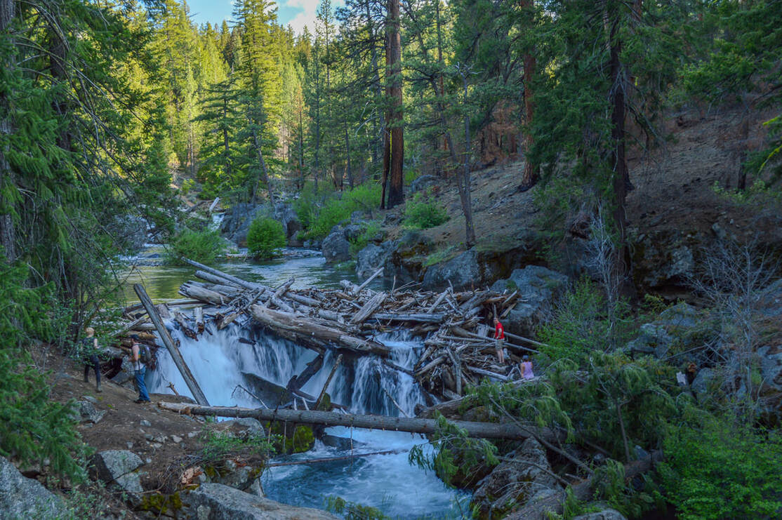
(small waterfall along Whychus Creek)
|
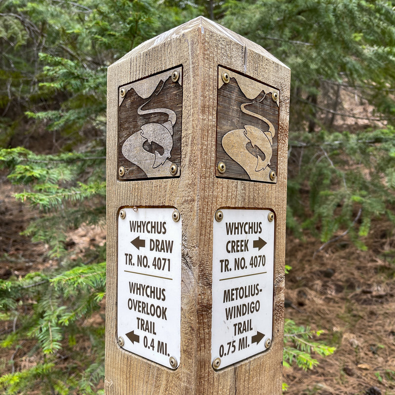
The forest along the creek is a lot more lush and green and less exposed to the sun. At the 1.8 mile mark you will see a trail sign that indicates the short 0.4 mile trail that goes up to the left to the Whychus Creek Overlook. If you are hiking on a clear day, this short out and back side trip is not to be missed because the views from up there are truly incredible.
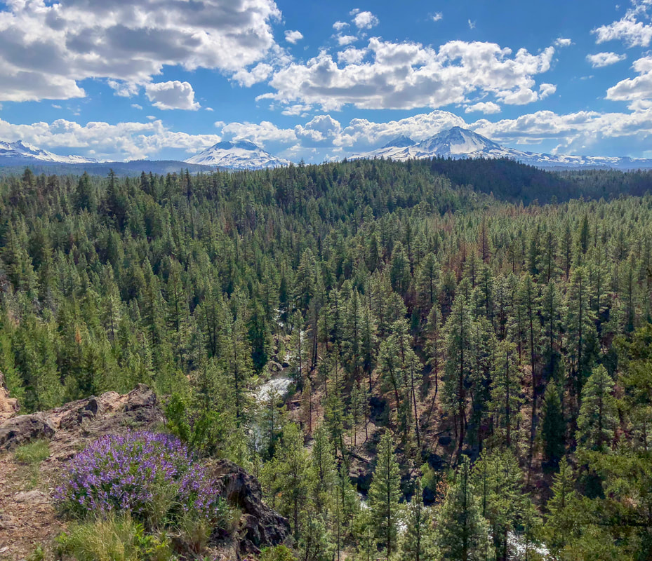
From the overlook you will see Broken Top, South Sister, Middle Sister and North Sister and Whychus Creek winding through the trees down below. *If you are not up to hiking the 6.4 mile round trip hike along the creek, you can get to this viewpoint via the Whychus Overlook trailhead parking area. From there you can take a 0.9 mile wheelchair friendly loop and you will see this gorgeous overlook as well. |
(Broken Top)
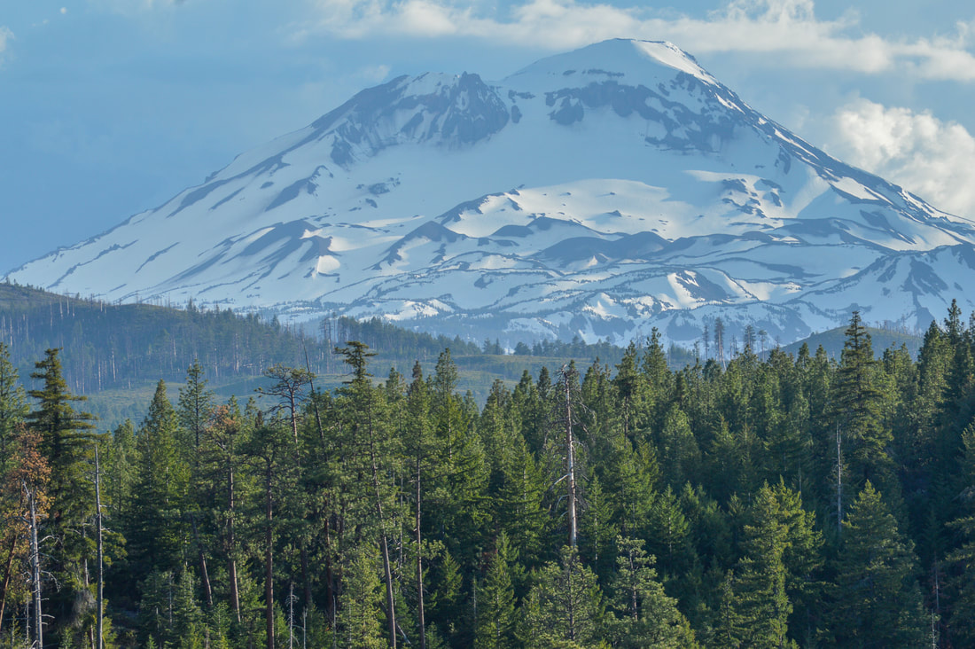
(South Sister)
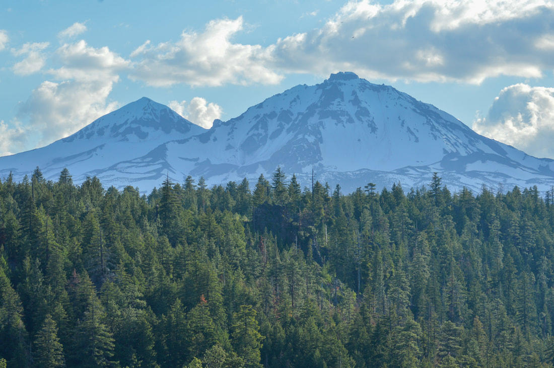
(Middle Sister & North Sister)
After checking out the overlook, hike the 0.4 miles back down to the Whychus Creek Trail and continue upstream through a mixed forest of lodgepole and stately ponderosa pines. This 0.8 mile section of the hike is pretty neat because along the way you will see multiple cool spots along the creek where the rushing water has carved out slick holes in the rocks. There are lots of places where you can sit on the rocks by the water and enjoy the amazing sound of the birds and the creek. Keep to the right at a trail junction, and now you are on the Metolius-Windigo Trail, a trail that starts northwest of Sisters at Bear Valley and goes all the way to Crescent Lake. Continue along the Metolius-Windigo Trail for just 0.1 miles to where it crosses the creek. There is no bridge here, so you likely won't be able to cross unless you are on horseback or it is very late in the summer season or in the fall season. There is a lovely large flat spot among large ponderosa pines, where you can sit and enjoy a snack. From here, head back the way you came.
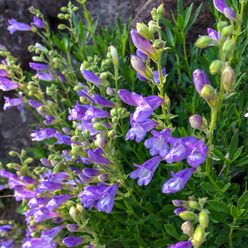
(penstemon)
|
The Whychus Creek Trail is definitely a year-round staple in Central Oregon and a must-see little trail if you are visiting. The mixture of forest, creekside trail, lava rock, spring flowers and mountain views makes this hike pretty much have it all packed in just 6.4 miles. The only reason this hike is rated as 'moderate' is because of the steep lava rock section and because it is over 5 miles, other than that, it is a pretty easy hike and great for the whole family. Keep in mind that the beginning section through the old burn area is fairly exposed so it can get pretty hot during the summer.
|
Directions:
From Sisters
- Drive S on Elm St. which turns into Three Creek Rd./NF-16. Right before the road starts going up a hill, you will see a sign for the trailhead on the right. (Total of 4.3 miles)
- Total of 110 miles via Sisters.
- Total of 114 miles via Sisters.
- Total of 158 miles via Sisters.
- Total of 199 miles via Sisters.
-This trail write-up is up to date as of June, 2022-
*All pictures are taken by Franziska Weinheimer
*All pictures are taken by Franziska Weinheimer
*Disclaimer: The trail descriptions, mileage, GPS tracks and difficulty ratings depicted on this website are never 100% accurate. Always hike at your own risk, using your own knowledge, equipment and common sense. Franziska Weinheimer/Hike Oregon are not responsible if you or anyone in your party gets injured or lost while attempting one of these or any other hikes.