South Sister summit
Hike details:
Mileage: 12.5 miles round trip w/ 5,000 ft. elevation gain
Approximate hike time: 7 hours w/ an average pace of 1.8 mph (most people average 6-10 hours to do this hike).
Difficulty: Difficult
Trail usage: High during the summer, high on early fall weekends, low on fall weekdays
Highest elevation: 10,363 ft. Lowest elevation: 5,453 ft.
General location: 28 miles west of Bend - Three Sisters Wilderness - Deschutes National Forest
Accessible: End of May (there will still be snow) through mid-November
(Best time to go is early July because the weather is good and there are still some snow patches which makes hiking up easier than hiking through the scree).
Permits required: Day trips & overnight trips - Central Cascades Wilderness Permit June 15 - October 15 available via recreation.gov
Northwest Forest Pass for parking
Pit toilet at trailhead: Yes
Trail allows: Dogs on leash July 15 - September 15 (but I recommend leaving your dog at home due to sharp rocks, lack of water and lots of sun exposure), camping, touring.
Possible dangers: Rock fall, steep cliff drop offs at the summit, altitude sickness
|
Description:South Sister (aka Charity) is one of the easiest Cascade Mountains to summit and hundreds of people do it every year. This however, does not mean it is an easy hike by any means, and you have to remember that you are climbing a 10,363 ft. volcano and you gain 5,000 ft. of elevation of exposed lava rock in just 6.25 miles.
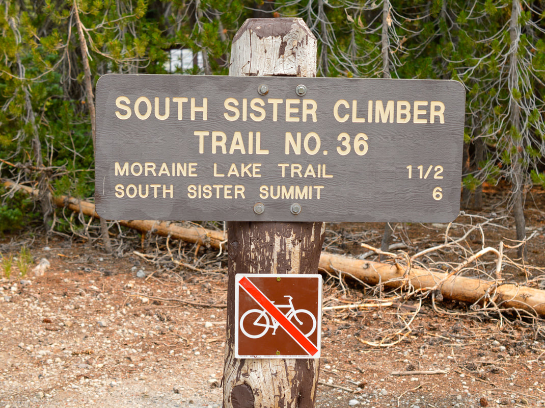
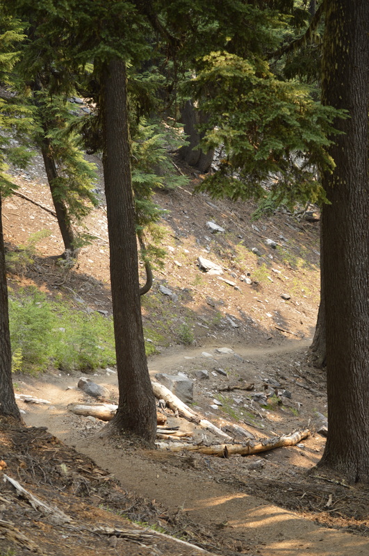
The parking for this hike is at Devils Lake, however this is also the trailhead parking for a few other hikes, as well as camping at Devils Lake, so it can often be crowded. Starting in the summer of 2021, you will need to purchase a limited entry permit to hike the South Sister Climber Trail and to park at the trailhead between the June 15 - October 15. There are 100 day use permits per day and they are available at www.recreation.gov. From the north side of the parking lot take the South Sister Climber Trail #36, following a creek until you come to the road. Once you have crossed the Cascade Lakes Hwy., you will see the official trailhead sign and if you are hiking outside of the limited entry permit dates, you must register your hiking group by filling out a free Wilderness Permit. The first 2 miles start off in a thick forest along a creek, where in late June and through the month of July, the mosquito swarms are thick and hungry. The trail goes up pretty steep as you make your way between Kaleetan Butte and Devils Hill, gaining 1,300 feet of elevation. There are countless little switchbacks, and after 2 miles you will crest up to a plateau. This is a great spot to take a little snack break. Because you are gaining so much elevation, it is important to take frequent breaks for food and water and to let your body acclimate to the elevation. At the plateau you will see your first trail intersection. The trail to the left takes you to Wickiup Plain and the trail to the right takes you down to Moraine Lake (which is a great place to camp). Keep going straight to endure more of South Sister's wrath. |
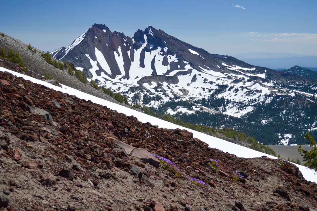
(Broken Top from the plateau)
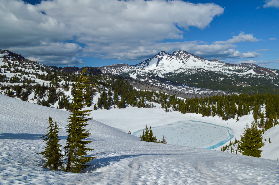
(Broken Top & Moraine Lake in May)
|
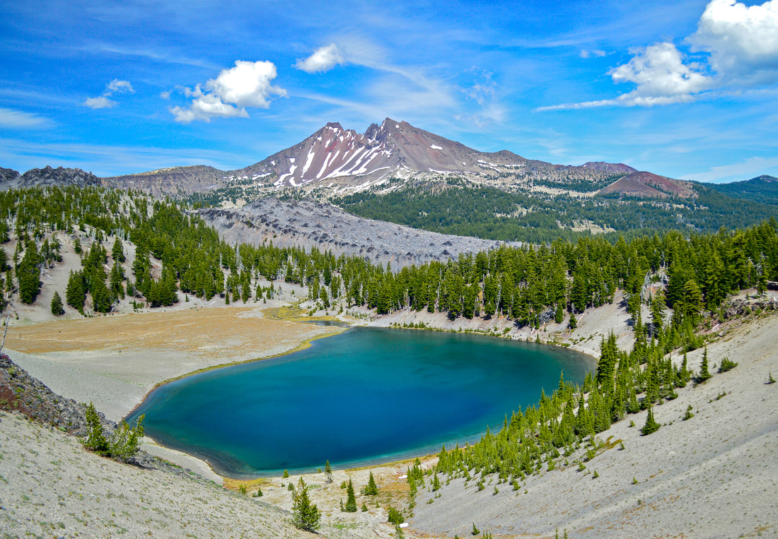
(Broken Top & Moraine Lake later in the summer)
|
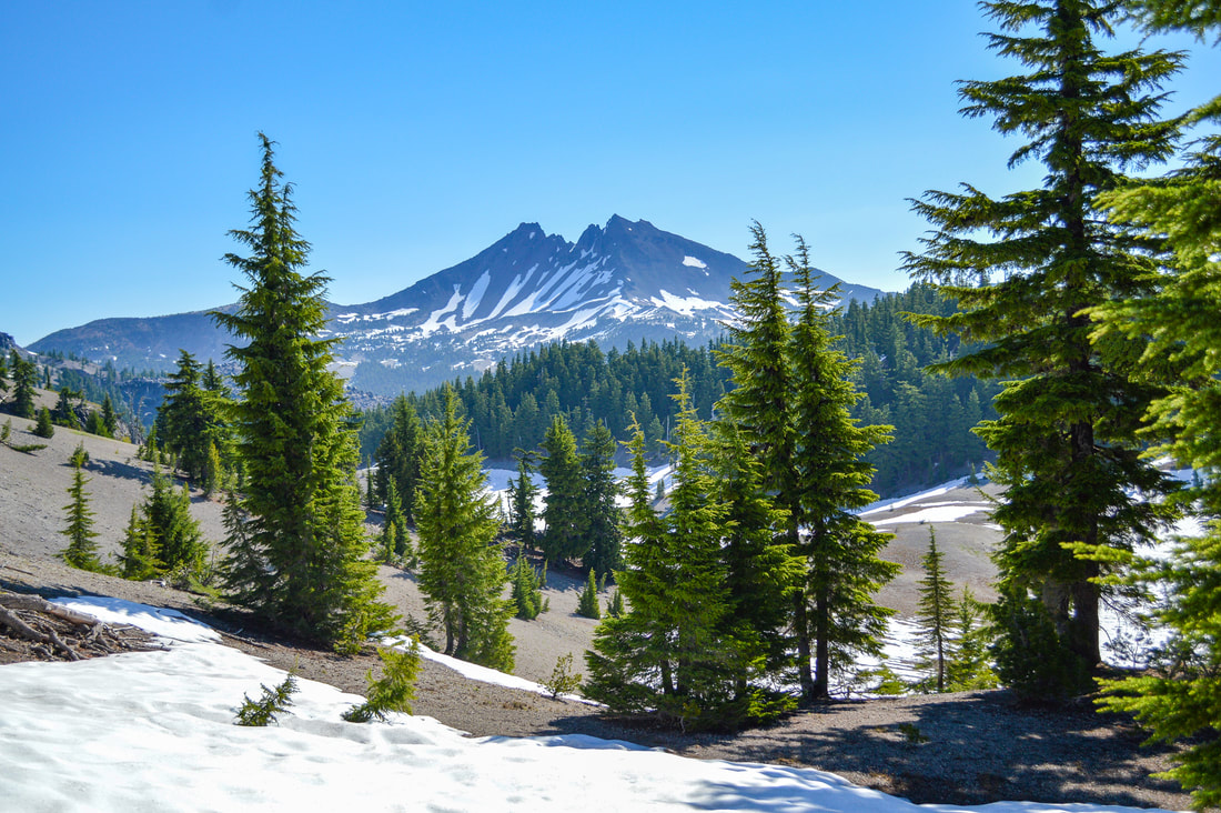
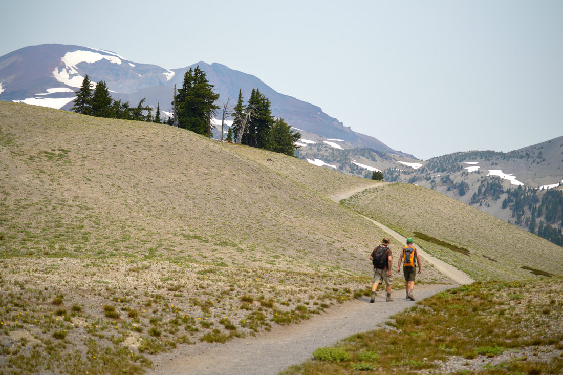
This next 1 mile section is the tamest part of the entire hike. Enjoy this part, as you easily hike along the plateau, marveling at the many views this hike has to offer. Broken Top and Moraine Lake to the east, Mt. Bachelor to the southeast, and grandiose South Sister looming out in front of you. From here it is hard to imagine that you are only 3 miles from the summit, since the mountain looks so far away. But these are 3 of the most strenuous miles! Even if you are in generally good shape, work out 4-5 days a week, eat healthy and hike with a pack at least once a week, this 12.5 mile hike with 5,000 ft. of elevation gain will take it out of you!
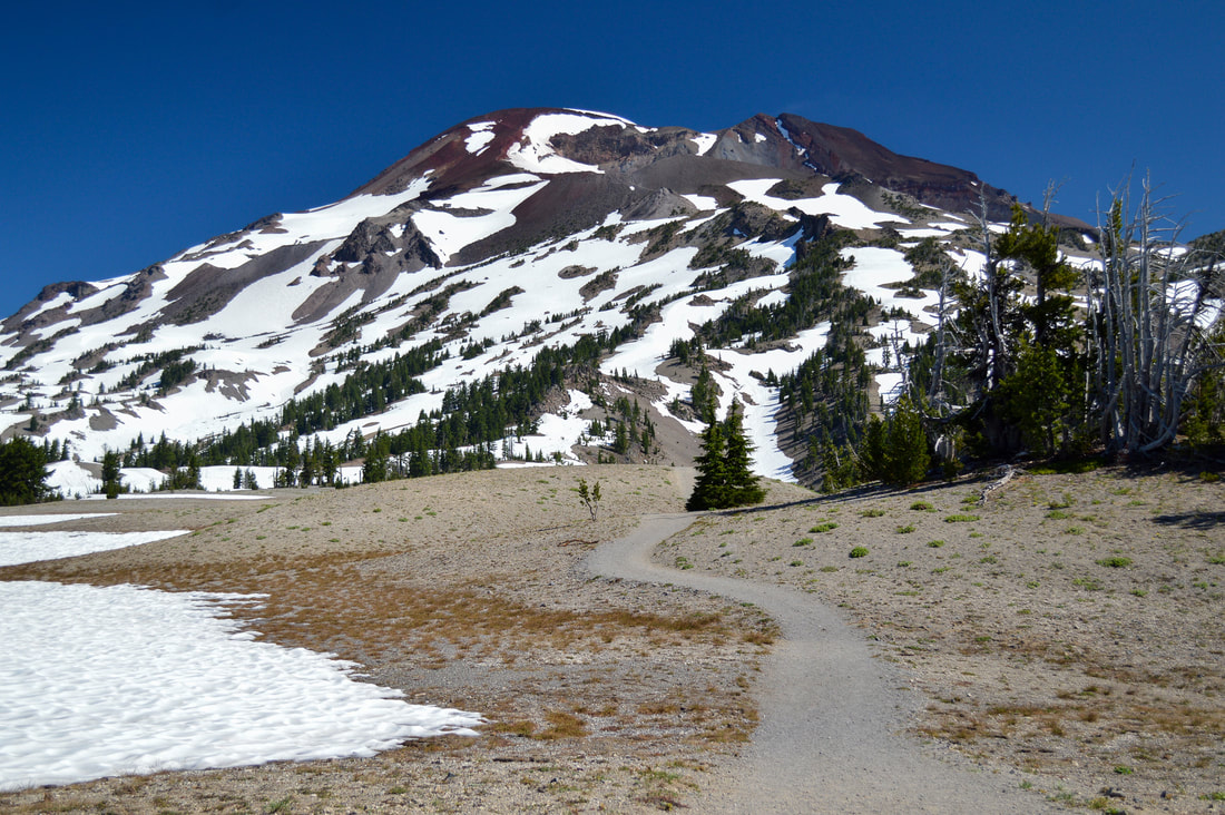
(South Sister)
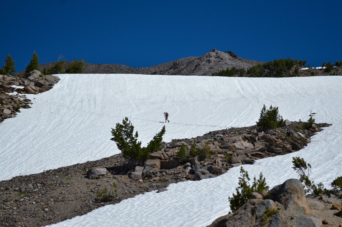
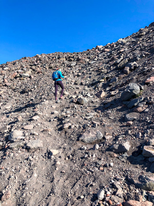
As quickly as it came, the semi-easy section of the hike is done. The next 1.5 miles up to Lewis Glacier are incredibly steep, but here you will have larger rocks to step on like stairs, which is a huge help. Once the large rocks end, the scree begins. The scree is loose and difficult to walk on, so this is where it is helpful if you go in early to mid-July because there will still be large snow fields that will help immensely with traction. The earlier in the morning you go the better, before the snow fields start to get slushy. Take some micro spikes and you will have a much easier time getting up the mountain.
(Broken Top)
(the red mile)
|
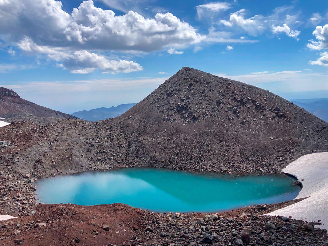
(glacial tarn by Lewis Glacier)
|
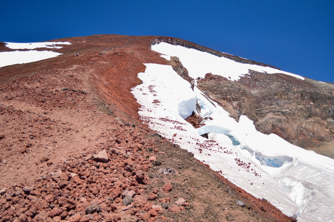
(the last push to the rim - this is a 45 degree incline)
|
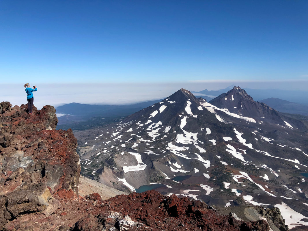
Once you have sight of Lewis Glacier and the beautiful turquoise colored glacial tarn, you will have hiked a total of 5 miles. Taking a break at the tarn is a really good idea before braving what is known as "the red mile". From the tarn it is 1 mile up to the rim and then 0.3 to the true summit. When you get to the rim of this majestic volcano, you will hike around the crater to the right to get to the other side and the true summit, where you can see the Middle Sister and North Sister, Chambers Lakes below and Mt. Washington, Three Fingered Jack, Mt. Jefferson and Mt. Hood to the north beyond. To the south you will see Mount Bachelor, the many lakes along the Cascade Lakes Highway, and Diamond Peak.
Even though in the summer it can be close to 90 degrees at the trailhead, being up at 10,358 ft. can be quite cold and windy. The mountain can often create its own weather so make sure to check mountain-forecast.com before going, to be sure you are not going to be in danger of being at the summit during a thunderstorm or possible snow/whiteout conditions. Always make sure to bring an extra wind layer and puffy coat with you for the summit. |
(South Sister summit)
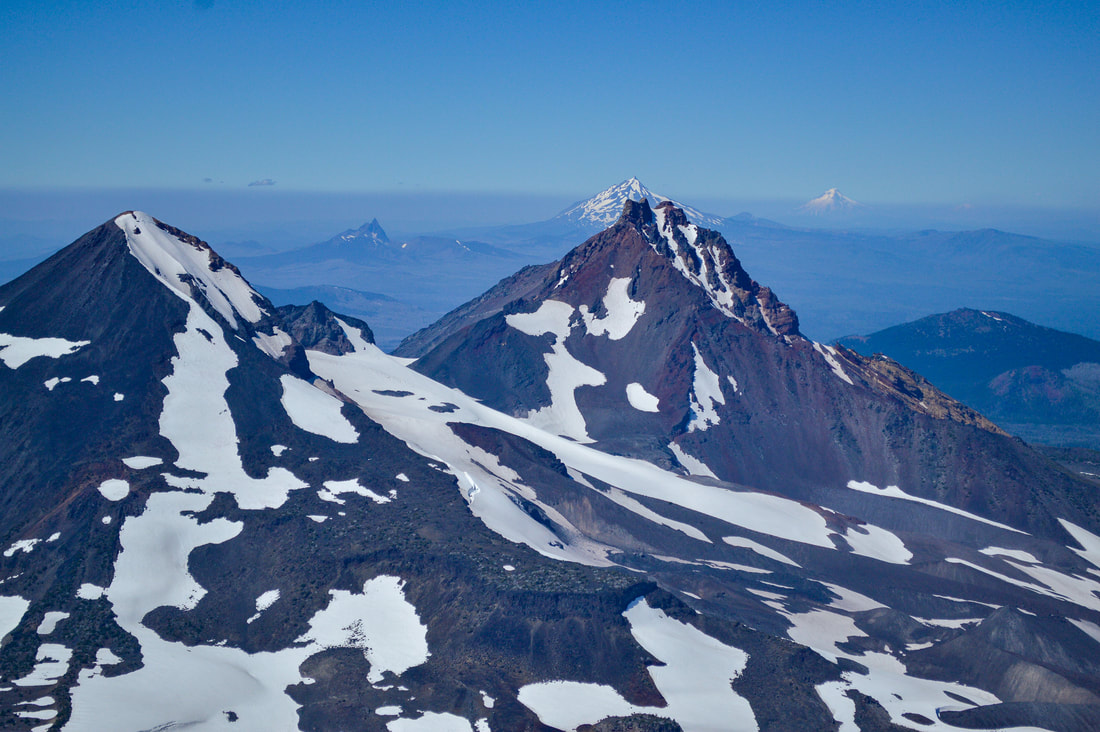
(view to the north from the summit - Middle Sister, North Sister, Three Fingered Jack, Mt. Jefferson, Mt. Hood)
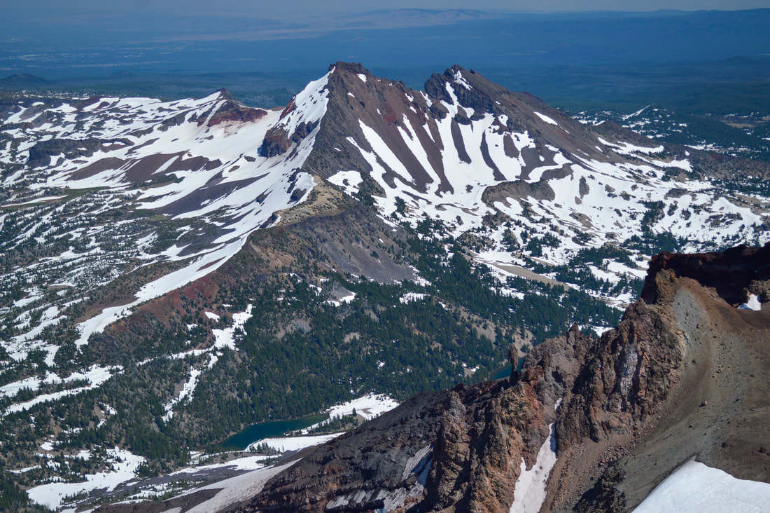
(Broken Top from South Sister summit)
On the way down your legs will most likely feel like jelly, and because of all of the loose rock it is easy to slide and fall. Trekking poles help a lot in this kind of terrain going up and coming back down, as they take a lot of pressure off of your muscles and joints. Gaiters are a must-have on this hike so that you don't end up with piles of rocks and sand in your shoes.
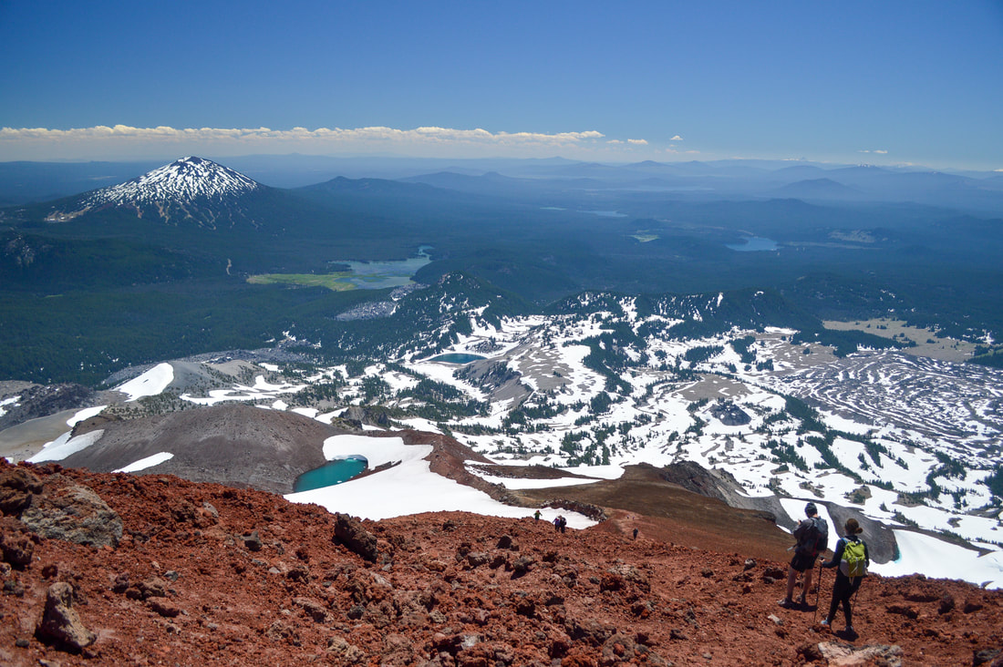
(view to the south of Mount Bachelor and Sparks Lake)
South Sister summit is a TOUGH hike! It is recommended that you do some training for this one. Keep in mind that the majority of this hike is above the tree line so there is no shade and it can get extremely hot in late July, August and early September. Make sure to bring at least 3 liters of water and a way to filter water for the trek back down. The trail is easy to follow, as it has become quite wide over the years due to its popularity, and at every trail junction there are signs. This hike is not for the faint of heart, but if you take your time, take lots of water and snack breaks, you will be rewarded by epic views from the top, and you will feel incredibly accomplished as you will have just climbed the 3rd tallest mountain in Oregon!
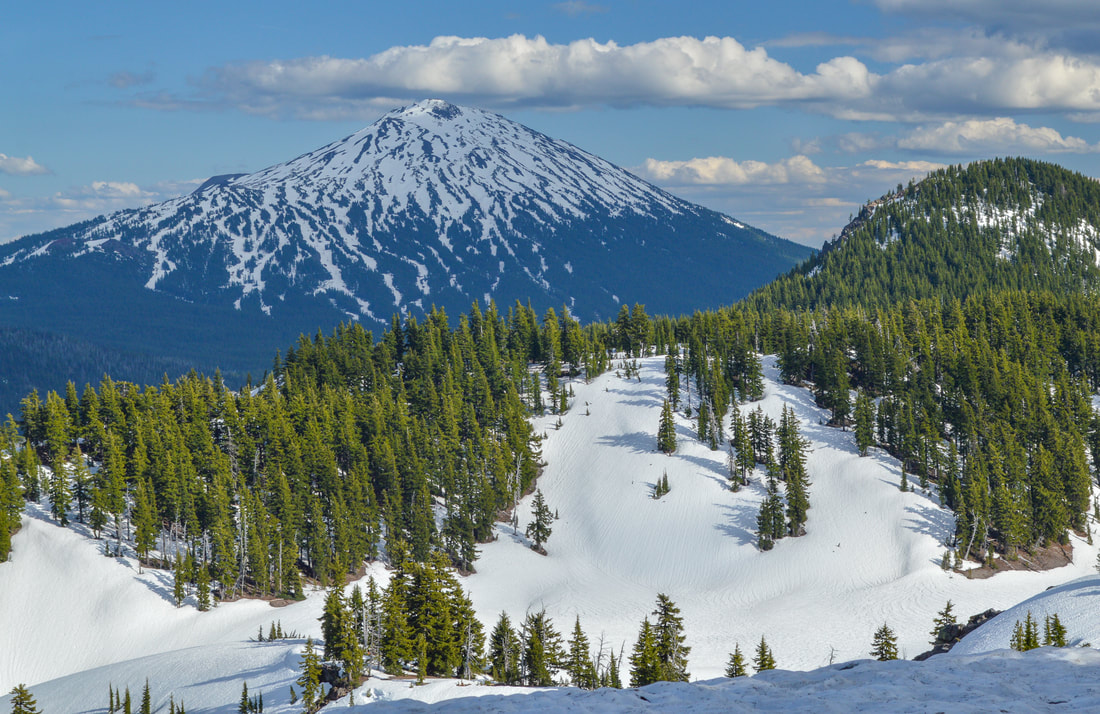
(Mount Bachelor from the South Sister climber trail in May)
Directions:
From Bend
- Drive 22 miles west on the Cascade Lakes Hwy. After passing the Mt. Bachelor Ski area, continue about 6.5 miles and turn left into the Devils Lake Campground. (Total of 28 miles).
- Drive east on Hwy. 58 for 79 miles to the Cascade Lakes National Scenic Byway/Crescent Cutoff Rd/NF-61. Turn left here and follow this road for 3.2 miles and then turn left at a sign for Cascade Lakes National Scenic Byway. Stay on this scenic road for about 41.6 miles and turn right into the Devils Lake Campground. (Total of 125 miles).
- Drive OR-62 east towards Crescent. After 55 miles at Union Creek you will merge left onto OR-230 and stay on this road for 23.8 miles and then turn right onto OR-138 for 17.7 miles. At the Diamond Lake Junction Cafe turn left onto US-97 north for 17.8 miles and then merge left onto OR-58 west towards Oakridge for 13.1 miles. Turn right at the Cascade Lakes National Scenic Byway/Crescent Cutoff Rd/NF-61 and follow this road for 3.2 miles and then turn left at a sign for Cascade Lakes National Scenic Byway. Stay on this scenic road for about 41.6 miles and turn right into the Devils Lake Campground. (Total of 174 miles).
- It is a total of 159 miles via Bend.
- It is a total of 190 miles via Mt. Hood, Madras and Bend.
|
-This trail write-up was last updated in May 2018-
*All pictures are taken by Franziska Weinheimer *Disclaimer: The trail descriptions, mileage, GPS tracks and difficulty ratings depicted on this website are never 100% accurate. Always hike at your own risk, using your own knowledge, equipment and common sense. Franziska Weinheimer/Hike Oregon are not responsible if you or anyone in your party gets injured or lost while attempting one of these or any other hikes.
|
To get a more in-depth and personal view of this hike, watch the YouTube video.
|