Ridgeline Trail
Hike details:
Mileage: 3.4 miles round trip w/ 400 ft. elevation gain (Blanton Ridge)
5.2 mile lollipop loop w/ 1,600 ft. elevation gain (Ridgeline Trail to Spencer Butte summit loop)
1.8 mile loop w/ 140 ft. elevation gain (Fox Hollow to Dillard loop)
1 mile round trip w/ 250 ft. elevation gain (Mount Baldy) or 1.7 mile loop w/ 420 ft. elevation gain (Mount Baldy loop)
Approximate hike time: Depends on which section you hike
Difficulty: Easy to moderate
Trail usage: High on weekends, low on weekdays
Highest elevation: 2,064 ft. (the summit of Spencer Butte) Lowest elevation: 928 ft.
General location: 3 miles south of downtown Eugene - Blanton Ridge, Spencer Butte Park, Amazon Headwaters, Mount Baldy
Accessible: Year-round
(Best time to go is April for blooming wildflowers and October for fall foliage).
Permits required: N/A
Pit toilet at trailhead: Depends on which trailhead you start at
Trail allows: Dogs on leash
Possible dangers: Poison oak
|
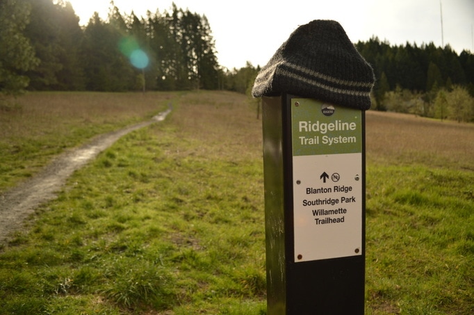
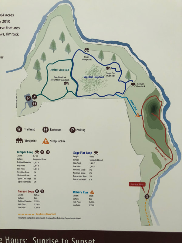
Description:The entire Ridgeline Trail system ties together right around 8 miles of trail one way, which makes it quite a long trip for a casual hiker, but many people do trail run it daily. Luckily, the Ridgeline Trail has four distinct sections and separate trailheads.
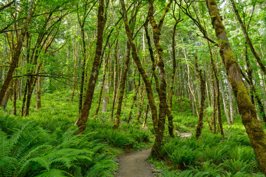
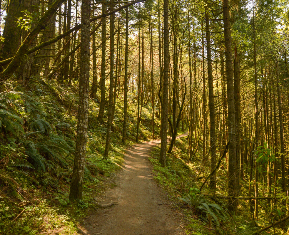
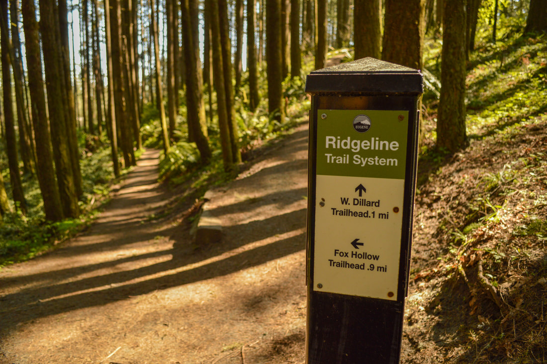
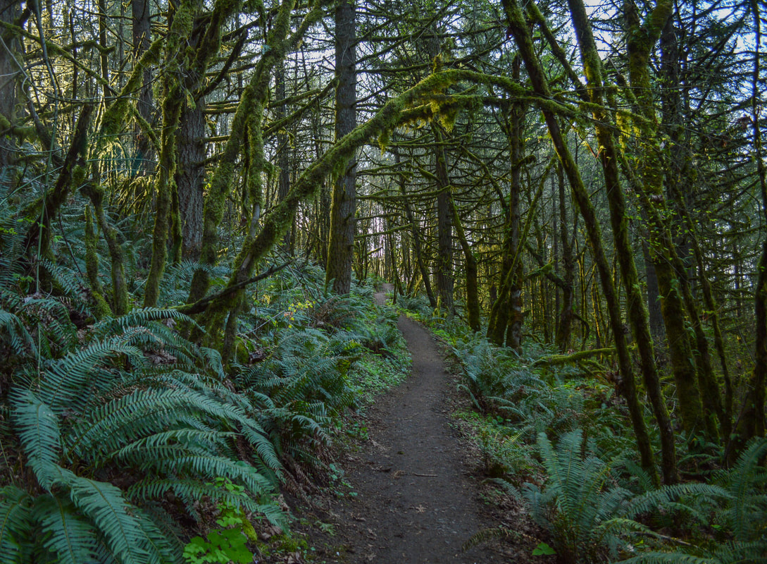
Section 1 Blanton Ridge to Willamette Street is 1.7 miles each way. The parking area is very easy to find, right off of Blanton Rd. and the trail starts off in the middle of a neighborhood so you're kind of thinking "how is this a hiking trail?" but once you are on the trail, it quickly disappears into a lush green forest. The trail is well maintained is a mixture of compacted gravel and compacted dirt (which can get a bit muddy in the winter and early spring). |
|
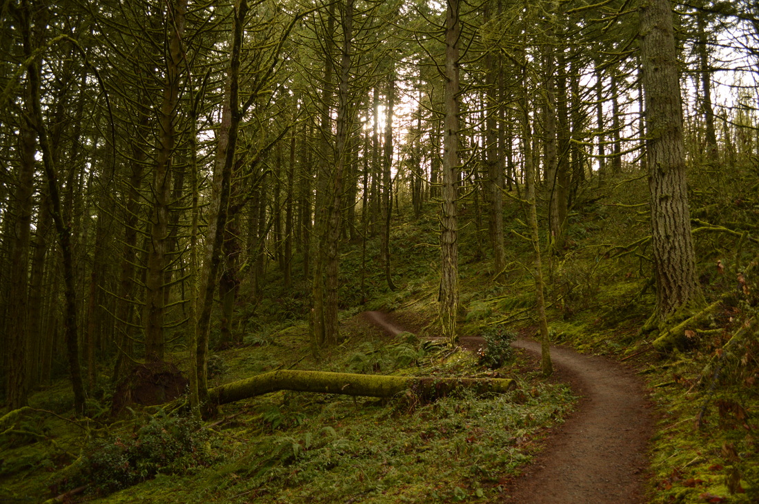
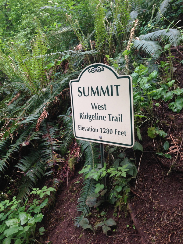
It is quite a narrow trail and this section has a slow climb to what they call the West Ridgeline Trail summit at 1,280 ft. Because this section of the trail is in between two residential neighborhoods, you do see quite a few people, especially runners and people walking their dogs, as well as some houses along the way. There is a viewpoint towards the end of the trail, where you see the big Oregon Ducks "O" on Autzen Stadium through the trees.
This is the perfect little hike to go on when you don't have a lot of time but still want to get out and experience some nature. The trail is perfect for little kids, because it isn't difficult at all, the path is extremely easy to walk on and there are some beautiful things to see. |
|
(view of Autzen Stadium through the trees)
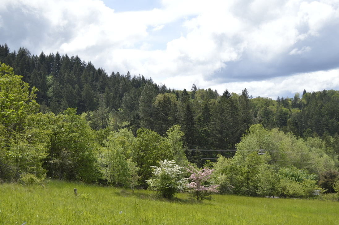
(meadow and flowering trees near the trailhead)
Directions to Blanton Road trailhead: From downtown Eugene take 18th Ave. W then turn left onto Chambers St. Go all the way up Chambers until it T's. Here turn left onto Crest Dr. until you come to another T junction. Turn right here and this road will turn into Blanton Rd. The trailhead will be on your left.
|
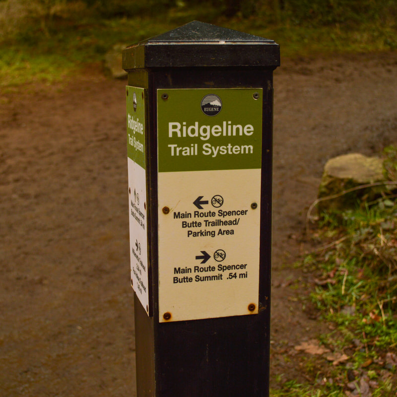
Section 2 Willamette St. to Spencer Butte summit.
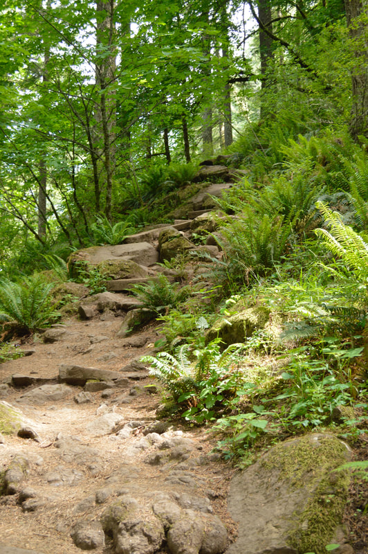
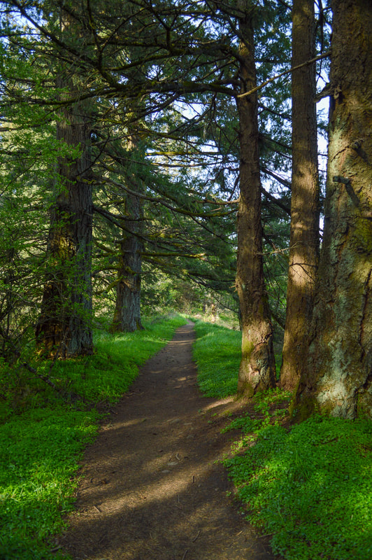
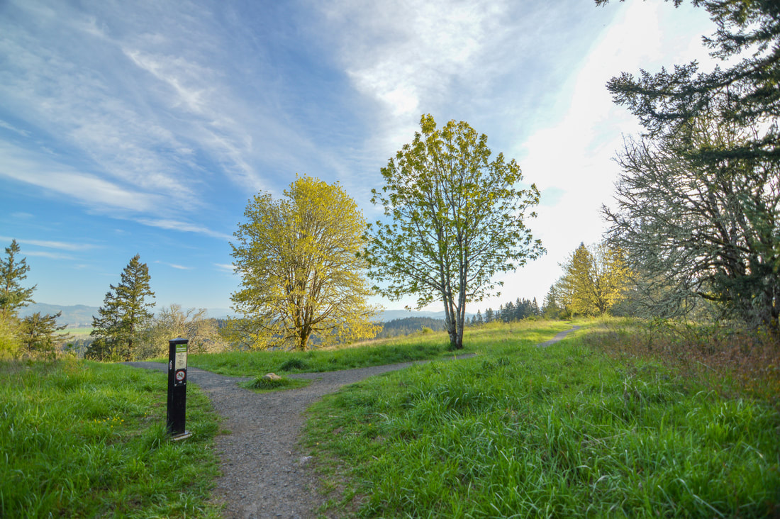
Most people who live in Eugene have done the Spencer Butte hike, but the majority of people do it from the Spencer Butte trailhead. From there it is a 2 mile hike up to the summit. If you want more, you can park at the Willamette St. Ridgeline Trail System trailhead and make the hike a more challenging 5.2 mile lollipop loop. From the Willamette St. trailhead you will follow the Ridgeline Trail for 1.2 miles. At first the woods are a bit sparse, but they quickly become very lush, with lots of bright green fern undergrowth and tall evergreen trees. The trail is very smooth and well maintained, however because this area is so lush and wet, it does tend to get pretty muddy in the winter season, so it's best to wear good hiking shoes! |
|
After 1.2 miles you will come to a marked trail junction. The Ridgeline Trail continues straight another 0.7 miles to the Fox Hollow Rd. trailhead. However, if you want to go up Spencer Butte you will follow the well-marked signs and turn right. Here the trail starts to climb uphill a bit more, and you will continue for 0.7 miles until you come to a T-junction.
|
|
If you are doing the lollipop loop, you will take a left and take the west side trail up to the top of Spencer Butte and head down the east side trail (main route). If it is wet and slippery, it is not recommended to go the west side trail because there are many more steep rocks to climb up, which can be dangerous when they are wet. Regardless of the weather, this route is not recommended to those with small children (under the age of 6 or 7).
|
(west side summit trail is very steep and slippery)
|

(Spencer Butte summit)
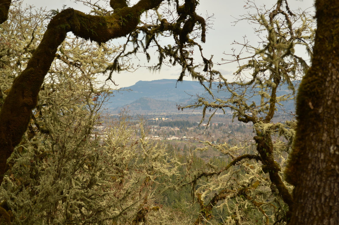
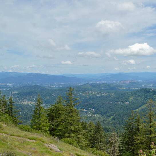
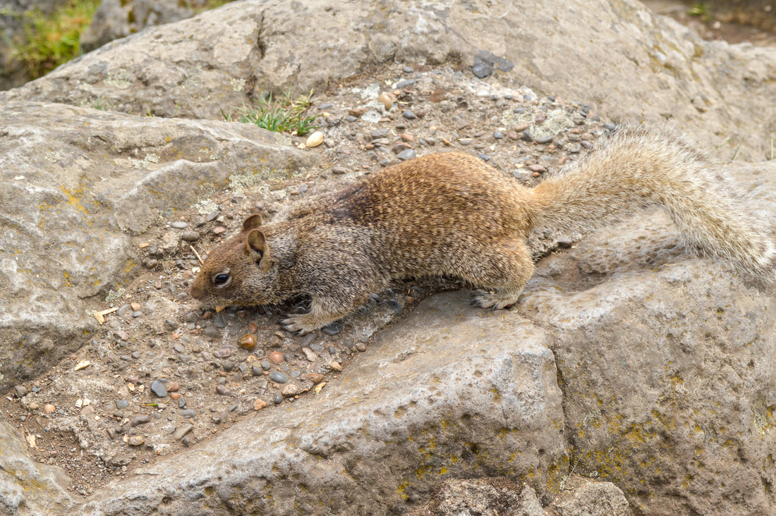
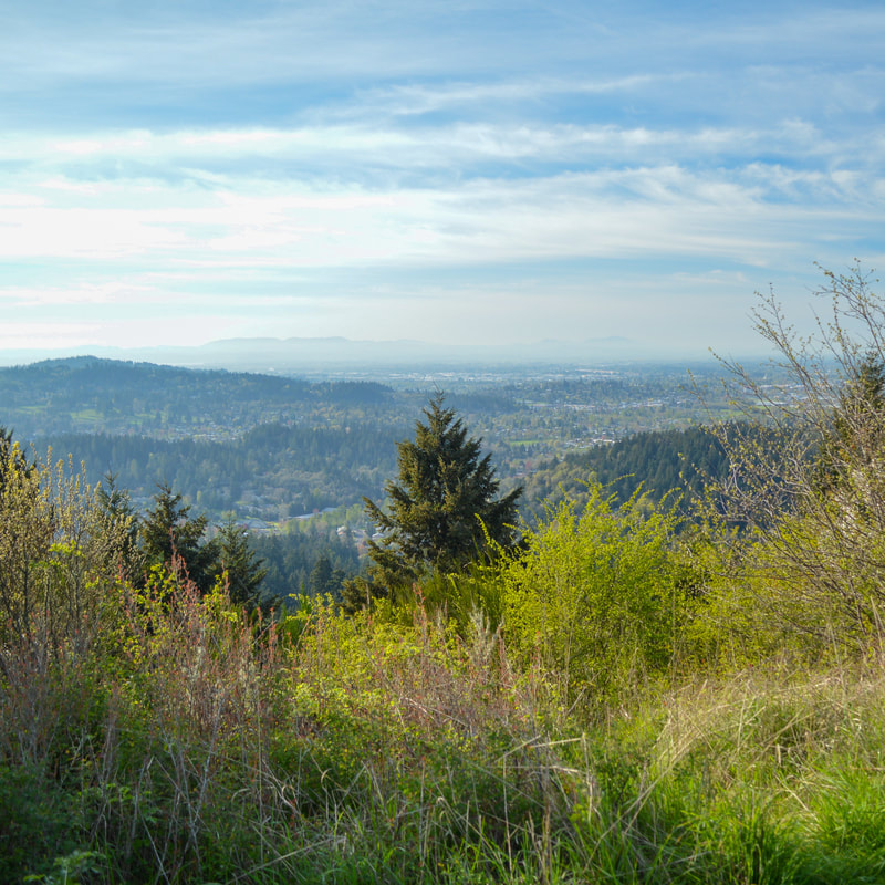
The top of Spencer Butte is awesome, with lots of rocks to sit on and enjoy the 360 degree view. If it's a clear day, you will be rewarded with views across Eugene and Springfield, as well as Fern Ridge Reservoir, the coast range to the west, and on a really clear day even the Three Sisters can be seen to the east. There are a lot of fat squirrels that hang out at the top, begging for your food. Please adhere to the Leave No Trace Principles, and DON'T FEED THEM!!!
|
This section of the Ridgeline Trail to the Spencer Butte summit trail is a great hike, especially for practically being in the heart of Eugene. Please remember, if you have physical limitations in any way, it is not recommend that you do the more difficult west side trail up to the summit. On the east trail (the main Spencer Butte trail) to the summit, they have carved stairs into what once was incredibly slick worn rock for easier stepping, making this the better route to take if you have kids with you.
|
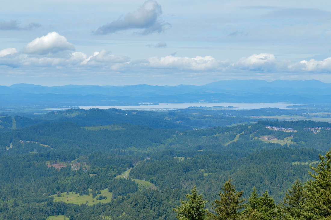
(view of Fern Ridge and the Coast Range from Spencer Butte summit)
Directions to the Willamette St. trailhead: From downtown Eugene head S on Willamette St. until there is a Y split. Keep right on Willamette St. and continue 2 miles until you see the Ridgeline trailhead on your left.
|
Section 3 Fox Hollow Road to Dillard Road
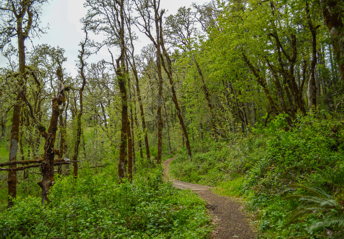
This short 1.8 mile loop from Fox Hollow Road to Dillard Road is beautiful, gains almost no elevation and is the perfect family friendly afternoon springtime walk. In the spring you will see the many ferns unfurl their new bright green growth, and in the month of April you will find an abundance of wildflowers along the trail such as white trillium, violet colored Pacific hound's tongue and Oregon fawn lilies. At the Fox Hollow trailhead you will take the Ridgeline Trail to the right and after 0.85 miles of hiking through this lush green forest, you will see another sign post. Unless you have a car at the Dillard Road trailhead, you will just continue on the Ridgeline Trail, which loops around and takes you back to the Fox Hollow trailhead. This is really a great section of the Ridgeline Trail located within the boundaries of the Amazon Headwaters. It is lush and green and perfect for an afternoon of forest bathing. |
(white trillium)
|
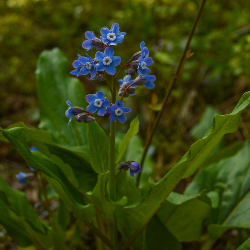
(Pacific hound's tongue)
|
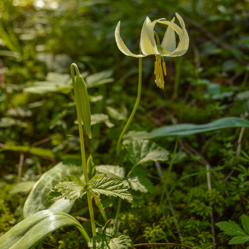
(Oregon fawn lily)
|
Directions to Fox Hollow trailhead: From downtown Eugene drive S on Hilyard St. then take West Amazon Dr. for 0.7 miles. Turn right onto Fox Hollow Rd. and drive for 2.2 miles. Across the street from the Cascade Raptor Center you will see the trailhead on your left.
|
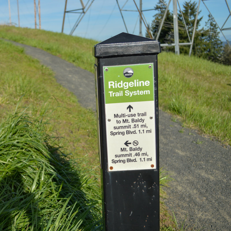
Section 4 Dillard East trailhead to Mount Baldy
The Dillard Skyline Path is a semi-steep gravel trail that leads up to the top of Mount Baldy. The trailhead holds 9 cars and the trail takes you underneath some power lines up through a meadow with expansive views to the south. There are large mansions built on the hillside so the trail up to the summit isn't as much in nature as some of the other Ridgeline Trail sections. After just under half a mile you will arrive at the top of Mount Baldy where you will see views of Eugene and some beautiful deciduous trees. From the summit you can choose if you want to go through the forest downhill 0.6 miles to the Spring Blvd. trailhead and from there you can take a trail 0.7 miles along the base of Mount Baldy and complete a loop. Or you can enjoy the summit and go back the way you came, making it a 1 mile round trip hike. |
|
(view towards Eugene from Mount Baldy)
|
Whether you do the 1.7 mile loop or the 1 mile round trip hike, this section of the Ridgeline Trail is a great neighborhood walk up to Mount Baldy. This trail is very family and dog friendly and you will get some beautiful views, and lots of lush forest undergrowth like ferns and springtime wildflowers.
Directions to Dillard East trailhead: From downtown Eugene drive S on Hilyard St. then take E Amazon Dr. for 1.1 miles, then turn left onto Dillard Rd. for 1.4 miles. Turn left onto Hidden Meadows Dr. and immediately find the East Dillard Trailhead parking area on your left.
-This trail write-up was last updated in 2022-
*All pictures are taken by Franziska Weinheimer
*All pictures are taken by Franziska Weinheimer
*Disclaimer: The trail descriptions, mileage, GPS tracks and difficulty ratings depicted on this website are never 100% accurate. Always hike at your own risk, using your own knowledge, equipment and common sense. Franziska Weinheimer/Hike Oregon are not responsible if you or anyone in your party gets injured or lost while attempting one of these or any other hikes.