Hobbit Beach to Heceta Head
Hike details:
Mileage: 0.75 miles round trip w/ 190 ft. elevation gain (to Hobbit Beach)
3.2 miles round trip w/ 700 ft. elevation gain (Hobbit Beach and Heceta Head Lighthouse)
Approximate hike time: 1 hour 23 minutes w/ an average pace of 2.3 mph (for the full 3.2 mile hike)
Difficulty: Easy to moderate
Trail usage: High on weekends, low on weekday mornings
Highest elevation: 480 ft. Lowest elevation: 0 ft.
General location: 12.5 miles north of Florence - Heceta Head Lighthouse State Scenic Viewpoint
Accessible: Year-round
(Best time to go is January and February when the Oregon Coast typically has really nice weather).
Permits required: N/A to park at Hobbit Trail trailhead
Pit toilet at trailhead: No
Trail allows: Dogs on leash
Possible dangers: Sneaker waves on the beach
|
Description:This beautiful and popular hike from Hobbit Beach to Heceta Head is the perfect outing even if it's cloudy or rainy. Enjoy mystical trees, magical pathways through bushes and sand dunes to aptly named Hobbit Beach. The trail to Heceta Head Lighthouse offers coastal views, incredible forest scenery that seems straight out of a storybook, and then you can enjoy the history of this cute Oregon lighthouse.
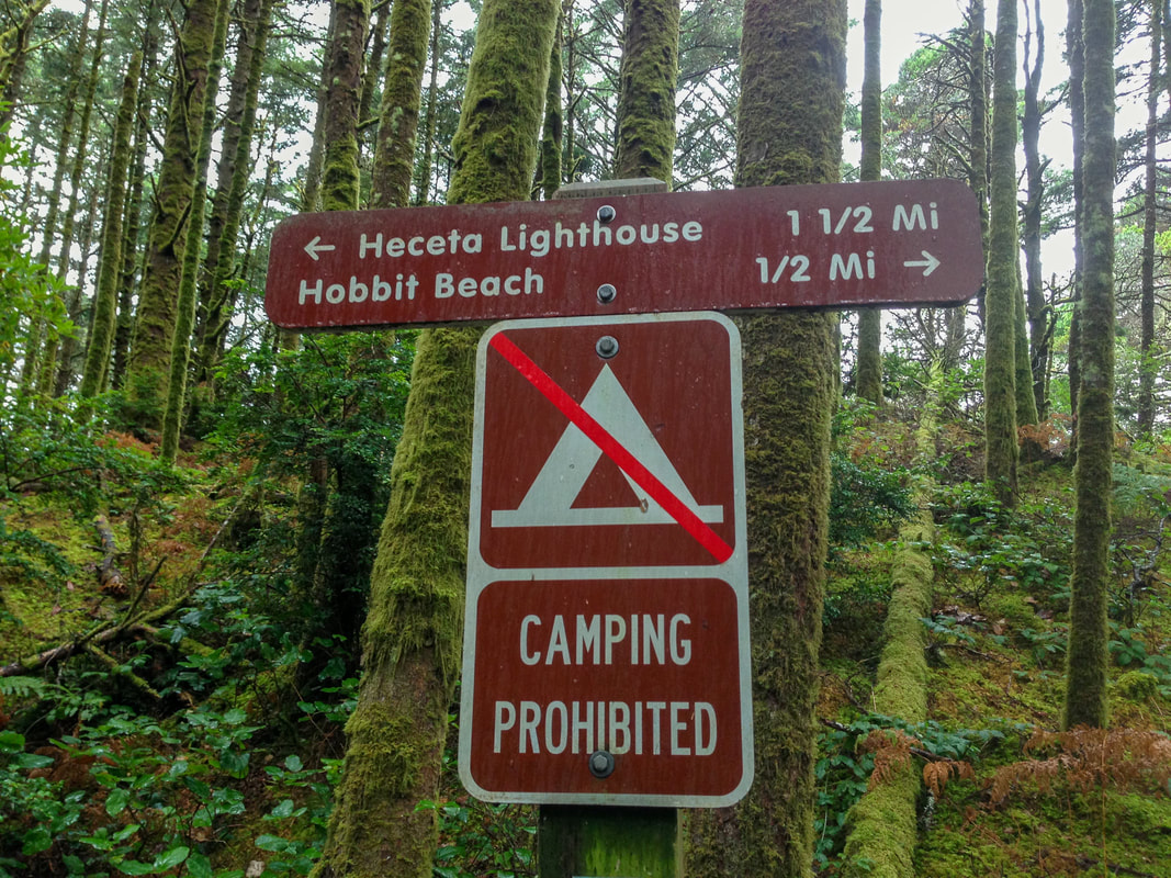
The parking area is located on the side of Highway 101 (there is a small gravel pull off that has a small hiking sign by it). You have to cross the highway to get to the trail. After crossing US-101 you will enter a thick mossy forest where you will see two trails and a sign. You can either go right to Hobbit Beach or left to Heceta Head Lighthouse. Since both trails are extremely short, combining them makes for a nice 3.2 mile hike. |
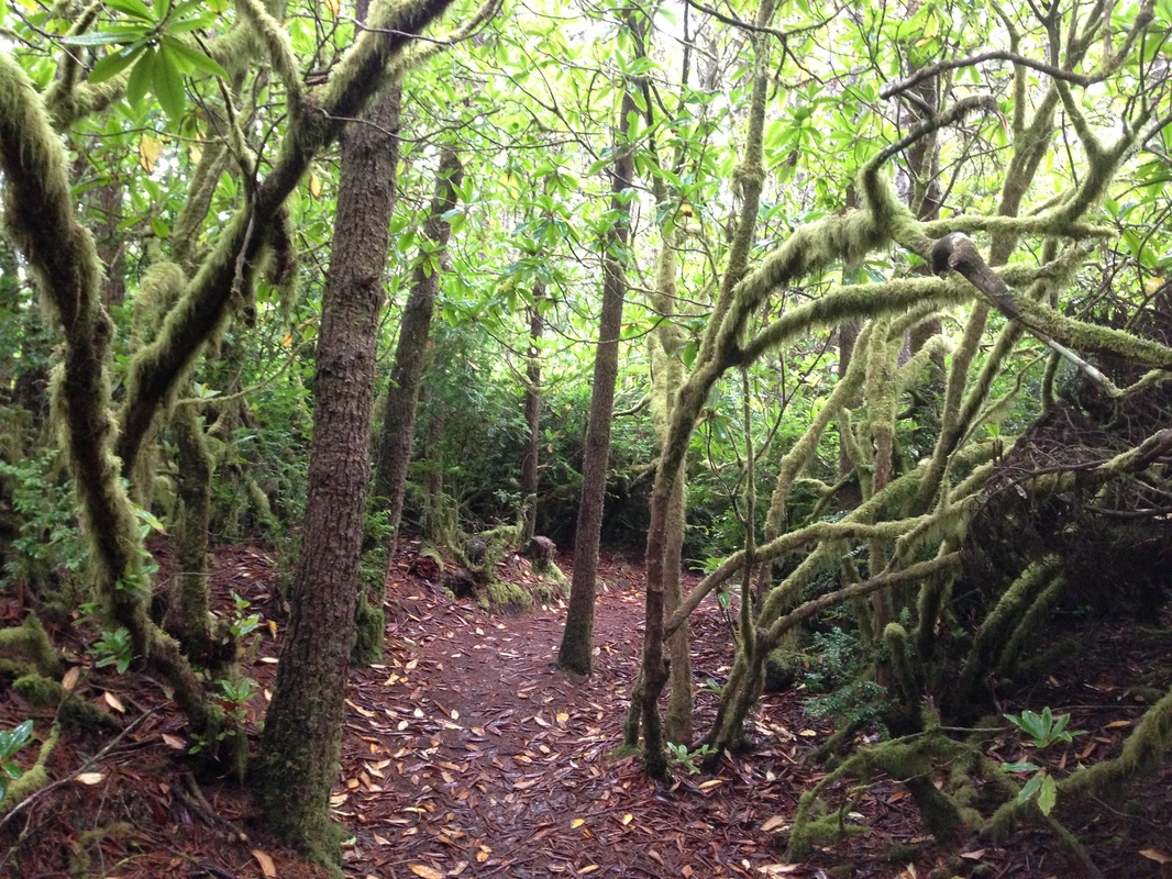
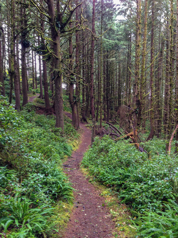
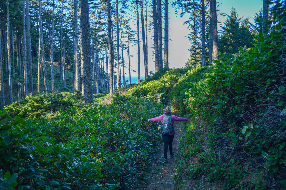
It is recommended to take Hobbit Trail to Hobbit Beach first, as the crowds tend to come in throngs starting after 10am. This trail is gorgeous, mossy trees everywhere as you make your way down towards the beach. At the end, the trail takes you through a tunnel of thick bushes and people have lined it with crab shells and seashells. The whole trail is magical and you're half expecting a gnome or hobbit to pop out at any moment.
|
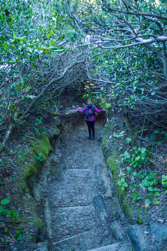
(tunnel through the bushes)
|
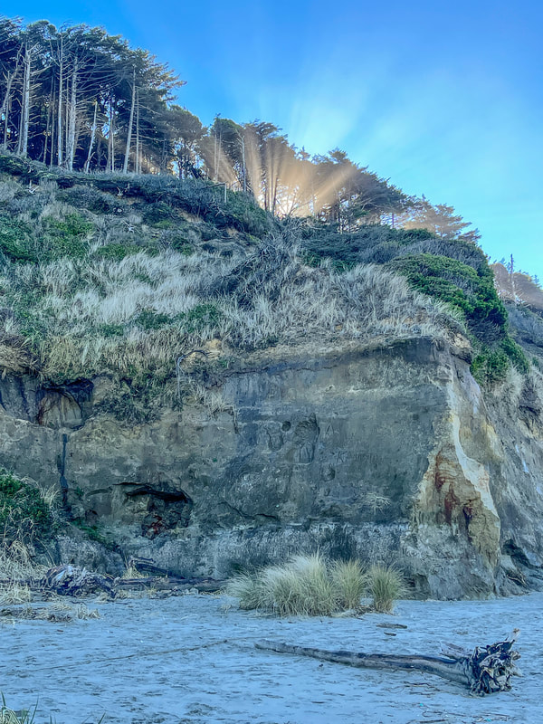
(the cliffs at Hobbit Beach)
|
|
|
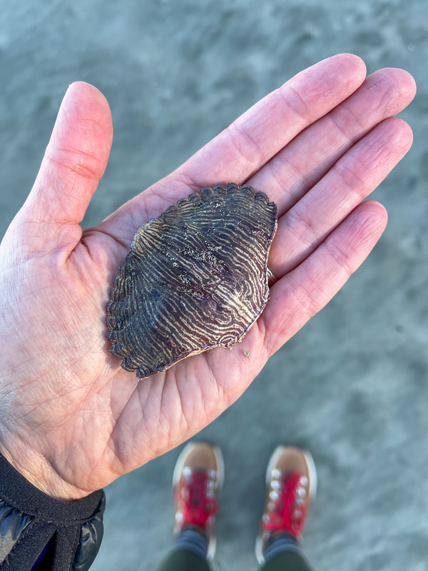
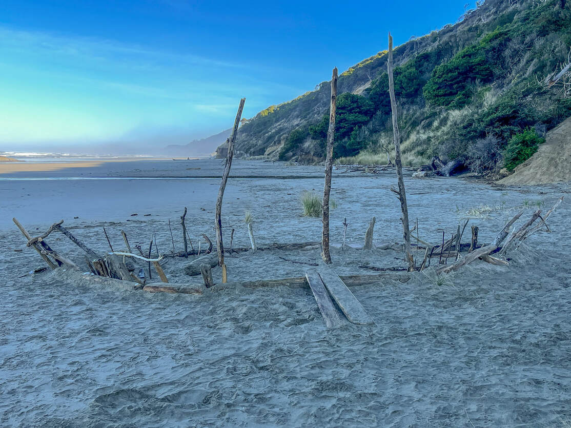
Hobbit Beach is beautiful and has lots of seashells, crab shells and driftwood. You will often times see fun things built with the driftwood like ships or little forts for kids to play on. It is a lovely beach and there isn't access to it other than the trail so it tends to stay pretty secluded.
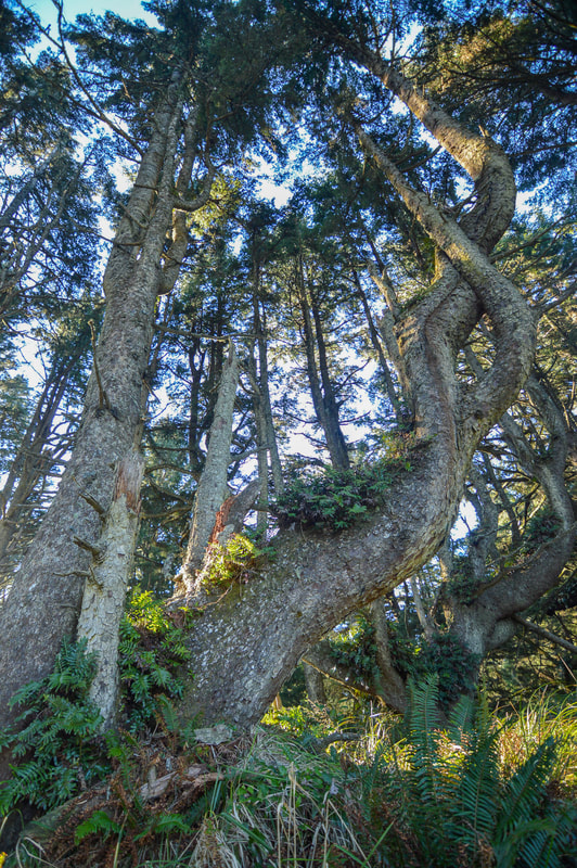
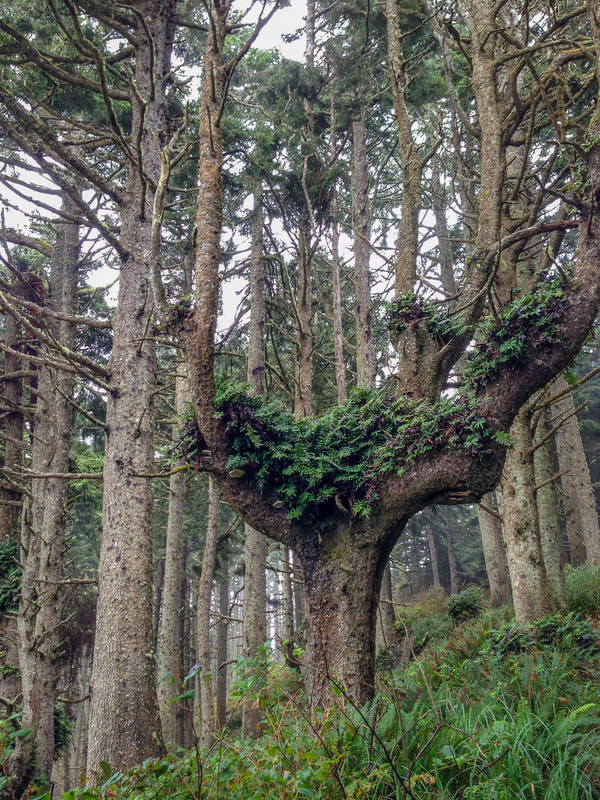
After checking out Hobbit Beach, head back up the trail to the sign you saw at the beginning and now you will take the Heceta Head Trail that takes you uphill through a stunning forest of gnarled and twisted trees, many of which look like octopus tentacles. These ancient trees have ferns growing in the crook of their branches. After 1 mile of hiking on the Heceta Head Trail, you will get a great view of Hobbit Beach through the trees. |
|
|
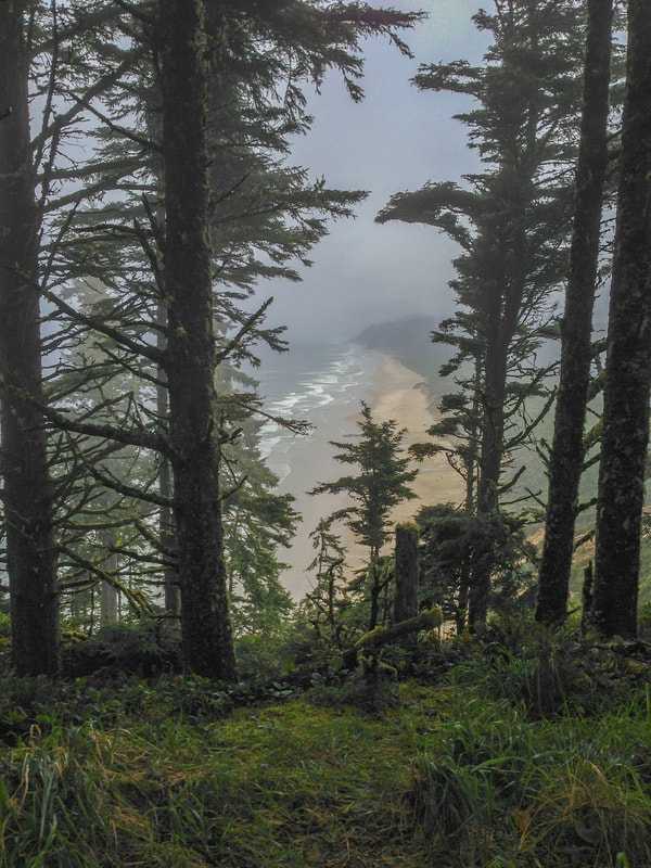
(the view from the highest point of the trail looking out over Hobbit Beach)
|
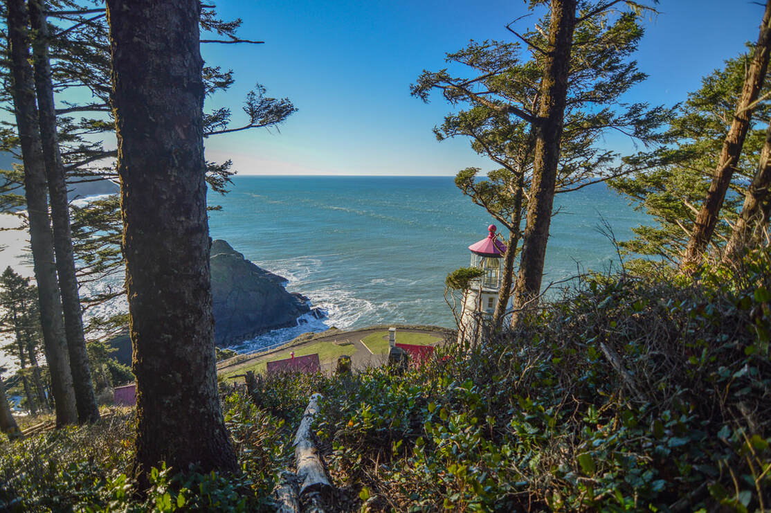
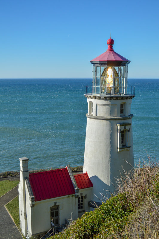
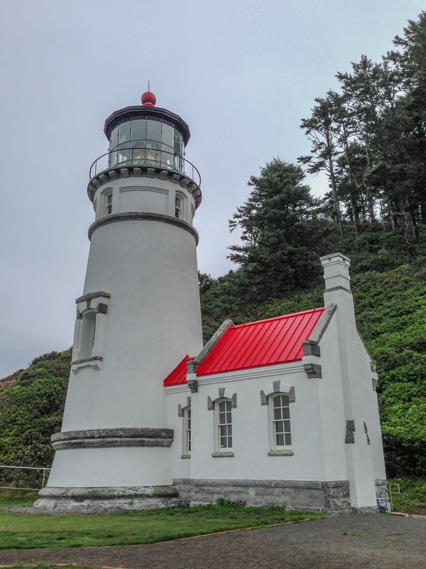
From the viewpoint you will hike downhill all the way to the light house. There are great view of the ocean, the light house itself as well as Cape Cove. The Heceta Head Lighthouse is very cute (much smaller than you imagine), and there are personal tours that run every 20 minutes that take you inside the lighthouse and give you all of the history. It was first lit in 1894, and now its automated light can be seen for 21 miles from land. After checking out the lighthouse and surrounding area (this is also a great place to sit and have a snack or lunch break), you will return the way you came, going back up and over the bluff and back down to the Hobbit Trail trailhead where you parked your car.
|
|
|

(Cape Cove as seen from the Heceta Head Lighthouse)
These two short trails are highly recommended to everyone because of the stunning iconic scenery of the Oregon coast! The whole family will love this area because there is something here for everyone, hobbit holes, a beach, views, lighthouse history and an amazing coastal forest with an abundance of plants. Whether you're an Oregon local or visiting the state, Hobbit Beach and Heceta Head are two must-see places while you're traveling between Florence and Yachats!
Directions:
From Florence
- Drive US-101 N for a total of 12.5 miles and find the trailhead parking on your right. There is room for about 10ish cars. (Total of 12.5 miles)
- Drive on OR-22 W for a total of 9.2 miles, then use the right lane to take the OR-99W ramp to Monmouth/McMinnville for 0.5 miles. Turn right onto OR-99W S/Pacific Ave N for 13.4 miles, then turn right onto Airlie Rd. for 5.9 miles. Turn left onto Maxfield Creek Rd. for 7.4 miles, then turn left onto OR-223 S for 7.1 miles. Turn right onto Priest Rd. for 0.9 miles, then turn right and becomes US-20 W/Corvallis-Newport Hwy. for 36.9 miles. Turn left onto US-101 S for 36.8 miles and find the trailhead parking on your left. There is room for about 10ish cars. (Total of 119 miles)
- Drive I-5 N for a total of 105.9 miles, then take exit 136 for OR-138 toward Sutherlin/Elkton. Turn left onto OR-138 W for 24.2 miles, then urn left onto OR-38 W for 36.2 miles. Turn right onto US-101 N for 34.3 miles and find the trailhead parking on your right. There is room for about 10ish cars. (Total of 203 miles)
- Total of 74 miles via Florence.
- Total of 168 miles via Salem.
- Total of 205 miles via Eugene and Florence.
-This trail write-up was last updated June, 2022-
*All pictures are taken by Franziska Weinheimer
*All pictures are taken by Franziska Weinheimer
*Disclaimer: The trail descriptions, mileage, GPS tracks and difficulty ratings depicted on this website are never 100% accurate. Always hike at your own risk, using your own knowledge, equipment and common sense. Franziska Weinheimer/Hike Oregon are not responsible if you or anyone in your party gets injured or lost while attempting one of these or any other hikes.