Watson Falls
Hike details:
Mileage: 1 mile loop w/ 425 ft. elevation gain
Approximate hike time: 26 minutes w/ an average pace of 2.3 mph
Difficulty: Easy
Trail usage: High on summer weekends, medium on fall weekends, low on weekdays
Highest elevation: 3,057 ft. Lowest elevation: 2,744 ft.
General location: 61 miles east of Roseburg - Umpqua National Forest
Accessible: Late March through mid-December
(Best time to go is end of September and early October for prime fall foliage. Late March, April and early May are great for prime water flow).
Permits required: N/A
Pit toilet at trailhead: Yes
Trail allows: Dogs on leash
Possible dangers: N/A
(Watson Creek)
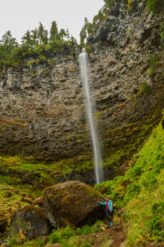
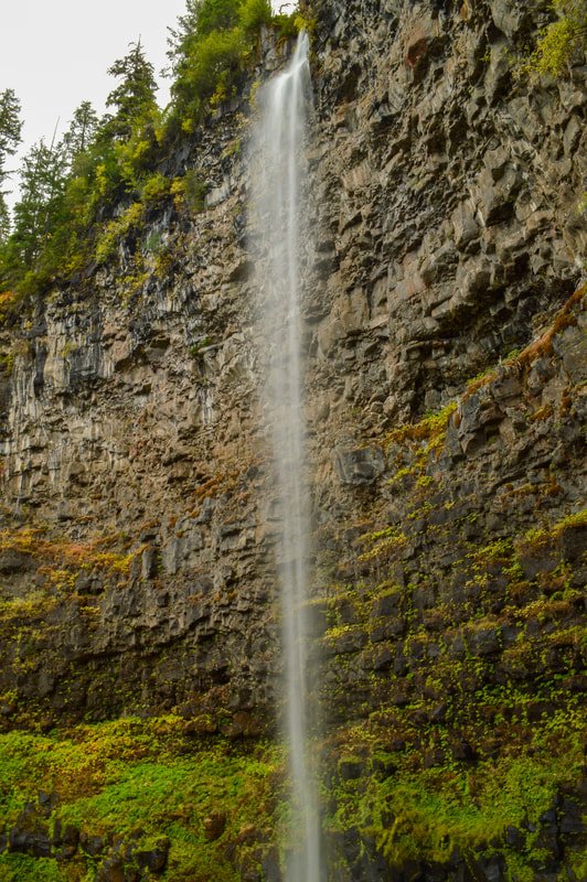
Description:Watson Falls is Oregon's 3rd tallest known waterfall. Its impressive 294-foot continuous drop can be seen from two viewpoints along this 1 mile, family friendly loop trail.
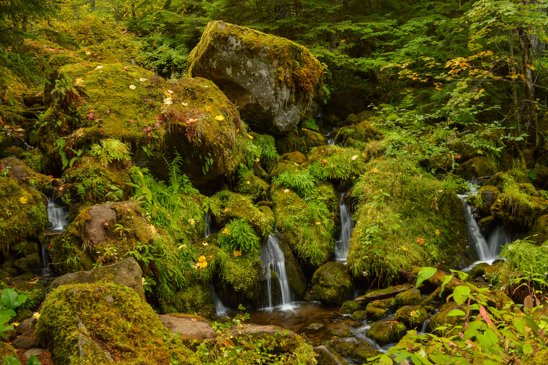
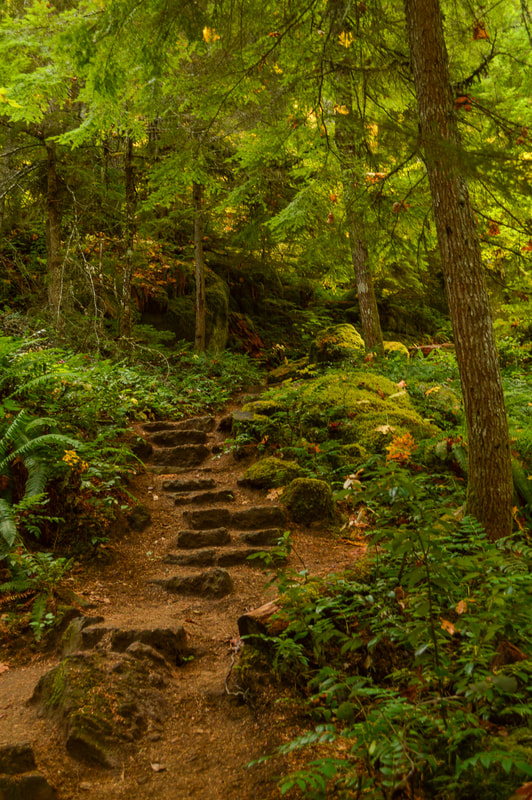
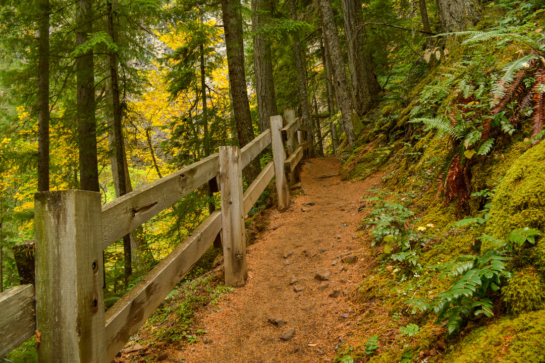
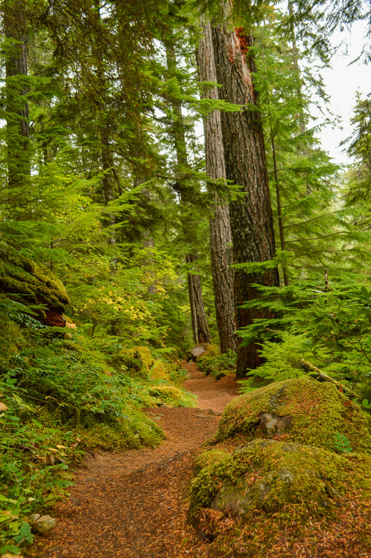
Begin the hike on the south side of the large parking area. You will cross NF-37 and you will see where the trail heads into the forest. The lush understory is full of large ferns, mosses, salal, Oregon grape and vine maples. The vine maples turn golden and eventually orange and red throughout late September and into early to mid-October. Follow the trail for 0.25 miles before coming to a trail split with a sign. This is a small loop that you will take on your way back. Continue straight on the trail up the hill and cross a small bridge before coming to the lower viewpoint of Watson Falls. |
|
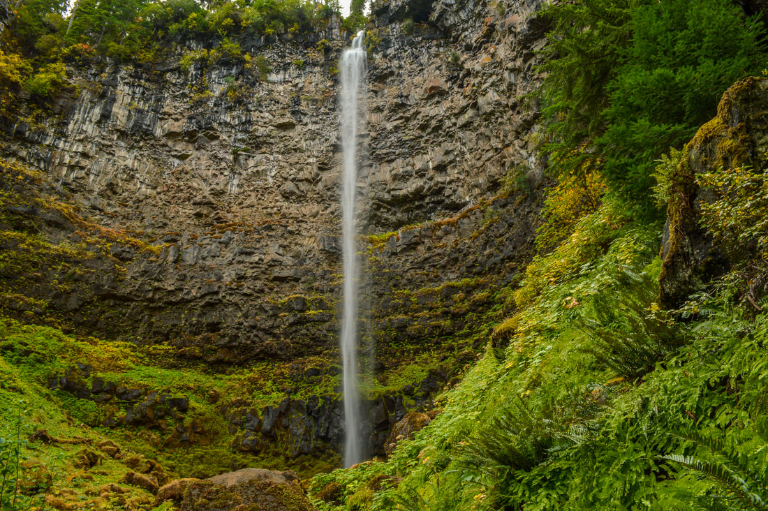
(Watson Falls from the lower viewpoint)
|
The lower viewpoint is spectacular and you are able to see the whole waterfall as it plunges over the basalt lava rocks. Watson Falls has flow year-round, but in spring this waterfall is the most impressive with tremendous water flow!
|
|
|
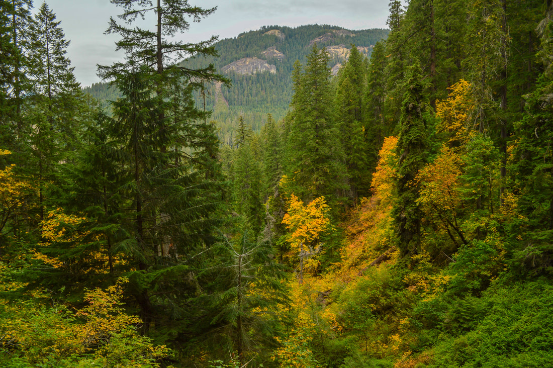
After enjoying the lower viewpoint, you can continue up the trail for another 0.25 miles to the upper viewpoint. The upper viewpoint lets you see the waterfall from about halfway up, which makes it difficult to get a picture of the entire waterfall from here. But you will be able to see the valley below, and if you come in the fall, the foliage across the hillside is stunning!
|
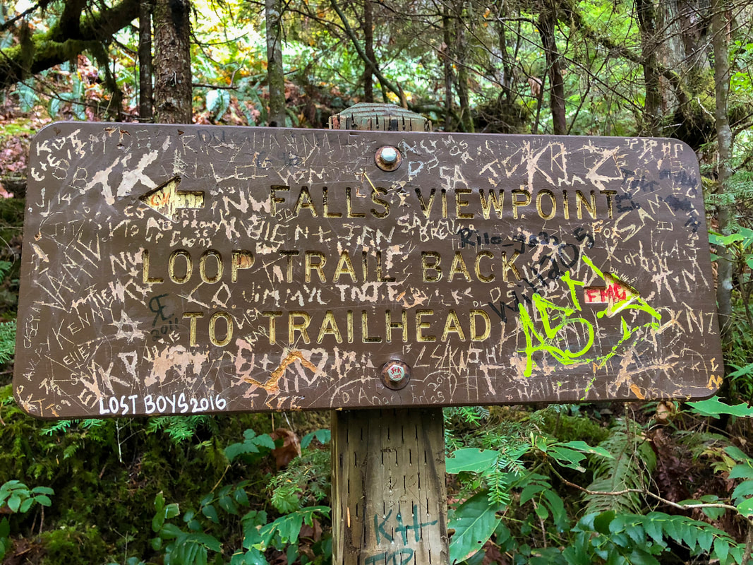
(PLEASE do not vandalize trail signs! Leave No Trace)
|
After checking out the upper viewpoint, head back down the hill to the sign. Unfortunately this sign has been completely decimated by people writing all over it, but you can still kind of make out what it says. Take the trail to the left to continue the loop 0.3 miles back to the trailhead.
Watson Falls Trail is a very easy loop that is perfect for the whole family. The trail is very well maintained and there are no loose rocks or any off camber terrain. This hike immerses you in the quintessential lush green Oregon forest and the highlight is the 294-foot Watson Falls. |
|
Directions:
From Roseburg
- Drive OR-138 east for a total of 61 miles, then turn right onto NF-37 at a sign for Watson Falls and continue for 0.2 miles to the large trailhead on your right. (Total of 61.2 miles)
- Take OR-62 east towards Crater Lake for 49.5 miles then take a slight left onto OR-230 north for 23.8 miles. Near Diamond Lake turn left onto OR-138 for 21.7 miles, then turn left onto NF-37 at a sign for Watson Falls and continue for 0.2 miles to the large trailhead on your right. (Total of 102 miles).
- Drive US-97 south for a total of 74.5 miles, then turn right onto OR-138 west for 39.4 miles. Turn left onto NF-37 at a sign for Watson Falls and continue for 0.2 miles to the large trailhead on your right. (Total of 115 miles)
- It is a total of 134 miles via Roseburg.
- It is a total of 196 miles via Roseburg.
- It is a total of 238 miles via Roseburg.
-This trail write-up was last updated June, 2022-
*All pictures are taken by Franziska Weinheimer
*All pictures are taken by Franziska Weinheimer
*Disclaimer: The trail descriptions, mileage, GPS tracks and difficulty ratings depicted on this website are never 100% accurate. Always hike at your own risk, using your own knowledge, equipment and common sense. Franziska Weinheimer/Hike Oregon are not responsible if you or anyone in your party gets injured or lost while attempting one of these or any other hikes.