Hike Oregon
  • Home
  • *Store*
  • About the author
  • How to use this site
  • Resources
    • Wildflowers
    • Videos
  • Best Oregon Hikes
    • Top Fall Foliage Hikes In Oregon
    • Top 10 Oregon Fall Hikes
    • 20 Best Oregon Waterfall Hikes
    • Top 10 Oregon Hikes for Kids
    • Sno-Parks In Central Oregon
    • Top 10 Oregon Winter Hikes
    • Top Low Elevation Winter Hikes
    • 9 Amazing Oregon Summit Hikes
    • 20 Central Oregon Day Hikes
    • 20 Epic Oregon Wildflower Hikes
    • 5 Weekend Backpacking Trips in Oregon
    • Top One Night Backpacking Trips in Oregon
    • Top 10 Oregon Summer Hikes
    • Top 10 Swimming Spots In Oregon
    • Top 10 Oregon Spring Hikes
  • Oregon Sno-Parks
    • Maxwell Sno-Park
    • Potato Hill Sno-Park
    • Ray Benson Sno-Park
      • Brandenburg Shelter
    • Santiam Sno-Park
    • Three Creek Sno-Park
    • Virginia Meissner Sno-Park
      • Meissner Shelter Loop
      • Nordeen Shelter
    • Gold Lake Sno-Park
      • Westview Shelter to Eagle Rock Overlook
      • Marilyn Lakes Loop
  • Southern Washington
    • Hamilton Mountain
    • Dog Mountain
    • Coyote Wall
    • Mount St. Helens
  • Portland
    • Powell Butte
    • Forest Park
    • Latourell Falls
    • Multnomah/Wahkeena Falls
    • Eagle Creek
    • Mitchell Point
    • Table Rock
    • Tamanawas Falls
    • Trillium Lake
    • East Zigzag Mountain (members only)
  • Salem
    • Abiqua Falls
    • Silver Falls State Park
    • Dome Rock
    • Marion Lake to Marion Mountain
    • Jefferson Park
  • Corvallis
    • Marys Peak East Ridge
    • Marys Peak North Ridge
    • Alsea Falls and Green Peak Falls
    • Corvallis to Sea Trail - Sugarbowl Creek segment (members only)
  • Sweet Home
    • Crescent Mountain
    • Iron Mountain
    • McDowell Creek Falls
    • Middle Santiam River (members only)
    • Lower Soda Creek Falls (members only)
    • Rooster Rock (members only)
  • McKenzie Bridge/Blue River
    • Macduff Mountain
    • Proxy Falls
    • Clear Lake
    • Sahalie/Koosah Falls
    • Blue Pool
    • Erma Bell Lakes
    • Olallie Mountain
    • Horsepasture Mountain
    • Tidbits Mountain
    • Castle Rock
    • Lowder Mountain (members only)
    • East Fork Trail (members only)
    • Rainbow Falls Overlook (members only)
    • Frissell Point (members only)
    • Chucksney Mountain (members only)
    • Substitute Point (members only)
  • Sisters/Santiam Pass
    • Coffin Mountain
    • Trappers Butte and Scar Mountain
    • Maxwell Butte
    • Black Butte
    • Whychus Creek Trail
    • Tam McArthur Rim
    • Black Crater
    • Scott Mountain
    • Obsidian Trail
    • Metolius Preserve
    • Three Fingered Jack Loop
    • Square Lake
    • Canyon Creek Meadows
    • Patjens Lakes
    • Craig Lake (members only)
    • Chush Falls (members only)
    • Rockpile Lake (members only)
    • Santiam Lake (members only)
    • Camp Lake (members only)
    • Park Meadow to Golden Lake (members only)
  • Bend/Redmond/LaPine
    • Steins Pillar
    • Chimney Rock
    • Steelhead Falls
    • Tumalo State Park
    • Shevlin Park Loop
    • Tumalo Falls
    • Tumalo Mountain
    • No Name Lake
    • Green Lakes
    • Moraine Lake
    • South Sister Summit
    • Horse Lake
    • Muskrat Lake
    • Paulina Peak
    • Peter Skene Ogden Trail (members only)
  • Eugene
    • Ridgeline Trail
    • Mount Pisgah Summit
    • Mount Pisgah Arboretum
    • Shotgun Creek
    • Mount June
    • Lawler
    • Tire Mountain
    • Goodman Creek
    • Brice Creek
    • Trestle Creek Falls
    • Parker Falls
    • Moon Falls
    • Elijah Bristow State Park
    • South Willamette Trail (members only)
    • Eula Ridge (members only)
    • Eagle's Rest (members only)
  • Oakridge
    • Deception Creek
    • North Salmon Creek
    • Grasshopper Ridge
    • Larison Creek
    • Bunchgrass Ridge
    • Salt Creek Falls
    • Waldo Lake Loop
    • South Waldo Loop
    • The Twins
    • Rosary Lakes
    • Yoran Lake
    • Fawn Lake
    • Windy Lakes
    • Divide Lake
    • Diamond Peak Summit
    • Cowhorn Mountain
    • Wall Creek Warm Springs (members only)
    • Moon Point (members only)
    • Bobby Lake (members only)
    • Lillian Falls (members only)
    • Middle Fork Willamette Trail (members only)
    • Pool Creek Falls (members only)
    • Dead Mountain (members only)
    • Larison Rock (members only)
    • Quinn Lakes & Eddeeleo Lakes (members only)
    • Waldo Mountain Lookout (members only)
    • Blair Lake to Spring Prairie (members only)
    • Rigdon Lakes loop (members only)
  • Oregon Coast
    • Cascade Head
    • Drift Creek Falls
    • Sweet Creek Falls
    • Beaver Creek Falls
    • Kentucky Falls
    • Hobbit Trail to Heceta Head
    • Valley Trail to China Creek
    • Sutton Creek Trail (members only)
    • North Fork Smith River (members only)
    • Cummins Ridge (member's only)
    • Horse Creek (members only)
    • Siltcoos Lake (members only)
  • Southern Oregon
    • Fall Creek Falls
    • Watson Falls
    • Wild Rogue Loop
    • Mt. Thielsen
    • Crater Lake National Park
      • The Watchman
      • Mount Scott
      • The Pinnacles
    • Lower Table Rock
    • Pilot Rock
    • Wagner Butte
    • Mt. McLoughlin
    • Lemolo Falls (members only)
    • Fern Falls (members only)
  • Eastern Oregon
    • Painted Cove
    • Anthony Lake Loop
    • Mount Howard
    • Eagle Cap summit
    • Schneider Cabin (members only)
    • Strawberry Lake & Strawberry Falls (members only)
  • Oregon PCT sections
  • Tips & Tricks
    • Leave No Trace
    • How To Pick The Right Backpacking Tent
    • Top Tips For Hiking With Infants And Toddlers
    • Poison Oak, Ivy and Sumac
    • How to dress for cold weather hikes
    • Outdoorsy Holiday Gift Guide 2022
    • Hiker Holiday Gift Guide 2019
    • Outdoor Holiday Gift Guide 2018
    • Hiking Holiday Gift Guide 2017
  • Reviews/Gear
    • Storing Your Bear Canister When Backpacking
    • Stay Kühl This Summer
    • Outdoor Herbivore Backpacking Food Review
    • Osprey Aura AG 65 Backpack review
    • Big Agnes Fly Creek UL2 review
    • REI Quarter Dome 1 review
  • Adventure Stories
    • Hiking The Rae Lakes Loop
    • 110 Miles on the PCT
    • Three Fingered Jack Adventures
    • Jefferson Wilderness

Dog Mountain

​
Get the printable version of this hike

Hike details:

Mileage: 3 miles round trip w/ 1,500 ft. elevation gain OR 6.9 mile loop w/ 2,835 ft. elevation gain
Approximate hike time: 3 hours (for the 6.9 mile loop) w/ an average pace of 2.3 mph
Difficulty: ​Moderate to difficult
Trail usage: Heavy to very heavy (very heavy usage especially during wildflower season)
Highest elevation: 3,025 ft. Lowest elevation: 25 ft.
General location: ​13.8 miles NE of Cascade Locks - Columbia River Gorge National Scenic Area - Gifford Pinchot National Forest
Accessible: Late March through December
(Best time to go is mid-April through May for prime wildflower bloom).
Permits required​: Sat. & Sun. from April 18 through June 14 for each individual using the Dog Mountain Trail System. The system includes Dog Mountain Trail (#147 and #147C), Dog Augspurger Tie Trail #147A, and the lower portion of Augspurger Trail #4407. Hikers on the system will be required to carry a hard copy permit or electronic proof of purchase. Click here for more info.
Northwest Forest Pass is required for parking for all other times. 

Pit toilet at trailhead: Yes
Trail allows: ​Dogs on leash only

Possible dangers: Steep drop offs near the top of the trail.
The Dog Mountain trailhead sign

Description:

Dog Mountain is technically in Washington, not Oregon, but it is being mentioned on this site because it is just a stone’s throw across the Columbia River from Oregon and it makes for an epic springtime hike.
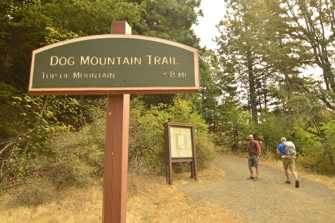
The trailhead is easy to find and it is very large to accommodate the huge number of people who do this hike every year. The best time to go is in mid-April, May and early June when all of the wildflowers are blooming on the hillside. During wildflower season be prepared to see hundreds of hikers!​
A trail sign along the Dog Mountain trail
Dog Mountain trail
This can be a loop or an out and back hike. You can start the loop by going to the east side of the parking lot. It appears that there is no pit toilet at all here, so a lot of people have used the woods by the parking lot (it is often littered with toilet paper and trash), however if you head a few hundred yards up the hill on the trail, you will see the pit toilet as well as a trash can.
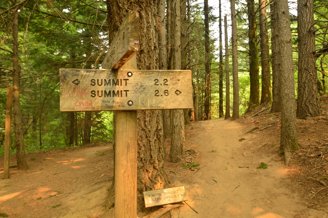
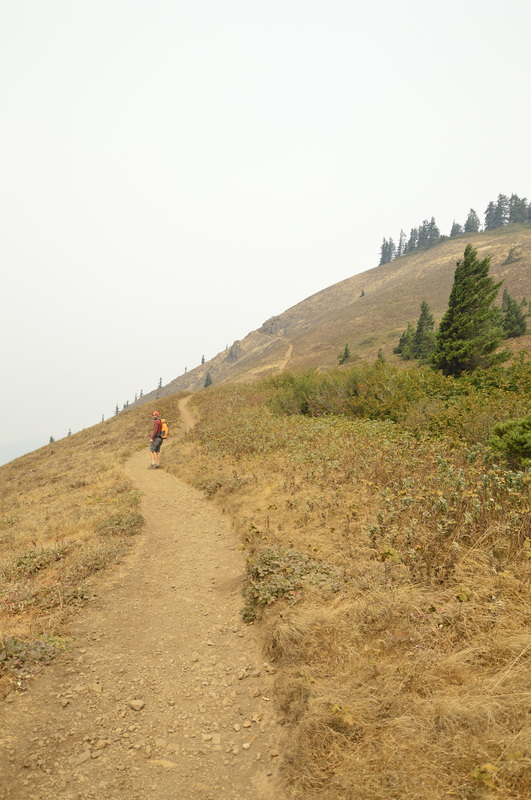
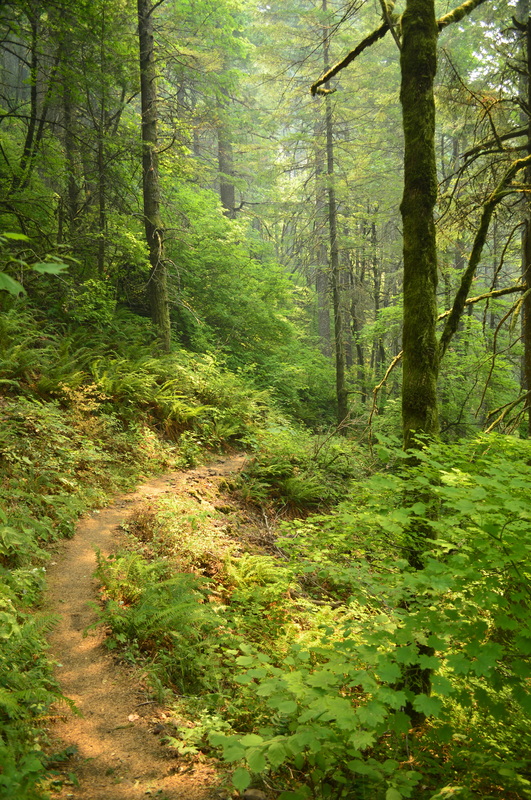
​The trail starts off with 9 small switchbacks which is a brutal warm-up! After this 0.5 mile warm-up, you will see that the trail forks. They are both the Dog Mountain Trail, the one to the left is an older trail and it is primarily in the woods and it has less switchbacks. The newer trail to the right has more switchbacks, and this is where you start to have those epic views of the Columbia Gorge. 
Hiking up the steep Dog Mountain trail
(Dog Mountain Trail during a rain storm)
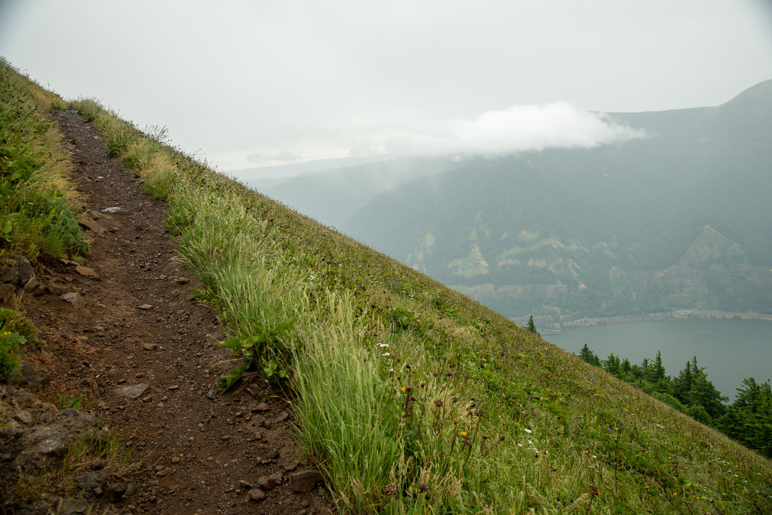
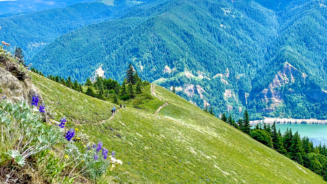
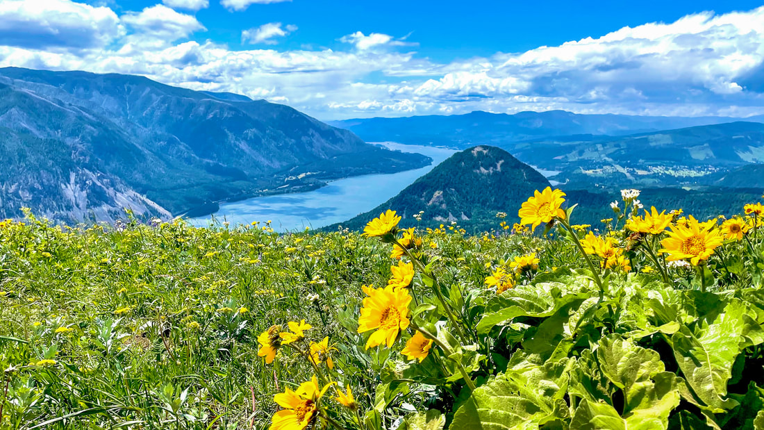
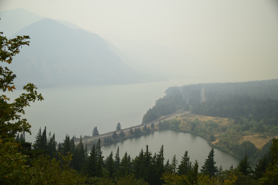
If you are hiking in May, you will see yellow Balsamroot flowers blooming all over the hill. You will continue on this very open section of trail for 2.5 miles. There are quite a few longer switchbacks and the trail here is pretty steep. But with every switchback you make, you get a view of the amazing Columbia Gorge below. You can actually make this a 3 mile out and back hike if you wanted to stop and turn around at the first lower viewpoint.​
The Dog Mountain trail
When you think you’re at the top you come to a Y junction. Take a right which will take you 0.1 miles to the very top of Dog Mountain where you can sit on some rocks and take in the view, or take shelter amongst some trees if it is windy. Or you can just enjoy the view from where the sign is, and then continue straight on the loop that takes you back down. 
Dog Mountain Trail
(picture by Bonnie Gulliver)
Dog Mountain covered in wildflowers with a view of the Columbia Gorge
(Photo of Dog Mountain in May taken by Bonnie Gulliver)
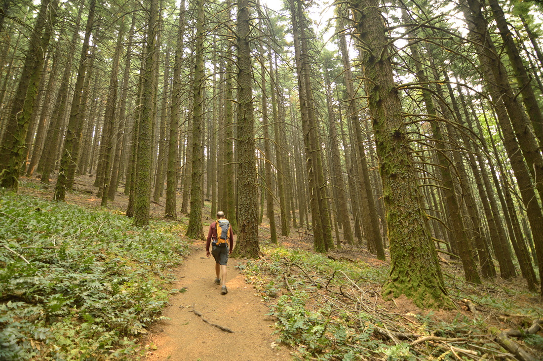
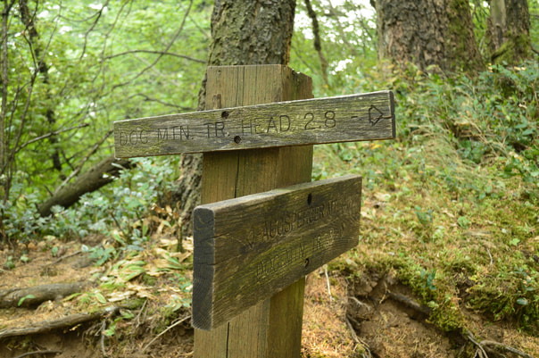
The back side of the loop is nice because it is less traveled and you get a different kind of landscape than what you saw at the beginning. At first you travel towards the backside of the mountain a bit on the ridge. After 1.1 miles you will see a split in the trail. You will want to take the 2.8 mile trail back to Dog Mtn. trailhead. The other trail would take you to Augsberger Mountain.
A trail sign along the Dog Mountain trail
The west side of Dog Mountain is much more lush with green ferns and lots of trees. After heading down a few of the last switchbacks, you will find 2.7 miles of steady downhill. Going down this way is much easier on the knees and ankles. Keep this in mind…every year there are at least 3 rescues that happen, from hikers hurting themselves on Dog Mountain! ​
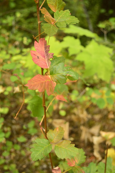
The Augsberger trail at Dog Mountain
A picture of poison oak along the Dog Mountain trail
(Poison Oak)
When you come around the SW side of Dog Mountain, the scenery changes once again. Here there are small oak trees and the hillside is covered in poison oak (be careful!) Through the trees, you will catch glimpses of the neighboring hills and the Gorge. The trail spits you out right into the parking lot, a few hundred feet from where you started the hike.
​
Dog Mountain is NOT an easy hike! You should be in semi-decent shape to be able to do this hike, as it is very steep. If you are hiking in the summer months especially, bring lots of water as this area is very dry and windy and you can get dehydrated quite easily. If you plan on doing this hike, it is advised to bring trekking poles, as they help when going down steep terrain. This is one of the most iconic views of the Columbia Gorge, so it is highly recommended, especially in mid-April, and May!
A view to the SW from the Dog Mountain trail

Directions:

From Portland
  • Drive on I-84 for 35.6 miles and take exit 44 to Cascade Locks and take the Bridge of the Gods across the Columbia River (bridge toll is $2 each way). Turn right on Washington Highway 14 for 19 miles. Between milepost 53 and 54 turn left into the large Dog Mountain parking lot.​ (Total of 56 miles)
From Salem
  • Drive north on I-5 towards Portland for 39.2 miles, then keep right and follow signs to merge onto I-84. Stay on I-84 for 35.6 miles and take exit 44 to Cascade Locks and take the Bridge of the Gods across the Columbia River (bridge toll is $2 each way). Turn right on Washington Highway 14 for 19 miles. Between milepost 53 and 54 turn left into the large Dog Mountain parking lot.​ (Total of 100 miles)
From Eugene
  • Drive north on I-5 towards Portland for 106 miles, then keep right and follow signs to merge onto I-84. Stay on I-84 for 35.6 miles and take exit 44 to Cascade Locks and take the Bridge of the Gods across the Columbia River (bridge toll is $2 each way). Turn right on Washington Highway 14 for 19 miles. Between milepost 53 and 54 turn left into the large Dog Mountain parking lot.​ (Total of 164 miles)
From Bend
  • Drive north on US-97 towards Madras for 41.2 miles. In the town of Madras merge left onto US-26 west towards Hood River for 59.5 miles then take State Route 35 N exit toward Hood River and stay on OR-35 for 38.2 miles. In Hood River continue onto the Hood River Bridge (bridge toll is $2 each way) and then turn left onto WA-14. Stay on this road for 11.3 miles then see the trailhead on your right. (Total of 155 miles)
From Medford
  • Drive north on I-5 towards Portland for 269 miles, then keep right and follow signs to merge onto I-84. Stay on I-84 for 35.6 miles and take exit 44 to Cascade Locks and take the Bridge of the Gods across the Columbia River (bridge toll is $2 each way). Turn right on Washington Highway 14 for 19 miles. Between milepost 53 and 54 turn left into the large Dog Mountain parking lot.​ (Total of 327 miles)
*All pictures unless otherwise marked are taken by Franziska Weinheimer
*Disclaimer: The trail descriptions, mileage, GPS tracks and difficulty ratings depicted on this website are never 100% accurate. Always hike at your own risk, using your own knowledge, equipment and common sense.  Franziska Weinheimer/Hike Oregon are not responsible if you or anyone in your party gets injured or lost while attempting one of these or any other hikes.

HIKED HERE RECENTLY? PLEASE LEAVE A TRIP REPORT BELOW:

© Hike Oregon 2023
P.O. Box 41911
​Eugene, OR 97404
Proudly powered by Weebly
  • Home
  • *Store*
  • About the author
  • How to use this site
  • Resources
    • Wildflowers
    • Videos
  • Best Oregon Hikes
    • Top Fall Foliage Hikes In Oregon
    • Top 10 Oregon Fall Hikes
    • 20 Best Oregon Waterfall Hikes
    • Top 10 Oregon Hikes for Kids
    • Sno-Parks In Central Oregon
    • Top 10 Oregon Winter Hikes
    • Top Low Elevation Winter Hikes
    • 9 Amazing Oregon Summit Hikes
    • 20 Central Oregon Day Hikes
    • 20 Epic Oregon Wildflower Hikes
    • 5 Weekend Backpacking Trips in Oregon
    • Top One Night Backpacking Trips in Oregon
    • Top 10 Oregon Summer Hikes
    • Top 10 Swimming Spots In Oregon
    • Top 10 Oregon Spring Hikes
  • Oregon Sno-Parks
    • Maxwell Sno-Park
    • Potato Hill Sno-Park
    • Ray Benson Sno-Park
      • Brandenburg Shelter
    • Santiam Sno-Park
    • Three Creek Sno-Park
    • Virginia Meissner Sno-Park
      • Meissner Shelter Loop
      • Nordeen Shelter
    • Gold Lake Sno-Park
      • Westview Shelter to Eagle Rock Overlook
      • Marilyn Lakes Loop
  • Southern Washington
    • Hamilton Mountain
    • Dog Mountain
    • Coyote Wall
    • Mount St. Helens
  • Portland
    • Powell Butte
    • Forest Park
    • Latourell Falls
    • Multnomah/Wahkeena Falls
    • Eagle Creek
    • Mitchell Point
    • Table Rock
    • Tamanawas Falls
    • Trillium Lake
    • East Zigzag Mountain (members only)
  • Salem
    • Abiqua Falls
    • Silver Falls State Park
    • Dome Rock
    • Marion Lake to Marion Mountain
    • Jefferson Park
  • Corvallis
    • Marys Peak East Ridge
    • Marys Peak North Ridge
    • Alsea Falls and Green Peak Falls
    • Corvallis to Sea Trail - Sugarbowl Creek segment (members only)
  • Sweet Home
    • Crescent Mountain
    • Iron Mountain
    • McDowell Creek Falls
    • Middle Santiam River (members only)
    • Lower Soda Creek Falls (members only)
    • Rooster Rock (members only)
  • McKenzie Bridge/Blue River
    • Macduff Mountain
    • Proxy Falls
    • Clear Lake
    • Sahalie/Koosah Falls
    • Blue Pool
    • Erma Bell Lakes
    • Olallie Mountain
    • Horsepasture Mountain
    • Tidbits Mountain
    • Castle Rock
    • Lowder Mountain (members only)
    • East Fork Trail (members only)
    • Rainbow Falls Overlook (members only)
    • Frissell Point (members only)
    • Chucksney Mountain (members only)
    • Substitute Point (members only)
  • Sisters/Santiam Pass
    • Coffin Mountain
    • Trappers Butte and Scar Mountain
    • Maxwell Butte
    • Black Butte
    • Whychus Creek Trail
    • Tam McArthur Rim
    • Black Crater
    • Scott Mountain
    • Obsidian Trail
    • Metolius Preserve
    • Three Fingered Jack Loop
    • Square Lake
    • Canyon Creek Meadows
    • Patjens Lakes
    • Craig Lake (members only)
    • Chush Falls (members only)
    • Rockpile Lake (members only)
    • Santiam Lake (members only)
    • Camp Lake (members only)
    • Park Meadow to Golden Lake (members only)
  • Bend/Redmond/LaPine
    • Steins Pillar
    • Chimney Rock
    • Steelhead Falls
    • Tumalo State Park
    • Shevlin Park Loop
    • Tumalo Falls
    • Tumalo Mountain
    • No Name Lake
    • Green Lakes
    • Moraine Lake
    • South Sister Summit
    • Horse Lake
    • Muskrat Lake
    • Paulina Peak
    • Peter Skene Ogden Trail (members only)
  • Eugene
    • Ridgeline Trail
    • Mount Pisgah Summit
    • Mount Pisgah Arboretum
    • Shotgun Creek
    • Mount June
    • Lawler
    • Tire Mountain
    • Goodman Creek
    • Brice Creek
    • Trestle Creek Falls
    • Parker Falls
    • Moon Falls
    • Elijah Bristow State Park
    • South Willamette Trail (members only)
    • Eula Ridge (members only)
    • Eagle's Rest (members only)
  • Oakridge
    • Deception Creek
    • North Salmon Creek
    • Grasshopper Ridge
    • Larison Creek
    • Bunchgrass Ridge
    • Salt Creek Falls
    • Waldo Lake Loop
    • South Waldo Loop
    • The Twins
    • Rosary Lakes
    • Yoran Lake
    • Fawn Lake
    • Windy Lakes
    • Divide Lake
    • Diamond Peak Summit
    • Cowhorn Mountain
    • Wall Creek Warm Springs (members only)
    • Moon Point (members only)
    • Bobby Lake (members only)
    • Lillian Falls (members only)
    • Middle Fork Willamette Trail (members only)
    • Pool Creek Falls (members only)
    • Dead Mountain (members only)
    • Larison Rock (members only)
    • Quinn Lakes & Eddeeleo Lakes (members only)
    • Waldo Mountain Lookout (members only)
    • Blair Lake to Spring Prairie (members only)
    • Rigdon Lakes loop (members only)
  • Oregon Coast
    • Cascade Head
    • Drift Creek Falls
    • Sweet Creek Falls
    • Beaver Creek Falls
    • Kentucky Falls
    • Hobbit Trail to Heceta Head
    • Valley Trail to China Creek
    • Sutton Creek Trail (members only)
    • North Fork Smith River (members only)
    • Cummins Ridge (member's only)
    • Horse Creek (members only)
    • Siltcoos Lake (members only)
  • Southern Oregon
    • Fall Creek Falls
    • Watson Falls
    • Wild Rogue Loop
    • Mt. Thielsen
    • Crater Lake National Park
      • The Watchman
      • Mount Scott
      • The Pinnacles
    • Lower Table Rock
    • Pilot Rock
    • Wagner Butte
    • Mt. McLoughlin
    • Lemolo Falls (members only)
    • Fern Falls (members only)
  • Eastern Oregon
    • Painted Cove
    • Anthony Lake Loop
    • Mount Howard
    • Eagle Cap summit
    • Schneider Cabin (members only)
    • Strawberry Lake & Strawberry Falls (members only)
  • Oregon PCT sections
  • Tips & Tricks
    • Leave No Trace
    • How To Pick The Right Backpacking Tent
    • Top Tips For Hiking With Infants And Toddlers
    • Poison Oak, Ivy and Sumac
    • How to dress for cold weather hikes
    • Outdoorsy Holiday Gift Guide 2022
    • Hiker Holiday Gift Guide 2019
    • Outdoor Holiday Gift Guide 2018
    • Hiking Holiday Gift Guide 2017
  • Reviews/Gear
    • Storing Your Bear Canister When Backpacking
    • Stay Kühl This Summer
    • Outdoor Herbivore Backpacking Food Review
    • Osprey Aura AG 65 Backpack review
    • Big Agnes Fly Creek UL2 review
    • REI Quarter Dome 1 review
  • Adventure Stories
    • Hiking The Rae Lakes Loop
    • 110 Miles on the PCT
    • Three Fingered Jack Adventures
    • Jefferson Wilderness