Mount Pisgah summit trail
Hike details:
Mileage: 2.8 miles round trip w/ 1,008 ft. elevation gain
Approximate hike time: 1 hour 13 minutes w/ an average pace of 2.3 mph
Difficulty: Moderate (only because it is very steep)
Trail usage: High on sunny weekends and weekday afternoons, low on weekdays and rainy weekends
Highest elevation: 1,536 ft. Lowest elevation: 528 ft.
General location: 9 miles southeast of Eugene - Howard Buford Recreation Area
Accessible: Year-round
(Best time to go is any day when you can see views).
Permits required: Howard Buford Day Pass $4 or an annual Lane County Parks Pass
Pit toilet at trailhead: Yes
Trail allows: Dogs on leash, some trails allow horses but not this particular trail to the summit.
Possible dangers: Poison oak, ticks
|
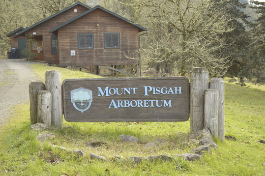
Description:Mount Pisgah/Howard Buford Recreation Area is a wonderful place to recreate, whether you're there to hike to the summit, check out the arboretum, or look at the many wildflowers along the river bank, this beautiful sanctuary has something to offer everyone who wants to get out into nature. It is not always feasible for everyone to get out of town for those longer day hike excursions, so Mount Pisgah is the perfect place to go for a short after work or weekend morning hike.
The parking lot is very large, room for about 200 cars. Right by the parking lot there is a little visitor's center where one can pick up information about the arboretum and also info about renting the barn that they have built here for school trips or wedding type functions (fun fact - the author of Hike Oregon had her wedding here!) |
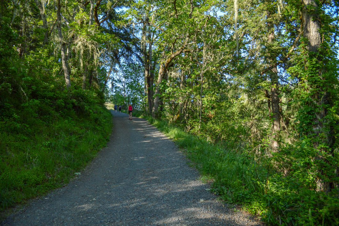
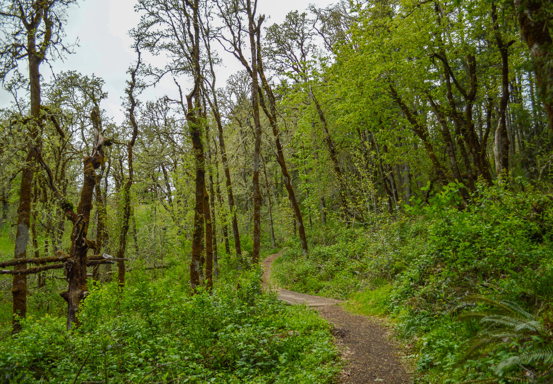
(the wide gravel summit trail through oak trees)

|
The main summit trail starts by an information kiosk and immediately begins heading uphill. Most of the trail is gravel ever since they revamped the trail a few years ago to make it much less muddy than it used to be. The first part of the trail is beautiful, as it opens up to the wide aak tree savannah below, and wild irises blooming along the side of the trail in April. The only thing that detracts from this beautiful hike are the power lines that buzz overhead almost the entire time. After 0.6 miles you will come to a trail junction where the trail to the left takes you over to Swing Hill. This is a beautiful little hill that has a swing attached to a large oak tree, and is such a picturesque place to watch the sunset. Going over to Swing Hill adds on 1 mile to the summit excursion.
|
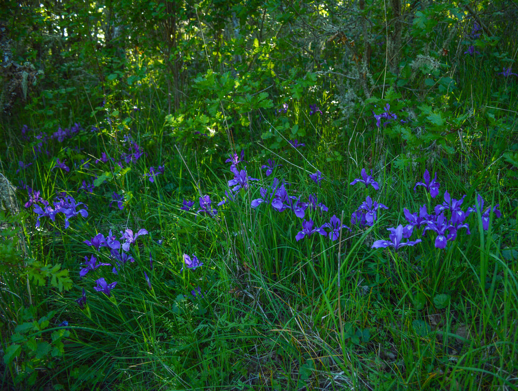
(wild irises in April)
|
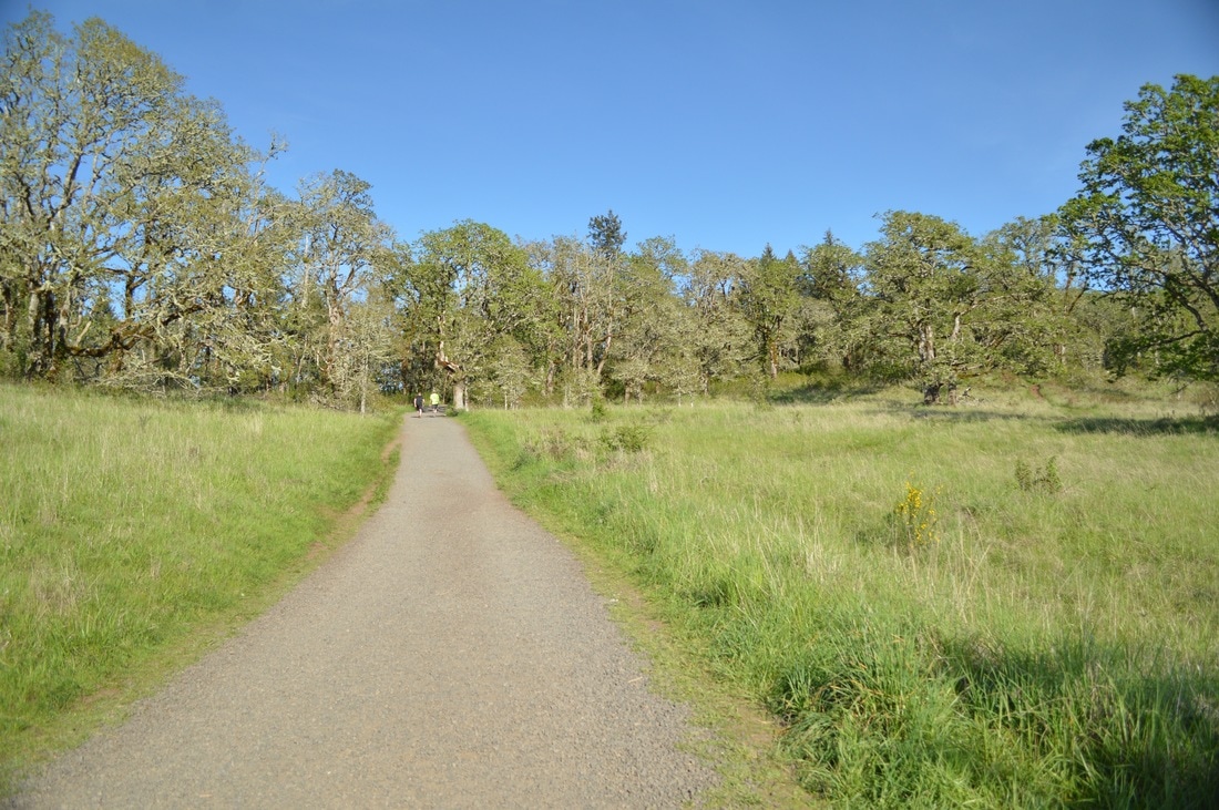
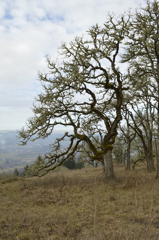
(lots of oak trees along the trail)
|
To go straight to the Mount Pisgah summit, continue straight on the Summit Trail. As you go farther up the hill, the terrain changes just a bit, with grassy fields appearing on either side of the trail. Here you will have to watch out for poison oak bushes. Poison oak is most potent in late spring and early summer, when the new leaves have just sprouted. Ticks are also a major problem here in the tall grasses of Mount Pisgah. It is very important to check yourself and your dogs after hiking here, even in the winter months!
As you near the summit of Mount Pisgah you will start to see more oak trees again and then all of the sudden the trail pops out onto a bald hilltop. From the summit there are 360 degree views of Eugene, the Willamette Valley, Pleasant Hill and beyond. On clear days you can see snow covered Diamond Peak and the Three Sisters. There is a very cool metal map at the top of Mount Pisgah showing you all of the surrounding area, the mountains and the rivers. This is a great feature especially for folks coming up here for the first time, or the many visitors that Eugene gets especially in the summer months. 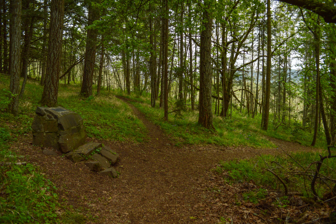
|
(Diamond Peak from the Mount Pisgah summit)
The short but steep hike up to the summit of Mount Pisgah is perfect for those who don't have a lot of time to drive somewhere out of town and hike, but still want to get some exercise and forest bathing in. This hike is great for after work on a nice warm spring or summer day and it is one of the best places near town to watch the sunset (but remember to take a headlamp and an extra layer for the dark trek back down to your car). Mount Pisgah summit is highly recommended to anyone visiting Eugene because it allows you to see the surrounding area as well as the beautiful flora that grows in this amazing part of Oregon.
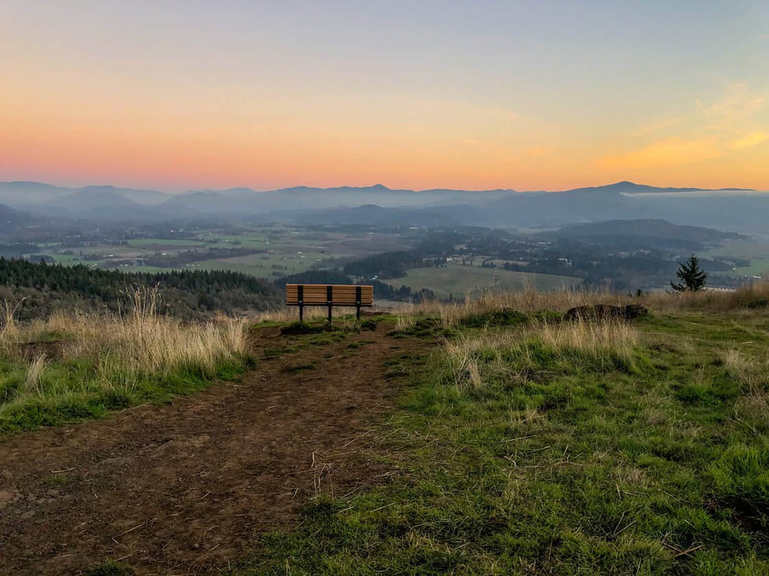
(Mount Pisgah summit at sunset)
Directions:
From Eugene
- From I-5 S take exit #189 then turn right onto Franklin Blvd. which you will stay on for only 0.4 miles before turning left onto Seavey Loop Rd. Drive along this road for 1.5 miles until you cross a bridge, here you will turn right to get to the main parking area. If you want to explore and take a less traveled back way you can turn left and park at a gravel parking area there.
- Total of 70 miles via Eugene.
- Total of 114 miles via Eugene.
- Total of 134 miles via Oakridge and Eugene.
- Total of 163 miles via Eugene.
-This trail write-up was last updated in 2018-
*All pictures are taken by Franziska Weinheimer
*All pictures are taken by Franziska Weinheimer
*Disclaimer: The trail descriptions, mileage, GPS tracks and difficulty ratings depicted on this website are never 100% accurate. Always hike at your own risk, using your own knowledge, equipment and common sense. Franziska Weinheimer/Hike Oregon are not responsible if you or anyone in your party gets injured or lost while attempting one of these or any other hikes.