Proxy Falls
Hike details:
Mileage: 2 mile loop w/ 250 ft. elevation gain from summer trailhead
6.75 miles round trip w/ 905 ft. elevation gain from the snow gate
Approximate hike time: 45 minutes to 1 hour for the 2 mile loop (depending on how long you stay at the waterfalls). Expect 3 hours for the longer hike/snowshoe trek.
Difficulty: Easy to moderate
Trail usage: Very high in the summer (late June through August), low during the weekdays after that and low in the winter
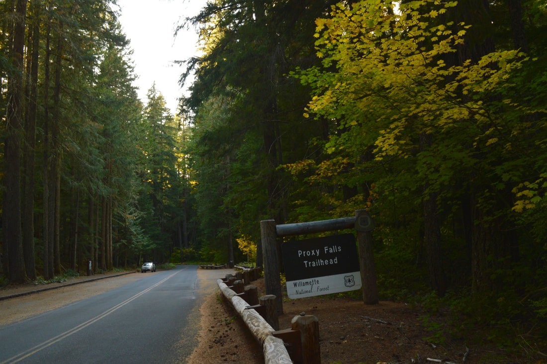
General location: 50 miles southwest of Bend - Three Sisters Wilderness - Willamette National Forest
Accessible: Year-round
(Best time to go is April through June when the waterfalls are raging and end of September to mid-October for prime fall foliage. January and February for the best snowshoeing).
Permits required: Free self issue wilderness permit June 15 - October 15 & Annual Northwest Forest Pass for parking or day pass (available at trailhead)
Pit toilet at trailhead: Yes
Trail allows: Dogs on leash
Possible dangers: Steep descent to the bottom of Lower Proxy Falls can be slippery.
6.75 miles round trip w/ 905 ft. elevation gain from the snow gate
Approximate hike time: 45 minutes to 1 hour for the 2 mile loop (depending on how long you stay at the waterfalls). Expect 3 hours for the longer hike/snowshoe trek.
Difficulty: Easy to moderate
Trail usage: Very high in the summer (late June through August), low during the weekdays after that and low in the winter
General location: 50 miles southwest of Bend - Three Sisters Wilderness - Willamette National Forest
Accessible: Year-round
(Best time to go is April through June when the waterfalls are raging and end of September to mid-October for prime fall foliage. January and February for the best snowshoeing).
Permits required: Free self issue wilderness permit June 15 - October 15 & Annual Northwest Forest Pass for parking or day pass (available at trailhead)
Pit toilet at trailhead: Yes
Trail allows: Dogs on leash
Possible dangers: Steep descent to the bottom of Lower Proxy Falls can be slippery.
Description:
Proxy Falls is a beautiful easy hike off of McKenzie Scenic Byway 242 which is only open for a few months out of the year (usually mid-June to early November, but it depends on snowfall). To see if the highway to the trailhead is open go to www.tripcheck.com. For how busy this hike is in the summer months, the trailhead does not offer a lot of parking. There is space for about 15 - 20 cars, and there is a picnic table, as well as a men's and women's pit toilet.
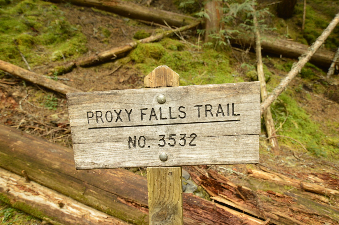
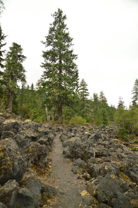
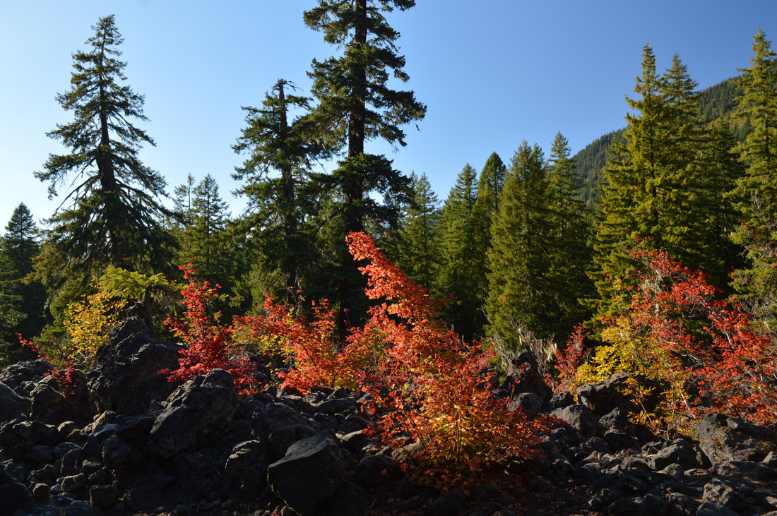
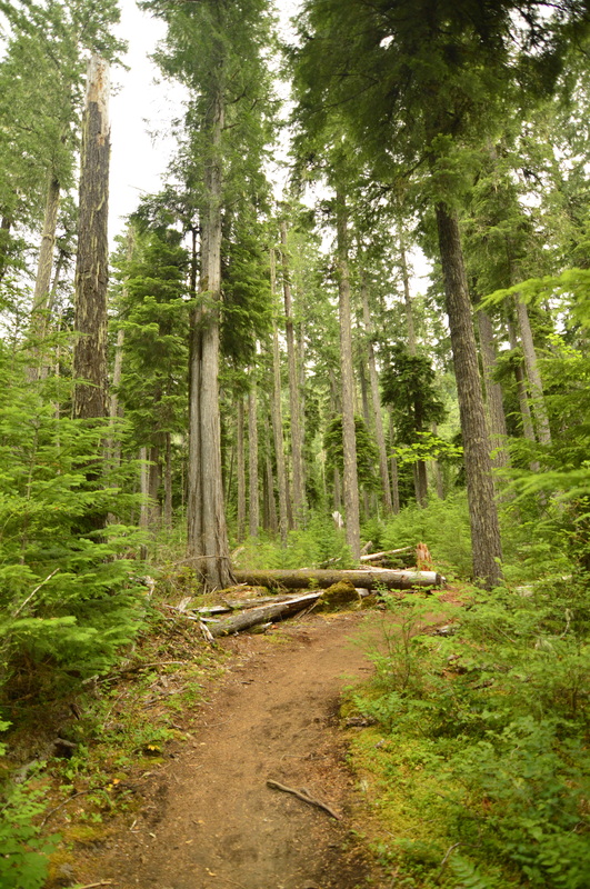
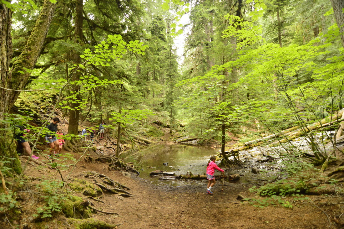
The loop starts at the southwest end of the parking lot next to the information sign. The first 0.5 miles of the trail are a bit rocky because you are walking through a lava flow, but then it levels off and meanders through the forest as you get closer to the falls. In the autumn season (mid-September to early October) the vine maples turn a beautiful bright yellow, orange and red, making the hike through the lava a rainbow trail! After crossing the lava field you will come to a trail split. The trail to the right will take you down to Lower Proxy Falls and the trail to the left will continue the loop and take you to Upper Proxy Falls.
|
|
|
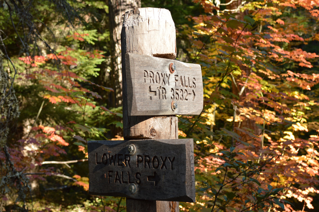
Shortly after the sign before hiking down the hill to Lower Proxy Falls, there is a lookout point from the top of the trail where you can see the waterfall quite nicely. If you have small children (2-3 years old), you may not want to go down to the bottom of the falls, as the path is extremely steep and eroded, and can be very slippery when the ground is wet.
|
|
If you do decide to go down to the bottom of Lower Proxy Falls, it is completely worth it. You can really appreciate the height of the falls (226 ft.) from the bottom. The cool spray from the water is fantastically refreshing in the summer season! If you hike here in the fall there is much less water, however this makes you able to get closer to the bottom of the waterfall which makes for some great pictures.
After checking out the upper falls, head back to the trail junction and take a right to go to Upper Proxy Falls. Because of all the trees that grow in the grotto, these falls are extremely hard to see, however if you climb up a small hill directly across from the falls, you can get a decent view and picture of this 129 foot tall waterfall. |
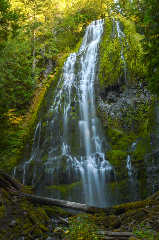
(Lower Proxy Falls 226 ft. in October)
|
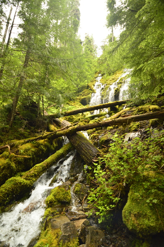
(Upper Proxy Falls 129 ft.)
|
(Upper Proxy Falls grotto)
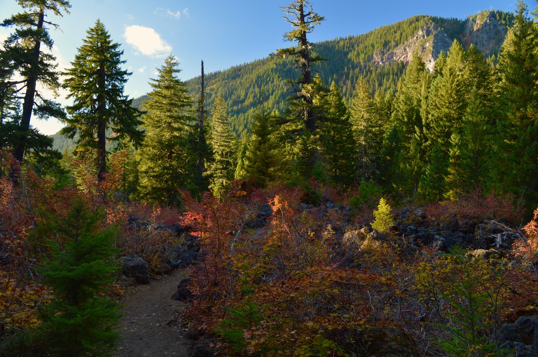
After doing the short out and back trail to Upper Proxy Falls, head back to the main trail and continue the loop. The trail takes you through a little bit more lava, and you will see some open views of the surrounding area. The trail trends downhill a bit and then ends at the other side of the parking area.
|
Proxy Falls Loop is a wonderful "stretch your legs" type of hike. It is not very strenuous, however the trail can be a little tricky navigating the lava as well as the steep side trail that goes down to Lower Proxy Falls. This hike is highly recommended during all seasons, and even if you don't go there during the 6 months that the road is open, the snow gate closes just over 2 miles down the road, so you can walk up the road, making the hike a total of 6.75 miles in the early spring, late fall or even on snowshoes in the winter. Seeing Proxy Falls when they are snowy and frozen is a truly spectacular experience.
Directions:
From Bend
- Drive on US-97 N for 2.3 miles then merge onto US-20 W towards Sisters for 19.7 miles. Towards the west end of Sisters, turn left at a sign for OR-242 W for 27.4 miles. At the hiker symbol sign between mileposts 64 and 65, you can park along the road. (Total of 50.6 miles)
- Drive on OR-126 E for a total of 48.4 miles, just past the McKenzie River Ranger Station turn right at the sign for Scenic Highway OR-242. At the hiker symbol sign between mileposts 64 and 65, you can park along the road. (Total of 66.1 miles)
- Drive on OR-22 E towards Detroit for a total of 80 miles, then at Santiam Junction stay to the right and merge onto US-20 W for 3.1 miles and then stay left at the next junction and continue on OR-126 towards Eugene for another 19.8 miles. At a sign for Scenic Highway OR-242 turn left for 8.9 miles. At the hiker symbol sign between mileposts 64 and 65, you can park along the road. (Total of 115 miles)
- Total of 158 miles via Salem.
- Total of 232 miles via Eugene.
-This trail write-up was last January 2019-
*All pictures are taken by Franziska Weinheimer
*All pictures are taken by Franziska Weinheimer
*Disclaimer: The trail descriptions, mileage, GPS tracks and difficulty ratings depicted on this website are never 100% accurate. Always hike at your own risk, using your own knowledge, equipment and common sense. Franziska Weinheimer/Hike Oregon are not responsible if you or anyone in your party gets injured or lost while attempting one of these or any other hikes.