Hike Oregon
  • Home
  • *Store*
  • About the author
  • How to use this site
  • Resources
    • Wildflowers
    • Videos
  • Best Oregon Hikes
    • Top Fall Foliage Hikes In Oregon
    • Top 10 Oregon Fall Hikes
    • 20 Best Oregon Waterfall Hikes
    • Top 10 Oregon Hikes for Kids
    • Sno-Parks In Central Oregon
    • Top 10 Oregon Winter Hikes
    • Top Low Elevation Winter Hikes
    • 9 Amazing Oregon Summit Hikes
    • 20 Central Oregon Day Hikes
    • 20 Epic Oregon Wildflower Hikes
    • 5 Weekend Backpacking Trips in Oregon
    • Top One Night Backpacking Trips in Oregon
    • Top 10 Oregon Summer Hikes
    • Top 10 Swimming Spots In Oregon
    • Top 10 Oregon Spring Hikes
  • Oregon Sno-Parks
    • Maxwell Sno-Park
    • Potato Hill Sno-Park
    • Ray Benson Sno-Park
      • Brandenburg Shelter
    • Santiam Sno-Park
    • Three Creek Sno-Park
    • Virginia Meissner Sno-Park
      • Meissner Shelter Loop
      • Nordeen Shelter
    • Gold Lake Sno-Park
      • Westview Shelter to Eagle Rock Overlook
      • Marilyn Lakes Loop
  • Southern Washington
    • Hamilton Mountain
    • Dog Mountain
    • Coyote Wall
    • Mount St. Helens
  • Portland
    • Powell Butte
    • Forest Park
    • Latourell Falls
    • Multnomah/Wahkeena Falls
    • Eagle Creek
    • Mitchell Point
    • Table Rock
    • Tamanawas Falls
    • Trillium Lake
    • East Zigzag Mountain (members only)
  • Salem
    • Abiqua Falls
    • Silver Falls State Park
    • Dome Rock
    • Marion Lake to Marion Mountain
    • Jefferson Park
  • Corvallis
    • Marys Peak East Ridge
    • Marys Peak North Ridge
    • Alsea Falls and Green Peak Falls
    • Corvallis to Sea Trail - Sugarbowl Creek segment (members only)
  • Sweet Home
    • Crescent Mountain
    • Iron Mountain
    • McDowell Creek Falls
    • Middle Santiam River (members only)
    • Lower Soda Creek Falls (members only)
    • Rooster Rock (members only)
  • McKenzie Bridge/Blue River
    • Macduff Mountain
    • Proxy Falls
    • Clear Lake
    • Sahalie/Koosah Falls
    • Blue Pool
    • Erma Bell Lakes
    • Olallie Mountain
    • Horsepasture Mountain
    • Tidbits Mountain
    • Castle Rock
    • Lowder Mountain (members only)
    • East Fork Trail (members only)
    • Rainbow Falls Overlook (members only)
    • Frissell Point (members only)
    • Chucksney Mountain (members only)
    • Substitute Point (members only)
  • Sisters/Santiam Pass
    • Coffin Mountain
    • Trappers Butte and Scar Mountain
    • Maxwell Butte
    • Black Butte
    • Whychus Creek Trail
    • Tam McArthur Rim
    • Black Crater
    • Scott Mountain
    • Obsidian Trail
    • Metolius Preserve
    • Three Fingered Jack Loop
    • Square Lake
    • Canyon Creek Meadows
    • Patjens Lakes
    • Craig Lake (members only)
    • Chush Falls (members only)
    • Rockpile Lake (members only)
    • Santiam Lake (members only)
    • Camp Lake (members only)
    • Park Meadow to Golden Lake (members only)
  • Bend/Redmond/LaPine
    • Steins Pillar
    • Chimney Rock
    • Steelhead Falls
    • Tumalo State Park
    • Tumalo Falls
    • Tumalo Mountain
    • No Name Lake
    • Green Lakes
    • Moraine Lake
    • South Sister Summit
    • Horse Lake
    • Muskrat Lake
    • Paulina Peak
    • Peter Skene Ogden Trail (members only)
  • Eugene
    • Ridgeline Trail
    • Mount Pisgah Summit
    • Mount Pisgah Arboretum
    • Shotgun Creek
    • Mount June
    • Lawler
    • Tire Mountain
    • Goodman Creek
    • Brice Creek
    • Trestle Creek Falls
    • Moon Falls
    • Elijah Bristow State Park
    • South Willamette Trail (members only)
    • Eula Ridge (members only)
    • Eagle's Rest (members only)
  • Oakridge
    • Deception Creek
    • North Salmon Creek
    • Grasshopper Ridge
    • Larison Creek
    • Bunchgrass Ridge
    • Salt Creek Falls
    • Waldo Lake Loop
    • South Waldo Loop
    • The Twins
    • Rosary Lakes
    • Yoran Lake
    • Fawn Lake
    • Windy Lakes
    • Divide Lake
    • Diamond Peak Summit
    • Cowhorn Mountain
    • Wall Creek Warm Springs (members only)
    • Moon Point (members only)
    • Bobby Lake (members only)
    • Lillian Falls (members only)
    • Middle Fork Willamette Trail (members only)
    • Pool Creek Falls (members only)
    • Dead Mountain (members only)
    • Larison Rock (members only)
    • Quinn Lakes & Eddeeleo Lakes (members only)
    • Waldo Mountain Lookout (members only)
    • Blair Lake to Spring Prairie (members only)
    • Rigdon Lakes loop (members only)
  • Oregon Coast
    • Cascade Head
    • Drift Creek Falls
    • Sweet Creek Falls
    • Beaver Creek Falls
    • Kentucky Falls
    • Hobbit Trail to Heceta Head
    • Valley Trail to China Creek
    • North Fork Smith River (members only)
    • Cummins Ridge (member's only)
    • Horse Creek (members only)
    • Siltcoos Lake (members only)
  • Southern Oregon
    • Fall Creek Falls
    • Watson Falls
    • Wild Rogue Loop
    • Mt. Thielsen
    • Crater Lake National Park
      • The Watchman
      • Mount Scott
      • The Pinnacles
    • Lower Table Rock
    • Pilot Rock
    • Wagner Butte
    • Mt. McLoughlin
    • Lemolo Falls (members only)
    • Fern Falls (members only)
  • Eastern Oregon
    • Painted Cove
    • Anthony Lake Loop
    • Mount Howard
    • Eagle Cap summit
    • Schneider Cabin (members only)
    • Strawberry Lake & Strawberry Falls (members only)
  • Oregon PCT sections
  • Tips & Tricks
    • Leave No Trace
    • How To Pick The Right Backpacking Tent
    • Top Tips For Hiking With Infants And Toddlers
    • Poison Oak, Ivy and Sumac
    • How to dress for cold weather hikes
    • Outdoorsy Holiday Gift Guide 2022
    • Hiker Holiday Gift Guide 2019
    • Outdoor Holiday Gift Guide 2018
    • Hiking Holiday Gift Guide 2017
  • Reviews/Gear
    • Stay Kühl This Summer
    • Outdoor Herbivore Backpacking Food Review
    • Osprey Aura AG 65 Backpack review
    • Big Agnes Fly Creek UL2 review
    • REI Quarter Dome 1 review
  • Adventure Stories
    • Hiking The Rae Lakes Loop
    • 110 Miles on the PCT
    • Three Fingered Jack Adventures
    • Jefferson Wilderness

Maxwell Sno-Park

​

Maxwell Loop to Mountain View & South Maxwell Shelters

​
Get the printable version of this hike

Hike details:

Mileage: 7.3 mile loop w/ 1,130 ft. elevation gain (the entire loop)
3.8 miles round trip w/ 700 ft. elevation gain (out and back to Mountain View Shelter)
Approximate hike time: 4 hours 3 minutes w/ an average pace of 1.8 mph (the entire loop)
Difficulty: Moderate
Trail usage: Low on weekdays, medium to high on sunny weekends
​
Highest elevation: 4,355 ft. Lowest elevation: 3,670 ft.
General location: 29 miles west of Sisters off of highway OR-22 - Willamette National Forest - Mt. Jefferson Wilderness
Accessible: Year-round  
(The sno-park trails are accessible for winter recreation as soon as about 2 feet of snow have accumulated usually end of December. This sno-park usually melts out around end of March).
Permits required: Sno-park pass is required from November 1 - April 30
Pit toilet at trailhead: Yes
Trail allows: Dogs on leash only, snowshoeing, cross-country skiing, overnight stay in shelters
Possible dangers: N/A
Picture
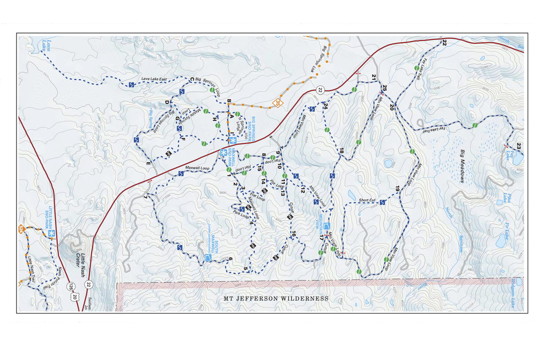
(map of the entire Maxwell Sno Park - click to enlarge)

Description:

Maxwell Sno-Park is a wonderful sno-park between Sisters and Detroit that has many easy and moderate trails. At Maxwell Sno-Park you will find many different loops you can snowshoe or cross-country ski and there is also Big Springs Sno-Park across the highway if you want even more trails to choose from. The main highlight of this sno-park is Mountain View Shelter which is a large 4-sided shelter where you can spend the night. It is stocked with fire wood, there is a nice wood stove inside and there is even an outhouse nearby. 
Oregon sno park permits
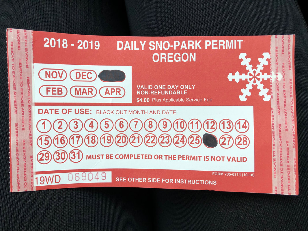
(Oregon sno-park permit)
Sno park signs
One of the most scenic loops at Maxwell Sno-Park is a moderate level 7.3 mile loop that takes you up to two shelters, the Mountain View Shelter and the South Maxwell Shelter. 
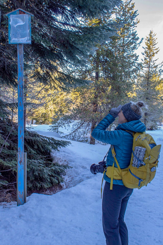
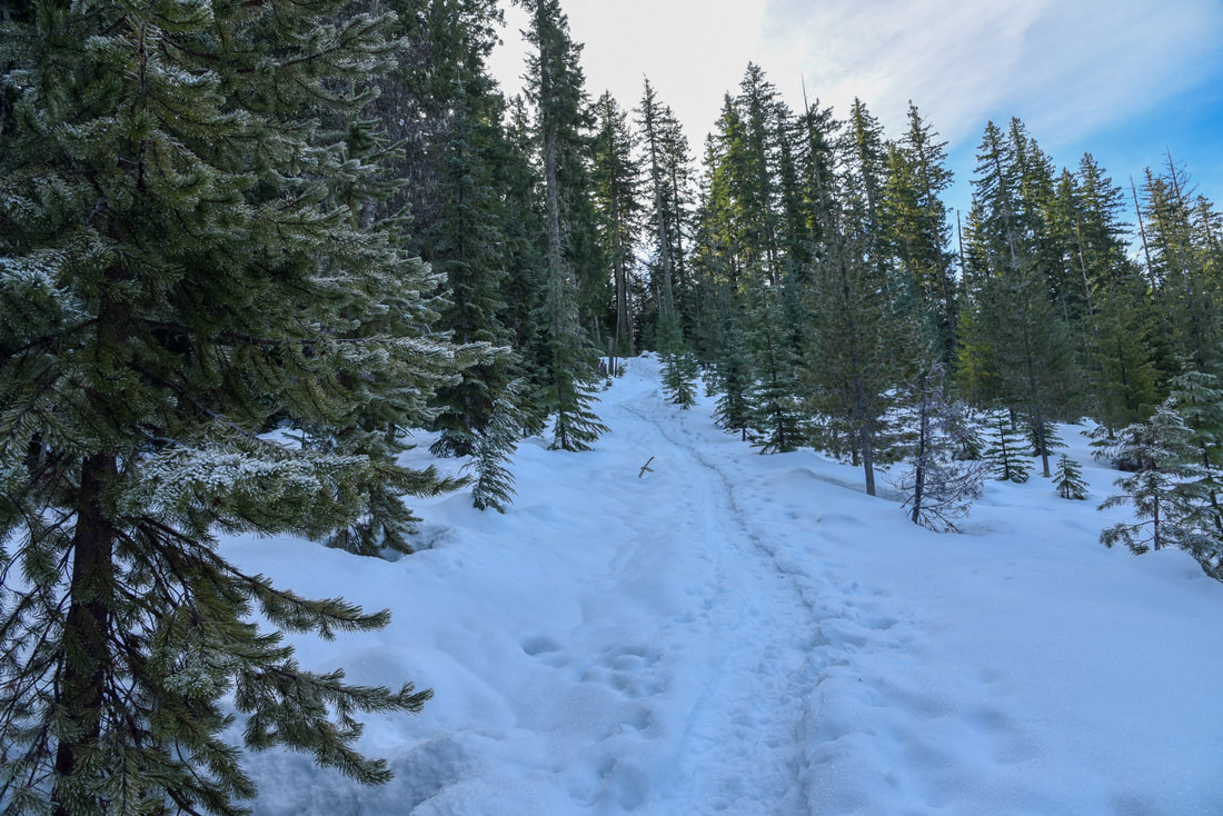
Maxwell Sno-Park has a very spacious, plowed parking area with a pit toilet. From the parking lot you will take the Flat Loop Trail to the north for 0.8 easy miles to a junction. The junctions are usually marked with blue signs and/or maps. Unfortunately, if the snow isn't very deep, the maps will be too high up to read. It is important to have a map of your own as well as a GPS track with you when you go. At the 3-way junction, go right for just 0.1 miles, then at a Y junction take the Mountain View Loop trail for 1.34 uphill miles to the Mountain View Shelter. 
Three Sisters viewpoint Maxwell Sno Park
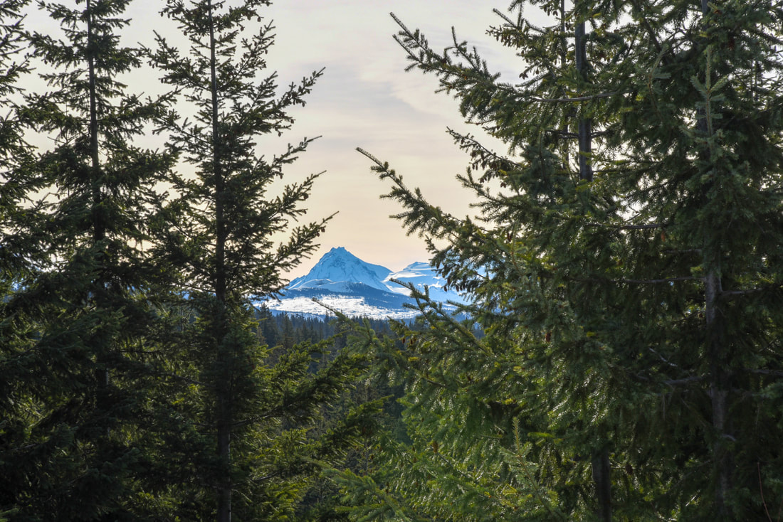
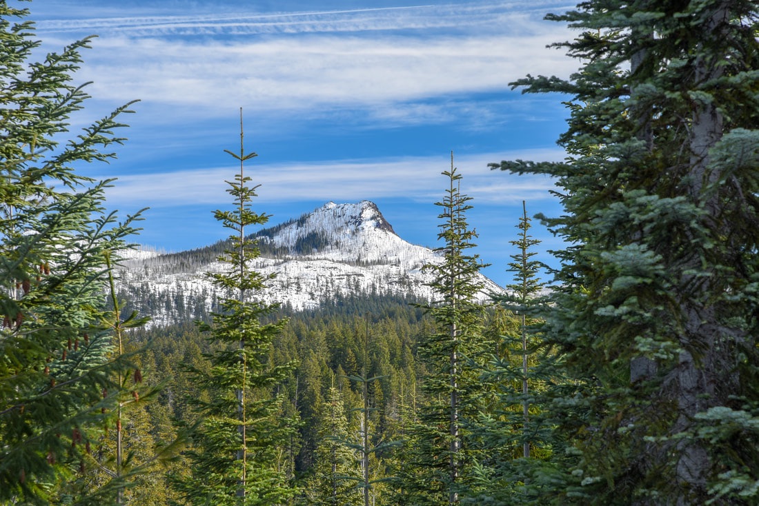
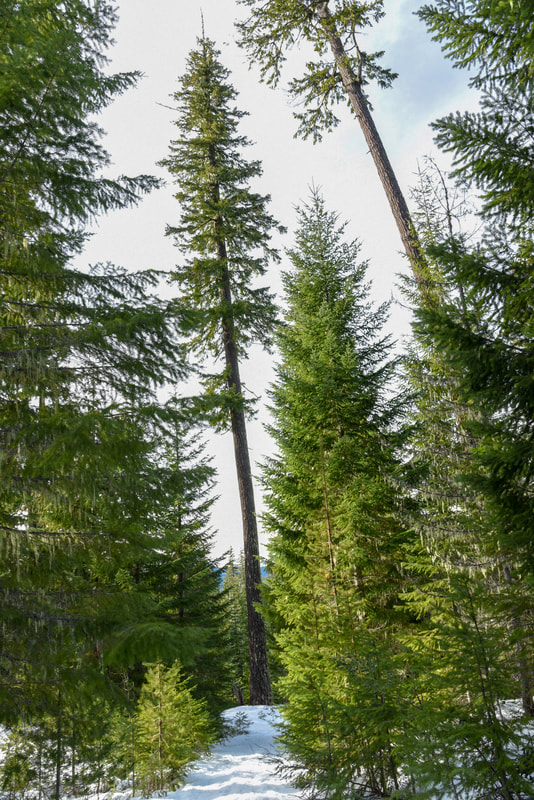
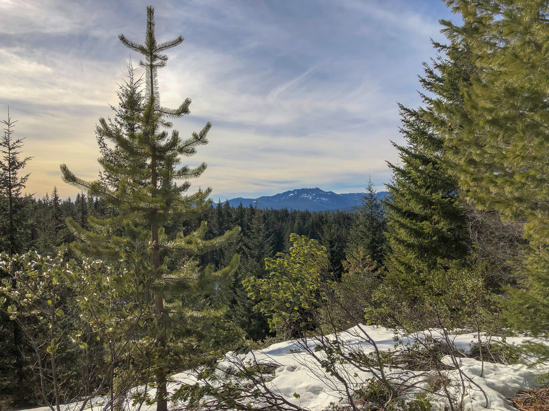
(view of North Sister through the trees)
The Mountain View Shelter sits up on a flat area where before the trees grew in, you could see amazing views of the Three Sisters and Mount Washington. Now you can just catch glimpses of the mountains through the trees to the south. To the northeast you will get a great view of Duffy Butte.
View of Duffy Butte at Maxwell Sno Park
(view of Duffy Butte from Mountain View Shelter)
Mountainview Shelter Maxwell Sno Park
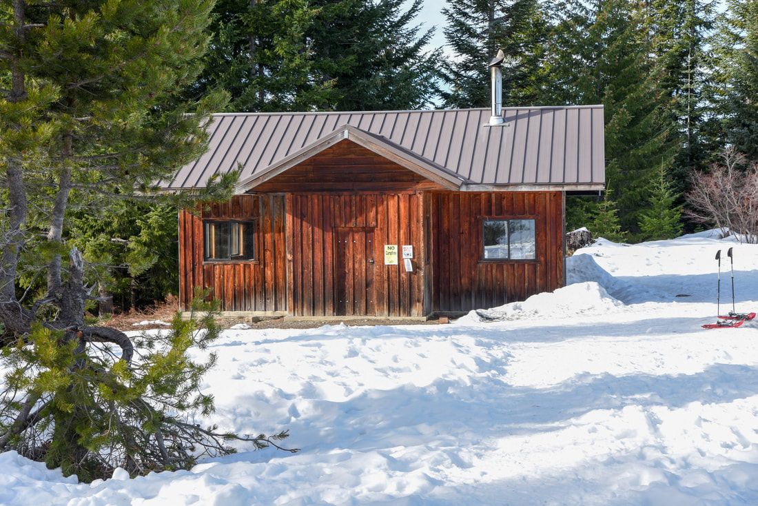
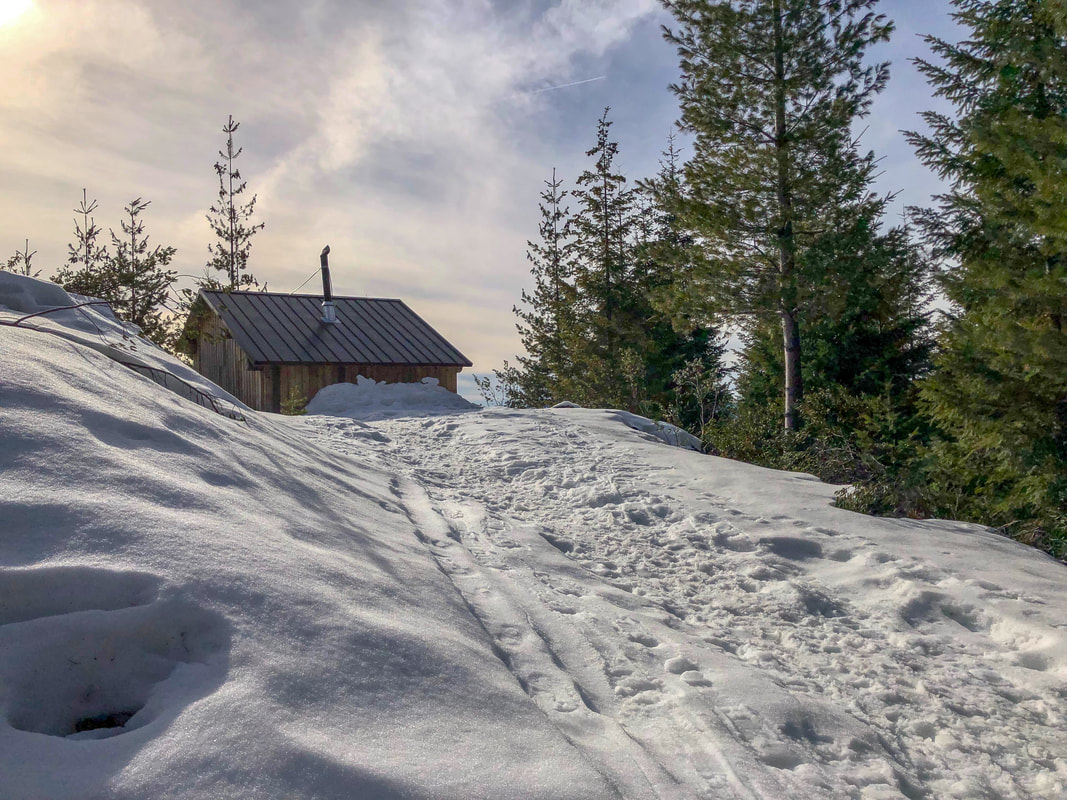
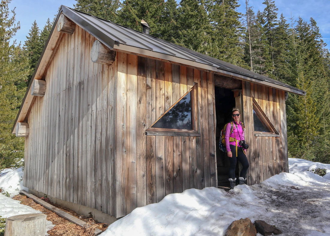
(Mountain View Shelter)
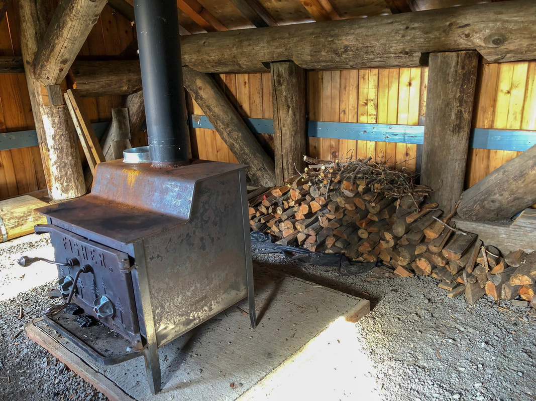
Mountain View Shelter is a spacious, fully enclosed shelter with lots of windows and a big wood stove. The shelter is usually stocked with fire wood, although if you are going late in the season, it is best to bring your own just in case the supply at the shelter has run out. The shelter can sleep about 15 people and there is even an outhouse close by for convenience. 
Inside of Mountainview shelter Maxwell Sno Park
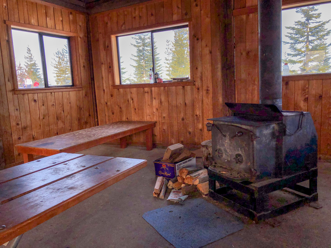
(the inside of Mountain View Shelter)
Cutoff trail Maxwell Sno Park
Cutoff Trail To South Maxwell Shelter Maxwell Sno Park
Big trees at Maxwell Sno Park
From Mountain View Shelter, you will take the wide road straight ahead to a gate and there you will take a right on the Cutoff Trail for a total of 1.6 miles to another signed junction. Continue straight through this junction and how you are on the Maxwell Loop Trail. This trail takes you up and down some small hills and through a beautiful forest for 0.7 miles, until you reach the South Maxwell Shelter. This is a mostly enclosed shelter with two small windows. The door is a leather flap that you can roll open or keep closed. After enjoying the shelter, please always pull the leather flap closed so that snow doesn't get into the shelter. The South Maxwell Shelter isn't very spacious and is more of just a warming hut rather than an overnight hut and it also has an awesome wood stove.
Trail to South Maxwell Shelter
South Maxwell Shelter Maxwell Sno Park
The view from the South Maxwell Shelter is open and you can see the hills of the old cascade crest to the southwest. Because the shelter faces south, on a sunny day this little area warms up quite nicely and you can sit on wooden stumps outside and soak up some winter sun during your lunch break. ​After visiting the South Maxwell Shelter, continue on the Maxwell Loop Trail for another easy 2.5, mostly downhill miles through the woods back to Maxwell Sno-Park. 
Inside of South Maxwell Shelter Maxwell Sno Park
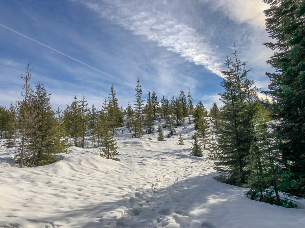
Even though it is fairly long for a snowshoe trek, this loop is relatively easy. There are a few elevation changes and you do have to pay attention to navigation because there are so many little loops and junctions, it is easy to take the wrong trail on accident. This loop is definitely a great intermediate snowshoe trail with some awesome views and a beautiful forest and even the possibility of a winter overnight. Because this is one of the lower elevation sno-parks, it is recommended to do this one in January/early February when there is generally the most snow. If you want to go up to Mountain View Shelter but don't want to commit to the entire loop, it would be an easy 3.8 mile out and back with 700 feet of elevation gain.
View from South Maxwell Shelter Maxwell Sno Park

Directions:

​From Bend
  • ​Drive on US-97 north and take exit 135A to merge onto US-20 west towards Sisters for 20 miles. In the town of Sisters at the roundabout take the 2nd exit and stay on US-20 west for another 25.1 miles. Take a slight right onto OR-22 west towards Detroit for 2.8 miles and then turn Turn right onto NF-080 at a sign for Maxwell Sno-Park. (Total of 51 miles)
From Salem
  • Take on OR-22 east towards Detroit Lake/Bend for a total of 77.4 miles then turn left onto NF-080 at a sign for Maxwell Sno-Park. (Total of 81 miles)
From Eugene
  • Take OR-126 east for 6.8 miles, at a traffic light use the left 2 lanes to turn left onto OR-126 E/Main St. and continue on OR-126 for 68.2 miles. Shortly after Clear Lake Resort take a slight right and merge onto US-20 east for 3.1 miles then turn left onto OR-22 west towards Detroit for a total of 2.6 miles. Turn right onto NF-080 at a sign for Maxwell Sno-Park. (Total of 83 miles)
From Portland
  • Drive I-5 south towards Salem for 45.3 miles, then take exit 253 for OR-22 east toward Detroit Lake/Bend. Take OR-22 east for 77.4 miles then turn left onto NF-080 at a sign for Maxwell Sno-Park. (Total of 124 miles)
From Medford
  • Drive on I-5 north for 170 miles to Eugene. Take exit 194A to merge onto OR-126 east toward Springfield for about 6.6 miles. At a traffic light use the two left lanes to turn left and continue on OR-126 for 72.6 miles. Shortly after Clear Lake Resort, take a slight right onto US-20 east for 3.1 miles and then turn left onto OR-22 west for 2.6 miles towards Detroit, then turn right onto NF-080 at a sign for Maxwell Sno-Park. (Total of 246 miles)
*All pictures unless otherwise marked are taken by Franziska Weinheimer
*Disclaimer:  the trail descriptions, mileage, GPS tracks and difficulty ratings depicted on this website are never 100% accurate. Always hike at your own risk, using your own knowledge, equipment and common sense. Franziska Weinheimer/Hike Oregon are not responsible if you or anyone in your party gets injured or lost while attempting one of these or any other hikes. ​​

HIKED HERE RECENTLY? PLEASE LEAVE A TRIP REPORT BELOW:

© Hike Oregon 2023
P.O. Box 41911
​Eugene, OR 97404
Proudly powered by Weebly
  • Home
  • *Store*
  • About the author
  • How to use this site
  • Resources
    • Wildflowers
    • Videos
  • Best Oregon Hikes
    • Top Fall Foliage Hikes In Oregon
    • Top 10 Oregon Fall Hikes
    • 20 Best Oregon Waterfall Hikes
    • Top 10 Oregon Hikes for Kids
    • Sno-Parks In Central Oregon
    • Top 10 Oregon Winter Hikes
    • Top Low Elevation Winter Hikes
    • 9 Amazing Oregon Summit Hikes
    • 20 Central Oregon Day Hikes
    • 20 Epic Oregon Wildflower Hikes
    • 5 Weekend Backpacking Trips in Oregon
    • Top One Night Backpacking Trips in Oregon
    • Top 10 Oregon Summer Hikes
    • Top 10 Swimming Spots In Oregon
    • Top 10 Oregon Spring Hikes
  • Oregon Sno-Parks
    • Maxwell Sno-Park
    • Potato Hill Sno-Park
    • Ray Benson Sno-Park
      • Brandenburg Shelter
    • Santiam Sno-Park
    • Three Creek Sno-Park
    • Virginia Meissner Sno-Park
      • Meissner Shelter Loop
      • Nordeen Shelter
    • Gold Lake Sno-Park
      • Westview Shelter to Eagle Rock Overlook
      • Marilyn Lakes Loop
  • Southern Washington
    • Hamilton Mountain
    • Dog Mountain
    • Coyote Wall
    • Mount St. Helens
  • Portland
    • Powell Butte
    • Forest Park
    • Latourell Falls
    • Multnomah/Wahkeena Falls
    • Eagle Creek
    • Mitchell Point
    • Table Rock
    • Tamanawas Falls
    • Trillium Lake
    • East Zigzag Mountain (members only)
  • Salem
    • Abiqua Falls
    • Silver Falls State Park
    • Dome Rock
    • Marion Lake to Marion Mountain
    • Jefferson Park
  • Corvallis
    • Marys Peak East Ridge
    • Marys Peak North Ridge
    • Alsea Falls and Green Peak Falls
    • Corvallis to Sea Trail - Sugarbowl Creek segment (members only)
  • Sweet Home
    • Crescent Mountain
    • Iron Mountain
    • McDowell Creek Falls
    • Middle Santiam River (members only)
    • Lower Soda Creek Falls (members only)
    • Rooster Rock (members only)
  • McKenzie Bridge/Blue River
    • Macduff Mountain
    • Proxy Falls
    • Clear Lake
    • Sahalie/Koosah Falls
    • Blue Pool
    • Erma Bell Lakes
    • Olallie Mountain
    • Horsepasture Mountain
    • Tidbits Mountain
    • Castle Rock
    • Lowder Mountain (members only)
    • East Fork Trail (members only)
    • Rainbow Falls Overlook (members only)
    • Frissell Point (members only)
    • Chucksney Mountain (members only)
    • Substitute Point (members only)
  • Sisters/Santiam Pass
    • Coffin Mountain
    • Trappers Butte and Scar Mountain
    • Maxwell Butte
    • Black Butte
    • Whychus Creek Trail
    • Tam McArthur Rim
    • Black Crater
    • Scott Mountain
    • Obsidian Trail
    • Metolius Preserve
    • Three Fingered Jack Loop
    • Square Lake
    • Canyon Creek Meadows
    • Patjens Lakes
    • Craig Lake (members only)
    • Chush Falls (members only)
    • Rockpile Lake (members only)
    • Santiam Lake (members only)
    • Camp Lake (members only)
    • Park Meadow to Golden Lake (members only)
  • Bend/Redmond/LaPine
    • Steins Pillar
    • Chimney Rock
    • Steelhead Falls
    • Tumalo State Park
    • Tumalo Falls
    • Tumalo Mountain
    • No Name Lake
    • Green Lakes
    • Moraine Lake
    • South Sister Summit
    • Horse Lake
    • Muskrat Lake
    • Paulina Peak
    • Peter Skene Ogden Trail (members only)
  • Eugene
    • Ridgeline Trail
    • Mount Pisgah Summit
    • Mount Pisgah Arboretum
    • Shotgun Creek
    • Mount June
    • Lawler
    • Tire Mountain
    • Goodman Creek
    • Brice Creek
    • Trestle Creek Falls
    • Moon Falls
    • Elijah Bristow State Park
    • South Willamette Trail (members only)
    • Eula Ridge (members only)
    • Eagle's Rest (members only)
  • Oakridge
    • Deception Creek
    • North Salmon Creek
    • Grasshopper Ridge
    • Larison Creek
    • Bunchgrass Ridge
    • Salt Creek Falls
    • Waldo Lake Loop
    • South Waldo Loop
    • The Twins
    • Rosary Lakes
    • Yoran Lake
    • Fawn Lake
    • Windy Lakes
    • Divide Lake
    • Diamond Peak Summit
    • Cowhorn Mountain
    • Wall Creek Warm Springs (members only)
    • Moon Point (members only)
    • Bobby Lake (members only)
    • Lillian Falls (members only)
    • Middle Fork Willamette Trail (members only)
    • Pool Creek Falls (members only)
    • Dead Mountain (members only)
    • Larison Rock (members only)
    • Quinn Lakes & Eddeeleo Lakes (members only)
    • Waldo Mountain Lookout (members only)
    • Blair Lake to Spring Prairie (members only)
    • Rigdon Lakes loop (members only)
  • Oregon Coast
    • Cascade Head
    • Drift Creek Falls
    • Sweet Creek Falls
    • Beaver Creek Falls
    • Kentucky Falls
    • Hobbit Trail to Heceta Head
    • Valley Trail to China Creek
    • North Fork Smith River (members only)
    • Cummins Ridge (member's only)
    • Horse Creek (members only)
    • Siltcoos Lake (members only)
  • Southern Oregon
    • Fall Creek Falls
    • Watson Falls
    • Wild Rogue Loop
    • Mt. Thielsen
    • Crater Lake National Park
      • The Watchman
      • Mount Scott
      • The Pinnacles
    • Lower Table Rock
    • Pilot Rock
    • Wagner Butte
    • Mt. McLoughlin
    • Lemolo Falls (members only)
    • Fern Falls (members only)
  • Eastern Oregon
    • Painted Cove
    • Anthony Lake Loop
    • Mount Howard
    • Eagle Cap summit
    • Schneider Cabin (members only)
    • Strawberry Lake & Strawberry Falls (members only)
  • Oregon PCT sections
  • Tips & Tricks
    • Leave No Trace
    • How To Pick The Right Backpacking Tent
    • Top Tips For Hiking With Infants And Toddlers
    • Poison Oak, Ivy and Sumac
    • How to dress for cold weather hikes
    • Outdoorsy Holiday Gift Guide 2022
    • Hiker Holiday Gift Guide 2019
    • Outdoor Holiday Gift Guide 2018
    • Hiking Holiday Gift Guide 2017
  • Reviews/Gear
    • Stay Kühl This Summer
    • Outdoor Herbivore Backpacking Food Review
    • Osprey Aura AG 65 Backpack review
    • Big Agnes Fly Creek UL2 review
    • REI Quarter Dome 1 review
  • Adventure Stories
    • Hiking The Rae Lakes Loop
    • 110 Miles on the PCT
    • Three Fingered Jack Adventures
    • Jefferson Wilderness