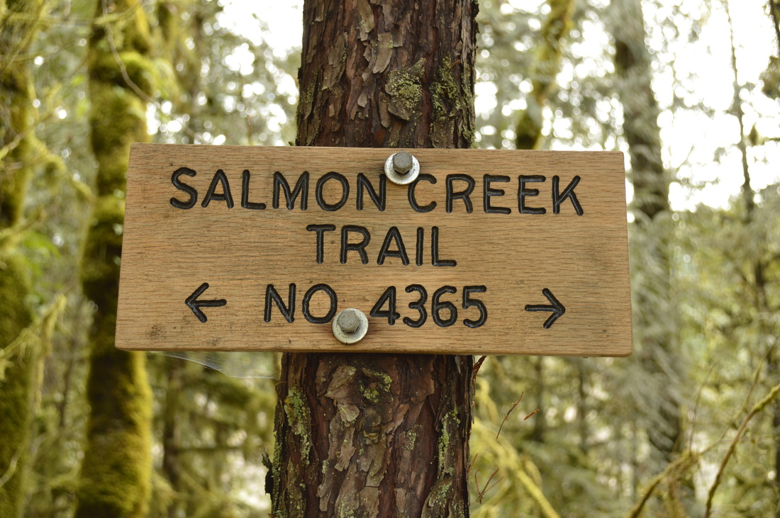
Salmon Creek Trail North Bank
Hike details:
Mileage: 6.5 miles round trip w/ 500 ft. elevation gain
Approximate hike time: 2 hours 43 minutes w/ an average pace of 2.3 mph
Difficulty: Moderate
Trail usage: Medium to high on weekends depending on the weather, low on weekdays
Highest elevation: 1,537 ft. Lowest elevation: 1,305 ft.
General location: 5 miles east of downtown Oakridge - Willamette National Forest
Accessible: Year-round
(Best time to go is during the spring when everything is lush and green and the waterfall is flowing).
Permits required: N/A
Pit toilet at trailhead: No
Trail allows: Dogs, mountain bikes
Possible dangers: N/A
|
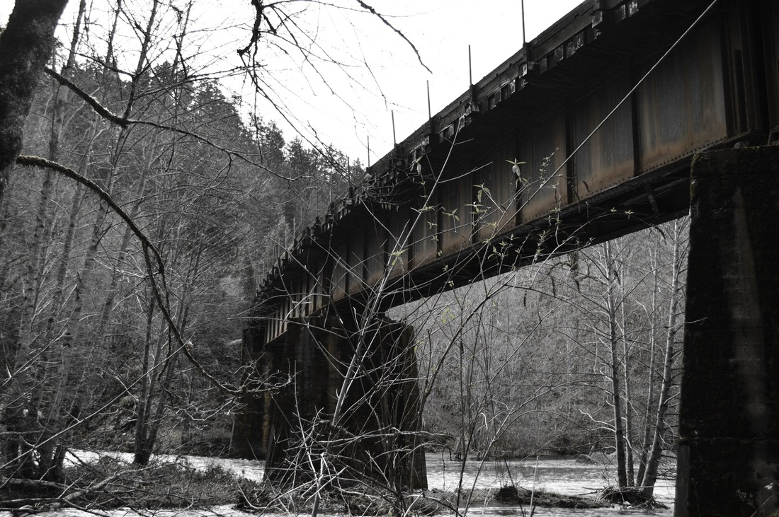
Description:The Salmon Creek #4365 has a north and south side which, with a tiny bit of road walking, can be combined, making a 8.25 mile loop that has 1,800 ft. elevation gain. For a shorter out and back hike you can do the Salmon Creek Trail North Bank to Salmon Creek Falls. The first few hundred feet from the parking area to the Salmon Creek Trail is nothing spectacular. You are walking right next to a railway line and there is spray paint on the wall, as well as trash in the bushes. But once you come up to the main trail, you can take a small trail to the right and go look at the impressive railroad bridge over the river. It does make for some neat photos.
|
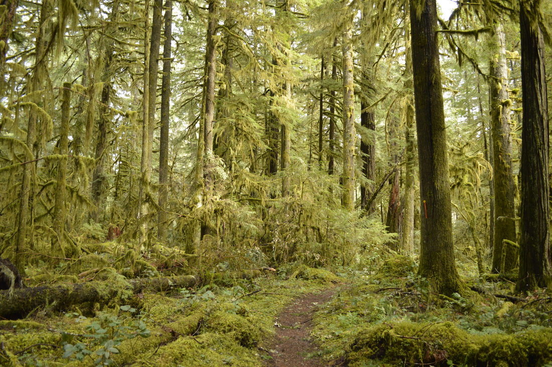
Once you hike upstream along Salmon Creek a little farther it becomes a beautiful lush green oasis. It doesn't matter how yucky the weather is, you will see people on this hike. There are lots of Oakridge residents who walk their dogs on this trail, as well as lots of mountain bikers who like to ride the loop. The great part about this trail is that you can make it as long or as short of a hike as you want to. Because it is so close to Oakridge, you are not necessarily committed to hours of hiking. And if you're hiking with small children, this trail is great because it is well maintained and pretty flat. Once you get tired of hiking, turn around and head back to town to enjoy some lunch, coffee or baked goods at the Lion Mountain Bakery.
|
|
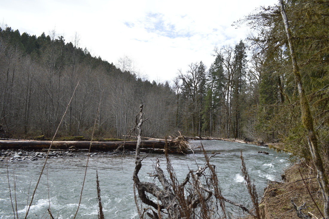
The entire trail is very beautiful, however there is a mile long section where you are walking on an old gravel road. This part is farther away from the river, and you are surrounded by younger trees. This section just doesn't have as much character and there is not much to look at. But at this point you are very close to Salmon Creek Campground. If your destination is the campground, be careful, because in the early spring the high water can wash out part of the trail. Shortly after crossing a gravel road (this is the gravel road you would turn right on if you were hiking the loop, to get to the beginning of the South Bank trailhead), you will arrive at the Salmon Creek Campground. Head to the edge of the creek and see a beautiful little waterfall plunging into Salmon Creek. This is a seasonal waterfall and definitely not heavily flowing year-round.
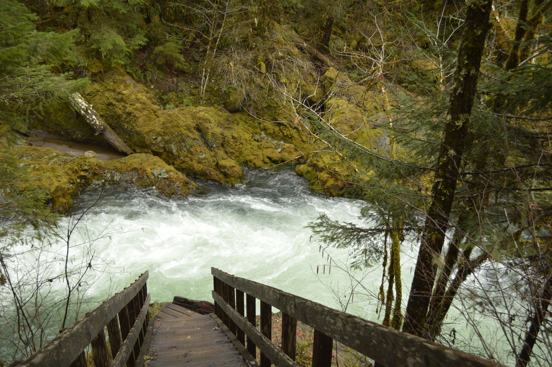
(this bridge used to connect the North and South Bank trails but it never got repaired after getting washed away)
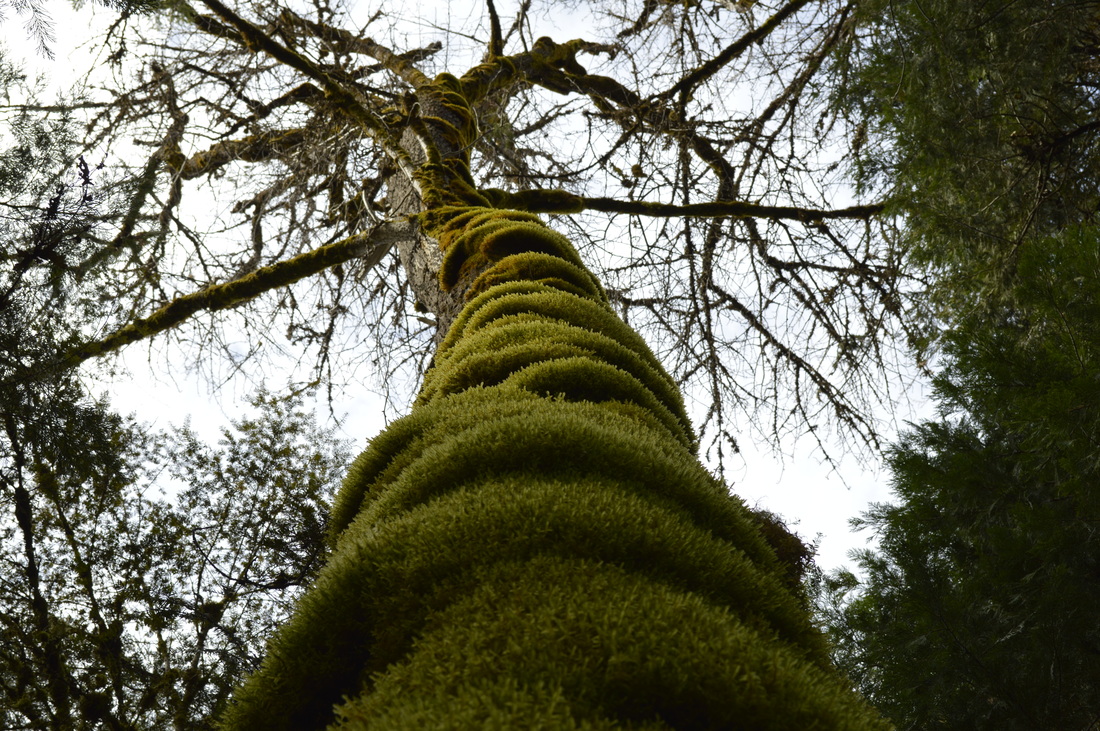
Overall, this easy but scenic hike is highly recommended. This is the perfect place to take your children and possibly even see some wildlife like bald eagles, deer and things like salamanders and huge slugs along the trail. If you are into nature photography, even just macro photos of moss, beautiful leaves, etc. there is ample opportunity for this along the trail. This hike is definitely for all ages and experience levels, and it will make anyone get out even more after seeing the beauty and strength of the river.
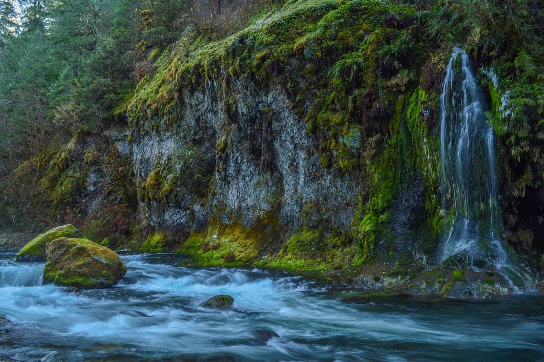
(Salmon Creek Falls)
Directions:
From Oakridge
- At the only stop light in the town of Oakridge turn onto Railroad Ave. which turns into Salmon Creek Rd. Head down this road for 1.2 miles until you see a pullout to your right. Here at the beginning of Flat Creek Rd. you will see signs for the trailhead.
-This trail write-up was last updated January 2023-
*All pictures are taken by Franziska Weinheimer
*All pictures are taken by Franziska Weinheimer
*Disclaimer: The trail descriptions, mileage, GPS tracks and difficulty ratings depicted on this website are never 100% accurate. Always hike at your own risk, using your own knowledge, equipment and common sense. Franziska Weinheimer/Hike Oregon are not responsible if you or anyone in your party gets injured or lost while attempting one of these or any other hikes.