Hike Oregon
  • Home
  • *Store*
  • About the author
  • How to use this site
  • Resources
    • Wildflowers
    • Videos
  • Best Oregon Hikes
    • Top Fall Foliage Hikes In Oregon
    • Top 10 Oregon Fall Hikes
    • 20 Best Oregon Waterfall Hikes
    • Top 10 Oregon Hikes for Kids
    • Sno-Parks In Central Oregon
    • Top 10 Oregon Winter Hikes
    • Top Low Elevation Winter Hikes
    • 9 Amazing Oregon Summit Hikes
    • 20 Central Oregon Day Hikes
    • 20 Epic Oregon Wildflower Hikes
    • 5 Weekend Backpacking Trips in Oregon
    • Top One Night Backpacking Trips in Oregon
    • Top 10 Oregon Summer Hikes
    • Top 10 Swimming Spots In Oregon
    • Top 10 Oregon Spring Hikes
  • Oregon Sno-Parks
    • Maxwell Sno-Park
    • Potato Hill Sno-Park
    • Ray Benson Sno-Park
      • Brandenburg Shelter
    • Santiam Sno-Park
    • Three Creek Sno-Park
    • Virginia Meissner Sno-Park
      • Meissner Shelter Loop
      • Nordeen Shelter
    • Gold Lake Sno-Park
      • Westview Shelter to Eagle Rock Overlook
      • Marilyn Lakes Loop
  • Southern Washington
    • Hamilton Mountain
    • Dog Mountain
    • Coyote Wall
    • Mount St. Helens
  • Portland
    • Powell Butte
    • Forest Park
    • Latourell Falls
    • Multnomah/Wahkeena Falls
    • Eagle Creek
    • Mitchell Point
    • Table Rock
    • Tamanawas Falls
    • Trillium Lake
    • East Zigzag Mountain (members only)
  • Salem
    • Abiqua Falls
    • Silver Falls State Park
    • Dome Rock
    • Marion Lake to Marion Mountain
    • Jefferson Park
  • Corvallis
    • Marys Peak East Ridge
    • Marys Peak North Ridge
    • Alsea Falls and Green Peak Falls
    • Corvallis to Sea Trail - Sugarbowl Creek segment (members only)
  • Sweet Home
    • Crescent Mountain
    • Iron Mountain
    • McDowell Creek Falls
    • Middle Santiam River (members only)
    • Lower Soda Creek Falls (members only)
    • Rooster Rock (members only)
  • McKenzie Bridge/Blue River
    • Macduff Mountain
    • Proxy Falls
    • Clear Lake
    • Sahalie/Koosah Falls
    • Blue Pool
    • Erma Bell Lakes
    • Olallie Mountain
    • Horsepasture Mountain
    • Tidbits Mountain
    • Castle Rock
    • Lowder Mountain (members only)
    • East Fork Trail (members only)
    • Rainbow Falls Overlook (members only)
    • Frissell Point (members only)
    • Chucksney Mountain (members only)
    • Substitute Point (members only)
  • Sisters/Santiam Pass
    • Coffin Mountain
    • Trappers Butte and Scar Mountain
    • Maxwell Butte
    • Black Butte
    • Whychus Creek Trail
    • Tam McArthur Rim
    • Black Crater
    • Scott Mountain
    • Obsidian Trail
    • Metolius Preserve
    • Three Fingered Jack Loop
    • Square Lake
    • Canyon Creek Meadows
    • Patjens Lakes
    • Craig Lake (members only)
    • Chush Falls (members only)
    • Rockpile Lake (members only)
    • Santiam Lake (members only)
    • Camp Lake (members only)
    • Park Meadow to Golden Lake (members only)
  • Bend/Redmond/LaPine
    • Steins Pillar
    • Chimney Rock
    • Steelhead Falls
    • Tumalo State Park
    • Shevlin Park Loop
    • Tumalo Falls
    • Tumalo Mountain
    • No Name Lake
    • Green Lakes
    • Moraine Lake
    • South Sister Summit
    • Horse Lake
    • Muskrat Lake
    • Paulina Peak
    • Peter Skene Ogden Trail (members only)
  • Eugene
    • Ridgeline Trail
    • Mount Pisgah Summit
    • Mount Pisgah Arboretum
    • Shotgun Creek
    • Mount June
    • Lawler
    • Tire Mountain
    • Goodman Creek
    • Brice Creek
    • Trestle Creek Falls
    • Parker Falls
    • Moon Falls
    • Elijah Bristow State Park
    • South Willamette Trail (members only)
    • Eula Ridge (members only)
    • Eagle's Rest (members only)
  • Oakridge
    • Deception Creek
    • North Salmon Creek
    • Grasshopper Ridge
    • Larison Creek
    • Bunchgrass Ridge
    • Salt Creek Falls
    • Waldo Lake Loop
    • South Waldo Loop
    • The Twins
    • Rosary Lakes
    • Yoran Lake
    • Fawn Lake
    • Windy Lakes
    • Divide Lake
    • Diamond Peak Summit
    • Cowhorn Mountain
    • Wall Creek Warm Springs (members only)
    • Moon Point (members only)
    • Bobby Lake (members only)
    • Lillian Falls (members only)
    • Middle Fork Willamette Trail (members only)
    • Pool Creek Falls (members only)
    • Dead Mountain (members only)
    • Larison Rock (members only)
    • Quinn Lakes & Eddeeleo Lakes (members only)
    • Waldo Mountain Lookout (members only)
    • Blair Lake to Spring Prairie (members only)
    • Rigdon Lakes loop (members only)
  • Oregon Coast
    • Cascade Head
    • Drift Creek Falls
    • Sweet Creek Falls
    • Beaver Creek Falls
    • Kentucky Falls
    • Hobbit Trail to Heceta Head
    • Valley Trail to China Creek
    • Sutton Creek Trail (members only)
    • North Fork Smith River (members only)
    • Cummins Ridge (member's only)
    • Horse Creek (members only)
    • Siltcoos Lake (members only)
  • Southern Oregon
    • Fall Creek Falls
    • Watson Falls
    • Wild Rogue Loop
    • Mt. Thielsen
    • Crater Lake National Park
      • The Watchman
      • Mount Scott
      • The Pinnacles
    • Lower Table Rock
    • Pilot Rock
    • Wagner Butte
    • Mt. McLoughlin
    • Lemolo Falls (members only)
    • Fern Falls (members only)
  • Eastern Oregon
    • Painted Cove
    • Anthony Lake Loop
    • Mount Howard
    • Eagle Cap summit
    • Schneider Cabin (members only)
    • Strawberry Lake & Strawberry Falls (members only)
  • Oregon PCT sections
  • Tips & Tricks
    • Leave No Trace
    • How To Pick The Right Backpacking Tent
    • Top Tips For Hiking With Infants And Toddlers
    • Poison Oak, Ivy and Sumac
    • How to dress for cold weather hikes
    • Outdoorsy Holiday Gift Guide 2022
    • Hiker Holiday Gift Guide 2019
    • Outdoor Holiday Gift Guide 2018
    • Hiking Holiday Gift Guide 2017
  • Reviews/Gear
    • Storing Your Bear Canister When Backpacking
    • Stay Kühl This Summer
    • Outdoor Herbivore Backpacking Food Review
    • Osprey Aura AG 65 Backpack review
    • Big Agnes Fly Creek UL2 review
    • REI Quarter Dome 1 review
  • Adventure Stories
    • Hiking The Rae Lakes Loop
    • 110 Miles on the PCT
    • Three Fingered Jack Adventures
    • Jefferson Wilderness

Eagle Cap summit

​

via West Fork Wallowa Trail

​
Get the printable version of this hike

Hike details​:

Mileage: 30.4 miles round trip w/ 7,250 ft. elevation gain
Approximate hike time: 13 hours 15 minutes w/ an average pace of 2.3 mph
Difficulty: Difficult
Trail usage: Medium on summer weekdays, high on summer weekends
Highest elevation: 9,544 ft. Lowest elevation: 4,636 ft.
General location: 6.2 miles south of Joseph - Eagle Cap Wilderness - Wallowa-Whitman National Forest
Accessible: End of July through end of September
(Best time to go is August and September).
Permits required: Free self issue wilderness permit available at the trailhead
Northwest Forest Pass for parking
Pit toilet at trailhead: Yes
Trail allows: Dogs, horses (not to the summit though), camping
Possible dangers: ​River crossings, loose rocks, steep drop offs at the summit
Wallowa Lake Trailhead sign

Description​:

The hike up to Eagle Cap summit is definitely recommended as an overnight trip. You can get to the Eagle Cap summit trail via a few different trailheads, but this write-up takes you from the Wallowa Lake Trailhead via the West Fork Wallowa Trail, which is one of the most direct routes. If you want to stay in the Wallowas longer, you can of course add on to this hike to make a big loop or to do other side trips and visit more lakes. Even though this trail is difficult, there are plenty of places to camp along the way, so you can make your daily mileage short and really enjoy this scenic area. 
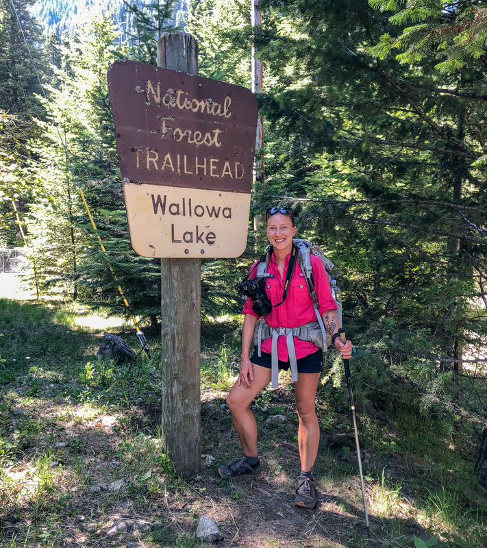
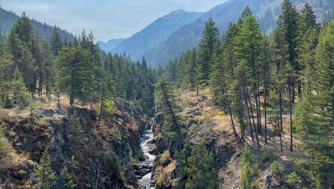
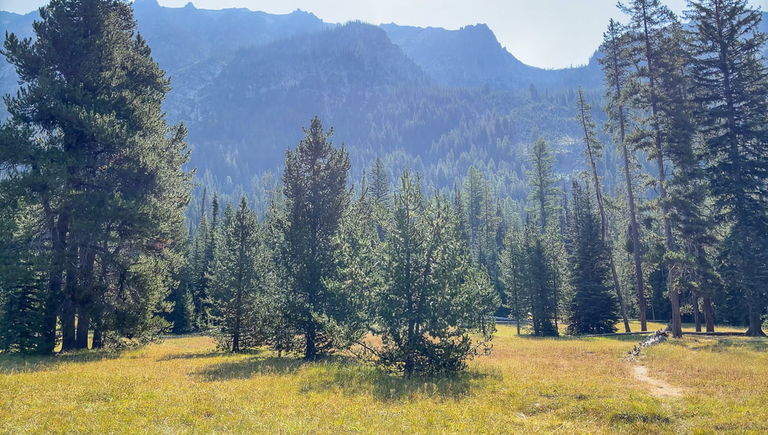
Start the hike at the Wallowa Lake Trailhead where you will see a large sign and a wilderness permit kiosk where you will fill out a free self-issue permit. From the trailhead make sure to get onto the West Fork Wallowa Trail #1820. After 0.3 miles there is a little turn off to the right to go see Wallowa Falls. This is a beautiful little viewpoint and is worth the short jaunt off the main trail. After checking out the viewpoint, continue uphill on the West Fork Wallowa Trail for 2.4 miles. This rocky and rugged trail takes you through the trees for a bit and then opens up to some river and mountain views. 
West Fork Wallowa River
(viewpoint for Wallowa Falls)
West Fork Wallowa Trail
Ice Lake Trail junction
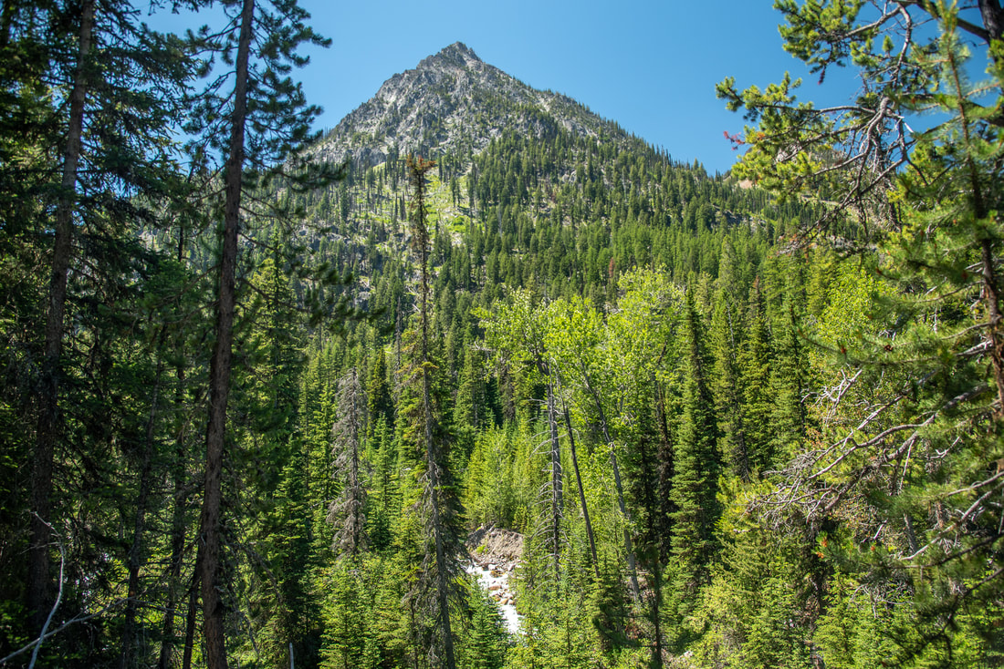
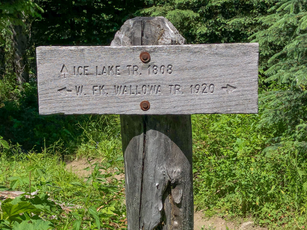
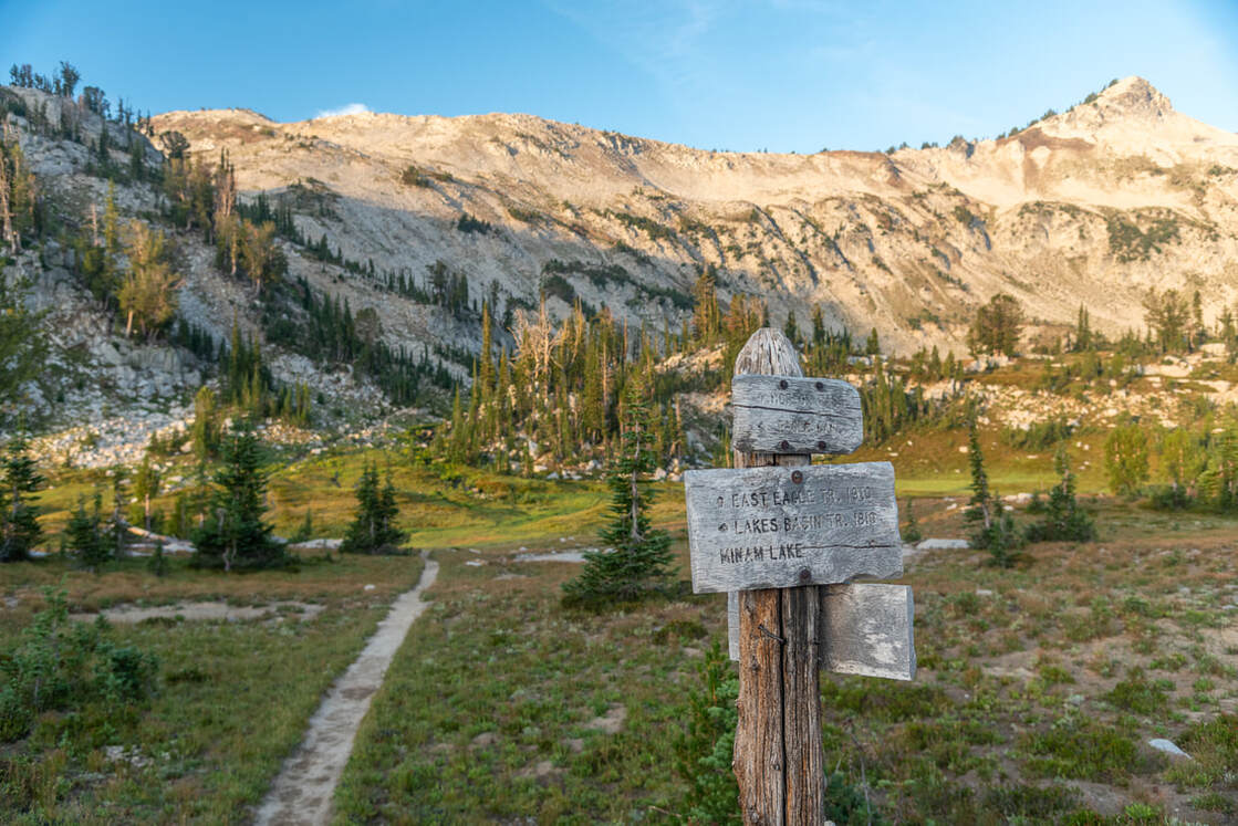
After those 2.4 miles you will reach a junction with the Ice Lake Trail. Ice Lake is a great destination, but this trail is not for the faint of heart with its 31 switchbacks and very narrow, rocky and exposed trail that gains 2,700 feet elevation in 4.5 miles. If you would like more details about this side trip and summiting Matterhorn, check out the write-up in the guidebook 'Oregon's Best Views'. From the junction, continue on the West Fork Wallowa Trail #1820 for another 3.3 miles until you see a sign for the Lakes Basin Trail and Six Mile Meadow. Turn right onto the Lakes Basin Trail #1810 walk through Six Mile Meadow which offers spectacular places to camp. This makes for a good first day stopping point since you will have already hiked 6 miles and gained 1,400 feet elevation. If you are still feeling fresh and want to hike a few more miles and camp at a lake, Horseshoe Lake is a wonderful place to camp. 
Six Mile Meadow
(Six Mile Meadow)
West Fork Wallowa River crossing
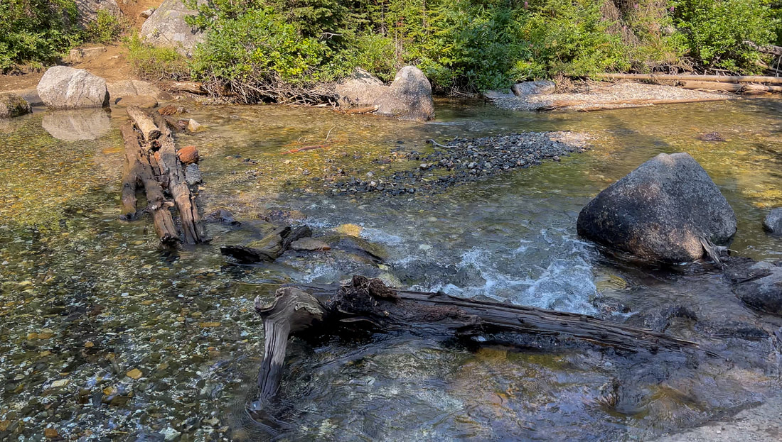
(West Fork Wallowa River crossing)
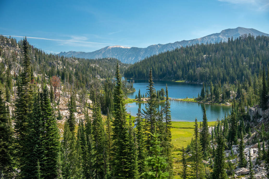
From Six Mile Meadow you will cross the West Fork Wallowa River, which is quite wide here and can be raging early in the season (July), but by August it is easy to rock or log hop across without getting your feet wet. After crossing the river, the trail takes you up 7 switchbacks as you gain another 1,220 feet in the next 2.3 miles to a trail junction right before Horseshoe Lake. Take the Horseshoe Lake Trail 1821 to the left, which takes you along the lakeshore. There are lots of backcountry campsites at Horseshoe Lake and the view across the lake of Sentinel Peak and Polaris Pass is absolutely incredible! 
Horseshoe Lake Wallowas August
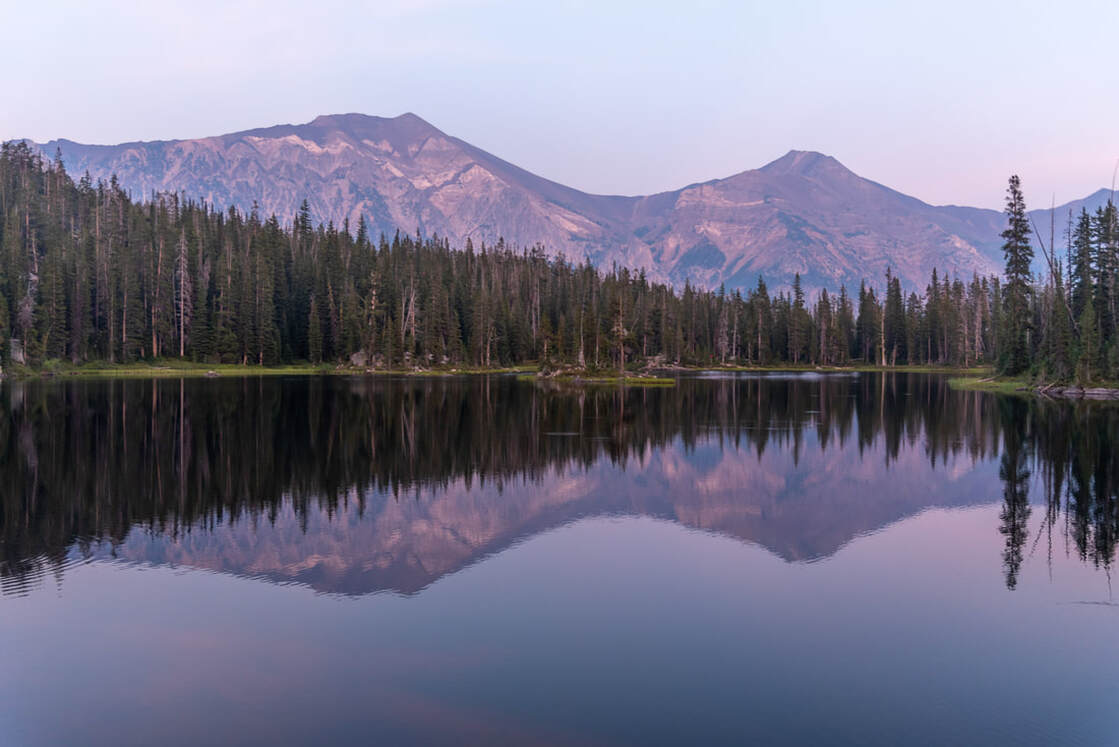
(Horseshoe Lake at sunset)
Douglas Lake Wallowas August
Wildflowers Moccasin Trail Wallowas
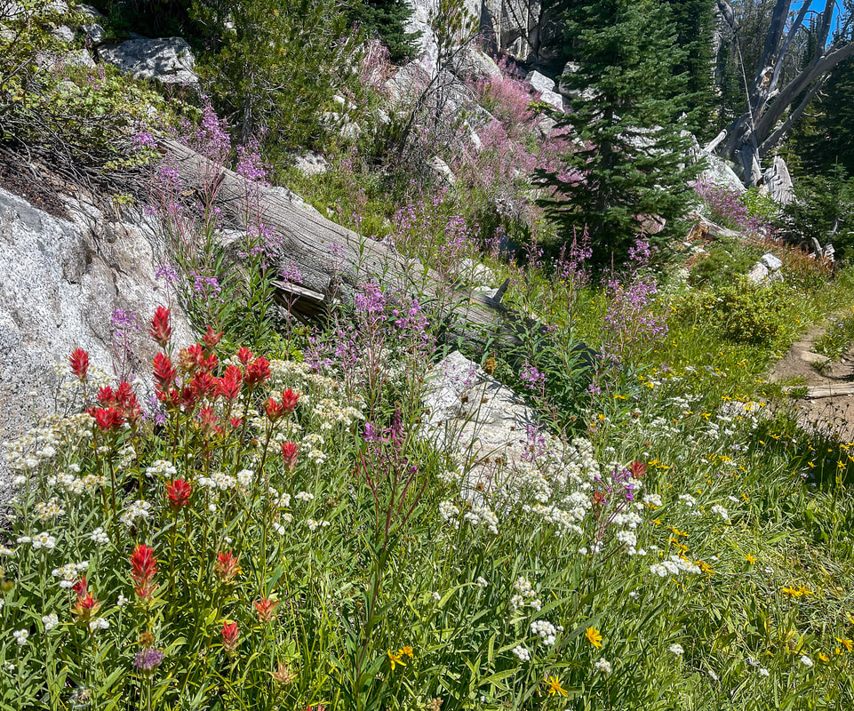
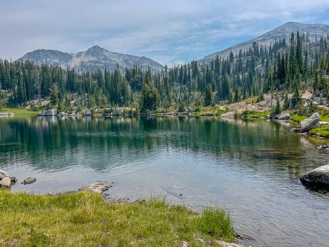
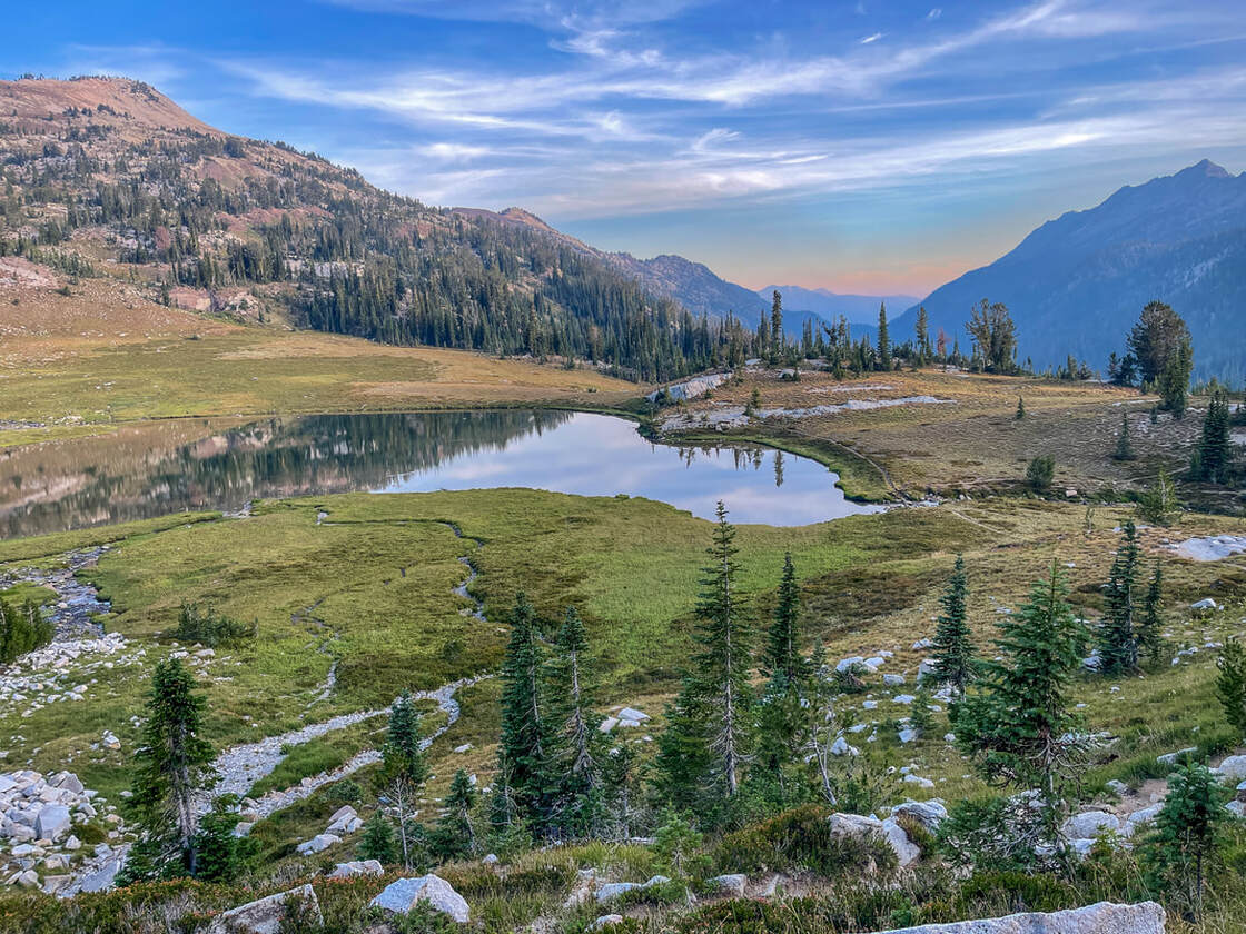
After leaving Horseshoe Lake, you will continue on the Horseshoe Lake Trail for another mile, passing Lee Lake and coming to where you will rejoin the Lakes Basin Trail #1810. Hike 0.3 miles to Douglas Lake, another stunning lake with jagged North Basin Peak in the background. At a Y split, take a left onto the Moccasin Trail #1810A and ascend gently up 1.7 miles to Moccasin Lake, passing by a rainbow array of wildflowers in late July and early August. 
If you are planning on summiting Eagle Cap the next morning, it is recommended that you stay at either Moccasin Lake or Mirror Lake. Moccasin Lake has better swimming access, the campsites are large and very flat, but the view isn't as grand and you are not as close to the Eagle Cap summit. 
Moccasin Lake north side
(Moccasin Lake)
Camping at Moccasin Lake Wallowas
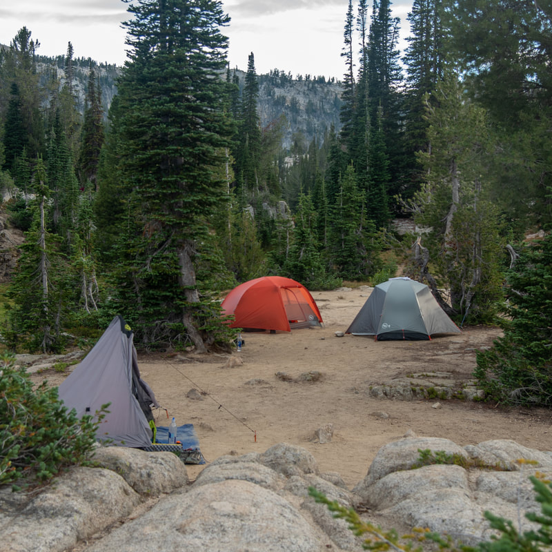
(camping at Moccasin Lake)
Eagle Cap from Moccasin Lake
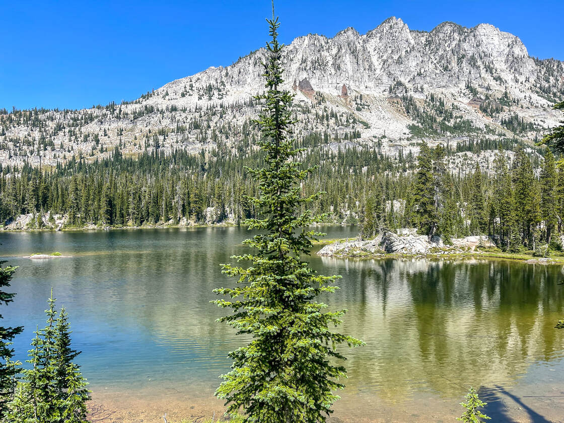
(the lower end of Moccasin Lake and Eagle Cap)
From Moccasin Lake you will continue on the Moccasin Trail for 0.4 miles over to Mirrow Lake. Mirror Lake has a better view of Eagle Cap (hence the name Mirror Lake) and therefor will have a lot more people. There are quite a few campsites but none of them are very big and many of them aren't very flat. Skirt around the north side of Mirror Lake just short of half a mile to a trail junction. Take a left on the Ivan Carper Trail #1661 for just 200 feet, then turn left on the East Eagle Trail #1910. 
Moccasin Lake Wallowas
(Moccasin Lake)
East Eagle Trail junction
Upper Lake Wallowas
(Upper Lake)
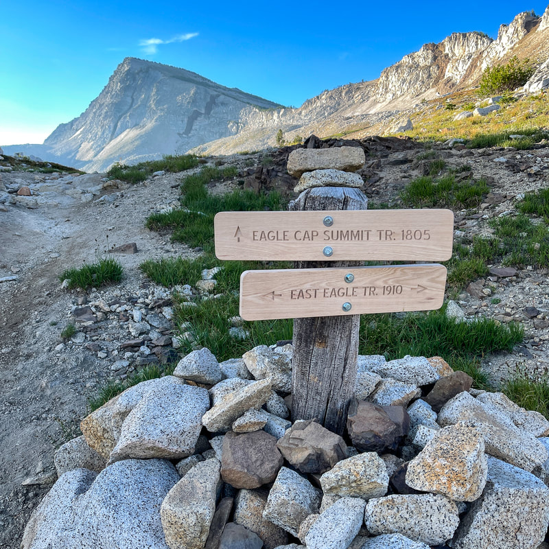
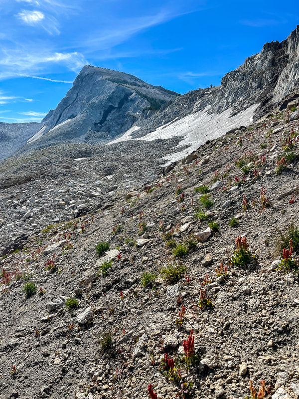
From here the trail starts to gain some elevation, as you pass Upper Lake, which is located on a beautiful little plateau. From Upper Lake there are a total of 12 short switchbacks in the next 0.7 miles to another trail junction. The East Eagle Trail goes to the right and you will continue straight, on the Eagle Cap Summit Trail #1805. The next 1.4 miles are steep and rocky, as you gain 1,300 feet of elevation. Take it slow, there is no rush. Remember that you are up at over 9,000 feet which can make it much harder to hike. Don't be surprised if you have a little bit of shortness of breath and that you just have to work a little bit harder. Please stop hiking immediately if you are feeling dizzy, start having a headache or feel nauseated. These are signs of altitude sickness and should not be pushed through! 
Eagle Cap summit sign
Eagle Cap summit trail
(Eagle Cap)
View of Hurricane Ridge from Eagle Cap summit trail
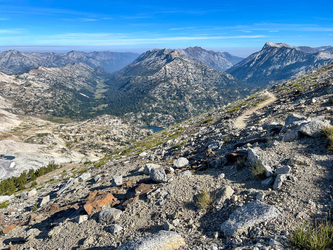
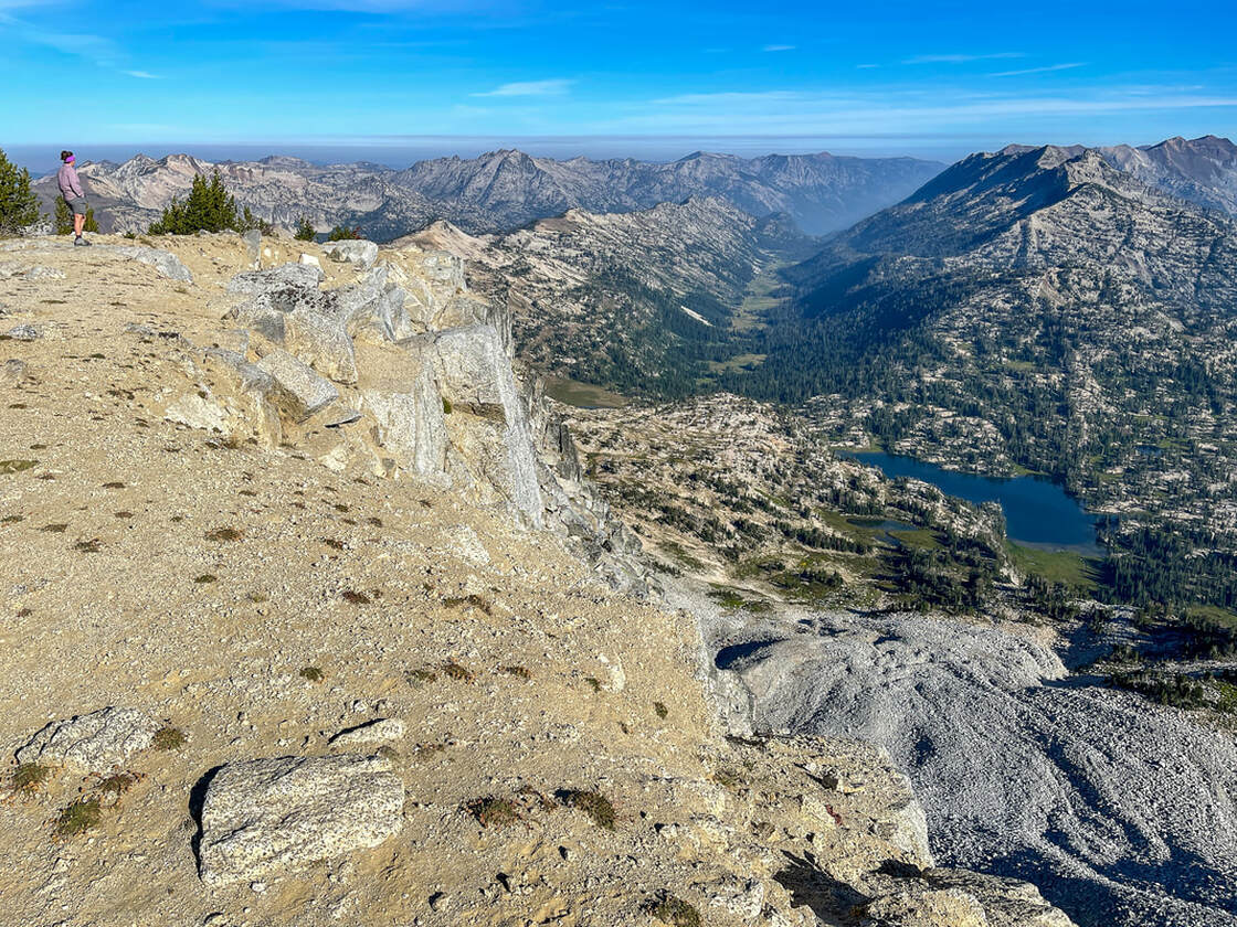
(view of the East Lostine River valley and the West Fork Wallowa River valley from the Eagle Cap Summit Trail)
View from Eagle Cap summit trail
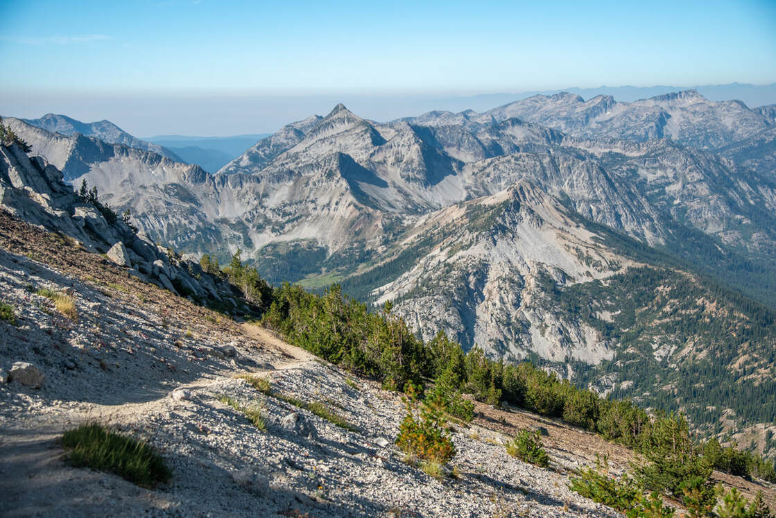
The views along this stretch of trail are absolutely fantastic and make you keep wanting to climb higher. You can see into the East Lostine River valley, as well as the West Fork Wallowa River valley and there are many prominent peaks that you can see, such as Brown Mountain (8,822 ft. tall), Minam-Mirror Peak (8,737 ft. tall), Moccasin Lake Mountain (8,442 ft. tall), and North Basin Peak (8,921 ft. tall). Alpine Lakes and meadows dot the landscapes between the mountains, making you wish you had weeks to spend out here exploring all of these beautiful places. 
view of Blue Lake Wallowas
(Blue Lake and Brown Mountain)
Eagle Cap summit
(Eagle Cap summit)
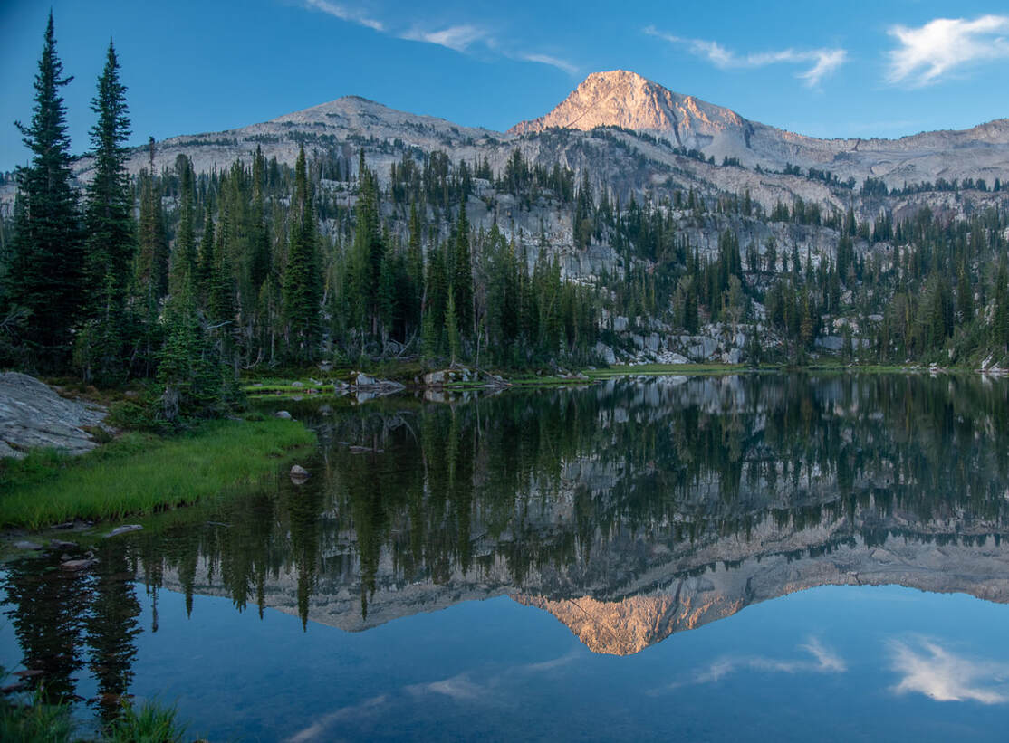
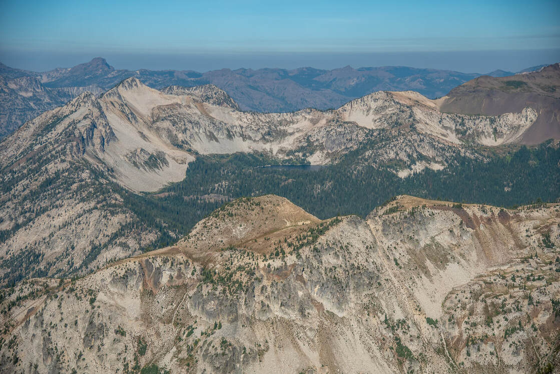
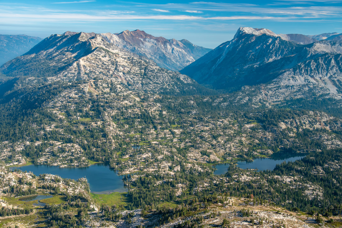
The summit of Eagle Cap is large and flat, making it easy to sit and have a snack or lunch break and enjoy the view. But don't get too close to the edge, the drop off is insanely steep! The summit is 9,544 feet high, and is actually only the 10th tallest peak in the Wallowa Mountain Range. From here you can see the various river valleys and Mirror Lake and Moccasin Lake bright blue below the mountain. Glacier Lake is off over to the east and looks a little bit like a heart from above. The granite landscape is absolutely breathtaking and unlike anything else you've ever seen in Oregon (hence why the Wallowas have earned the nickname "the Alps of Oregon" or "little Switzerland"). 
From the Eagle Cap summit, you will return the way you came. It is recommended that you leave most of your belongings at camp (either at Mirror or Moccasin Lake) and just summit with a summit pack. This will make it much easier than trying to summit with a large backpacking pack on. 
View of Mirror Lake and Moccasin Lake from Eagle Cap summit
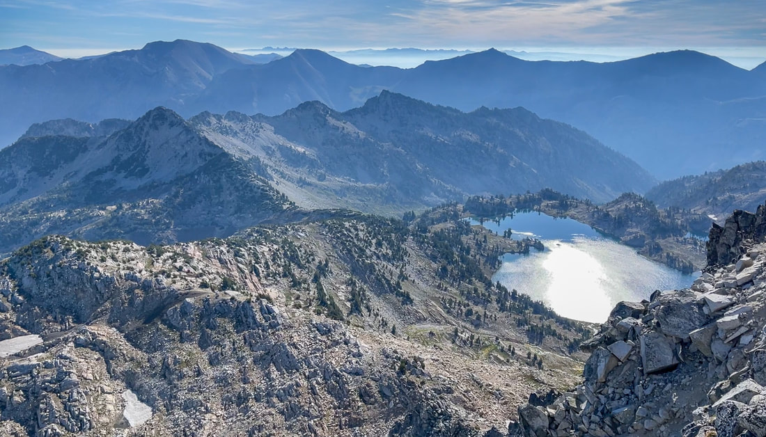
(Mirror Lake and Moccasin Lake from Eagle Cap summit)
The Eagle Cap summit trail is definitely not as difficult as some other Oregon summits. There is not loose rock, there are no hand holds necessary and there is no route finding that you have to do. The summit is a simply a steep walk up. Because there are no quick or easy ways to get into the base of Eagle Cap, this does become an overnight hike, most likely two nights and three days, depending on how many miles you want to hike a day and how many other things you want to explore in the area. 
Glacier Lake from Eagle Cap summit
(Glacier Lake from Eagle Cap summit)

Directions​:

From Joseph
  • Drive through the town of Joseph on OR-351 S for a total of 6 miles. At a Y junction, stay left on Powerhouse Dr. for 1 mile and find the trailhead parking along both sides of the road. (Total of 7 miles)
​To get a more in-depth and personal view of this hike, watch the YouTube video.
​-This trail write-up was last updated June, 2022-
*All pictures are taken by Franziska Weinheimer
*Disclaimer: The trail descriptions, mileage, GPS tracks and difficulty ratings depicted on this website are never 100% accurate. Always hike at your own risk, using your own knowledge, equipment and common sense. Franziska Weinheimer/Hike Oregon are not responsible if you or anyone in your party gets injured or lost while attempting one of these or any other hikes.

HIKED HERE RECENTLY? PLEASE LEAVE A TRIP REPORT BELOW:

© Hike Oregon 2023
P.O. Box 41911
​Eugene, OR 97404
Proudly powered by Weebly
  • Home
  • *Store*
  • About the author
  • How to use this site
  • Resources
    • Wildflowers
    • Videos
  • Best Oregon Hikes
    • Top Fall Foliage Hikes In Oregon
    • Top 10 Oregon Fall Hikes
    • 20 Best Oregon Waterfall Hikes
    • Top 10 Oregon Hikes for Kids
    • Sno-Parks In Central Oregon
    • Top 10 Oregon Winter Hikes
    • Top Low Elevation Winter Hikes
    • 9 Amazing Oregon Summit Hikes
    • 20 Central Oregon Day Hikes
    • 20 Epic Oregon Wildflower Hikes
    • 5 Weekend Backpacking Trips in Oregon
    • Top One Night Backpacking Trips in Oregon
    • Top 10 Oregon Summer Hikes
    • Top 10 Swimming Spots In Oregon
    • Top 10 Oregon Spring Hikes
  • Oregon Sno-Parks
    • Maxwell Sno-Park
    • Potato Hill Sno-Park
    • Ray Benson Sno-Park
      • Brandenburg Shelter
    • Santiam Sno-Park
    • Three Creek Sno-Park
    • Virginia Meissner Sno-Park
      • Meissner Shelter Loop
      • Nordeen Shelter
    • Gold Lake Sno-Park
      • Westview Shelter to Eagle Rock Overlook
      • Marilyn Lakes Loop
  • Southern Washington
    • Hamilton Mountain
    • Dog Mountain
    • Coyote Wall
    • Mount St. Helens
  • Portland
    • Powell Butte
    • Forest Park
    • Latourell Falls
    • Multnomah/Wahkeena Falls
    • Eagle Creek
    • Mitchell Point
    • Table Rock
    • Tamanawas Falls
    • Trillium Lake
    • East Zigzag Mountain (members only)
  • Salem
    • Abiqua Falls
    • Silver Falls State Park
    • Dome Rock
    • Marion Lake to Marion Mountain
    • Jefferson Park
  • Corvallis
    • Marys Peak East Ridge
    • Marys Peak North Ridge
    • Alsea Falls and Green Peak Falls
    • Corvallis to Sea Trail - Sugarbowl Creek segment (members only)
  • Sweet Home
    • Crescent Mountain
    • Iron Mountain
    • McDowell Creek Falls
    • Middle Santiam River (members only)
    • Lower Soda Creek Falls (members only)
    • Rooster Rock (members only)
  • McKenzie Bridge/Blue River
    • Macduff Mountain
    • Proxy Falls
    • Clear Lake
    • Sahalie/Koosah Falls
    • Blue Pool
    • Erma Bell Lakes
    • Olallie Mountain
    • Horsepasture Mountain
    • Tidbits Mountain
    • Castle Rock
    • Lowder Mountain (members only)
    • East Fork Trail (members only)
    • Rainbow Falls Overlook (members only)
    • Frissell Point (members only)
    • Chucksney Mountain (members only)
    • Substitute Point (members only)
  • Sisters/Santiam Pass
    • Coffin Mountain
    • Trappers Butte and Scar Mountain
    • Maxwell Butte
    • Black Butte
    • Whychus Creek Trail
    • Tam McArthur Rim
    • Black Crater
    • Scott Mountain
    • Obsidian Trail
    • Metolius Preserve
    • Three Fingered Jack Loop
    • Square Lake
    • Canyon Creek Meadows
    • Patjens Lakes
    • Craig Lake (members only)
    • Chush Falls (members only)
    • Rockpile Lake (members only)
    • Santiam Lake (members only)
    • Camp Lake (members only)
    • Park Meadow to Golden Lake (members only)
  • Bend/Redmond/LaPine
    • Steins Pillar
    • Chimney Rock
    • Steelhead Falls
    • Tumalo State Park
    • Shevlin Park Loop
    • Tumalo Falls
    • Tumalo Mountain
    • No Name Lake
    • Green Lakes
    • Moraine Lake
    • South Sister Summit
    • Horse Lake
    • Muskrat Lake
    • Paulina Peak
    • Peter Skene Ogden Trail (members only)
  • Eugene
    • Ridgeline Trail
    • Mount Pisgah Summit
    • Mount Pisgah Arboretum
    • Shotgun Creek
    • Mount June
    • Lawler
    • Tire Mountain
    • Goodman Creek
    • Brice Creek
    • Trestle Creek Falls
    • Parker Falls
    • Moon Falls
    • Elijah Bristow State Park
    • South Willamette Trail (members only)
    • Eula Ridge (members only)
    • Eagle's Rest (members only)
  • Oakridge
    • Deception Creek
    • North Salmon Creek
    • Grasshopper Ridge
    • Larison Creek
    • Bunchgrass Ridge
    • Salt Creek Falls
    • Waldo Lake Loop
    • South Waldo Loop
    • The Twins
    • Rosary Lakes
    • Yoran Lake
    • Fawn Lake
    • Windy Lakes
    • Divide Lake
    • Diamond Peak Summit
    • Cowhorn Mountain
    • Wall Creek Warm Springs (members only)
    • Moon Point (members only)
    • Bobby Lake (members only)
    • Lillian Falls (members only)
    • Middle Fork Willamette Trail (members only)
    • Pool Creek Falls (members only)
    • Dead Mountain (members only)
    • Larison Rock (members only)
    • Quinn Lakes & Eddeeleo Lakes (members only)
    • Waldo Mountain Lookout (members only)
    • Blair Lake to Spring Prairie (members only)
    • Rigdon Lakes loop (members only)
  • Oregon Coast
    • Cascade Head
    • Drift Creek Falls
    • Sweet Creek Falls
    • Beaver Creek Falls
    • Kentucky Falls
    • Hobbit Trail to Heceta Head
    • Valley Trail to China Creek
    • Sutton Creek Trail (members only)
    • North Fork Smith River (members only)
    • Cummins Ridge (member's only)
    • Horse Creek (members only)
    • Siltcoos Lake (members only)
  • Southern Oregon
    • Fall Creek Falls
    • Watson Falls
    • Wild Rogue Loop
    • Mt. Thielsen
    • Crater Lake National Park
      • The Watchman
      • Mount Scott
      • The Pinnacles
    • Lower Table Rock
    • Pilot Rock
    • Wagner Butte
    • Mt. McLoughlin
    • Lemolo Falls (members only)
    • Fern Falls (members only)
  • Eastern Oregon
    • Painted Cove
    • Anthony Lake Loop
    • Mount Howard
    • Eagle Cap summit
    • Schneider Cabin (members only)
    • Strawberry Lake & Strawberry Falls (members only)
  • Oregon PCT sections
  • Tips & Tricks
    • Leave No Trace
    • How To Pick The Right Backpacking Tent
    • Top Tips For Hiking With Infants And Toddlers
    • Poison Oak, Ivy and Sumac
    • How to dress for cold weather hikes
    • Outdoorsy Holiday Gift Guide 2022
    • Hiker Holiday Gift Guide 2019
    • Outdoor Holiday Gift Guide 2018
    • Hiking Holiday Gift Guide 2017
  • Reviews/Gear
    • Storing Your Bear Canister When Backpacking
    • Stay Kühl This Summer
    • Outdoor Herbivore Backpacking Food Review
    • Osprey Aura AG 65 Backpack review
    • Big Agnes Fly Creek UL2 review
    • REI Quarter Dome 1 review
  • Adventure Stories
    • Hiking The Rae Lakes Loop
    • 110 Miles on the PCT
    • Three Fingered Jack Adventures
    • Jefferson Wilderness