Horsepasture Mountain
via Saddle Trail
Hike details:
Mileage: 2.8 miles round trip w/ 910 ft. elevation gain from the upper trailhead
7 miles round trip w/ 2,320 ft. elevation gain from Saddle Trail trailhead
Approximate hike time: 1 hour 13 minutes w/ an average pace of 2.3 mph (from upper trailhead)
3 hours 2 minutes w/ an average pace of 2.3 mph (from the Saddle Trail trailhead)
Difficulty: Moderate to difficult
Trail usage: Low to medium (Saddle Trail has very light foot traffic, from the Horsepasture Mountain trailhead you will see moderate foot traffic in July when the wildflowers are at their peak).
Highest elevation: 5,675 ft. Lowest elevation: 3,275 ft.
General location: 50 miles east of Springfield - Willamette National Forest
Accessible: June through November
(Best time to go is late June to mid-July when the wildflowers are in full bloom).
Permits required: N/A
Pit toilet at trailhead: No
Trail allows: Dogs, camping
Possible dangers: Cougar and bear activity
Description:
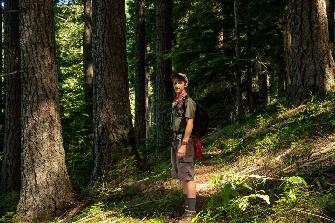
Horsepasture Mountain is one of the most underrated hikes in the area. It starts off of Road 1993. There is no large parking area, and the trail is only marked by a trail sign at the side of the gravel road. On the left side of the road you will see a small sign for Saddle Trail, this is a connector trail that leads up to Olallie Trail, O’Leary Mountain and Horsepasture Mountain.
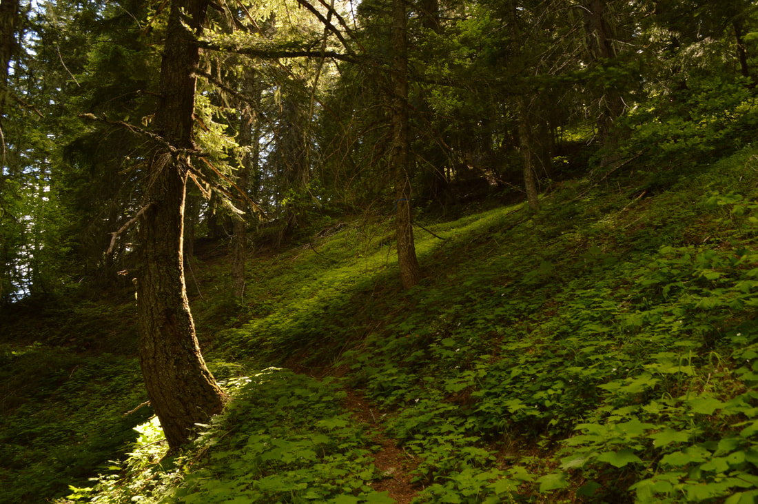
The first 2 miles from the road up to the ridge are very steep with a total of 22 switchbacks, going from 3,200 ft. elevation to 5,000 ft. Even though it is steep, the forest you are walking through is absolutely stunning. The trail does not get used much so there tends to be quite a lot of debris like branches and pine cones scattered on the trail. There is also a section through a small meadow where the trail is a little bit hard to see, especially early in the season.
|
|
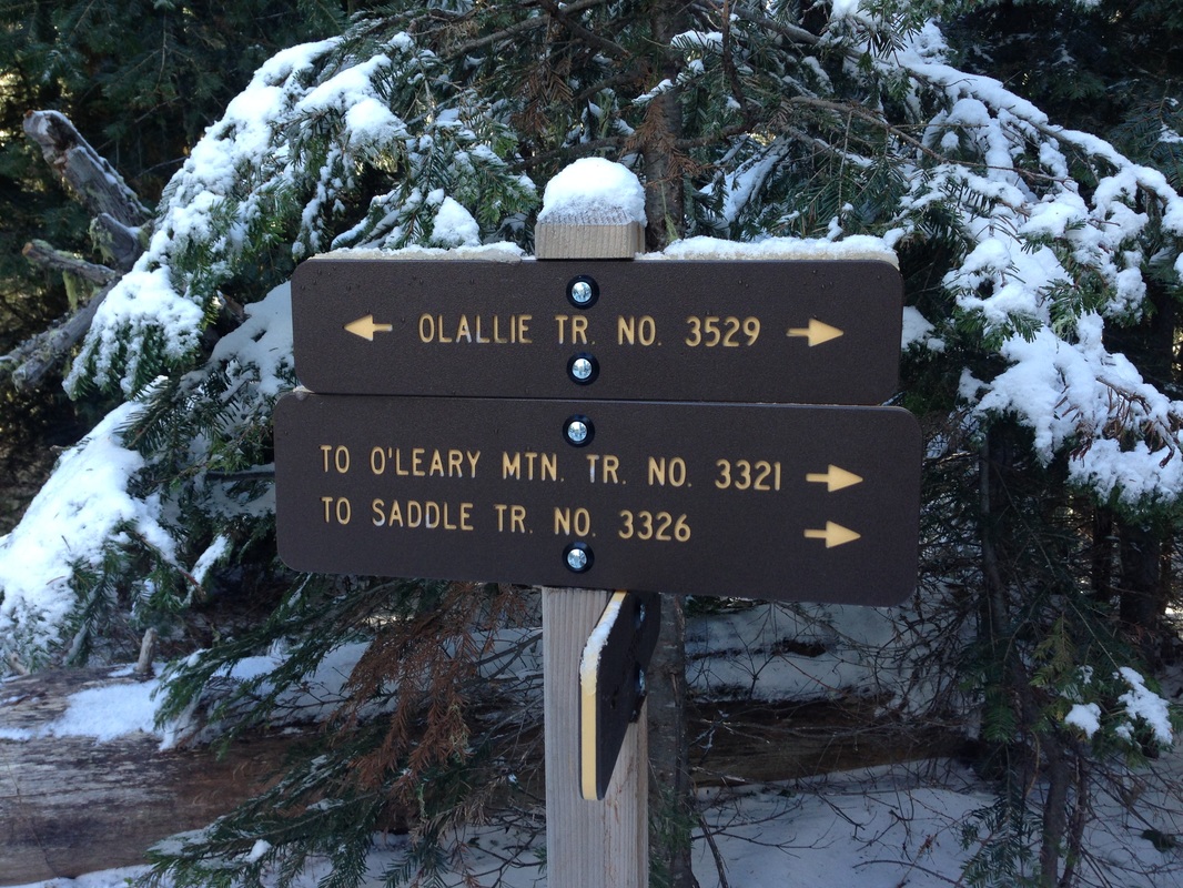
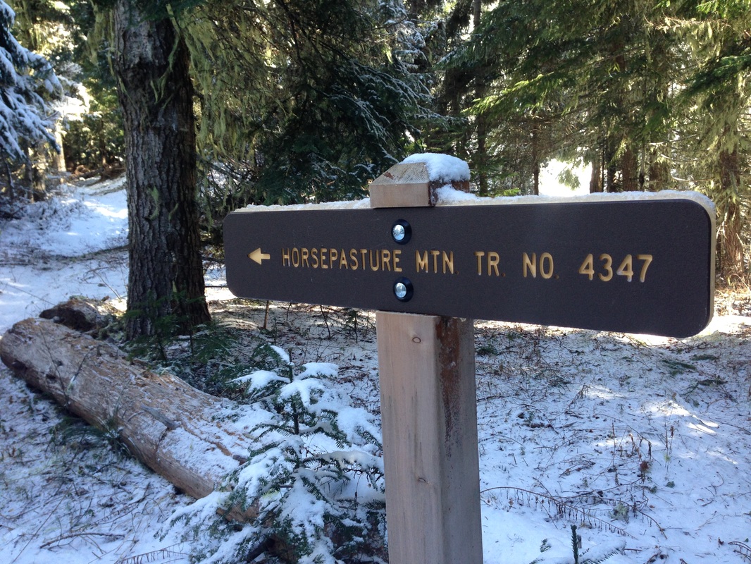
Once you arrive at the ridge, you will butt up to the Olallie Trail #3529 and you will see a T junction. You can either take the Olallie Trail to the left which will take to around O'Leary Mountain and will eventually intersect with O'Leary Mountain Trail #3321. But to get to Horsepasture Mountain you want to go right. Take the Olallie Trail to the right and in a few hundred yards the trail will split again. If you are out backpacking you can take Olallie Trail all the way to Olallie Mountain and even farther into the Three Sisters Wilderness, but if you are a day hiker and want spectacular views, take the Horsepasture Mountain Trail #4347 up another 1.4 miles to the top.
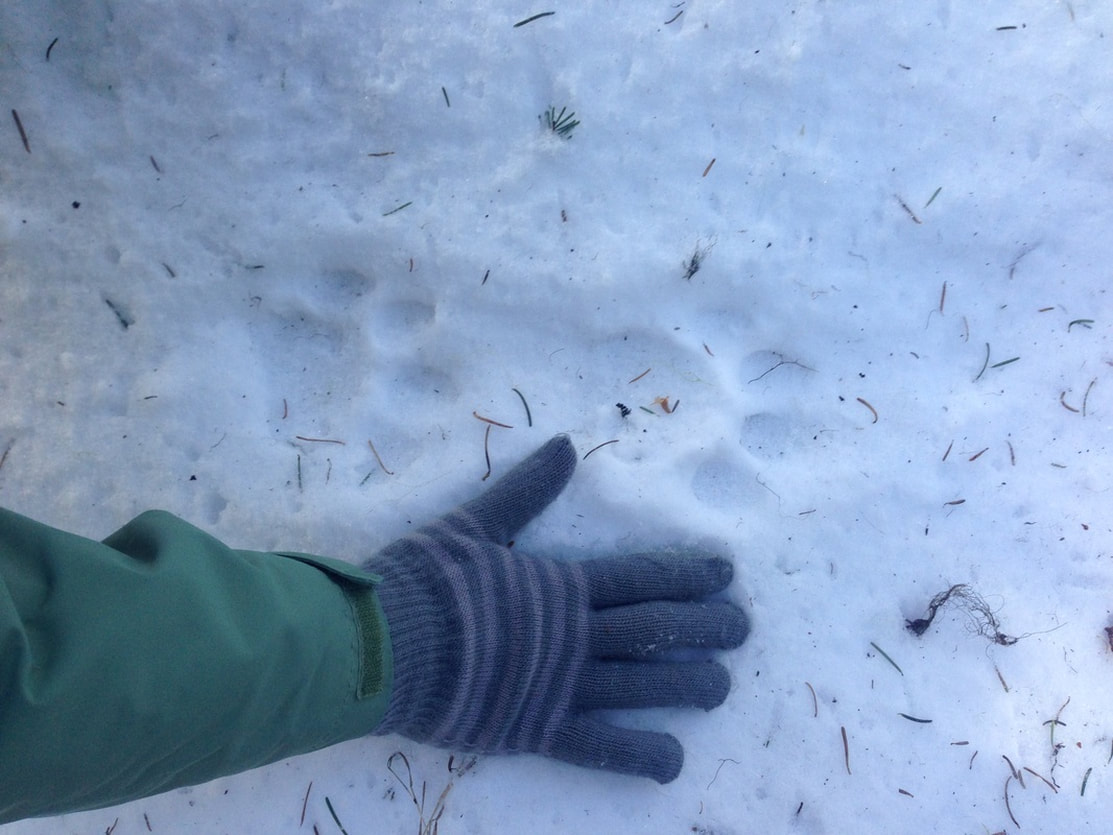
(Cougar tracks)
As mentioned before, this area is not frequented a lot and there were many signs (scat and tracks) of cougar and bear in the area. Please use caution when hiking in this area. Do not let your dogs off leash, keep your kids close, do not listen to headphones if you are solo hiking, and make a lot of noise when hiking through the meadows that have tall grasses and bushes so that you don't scare a bear! Once entering the meadows you also notice a lot of overgrowth, which can make it difficult to see the trail. Use caution here since moles can frequently make large holes through the meadows and underneath the trail.
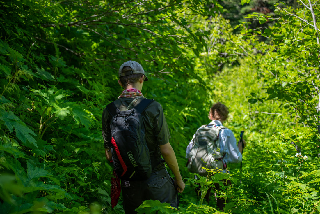
(overgrown trail)
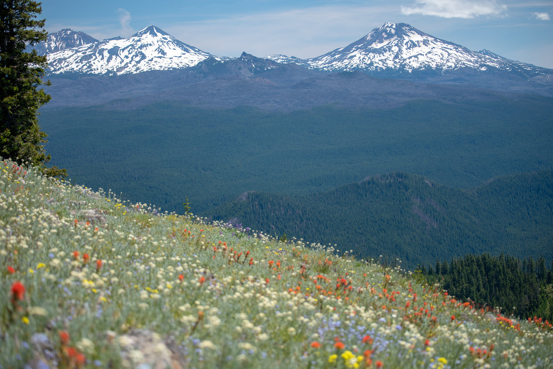
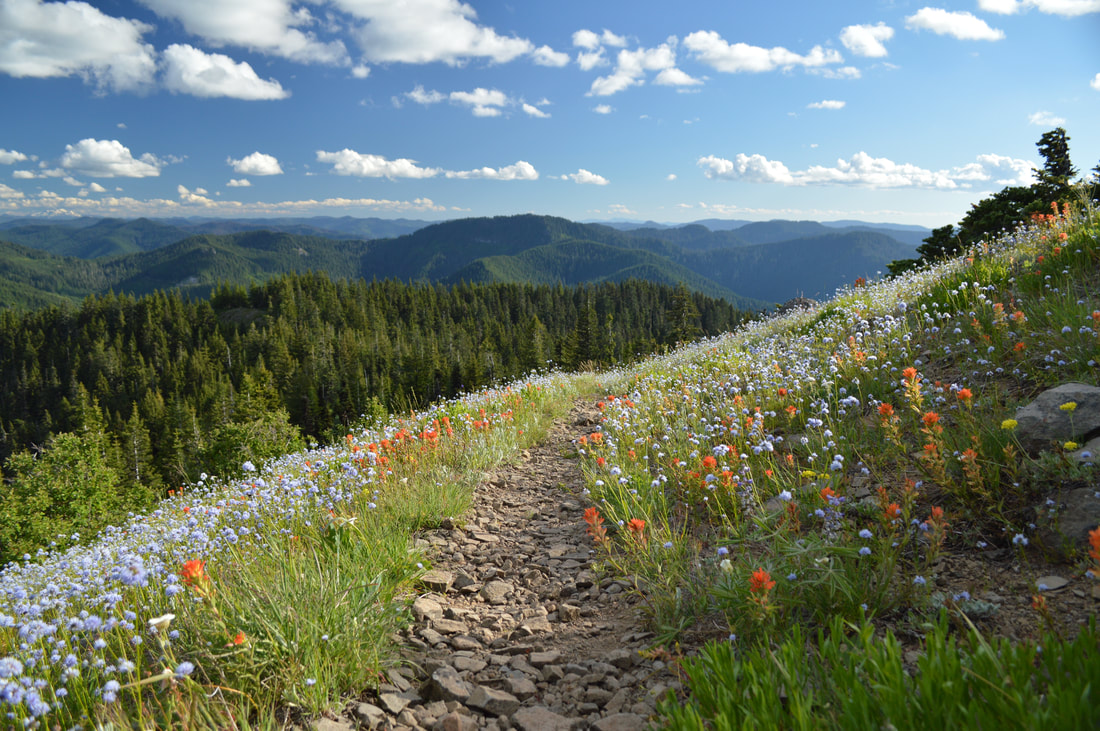
During late June and early July, the Horsepasture Mountain trail is known for its fields of wildflowers. And during the early fall, you can watch the bear grass change from its fluffy white plumes to its golden seed pods. The best time to hike this trail is the last weekend of June to the middle of July for prime wildflowers.
In the early days, there was a lookout up at the top which was supplied by pack animals and since there was (and still is) an excellent meadow on the south side of the hill for them to graze, this is how Horsepasture Mountain got its name.
In the early days, there was a lookout up at the top which was supplied by pack animals and since there was (and still is) an excellent meadow on the south side of the hill for them to graze, this is how Horsepasture Mountain got its name.
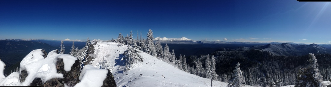
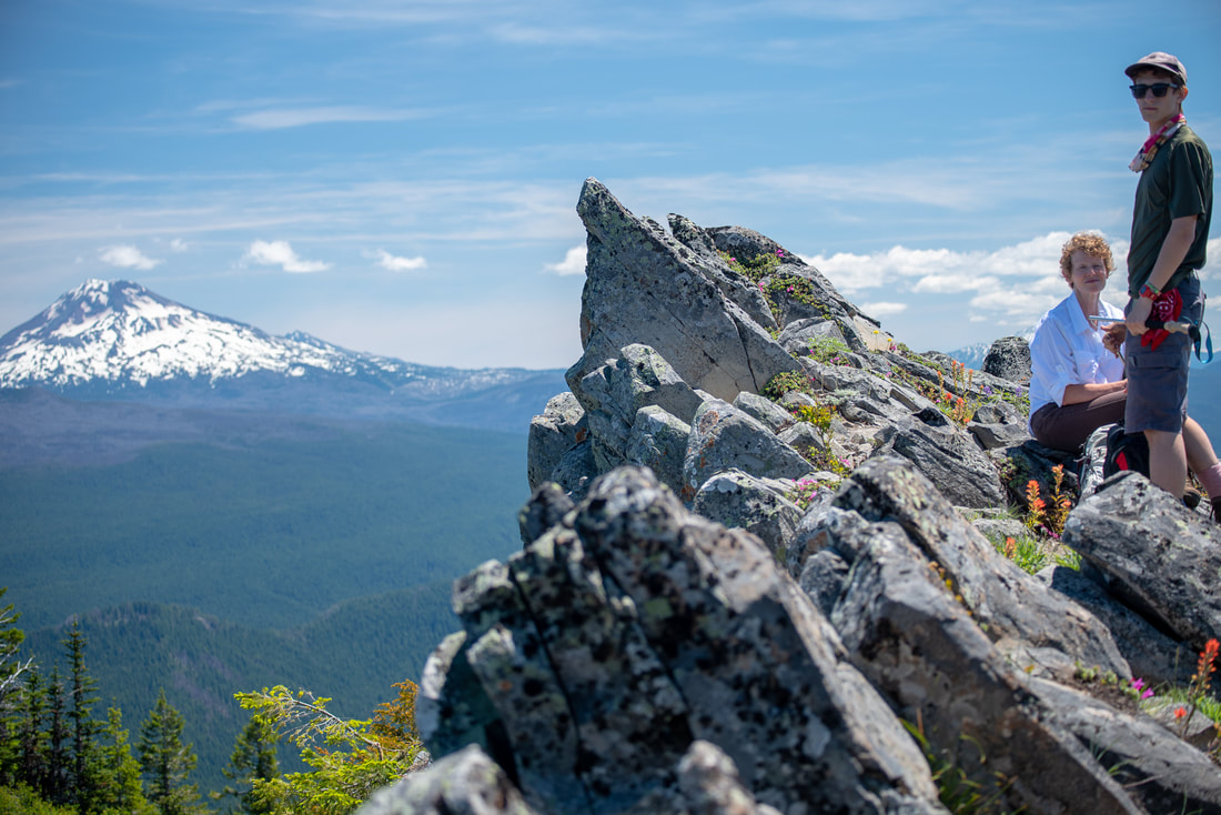
(Panorama view from the top of Horsepasture Mountain)
The view from the top is really quite stunning. You can see the entire string of the Cascade Mountains from Diamond Peak all the way up to Mt. Jefferson and on a very clear day you can even see the faint glimmer of white-capped Mt. Hood, but the Three Sisters definitely take center stage in this view.
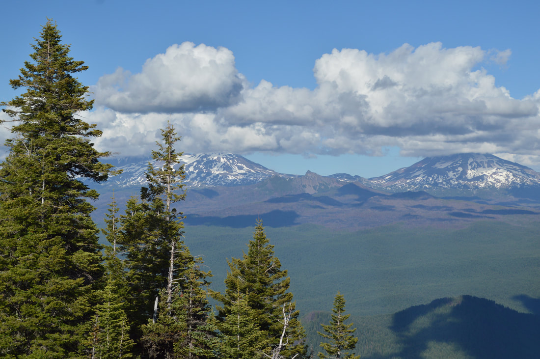
(the Three Sisters)
|
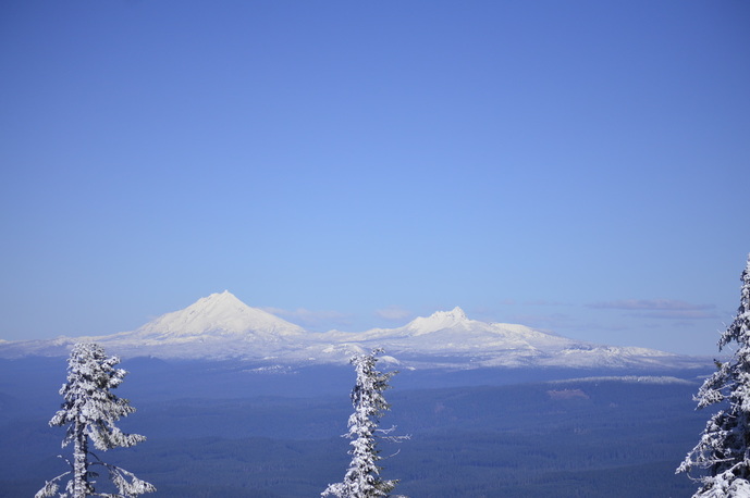
(Mount Jefferson and Three Fingered Jack)
|
On the way down from Horsepasture Mountain, you get to see across the small valley towards O'Leary Mountain. Looking at different land features during hikes, can give you a better understanding of the lay of the land and the more that you hike, the more knowledgeable you become with your surroundings.
**Please note- even though I did this hike in the winter, I do NOT by any means promote doing this hike in the snow. It is highly dangerous and the trees are not marked here, so it is possible to easily lose the trail. Always make sure to carry a map, compass and a GPS.
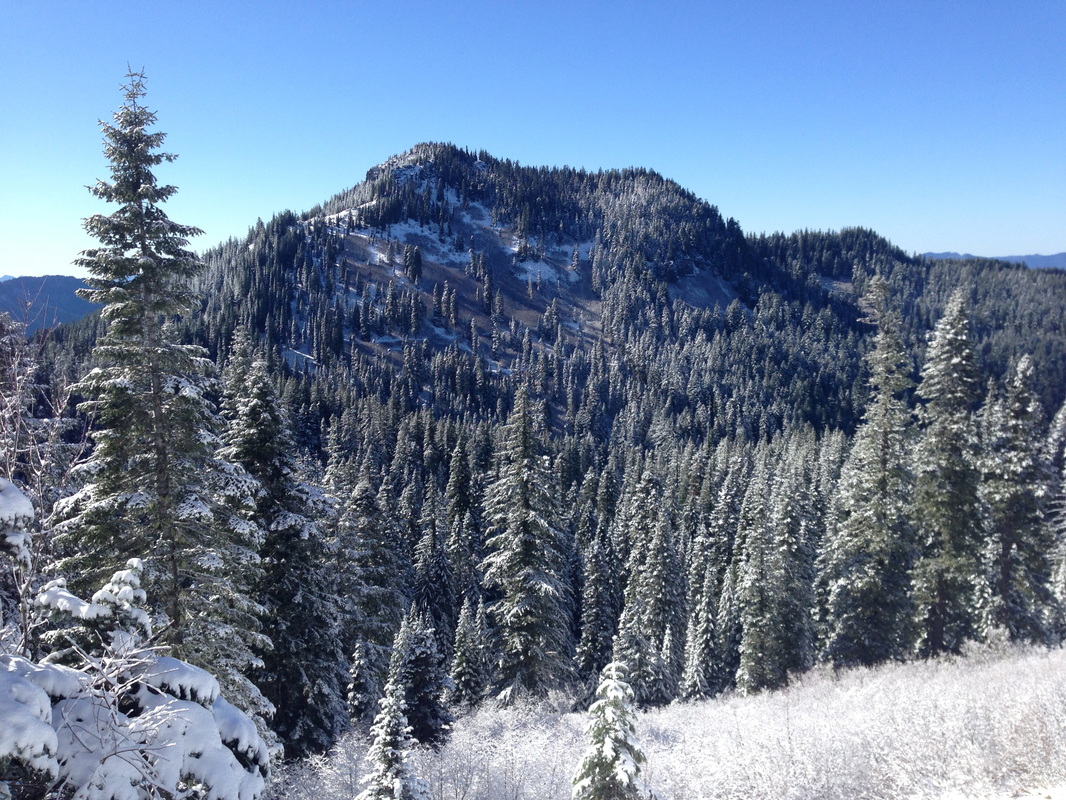
(O'Leary Mountain)
Horsepasture Mountain is a wonderful hidden gem of a hike that not very many people know about! If you are only wanting to do the Horsepasture Mountain summit from Horsepasture Mountain trailhead off of Rd. 1993, it is much easier and only 2.8 miles. However, the long steep gravel road that takes you up to the shorter Horsepasture Mountain Trail does not get frequent maintenance and can often have rock slides across it. Check with the local McKenzie River Ranger Station before heading out on the shorter hike to make sure it is accessible.
If you choose to do the longer route from Saddle Trail, the first part is much steeper and a bit more challenging. There are so many trails that connect and loop together around this area, this could be the perfect inlet for a wonderful backpacking trip.
If you choose to do the longer route from Saddle Trail, the first part is much steeper and a bit more challenging. There are so many trails that connect and loop together around this area, this could be the perfect inlet for a wonderful backpacking trip.
Directions:
From Eugene to Saddle Trail trailhead
- Drive OR-126 east for 6.8 miles, then use the left 2 lanes to turn left onto OR-126 E/Main St. and stay on this road for a total of 38.9 miles. Turn right onto Cougar Dam Rd/NF-19 for 0.4 miles, then make a slight right onto Aufderheide Dr. for 2.9 miles. At a Y junction turn left onto NF-1993 and stay on this road for 8.2 miles. Park at the pullout on the right side of the road. The trail is on the left side of the road. (Total of 59 miles)
- Drive US-97 north for 2.1 miles then take exit 135A to merge onto US-20 W toward Sisters for 19.9 miles. In the town of Sisters at the traffic circle, take the 2nd exit and stay on US-20 W for another 25.1 miles, then keep left to stay on US-20 W for 3.3 miles. Turn left onto OR-126 E and stay on this road for 29.3 miles, then turn left onto Cougar Dam Rd/NF-19 for 0.4 miles. Make a slight right onto Aufderheide Dr. for 2.9 miles. At a Y junction turn left onto NF-1993 and stay on this road for 8.2 miles. Park at the pullout on the right side of the road. The trail is on the left side of the road. (Total of 92.3 miles)
- Total of 121 miles via Eugene
- Total of 163 miles via Eugene
- Total of 222 miles via Eugene
|
-This trail write-up was last updated July 2019-
*All pictures are taken by Franziska Weinheimer *Disclaimer: the trail descriptions, mileage, GPS tracks and difficulty ratings depicted on this website are never 100% accurate. Always hike at your own risk, using your own knowledge, equipment and common sense. Franziska Weinheimer/Hike Oregon are not responsible if you or anyone in your party gets injured or lost while attempting one of these or any other hikes.
|
To get a more in-depth and personal view of this hike, watch the YouTube video.
|