Hike Oregon
  • Home
  • *Store*
  • About the author
  • How to use this site
  • Resources
    • Wildflowers
    • Videos
  • Best Oregon Hikes
    • 20 Epic Oregon Wildflower Hikes
    • 5 Weekend Backpacking Trips in Oregon
    • Top 10 Swimming Spots In Oregon
    • 9 Amazing Oregon Summit Hikes
    • Top 10 Oregon Summer Hikes
    • 20 Central Oregon Day Hikes
    • Top One Night Backpacking Trips in Central Oregon
    • Top 10 Oregon Hikes for Kids
    • 20 Best Oregon Waterfall Hikes
    • Underrated Fall Foliage Hikes In Oregon
    • Top 10 Oregon Fall Hikes
    • Best Rainy Day Hikes In Oregon
    • Sno-Parks In Central Oregon
    • Top 10 Oregon Winter Hikes
    • Top Low Elevation Winter Hikes
    • Easy Hikes in Oregon
    • Top 10 Oregon Spring Hikes
  • Oregon Sno-Parks
    • Maxwell Sno-Park
    • Potato Hill Sno-Park
    • Ray Benson Sno-Park
      • Brandenburg Shelter
    • Santiam Sno-Park
    • Three Creek Sno-Park
    • Virginia Meissner Sno-Park
      • Meissner Shelter Loop
      • Nordeen Shelter
    • Gold Lake Sno-Park
      • Westview Shelter to Eagle Rock Overlook
      • Marilyn Lakes Loop
    • Ikenick Sno-Park (members only)
  • Southern Washington
    • Hamilton Mountain
    • Dog Mountain
    • Coyote Wall
    • Mount St. Helens
  • Portland
    • Powell Butte
    • Forest Park
    • Latourell Falls
    • Multnomah/Wahkeena Falls
    • Eagle Creek
    • Mitchell Point
    • Table Rock
    • Tamanawas Falls
    • Trillium Lake
    • East Zigzag Mountain (members only)
  • Salem
    • Abiqua Falls
    • Silver Falls State Park
    • Dome Rock
    • Marion Lake to Marion Mountain
    • Jefferson Park via Whitewater Trail
  • Corvallis
    • William Finley Wildlife Refuge
      • Campbell Boardwalk
      • Woodpecker Loop
      • Mill Hill Loop
      • Beaver Pond Loop
    • Marys Peak East Ridge
    • Marys Peak North Ridge
    • Alsea Falls and Green Peak Falls
    • Corvallis to Sea Trail - Sugarbowl Creek segment (members only)
  • Sweet Home
    • Crescent Mountain
    • Iron Mountain
    • McDowell Creek Falls
    • Middle Santiam River (members only)
    • Lower Soda Creek Falls (members only)
    • Rooster Rock (members only)
  • McKenzie Bridge/Blue River
    • Macduff Mountain
    • Proxy Falls
    • Clear Lake
    • Sahalie/Koosah Falls
    • Blue Pool
    • Erma Bell Lakes
    • Olallie Mountain
    • Horsepasture Mountain
    • Tidbits Mountain
    • Castle Rock
    • Separation Lake (members only)
    • Lowder Mountain (members only)
    • East Fork Trail (members only)
    • Rainbow Falls Overlook (members only)
    • Frissell Point (members only)
    • Substitute Point (members only)
  • Sisters/Santiam Pass
    • Coffin Mountain
    • Trappers Butte and Scar Mountain
    • Maxwell Butte
    • Black Butte
    • Whychus Creek Trail
    • Tam McArthur Rim
    • Black Crater
    • Scott Mountain
    • Obsidian Trail
    • Metolius Preserve
    • Three Fingered Jack Loop
    • Square Lake
    • Canyon Creek Meadows
    • Patjens Lakes
    • Craig Lake (members only)
    • Chush Falls (members only)
    • Rockpile Lake (members only)
    • Santiam Lake (members only)
    • Camp Lake (members only)
    • Park Meadow to Golden Lake (members only)
  • Bend/Redmond/LaPine
    • Steins Pillar
    • Chimney Rock
    • Steelhead Falls
    • Tumalo State Park
    • Shevlin Park Loop
    • Tumalo Falls
    • Tumalo Mountain
    • No Name Lake
    • Green Lakes
    • Moraine Lake
    • South Sister Summit
    • Horse Lake
    • Muskrat Lake
    • Paulina Peak
    • The Badlands - Flatiron Rock Trail
    • Peter Skene Ogden Trail (members only)
  • Eugene
    • Ridgeline Trail
    • Mount Pisgah Summit
    • Mount Pisgah Arboretum
    • Shotgun Creek
    • Mount June
    • Lawler
    • Tire Mountain
    • Hardesty Mountain
    • Goodman Creek
    • Brice Creek
    • Trestle Creek Falls
    • Parker Falls
    • Moon Falls
    • Elijah Bristow State Park
    • South Willamette Trail (members only)
    • Eula Ridge (members only)
    • Eagle's Rest (members only)
  • Oakridge
    • Deception Butte
    • North Salmon Creek
    • Sourgrass Mountain
    • Grasshopper Ridge
    • Larison Creek
    • Bunchgrass Ridge
    • Salt Creek Falls
    • Waldo Lake Loop
    • South Waldo Loop
    • The Twins
    • Rosary Lakes
    • Yoran Lake
    • Fawn Lake
    • Windy Lakes
    • Divide Lake
    • Diamond Peak via Rockpile Lake Trailhead
    • Diamond Peak via Summit Lake
    • Cowhorn Mountain
    • Klovdahl Bay (members only)
    • Verdun Trail (members only)
    • Heckletooth Mountain (members only)
    • Wall Creek Warm Springs (members only)
    • Moon Point (members only)
    • Bobby Lake (members only)
    • Lillian Falls (members only)
    • Middle Fork Willamette Trail (members only)
    • Pool Creek Falls (members only)
    • Dead Mountain (members only)
    • Larison Rock (members only)
    • Quinn Lakes & Eddeeleo Lakes (members only)
    • Waldo Mountain Lookout (members only)
    • Blair Lake to Spring Prairie (members only)
    • Rigdon Lakes loop (members only)
  • Oregon Coast
    • Cascade Head
    • Drift Creek Falls
    • Sweet Creek Falls
    • Beaver Creek Falls
    • Kentucky Falls
    • Hobbit Trail to Heceta Head
    • Valley Trail to China Creek
    • Sutton Creek Trail (members only)
    • North Fork Smith River (members only)
    • Cummins Ridge (member's only)
    • Horse Creek (members only)
    • Siltcoos Lake (members only)
  • Southern Oregon
    • Fall Creek Falls
    • Watson Falls
    • Wild Rogue Loop
    • Mt. Thielsen
    • Crater Lake National Park
      • The Watchman
      • Mount Scott
      • The Pinnacles
    • Lower Table Rock
    • Pilot Rock
    • Wagner Butte
    • Mt. McLoughlin
    • Lemolo Falls (members only)
    • Fern Falls (members only)
  • Eastern Oregon
    • Painted Cove
    • Anthony Lake Loop
    • Mount Howard
    • Eagle Cap summit
    • Schneider Cabin (members only)
    • Strawberry Lake & Strawberry Falls (members only)
  • Northern California
    • Taylor & Hogan Lake (members only)
  • Oregon PCT sections
    • PCT: CA border to Callahan's
  • Tips & Tricks
    • Leave No Trace
    • Safety Tips for Solo Hiking & Backpacking
    • Nutrition On The Trail
    • How Much Water To Carry When Backpacking
    • Storing Your Bear Canister When Backpacking
    • How To Pick The Right Backpacking Tent
    • Top Tips For Hiking With Infants And Toddlers
    • Poison Oak, Ivy and Sumac
    • How to dress for cold weather hikes
  • Reviews and Gear
    • Choosing and Using Trekking Poles
    • A Guide to Choosing the Perfect Backpacking Pack
    • Hiking Pants and Leggings
    • Jackets for Hiking and Backpacking
    • Long Sleeved Shirts For Cold Weather Hiking
    • Stay Kühl This Summer
    • Outdoor Herbivore Backpacking Food Review
    • Osprey Aura AG 65 Backpack review
    • Big Agnes Fly Creek UL2 review
    • REI Quarter Dome 1 review
    • Hike Oregon's Gear Favorites
    • Outdoorsy Holiday Gift Guide 2022
    • Hiker Holiday Gift Guide 2019
    • Outdoor Holiday Gift Guide 2018
    • Hiking Holiday Gift Guide 2017
  • Adventure Stories
    • Hiking The Rae Lakes Loop
    • 110 Miles on the PCT
    • Three Fingered Jack Adventures
    • Jefferson Wilderness

Scott Mountain Loop

Get the printable version of this hike

Hike details:

Mileage: 2.6 miles round trip w/ about 350 ft. elevation gain (to Benson Lake)  
5 miles round trip w/ about 640 ft. elevation gain (to Tenas Lakes) 
7.7 miles round trip w/ 1,340 ft. elevation gain (up to Scott Mountain summit)  
9.7 mile loop w/ 2,420 ft. elevation gain

Approximate hike time: (up to Scott Mountain summit) 3 hours 20 minutes w/ an average pace of 2.3 mph 
(the entire 9.7 mile loop) 4 hours 13 minutes w/ an average pace of 2.3 mph

Difficulty: Easy to difficult (depending on where you go)
Trail usage: High on summer weekends, low to medium on weekdays
​
Highest elevation: 6,100 ft. Lowest elevation: 4,680 ft.
General location: 21.7 miles west of Sisters - Willamette National Forest - Mt. Washington Wilderness
Accessible: End of June through mid-November
(Best time to go is September, October and early November when the fall colors are beautiful and the mountains have a little bit of snow on them. During the fall there are also no mosquitoes and far less people).
Permits required: Day trips & overnight trips - Central Cascades Wilderness Permit June 15 - October 15 available via recreation.gov
Northwest Forest Pass for parking
Pit toilet at trailhead: Yes
Trail allows: Dogs, horses, camping
Possible dangers: ​N/A
Scott Lake trailhead
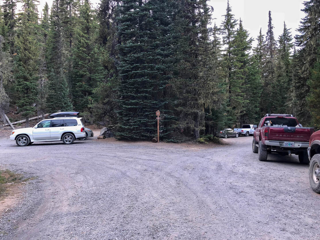
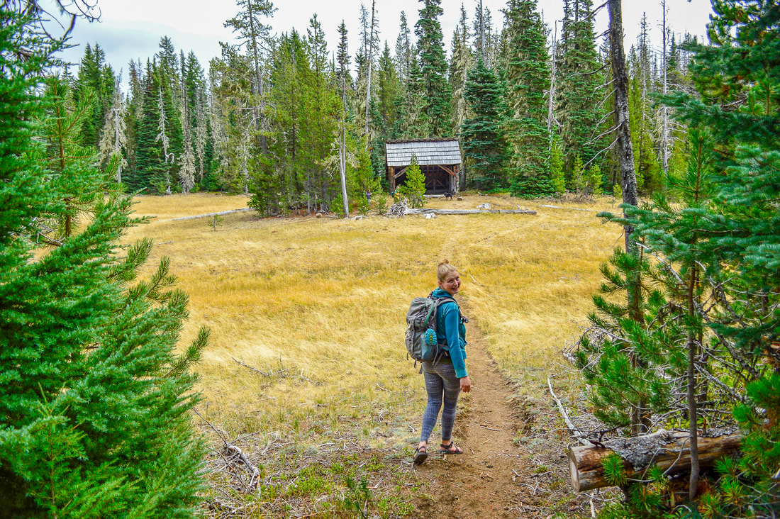
(Benson Lake/Scott Mountain Trailhead)

​Description:

The Scott Lake area has a lot to offer, from fishing, kayaking, to horseback riding, hiking and camping/backpacking. The Benson Lake/Scott Mountain trailhead is the starting point for many hikes, so it is often very busy and filled with cars. The parking area is a little bit awkward, so make sure to not block anyone in when parking here. 
Mount Washington Wilderness sign
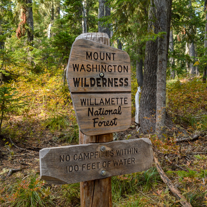
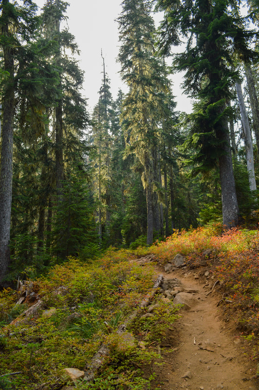
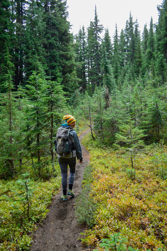
From the trailhead you will take Benson Lake Trail #3502 through a beautiful forest. You are entering the Mount Washington Wilderness here, so you will need a Central Cascades Wilderness Permit from June 15 - October 15. 
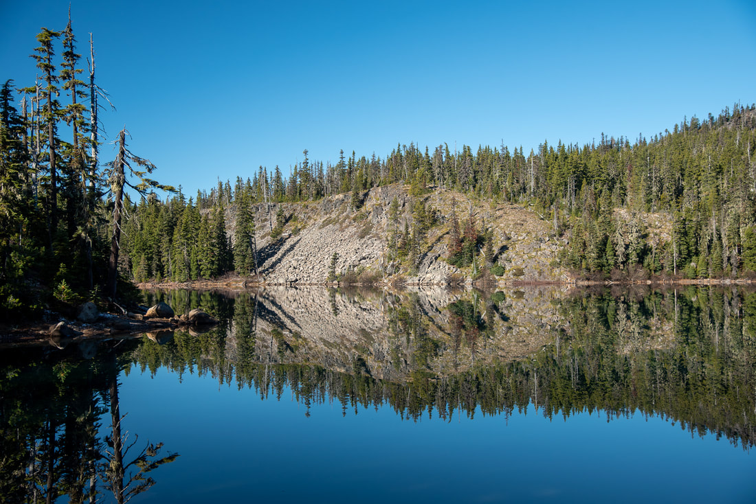
Benson Lake Trail
Benson Lake
(Benson Lake)
Fall colors along the Benson Lake Trail
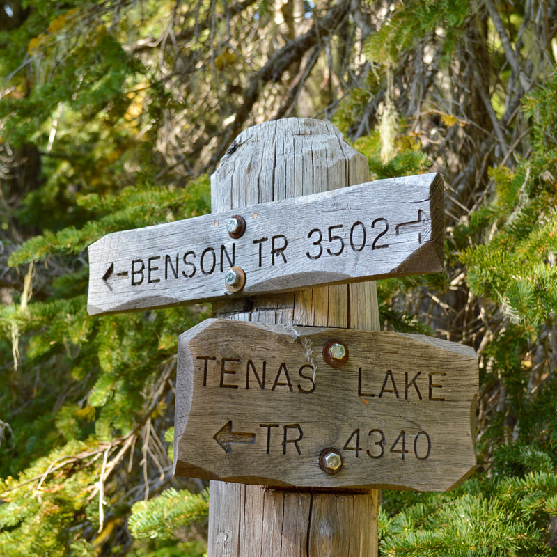
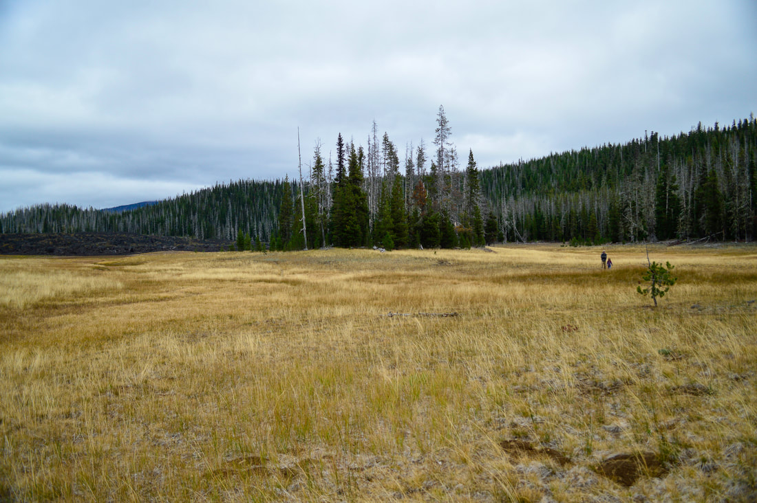
You will hike a total of 1.3 miles to Benson Lake. Benson Lake is a stunning lake with a large cliff on the northern side and there are some backcountry camping options. After checking out Benson Lake, you will continue uphill for another 1.1 miles until you get to a trail split. If you want to check out Tenas Lakes (highly recommended), take a left for just a quarter of a mile. Tenas Lakes is a series of very small lakes with great views of the Three Sisters. There are some backcountry camping options here as well. This is the perfect place to take your kids on their first backpacking trip.
Benson Lake Trail Tenas Lake Trail sign
Tenas Lake
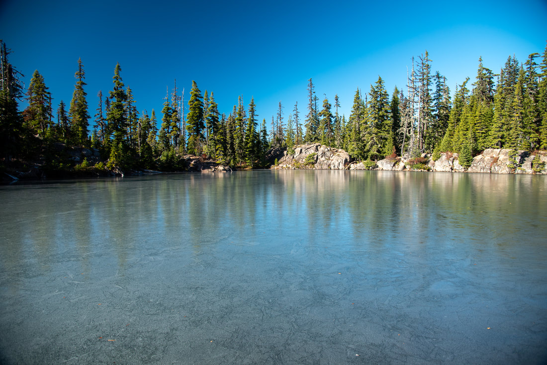
(Tenas Lake frozen over in early November 2019)
Scotty Way trail sign
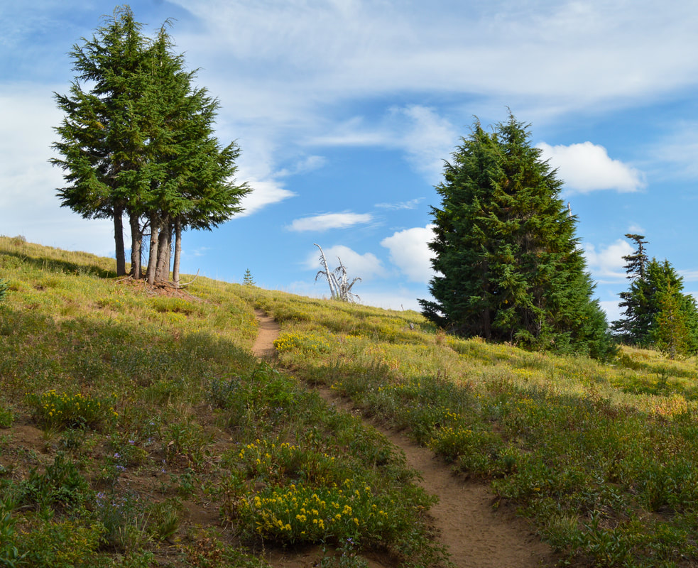
To go up to Scott Mountain, continue up the trail another mile from the Tenas Lakes trail junction and turn left at a sign for Scott Mountain. This is where the trail really starts to gain some elevation. As the trail wraps around the northeast side of the mountain, you may encounter some snow drifts if you are hiking here early in the season (mid-June or even into early July) as this side of the mountain stays shaded. In the 0.6 miles that you climb to the top, you gain a total of 336 feet of elevation. There are a few small switchbacks, and the last push to the summit is through a beautiful meadow dotted with wildflowers in the summertime. 
Scott Mountain summit approach
(Scott Mountain summit approach - early September 2015)
McKenzie River Valley from Scott Mountain
(McKenzie River valley)
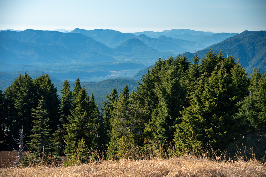
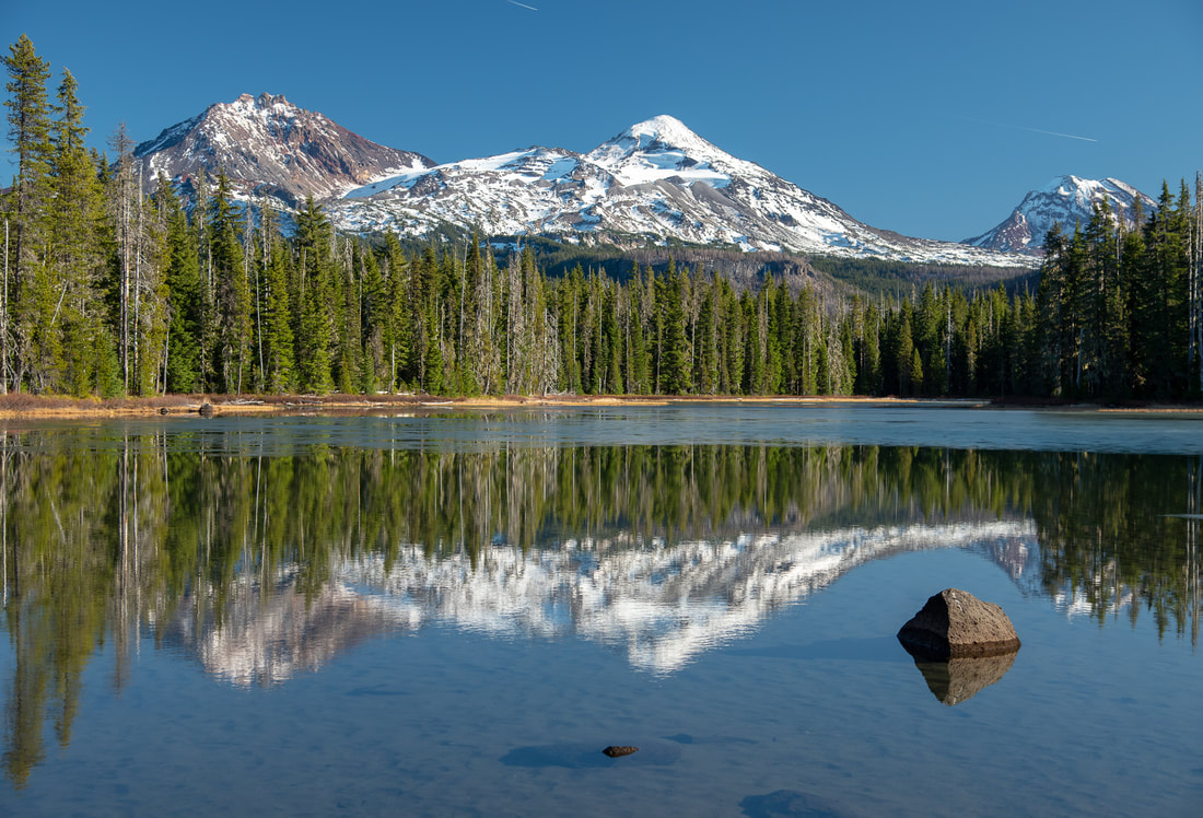
The summit of Scott Mountain is large and open, and you can walk around to see all of the different views. To the west you will see the McKenzie River valley below, to the northeast you will see Mount Jefferson, Three Fingered Jack and Mount Washington and the entire landscape in between, which includes Hoodoo and Hayrick Butte as well as a big lava flow and Black Crater. To the south you will see the Three Sisters so close that you feel like you can reach out and touch them. 
View of Mt. Washington and Three Fingered Jack from Scott Mountain.jpg
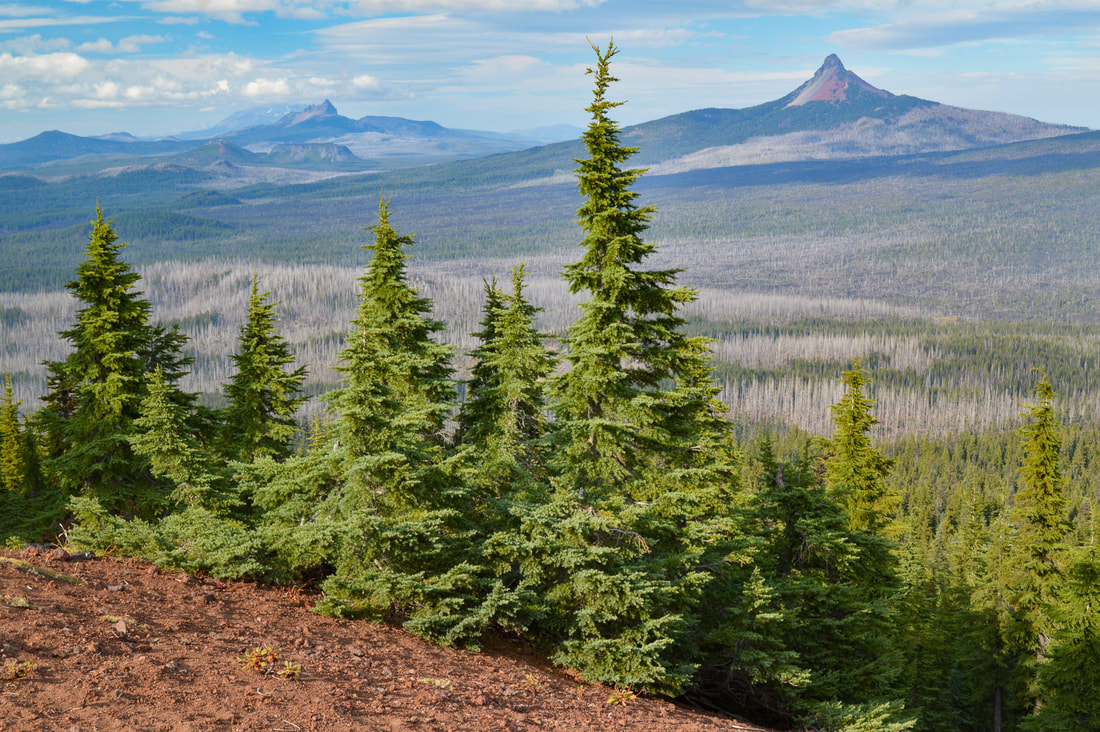
(Mount Jefferson, Three Fingered Jack, Mount Washington)
Three Sisters from Scott Mountain.jpg
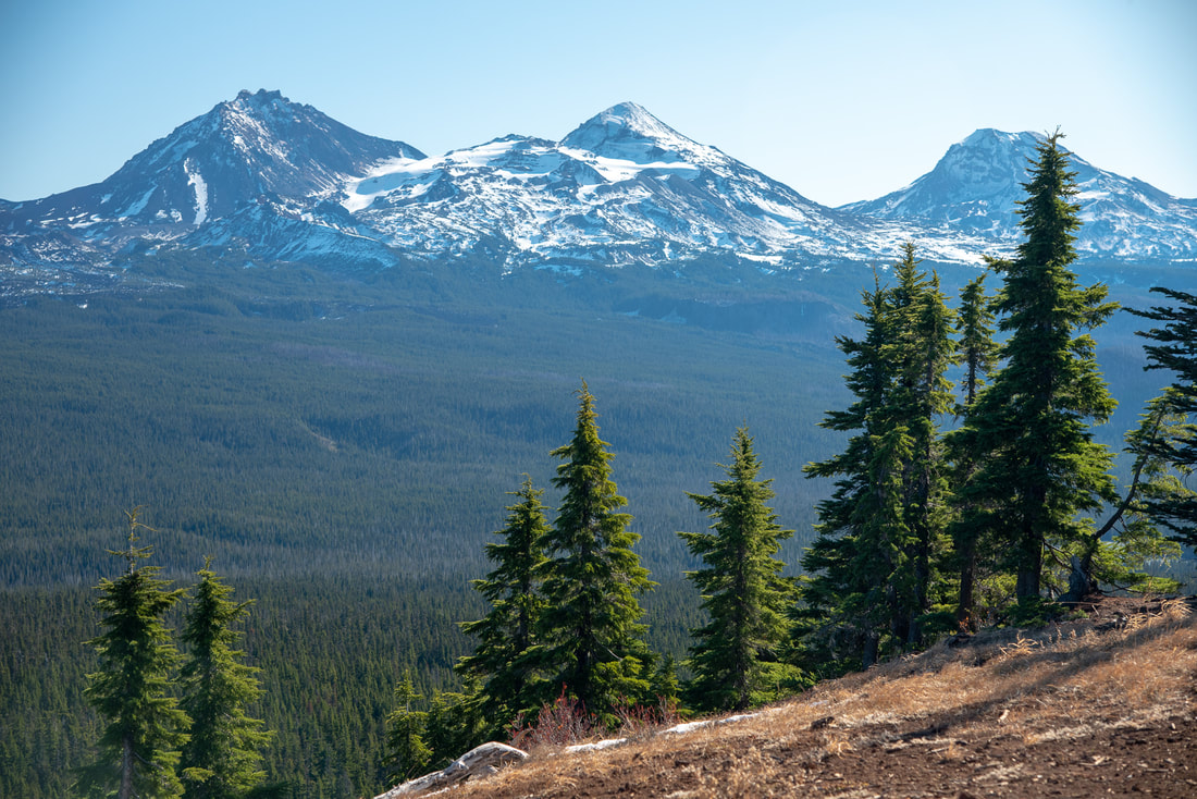
(North Sister, Middle Sister, South Sister - early November 2019)
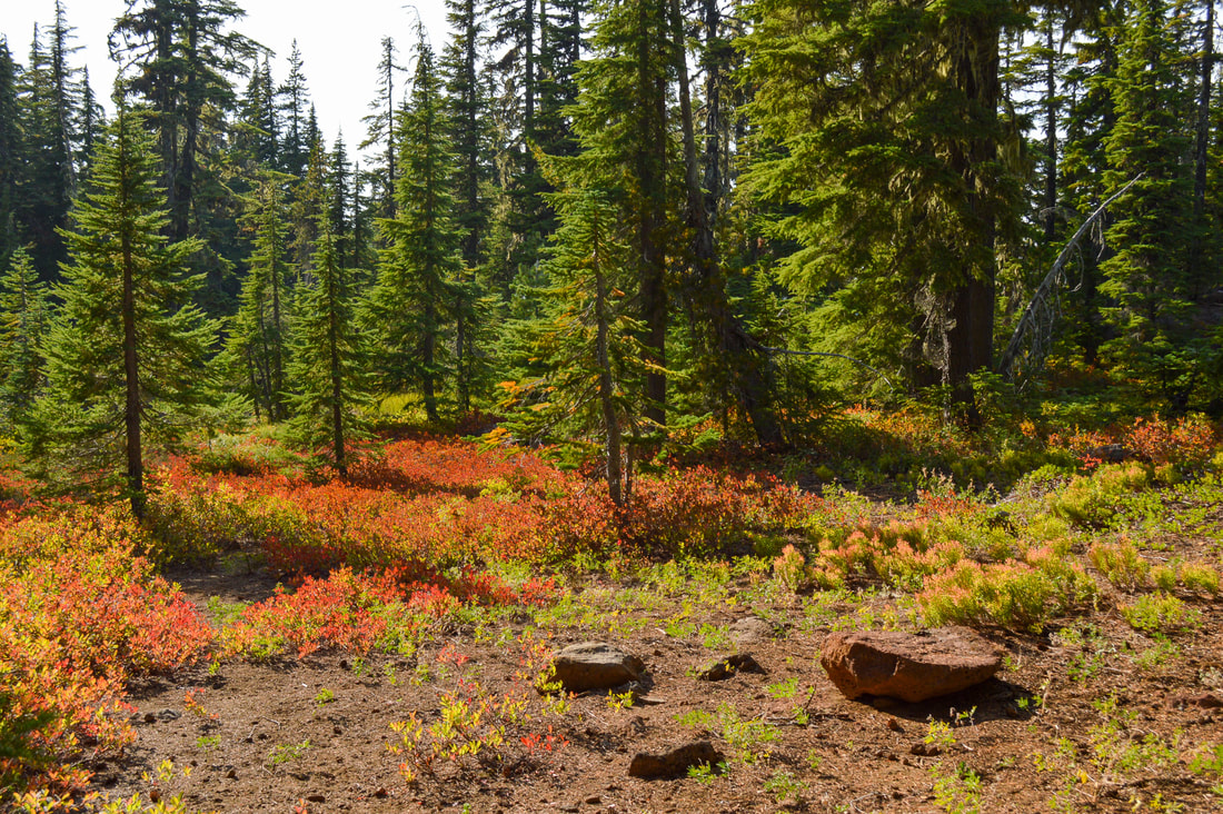
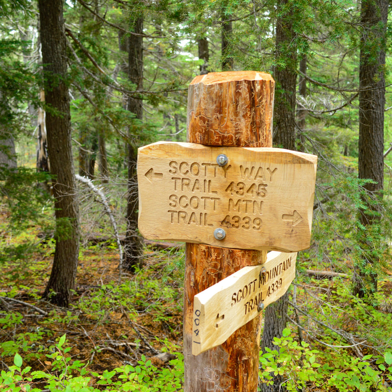
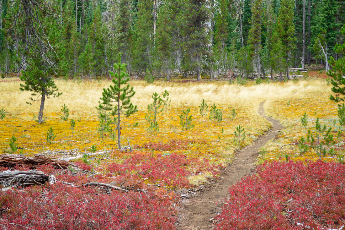
After enjoying the views up at Scott Mountain, hike the 0.6 miles back down to the trail junction and if you want to hike the loop, take the Scotty Way Trail #4345 to the left. This trail isn't used as much as the trail to Benson and Tenas Lakes and Scott Mountain, but this part of the loop is stunning. In the autumn the small huckleberry bushes turn a beautiful orange and red color which is a stunning contrast to the dark green pine trees. After 1.6 miles on Scotty Way Trail you will come to another trail split. To complete the loop, turn right onto Hand Lake Trail #3513. 
Hand Lake Scott Mountain trail sign
Scotty Way trail
Lava along the Hand Lake Trail
Lava flow along the Hand Lake Trail
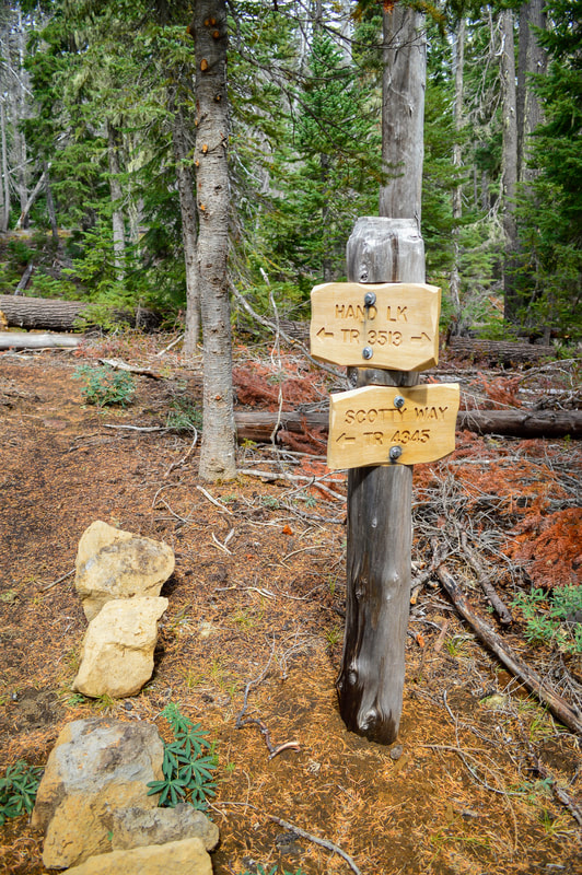
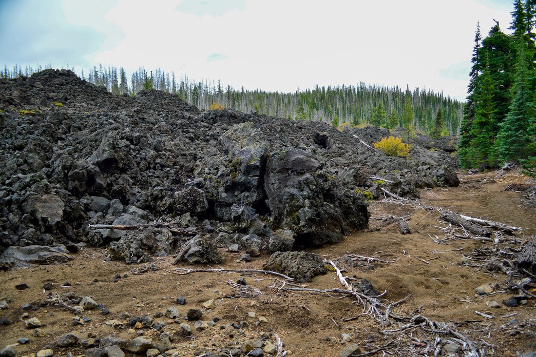
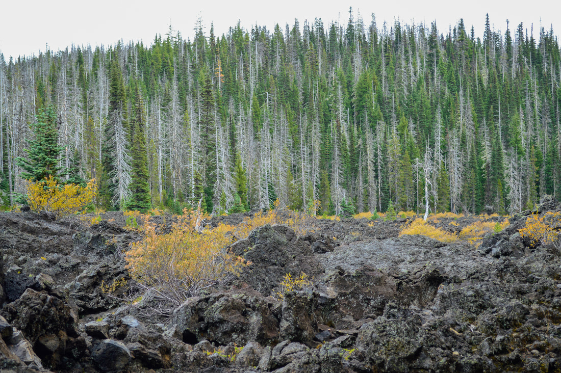
Continue along the Hand Lake Trail, which leads you past a large lava flow. Here the trail definitely becomes more sandy and it is very comfortable to walk on. After 1.9 miles you will see a trail on your left that leads to Hand Lake Shelter. Depending on the previous winter's snowfall, sometimes Hand Lake does dry up if you come here later in the season. (If you are hiking with little ones and want a nice short walk to go see Hand Land and the Shelter, you can start at Hand Lake Trailhead off of Hwy. 242 and it is roughly a 1 mile round trip hike). 
Hand Lake shelter
(Hand Lake shelter)
Dried up Hand Lake Oregon
(Hand Lake dries up later in the season during some years)
After checking out Hand Lake and Hand Lake Shelter you will continue on the Hand Lake Trail another 1.5 miles back to Scott Lake and the trailhead you parked your car at. This last bit of the hike is pretty flat and easy going, taking you through a sparse forest and some meadows. 
Hand Lake trail in the fall
The Scott Lake and Benson Lake area has plenty to offer. Whether you want to horseback ride, see mountain-top views, or do a short backpacking trip in and camp at stunning alpine lakes, you will not be disappointed here. The trails are generally well maintained, especially after mid-July when all of the snow has melted. Keep in mind that after the snow melts, there will be a lot of mosquitoes in this area until about mid-August. If you have the luxury of choosing when you want to do this hike, it is highly recommended that you hike the loop in September or early October. During that time there will be no bugs, less visitors, and the colors of the foliage are incredibly stunning!
Scott Lake and the Three Sisters
(Scott Lake and the Three Sisters - early November 2019)

Directions:

From Bend
  • ​Drive US-97 north and take exit 135A to merge onto US-20 W toward Sisters for 19.4 miles. Turn left onto S Pine St. then at the next block turn right at the 1st cross street onto W Hood Ave. for 0.3 miles. Turn left onto OR-242 W for 20.4 miles. At a sign for Scott Lake turn right onto NF-260 and drive up this narrow rutted road for 0.7 miles to the trailhead at its end. (Total of 44.2 miles)
From Eugene
  • Drive on OR-126 E for 6.8 miles, then Use the left 2 lanes to turn left onto OR-126 E/Main St. and continue on this road for a total of 48.4 miles. At a sign for Old McKenzie Scenic Byway turn right onto OR-242 E and take this very narrow and windy road uphill for 15.9 miles. At a sign for Scott Lake turn left onto NF-260 and drive up this narrow rutted road for 0.7 miles to the trailhead at its end. (Total of 73.8 miles)
From Salem
  • Drive on OR-22 E for 80 miles, then turn right toward US-20 W and then stay right for 3.1 miles. Turn left onto OR-126 E for 19.8 miles, and at a sign for Old McKenzie Scenic Byway turn left onto OR-242 E and take this very narrow and windy road uphill for 15.9 miles. At a sign for Scott Lake turn left onto NF-260 and drive up this narrow rutted road for 0.7 miles to the trailhead at its end. (Total of 123 miles)
From Portland
  • It is a total of 166 miles via Salem.
From Medford
  • ​It is a total of 237 miles via Eugene.
-This trail write-up was last updated in 2021-
​*All pictures are taken by Franziska Weinheimer
*Disclaimer: The trail descriptions, mileage, GPS tracks and difficulty ratings depicted on this website are never 100% accurate. Always hike at your own risk, using your own knowledge, equipment and common sense. Franziska Weinheimer/Hike Oregon are not responsible if you or anyone in your party gets injured or lost while attempting one of these or any other hikes.

HIKED HERE RECENTLY? PLEASE LEAVE A TRIP REPORT BELOW:

© Hike Oregon 2025
P.O. Box 41911
​Eugene, OR 97404
Proudly powered by Weebly
  • Home
  • *Store*
  • About the author
  • How to use this site
  • Resources
    • Wildflowers
    • Videos
  • Best Oregon Hikes
    • 20 Epic Oregon Wildflower Hikes
    • 5 Weekend Backpacking Trips in Oregon
    • Top 10 Swimming Spots In Oregon
    • 9 Amazing Oregon Summit Hikes
    • Top 10 Oregon Summer Hikes
    • 20 Central Oregon Day Hikes
    • Top One Night Backpacking Trips in Central Oregon
    • Top 10 Oregon Hikes for Kids
    • 20 Best Oregon Waterfall Hikes
    • Underrated Fall Foliage Hikes In Oregon
    • Top 10 Oregon Fall Hikes
    • Best Rainy Day Hikes In Oregon
    • Sno-Parks In Central Oregon
    • Top 10 Oregon Winter Hikes
    • Top Low Elevation Winter Hikes
    • Easy Hikes in Oregon
    • Top 10 Oregon Spring Hikes
  • Oregon Sno-Parks
    • Maxwell Sno-Park
    • Potato Hill Sno-Park
    • Ray Benson Sno-Park
      • Brandenburg Shelter
    • Santiam Sno-Park
    • Three Creek Sno-Park
    • Virginia Meissner Sno-Park
      • Meissner Shelter Loop
      • Nordeen Shelter
    • Gold Lake Sno-Park
      • Westview Shelter to Eagle Rock Overlook
      • Marilyn Lakes Loop
    • Ikenick Sno-Park (members only)
  • Southern Washington
    • Hamilton Mountain
    • Dog Mountain
    • Coyote Wall
    • Mount St. Helens
  • Portland
    • Powell Butte
    • Forest Park
    • Latourell Falls
    • Multnomah/Wahkeena Falls
    • Eagle Creek
    • Mitchell Point
    • Table Rock
    • Tamanawas Falls
    • Trillium Lake
    • East Zigzag Mountain (members only)
  • Salem
    • Abiqua Falls
    • Silver Falls State Park
    • Dome Rock
    • Marion Lake to Marion Mountain
    • Jefferson Park via Whitewater Trail
  • Corvallis
    • William Finley Wildlife Refuge
      • Campbell Boardwalk
      • Woodpecker Loop
      • Mill Hill Loop
      • Beaver Pond Loop
    • Marys Peak East Ridge
    • Marys Peak North Ridge
    • Alsea Falls and Green Peak Falls
    • Corvallis to Sea Trail - Sugarbowl Creek segment (members only)
  • Sweet Home
    • Crescent Mountain
    • Iron Mountain
    • McDowell Creek Falls
    • Middle Santiam River (members only)
    • Lower Soda Creek Falls (members only)
    • Rooster Rock (members only)
  • McKenzie Bridge/Blue River
    • Macduff Mountain
    • Proxy Falls
    • Clear Lake
    • Sahalie/Koosah Falls
    • Blue Pool
    • Erma Bell Lakes
    • Olallie Mountain
    • Horsepasture Mountain
    • Tidbits Mountain
    • Castle Rock
    • Separation Lake (members only)
    • Lowder Mountain (members only)
    • East Fork Trail (members only)
    • Rainbow Falls Overlook (members only)
    • Frissell Point (members only)
    • Substitute Point (members only)
  • Sisters/Santiam Pass
    • Coffin Mountain
    • Trappers Butte and Scar Mountain
    • Maxwell Butte
    • Black Butte
    • Whychus Creek Trail
    • Tam McArthur Rim
    • Black Crater
    • Scott Mountain
    • Obsidian Trail
    • Metolius Preserve
    • Three Fingered Jack Loop
    • Square Lake
    • Canyon Creek Meadows
    • Patjens Lakes
    • Craig Lake (members only)
    • Chush Falls (members only)
    • Rockpile Lake (members only)
    • Santiam Lake (members only)
    • Camp Lake (members only)
    • Park Meadow to Golden Lake (members only)
  • Bend/Redmond/LaPine
    • Steins Pillar
    • Chimney Rock
    • Steelhead Falls
    • Tumalo State Park
    • Shevlin Park Loop
    • Tumalo Falls
    • Tumalo Mountain
    • No Name Lake
    • Green Lakes
    • Moraine Lake
    • South Sister Summit
    • Horse Lake
    • Muskrat Lake
    • Paulina Peak
    • The Badlands - Flatiron Rock Trail
    • Peter Skene Ogden Trail (members only)
  • Eugene
    • Ridgeline Trail
    • Mount Pisgah Summit
    • Mount Pisgah Arboretum
    • Shotgun Creek
    • Mount June
    • Lawler
    • Tire Mountain
    • Hardesty Mountain
    • Goodman Creek
    • Brice Creek
    • Trestle Creek Falls
    • Parker Falls
    • Moon Falls
    • Elijah Bristow State Park
    • South Willamette Trail (members only)
    • Eula Ridge (members only)
    • Eagle's Rest (members only)
  • Oakridge
    • Deception Butte
    • North Salmon Creek
    • Sourgrass Mountain
    • Grasshopper Ridge
    • Larison Creek
    • Bunchgrass Ridge
    • Salt Creek Falls
    • Waldo Lake Loop
    • South Waldo Loop
    • The Twins
    • Rosary Lakes
    • Yoran Lake
    • Fawn Lake
    • Windy Lakes
    • Divide Lake
    • Diamond Peak via Rockpile Lake Trailhead
    • Diamond Peak via Summit Lake
    • Cowhorn Mountain
    • Klovdahl Bay (members only)
    • Verdun Trail (members only)
    • Heckletooth Mountain (members only)
    • Wall Creek Warm Springs (members only)
    • Moon Point (members only)
    • Bobby Lake (members only)
    • Lillian Falls (members only)
    • Middle Fork Willamette Trail (members only)
    • Pool Creek Falls (members only)
    • Dead Mountain (members only)
    • Larison Rock (members only)
    • Quinn Lakes & Eddeeleo Lakes (members only)
    • Waldo Mountain Lookout (members only)
    • Blair Lake to Spring Prairie (members only)
    • Rigdon Lakes loop (members only)
  • Oregon Coast
    • Cascade Head
    • Drift Creek Falls
    • Sweet Creek Falls
    • Beaver Creek Falls
    • Kentucky Falls
    • Hobbit Trail to Heceta Head
    • Valley Trail to China Creek
    • Sutton Creek Trail (members only)
    • North Fork Smith River (members only)
    • Cummins Ridge (member's only)
    • Horse Creek (members only)
    • Siltcoos Lake (members only)
  • Southern Oregon
    • Fall Creek Falls
    • Watson Falls
    • Wild Rogue Loop
    • Mt. Thielsen
    • Crater Lake National Park
      • The Watchman
      • Mount Scott
      • The Pinnacles
    • Lower Table Rock
    • Pilot Rock
    • Wagner Butte
    • Mt. McLoughlin
    • Lemolo Falls (members only)
    • Fern Falls (members only)
  • Eastern Oregon
    • Painted Cove
    • Anthony Lake Loop
    • Mount Howard
    • Eagle Cap summit
    • Schneider Cabin (members only)
    • Strawberry Lake & Strawberry Falls (members only)
  • Northern California
    • Taylor & Hogan Lake (members only)
  • Oregon PCT sections
    • PCT: CA border to Callahan's
  • Tips & Tricks
    • Leave No Trace
    • Safety Tips for Solo Hiking & Backpacking
    • Nutrition On The Trail
    • How Much Water To Carry When Backpacking
    • Storing Your Bear Canister When Backpacking
    • How To Pick The Right Backpacking Tent
    • Top Tips For Hiking With Infants And Toddlers
    • Poison Oak, Ivy and Sumac
    • How to dress for cold weather hikes
  • Reviews and Gear
    • Choosing and Using Trekking Poles
    • A Guide to Choosing the Perfect Backpacking Pack
    • Hiking Pants and Leggings
    • Jackets for Hiking and Backpacking
    • Long Sleeved Shirts For Cold Weather Hiking
    • Stay Kühl This Summer
    • Outdoor Herbivore Backpacking Food Review
    • Osprey Aura AG 65 Backpack review
    • Big Agnes Fly Creek UL2 review
    • REI Quarter Dome 1 review
    • Hike Oregon's Gear Favorites
    • Outdoorsy Holiday Gift Guide 2022
    • Hiker Holiday Gift Guide 2019
    • Outdoor Holiday Gift Guide 2018
    • Hiking Holiday Gift Guide 2017
  • Adventure Stories
    • Hiking The Rae Lakes Loop
    • 110 Miles on the PCT
    • Three Fingered Jack Adventures
    • Jefferson Wilderness