Salt Creek Falls
Diamond Creek Falls & Fall Creek Falls
Hike details:
Mileage: 3.75 mile loop w/ 900 ft. elevation gain (Salt Creek Falls & Diamond Creek Falls Loop)
6.4 mile lollipop loop w/ 1,550 ft. elevation gain (Salt Creek Falls & Diamond Creek Falls Loop w/ Fall Creek Falls out and back)
Approximate hike time: 1 hour 39 minutes w/ an average pace of 2.3 mph (if you are snowshoeing the loop it will take you about 1 hour longer)
Difficulty: Easy to moderate
Trail usage: Medium to high on weekends in the spring and summer, low on weekdays. Medium on weekends and low on weekdays in the winter.
Highest elevation: 4,972 ft. Lowest elevation: 4,000 ft.
General location: 22 miles east of Oakridge - Willamette National Forest
Accessible: Year-round
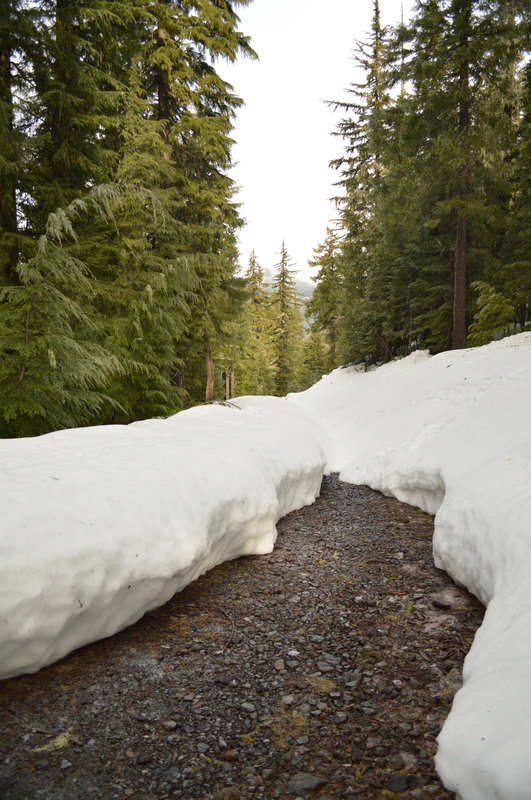
(Best time to go hiking is in early to mid-June when the Rhododendrons are blooming and the waterfalls are roaring. Best time to go snowshoeing/cross-country skiing is January and February).
Permits required: Annual Northwest Forest Pass or $5 day pass available at the trailhead May 1 - October 31. Sno-Park pass required November 1 - April 30.
Pit toilet at trailhead: Yes
Trail allows: Dogs, snowshoeing/cross-country skiing
Possible dangers: Steep drop off at the bottom waterfall viewing platform.
6.4 mile lollipop loop w/ 1,550 ft. elevation gain (Salt Creek Falls & Diamond Creek Falls Loop w/ Fall Creek Falls out and back)
Approximate hike time: 1 hour 39 minutes w/ an average pace of 2.3 mph (if you are snowshoeing the loop it will take you about 1 hour longer)
Difficulty: Easy to moderate
Trail usage: Medium to high on weekends in the spring and summer, low on weekdays. Medium on weekends and low on weekdays in the winter.
Highest elevation: 4,972 ft. Lowest elevation: 4,000 ft.
General location: 22 miles east of Oakridge - Willamette National Forest
Accessible: Year-round
(Best time to go hiking is in early to mid-June when the Rhododendrons are blooming and the waterfalls are roaring. Best time to go snowshoeing/cross-country skiing is January and February).
Permits required: Annual Northwest Forest Pass or $5 day pass available at the trailhead May 1 - October 31. Sno-Park pass required November 1 - April 30.
Pit toilet at trailhead: Yes
Trail allows: Dogs, snowshoeing/cross-country skiing
Possible dangers: Steep drop off at the bottom waterfall viewing platform.
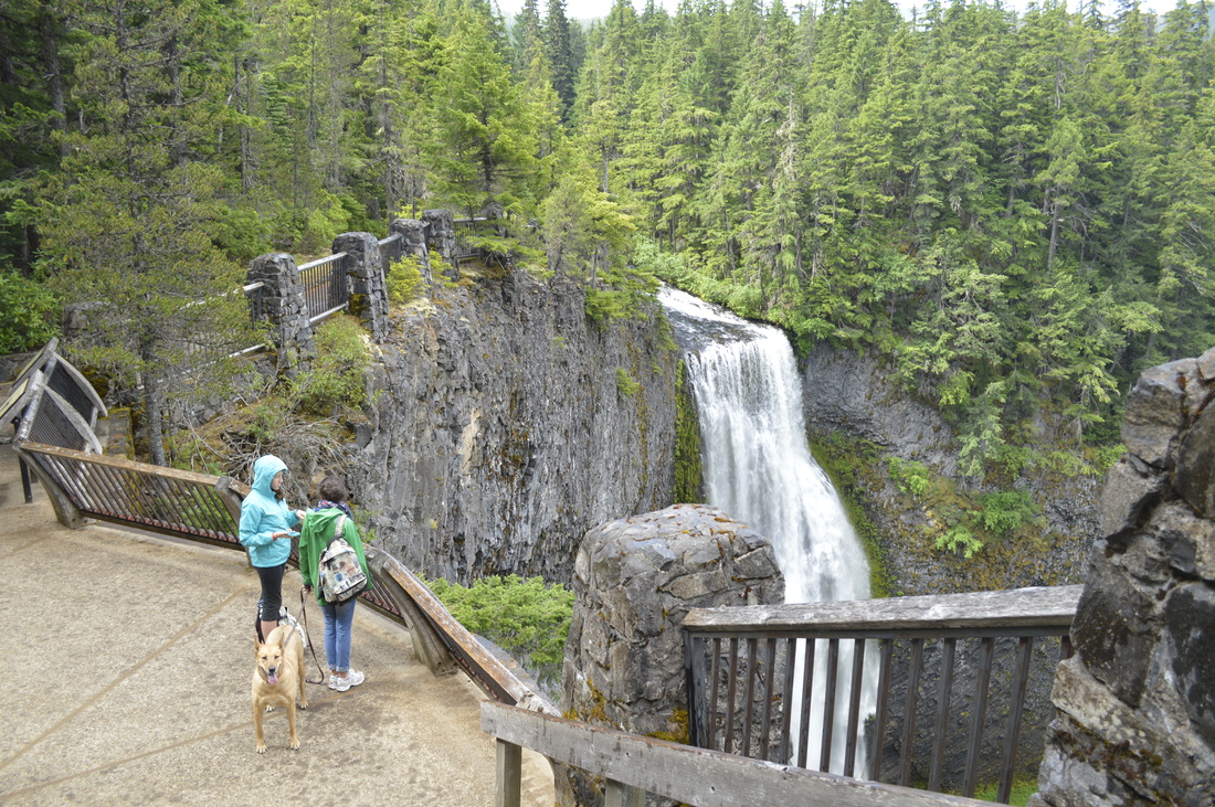
(Salt Creek Falls observation platform, July 2014)
Description:
The Salt Creek Falls and Diamond Creek Falls Loop is a short but spectacular trail that offers views of some of the most amazing waterfalls in the area. This hike is great for summer and fall hiking, as well as winter and early spring snowshoeing. Salt Creek Falls is Oregon's second tallest waterfall (286 ft.) and quite a sight to see! What's great about this hike, is that you can choose to hike a 3.75 mile loop or you can add 2.6 miles to the hike (making it a 6.4 mile hike) by taking an out and back trail to see Fall Creek Falls. *Keep in mind you can only do the shorter loop in the winter and early spring, as the trail up to Lower Fall Creek Falls is not marked with snow season trail markers.
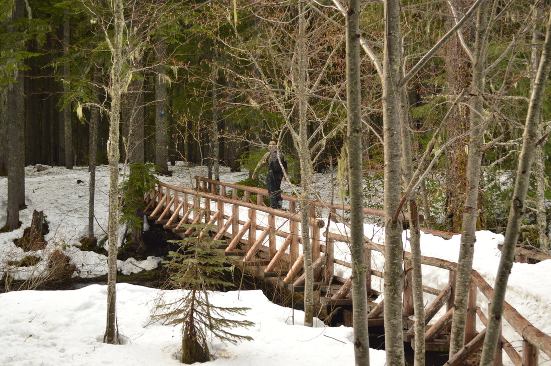
Start the hike on the south end of the parking lot loop (if you are snowshoeing you will begin at the Salt Creek Summit Sno-Park). You will almost immediately come to a wide bridge that crosses Salt Creek Falls. If you are snowshoeing in the winter the bridge can be a bit tricky to navigate because snow can pile up higher than the bridge's handrails, leaving you nothing to hold on to. But the bridge is very wide, which allows you to walk on the snow with some space on each side. Right after the bridge, there is another very small foot bridge and then the trail splits. Since this is a loop, you can choose to go either way, however most people go clockwise, and this is how the hike is described below.
|
|
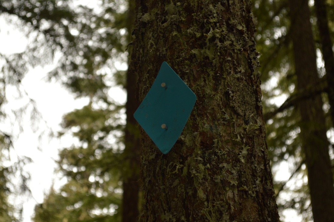
(diamond on the trees marking the trail in the winter)
|
From the trail junction you will now be on the Diamond Creek Falls Trail #3598 and for 0.6 miles you will traverse through the woods with a slight incline and 3 very short switchbacks. It is easy to find your way through the trees even when there is snow because of the bright blue diamonds that are posted to trees about 30-50 feet apart.
After 0.6 miles you will come to a road crossing. Cross the road and continue another 0.45 miles to a second road crossing. After having crossed the second gravel road, you will see a sign to Vivian Lake on your left. This trail is not marked with blue diamonds, so unless you are an expert navigator in the snow, it is not recommended that you do this in the winter. 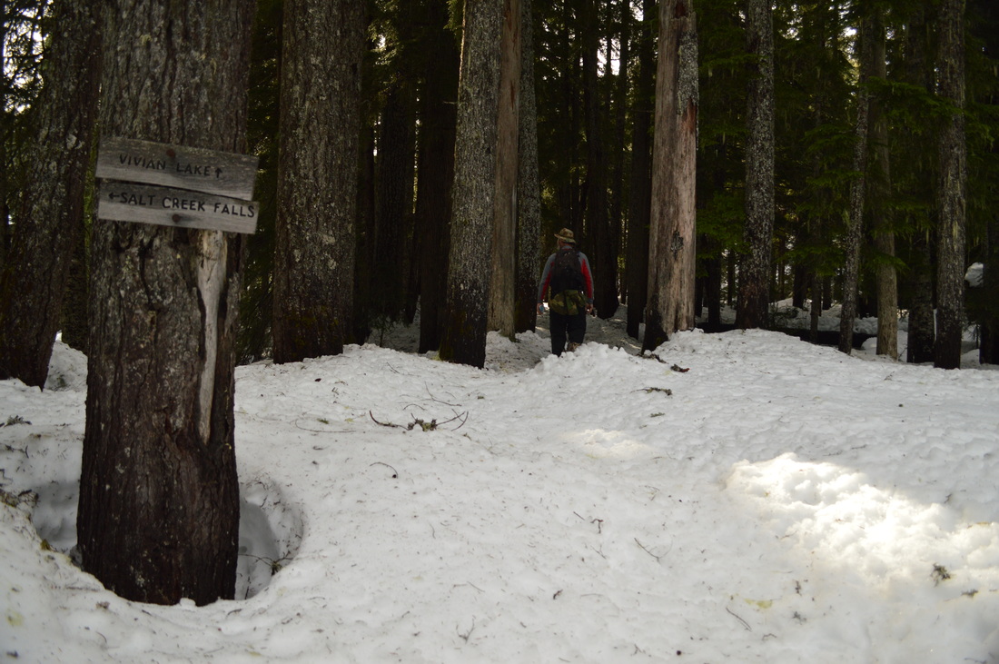
(Vivian Lake Trail junction)
|
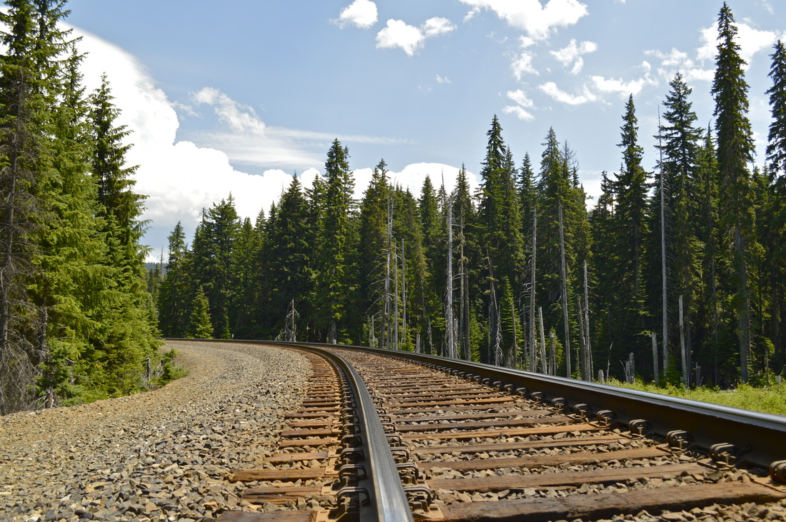
(railroad tracks that the trail crosses)
If you want to add an additional 2.4 round trip miles onto your hike in the summer go ahead and head up the hill and cross the train tracks to get to where the Vivian Lake Trail #3662 officially begins and takes you 1.3 uphill miles to a stunning viewpoint of Fall Creek Falls. The trail does continue uphill from here to Vivian Lake, but this lake is nothing special and honestly not really worth the extra mileage.
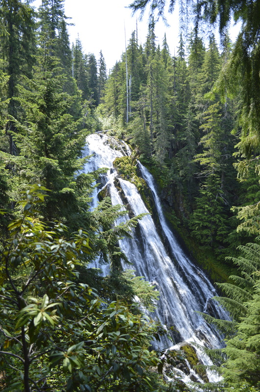
If you do not choose to hike up to Fall Creek Falls or Vivian Lake, you will continue straight on the Diamond Creek Falls loop, and you will reach the Diamond Creek Falls viewpoint within a few hundred yards. There is a small lookout platform which is safe in the winter. If you are hiking in the summer, you can take a little side trail down the hill, cross a log bridge (with only half of a handrail), to get to the bottom of the falls. Diamond Creek Falls cascades angelically down 100 feet and creates a wonderful cooling spray. It is about 0.2 miles to get to the bottom of Diamond Creek Falls from the actual trail, but the steep jaunt is definitely worth it! |
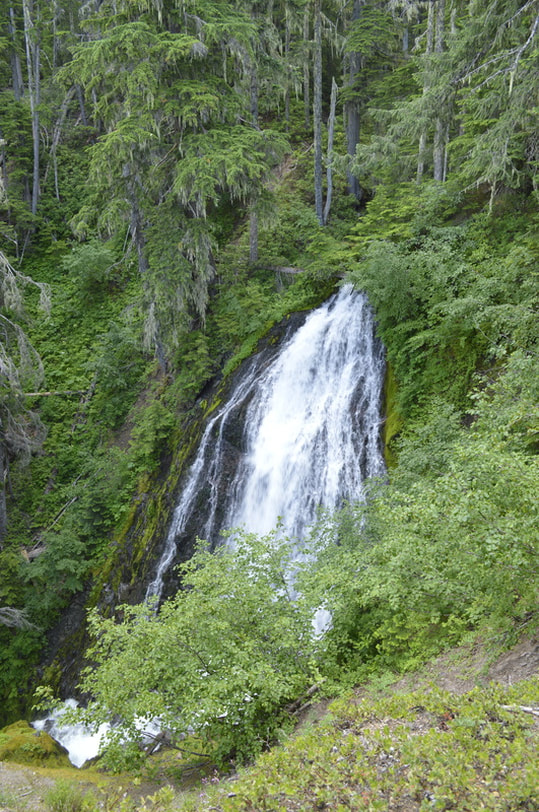
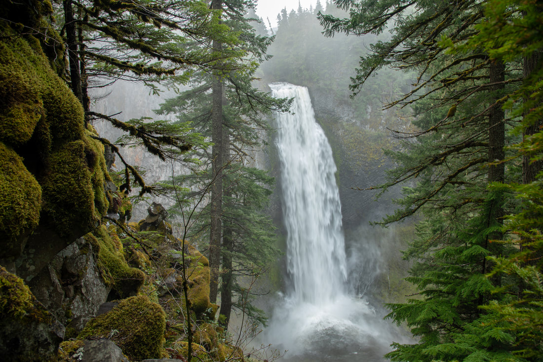
(Fall Creek Falls 160 ft.)
|
(Diamond Creek Falls from the lookout platform)
|
(Diamond Creek Falls 120 ft.)
|
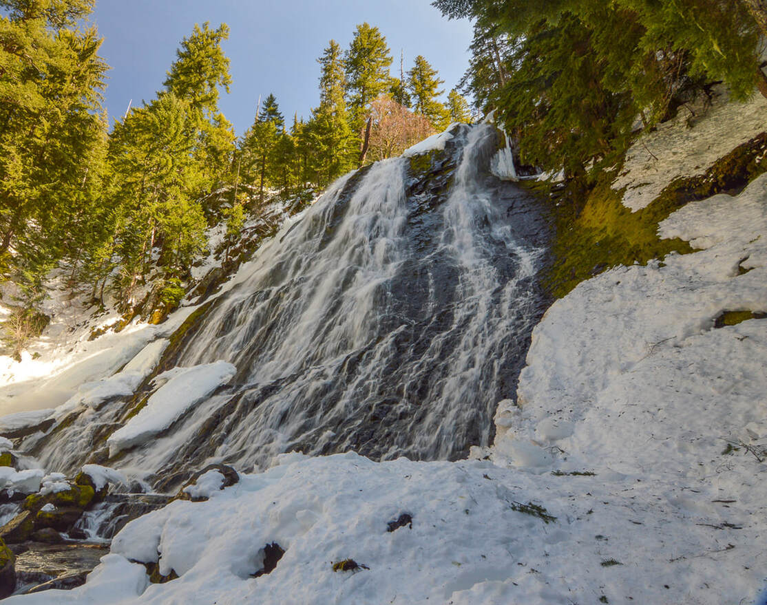
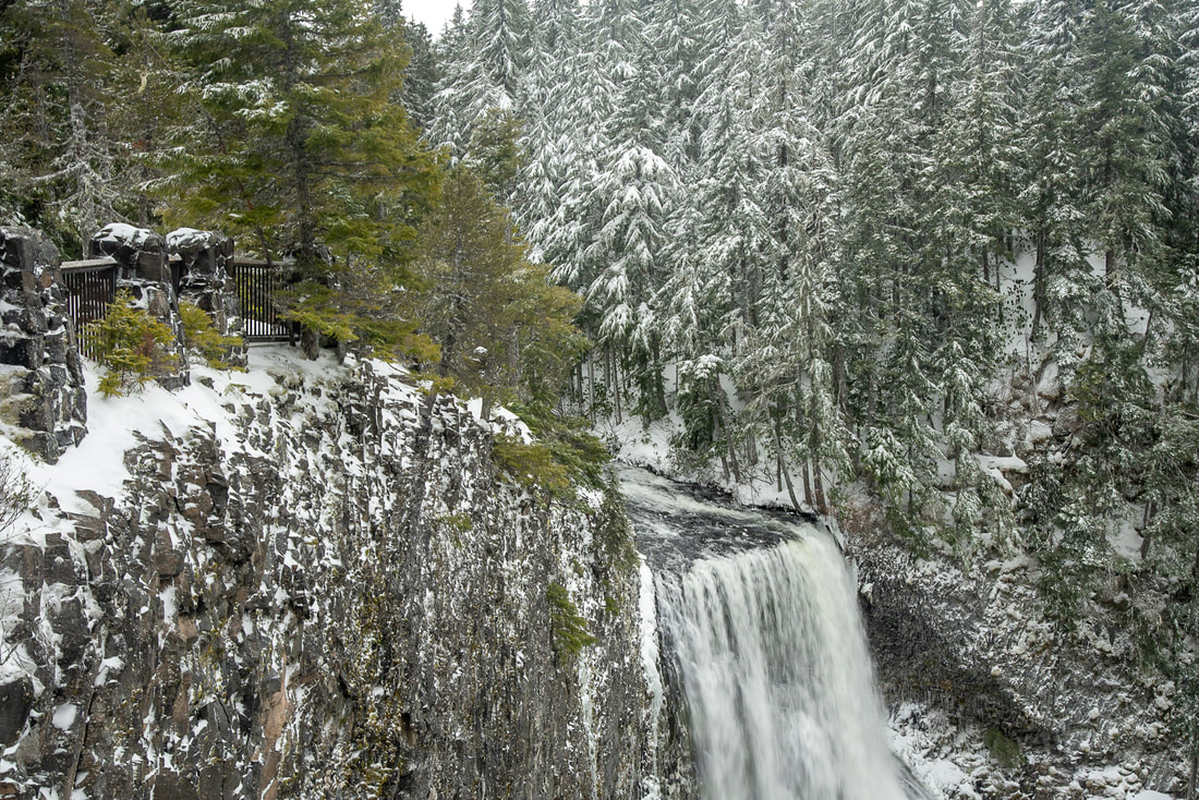
(Diamond Creek Falls in the winter)
After checking out Diamond Creek Falls you will hike 1 mile along Fall Creek (which later joins Salt Creek). After a little while in the forest, the views open up to your left and you can see magnificent views of the steep Salt Creek Falls canyon below. You can also see the hills beyond to the north, and on a clear day you can see the ski runs of Willamette Pass.

(views of the canyon and Willamette Pass)
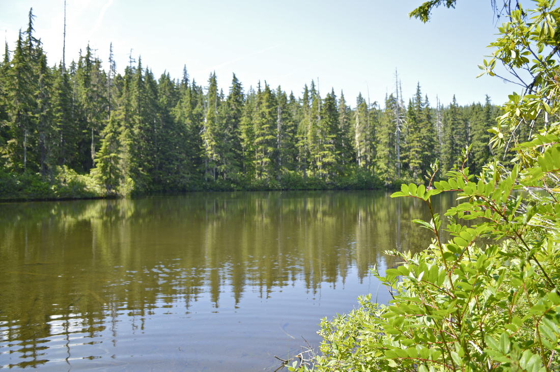
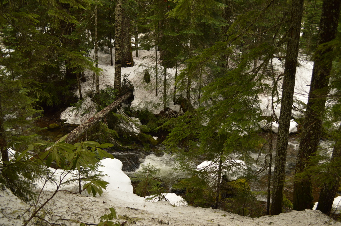
(Too Much Bear Lake)
|
After catching the breathtaking views, you will hike 0.1 miles and come across Too Much Bear Lake. If you are just doing the loop, this is a great place to have a picnic lunch. In the winter the lake is frozen over and covered in snow. 0.3 miles after the lake you will end the loop and cross the bridge again and right after crossing the bridge, instead of going back to your car, take a left to get to the Salt Creek Falls viewing platform.
|
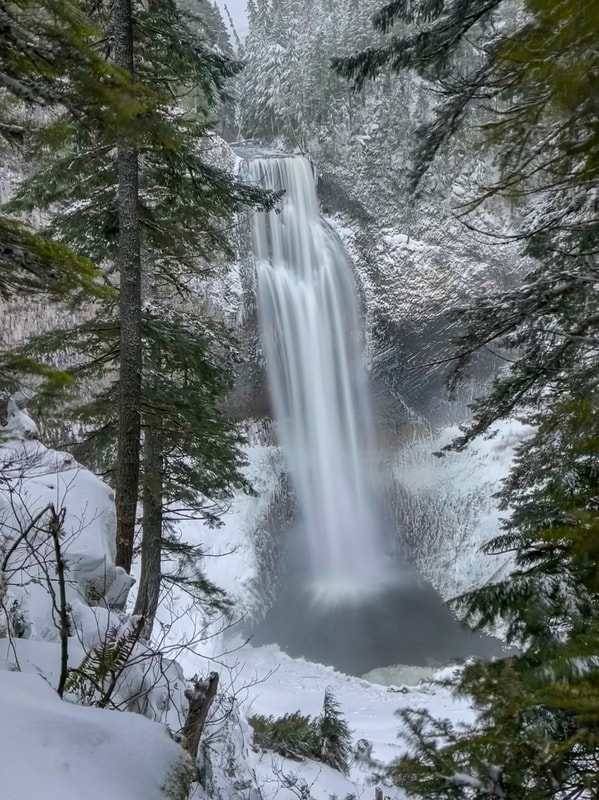
(Salt Creek Falls viewing platform in the winter)
|
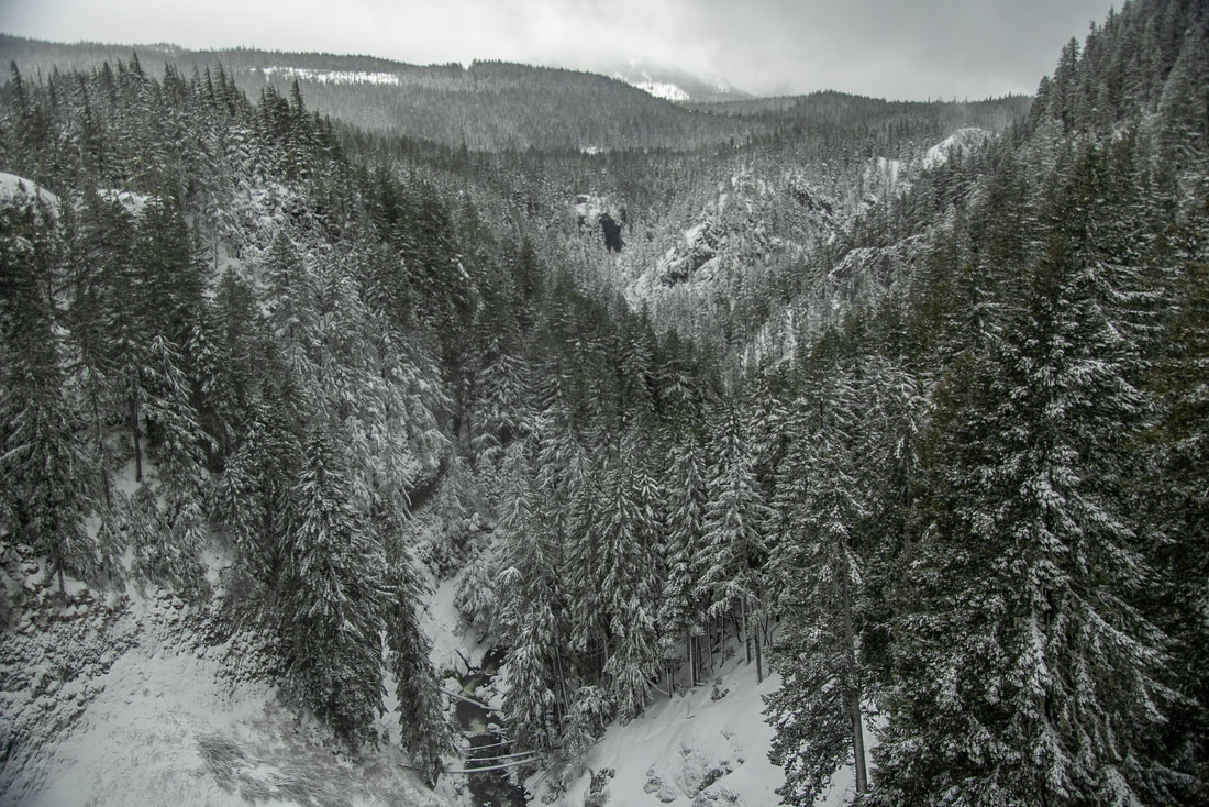
(view of the Salt Creek canyon in the winter)
|
(Salt Creek Falls 286 ft.)
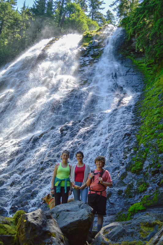
From the upper viewing platform you can walk 0.3 miles down to a lower viewing platform where you can get those epic photos of the entire 286-foot tall waterfall. The basalt rocks have broken off over the years and have left amazing shapes underneath the overhang of the falls. The lower viewing platform was built in 2020 and keeps folks from slipping down the steep embankment. Please adhere to the rules and do not jump the railing!
|
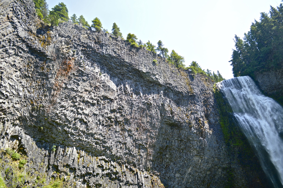
(basalt rocks under Salt Creek Falls)
The Salt Creek Falls area is highly recommended for sightseeing. There is something here for all ages and activity levels. In the prime of summer it is hot, there are lots of people, and the mosquitoes are out in throngs at the end of June and beginning of July! Try this hike in late September or early October if you want to avoid some of the summer crowds and the bugs. If you are into snowshoeing, you can do the loop any time during the winter, but you will typically have the best snow in January and February.
|
Directions:
From Oakridge
- Drive on OR-58 E for a total of 22 miles until you see a sign for Salt Creek Falls on your right. Once you have turned off the highway you will come to a fork. When the snow gate isn’t closed, you can take a right and drive to the main parking area. If the snow gate is closed, continue straight to the sno-park. (Total of 22.8 miles)
- Drive on US-97 S for a total of 47 miles. Then turn right at the Crescent Cutoff Road and then merge right onto OR-58 W. Shortly after the summit of Willamette Pass, turn left at the sign for Salt Creek Falls. Once you have turned off the highway you will come to a fork. When the snow gate isn’t closed, you can take a right and drive to the main parking area. If the snow gate is closed, continue straight to the sno-park. (Total of 75.9 miles)
- Total of 65 miles via Oakridge.
- Total of 127 miles via Oakridge.
- Total of 172 miles via Eugene.
|
*All pictures unless otherwise marked are taken by Franziska Weinheimer
*Disclaimer: The trail descriptions, mileage, GPS tracks and difficulty ratings depicted on this website are never 100% accurate. Always hike at your own risk, using your own knowledge, equipment and common sense. Franziska Weinheimer/Hike Oregon are not responsible if you or anyone in your party gets injured or lost while attempting one of these or any other hikes.
|
To get a more in-depth and personal view of this hike, watch the YouTube video.
|