Hike Oregon
  • Home
  • *Store*
  • About the author
  • How to use this site
  • Resources
    • Wildflowers
    • Videos
  • Best Oregon Hikes
    • 20 Epic Oregon Wildflower Hikes
    • 5 Weekend Backpacking Trips in Oregon
    • Top 10 Swimming Spots In Oregon
    • 9 Amazing Oregon Summit Hikes
    • Top 10 Oregon Summer Hikes
    • 20 Central Oregon Day Hikes
    • Top One Night Backpacking Trips in Central Oregon
    • Top 10 Oregon Hikes for Kids
    • 20 Best Oregon Waterfall Hikes
    • Underrated Fall Foliage Hikes In Oregon
    • Top 10 Oregon Fall Hikes
    • Best Rainy Day Hikes In Oregon
    • Sno-Parks In Central Oregon
    • Top 10 Oregon Winter Hikes
    • Top Low Elevation Winter Hikes
    • Easy Hikes in Oregon
    • Top 10 Oregon Spring Hikes
  • Oregon Sno-Parks
    • Maxwell Sno-Park
    • Potato Hill Sno-Park
    • Ray Benson Sno-Park
      • Brandenburg Shelter
    • Santiam Sno-Park
    • Three Creek Sno-Park
    • Virginia Meissner Sno-Park
      • Meissner Shelter Loop
      • Nordeen Shelter
    • Gold Lake Sno-Park
      • Westview Shelter to Eagle Rock Overlook
      • Marilyn Lakes Loop
    • Ikenick Sno-Park (members only)
  • Southern Washington
    • Hamilton Mountain
    • Dog Mountain
    • Coyote Wall
    • Mount St. Helens
  • Portland
    • Powell Butte
    • Forest Park
    • Latourell Falls
    • Multnomah/Wahkeena Falls
    • Eagle Creek
    • Mitchell Point
    • Table Rock
    • Tamanawas Falls
    • Trillium Lake
    • East Zigzag Mountain (members only)
  • Salem
    • Abiqua Falls
    • Silver Falls State Park
    • Dome Rock
    • Marion Lake to Marion Mountain
    • Jefferson Park via Whitewater Trail
  • Corvallis
    • William Finley Wildlife Refuge
      • Campbell Boardwalk
      • Woodpecker Loop
      • Mill Hill Loop
      • Beaver Pond Loop
    • Marys Peak East Ridge
    • Marys Peak North Ridge
    • Alsea Falls and Green Peak Falls
    • Corvallis to Sea Trail - Sugarbowl Creek segment (members only)
  • Sweet Home
    • Crescent Mountain
    • Iron Mountain
    • McDowell Creek Falls
    • Middle Santiam River (members only)
    • Lower Soda Creek Falls (members only)
    • Rooster Rock (members only)
  • McKenzie Bridge/Blue River
    • Macduff Mountain
    • Proxy Falls
    • Clear Lake
    • Sahalie/Koosah Falls
    • Blue Pool
    • Erma Bell Lakes
    • Olallie Mountain
    • Horsepasture Mountain
    • Tidbits Mountain
    • Castle Rock
    • Separation Lake (members only)
    • Lowder Mountain (members only)
    • East Fork Trail (members only)
    • Rainbow Falls Overlook (members only)
    • Frissell Point (members only)
    • Substitute Point (members only)
  • Sisters/Santiam Pass
    • Coffin Mountain
    • Trappers Butte and Scar Mountain
    • Maxwell Butte
    • Black Butte
    • Whychus Creek Trail
    • Tam McArthur Rim
    • Black Crater
    • Scott Mountain
    • Obsidian Trail
    • Metolius Preserve
    • Three Fingered Jack Loop
    • Square Lake
    • Canyon Creek Meadows
    • Patjens Lakes
    • Craig Lake (members only)
    • Chush Falls (members only)
    • Rockpile Lake (members only)
    • Santiam Lake (members only)
    • Camp Lake (members only)
    • Park Meadow to Golden Lake (members only)
  • Bend/Redmond/LaPine
    • Steins Pillar
    • Chimney Rock
    • Steelhead Falls
    • Tumalo State Park
    • Shevlin Park Loop
    • Tumalo Falls
    • Tumalo Mountain
    • No Name Lake
    • Green Lakes
    • Moraine Lake
    • South Sister Summit
    • Horse Lake
    • Muskrat Lake
    • Paulina Peak
    • The Badlands - Flatiron Rock Trail
    • Peter Skene Ogden Trail (members only)
  • Eugene
    • Ridgeline Trail
    • Mount Pisgah Summit
    • Mount Pisgah Arboretum
    • Shotgun Creek
    • Mount June
    • Lawler
    • Tire Mountain
    • Hardesty Mountain
    • Goodman Creek
    • Brice Creek
    • Trestle Creek Falls
    • Parker Falls
    • Moon Falls
    • Elijah Bristow State Park
    • South Willamette Trail (members only)
    • Eula Ridge (members only)
    • Eagle's Rest (members only)
  • Oakridge
    • Deception Butte
    • North Salmon Creek
    • Sourgrass Mountain
    • Grasshopper Ridge
    • Larison Creek
    • Bunchgrass Ridge
    • Salt Creek Falls
    • Waldo Lake Loop
    • South Waldo Loop
    • The Twins
    • Rosary Lakes
    • Yoran Lake
    • Fawn Lake
    • Windy Lakes
    • Divide Lake
    • Diamond Peak via Rockpile Lake Trailhead
    • Diamond Peak via Summit Lake
    • Cowhorn Mountain
    • Klovdahl Bay (members only)
    • Verdun Trail (members only)
    • Heckletooth Mountain (members only)
    • Wall Creek Warm Springs (members only)
    • Moon Point (members only)
    • Bobby Lake (members only)
    • Lillian Falls (members only)
    • Middle Fork Willamette Trail (members only)
    • Pool Creek Falls (members only)
    • Dead Mountain (members only)
    • Larison Rock (members only)
    • Quinn Lakes & Eddeeleo Lakes (members only)
    • Waldo Mountain Lookout (members only)
    • Blair Lake to Spring Prairie (members only)
    • Rigdon Lakes loop (members only)
  • Oregon Coast
    • Cascade Head
    • Drift Creek Falls
    • Sweet Creek Falls
    • Beaver Creek Falls
    • Kentucky Falls
    • Hobbit Trail to Heceta Head
    • Valley Trail to China Creek
    • Sutton Creek Trail (members only)
    • North Fork Smith River (members only)
    • Cummins Ridge (member's only)
    • Horse Creek (members only)
    • Siltcoos Lake (members only)
  • Southern Oregon
    • Fall Creek Falls
    • Watson Falls
    • Wild Rogue Loop
    • Mt. Thielsen
    • Crater Lake National Park
      • The Watchman
      • Mount Scott
      • The Pinnacles
    • Lower Table Rock
    • Pilot Rock
    • Wagner Butte
    • Mt. McLoughlin
    • Lemolo Falls (members only)
    • Fern Falls (members only)
  • Eastern Oregon
    • Painted Cove
    • Anthony Lake Loop
    • Mount Howard
    • Eagle Cap summit
    • Schneider Cabin (members only)
    • Strawberry Lake & Strawberry Falls (members only)
  • Northern California
    • Taylor & Hogan Lake (members only)
  • Oregon PCT sections
    • PCT: CA border to Callahan's
  • Tips & Tricks
    • Leave No Trace
    • Safety Tips for Solo Hiking & Backpacking
    • Nutrition On The Trail
    • How Much Water To Carry When Backpacking
    • Storing Your Bear Canister When Backpacking
    • How To Pick The Right Backpacking Tent
    • Top Tips For Hiking With Infants And Toddlers
    • Poison Oak, Ivy and Sumac
    • How to dress for cold weather hikes
  • Reviews and Gear
    • Choosing and Using Trekking Poles
    • A Guide to Choosing the Perfect Backpacking Pack
    • Hiking Pants and Leggings
    • Jackets for Hiking and Backpacking
    • Long Sleeved Shirts For Cold Weather Hiking
    • Stay Kühl This Summer
    • Outdoor Herbivore Backpacking Food Review
    • Osprey Aura AG 65 Backpack review
    • Big Agnes Fly Creek UL2 review
    • REI Quarter Dome 1 review
    • Hike Oregon's Gear Favorites
    • Outdoorsy Holiday Gift Guide 2022
    • Hiker Holiday Gift Guide 2019
    • Outdoor Holiday Gift Guide 2018
    • Hiking Holiday Gift Guide 2017
  • Adventure Stories
    • Hiking The Rae Lakes Loop
    • 110 Miles on the PCT
    • Three Fingered Jack Adventures
    • Jefferson Wilderness

Three Fingered Jack Loop

​

via Santiam Pass

​
Get the printable version of this hike

Hike details:

Mileage: 21.5 mile loop w/ 2,500 ft. elevation gain
Approximate hike time: 9 hours 20 minutes w/ an average pace of 2.3 mph
Difficulty: Difficult
Trail usage: High on summer weekends, medium on summer weekdays, medium on fall weekends, low on fall weekdays.
Highest elevation: 6,500 ft. Lowest elevation: 4,800 ft.
General location: 20 miles west of Sisters - Willamette National Forest - Mount Jefferson Wilderness
Accessible: Mid-June through November
(Best time to go is August through October. Avoid the month of June due to lingering snow and it is easy to lose the trail and avoid July due to lots of mosquitoes in the area).
Permits required: Day trips - Free self issue wilderness permit June 15 - October 15 and Northwest Forest Pass for parking. 
Overnight trips - Central Cascades Wilderness Permit June 15 - October 15 via recreation.gov 
and Northwest Forest Pass for parking. 
Pit toilet at trailhead: Yes
Trail allows: Dogs, horses, camping
Possible dangers: ​This trail is very exposed to the sun so it gets extremely hot in the summer. 
Pacific Crest Trailhead at Santiam Pass
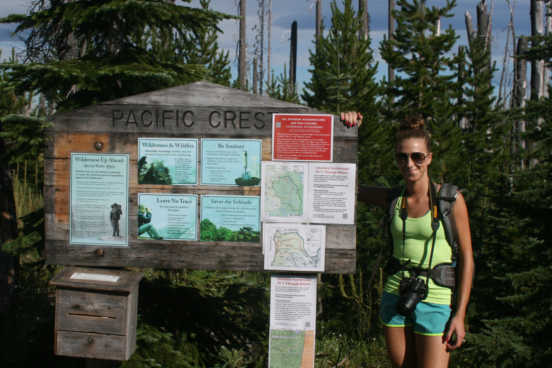
(Pacific Crest Trailhead & loop trailhead sign)

 Description:

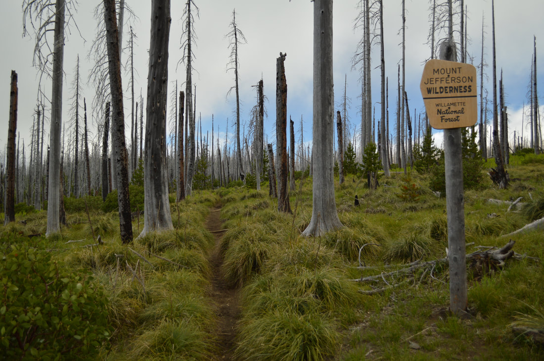
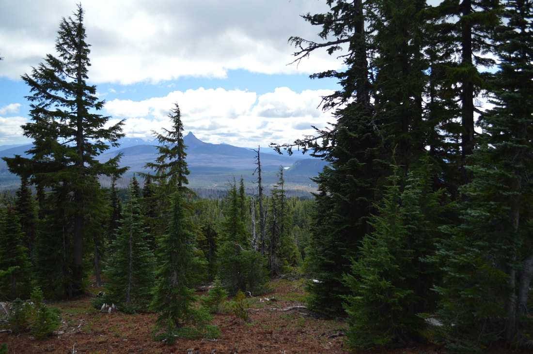
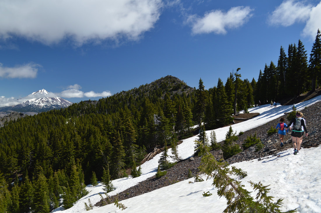
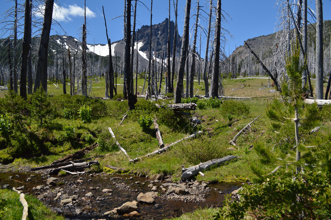
The hike around Three Fingered Jack is a popular 21.5 mile loop, starting at the Pacific Crest Trailhead at Santiam Pass. You can also start the hike at Jack Lake Trailhead, however the road up to Jack Lake is long and rough, so even if you're coming from Bend or Sisters, it will still take less time to drive to Santiam Pass. At the Santiam Pass trailhead, don't forget to fill out your wilderness permit if you are day hiking between June 15 and October 15. If you are backpacking, you will need to obtain a limited entry permit beforehand. ​The hike starts out on the Pacific Crest Trail, heading northbound through bushels of bear grass and silvery tree snags that remain from the very large B&B Complex fire in 2003. The Pacific Crest Trail will continue gaining elevation, as you head up the southern flank of Three Fingered Jack.
Three Fingered Jack Loop Mount Jefferson Wilderness sign
Three Fingered Jack Loop trail
Three Fingered Jack Loop PCT section
View of Mt. Washington from the Three Fingered Jack Loop
(view from the PCT looking south at Mount Washington)
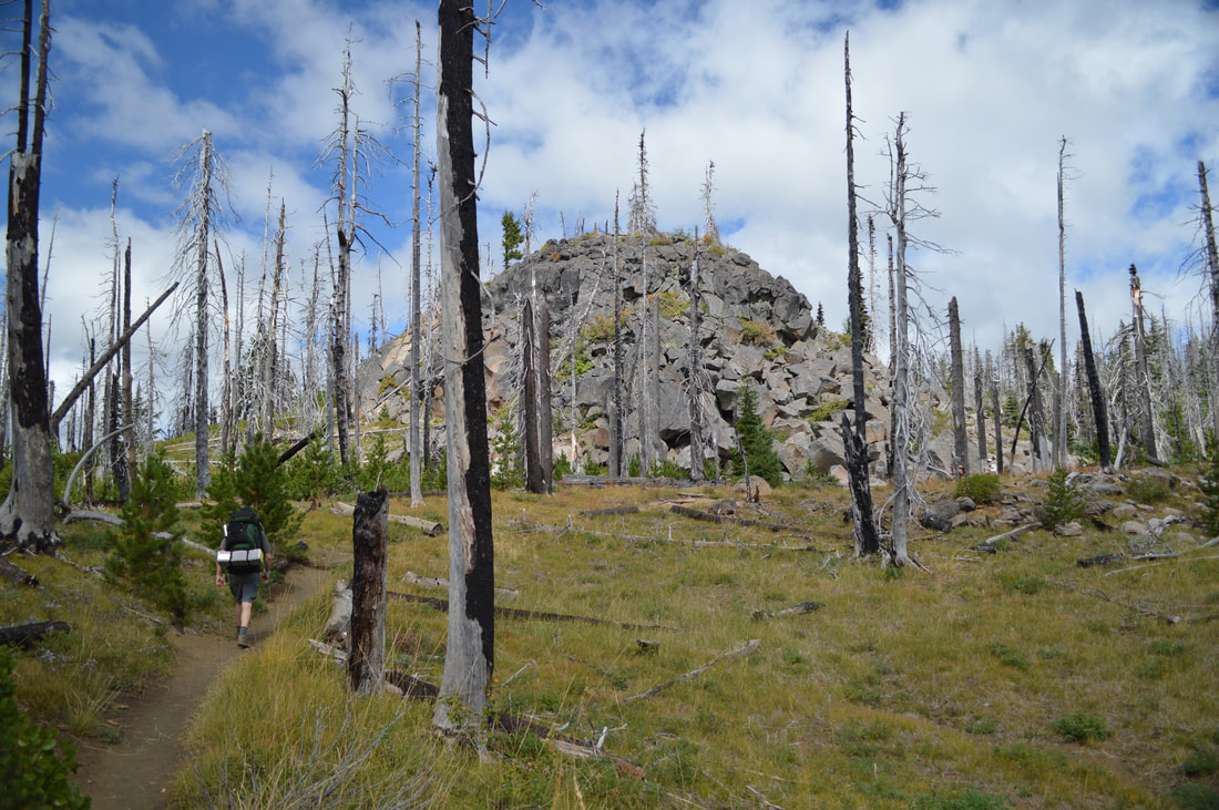
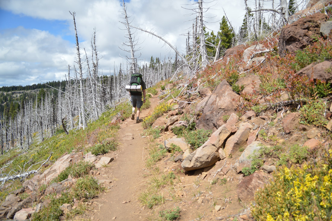
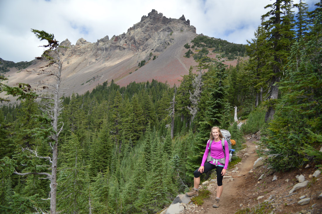
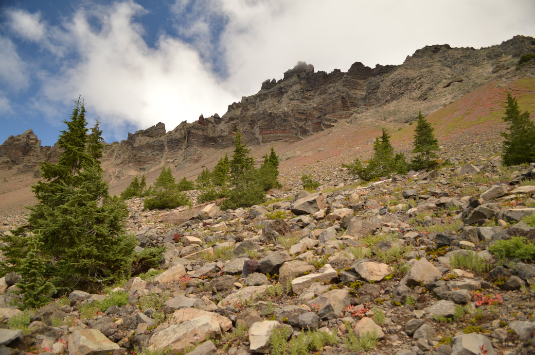
The trail is dry and sandy until you get to the forest. Here the trail becomes compact and the further up you go, the more rocks you will encounter. Watch your footing as you come around the west side of Three Fingered Jack, the trail becomes entirely rock for about a quarter of  a mile and you will cross a few dry creek beds. Keep your eyes out for white mountain goats on the sides of the mountain. They like to graze up here on the high slopes and there is frequently a whole herd up there throughout the summer.
Backpacking the Three Fingered Jack Loop
Three Fingered Jack
(looking up at Three Fingered Jack from the trail)
View of Duffy Lake from the Three Fingered Jack Loop
(Duffy Butte and Duffy Lake)
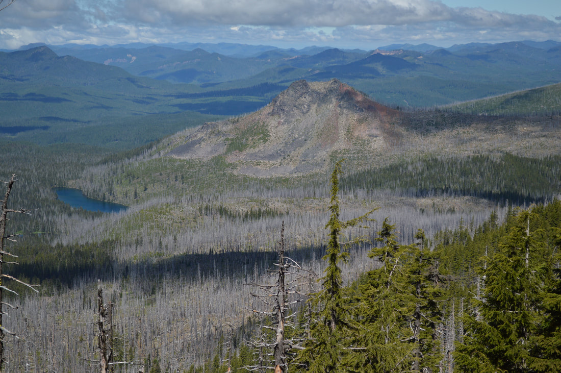
As you near the highest point of the trail, you will have expansive views to the west, where you will see Santiam Lake, Maxwell Butte, Duffy Lake and Duffy Butte, Mowich Lake and multiple other beautiful destinations within the Jefferson Wilderness. Eventually you will also see Mount Jefferson to the north and you will continue seeing views of this mountain until you come around the northern side of Three Fingered Jack. 
View of Mt. Jefferson from the Three Fingered Jack Loop
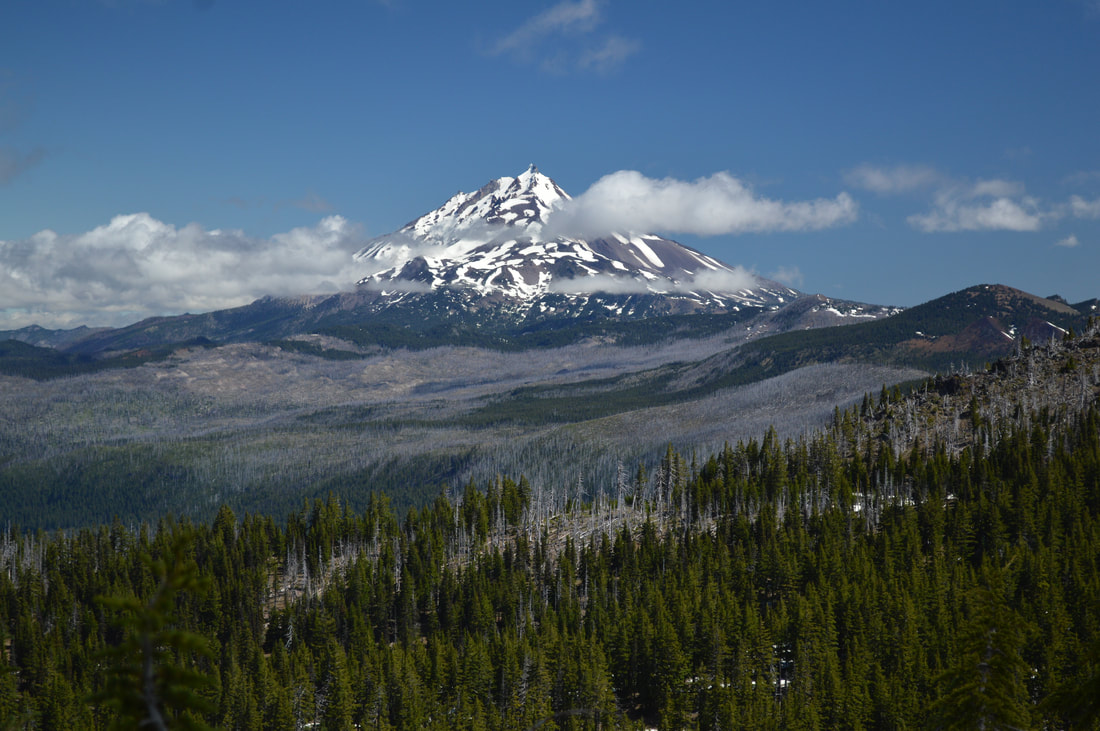
(view of Mount Jefferson to the north)
Three Fingered Jack Loop trail
(the trail at the end of June)
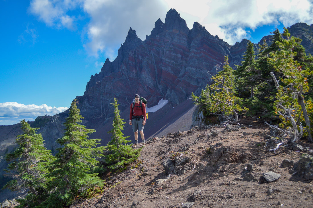
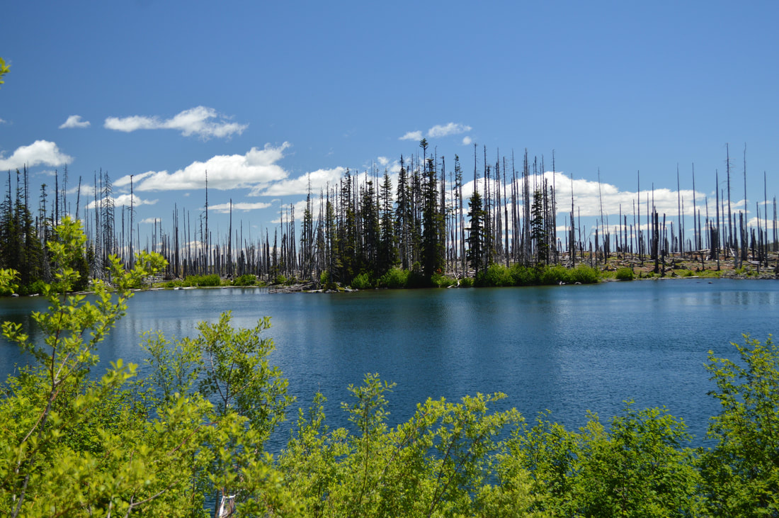
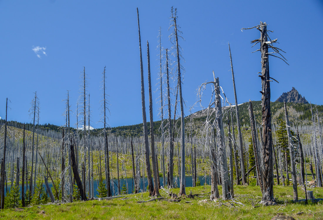
At the northern tip of the loop, there is a spectacular viewpoint of Three Fingered Jack. Here you can see the different layers of rock in the mountain, the various glaciers that hang on for dear life in this ever warming climate, and you can look down into the very green Canyon Creek Meadows area. While heading down to Minto Pass, make sure you don't miss the awesome viewpoint of Wasco Lake.
East side of Three Fingered Jack
(Three Fingered Jack viewpoint)
Wasco Lake and Three Fingered Jack
(Wasco Lake, Black Butte and Three Fingered Jack)
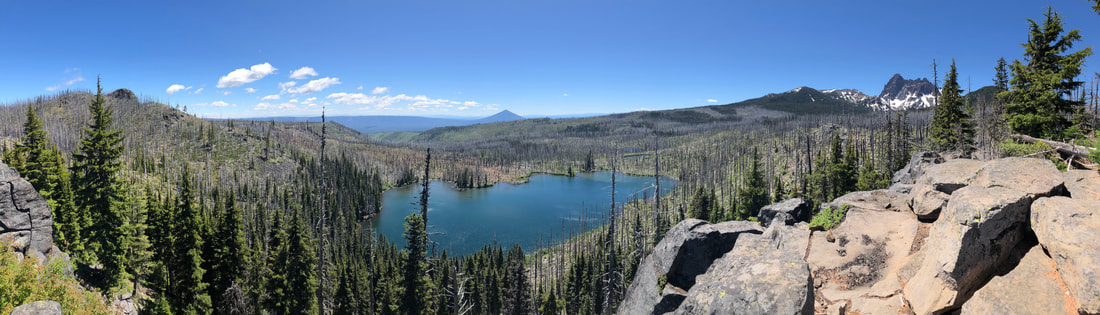
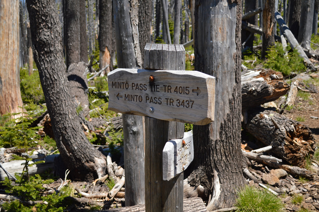
A few hundred feet past the Wasco Lake viewpoint, you will see a trail junction, this is Minto Pass. Here the Pacific Crest Trail continues north 4 miles to Rockpile Lake (also a great place to backpack to), and the Minto Pass Trail #3437 goes west to Marion Lake. At this trail junction you will leave the PCT and take Summit Lake Trail #4014 to the right, which goes steeply down to Wasco Lake. There is plenty of camping at Wasco Lake if you are wanting to camp. At this point you are a little over 10 miles into the loop, which is a great halfway stopping point. 
Minto Pass sign Oregon Pacific Crest Trail
Wasco Lake Three Fingered Jack Loop
(Wasco Lake)
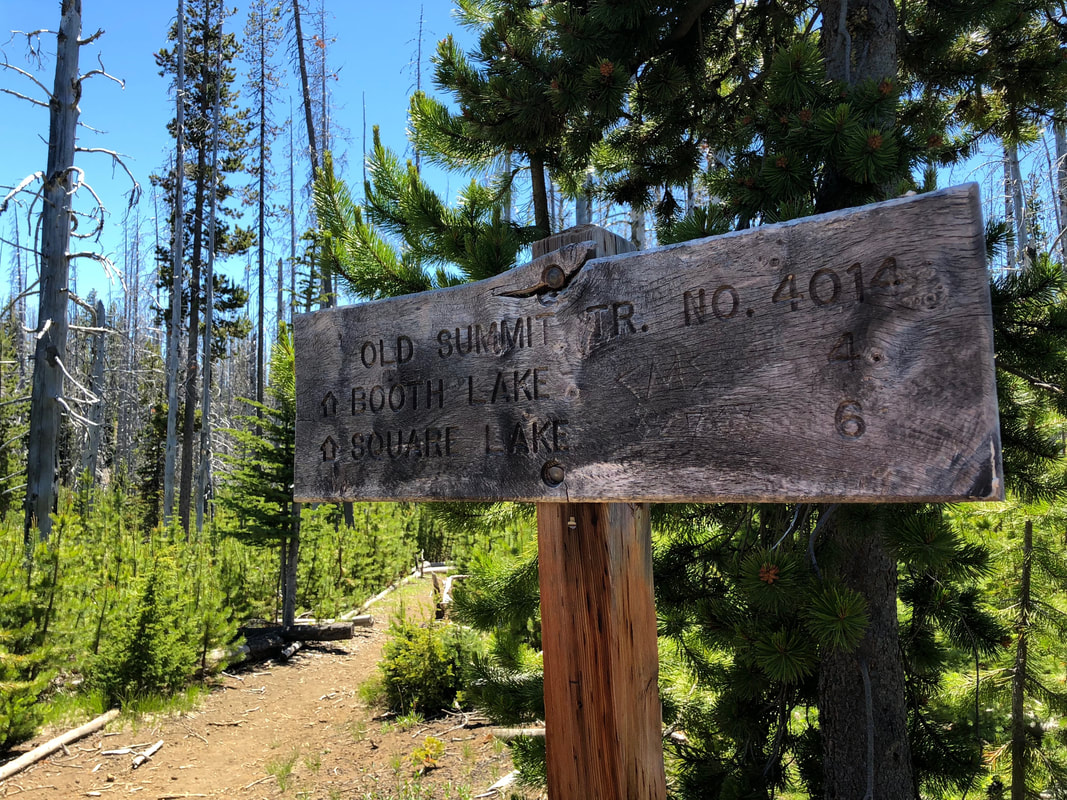
After Wasco Lake, you will see a few trail splits heading off to the right towards Canyon Creek Meadows. Unless you are wanting to check out Canyon Creek Meadows and add on 2.8 miles to the hike, make sure you continue to follow signs towards Jack Lake Trailhead. There is also some primitive camping at Jack Lake, and from there you will have 4 miles to Booth Lake and 6 miles until you get to Square Lake which are the next camping spots. So some folks might opt to camp at Jack Lake, although camping at Jack Lake is not as secluded as Wasco Lake or Square Lake because it is right by a very busy trailhead. Continue past Jack Lake on the Old Summit Trail #4014. You will stay on this trail for the remainder of the hike. 
Jack Lake Three Fingered Jack Loop
(Jack Lake)
Old Summit Trail Three Fingered Jack Loop
Creek crossing Three Fingered Jack Loop
The 6 miles to Square Lake are all through a sparse burn area, also devastated by the B&B Complex fire. You will see miles and miles of silver trees, waist or shoulder high snowbush and a few new trees that are trying to grow back in this harsh environment and short growing season. This area gets extremely hot in the afternoon and there is absolutely no shade. Bring a hat, sunscreen, sunglasses, and if you bring your dog, PLEASE bring booties to protect their paws from the very hot sand! 
Booth Lake Three Fingered Jack Loop
(Booth Lake)
4 miles past Jack Lake trailhead, you will come to Booth Lake. A small lake on your right, with great views of Three Fingered Jack. There is one small primitive campsite here. 2 miles after Booth Lake, you will come to Square Lake and another trail split. At the junction, continue to the right for another 2 miles back to the car.
Square Lake Three Fingered Jack Loop
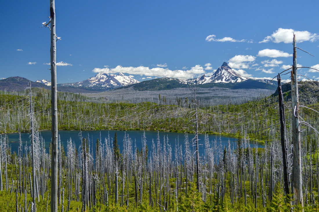
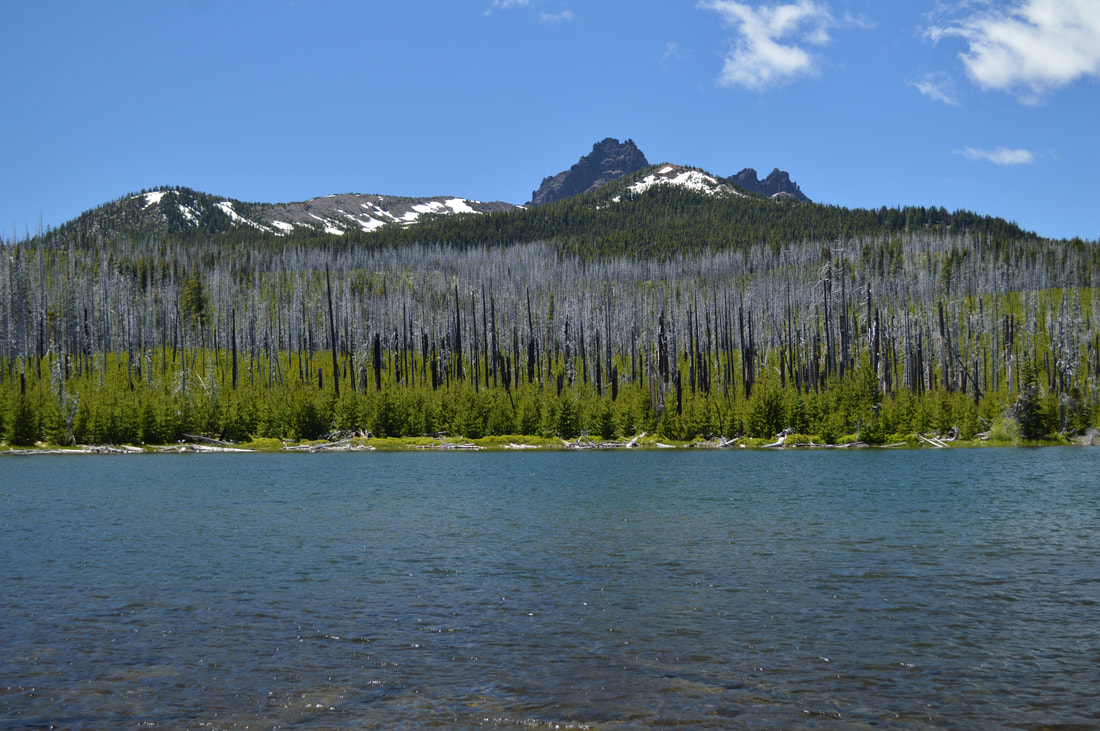
(Square Lake, Mount Washington and the Three Sisters)
This loop around Three Fingered Jack is really great, and perfect for those wanting to experience their first time camping in the backcountry. The trail is a mixture between sandy and rocky terrain, and there are only two spots where the trail has a steep drop-off. The terrain is not very difficult but due the trail being 85% exposed, it gets very hot and if you do not have adequate clothing to shield you from the sun, it can zap all of the energy out of you and make this hike a long slog. Along with your 10 Essentials, it is recommended you take a hat, sunscreen, sunglasses, electrolytes, and a water filter so that you can get extra water when yours is empty. So if you're wanting to spend a night or two out in the wilderness, this is an awesome hike for folks of all levels of hiking and backpacking experience. 

Directions:

From Sisters
  • Drive on US-20 W for a total of  20.2 miles, then turn right at a sign for Pacific Crest Trail. Drive 0.5 miles up to the circular parking area. (Total of 20.7 miles)
From Salem
  • ​Drive on OR-22 E for a total of 80.2 miles, then make a slight left onto US-20 E for 5.4 miles. Turn left at a sign for Pacific Crest Trail. Drive 0.5 miles up to the circular parking area. (Total of 89.6 miles)
From Eugene
  • Drive on OR-126 E for a total of 68.2 miles, then merge right onto US-20 E for 8.8 miles. Turn left at a sign for Pacific Crest Trail. Drive 0.5 miles up to the circular parking area. (Total of 86.2 miles)
From Bend
  • Total of 43.2 miles via Sisters.
From Medford
  • ​Total of 215 miles via Bend and Sisters.
​​​To get a more in-depth and personal view of this hike, watch the YouTube video.
-This trail write-up was last updated in 2020-
*All pictures are taken by Franziska Weinheimer
*Disclaimer: The trail descriptions, mileage, GPS tracks and difficulty ratings depicted on this website are never 100% accurate. Always hike at your own risk, using your own knowledge, equipment and common sense. Franziska Weinheimer/Hike Oregon are not responsible if you or anyone in your party gets injured or lost while attempting one of these or any other hikes. ​​​

HIKED HERE RECENTLY? PLEASE LEAVE A TRIP REPORT BELOW:

© Hike Oregon 2025
P.O. Box 41911
​Eugene, OR 97404
Proudly powered by Weebly
  • Home
  • *Store*
  • About the author
  • How to use this site
  • Resources
    • Wildflowers
    • Videos
  • Best Oregon Hikes
    • 20 Epic Oregon Wildflower Hikes
    • 5 Weekend Backpacking Trips in Oregon
    • Top 10 Swimming Spots In Oregon
    • 9 Amazing Oregon Summit Hikes
    • Top 10 Oregon Summer Hikes
    • 20 Central Oregon Day Hikes
    • Top One Night Backpacking Trips in Central Oregon
    • Top 10 Oregon Hikes for Kids
    • 20 Best Oregon Waterfall Hikes
    • Underrated Fall Foliage Hikes In Oregon
    • Top 10 Oregon Fall Hikes
    • Best Rainy Day Hikes In Oregon
    • Sno-Parks In Central Oregon
    • Top 10 Oregon Winter Hikes
    • Top Low Elevation Winter Hikes
    • Easy Hikes in Oregon
    • Top 10 Oregon Spring Hikes
  • Oregon Sno-Parks
    • Maxwell Sno-Park
    • Potato Hill Sno-Park
    • Ray Benson Sno-Park
      • Brandenburg Shelter
    • Santiam Sno-Park
    • Three Creek Sno-Park
    • Virginia Meissner Sno-Park
      • Meissner Shelter Loop
      • Nordeen Shelter
    • Gold Lake Sno-Park
      • Westview Shelter to Eagle Rock Overlook
      • Marilyn Lakes Loop
    • Ikenick Sno-Park (members only)
  • Southern Washington
    • Hamilton Mountain
    • Dog Mountain
    • Coyote Wall
    • Mount St. Helens
  • Portland
    • Powell Butte
    • Forest Park
    • Latourell Falls
    • Multnomah/Wahkeena Falls
    • Eagle Creek
    • Mitchell Point
    • Table Rock
    • Tamanawas Falls
    • Trillium Lake
    • East Zigzag Mountain (members only)
  • Salem
    • Abiqua Falls
    • Silver Falls State Park
    • Dome Rock
    • Marion Lake to Marion Mountain
    • Jefferson Park via Whitewater Trail
  • Corvallis
    • William Finley Wildlife Refuge
      • Campbell Boardwalk
      • Woodpecker Loop
      • Mill Hill Loop
      • Beaver Pond Loop
    • Marys Peak East Ridge
    • Marys Peak North Ridge
    • Alsea Falls and Green Peak Falls
    • Corvallis to Sea Trail - Sugarbowl Creek segment (members only)
  • Sweet Home
    • Crescent Mountain
    • Iron Mountain
    • McDowell Creek Falls
    • Middle Santiam River (members only)
    • Lower Soda Creek Falls (members only)
    • Rooster Rock (members only)
  • McKenzie Bridge/Blue River
    • Macduff Mountain
    • Proxy Falls
    • Clear Lake
    • Sahalie/Koosah Falls
    • Blue Pool
    • Erma Bell Lakes
    • Olallie Mountain
    • Horsepasture Mountain
    • Tidbits Mountain
    • Castle Rock
    • Separation Lake (members only)
    • Lowder Mountain (members only)
    • East Fork Trail (members only)
    • Rainbow Falls Overlook (members only)
    • Frissell Point (members only)
    • Substitute Point (members only)
  • Sisters/Santiam Pass
    • Coffin Mountain
    • Trappers Butte and Scar Mountain
    • Maxwell Butte
    • Black Butte
    • Whychus Creek Trail
    • Tam McArthur Rim
    • Black Crater
    • Scott Mountain
    • Obsidian Trail
    • Metolius Preserve
    • Three Fingered Jack Loop
    • Square Lake
    • Canyon Creek Meadows
    • Patjens Lakes
    • Craig Lake (members only)
    • Chush Falls (members only)
    • Rockpile Lake (members only)
    • Santiam Lake (members only)
    • Camp Lake (members only)
    • Park Meadow to Golden Lake (members only)
  • Bend/Redmond/LaPine
    • Steins Pillar
    • Chimney Rock
    • Steelhead Falls
    • Tumalo State Park
    • Shevlin Park Loop
    • Tumalo Falls
    • Tumalo Mountain
    • No Name Lake
    • Green Lakes
    • Moraine Lake
    • South Sister Summit
    • Horse Lake
    • Muskrat Lake
    • Paulina Peak
    • The Badlands - Flatiron Rock Trail
    • Peter Skene Ogden Trail (members only)
  • Eugene
    • Ridgeline Trail
    • Mount Pisgah Summit
    • Mount Pisgah Arboretum
    • Shotgun Creek
    • Mount June
    • Lawler
    • Tire Mountain
    • Hardesty Mountain
    • Goodman Creek
    • Brice Creek
    • Trestle Creek Falls
    • Parker Falls
    • Moon Falls
    • Elijah Bristow State Park
    • South Willamette Trail (members only)
    • Eula Ridge (members only)
    • Eagle's Rest (members only)
  • Oakridge
    • Deception Butte
    • North Salmon Creek
    • Sourgrass Mountain
    • Grasshopper Ridge
    • Larison Creek
    • Bunchgrass Ridge
    • Salt Creek Falls
    • Waldo Lake Loop
    • South Waldo Loop
    • The Twins
    • Rosary Lakes
    • Yoran Lake
    • Fawn Lake
    • Windy Lakes
    • Divide Lake
    • Diamond Peak via Rockpile Lake Trailhead
    • Diamond Peak via Summit Lake
    • Cowhorn Mountain
    • Klovdahl Bay (members only)
    • Verdun Trail (members only)
    • Heckletooth Mountain (members only)
    • Wall Creek Warm Springs (members only)
    • Moon Point (members only)
    • Bobby Lake (members only)
    • Lillian Falls (members only)
    • Middle Fork Willamette Trail (members only)
    • Pool Creek Falls (members only)
    • Dead Mountain (members only)
    • Larison Rock (members only)
    • Quinn Lakes & Eddeeleo Lakes (members only)
    • Waldo Mountain Lookout (members only)
    • Blair Lake to Spring Prairie (members only)
    • Rigdon Lakes loop (members only)
  • Oregon Coast
    • Cascade Head
    • Drift Creek Falls
    • Sweet Creek Falls
    • Beaver Creek Falls
    • Kentucky Falls
    • Hobbit Trail to Heceta Head
    • Valley Trail to China Creek
    • Sutton Creek Trail (members only)
    • North Fork Smith River (members only)
    • Cummins Ridge (member's only)
    • Horse Creek (members only)
    • Siltcoos Lake (members only)
  • Southern Oregon
    • Fall Creek Falls
    • Watson Falls
    • Wild Rogue Loop
    • Mt. Thielsen
    • Crater Lake National Park
      • The Watchman
      • Mount Scott
      • The Pinnacles
    • Lower Table Rock
    • Pilot Rock
    • Wagner Butte
    • Mt. McLoughlin
    • Lemolo Falls (members only)
    • Fern Falls (members only)
  • Eastern Oregon
    • Painted Cove
    • Anthony Lake Loop
    • Mount Howard
    • Eagle Cap summit
    • Schneider Cabin (members only)
    • Strawberry Lake & Strawberry Falls (members only)
  • Northern California
    • Taylor & Hogan Lake (members only)
  • Oregon PCT sections
    • PCT: CA border to Callahan's
  • Tips & Tricks
    • Leave No Trace
    • Safety Tips for Solo Hiking & Backpacking
    • Nutrition On The Trail
    • How Much Water To Carry When Backpacking
    • Storing Your Bear Canister When Backpacking
    • How To Pick The Right Backpacking Tent
    • Top Tips For Hiking With Infants And Toddlers
    • Poison Oak, Ivy and Sumac
    • How to dress for cold weather hikes
  • Reviews and Gear
    • Choosing and Using Trekking Poles
    • A Guide to Choosing the Perfect Backpacking Pack
    • Hiking Pants and Leggings
    • Jackets for Hiking and Backpacking
    • Long Sleeved Shirts For Cold Weather Hiking
    • Stay Kühl This Summer
    • Outdoor Herbivore Backpacking Food Review
    • Osprey Aura AG 65 Backpack review
    • Big Agnes Fly Creek UL2 review
    • REI Quarter Dome 1 review
    • Hike Oregon's Gear Favorites
    • Outdoorsy Holiday Gift Guide 2022
    • Hiker Holiday Gift Guide 2019
    • Outdoor Holiday Gift Guide 2018
    • Hiking Holiday Gift Guide 2017
  • Adventure Stories
    • Hiking The Rae Lakes Loop
    • 110 Miles on the PCT
    • Three Fingered Jack Adventures
    • Jefferson Wilderness