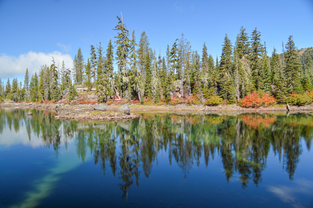
Divide Lake
Hike details:
Mileage: 1.8 miles round trip w/ 230 ft. elevation gain (to Notch Lake)
8 miles round trip w/ 1,435 ft. elevation gain (to Divide Lake)
Approximate hike time: 46 minutes w/ an average pace of 2.3 mph
3 hours 30 minutes w/ an average pace of 2.3 mph
Difficulty: Easy to moderate
Trail usage: Low on weekdays, medium on weekends
Highest elevation: 6,462 ft. Lowest elevation: 5,200 ft.
General location: 22 miles southeast of Oakridge - Diamond Peak Wilderness - Willamette National Forest
Suggested seasons: Summer, fall
(Best time to go is in August for ripe huckleberries. Mid-September through early October for fall foliage).
Permits required: Free self issue wilderness permit from Memorial Day - October 31
Pit toilet at trailhead: No
Trail allows: Dogs, horses, camping
Possible dangers: N/A
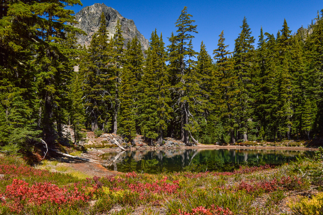
(Notch Lake)
|
Description:Divide Lake is a beautiful hike in the Diamond Peak Wilderness, at the base of Mt. Yoran. The trailhead is quite out of the way and due to the short hiking season at this elevation, this hike doesn’t get as much traction as some of the lake hikes closer to main roads, so it will most of the time be pretty secluded.
Start the hike on the Vivian Lake Trail #3662 and the first 0.8 miles start off with a fairly even grade to Notch Lake. Notch Lake is almost always glassy and it has a sandy beach, perfect for swimming! There is also an area to camp here. Notch Lake only has a maximum depth of 16 feet and there is a small rocky island in the middle. If you are into fishing, this would be a great place to come, set up camp and enjoy catching some cutthroat and rainbow trout. |
|
|
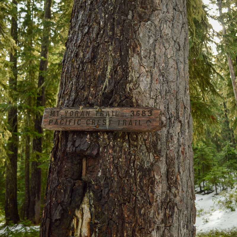
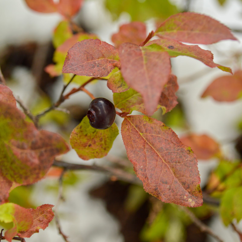
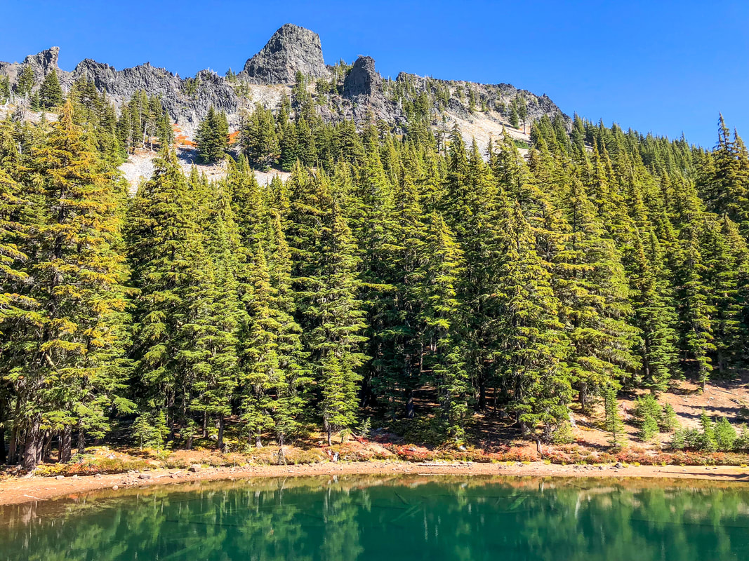
Right after passing Notch Lake you will come to a trail split. The Vivian Lake Trail continues to the left 2.7 miles down to Vivian Lake. If you are going up to Divide Lake, stay to the right on the Mount Yoran Trail #3683. From the trail junction you will walk 1.6 steep miles through a dense forest of mountain hemlock, noble fir and Pacific silver fir and the understory is primarily that are huckleberry bushes, which offer a tasty snack in mid to late August.
(picture taken by Jeremy Henricks)
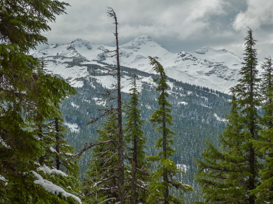
(Diamond Peak with snow)
|
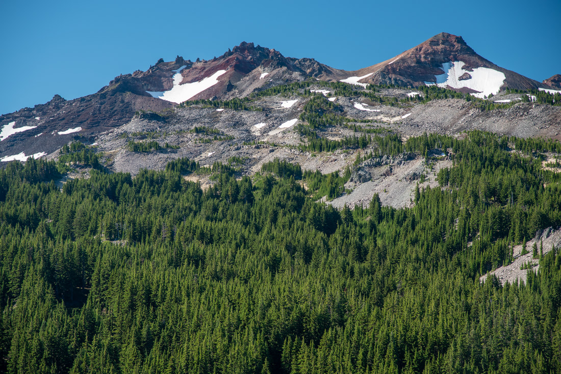
(Diamond Peak in August)
|
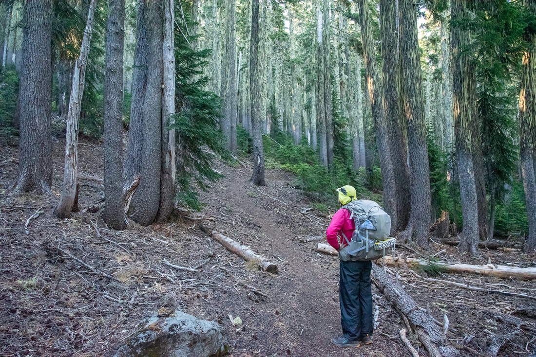
After a few switchbacks and eating your fill of huckleberries, you will come to an open ridge where you will get great views of Diamond Peak to the right and Mount Yoran straight ahead. After another 1.4 miles of hiking along the ridge, you will be at the base of Mount Yoran, where Divide Lake lies in a basin. Right before heading down to the lakeshore, you will see a footpath going off to the left. This is the Mount Yoran climber trail. Unless you are experienced at scrambling and are comfortable with loose rock and steep drop offs, it is not recommended that you summit Mount Yoran.
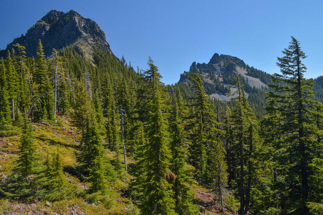
(Mount Yoran)
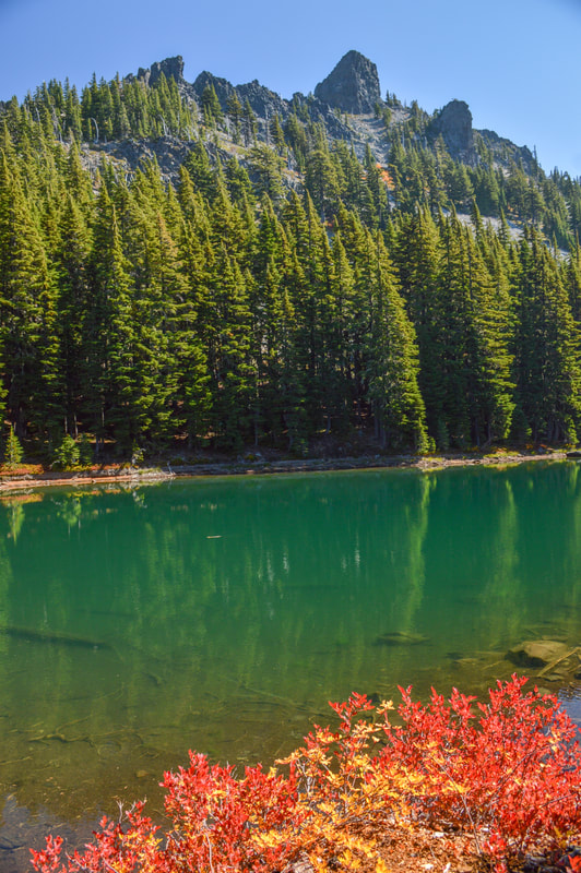
(Divide Lake in October)
The trail to Divide Lake is one of the best hikes for fall foliage, usually from mid-September through mid-October. The beautiful mountain views and clear alpine lakes and ponds are an oasis on hot summer days and the delicious huckleberries along the way are an added bonus, making this excursion that much sweeter.
|
Divide Lake is absolutely stunning with its unique jade green color to it. There are some beautiful campsites all around the lake basin and the swimming here is amazing because there is a nice rock on the southwest side of the lake that you can jump off of. Just past Divide Lake there are three small ponds that also have wonderful camp spots by them, if you can’t find anything at Divide Lake, or you just want a little bit more privacy. From the Divide Lake basin the Mount Yoran Trail does continue up a hill for 0.6 miles and connects with the Pacific Crest Trail, which is helpful if you are doing one of the smaller loops around Diamond Peak.
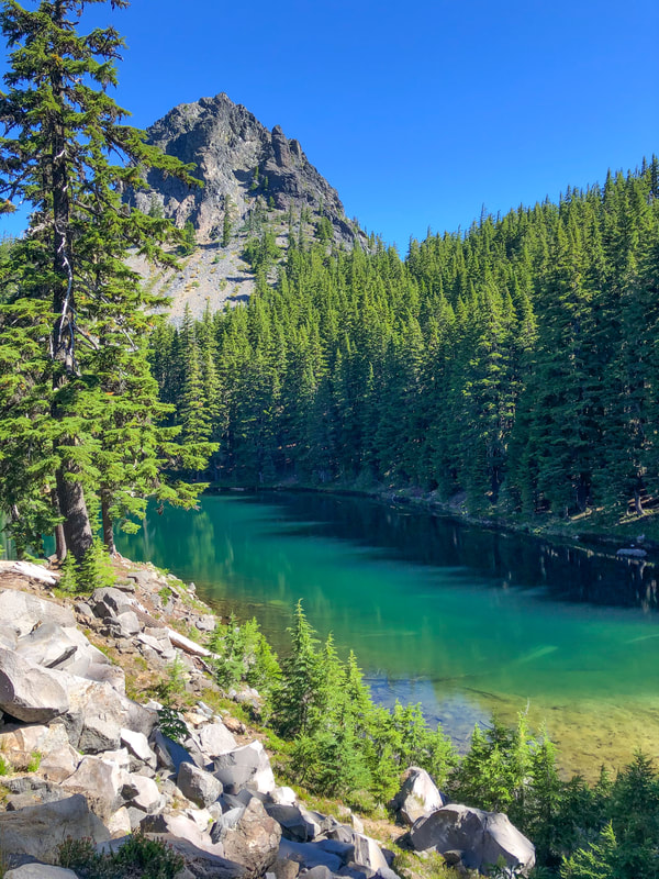
(Divide Lake and Mount Yoran)
|
Directions:
From Oakridge
- Drive on OR-58 E 1.3 miles then turn right at the sign for Hills Creek Dam. After 0.5 miles continue straight on Road 23 for 15.6 winding miles and another 3.9 miles once the road turns to gravel. After reaching the pass by Hemlock Butte, turn left at a hiker symbol and drive 200 yards on a spur road that turns to the Vivian Lake trailhead at its end. There is room for about 5-8 cars. (Total of 22 miles)
- Drive on US-97 S for a total of 46.9 miles, then turn right onto Crescent Cutoff Rd. for 12 miles. At the stop sign turn right onto OR-58 W for 35.6 miles, then turn left at a sign for Hills Creek Dam. After 0.5 miles continue straight on Road 23 for 15.6 winding miles and another 3.9 miles once the road turns to gravel. After reaching the pass by Hemlock Butte, turn left at a hiker symbol and drive 200 yards on a spur road that turns to the Vivian Lake trailhead at its end. There is room for about 5-8 cars. (Total of 115 miles)
- Take OR-62 E towards Crater Lake for 49.5 miles then take a slight left onto OR-230 N for 23.8 miles. Near Diamond Lake turn right onto OR-138 east for 17.7 miles until it T’s into highway 97. Turn left onto US-97 N for 17.8 miles then use the left lane to take the OR-58 W exit toward Eugene and stay on OR-58 for 48.7 miles. Turn left at a sign for Hills Creek Dam and after 0.5 miles continue straight on Road 23 for 15.6 winding miles and another 3.9 miles once the road turns to gravel. After reaching the pass by Hemlock Butte, turn left at a hiker symbol and drive 200 yards on a spur road that turns to the Vivian Lake trailhead at its end. There is room for about 5-8 cars. (Total of 186 miles)
- Total of 64 miles via Oakridge.
- Total of 126 miles via Oakridge.
- Total of 169 miles via Oakridge.
|
To get a more in-depth and personal view of this hike, watch the YouTube video.
|
*All pictures are taken by Franziska Weinheimer
*Disclaimer: The trail descriptions, mileage, GPS tracks and difficulty ratings depicted on this website are never 100% accurate. Always hike at your own risk, using your own knowledge, equipment and common sense. Franziska Weinheimer/Hike Oregon are not responsible if you or anyone in your party gets injured or lost while attempting one of these or any other hikes.
|