Tire Mountain
via Alpine trailhead
Hike details:
Mileage: 8 miles round trip w/ 1,540 ft. elevation gain
Approximate hike time: 3 hours 28 minutes w/ an average pace of 2.3 mph
Difficulty: Moderate
Trail usage: Medium on sunny weekends, low on weekdays
Highest elevation: 4,331 ft. Lowest elevation: 3,793 ft.
General location: 13 miles north of Westfir - Willamette National Forest
Accessible: End of May to early December
(Best time to go is mid-June when the wildflowers are blooming).
Permits required: N/A
Pit toilet at trailhead: No
Trail allows: Dogs, horses, mountain bikes, dirt bikes, camping
Possible dangers: Narrow trail in some sections which makes it difficult for hikers and mountain bikers to share the trail.
Description:Tire Mountain Trail is one of the most stunning trails in the Oakridge area, especially if hiked in early summer when all of the wildflowers are in bloom. This trail is a definitely wildflower lover's and photographer’s dream! If you want to see the many fields of wildflowers, start this hike at the Alpine Trailhead #3 near Windy Pass, not the official Tire Mountain Trailhead.
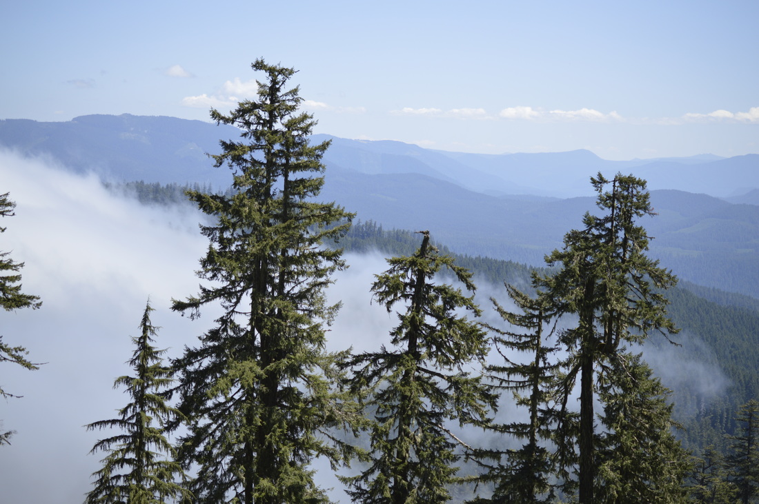
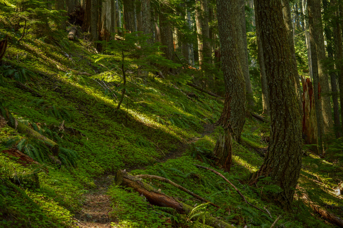
The trailhead near Windy Pass is aptly named for the gusts of cold wind that come over this hilltop. You will begin hiking on the Alpine Trail #3450 to the southwest, as the trail undulates through a hemlock forest. Here you will find white twin fairy bells, pine violets, blooming miner's lettuce and wild hyacinth. After 1.2 miles through the forest, the trail rounds a corner and you will see your first view to the southwest. On a clear day you can see gorgeous views of Diamond Peak, Mount Bachelor and the Three Sisters. Here you will also see a trail split, where the Alpine Trail continues south and you will continue to the right on the Tire Mountain Trail #3485. |
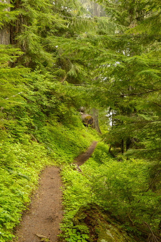
(example of the undulating trail)
|

(blue head gilia)
|
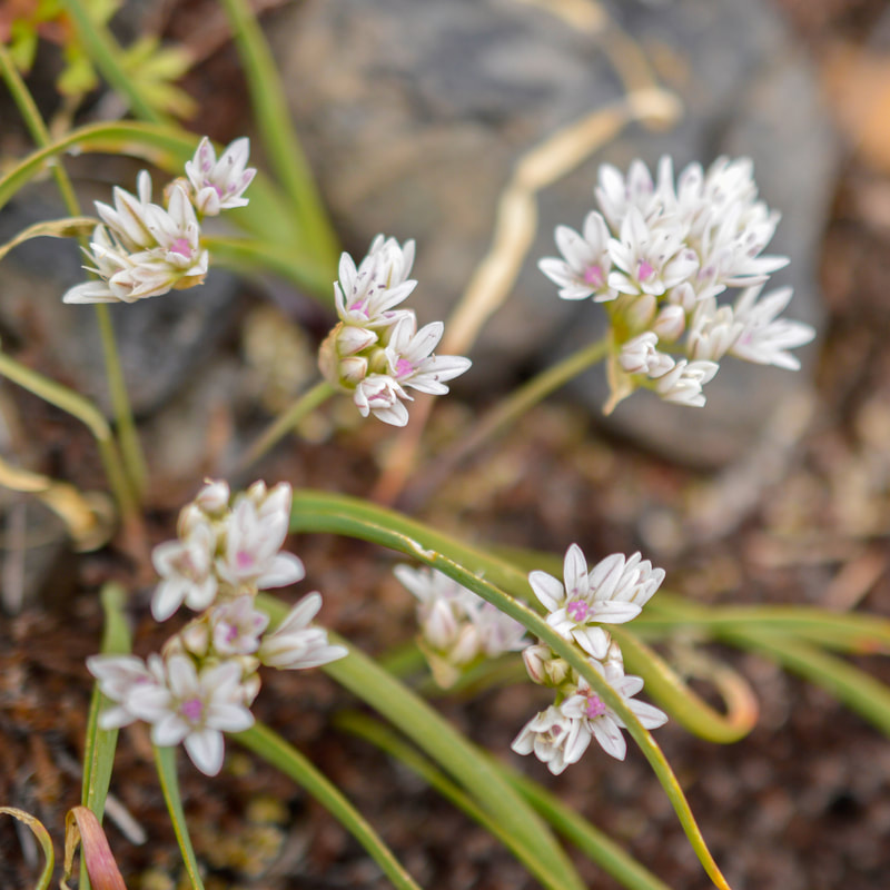
(Olympic onion)
|
(scabland penstemon)
|
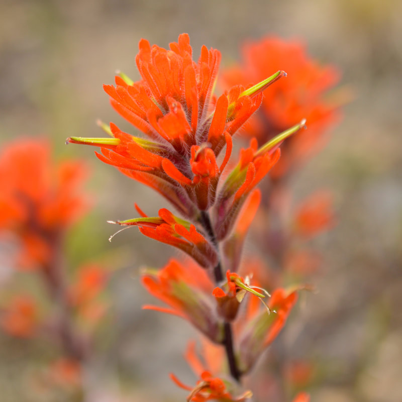
(paintbrush)
|
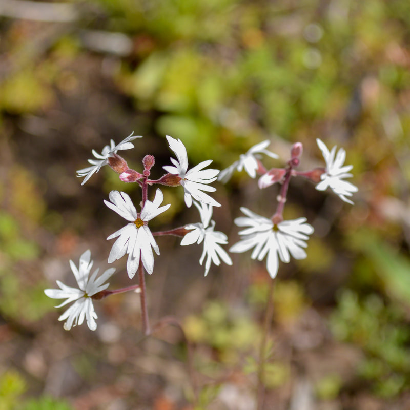
(woodland star)
|
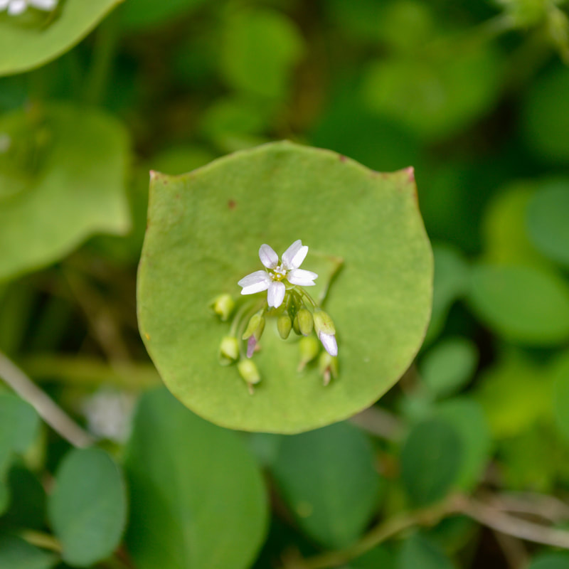
(miner's lettuce)
|
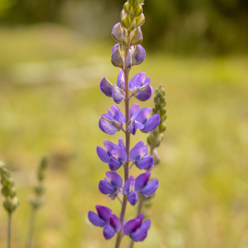
(lupine)
|

(yellow leaf iris)
|

|

(balsamroot)
|
(western waterleaf)
|

(wild hyacinth)
|

(starry Solomon's seal)
|

(shortspur seablush)
|
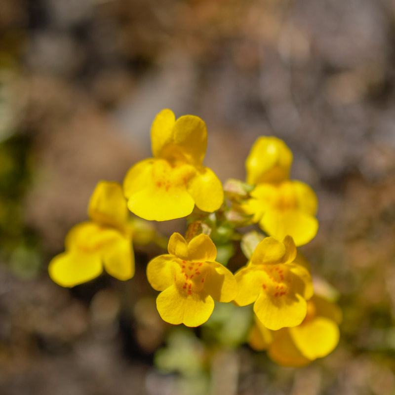
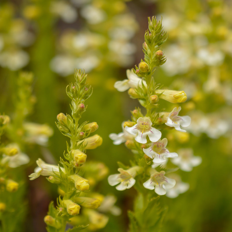
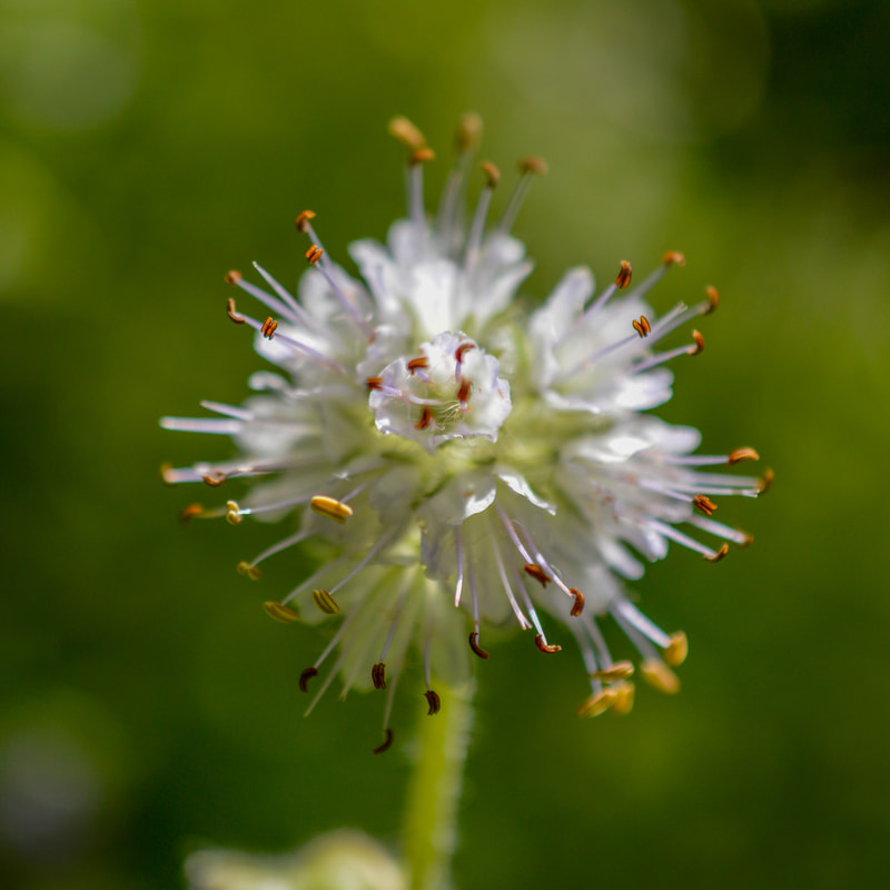
(monkey flower)
|
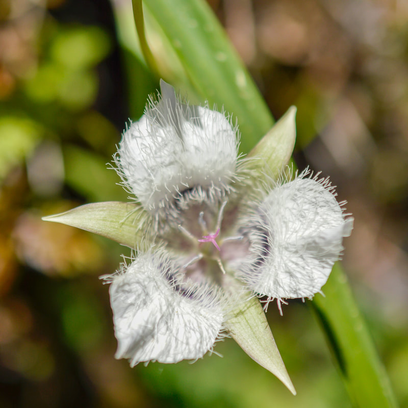
(Tolmie's mariposa-lily)
|
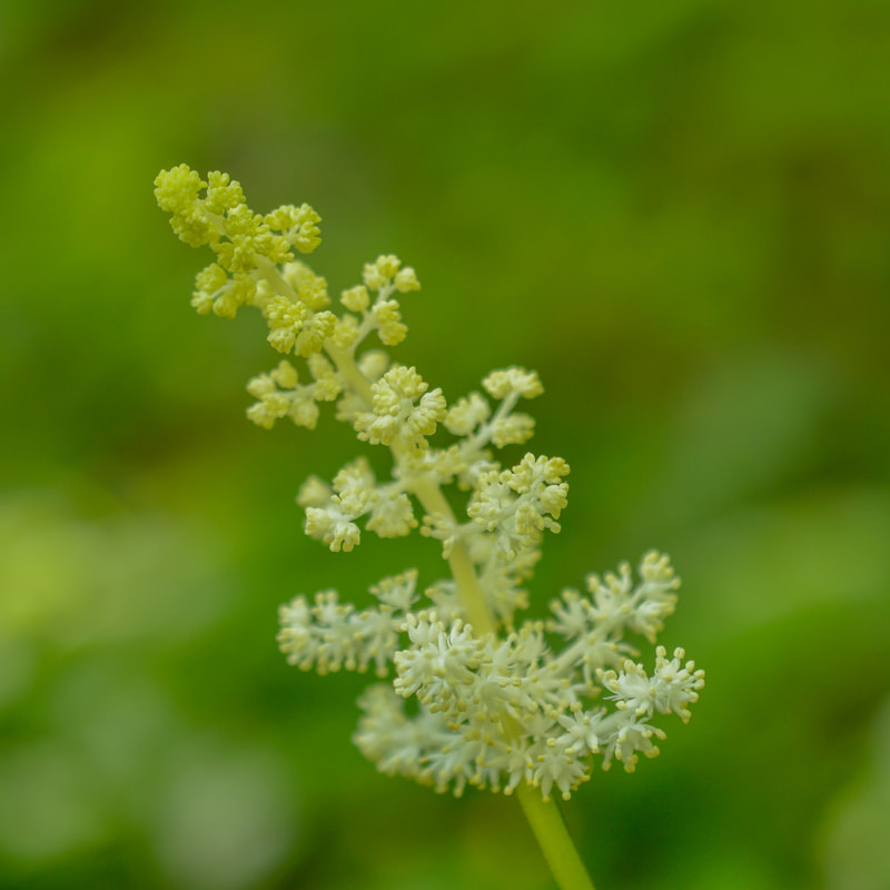
(plumed Solomon's seal)
|
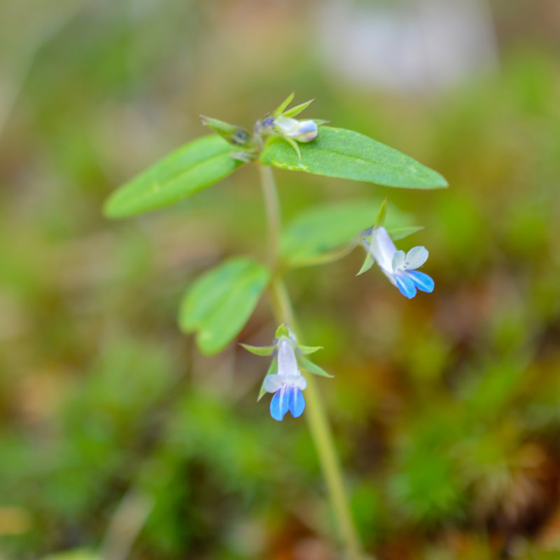
(maiden blue-eyed Mary)
|
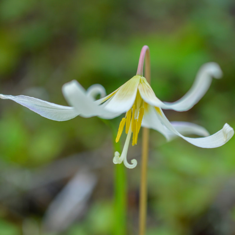
(fawn lily)
|

(Sitka valarian)
|
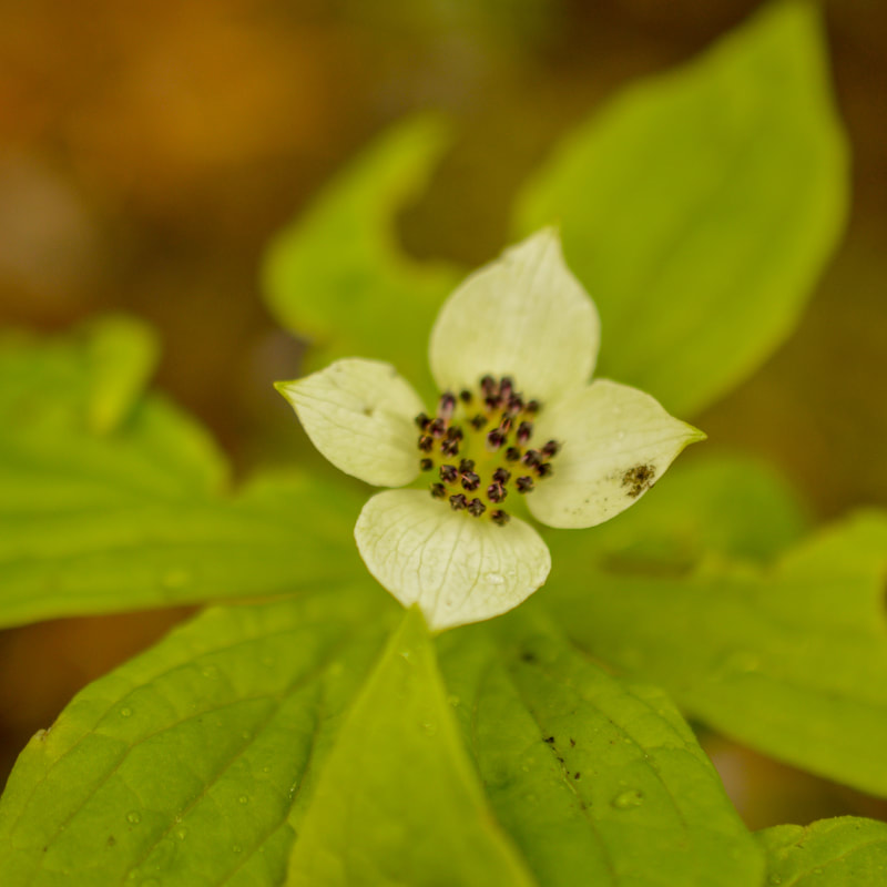
(Western bunchberry)
|

(larkspur)
|

(pine violet)
|
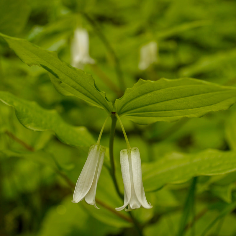
(Smith's fairybells)
|
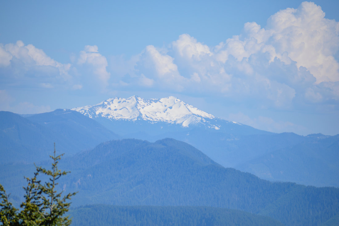
(Diamond Peak)
|
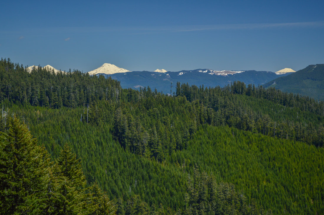
(Three Sisters, Broken Top and Mount Bachelor)
|
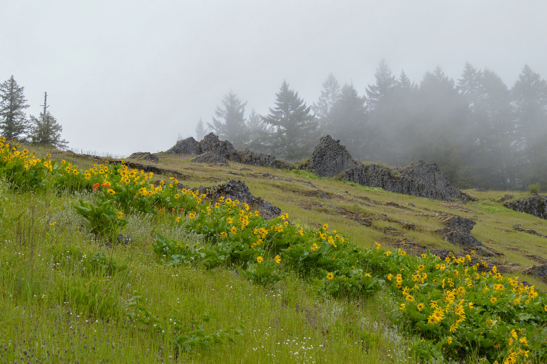
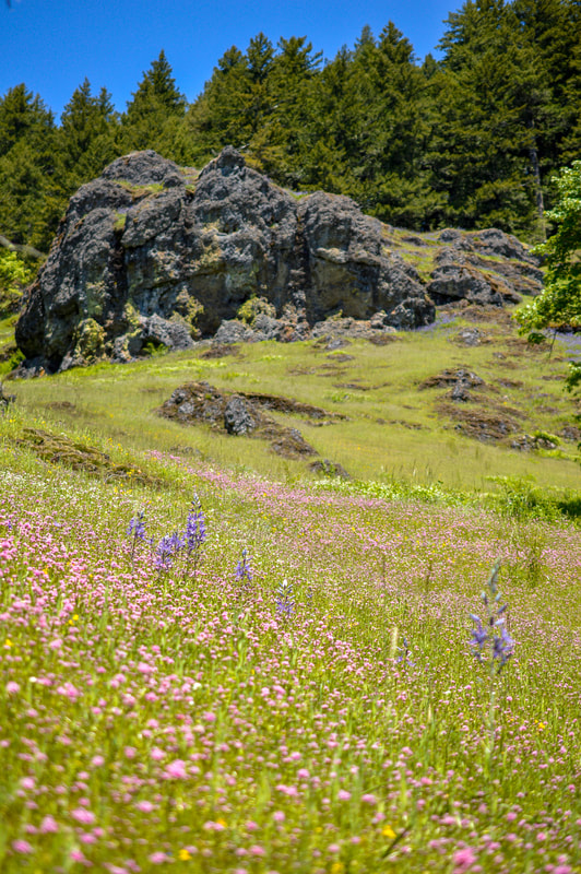
From the junction the trail traverses a sidehill through incredible meadows, where in late May and early June, you will see flowers that strongly resemble sunflowers, but they have large waxy looking leaves. This is balsamroot and entire hillsides will be covered in these yellow flowers, as well as dotted with red paintbrush, purple larkspur, pink seablush and unique rocks. After 0.8 miles of meandering through wildflower meadows, you will see a rocky hill and think "that sure looks like Tire Mountain", but this is definitely what hikers call the 'false summit' of the hike. Feel free to climb up this small hill though to catch some more spectacular views of the mountains, because the official summit of Tire Mountain doesn’t actually have any views.
|
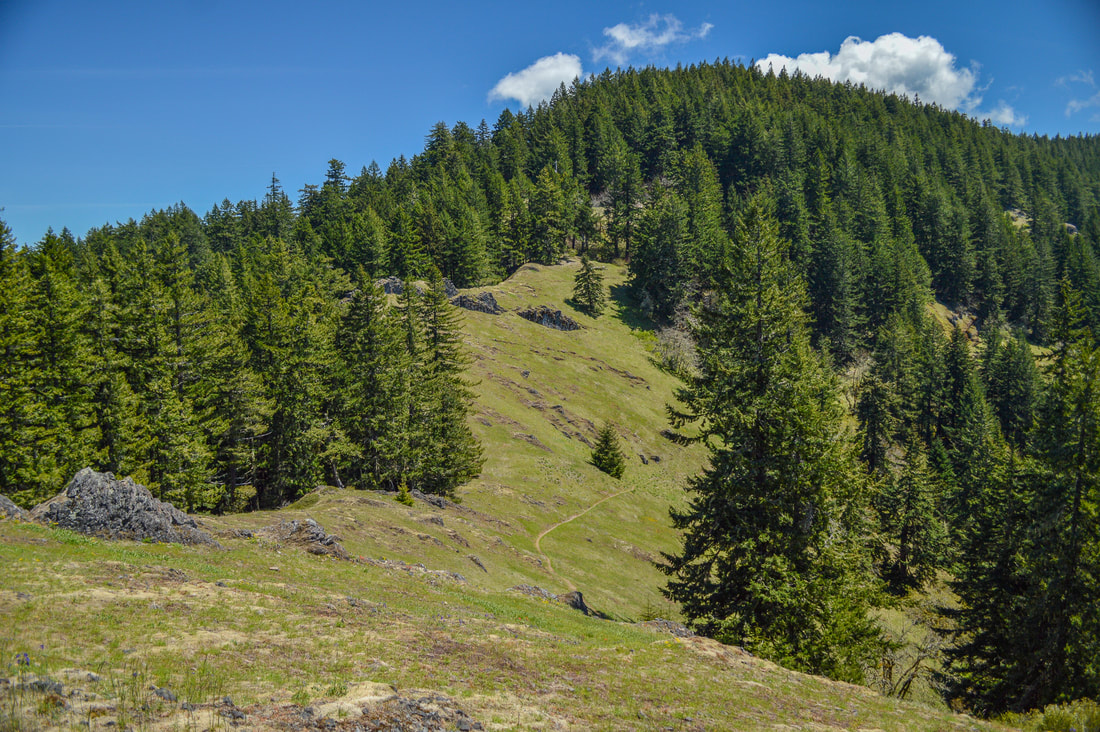
After checking out the viewpoint, you will continue on the trail as it slopes downward toward another wooded area. You will traverse along a ridgeline through a lush forest of hemlocks, fir and pines for 1.1 miles until you see another trail junction. This is where the Tire Mountain Trail comes in from the official trailhead. From this point to the summit of Tire Mountain it is another half mile and you will gain 230 feet of elevation via 5 switchbacks. The top of Tire Mountain is a large flat area where at this point many large bushes and trees have grown and obscured the once epic view. However, through the trees you can still catch some glimpses of the mountains. This flat area is great for camping if you are wanting to make a one night backpacking trip out of this hike (note: there are no water sources on this hike, so make sure to take all the water you would need for camping). After taking a break at the top, head back down this beautiful trail to get back to the car.
|
Tire Mountain is quite a magical hike that is well worth the steep drive up to Windy Pass. The hike is rated as moderate because of the mileage and elevation gain. Because this is also a mountain bike trail, it gets a lot of attention when it comes to early season trail maintenance, so the trail is generally well groomed and in good condition. This trail is family friendly and there are no steep or sketchy drop offs, large rocks or many trip hazards, and the views and wildflowers will definitely keep kids occupied. If you wanted to make this a shorter hike, you can skip the Tire Mountain summit and opt to just go to the meadow viewpoint and have it be a 4.2 mile round trip hike.
Directions:
From Eugene
- Drive on OR-58 E for 31.3 miles then turn left at the Westfir exit. After 1 mile you will reach a covered bridge. Continue straight for 4.5 miles on Aufderheide Road 19. Turn left on gravel Rd. 1912 for 6.6 curvy and steep miles up to Windy Pass. Here continue straight on Rd. 1910 for 0.4 miles and then fork right onto Rd. 1911 for another 0.4 miles until you see the 'Alpine Trail' sign on your left. Here the road has small pullouts on the side where you can park and the trail starts on the left side of the road. (Total of 53 miles)
- Drive US-97 S towards Crescent for 46.9 miles. Turn right onto Crescent Cutoff Road for 12 miles and then turn right onto OR-58 west towards Oakridge for 40 miles. Take the Westfir exit and after 1 mile you will reach a covered bridge. Continue straight for 4.5 miles on Aufderheide Road 19. Turn left on gravel Rd. 1912 for 6.6 curvy and steep miles up to Windy Pass. Here continue straight on Rd. 1910 for 0.4 miles and then fork right onto Rd. 1911 for another 0.4 miles until you see the 'Alpine Trail' sign on your left. Here the road has small pullouts on the side where you can park and the trail starts on the left side of the road. (Total of 114 miles)
- Total of 114 miles via Eugene.
- Total of 160 miles via Eugene.
|
-This trail write-up was last updated in July 2024-
*All pictures are taken by Franziska Weinheimer *Disclaimer: The trail descriptions, mileage, GPS tracks and difficulty ratings depicted on this website are never 100% accurate. Always hike at your own risk, using your own knowledge, equipment and common sense. Franziska Weinheimer/Hike Oregon are not responsible if you or anyone in your party gets injured or lost while attempting one of these or any other hikes.
|
To get a more in-depth and personal view of this hike, watch the YouTube video.
|