Rosary Lakes
& Maiden Peak Shelter
Hike details:
Mileage: 7 miles round trip w/ 800 ft. elevation gain (summer hiking from PCT trailhead)
8 miles round trip w/ 800 ft. elevation gain (winter snowshoeing/xcountry skiing)
12.5 miles round trip w/ 1,540 ft. elevation gain (summer hiking from the PCT trailhead to Maiden Peak shelter)
Approximate hike time: 3 hours 2 minutes w/ an average pace of 2.3 mph (for the summer hike)
4 hours 26 minutes w/ an average pace of 1.8 mph (for winter snowshoeing)
5 hours 26 minutes w/ an average pace of 2.3 mph (to Maiden Peak shelter)
Difficulty: Moderate to difficult
Trail usage: Medium both in summer and winter
Highest elevation: 6,375 ft. Lowest elevation: 5,146 ft.
General location: 27 miles east of Oakridge - Deschutes National Forest & Willamette National Forest
Accessible: Year-round
(Best time to go for hiking is August through November. Best time to go for snowshoeing & xcountry skiing is mid-December to mid-March).
Permits required: N/A
Pit toilet at trailhead: Yes
Trail allows: Dogs, horses, camping, snowshoeing/xcountry skiing
Possible dangers: N/A
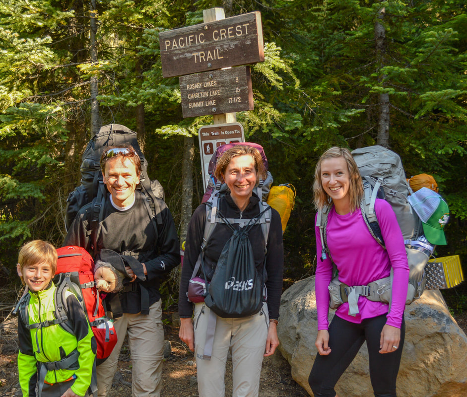
(Pacific Crest Trail Willamette Pass trailhead)
|
Description:Rosary Lakes trail is an easily accessible section of the Pacific Crest Trail near Willamette Pass and is great for summer hiking, swimming, fishing and backpacking, and in the winter it is the perfect trail for snowshoeing and cross-country skiing.
In the summer the trail starts off at the well-marked Pacific Crest Trail trailhead where there is ample parking and a pit toilet. In the winter you cannot park at the trailhead because it is not plowed, so you will have to park at Willamette Pass ski resort. You can park there for free and walk over past the bunny hill lift where you will see a sign for the trail that connects you to the PCT in half a mile. |
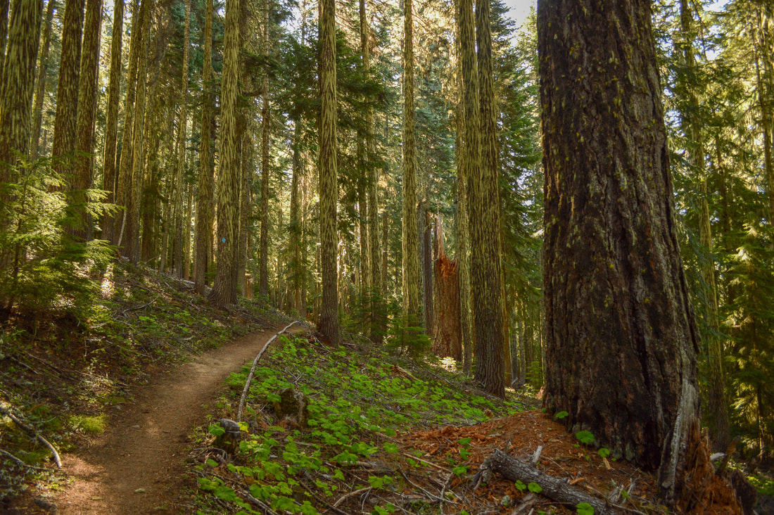
(Pacific Crest Trail in the summer)
|
|
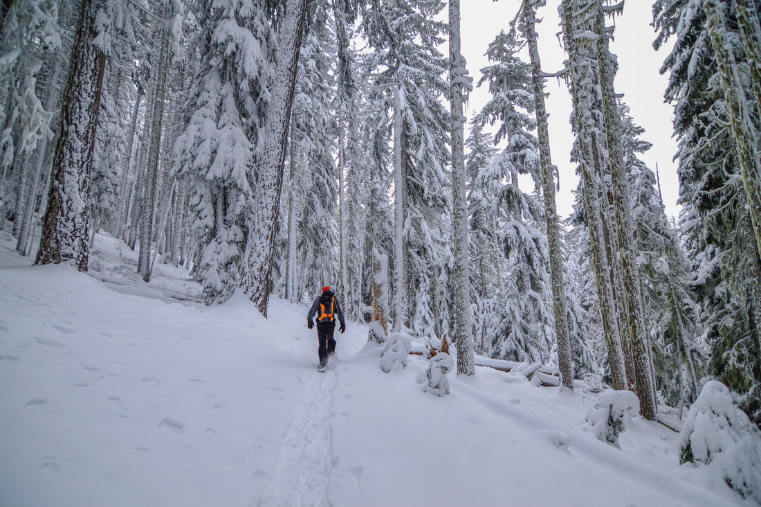
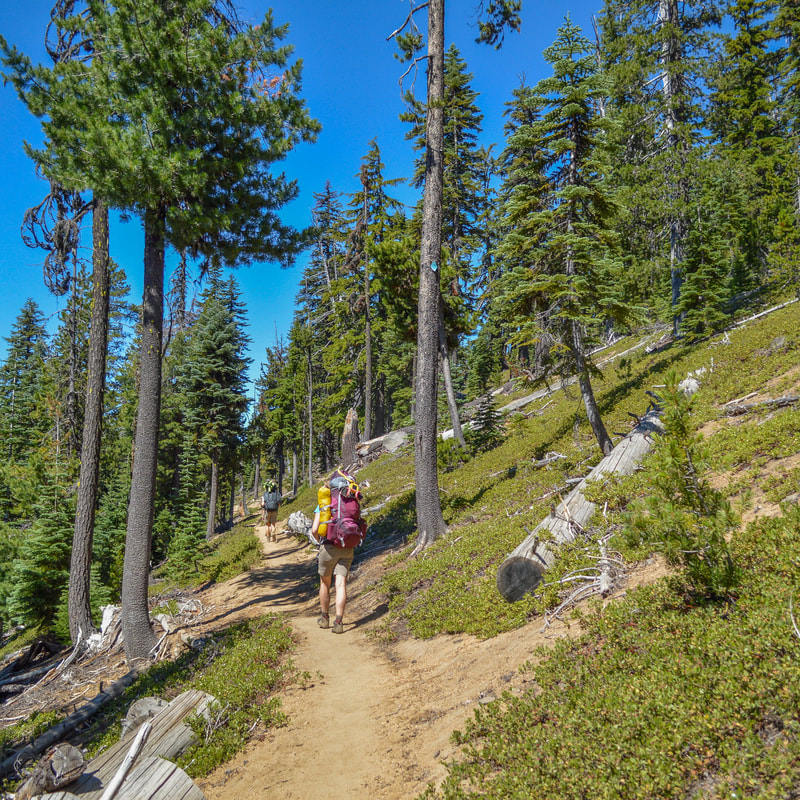
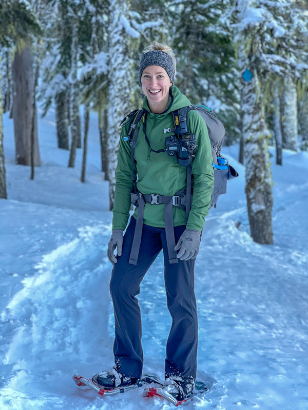
Both in the summer and winter, the trail is very well maintained as this is a popular trail during all seasons. The first part of the hike is a gradual 2 mile climb through a beautiful open mixed forest of mountain hemlock, lodgepole pine, western white pine and Pacific silver fir. All of the trees have a plethora of moss on them and in the summer you can see where the snow line usually is. If you are snowshoeing or cross-country skiing and for some reason the trail isn't already blazed, you will follow the bright blue diamonds that are high up on the trees. Keep in mind that if you are having to break trail through the snow, this will take you much longer than the average snowshoe time noted above and you will likely only maintain a pace of 1 mph.
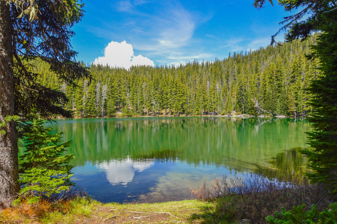
(Lower Rosary Lake)
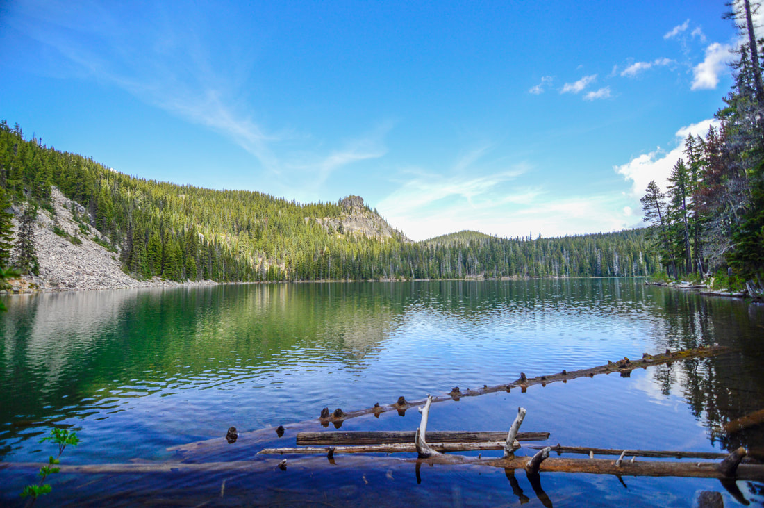
For the first few miles you will still hear some traffic noise from Highway 58, but after the trail switchbacks once the hike becomes much quieter with only the noise of birds and some chipmunks scurrying about. For the next 0.6 miles you are on a continual uphill trajectory to Lower Rosary Lake. This is the largest of the three lakes and there is a wonderful flat spot to camp on the south end of the lake. The PCT takes you 0.6 miles from the south end of Lower Rosary to Middle Rosary Lake. This lake has a lovely camp spot on the southwest side of the lake by a huge rock. There is also great camping on the strip of land between Middle and Upper Rosary Lakes. From Middle Rosary Lake you can see 6,385 foot tall Pulpit Rock perfectly across the lake. If you are here for fishing, you will find a shallow shoreline lined with some down logs and here you will find brook and rainbow trout.
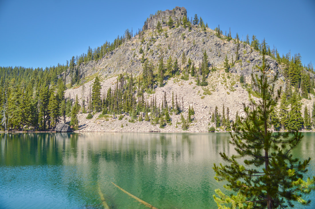
(Middle Rosary Lake & Pulpit Rock in the summer)
|
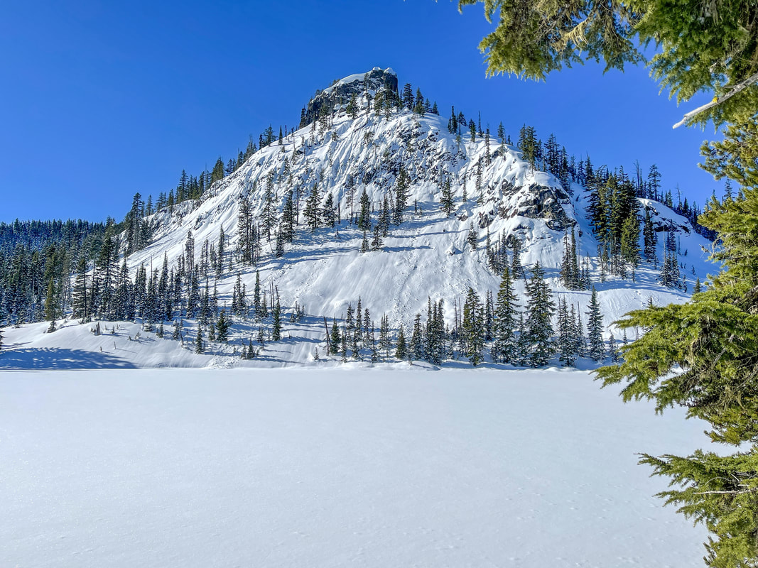
(Middle Rosary Lake & Pulpit Rock in the winter)
|
(Upper Rosary Lake)
Right after Upper Rosary Lake (the smallest of the three lakes), the trail will start to switchback up a steep hill. You will see a sign for Maiden Lake Trail (this trail takes you to a small lake, as well as up to Maiden Peak summit). Continue on the PCT up the hill and you will quickly be rewarded with amazing views of all three Rosary Lakes and Pulpit Rock below and Odell Lake, Summit Lake and Diamond Peak in the distance to the south.
|
(PCT trail up the switchbacks to the viewpoint)
|
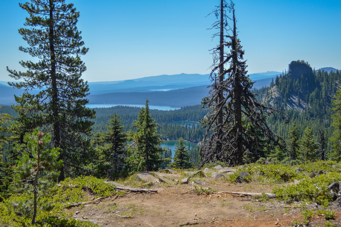
(Upper, Middle, Lower Rosary Lakes, Pulpit Rock, Odell Lake, Summit Lake, Diamond Peak)
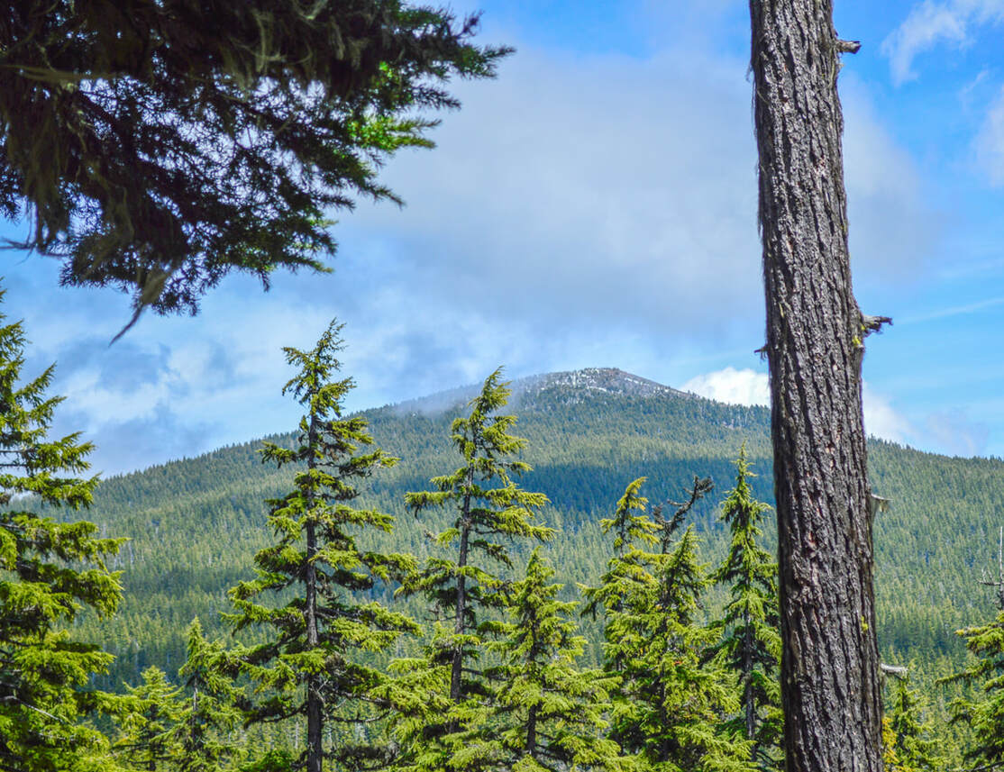
(Maiden Peak)
After the 1.1 miles of uphill, you will come to the Maiden Peak Saddle. This is where you can see Maiden Peak to your right, and this is also where the trail levels out again. Another 2.5 miles through the forest with various small elevation changes, will bring you to the Maiden Peak Ski Shelter. This would be the place to ski or snowshoe up to and spend the night if you were coming here in the winter. There is also plenty of flat ground around the shelter where one could set up a tent if you are section hiking the PCT and wanted to camp here.
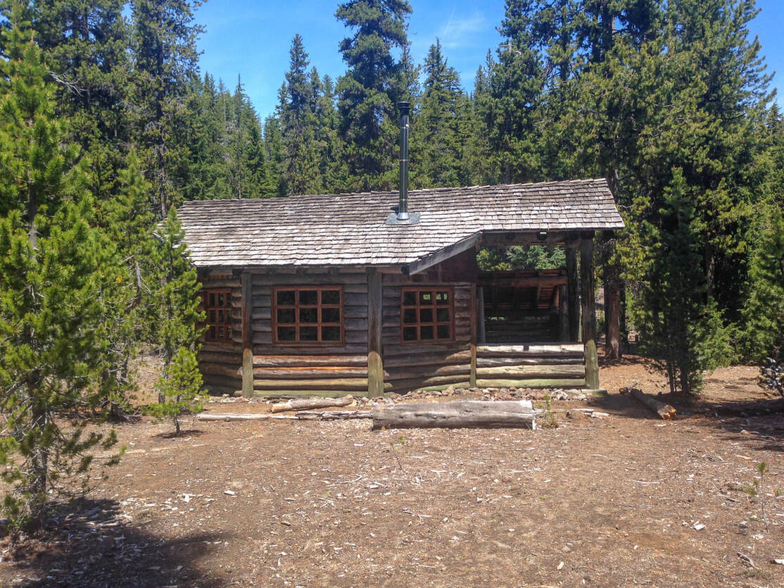
(Maiden Peak Shelter)
|
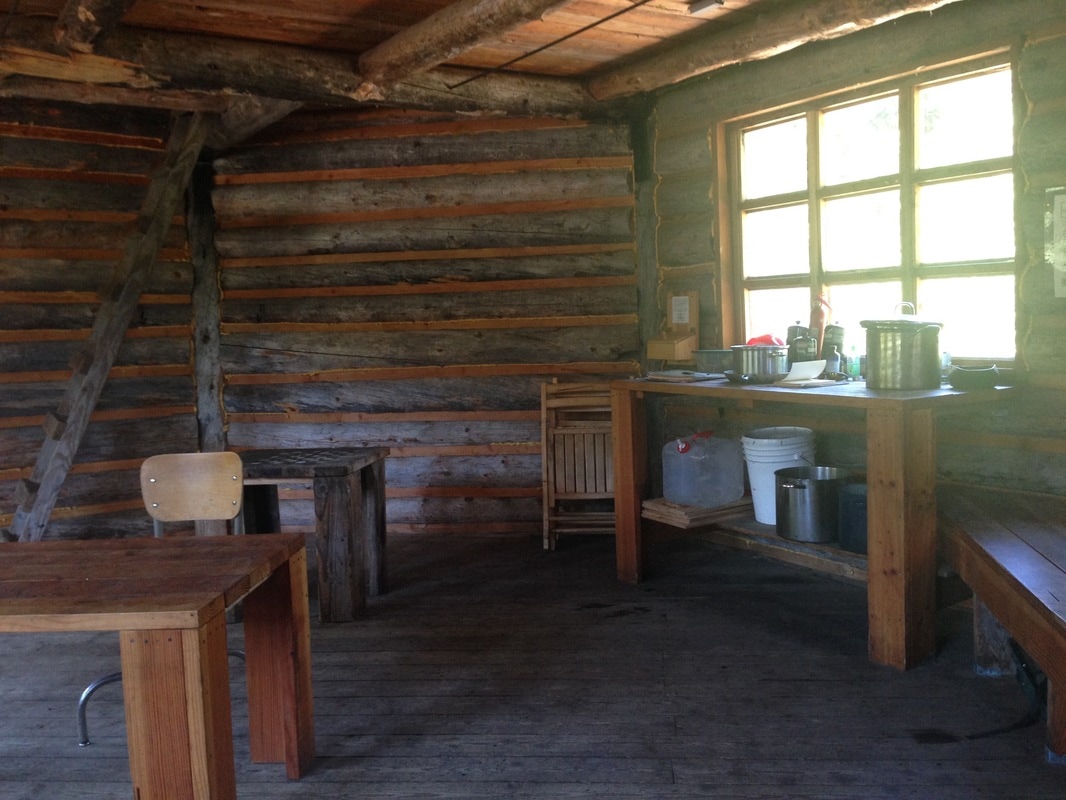
(inside the Maiden Peak Shelter)
|
|
The Maiden Peak Ski Shelter was constructed in 1999 by the Eugene chapter of the Oregon Nordic Club in cooperation with the US Forest Service. It is very spacious inside. It has various bench seating against the walls, a table to eat at, a place where they store extra water and pots for cooking, and the log book for people to sign. There is also a large wood stove and a huge upstairs sleeping loft. Outside underneath a cover, there is ample fire wood for use in the winter.
Rosary Lakes is a great place to visit whether it be summer or winter. There are many great spots to camp and the lakes are a stunning blue/green color with Pulpit Rock as a backdrop. These lakes are wonderful for swimming and fishing and this is a great stopping point if you are backpacking a section of the Pacific Crest Trail or if you’re just wanting to get out for an easy one nighter. If you want more mileage for your trip and some epic views, choose the option to continue on to Maiden Peak Shelter, but remember that if you are day hiking it is best done in the summer and fall only. If you are snowshoeing up to the shelter, definitely spend the night since it is slow going and will take all day to get up there. |
|
Directions:
From Oakridge
- Drive on OR-58 E for a total of 26.6 miles. If you are snowshoeing you will turn left into the Willamette Pass parking lot, if you are hiking, just past Willamette Pass Ski Resort you will turn left at a sign for Pacific Crest Trail and then immediately turn right past a large building to find the trailhead at the end of the short road. (Total of 27 miles)
- Drive on US-97 S for a total of 46.9 miles, then turn right onto Crescent Cutoff Rd. for 12 miles. At the stop sign turn right onto OR-58 W for 10.8 miles. If you are hiking you will turn right at a sign for Pacific Crest Trail and then immediately turn right past a large building to find the trailhead at the end of the short road. If you are snowshoeing, just past the Pacific Crest Trail sign you will turn right into the Willamette Pass parking lot, if you are hiking, just past Willamette Pass Ski Resort you will turn left. (Total of 70 miles)
- Take OR-62 E towards Crater Lake for 49.5 miles then take a slight left onto OR-230 N for 23.8 miles. Near Diamond Lake turn right onto OR-138 east for 17.7 miles until it T’s into highway 97. Turn left onto US-97 N for 17.8 miles then use the left lane to take the OR-58 W exit toward Eugene. Continue on OR-58 for 23.9 miles. If you are hiking you will turn right at a sign for Pacific Crest Trail and then immediately turn right past a large building to find the trailhead at the end of the short road. If you are snowshoeing, just past the Pacific Crest Trail sign you will turn right into the Willamette Pass parking lot, if you are hiking, just past Willamette Pass Ski Resort you will turn left. (Total of 140 miles)
- Total of 70 miles via Oakridge.
- Total of 131 miles via Oakridge.
- Total of 175 miles via Oakridge.
|
To get a more in-depth and personal view of this hike, watch the YouTube video.
|
*All pictures are taken by Franziska Weinheimer
*Disclaimer: The trail descriptions, mileage, GPS tracks and difficulty ratings depicted on this website are never 100% accurate. Always hike at your own risk, using your own knowledge, equipment and common sense. Franziska Weinheimer/Hike Oregon are not responsible if you or anyone in your party gets injured or lost while attempting one of these or any other hikes.
|