Hike Oregon
  • Home
  • *Store*
  • About the author
  • How to use this site
  • Resources
    • Wildflowers
    • Videos
  • Best Oregon Hikes
    • Top Fall Foliage Hikes In Oregon
    • Top 10 Oregon Fall Hikes
    • 20 Best Oregon Waterfall Hikes
    • Top 10 Oregon Hikes for Kids
    • Sno-Parks In Central Oregon
    • Top 10 Oregon Winter Hikes
    • Top Low Elevation Winter Hikes
    • 9 Amazing Oregon Summit Hikes
    • 20 Central Oregon Day Hikes
    • 20 Epic Oregon Wildflower Hikes
    • 5 Weekend Backpacking Trips in Oregon
    • Top One Night Backpacking Trips in Oregon
    • Top 10 Oregon Summer Hikes
    • Top 10 Swimming Spots In Oregon
    • Top 10 Oregon Spring Hikes
  • Oregon Sno-Parks
    • Maxwell Sno-Park
    • Potato Hill Sno-Park
    • Ray Benson Sno-Park
      • Brandenburg Shelter
    • Santiam Sno-Park
    • Three Creek Sno-Park
    • Virginia Meissner Sno-Park
      • Meissner Shelter Loop
      • Nordeen Shelter
    • Gold Lake Sno-Park
      • Westview Shelter to Eagle Rock Overlook
      • Marilyn Lakes Loop
  • Southern Washington
    • Hamilton Mountain
    • Dog Mountain
    • Coyote Wall
    • Mount St. Helens
  • Portland
    • Powell Butte
    • Forest Park
    • Latourell Falls
    • Multnomah/Wahkeena Falls
    • Eagle Creek
    • Mitchell Point
    • Table Rock
    • Tamanawas Falls
    • Trillium Lake
    • East Zigzag Mountain (members only)
  • Salem
    • Abiqua Falls
    • Silver Falls State Park
    • Dome Rock
    • Marion Lake to Marion Mountain
    • Jefferson Park
  • Corvallis
    • Marys Peak East Ridge
    • Marys Peak North Ridge
    • Alsea Falls and Green Peak Falls
    • Corvallis to Sea Trail - Sugarbowl Creek segment (members only)
  • Sweet Home
    • Crescent Mountain
    • Iron Mountain
    • McDowell Creek Falls
    • Middle Santiam River (members only)
    • Lower Soda Creek Falls (members only)
    • Rooster Rock (members only)
  • McKenzie Bridge/Blue River
    • Macduff Mountain
    • Proxy Falls
    • Clear Lake
    • Sahalie/Koosah Falls
    • Blue Pool
    • Erma Bell Lakes
    • Olallie Mountain
    • Horsepasture Mountain
    • Tidbits Mountain
    • Castle Rock
    • Lowder Mountain (members only)
    • East Fork Trail (members only)
    • Rainbow Falls Overlook (members only)
    • Frissell Point (members only)
    • Chucksney Mountain (members only)
    • Substitute Point (members only)
  • Sisters/Santiam Pass
    • Coffin Mountain
    • Trappers Butte and Scar Mountain
    • Maxwell Butte
    • Black Butte
    • Whychus Creek Trail
    • Tam McArthur Rim
    • Black Crater
    • Scott Mountain
    • Obsidian Trail
    • Metolius Preserve
    • Three Fingered Jack Loop
    • Square Lake
    • Canyon Creek Meadows
    • Patjens Lakes
    • Craig Lake (members only)
    • Chush Falls (members only)
    • Rockpile Lake (members only)
    • Santiam Lake (members only)
    • Camp Lake (members only)
    • Park Meadow to Golden Lake (members only)
  • Bend/Redmond/LaPine
    • Steins Pillar
    • Chimney Rock
    • Steelhead Falls
    • Tumalo State Park
    • Tumalo Falls
    • Tumalo Mountain
    • No Name Lake
    • Green Lakes
    • Moraine Lake
    • South Sister Summit
    • Horse Lake
    • Muskrat Lake
    • Paulina Peak
    • Peter Skene Ogden Trail (members only)
  • Eugene
    • Ridgeline Trail
    • Mount Pisgah Summit
    • Mount Pisgah Arboretum
    • Shotgun Creek
    • Mount June
    • Lawler
    • Tire Mountain
    • Goodman Creek
    • Brice Creek
    • Trestle Creek Falls
    • Moon Falls
    • Elijah Bristow State Park
    • South Willamette Trail (members only)
    • Eula Ridge (members only)
    • Eagle's Rest (members only)
  • Oakridge
    • Deception Creek
    • North Salmon Creek
    • Grasshopper Ridge
    • Larison Creek
    • Bunchgrass Ridge
    • Salt Creek Falls
    • Waldo Lake Loop
    • South Waldo Loop
    • The Twins
    • Rosary Lakes
    • Yoran Lake
    • Fawn Lake
    • Windy Lakes
    • Divide Lake
    • Diamond Peak Summit
    • Cowhorn Mountain
    • Wall Creek Warm Springs (members only)
    • Moon Point (members only)
    • Bobby Lake (members only)
    • Lillian Falls (members only)
    • Middle Fork Willamette Trail (members only)
    • Pool Creek Falls (members only)
    • Dead Mountain (members only)
    • Larison Rock (members only)
    • Quinn Lakes & Eddeeleo Lakes (members only)
    • Waldo Mountain Lookout (members only)
    • Blair Lake to Spring Prairie (members only)
    • Rigdon Lakes loop (members only)
  • Oregon Coast
    • Cascade Head
    • Drift Creek Falls
    • Sweet Creek Falls
    • Beaver Creek Falls
    • Kentucky Falls
    • Hobbit Trail to Heceta Head
    • Valley Trail to China Creek
    • North Fork Smith River (members only)
    • Cummins Ridge (member's only)
    • Horse Creek (members only)
    • Siltcoos Lake (members only)
  • Southern Oregon
    • Fall Creek Falls
    • Watson Falls
    • Wild Rogue Loop
    • Mt. Thielsen
    • Crater Lake National Park
      • The Watchman
      • Mount Scott
      • The Pinnacles
    • Lower Table Rock
    • Pilot Rock
    • Wagner Butte
    • Mt. McLoughlin
    • Lemolo Falls (members only)
    • Fern Falls (members only)
  • Eastern Oregon
    • Painted Cove
    • Anthony Lake Loop
    • Mount Howard
    • Eagle Cap summit
    • Schneider Cabin (members only)
    • Strawberry Lake & Strawberry Falls (members only)
  • Oregon PCT sections
  • Tips & Tricks
    • Leave No Trace
    • How To Pick The Right Backpacking Tent
    • Top Tips For Hiking With Infants And Toddlers
    • Poison Oak, Ivy and Sumac
    • How to dress for cold weather hikes
    • Outdoorsy Holiday Gift Guide 2022
    • Hiker Holiday Gift Guide 2019
    • Outdoor Holiday Gift Guide 2018
    • Hiking Holiday Gift Guide 2017
  • Reviews/Gear
    • Stay Kühl This Summer
    • Outdoor Herbivore Backpacking Food Review
    • Osprey Aura AG 65 Backpack review
    • Big Agnes Fly Creek UL2 review
    • REI Quarter Dome 1 review
  • Adventure Stories
    • Hiking The Rae Lakes Loop
    • 110 Miles on the PCT
    • Three Fingered Jack Adventures
    • Jefferson Wilderness

Multnomah & Wahkeena Falls Loop

Get the printable version of this hike

Hike details​:

Mileage: 2.2 miles round trip OR 6.2 mile loop w/ 1,600 ft. elevation gain
Approximate hike time: 57 minutes w/ an average pace of 2.3 mph OR 2 hours 41 minutes w/ an average pace of 2.3 mph
Difficulty: Easy to moderate
Trail usage: Very high on weekends, high on weekdays
Highest elevation: 1,530 ft. Lowest elevation: 55 ft.

General location: 30 miles east of Portland - Columbia River Gorge National Scenic Area
Accessible: March through December
(Best time to go is April, May, early June, September and October. Skip the months of July and August because of the throngs of people here).
Permits required​: N/A
Pit toilet at trailhead: full service bathroom inside the lodge
Trail allows: Dogs on leash
Possible dangers: Slippery trail when it's icy.
Multnomah Falls
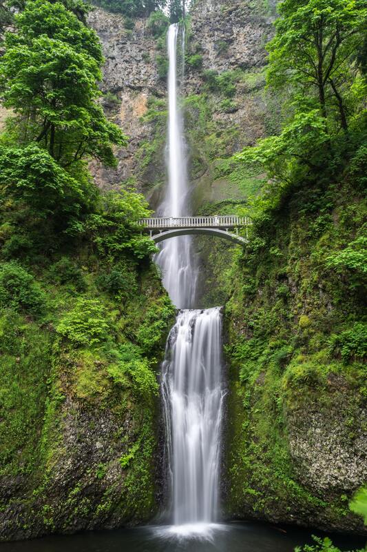
(Multnomah Falls picture taken by Blake Verdoorn)
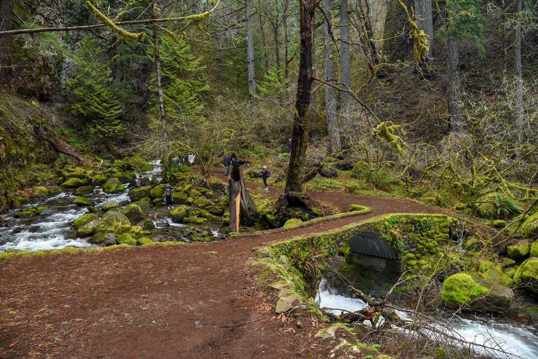
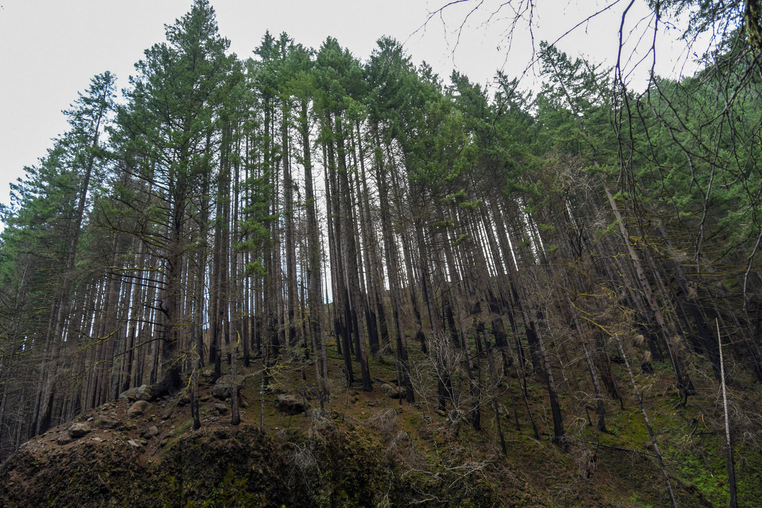
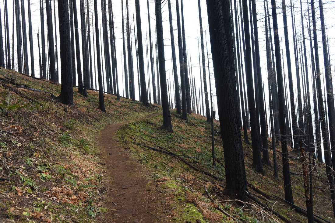
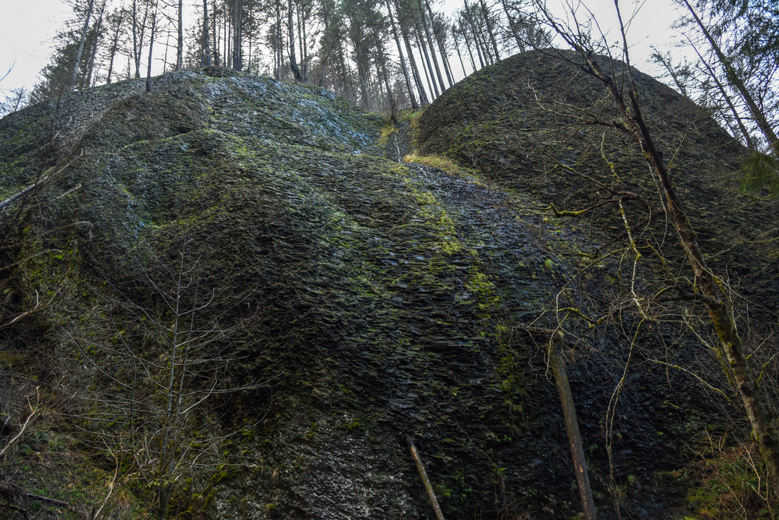
Description:

In 2017 the Eagle Creek Fire swept through the area and destroyed many of the trails on the Oregon side of the Columbia River Gorge. Some trails in the area are still closed. Even though this trail has reopened, one should use extreme caution when hiking here especially during the months of November through March. Heavy winds can knock down dead burned trees and rain and snow melt can cause massive landslides in this very steep terrain.

The trail for this amazing loop hike starts at the base of Multnomah Falls, which is Oregon’s largest waterfall standing at 542 ft. tall. It comes tumbling down two tiers with impressive strength. From the lower viewing platform, you will make your way up the paved walkway 0.6 miles to the top of the falls.
Multnomah Falls Columbia Gorge overlook
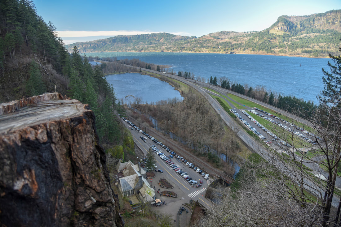
(Multnomah Lodge and Columbia River)
Multnomah Falls from trail
(Multnomah Falls)


Even though this section is paved, there are plenty of switchbacks, and it is by no means easy as you are immediately gaining 800 ft. of elevation! Because of the fire, there are no longer any hand railings, so if you are hiking with young children, please make sure they don’t walk too close to edge.


​
Once you reach the top of Multnomah Falls, you will come to a trail sign. Go right if you want to see the Multnomah Falls lookout platform. This is not for someone who is afraid of heights. From here you will see Multnomah Lodge and many tiny cars 542 feet below!
Multnomah Creek
(Small falls right above Multnomah Falls)
New Multnomah Wahkeena falls loop trail sign
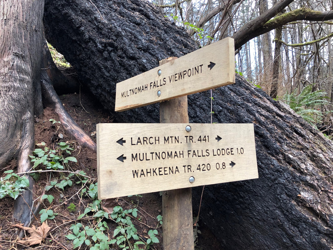
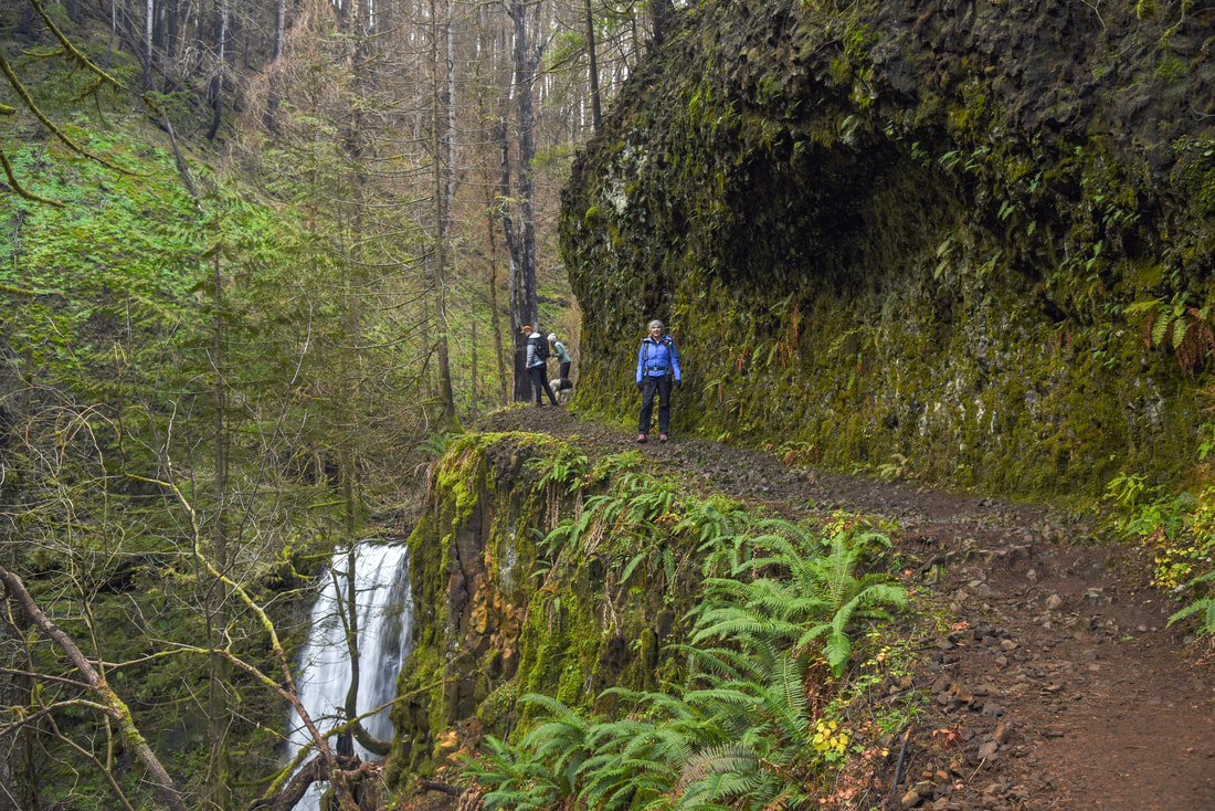
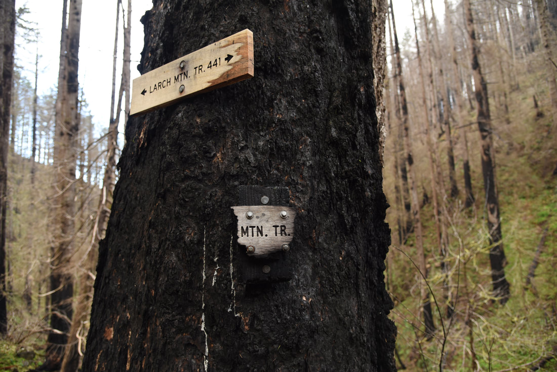
After going to the lookout platform, continue right on the Larch Mountain Trail #441. The crowds will thin a bit from here on out. Even though Multnomah Falls is one of the most popular places to visit in Oregon, most people only go up to the viewing bridge or the top of the falls and don’t continue on to hike the loop. ​
Multnomah Creek Multnomah Wakeena Falls Loop
Multnomah Falls Wahkeena Falls loop after the fire
Dutchman Falls along the Multnomah Wahkeena Falls trail
(Dutchman Falls)
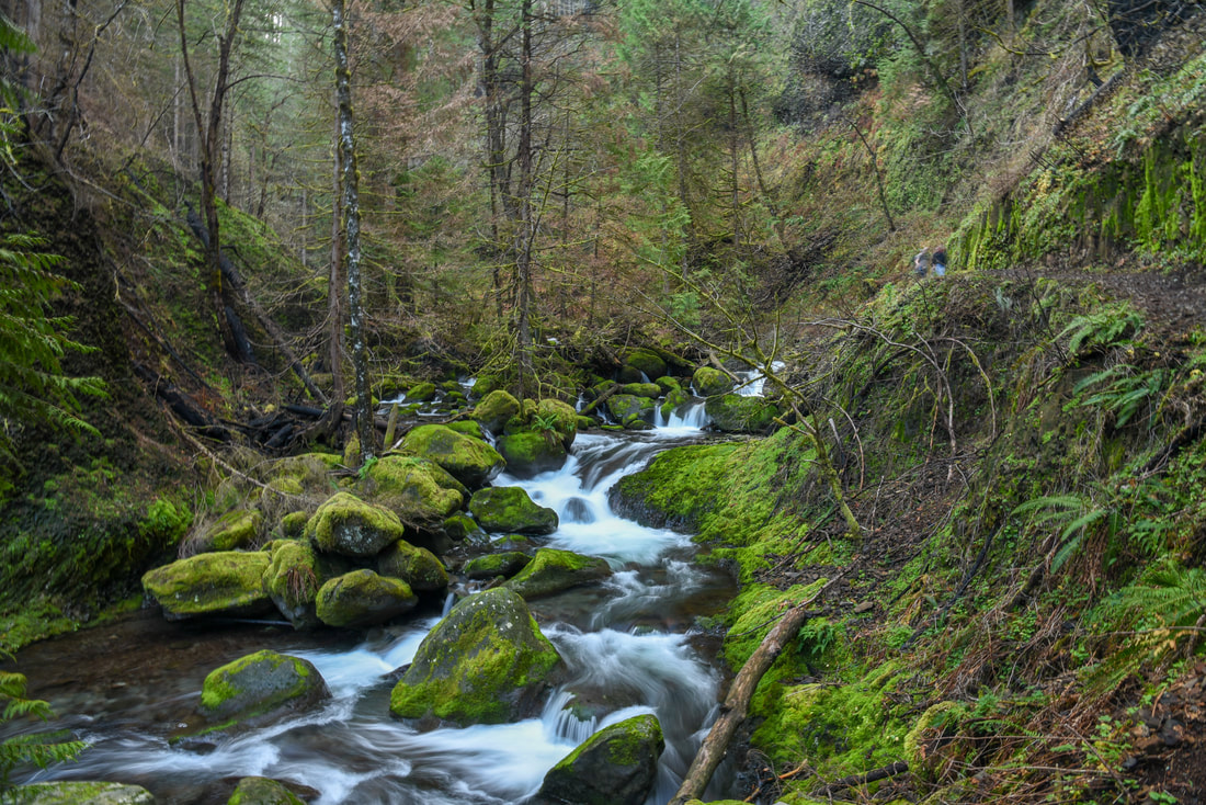
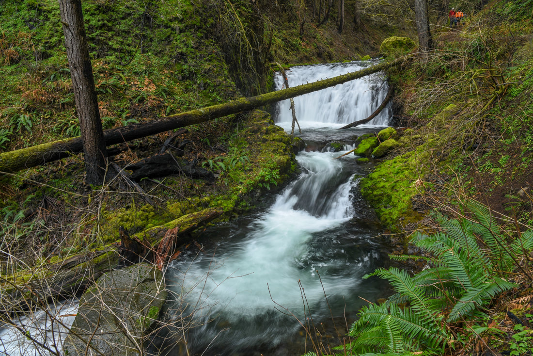
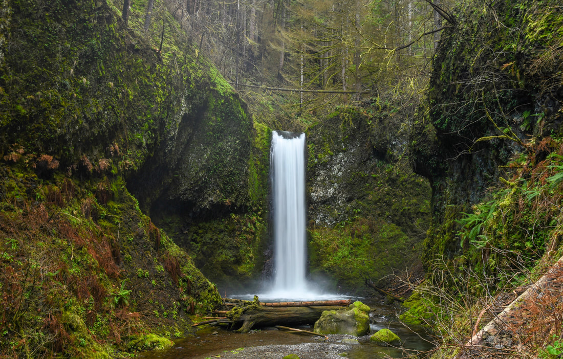
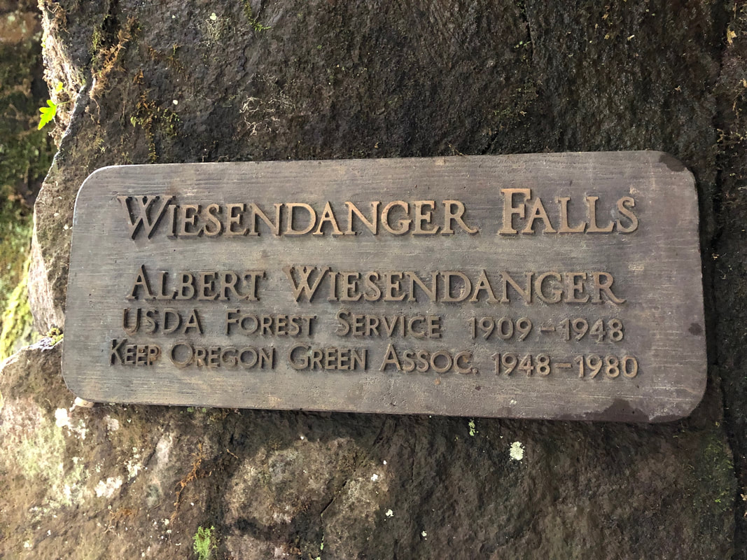
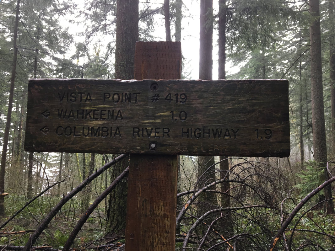
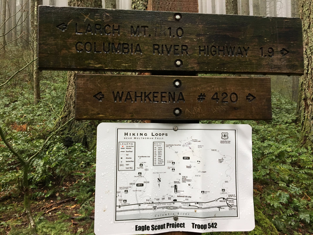
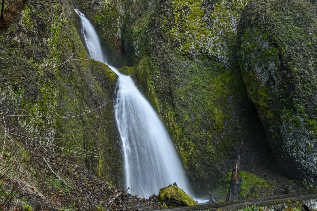
You will continue on the Larch Mountain Trail for another 0.8 miles witnessing 35 ft. Dutchman Falls, 50 ft. Wiesendanger Falls and 55 ft. Ecola Falls (aka Hidden Falls) along the way. Right after Ecola Falls you will split away from the Larch Mountain Trail and you will continue to the right on the Wahkeena Trail #420. This trail takes you up a beautiful forest ridge, high above all of the creeks. While you’re walking over to the Wahkeena Creek watershed, you will see trail off-shoots for Devils Rest Trail as well as Angels Rest Trail. Both are extremely grueling hikes, but can be done in conjunction with this loop if you have enough stamina and daylight.
Wiesendanger Falls Columbia Gorge
(Wiesendanger Falls)
Wiesendanger Falls sign
Ecola Falls along the Multnomah Wahkeena Falls loop
(Ecola Falls)
Forest fire damage Multnomah Wahkeena Falls loop trail
Burnt sign Columbia Gorge
Burned Forest Multnomah Wahkeena Falls Loop
The forest here is extremely burned but you will see the forest floor already recovering a bit with ferns sprouting and moss starting to grow again. Once you reach the Wahkeena Creek watershed and what looks like a saddle, you will come across a 3-way trail split, Devils Rest, Wahkeena Trail and Vista Point. You can take Vista Point Trail, it will take you back to the Wahkeena Trail right before Fairy Falls. 
Trail sign Wahkeena Trail
Larch Mountain Trail sign
If you continue on the Wahkeena Trail  you will see and hear the massive roaring creek tumbling steeply down the hill. The trail switchbacks next to the creek until you get to the bottom, making you feel like you are walking next to a waterfall the whole time. Along the way you will see Fairy Falls, which is a very pretty 20 ft. waterfall strongly resembling Ramona Falls.
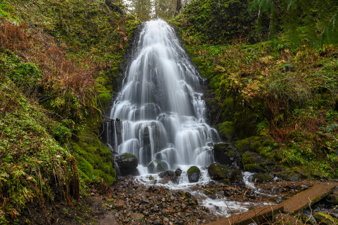
Fairy Falls Columbia Gorge
(Fairy Falls)
Basalt rock Wahkeena Falls Trail
The Wahkeena Creek canyon becomes more narrow the further down you go, and by the end the trail is almost in the river. Watch out here when the water is really high!
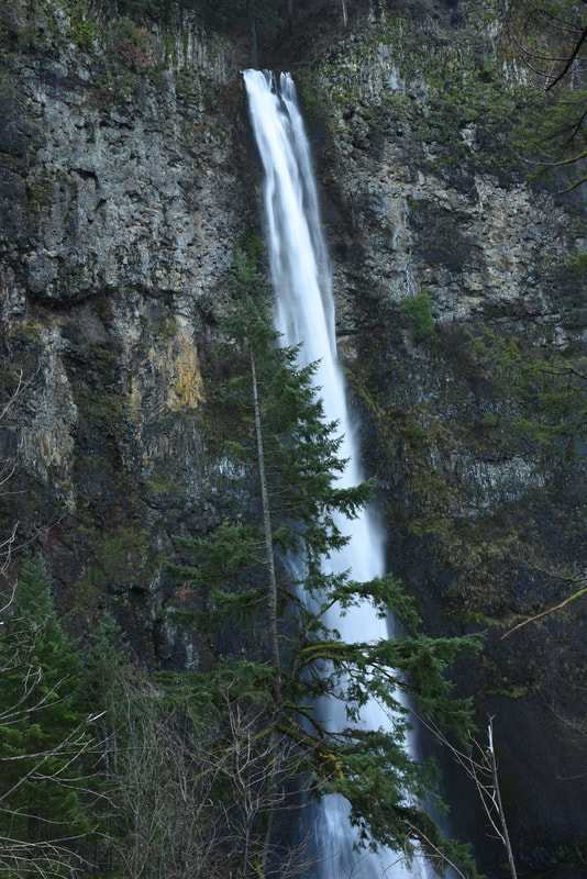
The view of Wahkeena Falls is wonderful and you are able to see the two distinct tiers of the 242 ft. waterfall (although it actually has a total of 6 drops, you can’t see all of them at once).
"These falls were once known as Gordon Falls, for F.E. Gordon, a pioneer landowner. On account of confusion with Gordon Creek near the Sandy River and Gorton Creek at Cascade Locks, a committee appointed by the Mazamas in 1915 to name points on the Columbia River Highway changed the name to Wahkeena Falls and Wahkeena Creek. This name is said to be a Yakama word meaning most beautiful." - Oregon Geographic Names
Wahkeena Falls Columbia Gorge
(Wahkeena Falls)
Once you get back down to the Scenic Highway, you will find the Tie Trail #442 to east of the falls. Continue on this trail for roughly half a mile back to the historic Multnomah Falls Lodge. The lodge serves food and drinks and is open 7 days a week.
The Multnomah Falls/Wahkeena Falls loop is one of the most scenic hikes in the Columbia Gorge, and even after the 2017 Eagle Creek Fire, it has a different sort of beauty to it. Doing the entire loop is not recommended to small children or persons with bad knees, as there are some extremely steep sections that can be wet, slippery and dangerous. The trail here is generally well maintained and there is a large section by Multnomah Falls that is even paved, however since the fire, conditions are not ideal with lots of rockslides across the trail and lots of debris in the trail. ​
Multnomah Wahkeena Falls loop return loop trail sign
Herb Robert non-native wildflower
(Herb Robert a non-native wildflower)
Candy flower native wildflower
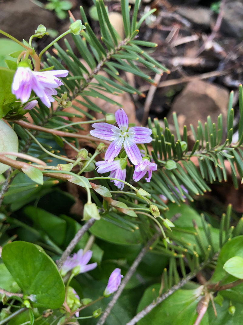
(Candy flower a native wildflower)

Directions:

From Portland
  • Drive on I-84 east towards Hood River for 29.6 miles and exit at the sign for Multnomah Falls. (Total of 30 miles)
From Salem
  • Drive north on I-5 towards Portland for 27.8 miles then turn off at exit 288 for I-205 towards The Dalles/Seattle. Continue on I-205 north for 21.1 miles then take exit 22 to merge onto I-84 east towards The Dalles. Continue on I-84 for 22.7 miles exit at the sign for Multnomah Falls. (Total of  77.8 miles)
From Eugene
  • Drive north on I-5 towards Portland for 108.6 miles then turn off at exit 288 for I-205 towards The Dalles/Seattle. Continue on I-205 north for 21.1 miles then take exit 22 to merge onto I-84 east towards The Dalles. Continue on I-84 for 22.7 miles exit at the sign for Multnomah Falls. (Total of 138.8 miles)
From Bend
  • Drive north on US-97 towards Redmond and Madras. In Madras merge left onto US-26 and stay on this highway for 100 miles. In Troutdale merge right onto I-84 towards Hood River for 14 miles then exit at the sign for Multnomah Falls.​ (Total of 162.2 miles)
From Medford
  • Drive north on I-5 to Portland for 269 miles then turn off at exit 288 for I-205 towards The Dalles/Seattle. Continue on I-205 north for 21.1 miles then take exit 22 to merge onto I-84 east towards The Dalles. Continue on I-84 for 22.7 miles exit at the sign for Multnomah Falls. (Total of 302 miles)
*All pictures unless otherwise marked are taken by Franziska Weinheimer
*Disclaimer: The trail descriptions, mileage, GPS tracks and difficulty ratings depicted on this website are never 100% accurate. Always hike at your own risk, using your own knowledge, equipment and common sense. Franziska Weinheimer/Hike Oregon are not responsible if you or anyone in your party gets injured or lost while attempting one of these or any other hikes.
To get a more in-depth and personal view of this hike, watch the YouTube video.

HIKED HERE RECENTLY?! PLEASE LEAVE A TRIP REPORT BELOW:

© Hike Oregon 2023
P.O. Box 41911
​Eugene, OR 97404
Proudly powered by Weebly
  • Home
  • *Store*
  • About the author
  • How to use this site
  • Resources
    • Wildflowers
    • Videos
  • Best Oregon Hikes
    • Top Fall Foliage Hikes In Oregon
    • Top 10 Oregon Fall Hikes
    • 20 Best Oregon Waterfall Hikes
    • Top 10 Oregon Hikes for Kids
    • Sno-Parks In Central Oregon
    • Top 10 Oregon Winter Hikes
    • Top Low Elevation Winter Hikes
    • 9 Amazing Oregon Summit Hikes
    • 20 Central Oregon Day Hikes
    • 20 Epic Oregon Wildflower Hikes
    • 5 Weekend Backpacking Trips in Oregon
    • Top One Night Backpacking Trips in Oregon
    • Top 10 Oregon Summer Hikes
    • Top 10 Swimming Spots In Oregon
    • Top 10 Oregon Spring Hikes
  • Oregon Sno-Parks
    • Maxwell Sno-Park
    • Potato Hill Sno-Park
    • Ray Benson Sno-Park
      • Brandenburg Shelter
    • Santiam Sno-Park
    • Three Creek Sno-Park
    • Virginia Meissner Sno-Park
      • Meissner Shelter Loop
      • Nordeen Shelter
    • Gold Lake Sno-Park
      • Westview Shelter to Eagle Rock Overlook
      • Marilyn Lakes Loop
  • Southern Washington
    • Hamilton Mountain
    • Dog Mountain
    • Coyote Wall
    • Mount St. Helens
  • Portland
    • Powell Butte
    • Forest Park
    • Latourell Falls
    • Multnomah/Wahkeena Falls
    • Eagle Creek
    • Mitchell Point
    • Table Rock
    • Tamanawas Falls
    • Trillium Lake
    • East Zigzag Mountain (members only)
  • Salem
    • Abiqua Falls
    • Silver Falls State Park
    • Dome Rock
    • Marion Lake to Marion Mountain
    • Jefferson Park
  • Corvallis
    • Marys Peak East Ridge
    • Marys Peak North Ridge
    • Alsea Falls and Green Peak Falls
    • Corvallis to Sea Trail - Sugarbowl Creek segment (members only)
  • Sweet Home
    • Crescent Mountain
    • Iron Mountain
    • McDowell Creek Falls
    • Middle Santiam River (members only)
    • Lower Soda Creek Falls (members only)
    • Rooster Rock (members only)
  • McKenzie Bridge/Blue River
    • Macduff Mountain
    • Proxy Falls
    • Clear Lake
    • Sahalie/Koosah Falls
    • Blue Pool
    • Erma Bell Lakes
    • Olallie Mountain
    • Horsepasture Mountain
    • Tidbits Mountain
    • Castle Rock
    • Lowder Mountain (members only)
    • East Fork Trail (members only)
    • Rainbow Falls Overlook (members only)
    • Frissell Point (members only)
    • Chucksney Mountain (members only)
    • Substitute Point (members only)
  • Sisters/Santiam Pass
    • Coffin Mountain
    • Trappers Butte and Scar Mountain
    • Maxwell Butte
    • Black Butte
    • Whychus Creek Trail
    • Tam McArthur Rim
    • Black Crater
    • Scott Mountain
    • Obsidian Trail
    • Metolius Preserve
    • Three Fingered Jack Loop
    • Square Lake
    • Canyon Creek Meadows
    • Patjens Lakes
    • Craig Lake (members only)
    • Chush Falls (members only)
    • Rockpile Lake (members only)
    • Santiam Lake (members only)
    • Camp Lake (members only)
    • Park Meadow to Golden Lake (members only)
  • Bend/Redmond/LaPine
    • Steins Pillar
    • Chimney Rock
    • Steelhead Falls
    • Tumalo State Park
    • Tumalo Falls
    • Tumalo Mountain
    • No Name Lake
    • Green Lakes
    • Moraine Lake
    • South Sister Summit
    • Horse Lake
    • Muskrat Lake
    • Paulina Peak
    • Peter Skene Ogden Trail (members only)
  • Eugene
    • Ridgeline Trail
    • Mount Pisgah Summit
    • Mount Pisgah Arboretum
    • Shotgun Creek
    • Mount June
    • Lawler
    • Tire Mountain
    • Goodman Creek
    • Brice Creek
    • Trestle Creek Falls
    • Moon Falls
    • Elijah Bristow State Park
    • South Willamette Trail (members only)
    • Eula Ridge (members only)
    • Eagle's Rest (members only)
  • Oakridge
    • Deception Creek
    • North Salmon Creek
    • Grasshopper Ridge
    • Larison Creek
    • Bunchgrass Ridge
    • Salt Creek Falls
    • Waldo Lake Loop
    • South Waldo Loop
    • The Twins
    • Rosary Lakes
    • Yoran Lake
    • Fawn Lake
    • Windy Lakes
    • Divide Lake
    • Diamond Peak Summit
    • Cowhorn Mountain
    • Wall Creek Warm Springs (members only)
    • Moon Point (members only)
    • Bobby Lake (members only)
    • Lillian Falls (members only)
    • Middle Fork Willamette Trail (members only)
    • Pool Creek Falls (members only)
    • Dead Mountain (members only)
    • Larison Rock (members only)
    • Quinn Lakes & Eddeeleo Lakes (members only)
    • Waldo Mountain Lookout (members only)
    • Blair Lake to Spring Prairie (members only)
    • Rigdon Lakes loop (members only)
  • Oregon Coast
    • Cascade Head
    • Drift Creek Falls
    • Sweet Creek Falls
    • Beaver Creek Falls
    • Kentucky Falls
    • Hobbit Trail to Heceta Head
    • Valley Trail to China Creek
    • North Fork Smith River (members only)
    • Cummins Ridge (member's only)
    • Horse Creek (members only)
    • Siltcoos Lake (members only)
  • Southern Oregon
    • Fall Creek Falls
    • Watson Falls
    • Wild Rogue Loop
    • Mt. Thielsen
    • Crater Lake National Park
      • The Watchman
      • Mount Scott
      • The Pinnacles
    • Lower Table Rock
    • Pilot Rock
    • Wagner Butte
    • Mt. McLoughlin
    • Lemolo Falls (members only)
    • Fern Falls (members only)
  • Eastern Oregon
    • Painted Cove
    • Anthony Lake Loop
    • Mount Howard
    • Eagle Cap summit
    • Schneider Cabin (members only)
    • Strawberry Lake & Strawberry Falls (members only)
  • Oregon PCT sections
  • Tips & Tricks
    • Leave No Trace
    • How To Pick The Right Backpacking Tent
    • Top Tips For Hiking With Infants And Toddlers
    • Poison Oak, Ivy and Sumac
    • How to dress for cold weather hikes
    • Outdoorsy Holiday Gift Guide 2022
    • Hiker Holiday Gift Guide 2019
    • Outdoor Holiday Gift Guide 2018
    • Hiking Holiday Gift Guide 2017
  • Reviews/Gear
    • Stay Kühl This Summer
    • Outdoor Herbivore Backpacking Food Review
    • Osprey Aura AG 65 Backpack review
    • Big Agnes Fly Creek UL2 review
    • REI Quarter Dome 1 review
  • Adventure Stories
    • Hiking The Rae Lakes Loop
    • 110 Miles on the PCT
    • Three Fingered Jack Adventures
    • Jefferson Wilderness