Hike Oregon
  • Home
  • *Store*
  • About the author
  • How to use this site
  • Resources
    • Wildflowers
    • Videos
  • Best Oregon Hikes
    • Best Rainy Day Hikes In Oregon
    • Top 10 Oregon Fall Hikes
    • Underrated Fall Foliage Hikes In Oregon
    • 20 Best Oregon Waterfall Hikes
    • Sno-Parks In Central Oregon
    • Top 10 Oregon Winter Hikes
    • Top Low Elevation Winter Hikes
    • Easy Hikes in Oregon
    • Top 10 Oregon Hikes for Kids
    • Top 10 Oregon Spring Hikes
    • Top One Night Backpacking Trips in Oregon
    • 5 Weekend Backpacking Trips in Oregon
    • 20 Epic Oregon Wildflower Hikes
    • 9 Amazing Oregon Summit Hikes
    • Top 10 Oregon Summer Hikes
    • Top 10 Swimming Spots In Oregon
    • 20 Central Oregon Day Hikes
  • Oregon Sno-Parks
    • Maxwell Sno-Park
    • Potato Hill Sno-Park
    • Ray Benson Sno-Park
      • Brandenburg Shelter
    • Santiam Sno-Park
    • Three Creek Sno-Park
    • Virginia Meissner Sno-Park
      • Meissner Shelter Loop
      • Nordeen Shelter
    • Gold Lake Sno-Park
      • Westview Shelter to Eagle Rock Overlook
      • Marilyn Lakes Loop
    • Ikenick Sno-Park (members only)
  • Southern Washington
    • Hamilton Mountain
    • Dog Mountain
    • Coyote Wall
    • Mount St. Helens
  • Portland
    • Powell Butte
    • Forest Park
    • Latourell Falls
    • Multnomah/Wahkeena Falls
    • Eagle Creek
    • Mitchell Point
    • Table Rock
    • Tamanawas Falls
    • Trillium Lake
    • East Zigzag Mountain (members only)
  • Salem
    • Abiqua Falls
    • Silver Falls State Park
    • Dome Rock
    • Marion Lake to Marion Mountain
    • Jefferson Park via Whitewater Trail
  • Corvallis
    • William Finley Wildlife Refuge
      • Campbell Boardwalk
      • Woodpecker Loop
      • Mill Hill Loop
      • Beaver Pond Loop
    • Marys Peak East Ridge
    • Marys Peak North Ridge
    • Alsea Falls and Green Peak Falls
    • Corvallis to Sea Trail - Sugarbowl Creek segment (members only)
  • Sweet Home
    • Crescent Mountain
    • Iron Mountain
    • McDowell Creek Falls
    • Middle Santiam River (members only)
    • Lower Soda Creek Falls (members only)
    • Rooster Rock (members only)
  • McKenzie Bridge/Blue River
    • Macduff Mountain
    • Proxy Falls
    • Clear Lake
    • Sahalie/Koosah Falls
    • Blue Pool
    • Erma Bell Lakes
    • Olallie Mountain
    • Horsepasture Mountain
    • Tidbits Mountain
    • Castle Rock
    • Separation Lake (members only)
    • Lowder Mountain (members only)
    • East Fork Trail (members only)
    • Rainbow Falls Overlook (members only)
    • Frissell Point (members only)
    • Substitute Point (members only)
  • Sisters/Santiam Pass
    • Coffin Mountain
    • Trappers Butte and Scar Mountain
    • Maxwell Butte
    • Black Butte
    • Whychus Creek Trail
    • Tam McArthur Rim
    • Black Crater
    • Scott Mountain
    • Obsidian Trail
    • Metolius Preserve
    • Three Fingered Jack Loop
    • Square Lake
    • Canyon Creek Meadows
    • Patjens Lakes
    • Craig Lake (members only)
    • Chush Falls (members only)
    • Rockpile Lake (members only)
    • Santiam Lake (members only)
    • Camp Lake (members only)
    • Park Meadow to Golden Lake (members only)
  • Bend/Redmond/LaPine
    • Steins Pillar
    • Chimney Rock
    • Steelhead Falls
    • Tumalo State Park
    • Shevlin Park Loop
    • Tumalo Falls
    • Tumalo Mountain
    • No Name Lake
    • Green Lakes
    • Moraine Lake
    • South Sister Summit
    • Horse Lake
    • Muskrat Lake
    • Paulina Peak
    • The Badlands - Flatiron Rock Trail
    • Peter Skene Ogden Trail (members only)
  • Eugene
    • Ridgeline Trail
    • Mount Pisgah Summit
    • Mount Pisgah Arboretum
    • Shotgun Creek
    • Mount June
    • Lawler
    • Tire Mountain
    • Hardesty Mountain
    • Goodman Creek
    • Brice Creek
    • Trestle Creek Falls
    • Parker Falls
    • Moon Falls
    • Elijah Bristow State Park
    • South Willamette Trail (members only)
    • Eula Ridge (members only)
    • Eagle's Rest (members only)
  • Oakridge
    • Deception Butte
    • North Salmon Creek
    • Sourgrass Mountain
    • Grasshopper Ridge
    • Larison Creek
    • Bunchgrass Ridge
    • Salt Creek Falls
    • Waldo Lake Loop
    • South Waldo Loop
    • The Twins
    • Rosary Lakes
    • Yoran Lake
    • Fawn Lake
    • Windy Lakes
    • Divide Lake
    • Diamond Peak via Rockpile Lake Trailhead
    • Diamond Peak via Summit Lake
    • Cowhorn Mountain
    • Klovdahl Bay (members only)
    • Verdun Trail (members only)
    • Heckletooth Mountain (members only)
    • Wall Creek Warm Springs (members only)
    • Moon Point (members only)
    • Bobby Lake (members only)
    • Lillian Falls (members only)
    • Middle Fork Willamette Trail (members only)
    • Pool Creek Falls (members only)
    • Dead Mountain (members only)
    • Larison Rock (members only)
    • Quinn Lakes & Eddeeleo Lakes (members only)
    • Waldo Mountain Lookout (members only)
    • Blair Lake to Spring Prairie (members only)
    • Rigdon Lakes loop (members only)
  • Oregon Coast
    • Cascade Head
    • Drift Creek Falls
    • Sweet Creek Falls
    • Beaver Creek Falls
    • Kentucky Falls
    • Hobbit Trail to Heceta Head
    • Valley Trail to China Creek
    • Sutton Creek Trail (members only)
    • North Fork Smith River (members only)
    • Cummins Ridge (member's only)
    • Horse Creek (members only)
    • Siltcoos Lake (members only)
  • Southern Oregon
    • Fall Creek Falls
    • Watson Falls
    • Wild Rogue Loop
    • Mt. Thielsen
    • Crater Lake National Park
      • The Watchman
      • Mount Scott
      • The Pinnacles
    • Lower Table Rock
    • Pilot Rock
    • Wagner Butte
    • Mt. McLoughlin
    • Lemolo Falls (members only)
    • Fern Falls (members only)
  • Eastern Oregon
    • Painted Cove
    • Anthony Lake Loop
    • Mount Howard
    • Eagle Cap summit
    • Schneider Cabin (members only)
    • Strawberry Lake & Strawberry Falls (members only)
  • Northern California
    • Taylor & Hogan Lake (members only)
  • Oregon PCT sections
    • PCT: CA border to Callahan's
  • Tips & Tricks
    • Leave No Trace
    • Safety Tips for Solo Hiking & Backpacking
    • Nutrition On The Trail
    • How Much Water To Carry When Backpacking
    • Storing Your Bear Canister When Backpacking
    • How To Pick The Right Backpacking Tent
    • Top Tips For Hiking With Infants And Toddlers
    • Poison Oak, Ivy and Sumac
    • How to dress for cold weather hikes
  • Reviews and Gear
    • Choosing and Using Trekking Poles
    • A Guide to Choosing the Perfect Backpacking Pack
    • Hiking Pants and Leggings
    • Jackets for Hiking and Backpacking
    • Long Sleeved Shirts For Cold Weather Hiking
    • Stay Kühl This Summer
    • Outdoor Herbivore Backpacking Food Review
    • Osprey Aura AG 65 Backpack review
    • Big Agnes Fly Creek UL2 review
    • REI Quarter Dome 1 review
    • Hike Oregon's Gear Favorites
    • Outdoorsy Holiday Gift Guide 2022
    • Hiker Holiday Gift Guide 2019
    • Outdoor Holiday Gift Guide 2018
    • Hiking Holiday Gift Guide 2017
  • Adventure Stories
    • Hiking The Rae Lakes Loop
    • 110 Miles on the PCT
    • Three Fingered Jack Adventures
    • Jefferson Wilderness

Ray Benson Sno-Park

​

Brandenburg Shelter South Loop

​
Get the printable version of this hike

Hike details:

Mileage: 7.6 mile loop w/ 395 ft. elevation gain
Approximate hike time: 4 hours 13 minutes w/ an average pace of 1.8 mph
Difficulty: Moderate
Trail usage: Low on weekdays, medium to high on sunny weekends
Highest elevation: 4,845 ft. Lowest elevation: 4,655 ft.
General location: 20 miles west of Sisters - Willamette National Forest
Accessible: Year-round 
(The sno-park trails are accessible for winter recreation as soon as about 2 feet of snow have accumulated, usually by mid-December. This one generally melts out some time around late March or early April).
Permits required: Sno-park pass is required from November 1 - April 30
Pit toilet at trailhead: Yes
Trail allows: ​Dogs on leash, snowshoeing, cross-country skiing, snowmobiles, camping
Picture
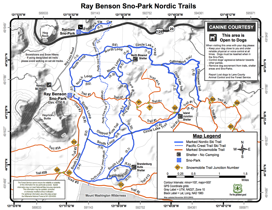
(map of the entire Ray Benson Sno Park - click to enlarge)

Description:

Ray Benson Sno-Park is one of the largest sno-parks in Central Oregon. It offers dozens of trails that create many different loops and there are a total of three shelters and warming huts! The parking area is huge with a few pit toilets and this is also where the warming hut is located. 
View of Three Fingered Jack from Ray Benson Sno Park
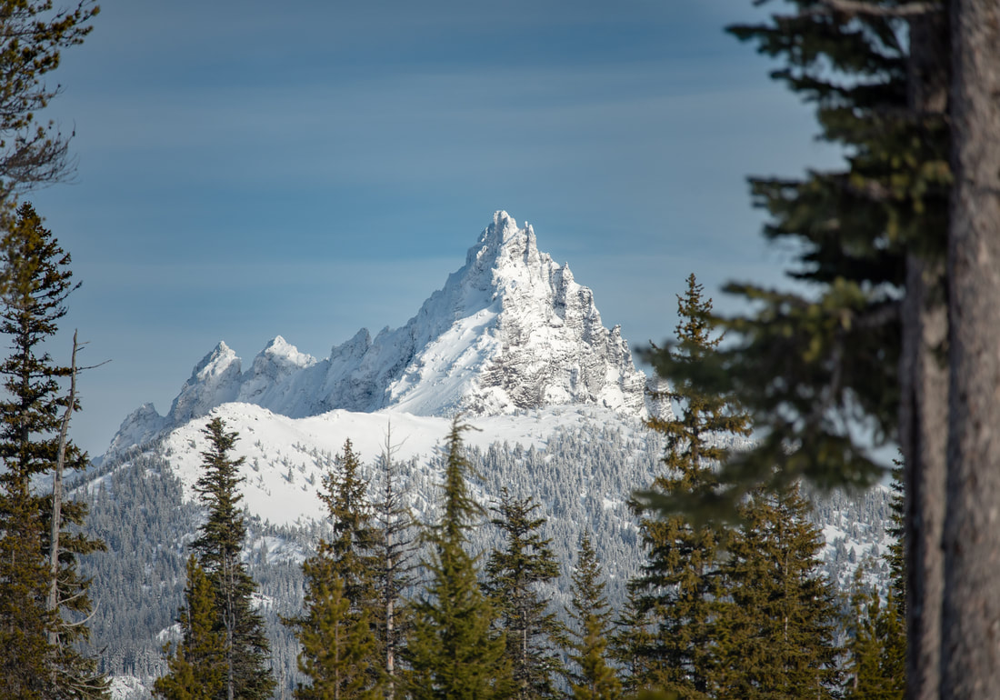
(Three Fingered Jack from the parking area)
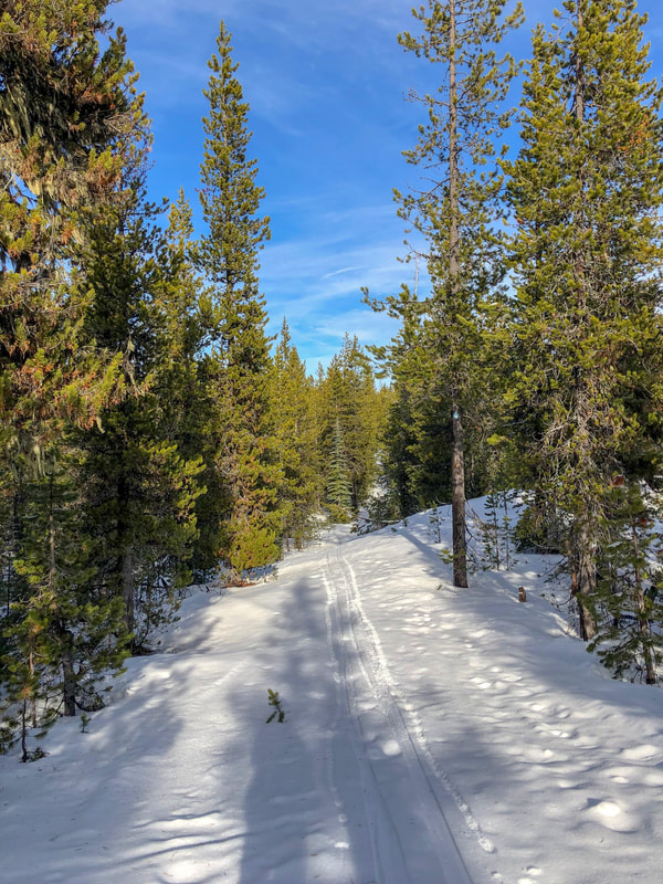
You don't even have to leave the parking lot to be able to get your first mountain view! Three Fingered Jack looms across the parking lot in all his winter glory. You will find the start of the South Loop on the south side of the parking lot loop, right after the entrance. You can also choose to walk on the road that is gated off. Snowmobiles are allowed on the road so be careful, but if you go early in the morning, it is generally pretty quiet. 
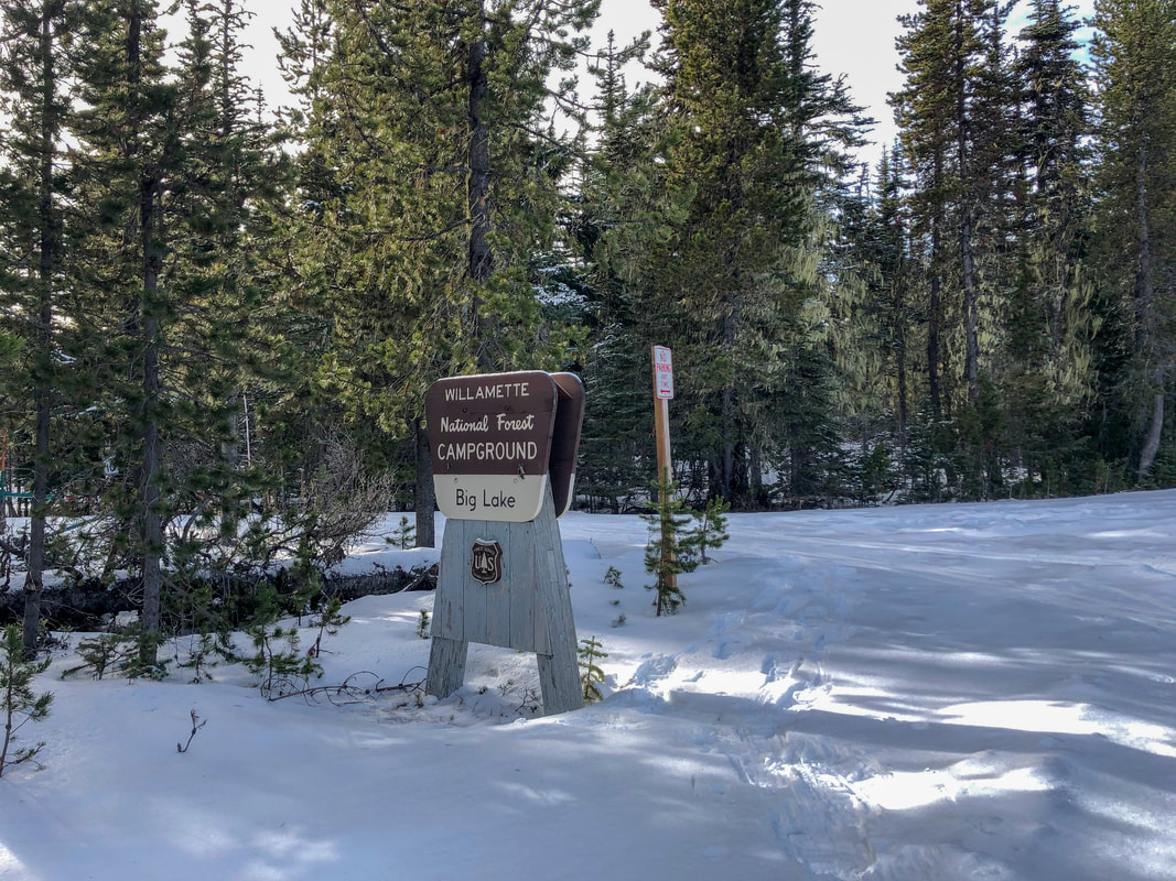
If there isn't a lot of snow, ​or if there is a lot of new snow, it can be easier to walk on the road. ​If you are at Ray Benson on a clear day, you must go on a little detour from the actual loop to see Big Lake and Mount Washington. If you walk down the road it is a total of 2.3 miles to Big Lake Campground, where you will walk through the campground to the lakeshore. Here you have a great unobstructed view of Big Lake and a close-up view of Mount Washington. If you are into snow camping, you can camp by the lake during the winter. ​
Big Lake campground
Mt. Washington across Big Lake in winter
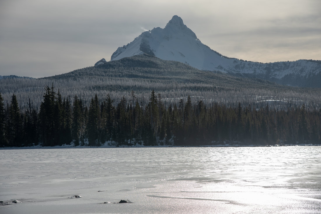
(frozen Big Lake and Mount Washington)
Pacific Crest Trail sign Santiam Pass
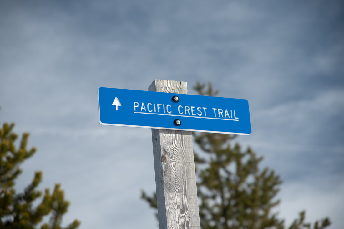
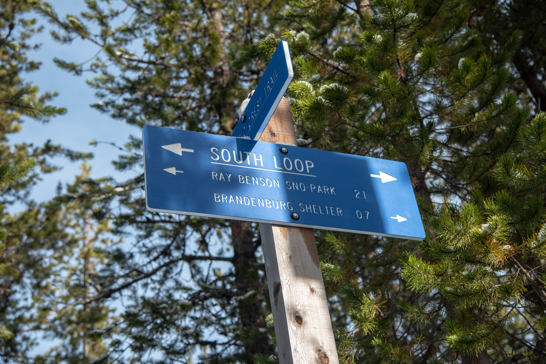
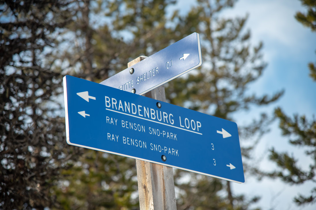
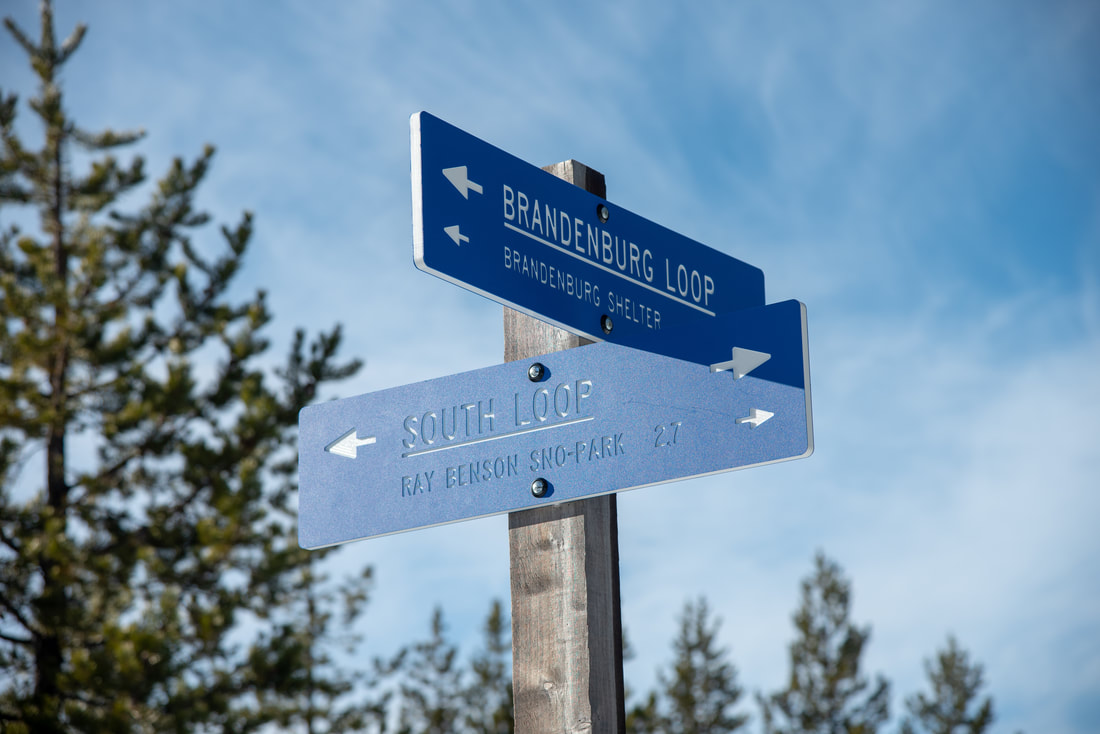
From the campground, go back up the road for 0.4 miles to a road split and take a right. Go down that road for another 0.56 miles to where you will see a very tall blue Pacific Crest Trail sign. Take a left here onto the PCT for only 0.1 mile and then stay right on the South Loop following signs to Brandenburg Shelter. After 0.3 miles stay right again on the Brandenburg Loop for another 0.75 miles to the shelter. 
South Loop Trail sign Benson Sno Park
Brandenburg Shelter view of Three Fingered Jack Ray Benson Sno Park
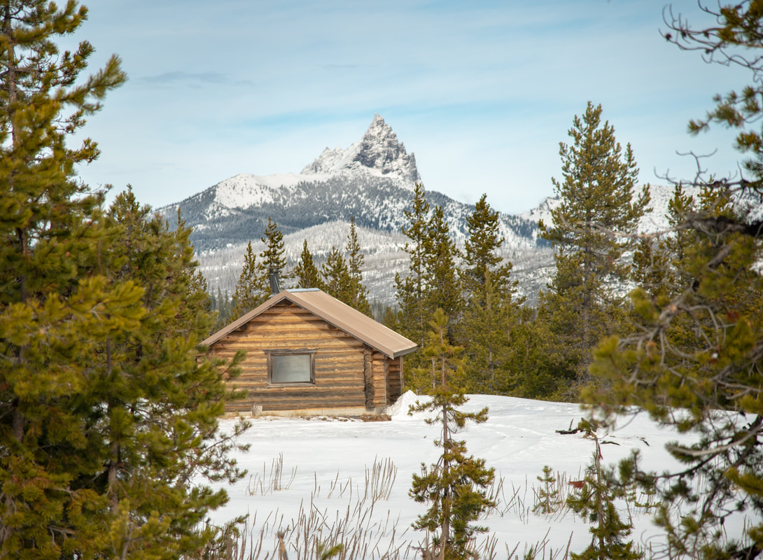
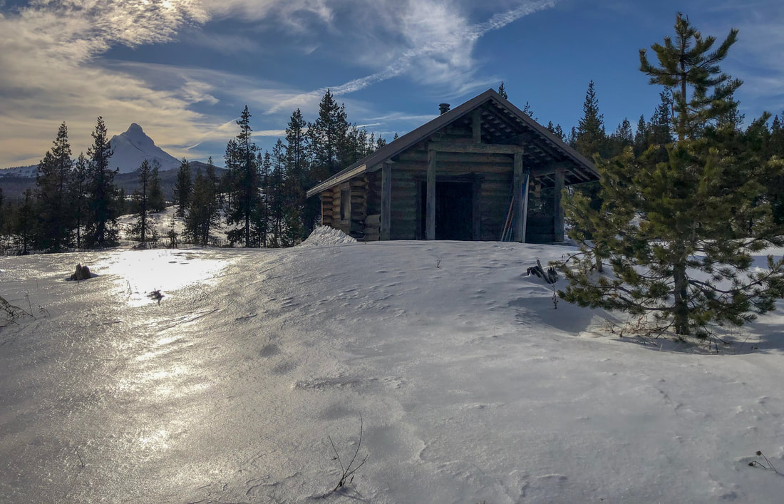
(Three Fingered Jack and Brandenburg Shelter)
Brandenburg Shelter Ray Benson Sno Park
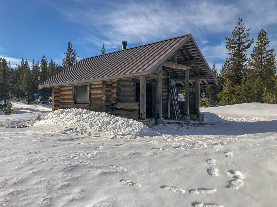
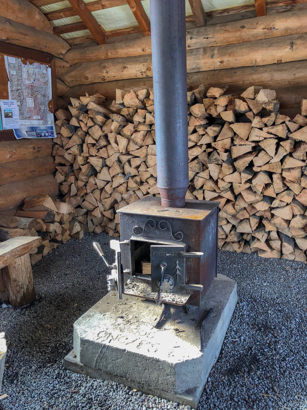
The Brandenburg shelter is a mostly enclosed shelter and sits in a clearing with views of Three Fingered Jack to the north and Mount Washington to the south. It is bright and spacious inside with plenty of firewood, benches for sitting and a wood stove in the middle. The shelter is a great place to warm up, enjoy the views, and have lunch. Keep in mind, if you want to start a fire, bring your own paper and fire starter. Do not use the map that is hanging in the shelter to start your fire!
Inside of Brandenburg Shelter Ray Benson Sno Park
Brandenburg Shelter view of Mt. Washington Ray Benson Sno Park
(Brandenburg Shelter and Mount Washington)
Brandenburg loop sign Ray Benson Sno Park
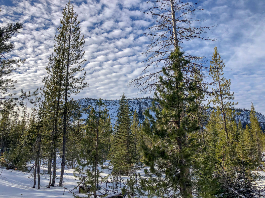
After enjoying Brandenburg Shelter, continue on the Brandenburg Loop trail for another 0.25 miles to where it meets the South Loop again. Take the South Loop to the right (north) and continue through a large open area with views of Hayrick Butte for another 0.67 miles to another junction. 
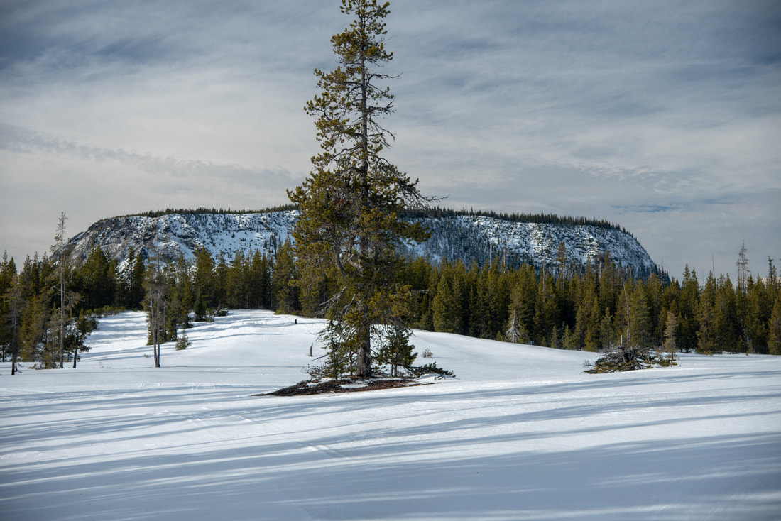
Brandenburg Loop Sign South Loop Sign Ray Benson Sno Park
Hayrick Butte Ray Benson Sno Park
(Hayrick Butte)
South Loop sign Ray Benson Sno Park
South Loop trail Ray Benson Sno Park
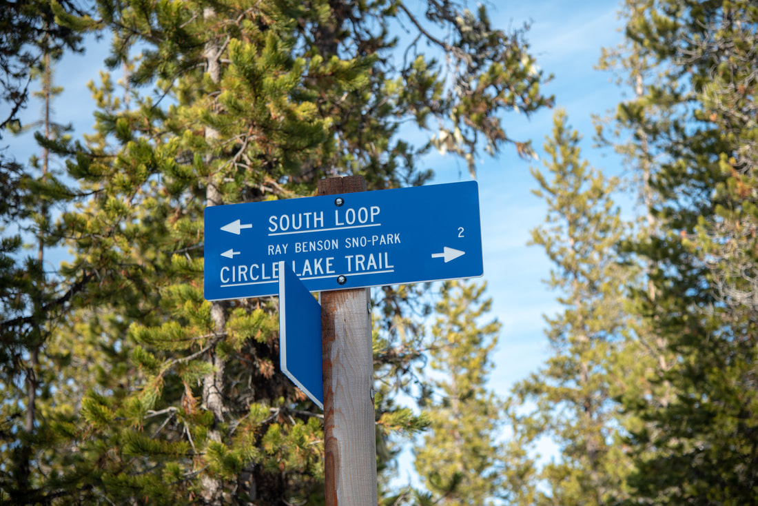
At the junction with the Circle Lake Trail, continue left on the South Loop trail, following signs for Ray Benson Sno-Park. From here you will continue 2 more miles back to the car. Don't miss another awesome glimpse of Mount Washington across a big open meadow which makes for an awesome last photo opportunity before heading back the last bit through the woods. 
​Although the South Loop isn't a snowmobile trail, the last bit of this loop takes you fairly close to the road and in the afternoon you do hear quite a bit of snowmobile noise, which can take away from some of the nature experience. 
​This loop is a great moderate nordic trail with very minimal elevation gain and epic mountain views! Because it is one of the largest sno-parks, it does tend to get busy on nice weekend days. Keep in mind that this loop will take you longer if you have to break trail after new snow falls. Breaking trail can be extremely exhausting and it is best to choose something a bit shorter if you are coming to Ray Benson after new snowfall.
Ray Benson Sno Park

Directions:

From Bend
  • Drive on US-97 north then take exit 135A to merge onto US-20 west toward Sisters for 19.9 miles. At the traffic circle in Sisters, take the 2nd exit and continue on US-20 west for another 20 miles. Then turn left at a sign for Hoodoo Ski Area/Ray Benson Sno Park, follow signs to the sno park parking area. (Total of 44.6 miles)
From Eugene
  • Take OR-126 east toward Springfield. At a traffic light use the two left lanes to turn left, following signs to continue on OR-126 for another 72.6 miles. Shortly after Clear Lake Resort, take a slight right onto US-20 east for 8.4 miles and then turn right at a sign for Hoodoo Ski Area and Ray Benson Sno Park. Follow signs to the sno park parking area. (Total of 86.9 miles)
From Salem
  • Take OR-22 east toward Detroit Lake/Bend for a total of 80.2 miles, then take a slight left onto US-20 east for 5.1 miles and then turn right at a sign for Hoodoo Ski Area and Ray Benson Sno Park. Follow signs to the sno park parking area. (Total of 90.3 miles)
From Portland
  • Drive on I-5 south towards Salem for 45.3 miles, then use the right 2 lanes to take exit 253 for OR-22 east toward Detroit Lake/Bend. Stay on OR-22 for a total of 80.2 miles, then take a slight left onto US-20 east for 5.1 miles and then turn right at a sign for Hoodoo Ski Area and Ray Benson Sno Park. Follow signs to the sno park parking area. (Total of 133 miles)
From Medford
  • Take OR-62 east towards Crater Lake for 49.5 miles then take a slight left onto OR-230 north for 23.8 miles. Near Diamond Lake turn right onto OR-138 east for 17.7 miles until it T’s into highway 97. Turn left onto US-97 north for 77.3 miles then take exit 135A to merge onto US-20 west toward Sisters. Drive on US-20 for a total of 19.5 miles to the town of Sisters. In Sisters at the roundabout take the 2nd exit and continue on US-20 for another 20 miles and then turn left at a sign for Hoodoo Ski Area/Ray Benson Sno Park, follow signs to the sno park parking area. (Total of 217 miles)
-This trail write-up was last updated January 2020-
*All pictures are taken by Franziska Weinheimer
*Disclaimer: The trail descriptions, mileage, GPS tracks and difficulty ratings depicted on this website are never 100% accurate. Always hike at your own risk, using your own knowledge, equipment and common sense. Franziska Weinheimer/Hike Oregon are not responsible if you or anyone in your party gets injured or lost while attempting one of these or any other hikes. ​​​​

HIKED HERE RECENTLY? PLEASE LEAVE A TRIP REPORT BELOW:

© Hike Oregon 2025
P.O. Box 41911
​Eugene, OR 97404
Proudly powered by Weebly
  • Home
  • *Store*
  • About the author
  • How to use this site
  • Resources
    • Wildflowers
    • Videos
  • Best Oregon Hikes
    • Best Rainy Day Hikes In Oregon
    • Top 10 Oregon Fall Hikes
    • Underrated Fall Foliage Hikes In Oregon
    • 20 Best Oregon Waterfall Hikes
    • Sno-Parks In Central Oregon
    • Top 10 Oregon Winter Hikes
    • Top Low Elevation Winter Hikes
    • Easy Hikes in Oregon
    • Top 10 Oregon Hikes for Kids
    • Top 10 Oregon Spring Hikes
    • Top One Night Backpacking Trips in Oregon
    • 5 Weekend Backpacking Trips in Oregon
    • 20 Epic Oregon Wildflower Hikes
    • 9 Amazing Oregon Summit Hikes
    • Top 10 Oregon Summer Hikes
    • Top 10 Swimming Spots In Oregon
    • 20 Central Oregon Day Hikes
  • Oregon Sno-Parks
    • Maxwell Sno-Park
    • Potato Hill Sno-Park
    • Ray Benson Sno-Park
      • Brandenburg Shelter
    • Santiam Sno-Park
    • Three Creek Sno-Park
    • Virginia Meissner Sno-Park
      • Meissner Shelter Loop
      • Nordeen Shelter
    • Gold Lake Sno-Park
      • Westview Shelter to Eagle Rock Overlook
      • Marilyn Lakes Loop
    • Ikenick Sno-Park (members only)
  • Southern Washington
    • Hamilton Mountain
    • Dog Mountain
    • Coyote Wall
    • Mount St. Helens
  • Portland
    • Powell Butte
    • Forest Park
    • Latourell Falls
    • Multnomah/Wahkeena Falls
    • Eagle Creek
    • Mitchell Point
    • Table Rock
    • Tamanawas Falls
    • Trillium Lake
    • East Zigzag Mountain (members only)
  • Salem
    • Abiqua Falls
    • Silver Falls State Park
    • Dome Rock
    • Marion Lake to Marion Mountain
    • Jefferson Park via Whitewater Trail
  • Corvallis
    • William Finley Wildlife Refuge
      • Campbell Boardwalk
      • Woodpecker Loop
      • Mill Hill Loop
      • Beaver Pond Loop
    • Marys Peak East Ridge
    • Marys Peak North Ridge
    • Alsea Falls and Green Peak Falls
    • Corvallis to Sea Trail - Sugarbowl Creek segment (members only)
  • Sweet Home
    • Crescent Mountain
    • Iron Mountain
    • McDowell Creek Falls
    • Middle Santiam River (members only)
    • Lower Soda Creek Falls (members only)
    • Rooster Rock (members only)
  • McKenzie Bridge/Blue River
    • Macduff Mountain
    • Proxy Falls
    • Clear Lake
    • Sahalie/Koosah Falls
    • Blue Pool
    • Erma Bell Lakes
    • Olallie Mountain
    • Horsepasture Mountain
    • Tidbits Mountain
    • Castle Rock
    • Separation Lake (members only)
    • Lowder Mountain (members only)
    • East Fork Trail (members only)
    • Rainbow Falls Overlook (members only)
    • Frissell Point (members only)
    • Substitute Point (members only)
  • Sisters/Santiam Pass
    • Coffin Mountain
    • Trappers Butte and Scar Mountain
    • Maxwell Butte
    • Black Butte
    • Whychus Creek Trail
    • Tam McArthur Rim
    • Black Crater
    • Scott Mountain
    • Obsidian Trail
    • Metolius Preserve
    • Three Fingered Jack Loop
    • Square Lake
    • Canyon Creek Meadows
    • Patjens Lakes
    • Craig Lake (members only)
    • Chush Falls (members only)
    • Rockpile Lake (members only)
    • Santiam Lake (members only)
    • Camp Lake (members only)
    • Park Meadow to Golden Lake (members only)
  • Bend/Redmond/LaPine
    • Steins Pillar
    • Chimney Rock
    • Steelhead Falls
    • Tumalo State Park
    • Shevlin Park Loop
    • Tumalo Falls
    • Tumalo Mountain
    • No Name Lake
    • Green Lakes
    • Moraine Lake
    • South Sister Summit
    • Horse Lake
    • Muskrat Lake
    • Paulina Peak
    • The Badlands - Flatiron Rock Trail
    • Peter Skene Ogden Trail (members only)
  • Eugene
    • Ridgeline Trail
    • Mount Pisgah Summit
    • Mount Pisgah Arboretum
    • Shotgun Creek
    • Mount June
    • Lawler
    • Tire Mountain
    • Hardesty Mountain
    • Goodman Creek
    • Brice Creek
    • Trestle Creek Falls
    • Parker Falls
    • Moon Falls
    • Elijah Bristow State Park
    • South Willamette Trail (members only)
    • Eula Ridge (members only)
    • Eagle's Rest (members only)
  • Oakridge
    • Deception Butte
    • North Salmon Creek
    • Sourgrass Mountain
    • Grasshopper Ridge
    • Larison Creek
    • Bunchgrass Ridge
    • Salt Creek Falls
    • Waldo Lake Loop
    • South Waldo Loop
    • The Twins
    • Rosary Lakes
    • Yoran Lake
    • Fawn Lake
    • Windy Lakes
    • Divide Lake
    • Diamond Peak via Rockpile Lake Trailhead
    • Diamond Peak via Summit Lake
    • Cowhorn Mountain
    • Klovdahl Bay (members only)
    • Verdun Trail (members only)
    • Heckletooth Mountain (members only)
    • Wall Creek Warm Springs (members only)
    • Moon Point (members only)
    • Bobby Lake (members only)
    • Lillian Falls (members only)
    • Middle Fork Willamette Trail (members only)
    • Pool Creek Falls (members only)
    • Dead Mountain (members only)
    • Larison Rock (members only)
    • Quinn Lakes & Eddeeleo Lakes (members only)
    • Waldo Mountain Lookout (members only)
    • Blair Lake to Spring Prairie (members only)
    • Rigdon Lakes loop (members only)
  • Oregon Coast
    • Cascade Head
    • Drift Creek Falls
    • Sweet Creek Falls
    • Beaver Creek Falls
    • Kentucky Falls
    • Hobbit Trail to Heceta Head
    • Valley Trail to China Creek
    • Sutton Creek Trail (members only)
    • North Fork Smith River (members only)
    • Cummins Ridge (member's only)
    • Horse Creek (members only)
    • Siltcoos Lake (members only)
  • Southern Oregon
    • Fall Creek Falls
    • Watson Falls
    • Wild Rogue Loop
    • Mt. Thielsen
    • Crater Lake National Park
      • The Watchman
      • Mount Scott
      • The Pinnacles
    • Lower Table Rock
    • Pilot Rock
    • Wagner Butte
    • Mt. McLoughlin
    • Lemolo Falls (members only)
    • Fern Falls (members only)
  • Eastern Oregon
    • Painted Cove
    • Anthony Lake Loop
    • Mount Howard
    • Eagle Cap summit
    • Schneider Cabin (members only)
    • Strawberry Lake & Strawberry Falls (members only)
  • Northern California
    • Taylor & Hogan Lake (members only)
  • Oregon PCT sections
    • PCT: CA border to Callahan's
  • Tips & Tricks
    • Leave No Trace
    • Safety Tips for Solo Hiking & Backpacking
    • Nutrition On The Trail
    • How Much Water To Carry When Backpacking
    • Storing Your Bear Canister When Backpacking
    • How To Pick The Right Backpacking Tent
    • Top Tips For Hiking With Infants And Toddlers
    • Poison Oak, Ivy and Sumac
    • How to dress for cold weather hikes
  • Reviews and Gear
    • Choosing and Using Trekking Poles
    • A Guide to Choosing the Perfect Backpacking Pack
    • Hiking Pants and Leggings
    • Jackets for Hiking and Backpacking
    • Long Sleeved Shirts For Cold Weather Hiking
    • Stay Kühl This Summer
    • Outdoor Herbivore Backpacking Food Review
    • Osprey Aura AG 65 Backpack review
    • Big Agnes Fly Creek UL2 review
    • REI Quarter Dome 1 review
    • Hike Oregon's Gear Favorites
    • Outdoorsy Holiday Gift Guide 2022
    • Hiker Holiday Gift Guide 2019
    • Outdoor Holiday Gift Guide 2018
    • Hiking Holiday Gift Guide 2017
  • Adventure Stories
    • Hiking The Rae Lakes Loop
    • 110 Miles on the PCT
    • Three Fingered Jack Adventures
    • Jefferson Wilderness