Hike Oregon
  • Home
  • *Store*
  • About the author
  • How to use this site
  • Resources
    • Wildflowers
    • Videos
  • Best Oregon Hikes
    • Top Fall Foliage Hikes In Oregon
    • Top 10 Oregon Fall Hikes
    • 20 Best Oregon Waterfall Hikes
    • Top 10 Oregon Hikes for Kids
    • Sno-Parks In Central Oregon
    • Top 10 Oregon Winter Hikes
    • Top Low Elevation Winter Hikes
    • 9 Amazing Oregon Summit Hikes
    • 20 Central Oregon Day Hikes
    • 20 Epic Oregon Wildflower Hikes
    • 5 Weekend Backpacking Trips in Oregon
    • Top One Night Backpacking Trips in Oregon
    • Top 10 Oregon Summer Hikes
    • Top 10 Swimming Spots In Oregon
    • Top 10 Oregon Spring Hikes
  • Oregon Sno-Parks
    • Maxwell Sno-Park
    • Potato Hill Sno-Park
    • Ray Benson Sno-Park
      • Brandenburg Shelter
    • Santiam Sno-Park
    • Three Creek Sno-Park
    • Virginia Meissner Sno-Park
      • Meissner Shelter Loop
      • Nordeen Shelter
    • Gold Lake Sno-Park
      • Westview Shelter to Eagle Rock Overlook
      • Marilyn Lakes Loop
  • Southern Washington
    • Hamilton Mountain
    • Dog Mountain
    • Coyote Wall
    • Mount St. Helens
  • Portland
    • Powell Butte
    • Forest Park
    • Latourell Falls
    • Multnomah/Wahkeena Falls
    • Eagle Creek
    • Mitchell Point
    • Table Rock
    • Tamanawas Falls
    • Trillium Lake
    • East Zigzag Mountain (members only)
  • Salem
    • Abiqua Falls
    • Silver Falls State Park
    • Dome Rock
    • Marion Lake to Marion Mountain
    • Jefferson Park
  • Corvallis
    • Marys Peak East Ridge
    • Marys Peak North Ridge
    • Alsea Falls and Green Peak Falls
    • Corvallis to Sea Trail - Sugarbowl Creek segment (members only)
  • Sweet Home
    • Crescent Mountain
    • Iron Mountain
    • McDowell Creek Falls
    • Middle Santiam River (members only)
    • Lower Soda Creek Falls (members only)
    • Rooster Rock (members only)
  • McKenzie Bridge/Blue River
    • Macduff Mountain
    • Proxy Falls
    • Clear Lake
    • Sahalie/Koosah Falls
    • Blue Pool
    • Erma Bell Lakes
    • Olallie Mountain
    • Horsepasture Mountain
    • Tidbits Mountain
    • Castle Rock
    • Lowder Mountain (members only)
    • East Fork Trail (members only)
    • Rainbow Falls Overlook (members only)
    • Frissell Point (members only)
    • Chucksney Mountain (members only)
    • Substitute Point (members only)
  • Sisters/Santiam Pass
    • Coffin Mountain
    • Trappers Butte and Scar Mountain
    • Maxwell Butte
    • Black Butte
    • Whychus Creek Trail
    • Tam McArthur Rim
    • Black Crater
    • Scott Mountain
    • Obsidian Trail
    • Metolius Preserve
    • Three Fingered Jack Loop
    • Square Lake
    • Canyon Creek Meadows
    • Patjens Lakes
    • Craig Lake (members only)
    • Chush Falls (members only)
    • Rockpile Lake (members only)
    • Santiam Lake (members only)
    • Camp Lake (members only)
    • Park Meadow to Golden Lake (members only)
  • Bend/Redmond/LaPine
    • Steins Pillar
    • Chimney Rock
    • Steelhead Falls
    • Tumalo State Park
    • Tumalo Falls
    • Tumalo Mountain
    • No Name Lake
    • Green Lakes
    • Moraine Lake
    • South Sister Summit
    • Horse Lake
    • Muskrat Lake
    • Paulina Peak
    • Peter Skene Ogden Trail (members only)
  • Eugene
    • Ridgeline Trail
    • Mount Pisgah Summit
    • Mount Pisgah Arboretum
    • Shotgun Creek
    • Mount June
    • Lawler
    • Tire Mountain
    • Goodman Creek
    • Brice Creek
    • Trestle Creek Falls
    • Moon Falls
    • Elijah Bristow State Park
    • South Willamette Trail (members only)
    • Eula Ridge (members only)
    • Eagle's Rest (members only)
  • Oakridge
    • Deception Creek
    • North Salmon Creek
    • Grasshopper Ridge
    • Larison Creek
    • Bunchgrass Ridge
    • Salt Creek Falls
    • Waldo Lake Loop
    • South Waldo Loop
    • The Twins
    • Rosary Lakes
    • Yoran Lake
    • Fawn Lake
    • Windy Lakes
    • Divide Lake
    • Diamond Peak Summit
    • Cowhorn Mountain
    • Wall Creek Warm Springs (members only)
    • Moon Point (members only)
    • Bobby Lake (members only)
    • Lillian Falls (members only)
    • Middle Fork Willamette Trail (members only)
    • Pool Creek Falls (members only)
    • Dead Mountain (members only)
    • Larison Rock (members only)
    • Quinn Lakes & Eddeeleo Lakes (members only)
    • Waldo Mountain Lookout (members only)
    • Blair Lake to Spring Prairie (members only)
    • Rigdon Lakes loop (members only)
  • Oregon Coast
    • Cascade Head
    • Drift Creek Falls
    • Sweet Creek Falls
    • Beaver Creek Falls
    • Kentucky Falls
    • Hobbit Trail to Heceta Head
    • Valley Trail to China Creek
    • North Fork Smith River (members only)
    • Cummins Ridge (member's only)
    • Horse Creek (members only)
    • Siltcoos Lake (members only)
  • Southern Oregon
    • Fall Creek Falls
    • Watson Falls
    • Wild Rogue Loop
    • Mt. Thielsen
    • Crater Lake National Park
      • The Watchman
      • Mount Scott
      • The Pinnacles
    • Lower Table Rock
    • Pilot Rock
    • Wagner Butte
    • Mt. McLoughlin
    • Lemolo Falls (members only)
    • Fern Falls (members only)
  • Eastern Oregon
    • Painted Cove
    • Anthony Lake Loop
    • Mount Howard
    • Eagle Cap summit
    • Schneider Cabin (members only)
    • Strawberry Lake & Strawberry Falls (members only)
  • Oregon PCT sections
  • Tips & Tricks
    • Leave No Trace
    • How To Pick The Right Backpacking Tent
    • Top Tips For Hiking With Infants And Toddlers
    • Poison Oak, Ivy and Sumac
    • How to dress for cold weather hikes
    • Outdoorsy Holiday Gift Guide 2022
    • Hiker Holiday Gift Guide 2019
    • Outdoor Holiday Gift Guide 2018
    • Hiking Holiday Gift Guide 2017
  • Reviews/Gear
    • Stay Kühl This Summer
    • Outdoor Herbivore Backpacking Food Review
    • Osprey Aura AG 65 Backpack review
    • Big Agnes Fly Creek UL2 review
    • REI Quarter Dome 1 review
  • Adventure Stories
    • Hiking The Rae Lakes Loop
    • 110 Miles on the PCT
    • Three Fingered Jack Adventures
    • Jefferson Wilderness

Mount Thielsen

​
Get the printable version of this hike

Hike details:

Mileage: 9.5 miles round trip w/ 3,784 ft. elevation gain
Approximate hike time: 4 hours 45 minutes w/ an average pace of 2 mph (it is difficult to do this hike much faster than an average of 2 mph)
Difficulty: Difficult to very difficult
Trail usage: Medium
Highest elevation: 9,184 ft. Lowest elevation: 5,400 ft.
General location: 80 miles northeast of Medford - Umpqua National Forest - Mount Thielsen Wilderness
Accessible: July through October
(Best time to go is late August, September and October).
Permits required: Free self issue wilderness permit Memorial Day - October 31  
​Northwest Forest Pass for parking

Pit toilet at trailhead: Yes
Trail allows: ​Dogs, camping, horses (up to the PCT), snowshoeing & cross-country skiing
Possible dangers: ​Class 4-5.1 rock climb to summit, loose rocks, afternoon thunderstorms in July and August
Mt. Thielsen trailhead parking lot
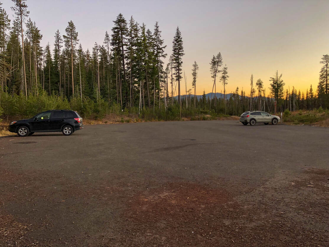
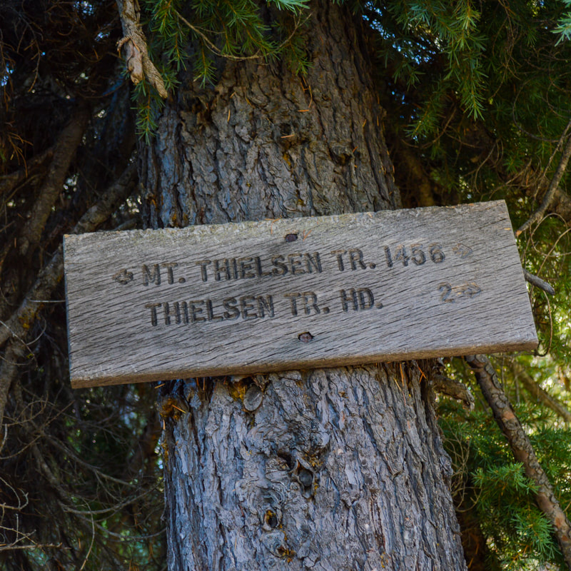
(the Mount Thielsen trailhead parking lot)

Description​:

Mount Thielsen is Southern Oregon's most difficult mountain to summit. It is honestly more of a climb than a hike, but there are various different stopping points, making the lower sections of this trail attainable for just about everyone. The last 80 feet to the summit are definitely not for the faint of heart and you should have some rock climbing experience before attempting it. 
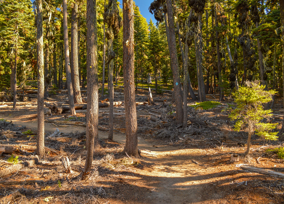
​The trail starts out through the woods as it gradually heads uphill. The first part of this trail is marked with blue diamonds on the trees because this area is also winter recreation friendly. You will cross seasonal Porcupine Creek and shortly after that, at the 1.4 mile mark, you will come to a trail junction.
Mt. Thielsen trailhead
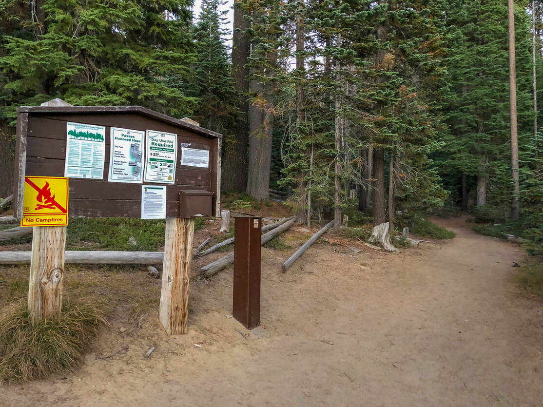
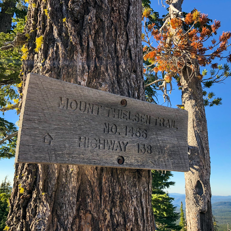
(Mount Thielsen trailhead)
Mt. Thielsen Trail 1456
Mt. Thielsen Wilderness sign
Spruce Ridge Trail junction sign
The trail to the left is the Spruce Ridge Trail, which in 2.5 miles will take you to the Howlock Mountain Trail (also a popular hike). You will follow the Mt. Thielsen Trail sign and continue straight. At the 3.75 mile mark you will have already gained 1,930 ft. of elevation and that is when you will come to the Pacific Crest Trail junction. To the left you will see PCT northbound and to the right PCT southbound. If you do not want to summit Mt. Thielsen but you want to enjoy the views and possibly also some backpacking, you can head northbound for just a little over 2 miles to Thielsen Creek, a beautiful camp spot along the PCT with a nice view of the mountain. 
Mt. Thielsen and PCT intersection
(sign at the PCT junction)
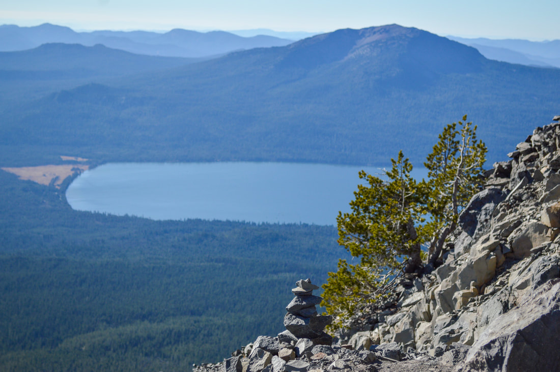
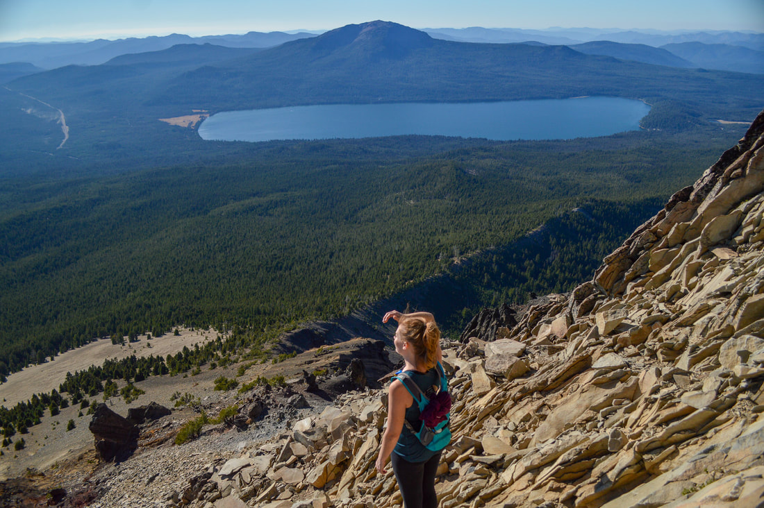
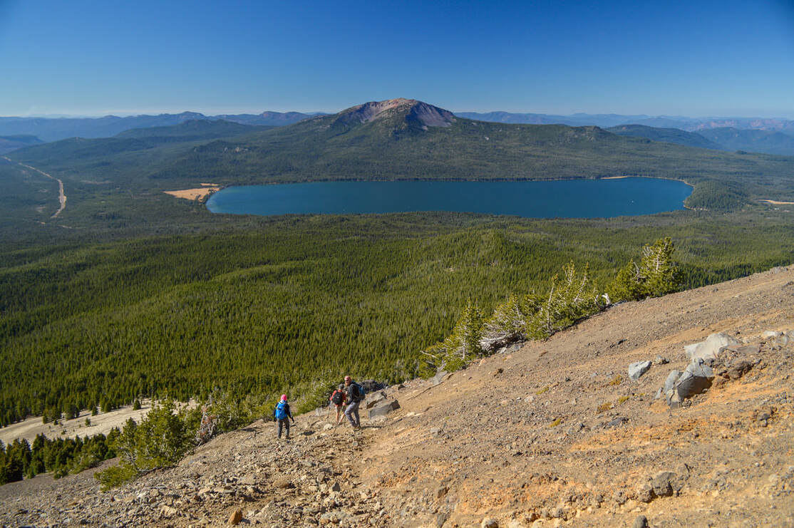
If you want to keep going on the Mt. Thielsen climber trail, continue straight through the PCT intersection. Just a little ways up the trail you will find an awesome viewpoint. This is where most people who do not want to summit the mountain will stop, enjoy a snack or lunch and turn around. At this point you will have gone 3.8 miles already, making it an 7.6 mile moderate level hike. 
Mt. Thielsen view from PCT trail junction
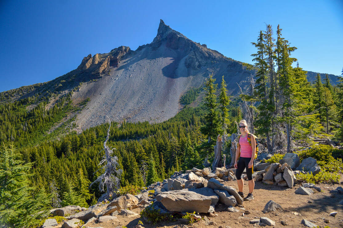
(Mount Thielsen viewpoint - good turn around spot if you don't want to summit)
Mt. Thielsen climber trail
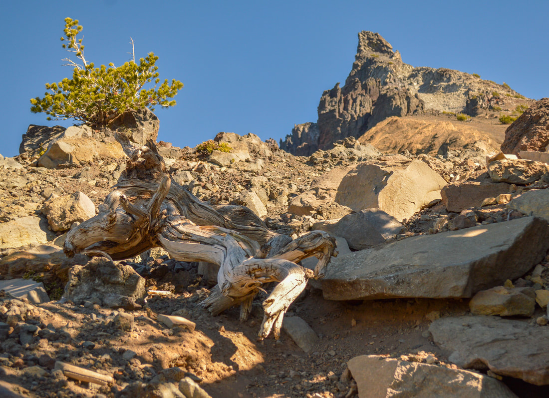
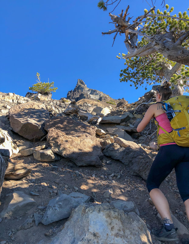
After the viewpoint is where the trail starts getting a little bit faint. There are multiple foot paths winding through the small trees until you get above tree line. From there on out it is just rocks and you have to know where you are going, otherwise you can easily end up on the wrong side of the mountain, which is not safe!
Taking a picture of Mt. Thielsen climber trail
Mt. Thielsen rock formations
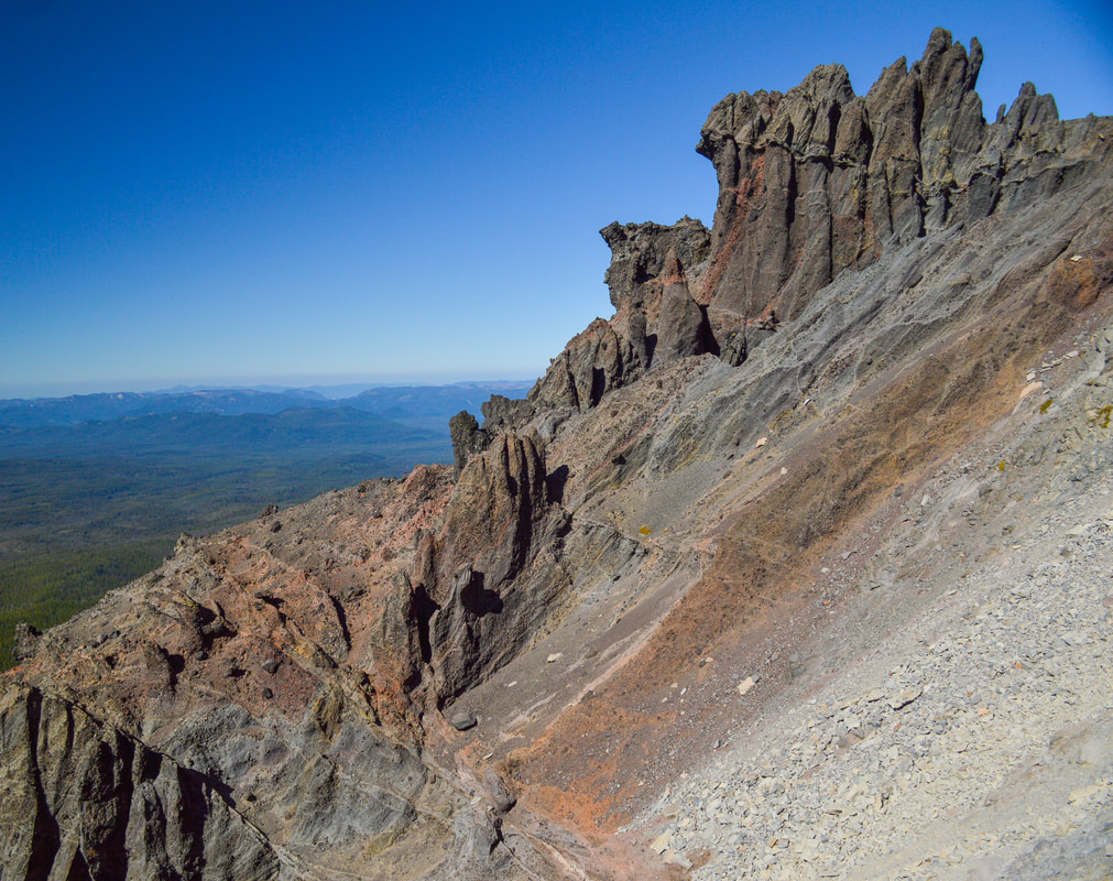
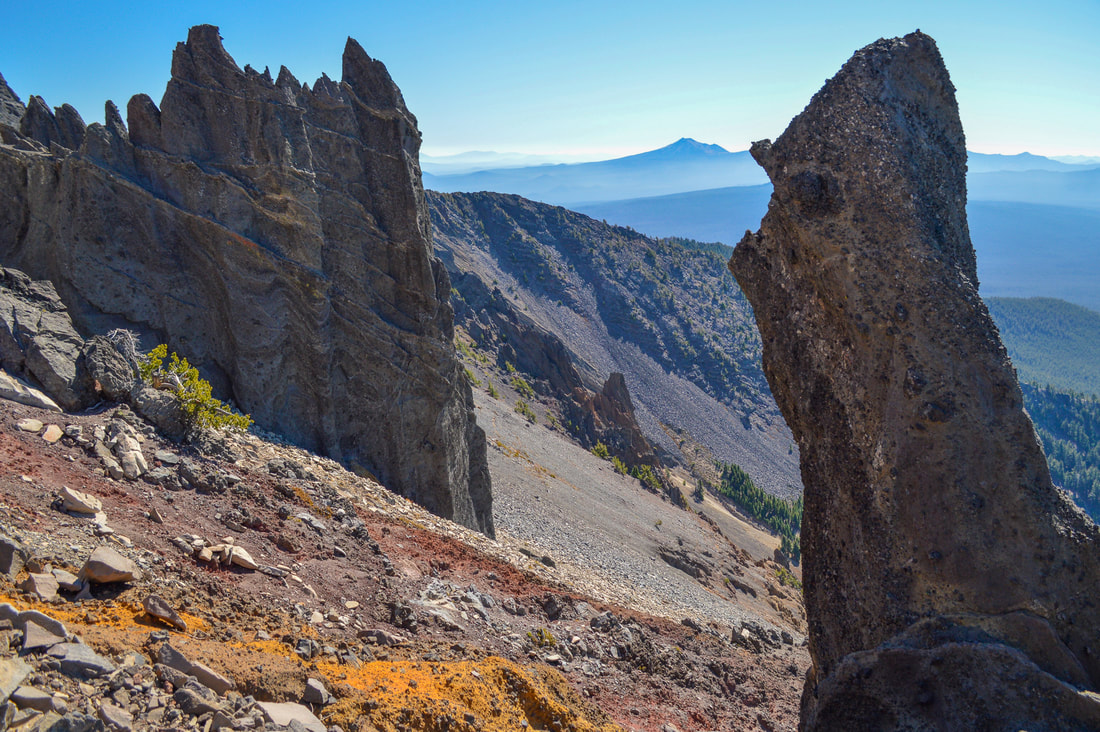
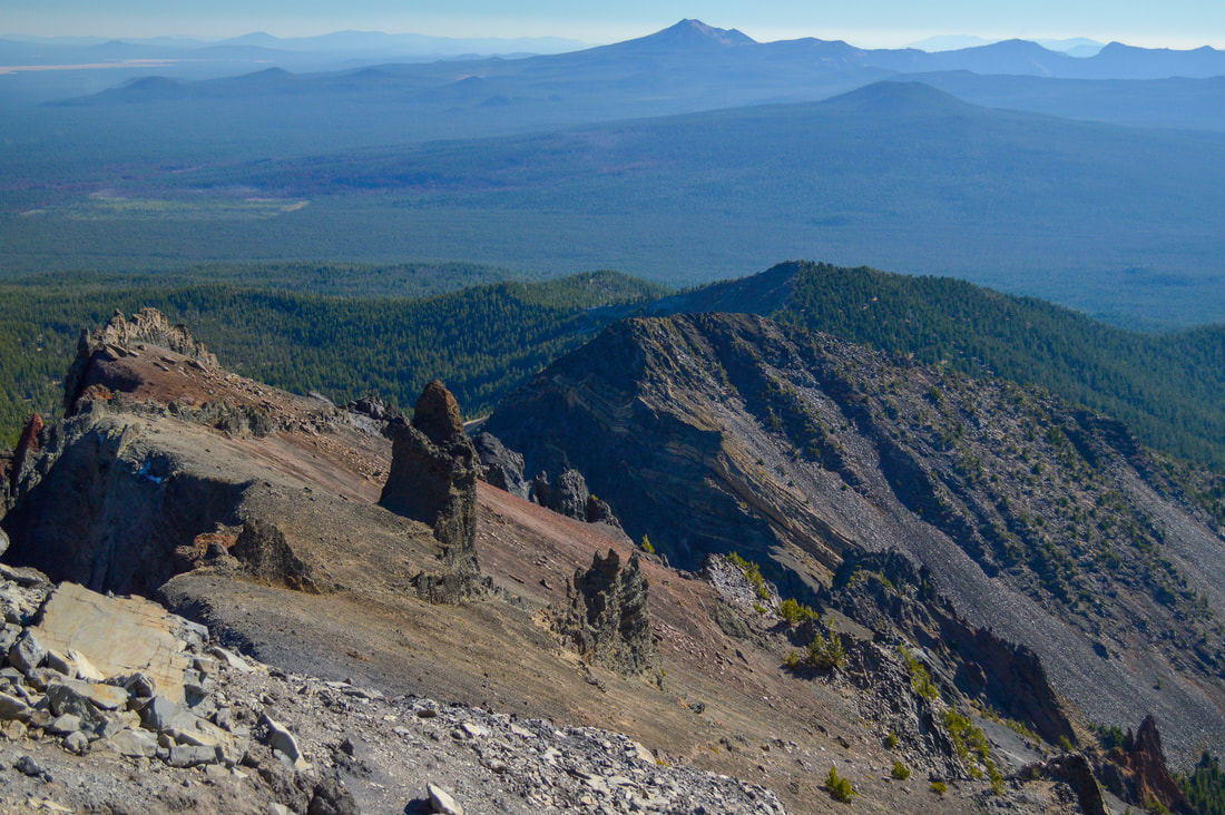
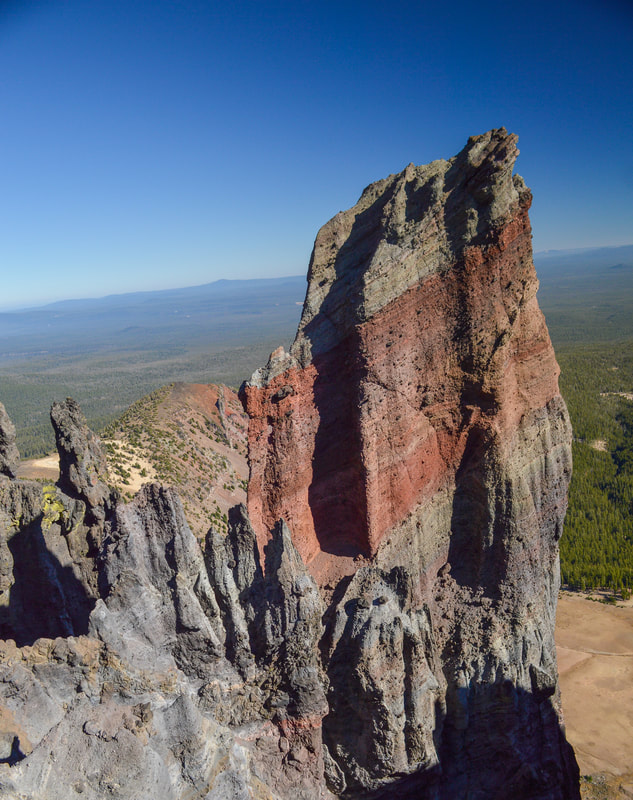
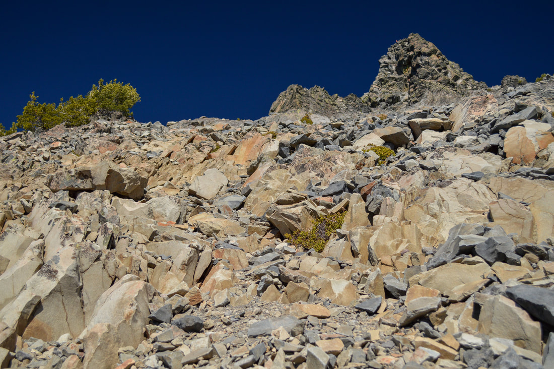
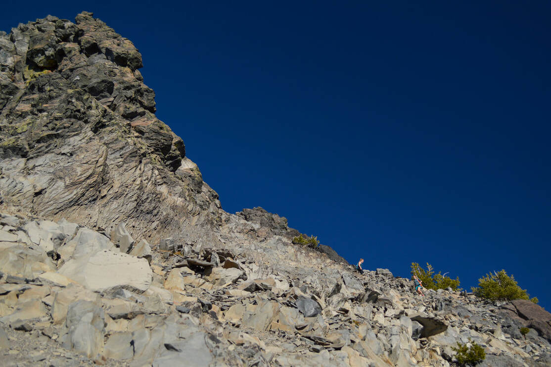
Above timberline you will start seeing all of the really neat rock formations that you don't really get to see when looking at the mountain from a distance. These large rock spires are red, orange and have slight hues of blue in them as well. 
Mt. Thielsen climber trail is very steep
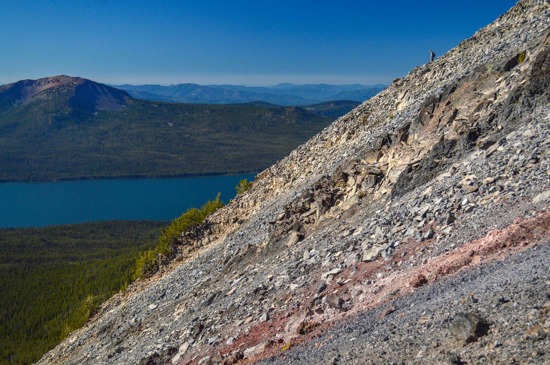
(this picture is a good depiction of just how steep it is)
Rock wall Mt. Thielsen
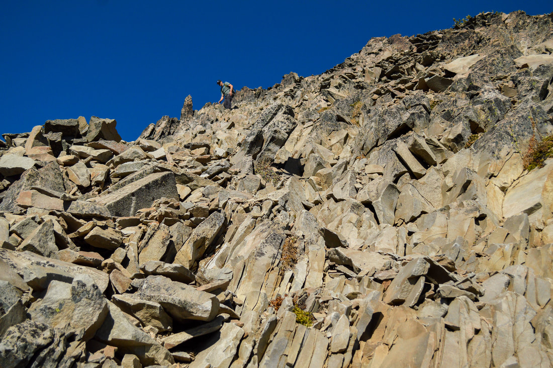
(the "rock wall" you need to climb to stay on the climbers route)
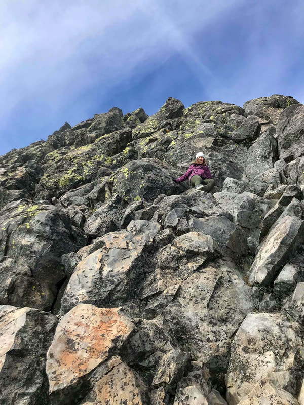
The rocky slopes of Thielsen are slippery and incredibly steep! At the 4.45 mile mark, the trail no longer becomes obvious at all as you are faced with what looks like a rock wall. It is not intuitive to want to climb up this, but this is indeed the route to take. If you take what looks like the "safer" route to the right, you will end up in a sliding scree field that is incredibly difficult to cross without sliding hundreds of feet downhill. Climbing up this "rock wall" is treacherous because the rocks are loose. If other hikers are coming down as you are going up, be very careful as their footsteps can send rocks flying at your head. There are many hikers who climb Thielsen with helmets for this exact reason. 
climbing up Mt. Thielsen's rock wall
Top of Mt. Thielsen's rock wall view of Diamond Lake and Mount Bailey
view of Diamond Lake and OR-230 from Mt. Thielsen
After getting up the "rock wall" you will start seeing some rock cairns, as well as Thielsen's 80-foot spire. From here the trail wraps around the spire to the right as you climb up to what's known as "Chicken's Ledge". If you have made it to this point, you are by no means a chicken! It is quite an accomplishment to make it that far up the mountain and the views are incredible from 9,184 feet!
Chicken's Ledge Mt. Thielsen
(wrapping around the right side of the spire to Chicken's Ledge)
Mt. Thielsen's spire
(view of the spire from Chicken's Ledge - picture by Shaylene Murry)
survey marker Mt. Thielsen summit
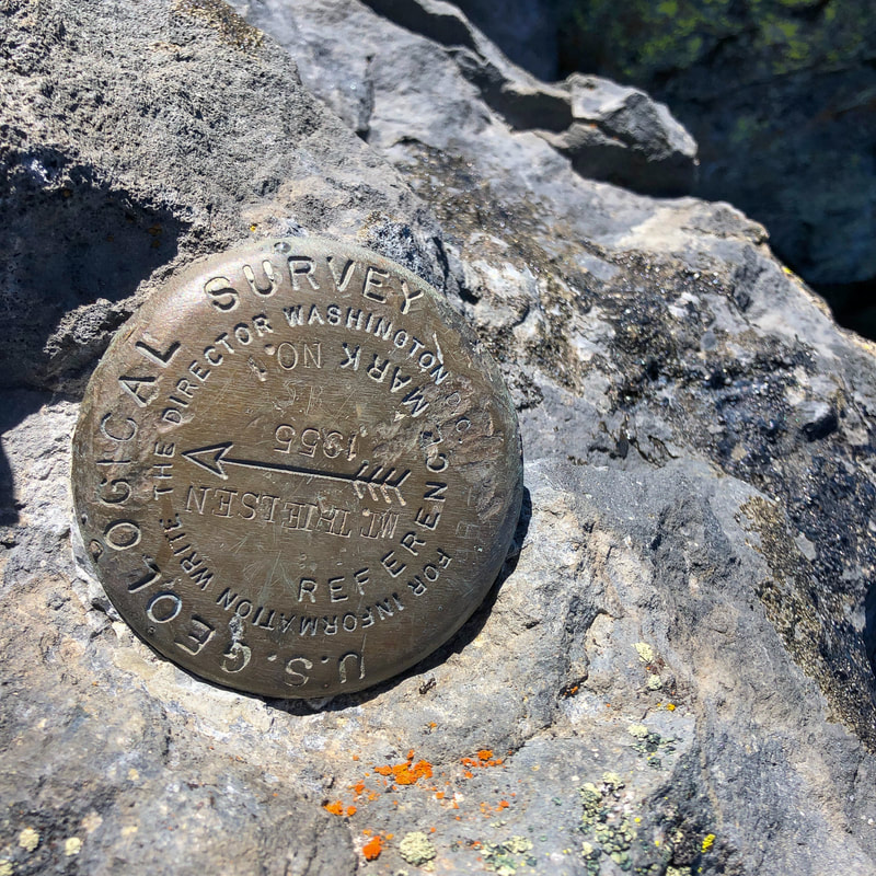
(geological survey market at the summit - picture taken by Nicole Butterfield)
If you are brave and skilled enough, from "Chicken's Ledge" you can continue on the last 80 feet up to the summit. This is a class 4-5.1 rock climb and you will have to be able to go up and come back down on your own. Some folks do bring ropes for this section. This is definitely NOT for the faint of heart and even just sitting at chicken's ledge can make most people dizzy. A fall from the spire can easily cost you your life. The summit of Mount Thielsen is not very big, so be careful if there are a lot of people climbing up at one time. From the top you will have 360 degree views of all of Southern Oregon. You can see Mount Bailey (which looks so tiny from up there), Diamond Lake, the rim of Crater Lake, Mount McLoughlin, Mount Shasta, Tipsoo Peak, Diamond Peak and on a very clear day even the Three Sisters. 
Mount Bailey and Diamond Lake from the summit of Mt. Thielsen
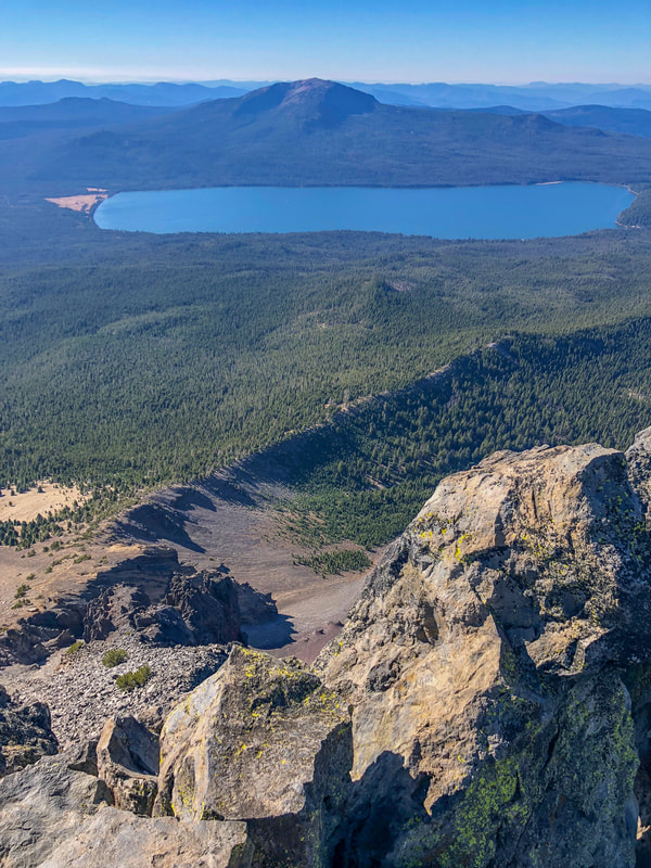
(Mount Bailey & Diamond Lake from the summit - picture taken by Nicole Butterfield)
Steep drop off from Mt. Thielsen summit
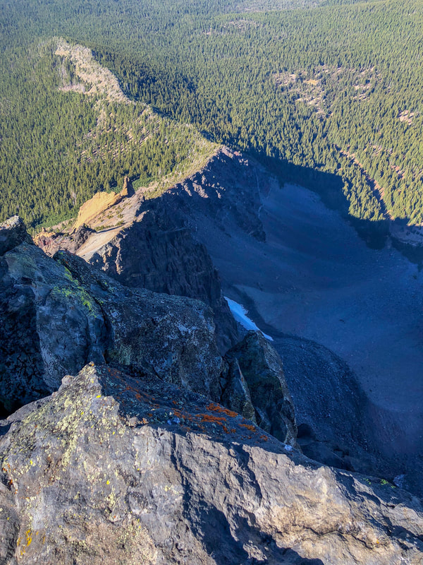
(steep drop off from the summit of Mount Thielsen - picture taken by Nicole Butterfield)
If you have summited Mount Thielsen, congratulations! It is one of the toughest Oregon Cascade mountains to climb. Be careful coming down the mountain as the rocks are loose and slippery and one can easily slip and fall, especially after the adrenaline rush from climbing the spire. Having collapsible trekking poles really help for climbs like this one because as soon as you have to use 3 points of contact, you can easily put your poles away. 
Mt. Thielsen summit view
(Mount Thielsen summit view - picture taken by Nicole Butterfield)
person on top of Mt. Thielsen
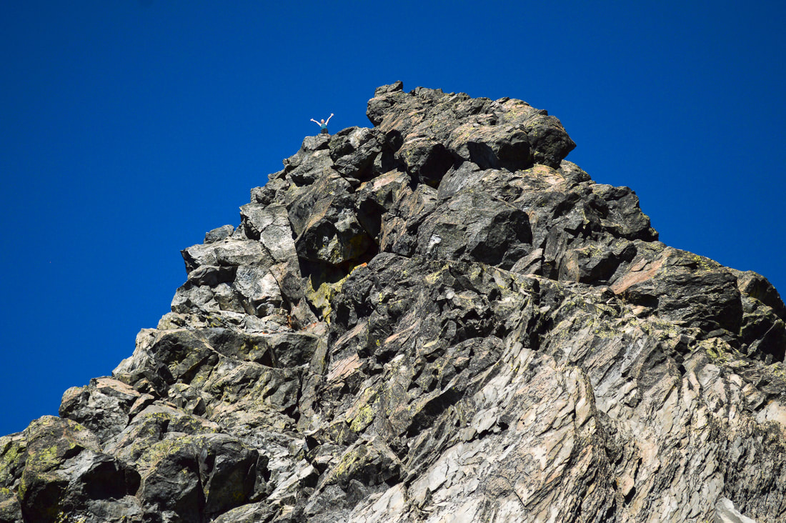
(a person on top of Mount Thielsen's spire)
Mount Thielsen's summit is not for the faint of heart or the inexperienced climber, but don't be discouraged if you didn't make it to the summit. There are so many stopping points along the way if the rocks, the steepness or the heights make it feel unsafe, or if weather conditions change. Mount Thielsen is known as the Lightning Rod of the Cascades and in the months of July and August there are frequent afternoon thunderstorms. Do not get caught above tree line during a storm! This summit climb is rated very difficult because of the lack of obvious trail, the loose rocks, and the class 4-5.1 rock climb you have to do to reach the top. ​​
Mount Bailey and Diamond Lake from Mt. Thielsen

Directions:

From Medford
  • Drive on OR-62 E for a total of 49.5 miles, then at a fork take a slight left onto OR-230 N and stay on this road for 23.8 miles. Turn left onto OR-138 W for 1.5 miles and find the trailhead on your right. (Total of 81.8 miles)
From Bend
  • Drive on US-97 S for 74.5 miles, then turn right onto OR-138 W and stay on this road for 19.2 miles. Find the trailhead parking lot on your right. (Total of 94.3 miles)
From Eugene
  • Drive on OR-58 for 86.2 miles, then merge onto US-97 S and stay on this road for 17.9 miles. Turn right onto OR-138 W and stay on this road for 19.2 miles. Find the trailhead parking lot on your right. (Total of 131 miles)
From Salem
  • Total of 192 miles via Eugene.
From Portland
  • ​Total of 236 miles via Eugene.
-This trail write-up was last updated June, 2022-
*All pictures unless otherwise marked are taken by Franziska Weinheimer.
*Disclaimer: The trail descriptions, mileage, GPS tracks and difficulty ratings depicted on this website are never 100% accurate. Always hike at your own risk, using your own knowledge, equipment and common sense. Franziska Weinheimer/Hike Oregon are not responsible if you or anyone in your party gets injured or lost while attempting one of these or any other hikes.

HIKED HERE RECENTLY? PLEASE LEAVE A TRIP REPORT BELOW:

© Hike Oregon 2023
P.O. Box 41911
​Eugene, OR 97404
Proudly powered by Weebly
  • Home
  • *Store*
  • About the author
  • How to use this site
  • Resources
    • Wildflowers
    • Videos
  • Best Oregon Hikes
    • Top Fall Foliage Hikes In Oregon
    • Top 10 Oregon Fall Hikes
    • 20 Best Oregon Waterfall Hikes
    • Top 10 Oregon Hikes for Kids
    • Sno-Parks In Central Oregon
    • Top 10 Oregon Winter Hikes
    • Top Low Elevation Winter Hikes
    • 9 Amazing Oregon Summit Hikes
    • 20 Central Oregon Day Hikes
    • 20 Epic Oregon Wildflower Hikes
    • 5 Weekend Backpacking Trips in Oregon
    • Top One Night Backpacking Trips in Oregon
    • Top 10 Oregon Summer Hikes
    • Top 10 Swimming Spots In Oregon
    • Top 10 Oregon Spring Hikes
  • Oregon Sno-Parks
    • Maxwell Sno-Park
    • Potato Hill Sno-Park
    • Ray Benson Sno-Park
      • Brandenburg Shelter
    • Santiam Sno-Park
    • Three Creek Sno-Park
    • Virginia Meissner Sno-Park
      • Meissner Shelter Loop
      • Nordeen Shelter
    • Gold Lake Sno-Park
      • Westview Shelter to Eagle Rock Overlook
      • Marilyn Lakes Loop
  • Southern Washington
    • Hamilton Mountain
    • Dog Mountain
    • Coyote Wall
    • Mount St. Helens
  • Portland
    • Powell Butte
    • Forest Park
    • Latourell Falls
    • Multnomah/Wahkeena Falls
    • Eagle Creek
    • Mitchell Point
    • Table Rock
    • Tamanawas Falls
    • Trillium Lake
    • East Zigzag Mountain (members only)
  • Salem
    • Abiqua Falls
    • Silver Falls State Park
    • Dome Rock
    • Marion Lake to Marion Mountain
    • Jefferson Park
  • Corvallis
    • Marys Peak East Ridge
    • Marys Peak North Ridge
    • Alsea Falls and Green Peak Falls
    • Corvallis to Sea Trail - Sugarbowl Creek segment (members only)
  • Sweet Home
    • Crescent Mountain
    • Iron Mountain
    • McDowell Creek Falls
    • Middle Santiam River (members only)
    • Lower Soda Creek Falls (members only)
    • Rooster Rock (members only)
  • McKenzie Bridge/Blue River
    • Macduff Mountain
    • Proxy Falls
    • Clear Lake
    • Sahalie/Koosah Falls
    • Blue Pool
    • Erma Bell Lakes
    • Olallie Mountain
    • Horsepasture Mountain
    • Tidbits Mountain
    • Castle Rock
    • Lowder Mountain (members only)
    • East Fork Trail (members only)
    • Rainbow Falls Overlook (members only)
    • Frissell Point (members only)
    • Chucksney Mountain (members only)
    • Substitute Point (members only)
  • Sisters/Santiam Pass
    • Coffin Mountain
    • Trappers Butte and Scar Mountain
    • Maxwell Butte
    • Black Butte
    • Whychus Creek Trail
    • Tam McArthur Rim
    • Black Crater
    • Scott Mountain
    • Obsidian Trail
    • Metolius Preserve
    • Three Fingered Jack Loop
    • Square Lake
    • Canyon Creek Meadows
    • Patjens Lakes
    • Craig Lake (members only)
    • Chush Falls (members only)
    • Rockpile Lake (members only)
    • Santiam Lake (members only)
    • Camp Lake (members only)
    • Park Meadow to Golden Lake (members only)
  • Bend/Redmond/LaPine
    • Steins Pillar
    • Chimney Rock
    • Steelhead Falls
    • Tumalo State Park
    • Tumalo Falls
    • Tumalo Mountain
    • No Name Lake
    • Green Lakes
    • Moraine Lake
    • South Sister Summit
    • Horse Lake
    • Muskrat Lake
    • Paulina Peak
    • Peter Skene Ogden Trail (members only)
  • Eugene
    • Ridgeline Trail
    • Mount Pisgah Summit
    • Mount Pisgah Arboretum
    • Shotgun Creek
    • Mount June
    • Lawler
    • Tire Mountain
    • Goodman Creek
    • Brice Creek
    • Trestle Creek Falls
    • Moon Falls
    • Elijah Bristow State Park
    • South Willamette Trail (members only)
    • Eula Ridge (members only)
    • Eagle's Rest (members only)
  • Oakridge
    • Deception Creek
    • North Salmon Creek
    • Grasshopper Ridge
    • Larison Creek
    • Bunchgrass Ridge
    • Salt Creek Falls
    • Waldo Lake Loop
    • South Waldo Loop
    • The Twins
    • Rosary Lakes
    • Yoran Lake
    • Fawn Lake
    • Windy Lakes
    • Divide Lake
    • Diamond Peak Summit
    • Cowhorn Mountain
    • Wall Creek Warm Springs (members only)
    • Moon Point (members only)
    • Bobby Lake (members only)
    • Lillian Falls (members only)
    • Middle Fork Willamette Trail (members only)
    • Pool Creek Falls (members only)
    • Dead Mountain (members only)
    • Larison Rock (members only)
    • Quinn Lakes & Eddeeleo Lakes (members only)
    • Waldo Mountain Lookout (members only)
    • Blair Lake to Spring Prairie (members only)
    • Rigdon Lakes loop (members only)
  • Oregon Coast
    • Cascade Head
    • Drift Creek Falls
    • Sweet Creek Falls
    • Beaver Creek Falls
    • Kentucky Falls
    • Hobbit Trail to Heceta Head
    • Valley Trail to China Creek
    • North Fork Smith River (members only)
    • Cummins Ridge (member's only)
    • Horse Creek (members only)
    • Siltcoos Lake (members only)
  • Southern Oregon
    • Fall Creek Falls
    • Watson Falls
    • Wild Rogue Loop
    • Mt. Thielsen
    • Crater Lake National Park
      • The Watchman
      • Mount Scott
      • The Pinnacles
    • Lower Table Rock
    • Pilot Rock
    • Wagner Butte
    • Mt. McLoughlin
    • Lemolo Falls (members only)
    • Fern Falls (members only)
  • Eastern Oregon
    • Painted Cove
    • Anthony Lake Loop
    • Mount Howard
    • Eagle Cap summit
    • Schneider Cabin (members only)
    • Strawberry Lake & Strawberry Falls (members only)
  • Oregon PCT sections
  • Tips & Tricks
    • Leave No Trace
    • How To Pick The Right Backpacking Tent
    • Top Tips For Hiking With Infants And Toddlers
    • Poison Oak, Ivy and Sumac
    • How to dress for cold weather hikes
    • Outdoorsy Holiday Gift Guide 2022
    • Hiker Holiday Gift Guide 2019
    • Outdoor Holiday Gift Guide 2018
    • Hiking Holiday Gift Guide 2017
  • Reviews/Gear
    • Stay Kühl This Summer
    • Outdoor Herbivore Backpacking Food Review
    • Osprey Aura AG 65 Backpack review
    • Big Agnes Fly Creek UL2 review
    • REI Quarter Dome 1 review
  • Adventure Stories
    • Hiking The Rae Lakes Loop
    • 110 Miles on the PCT
    • Three Fingered Jack Adventures
    • Jefferson Wilderness