Lower Table Rock
Hike details:
Mileage: 4 miles out and back w/ 850 ft. elevation gain
Approximate hike time: 2 hours w/ an average pace of 2mph
Difficulty: Easy
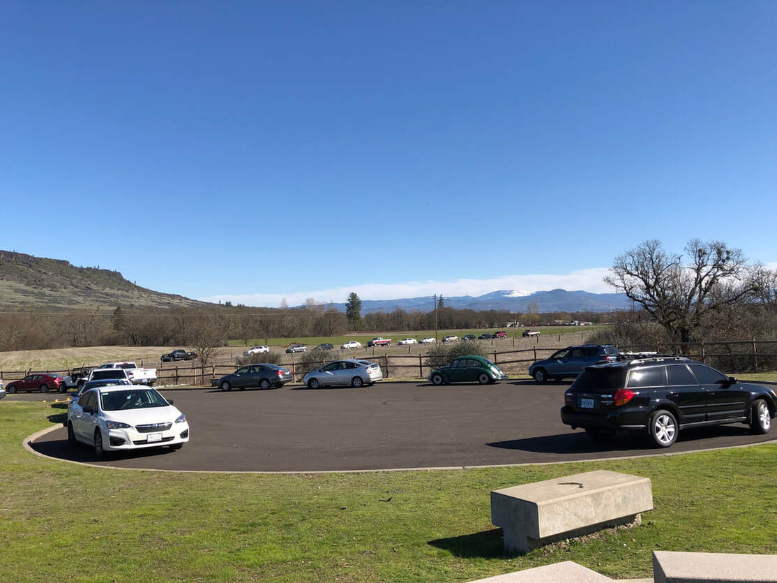
Trail usage: Medium on weekdays, very high on sunny weekends
Highest elevation: 2,038 ft. Lowest elevation: 1,211 ft.
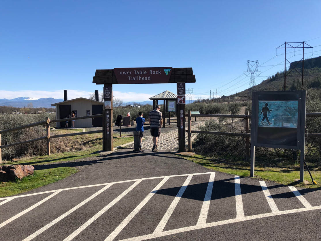
General location: 12 miles north of Medford off of Table Rock Road
Accessible: Year-round
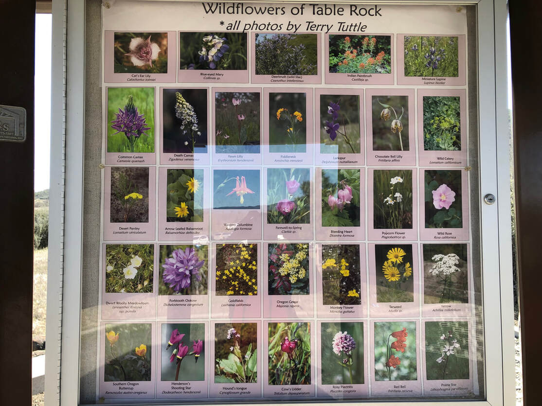
(Best time to go is end of March, April and early May when the wildflowers are blooming).
Permits required: N/A
Pit toilet at trailhead: Yes
Trail allows: N/A - DOGS ARE NOT ALLOWED ON THIS TRAIL!!!
Possible dangers: Steep drop offs at the top
Approximate hike time: 2 hours w/ an average pace of 2mph
Difficulty: Easy
Trail usage: Medium on weekdays, very high on sunny weekends
Highest elevation: 2,038 ft. Lowest elevation: 1,211 ft.
General location: 12 miles north of Medford off of Table Rock Road
Accessible: Year-round
(Best time to go is end of March, April and early May when the wildflowers are blooming).
Permits required: N/A
Pit toilet at trailhead: Yes
Trail allows: N/A - DOGS ARE NOT ALLOWED ON THIS TRAIL!!!
Possible dangers: Steep drop offs at the top
|
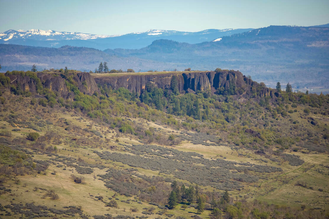
Description:Lower Table Rock is an easy hiking trail close to Medford and Central-Point which features spectacular views of the nearby Siskiyou and Cascade Mountain ranges. Both Lower and Upper Table Rocks have 125 foot thick andesite capping the mesas, which are remnants of lava that flowed down the Rogue River Valley about 9.6 million years ago. Geologists suspect that the Table Rocks are U-shaped because of how the river originally curved.
|
|
|
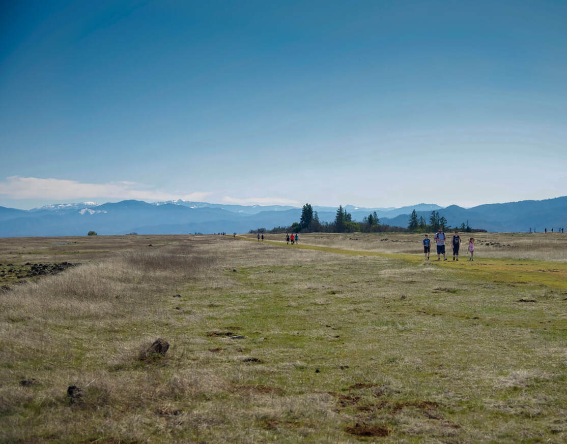
On beautiful spring weekends, the parking lot fills up pretty fast as people from all over the valley flock to these easy hikes to see the beautiful views and the wildflowers. Some of the wildflowers such as the Douglas Grasswidow start to bloom in mid-March, announcing the arrival of spring weather. Most of the other flowers don't fully bloom until mid-April and into May. The trail starts out through an Oak savannah on a pretty wide grave trail.
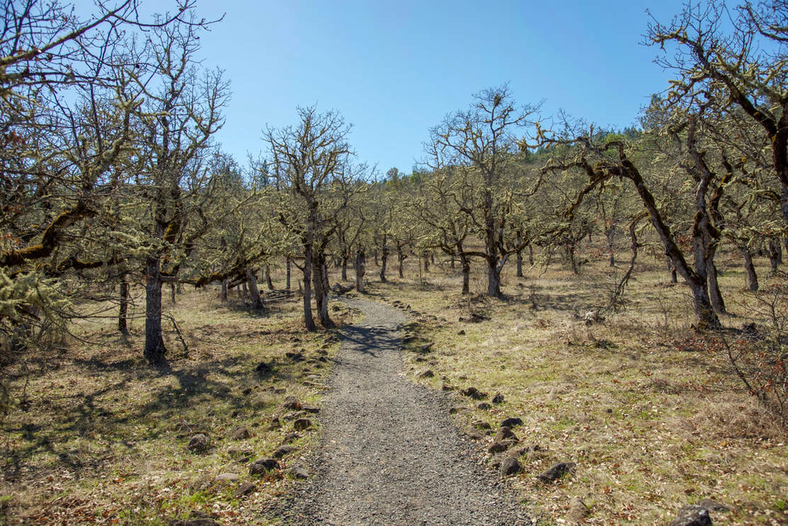
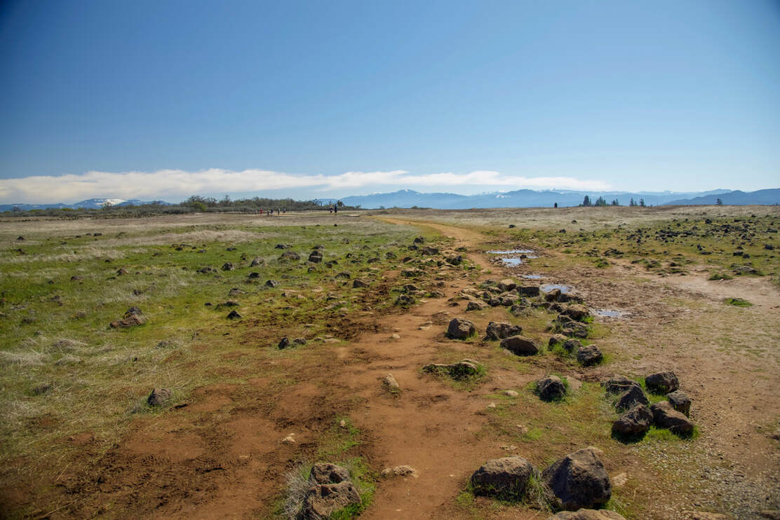
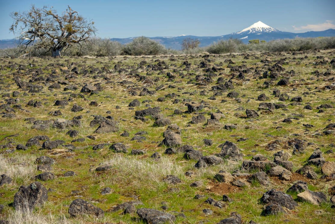
The trail then gets more narrow, rocky and enters a forest full of Madrone and Black Oak trees until you come the rocky plateau. In the winter and early spring there are some pools here which tend to dry up by May. If you are up there in the early evening or the very early morning, you will hear hundreds of frogs. You will notice what looks like an old road going straight to the south end of Lower Table Rock. You will also see a trail leading to the east where you will see a great viewpoint of Mt. McLoughlin.
|
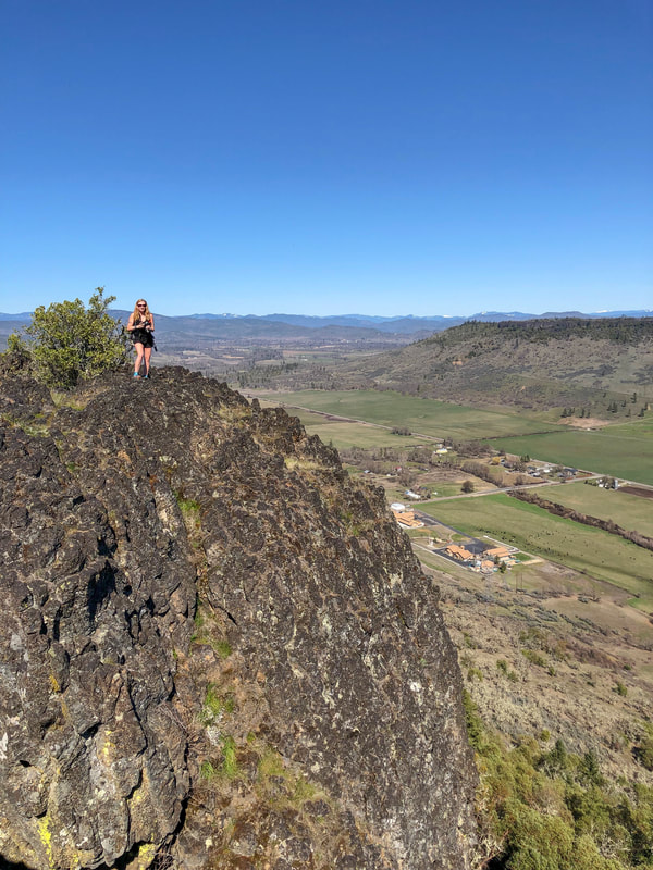
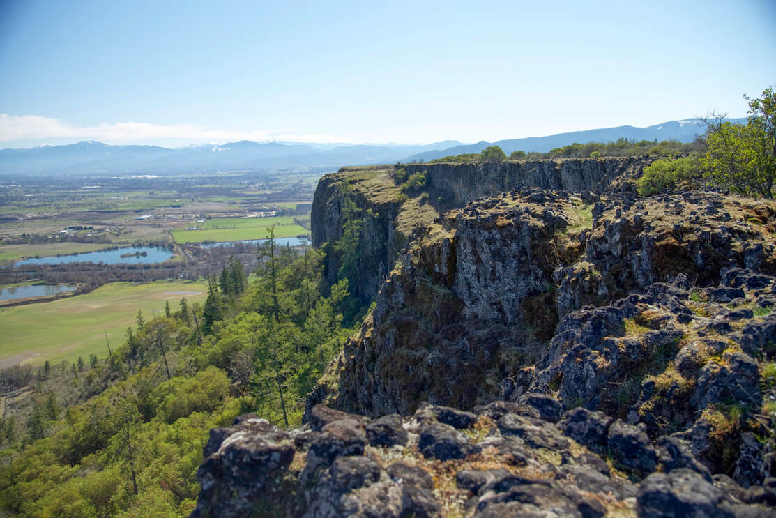
If you have kids with you, be careful at the cliff edges as they are steep and fall up to 800 down. From the eastern viewpoint, you can see Upper Table Rock as well as the Cascade Mountain range in the distance. The crowning jewel is Mount McLoughlin which looks very close. Down below, you will see many farms and vineyards. The Rogue Valley is known for its amazing wine!
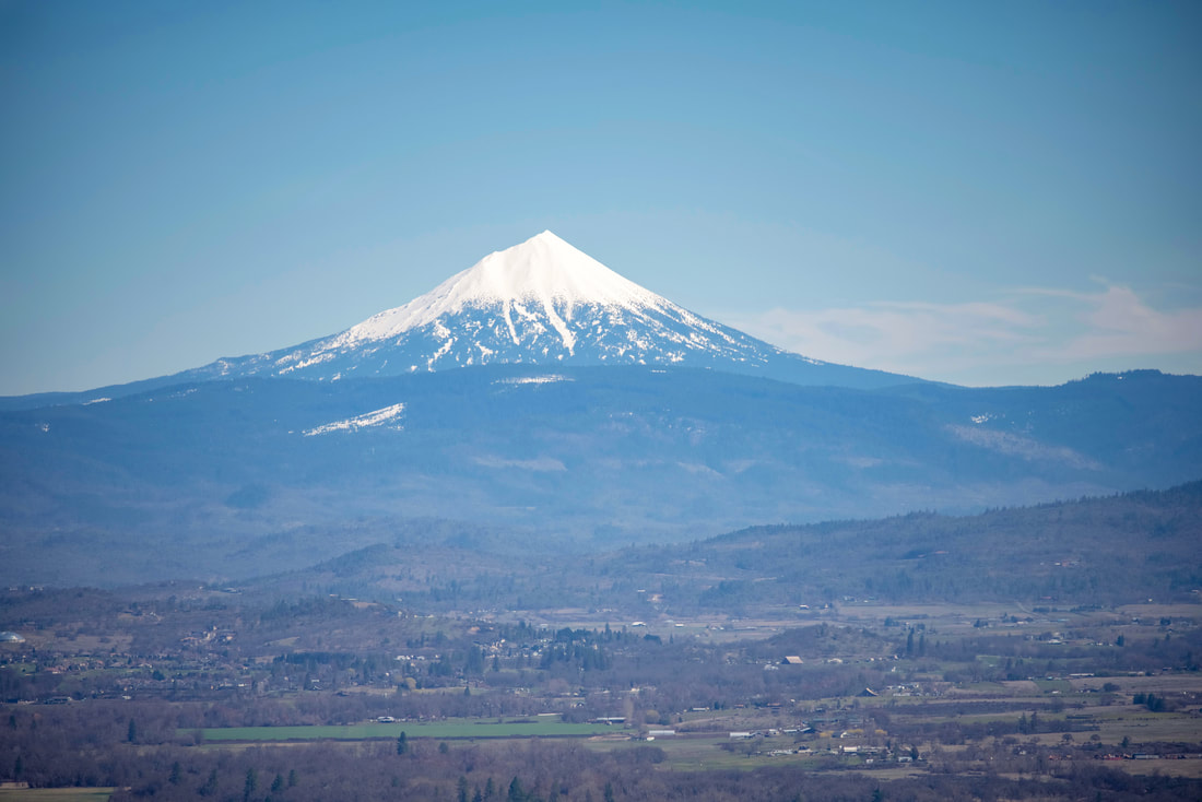
(Mount McLoughlin)
|
(view of Upper Table Rock)
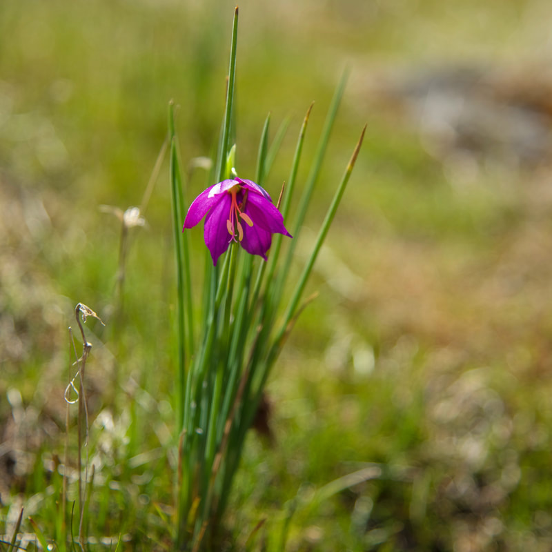
(Douglas grasswidow flower)
|
After you have done a little loop checking out the eastern viewpoints, you will connect back with the old road. This road actually turns into what used to be an airstrip and goes all the way to the end of Lower Table Rock. Here there is a viewpoint of the winding Rogue River below and the snow covered Siskiyou Mountain range south of Medford.
Overall, this is an easy hike filled with history and beautiful spring wildflowers. Because Lower Table Rock is a bit harder and steeper of a trail than Upper Table Rock, many use this trail for training and you will see many going up and down with backpacks and/or trail running. The trail starts off gravel but quickly turns rocky. But even though it is rocky, it is recommended for young and old and for most ability levels. Sturdy shoes and hiking poles can help tremendously. |
Directions:
From Medford
- Drive I-5 north and take exit #33 for Central Point. Head east on East Pine Street for 1 mile. Turn left on Table Rock Road and drive 8 miles to Wheeler Road and turn left. The trailhead is located another 0.5 mile on the left. (Total of 12 miles)
- Drive I-5 south towards Medford for 153 miles. Take exit 40 toward Access Rd. Turn left on Access Rd. then turn left onto OR-99 N/2nd Ave/Gold Hill Spur for 0.4 miles. Turn right onto Dardanelles St/Rogue-Umpqua Scenic Byway and then turn right onto 4th Ave. for 0.2 miles. Continue onto OR-234 E/Rogue-Umpqua Scenic Byway for 6.1 miles, turn right onto Gresham Lane for 1 mile and then turn right onto Wheeler Rd. for 0.8 miles. The trailhead will be on your right. (Total of 164 miles)
- Drive US-97 south for 74.5 miles then turn right onto OR-138 west for 17.8 miles. Near Diamond Lake turn left onto OR-230 south for 23.7 miles. Continue straight onto OR-62 west for 41.4 miles then turn right onto OR-234 west for 6.8 miles. Turn left onto Table Rock Rd. for 2 miles, turn right onto Wheeler Rd. for half a mile, then find the trailhead on your left. (Total of 167 miles)
- Total of 226 miles via Eugene.
- Total of 268 miles via Eugene.
|
To get a more in-depth and personal view of this hike, watch the YouTube video.
|
-This trail write-up was last updated June, 2022-
*All pictures are taken by Franziska Weinheimer *Disclaimer: The trail descriptions, mileage, GPS tracks and difficulty ratings depicted on this website are never 100% accurate. Always hike at your own risk, using your own knowledge, equipment and common sense. Franziska Weinheimer/Hike Oregon are not responsible if you or anyone in your party gets injured or lost while attempting one of these or any other hikes.
|