20 Central Oregon Day Hikes
that don't require a limited entry permit
In 2020 the Forest Service implemented the Central Cascades Wilderness Permit system, that requires you to pre purchase a limited entry permit for day hikes for 19 trailheads and for overnight trips for ALL trails in the Three Sisters, Mount Washington and Mount Jefferson Wildernesses. You are required to get permits from recreation.gov from June 15 - October 15 every year, and most of the day hike and overnight permits sell out within minutes of being released on the website. This makes it extremely difficult for folks to plan summer day hikes in Central Oregon, so I put together this list of incredible Central Oregon day hikes that don't require you to pre purchase a permit online, so that you can go hiking spontaneously as your schedule, the weather, snowmelt and wildflower blooms allow. **Keep in mind that just because these hikes don't require you to purchase a day use permit, many of these hikes do require a permit for overnight use, so if you are wanting to backpack, please plan accordingly.
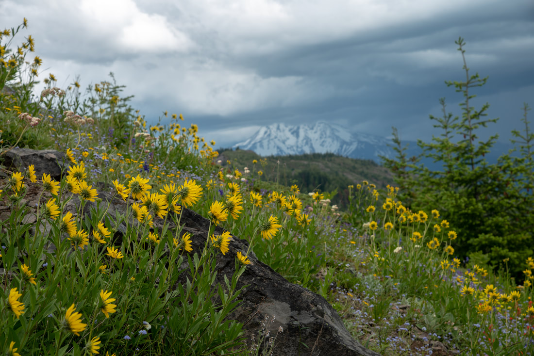
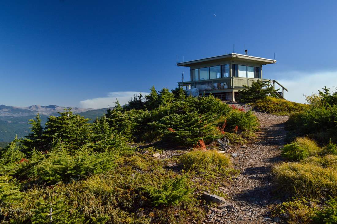
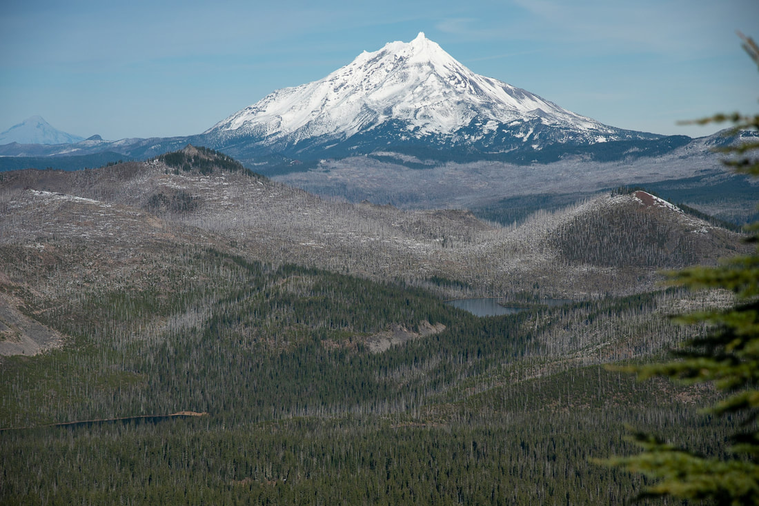
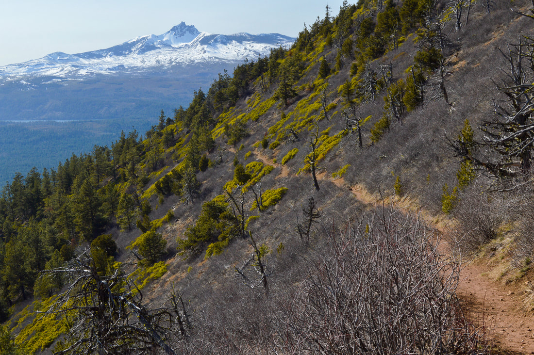
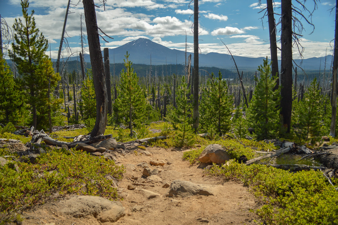
1) Coffin Mountain
|
|
Closest town: Sweet Home & Idanha
Hike features: Summer wildflowers, mountain views, fire lookout
Mileage: 2.75 miles round trip w/ 1,100 ft. elevation gain
Difficulty: Moderate
Trail usage: High on weekends during wildflower blooms, low on weekdays and during the fall
Best time to hike this trail: July for best wildflower viewing
About the hike: This area (the old Cascade Crest) is one of the best places for wildflower viewing in July. Coffin Mountain, Bachelor Mountain and nearby Cone Peak are all known for epic wildflower blooms. Coffin Mountain has a spectacular view of Mt. Jefferson and the Three Sisters as you make your way up to the fire lookout through massive meadows full of bear grass. From the summit you can also see Detroit Lake to the north and the thousands of acres that were burned in the Lionshead and Beachie Creek fires of 2020.
(Click here for more information and directions)
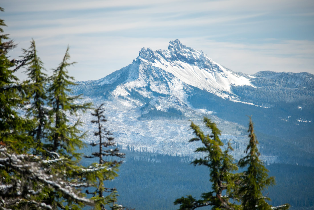
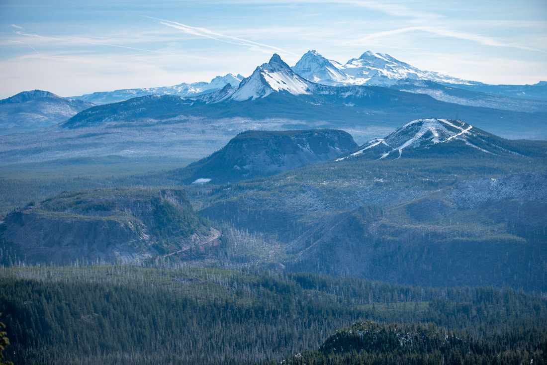
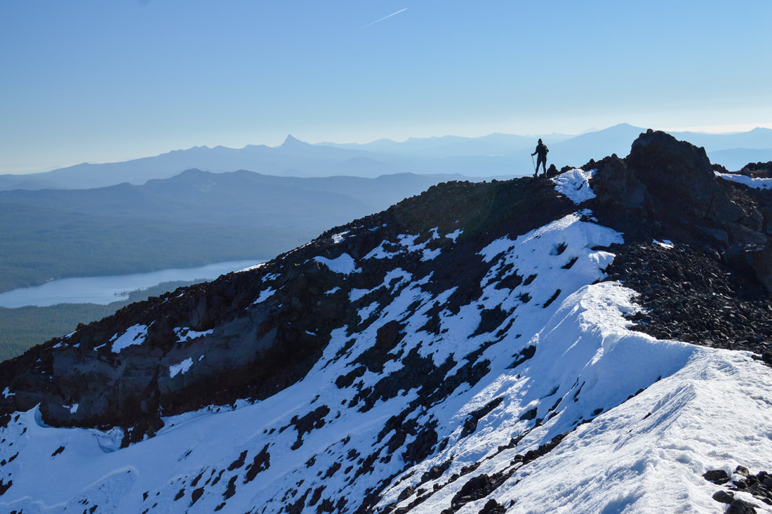
2) Trappers Butte & Scar Mountain
Closest town: Idanha
Hike features: Mountain views Mileage: 6 miles round trip w/ 1,670 ft. elevation gain (to Trappers Butte summit) 10.6 miles round trip w/ 3,000 ft. elevation gain (to Scar Mountain summit) Difficulty: Moderate to difficult Trail usage: Low Best time to hike this trail: August to early December About the hike: If you want to avoid the crowds of Iron Mountain and Coffin Mountain but still stay in the Old Cascade Crest area, this is the trail for you! The hike can be a challenge as it has quite a bit of elevation change as it meanders along the ridge crest, but the views of Mount Jefferson, Three Fingered Jack, Mount Washington and the Three Sisters from both Trappers Butte and Scar Mountain are absolutely worth the the climb! (Click here for more information and directions) |
|
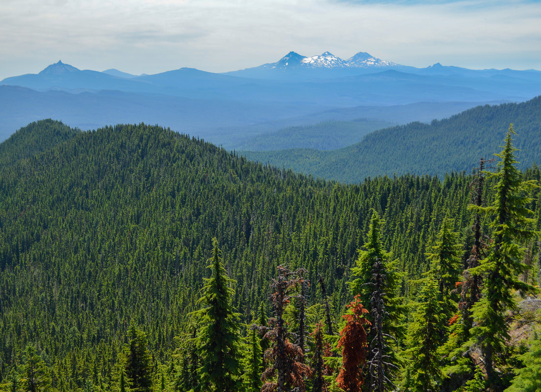
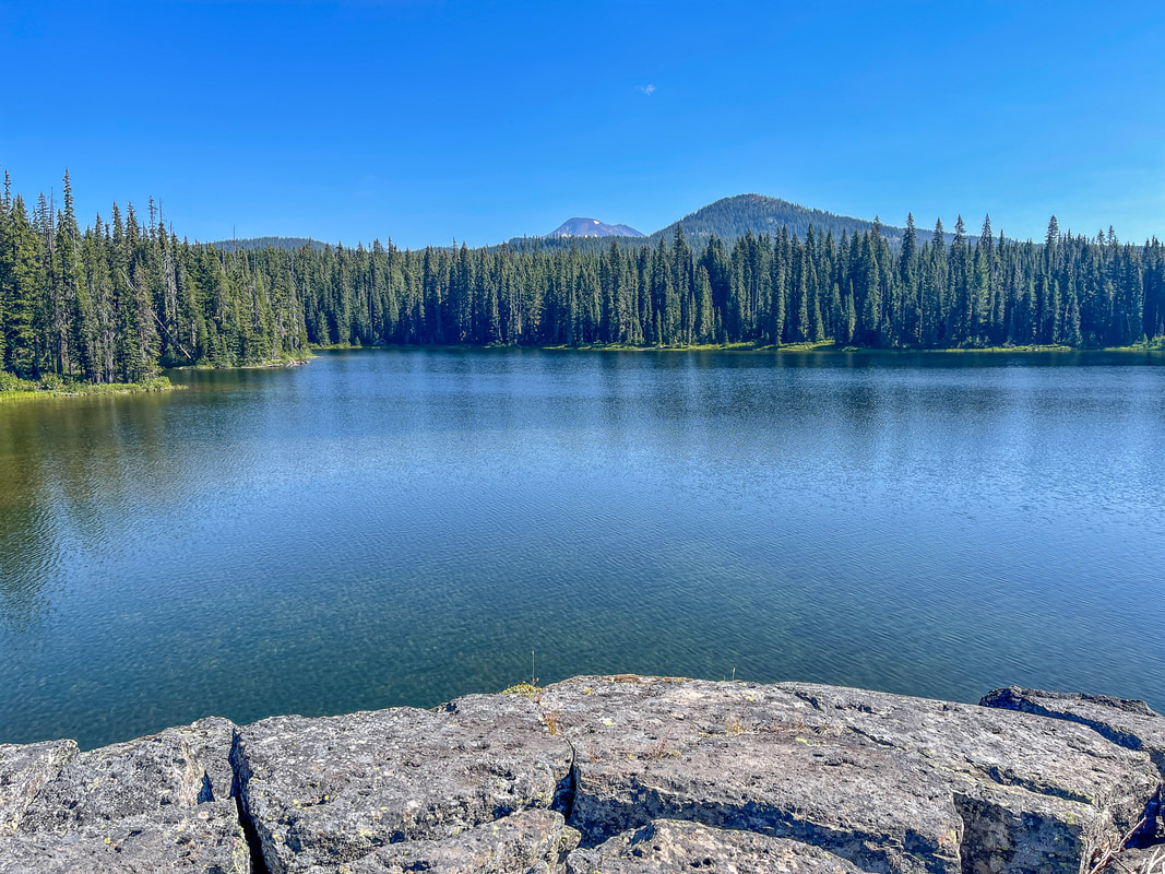
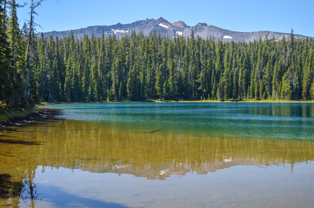
3) Maxwell Butte
|
|
Closest town: Sisters
Hike features: Some summer wildflowers, mountain views, lake
Mileage: 9.75 miles round trip w/ 2,515 ft. elevation gain
Difficulty: Difficult
Trail usage: Low
Best time to hike this trail: Mid-September through November for epic fall foliage.
About the hike: Maxwell Butte is one of the best view-laden hikes in the Santiam Pass area and it is most definitely worth the climb! The trail offers solitude, some summer wildflowers and you even pass by a lake. On the way up you will get views of Hoodoo, Mount Washington, the Three Sisters, Broken Top and Diamond Peak to the south and from the summit of Maxwell Butte you will have a close-up view of Three Fingered Jack, and to the north you will see Mount Jefferson and Mount Hood.
(Click here for more information and directions)
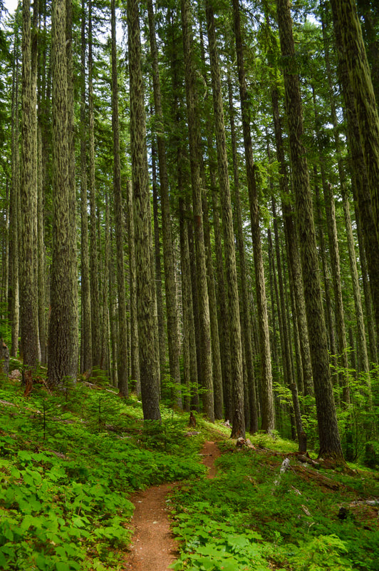
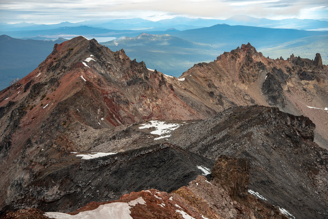
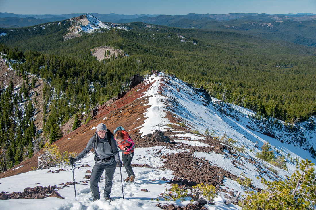
4) Crescent Mountain
Closest town: Sweet Home
Hike features: Summer wildflowers, lush old growth forest, mountain views Mileage: 9.3 miles round trip w/ 2,350 ft. elevation gain Difficulty: Difficult Trail usage: Low Best time to hike this trail: July for wildflowers. But there are also mosquitoes during that time. If you want to avoid the bugs and are just going for the views, September is the perfect time. About the hike: This hike is a seriously underrated wildflower hike also located in the Old Cascades. The trail takes you through a beautiful lush forest and then up to wildflower meadows with views of the Cascade Mountains. Wooden remains of an old fire lookout can be seen at the top. (Click here for more information and directions) |
|
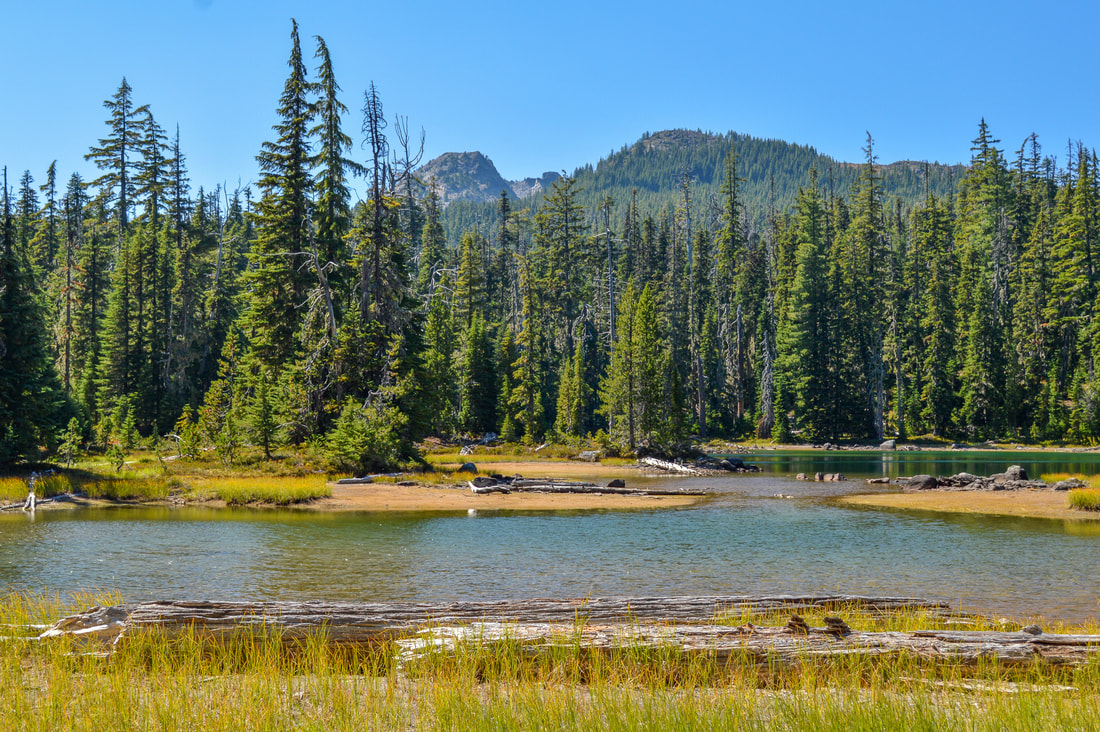
5) Square Lake & Booth Lake
|
|
Closest town: Sisters
Hike features: Summer wildflowers, mountain views, alpine lakes, backcountry camping
Mileage: 4.8 miles round trip w/ 550 ft. elevation gain (to Square Lake and back)
9.4 miles round trip w/ 860 ft. elevation gain (to Square Lake & Round Lake and back)
8.3 miles round trip w/ 1,100 ft. elevation gain (to Square Lake & Booth Lake and back)
Difficulty: Easy to moderate
Trail usage: Medium on summer weekends, low on weekdays
Best time to hike this trail: June and then again towards the end of September through November when the weather is cooler.
About the hike: The lakes on the southern edge of the Mount Jefferson Wilderness are beautiful and underrated. Due to the B&B Fire, the views through burnt snags are plentiful and you backcountry camping options are as well. Because there is no shade, it can get really hot in the summer months, but that makes it perfect for swimming in these deep blue alpine lakes.
(Click here for more information and directions)
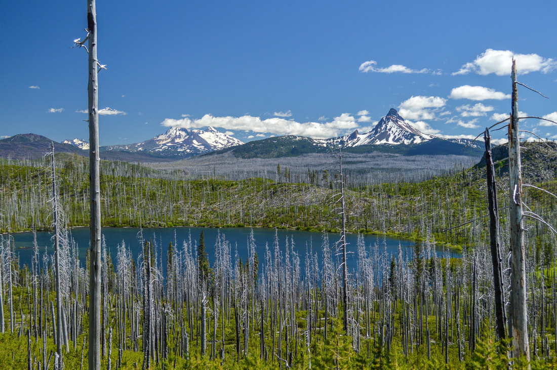
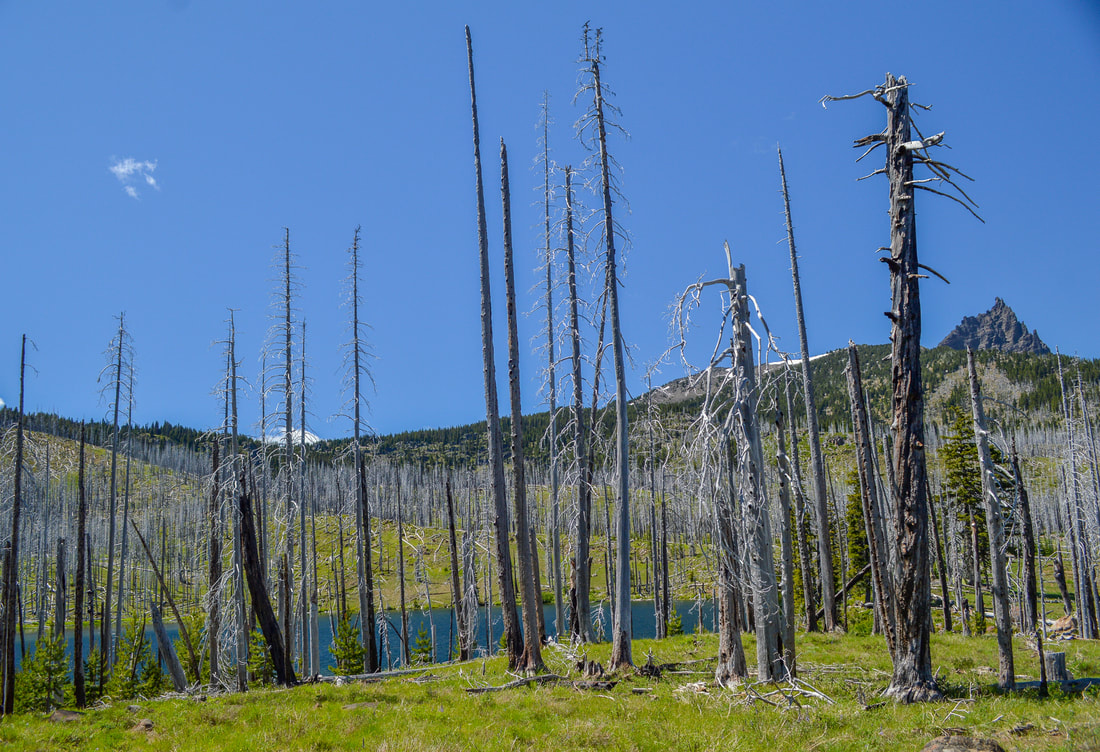
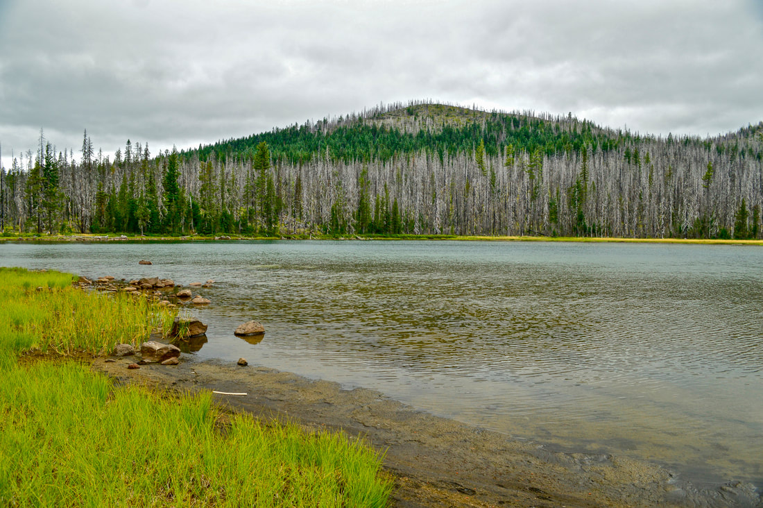
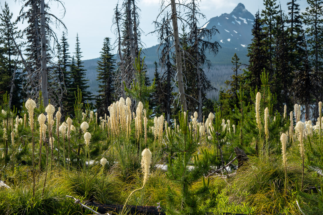
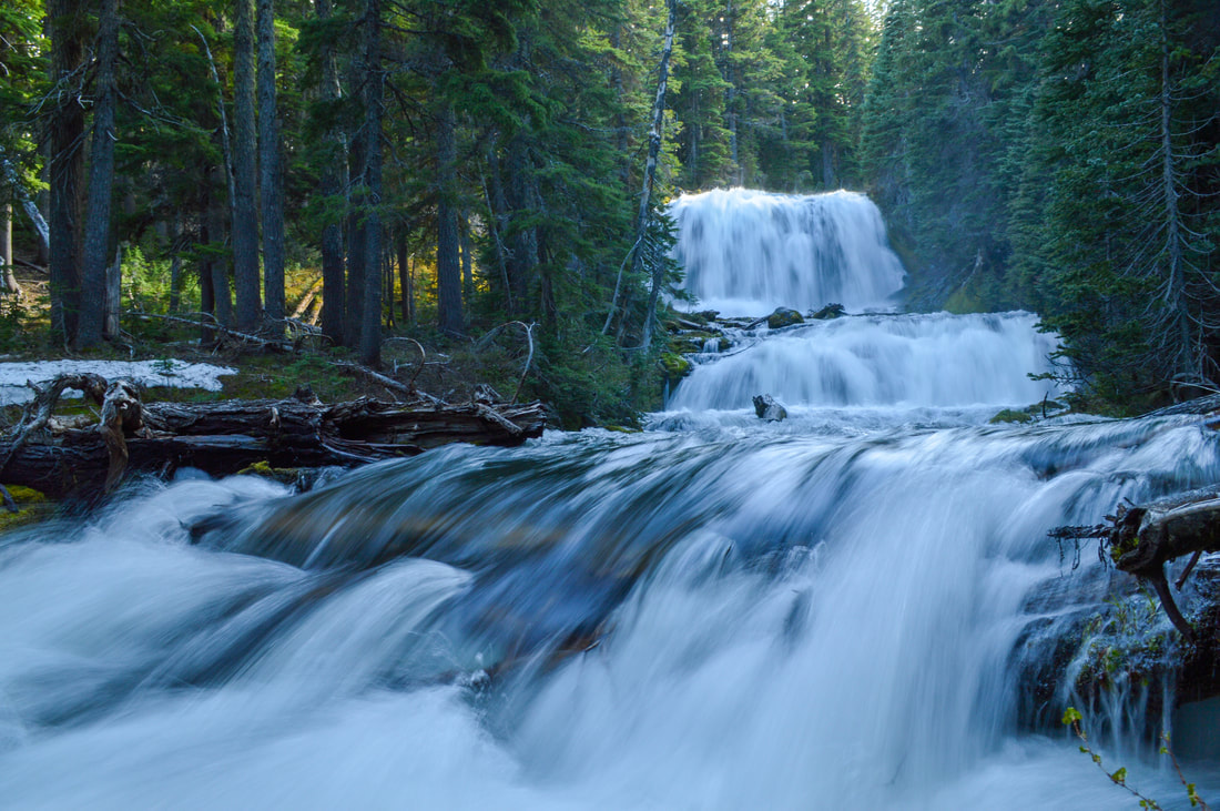
6) Patjens Lakes Loop
|
|
Closest town: Sisters
Hike features: Summer wildflowers, mountain views, alpine lakes, backcountry camping
Mileage: 6.8 mile loop w/ 845 ft. elevation gain
Difficulty: Moderate
Trail usage: Medium on summer weekends, low on weekdays
Best time to hike this trail: July for best wildflower viewing and September, October and early November when the fall colors are beautiful and the temperatures are cooler.
About the hike: This loop is perfect for the whole family and offers incredible mountain views, wildflower meadows and lakes that you can swim in. The scenery and landscape along this trail are varied as the trail takes you through old burn and green forest. Many different wildflowers pop up along the trail in July, like lupine, bear grass, Washington lily, scarlet gilia, penstemon, fireweed and many more.
(Click here for more information and directions)
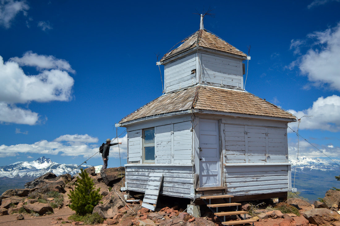
7) Black Butte
|
|
Closest town: Sisters
Hike features: Mountain views, fire lookouts
Mileage: 4 miles round trip w/ 1,600 ft. elevation gain
Difficulty: Moderate
Trail usage: Very high on summer weekends, high on summer weekdays, low during the spring and fall
Best time to hike this trail: June until the snow flies (usually early December)
About the hike: Black Butte has one of the best views in all of Central Oregon and you can get to the top in just 2 miles! The first part of the trail takes you through a beautiful ponderosa pine forest and once you crest the tree line, you will have spectacular views of the central Cascades. The 1923 cupola-style fire lookout is really neat to see and it is one of the few in this style that are still standing in Oregon. Because of the short trail and epic views, this trail is popular, especially in the summer, so going early in the morning is best.
(Click here for more information and directions)
8) Whychus Creek Trail
|
|
Closest town: Sisters
Hike features: Spring wildflowers, mountain views, small waterfall, creekside trail
Mileage: 6.4 miles round trip w/ 660 ft. elevation gain
Difficulty: Moderate
Trail usage: Medium
Best time to hike this trail: April and May for wildflowers, July and August for being able to splash in the creek water. October and November if you want to be able to cross the creek and continue on the Metolious Windigo Trail.
About the hike: This quaint trail is great for stretching your legs especially on days when you don't have a lot of time to go on an all day excursion. Even though it is short, this trail truly has everything, mountain views, wildflowers, lava rock and it follows the creek pretty much the entire time. The trail is great for the whole family and can be accessed year-round.
(Click here for more information and directions)
9) Chush Falls
|
|
Closest town: Sisters
Hike features: Mountain views, creekside trail, some wildflowers, waterfalls
Mileage: 5 miles round trip w/ 660 ft. elevation gain
Difficulty: Easy
Trail usage: Medium on summer and fall weekends, low on weekdays
Best time to hike this trail: June through early December
About the hike: This short but sweet hike takes you to Chush Falls located in the Three Sisters Wilderness. Along the way you will see some early summer wildflowers and on a clear day you can see that you are at the base of the Three Sisters and Broken Top. Whychus Creek rages below the trail, creating numerous beautiful pools and waterfalls.
(Click here to read more about this hike and to get directions- this post is for members only, you can purchase the seasonal membership for $9.99)
10) Black Crater
|
|
Closest town: Sisters
Hike features: Trail through burn scar, 360 degree mountain views
Mileage: 7.1 miles round trip w/ 2,325 ft. elevation gain
Difficulty: Moderate
Trail usage: Medium to high on summer weekends, low on weekdays
Best time to hike this trail: July, August and September. The road to the trailhead usually closes in mid-November.
About the hike: Because this trail takes you through the 2017 Milli Fire scar, you will get non-stop views the entire way to the summit. At the summit you will see the crater that this hike is named for, and the Three Sisters are so close you feel like you could reach out and touch them. To the south you will see the large lava flow, Mount Washington, Three Fingered Jack and Mount Jefferson. The red lava rock that you are walking on is very unique to this area and the silver wind blown trees often creak in the wind that whips around at the summit. This hike is not super difficult but it is steep so take your time, especially in the summer heat.
(Click here for more information and directions)
11) Tumalo Falls to Happy Valley
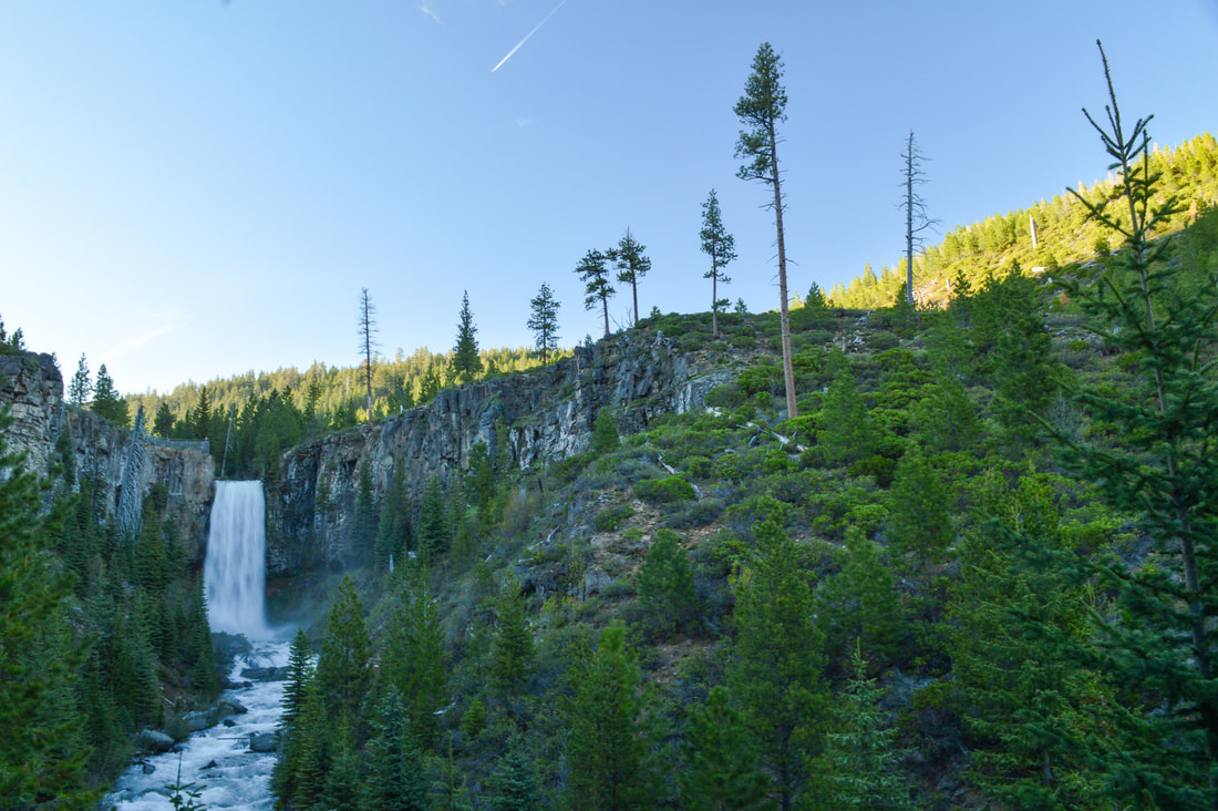
|
|
Closest town: Bend
Hike features: Creekside trail with multiple waterfalls, mountain views, backcountry camping
Mileage: 4 - 8.2 miles w/ up to 2,635 ft. elevation gain
Difficulty: Easy to moderate
Trail usage: High to very high from mid-May to mid-September, medium foot traffic in the fall
Best time to hike this trail: June, July, August, September
About the hike: Only 30 minutes from Bend, this is one of the most iconic waterfall hikes in all of Central Oregon and for good reason. This hike can be very short (to the viewing platform and back or up to the bridge), or you can make it into an 8 mile loop up to Happy Valley. Even if you're not up for an 8 mile hike, it is worth it to walk up river a bit because 98 foot Tumalo Falls isn't the only waterfall to see here. As you head upstream, there are many no name falls that are just as beautiful as the main attraction. This is a great family friendly hike!
(Click here for more information and directions)
12) Tumalo Mountain
|
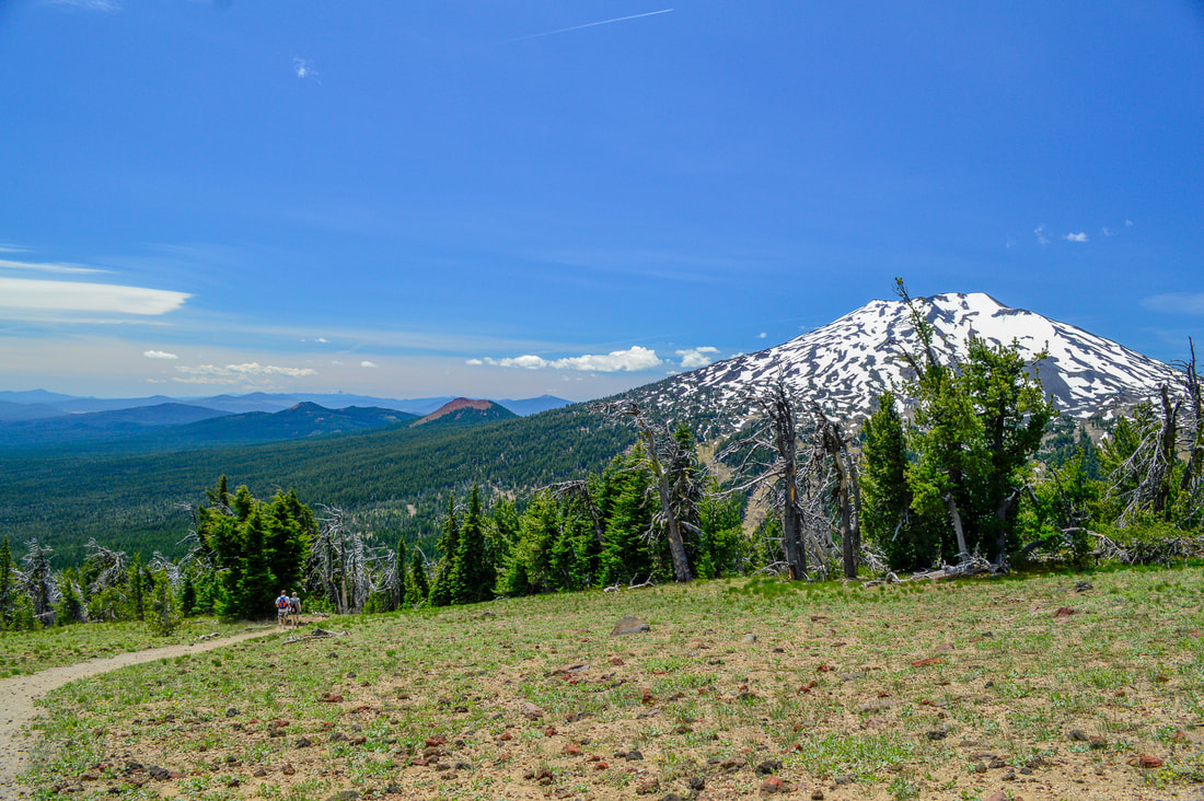
|
Closest town: Bend
Hike features: Summer wildflowers, mountain views
Mileage: 4 miles round trip w/ 1,380 ft. elevation gain
Difficulty: Moderate
Trail usage: High on weekends (summer and winter), medium on weekdays in the summer, low on weekdays in the winter
Best time to hike this trail: July - October for hiking, December - mid-April for snowshoeing/cross-country skiing
About the hike: Tumalo Mountain is another great viewpoint hike that gives you 360 degree views of the mountains. Right across from Mount Bachelor, this trail is accessible year-round (lots of people enjoy snowshoeing or skinning to the top and then skiing or snowboarding down in the winter). The trail takes you through the forest at first and once you leave the trees, there are wildflower meadows and insane views as far as the eye can see. Broken Top and the Three Sisters take center stage though, creating that iconic photo that you've likely seen before on Instagram.
(Click here for more information and directions)
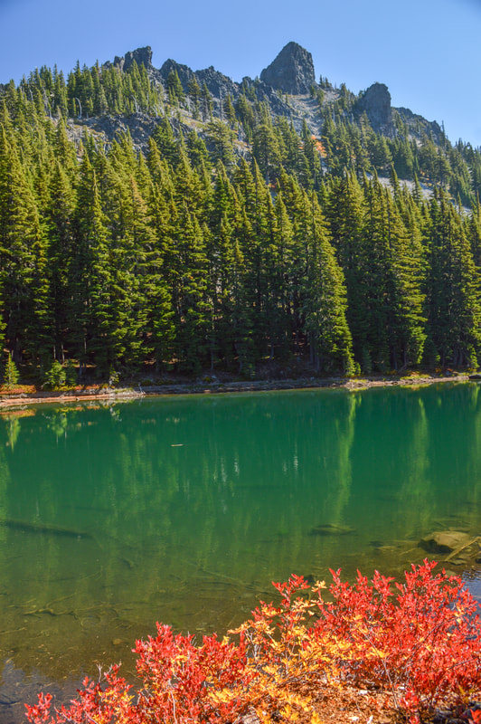
13) Horse Lake Loop
|
|
Closest town: Bend
Hike features: Lakes, huckleberries, some mountain views
Mileage: 9 mile loop w/ 1,050 ft. elevation gain
Difficulty: Difficult
Trail usage: Low during the week, medium on weekends
Best time to hike this trail: Mid-August and September when there are no more mosquitoes. And October and early November when the fall colors are glorious.
About the hike: This loop is very underrated is perfect for a long summer day hike because there is a nice lake to enjoy dipping your feet in during your lunch break. The trail takes you mostly through the forest which is littered with tiny huckleberry bushes. There are creeks, meadows and lakes along the way and the crowning jewel of this hike is Horse Lake, which makes for the perfect lunch and swimming spot.
(Click here for more information and directions)
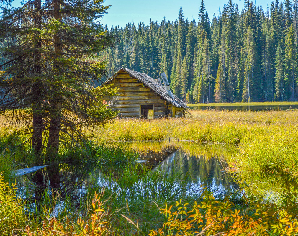
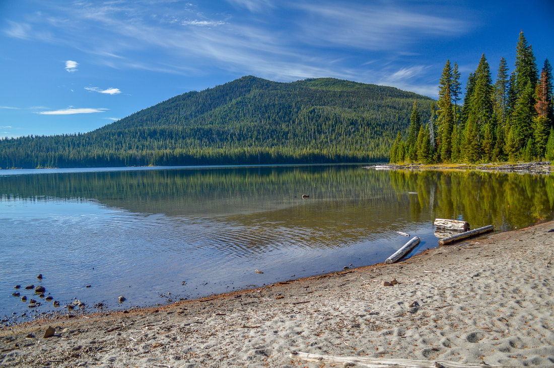
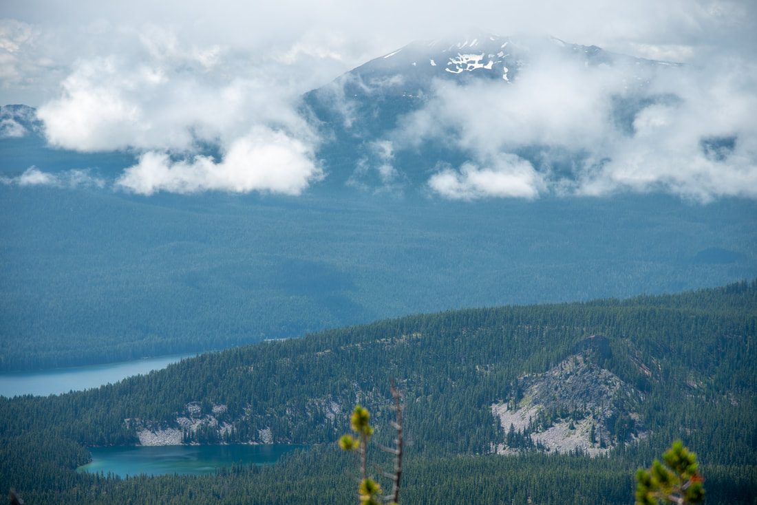
14) Muskrat Lake
|
|
Closest town: La Pine
Hike features: Trail through a lodgepole pine forest and numerous lakes along the way, backcountry camping
Mileage: 10.2 miles round trip w/ 885 ft. elevation gain
Difficulty: Moderate
Trail usage: Low
Best time to hike this trail: End of August, September, October and early November when the temperatures are a little bit cooler and in October the resort closes so there are no more loud boats on Cultus Lake.
About the hike: This hike is one of the best hidden gems along the Cascade Lakes Highway! Enjoy the sandy beaches of Cultus Lake, the very easy and almost flat trail leading up to Teddy Lakes, and the sinking cabin in the middle of Muskrat Lake. This is a unique hike that can be enjoyed towards the end of August and through the fall when the mosquitoes are gone.
(Click here for more information and directions)
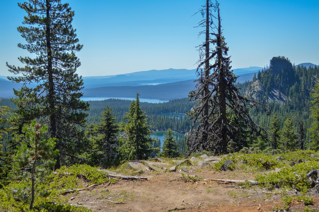
15) Maiden Peak
|
|
Closest town: Crescent
Hike features: Mountain and lake views
Mileage: 11.4 miles round trip w/ 3,100 ft. elevation gain
Difficulty: Difficult
Trail usage: Low
Best time to hike this trail: Mid-August through October
About the hike: Maiden Peak is one of the most underrated Oregon Cascade summits! The hike is steep and long as the trail takes you through a thick forest where in August you can eat ripe huckleberries along the way. You don't get views until you are almost at the summit, but the views are absolutely worth the climb. To the south you will see Rosary Lakes, Odell Lake, Crescent Lake and Diamond Peak, to the east you will see Davis Lake, Wickiup Reservoir and Crane Prairie, and to the north you can see Mount Bachelor, Broken Top and the Three Sisters. It is a unique view and you can definitely find solitude on this hike.
(Information for this hike can be found in the book 'Oregon's Best Views')
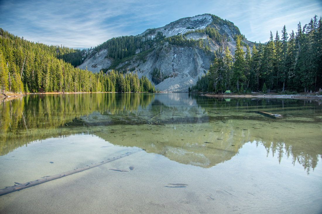
16) Rosary Lakes
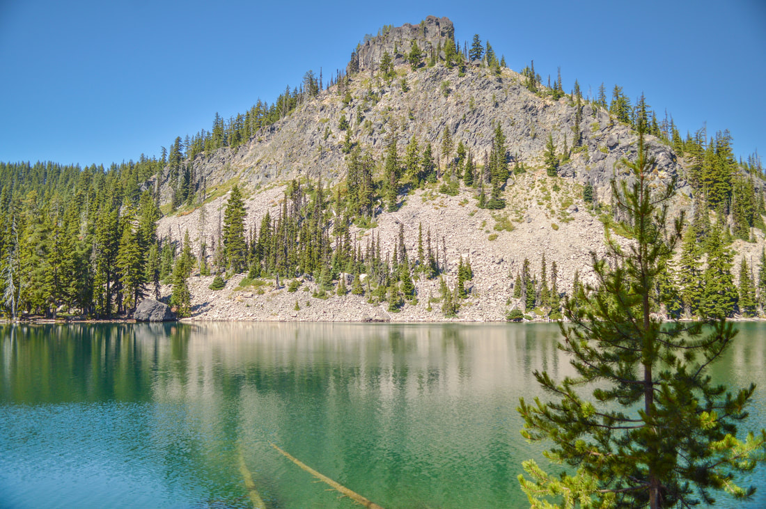
|
|
Closest town: Crescent & Oakridge
Hike features: Trail through old growth forest leading up to three alpine lakes with backcountry camping
Mileage: 7 miles round trip w/ 800 ft. elevation gain
Difficulty: Moderate
Trail usage: Medium during the week, high on weekends
Best time to hike this trail: August through November. Best time to go snowshoeing is mid-December through mid-March
About the hike: Rosary Lakes are a popular destination for swimming, camping and fishing. The trail is fairly easy as it takes you through a stunning forest and up to three incredible turquoise alpine lakes at the base of Pulpit Rock. You can enjoy a view of all three lakes from above by continuing up the Pacific Crest Trail just a bit to an awesome viewpoint.
(Click here for more information and directions)
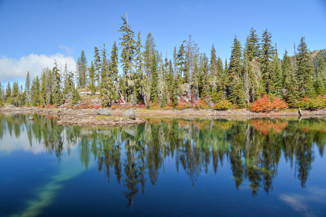
17) Yoran Lake Loop
|
|
Closest town: Crescent & Oakridge
Hike features: Alpine Lakes
Mileage: 11.3 mile loop w/ 1,215 ft. elevation gain
Difficulty: Difficult
Trail usage: Low during the week, medium on summer weekends
Best time to hike this trail: August through November
About the hike: This loop offers access to 5 alpine lakes in the Diamond Peak Wilderness. Yoran Lake is the biggest lake and the also the best for swimming. With views of Diamond Peak and Mount Yoran, this destination will truly take your breath away. It is an easy trail to hike and makes for the perfect long day hike or a one night backpacking trip for the whole family.
(Click here for more information and directions)
18) Divide Lake
Closest town: Oakridge
Hike features: Trail through old growth trees and huckleberry bushes leading to some beautiful lakes with backcountry camping Mileage: 1.8 miles round trip w/ 230 ft. elevation gain (to Notch Lake) 8 miles round trip w/ 1,435 ft. elevation gain (to Divide Lake) Difficulty: Easy to moderate Trail usage: Low on weekdays, medium on weekends Best time to hike this trail: August for ripe huckleberries. Mid-September through early October for fall foliage. About the hike: Tucked in between Mount Yoran and Diamond Peak, Divide Lake is an incredible summer destination! This is a great day hike, but you can also backcountry camp here and do day excursions from the lake, or just set up the hammock and enjoy the day swimming and reading a good book. (Click here for more information and directions) |
|
19) Diamond Peak Summit
|
|
Closest town: Oakridge
Hike features: Forested trail leading to the rocky climber's trail to the summit of Diamond Peak
Mileage: 11.25 miles out and back w/ 3,190 ft. elevation gain
Difficulty: Very difficult (some route finding is involved)
Trail usage: Low to medium (depending on if it's PCT thru-hiker season - usually early August)
Best time to hike this trail: August through October
About the hike: Diamond Peak is one of Oregon's most underrated mountains to summit. The majority of the hike is along the Pacific Crest Trail, which is an easy trail leading you through alpine forest and past small lakes. The last 1.5 miles of the hike are pretty grueling and this summit does involve some route finding and making sure you have secure hand and foot holds. This is not a hike for the inexperienced hiker. Once you reach the summit, you can see the very unique wide base of Diamond Peak, and the views span from the Three Sisters down to Mount Thielsen and all the mountains and lakes in between.
(Click here for more information and directions)
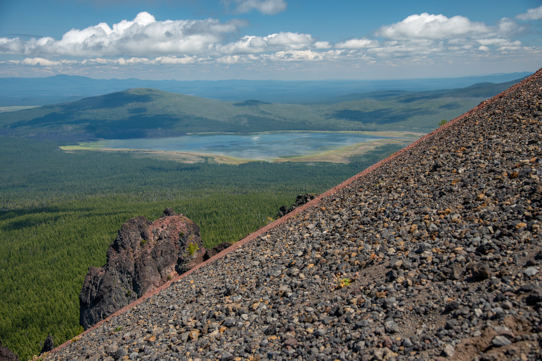
20) Timpanogas Lake to Cowhorn Mountain
|
|
Closest town: Oakridge
Hike features: Old growth forest trail leading up to the rocky summit of Cowhorn Mountain
Mileage: 9.6 miles round trip w/ 2,260 ft. elevation gain (Timpanogas Lake to Cowhorn Mountain summit and back)
11.5 miles loop w/ 2,390 ft. elevation gain (Timpanogas Lake - Cowhorn Mountain loop hike)
Difficulty: Difficult
Trail usage: Low
Best time to hike this trail: August through November
About the hike: This is one of the best hikes in the Diamond Peak Wilderness and offers hikers a summit, alpine lakes and an abundance of huckleberries in early August. Cowhorn Mountain is a great summit and gives the climber 360 degree views of the area with all of the lakes below and Diamond Peak, Maiden Peak and the Three Sisters in the distance to the north. To the south you can see Mount Bailey and Mount Thielsen.
(Click here for more information and directions)
*All pictures are taken by Franziska Weinheimer
*Disclaimer: The trail descriptions, mileage, GPS tracks and difficulty ratings depicted on this website are never 100% accurate. Always hike at your own risk, using your own knowledge, equipment and common sense. Franziska Weinheimer/Hike Oregon are not responsible if you or anyone in your party gets injured or lost while attempting one of these or any other hikes.