Marion Lake, Marion Falls & Marion Mountain
Hike details:
Mileage: 5.8 mile lollipop loop w/ 1,050 ft. elevation gain (Marion Lake & Marion Falls)
10.8 round trip w/ 2,620 ft. elevation gain (Marion Lake, Marion Falls & Marion Mountain)
Approximate hike time: 2 hours 23 minutes w/ an average pace of 2.3 mph (to the falls and lake)
4 hours 41 minutes w/ an average page of 2.3 mph (to the summit of Marion Mountain)
Difficulty: Moderate (to the lake) difficult (to Marion Mountain summit)
Trail usage: High to Marion Lake on summer weekends, low to Marion Mountain, low on weekdays and on autumn weekends.
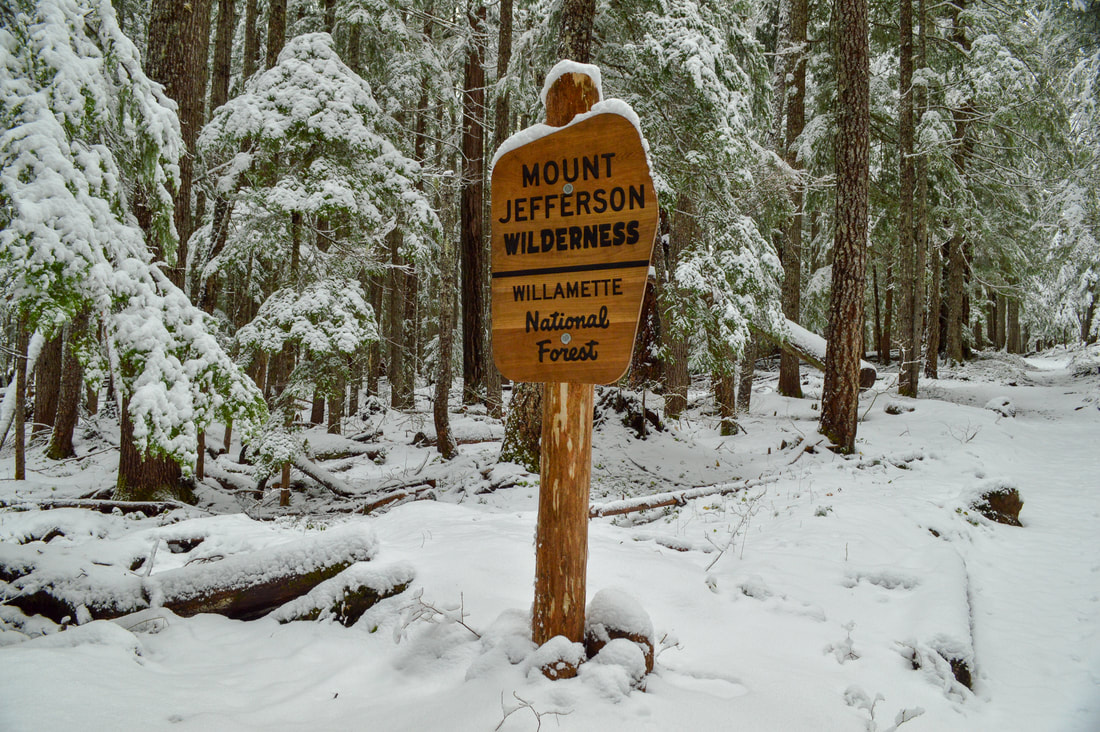
General location: 16 miles north of Santiam Junction - Mount Jefferson Wilderness - Willamette National Forest
Accessible: Late May through early December
(Best time to go is in late May/early June right after the snow melts and before the mosquitoes hatch, and after Labor Day when there are less people, no mosquitoes and the beautiful fall foliage starts to turn red and orange).
Permits required: Central Cascades Wilderness Permit for day hikes & overnight (June 15 - October 15) & Northwest Forest Pass for parking. Outside of those dates, free self issue wilderness permit & Northwest Forest Pass for parking.
Pit toilet at trailhead: Yes
Trail allows: Dogs on leash, camping, fishing
Possible dangers: Steep drop off at the top of Marion Mountain
10.8 round trip w/ 2,620 ft. elevation gain (Marion Lake, Marion Falls & Marion Mountain)
Approximate hike time: 2 hours 23 minutes w/ an average pace of 2.3 mph (to the falls and lake)
4 hours 41 minutes w/ an average page of 2.3 mph (to the summit of Marion Mountain)
Difficulty: Moderate (to the lake) difficult (to Marion Mountain summit)
Trail usage: High to Marion Lake on summer weekends, low to Marion Mountain, low on weekdays and on autumn weekends.
General location: 16 miles north of Santiam Junction - Mount Jefferson Wilderness - Willamette National Forest
Accessible: Late May through early December
(Best time to go is in late May/early June right after the snow melts and before the mosquitoes hatch, and after Labor Day when there are less people, no mosquitoes and the beautiful fall foliage starts to turn red and orange).
Permits required: Central Cascades Wilderness Permit for day hikes & overnight (June 15 - October 15) & Northwest Forest Pass for parking. Outside of those dates, free self issue wilderness permit & Northwest Forest Pass for parking.
Pit toilet at trailhead: Yes
Trail allows: Dogs on leash, camping, fishing
Possible dangers: Steep drop off at the top of Marion Mountain
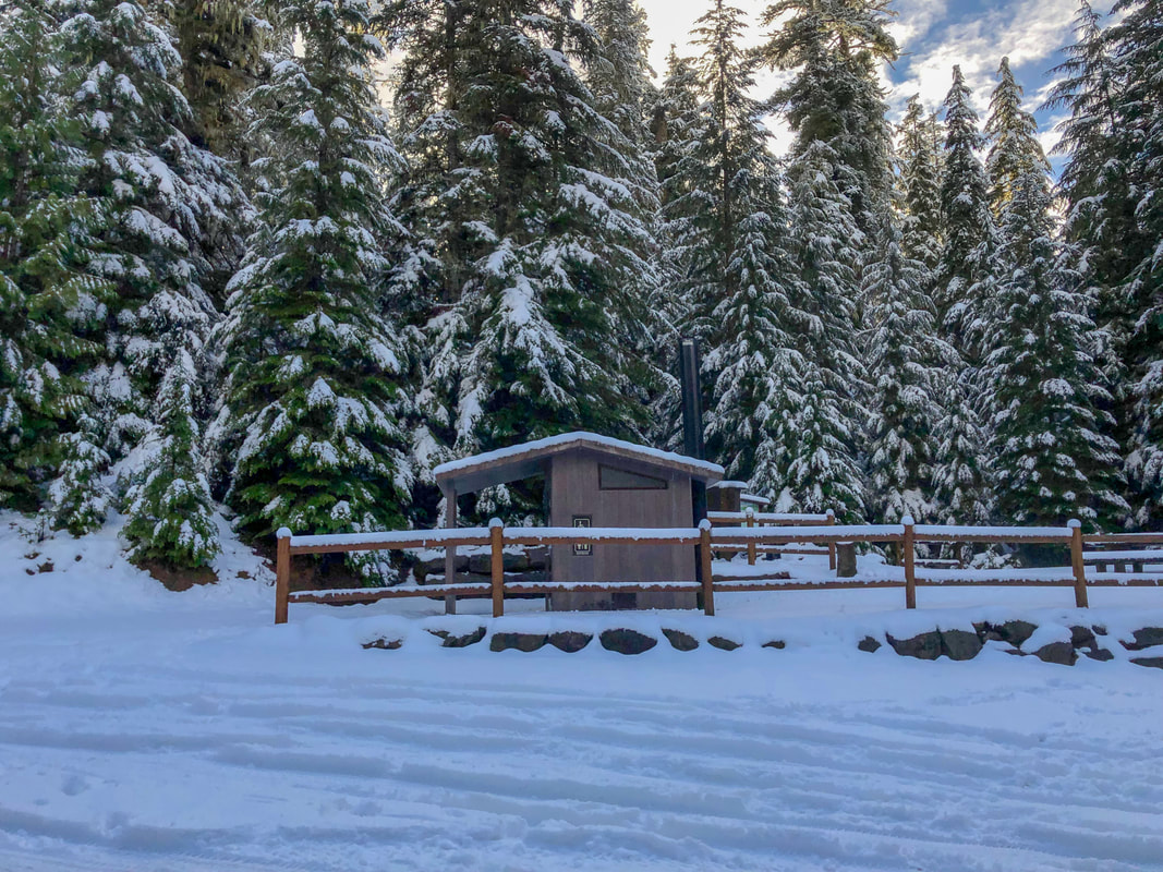
(Marion Lake trailhead parking area)
Description:
Marion Lake is a very popular destination in the summertime for folks from all over Oregon. The 3 mile hike to the lake is easy so most people only do that and then spend the day at the beautiful lake, fishing, paddle boarding or kayaking. You can also make this hike a bit more challenging by going up to Marion Mountain, where you will see spectacular 360 degree views of the Jefferson Wilderness!
|
The trailhead begins at the end of Marion Creek Road, where you will find a large parking area that can hold roughly 20 cars. If the parking lot is full, you can park along the gravel road. Because of the new limited entry permit system that started in 2021, only 40 people are allowed into Marion Lake per day for day use and 10 overnight permits are distributed daily. This helps keep the crowds down and makes it truly feel like a wilderness experience.
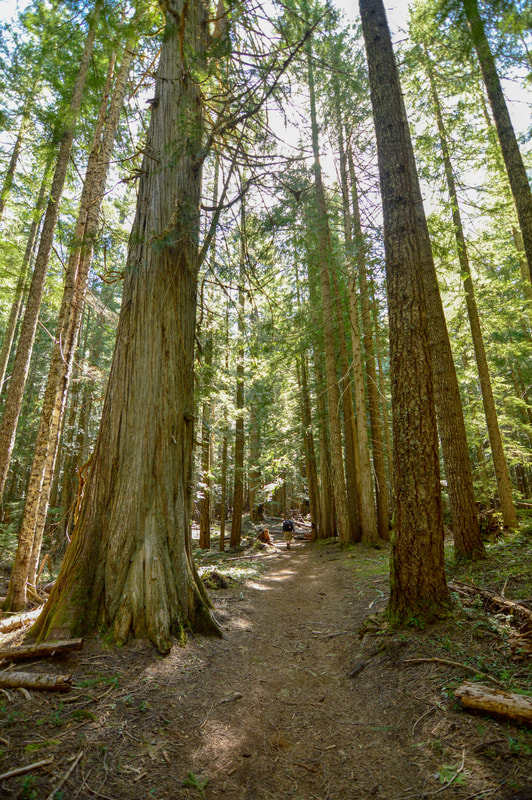
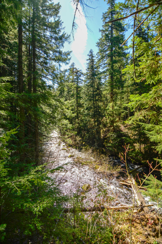
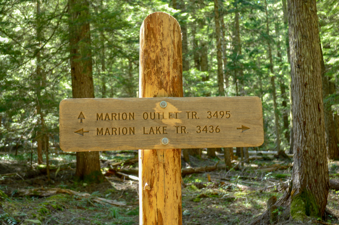
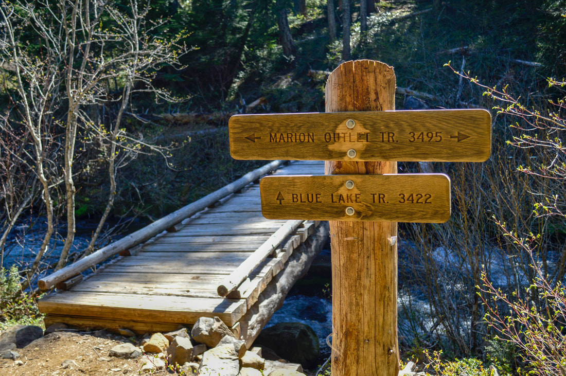
Marion Lake Trail #3436 starts out by going through a beautiful large old growth forest. Here the trail is very wide and all you can do is ogle at the giant trees and the moss covered ground! The first mile is almost flat and then the trail trends slightly uphill to the meadows of Lake Ann at mile 1.7. The trail next to Lake Ann is rocky, and if you listen closely you can hear the gurgle of water underneath the rocks as you cross the creek that flows out of Lake Ann under the rocks. This sound is really unique and you should definitely stop and listen to it for a moment. 0.3 miles past Lake Ann, you will come to your first trail junction. If you are hiking all the way up to Marion Mountain, you will encounter a total of 4 trail junctions during your trip. Stay to the right here and take Marion Outlet Trail #3495. |
|
(Lake Ann and the rocks over the creek)
|
About 200 yards after the trail split, there is a little side trail on the right side that takes you over to Marion Falls. This side trail is slightly hidden, but you can keep an eye out for a very obvious tree shaped like a Y, that marks the side trail. You will follow this trail through the woods to Marion Creek and then the trail goes down very steeply along the river's edge towards the falls. Be careful here as the rocks and roots can become very slippery from the waterfall spray.
|
(this obvious tree that marks the Marion Falls side trail)
|
|
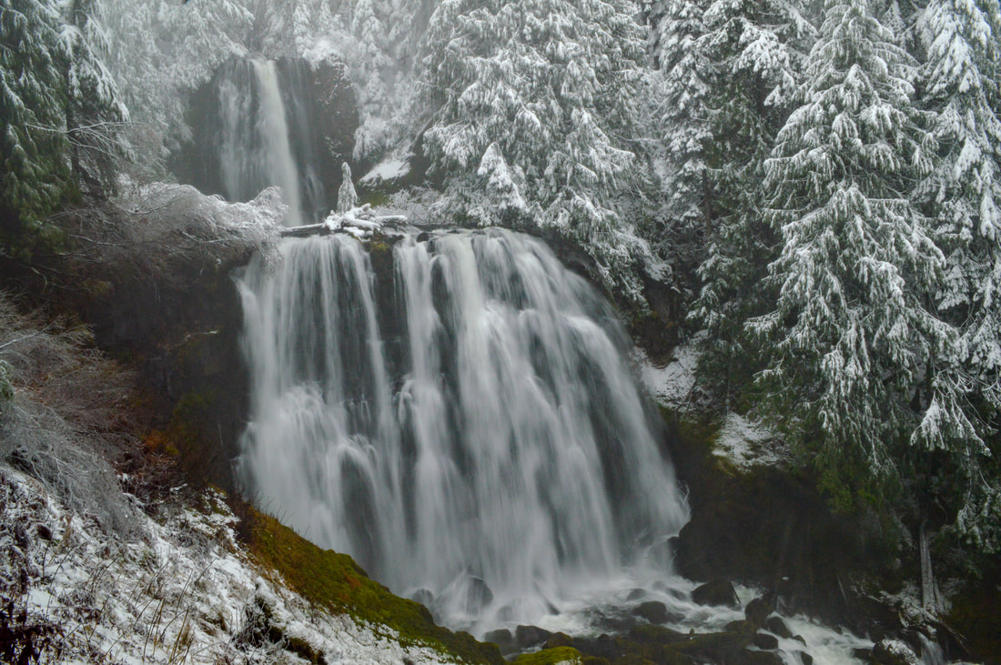
(Marion Falls in December)
|
|
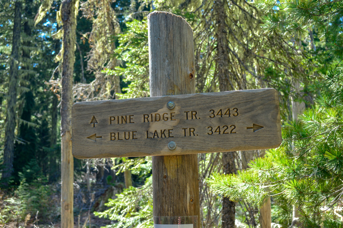
Half a mile after the short out and back excursion to Marion Falls, you will come to another trail junction. Here Marion Outlet trail goes to the left, loops around the shore of the lake and meets up with Marion Lake trail creating a little loop. Early in the season you will not be able to hike up to Marion Mountain due to snow, but if you are hiking after the end of June, and want to continue and head up to Marion Mountain, take a right onto the Blue Lake Trail #3422.
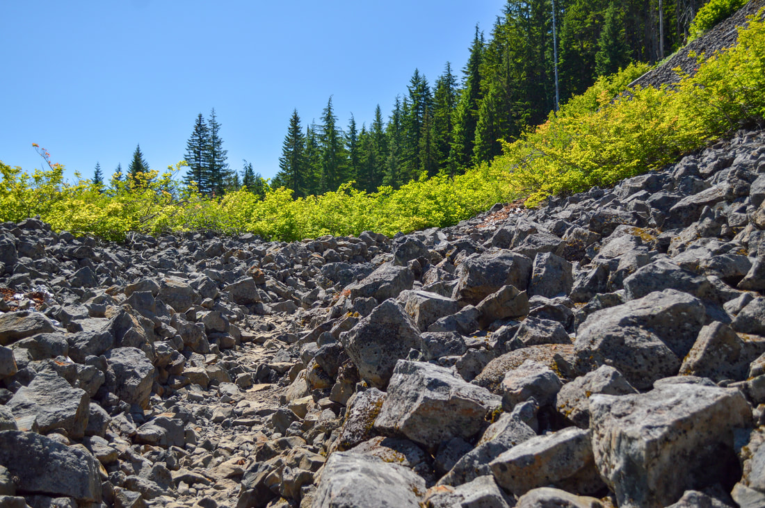
The 5.25 mile out and back up to Marion Mountain is really cool because the trail starts to head uphill along a rocky hillside. You will hike along Blue Lake trail for 1 mile until coming to another trail junction. Blue Lake trail continues to the left (if you are backpacking a large loop or want to do some camping in a less crowded area, this is a perfect place to head out to do that). To get to Marion Mountain you will take Pine Ridge Trail #3443 to the right.
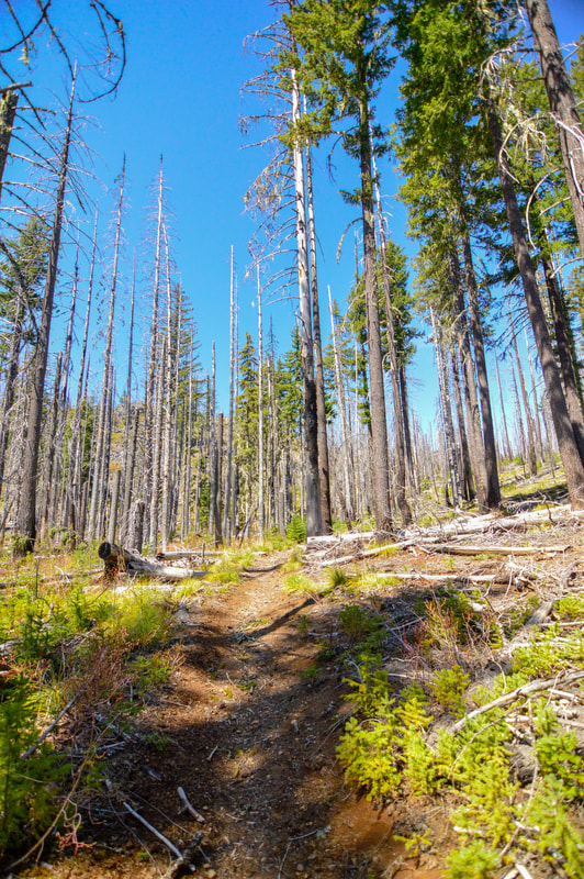
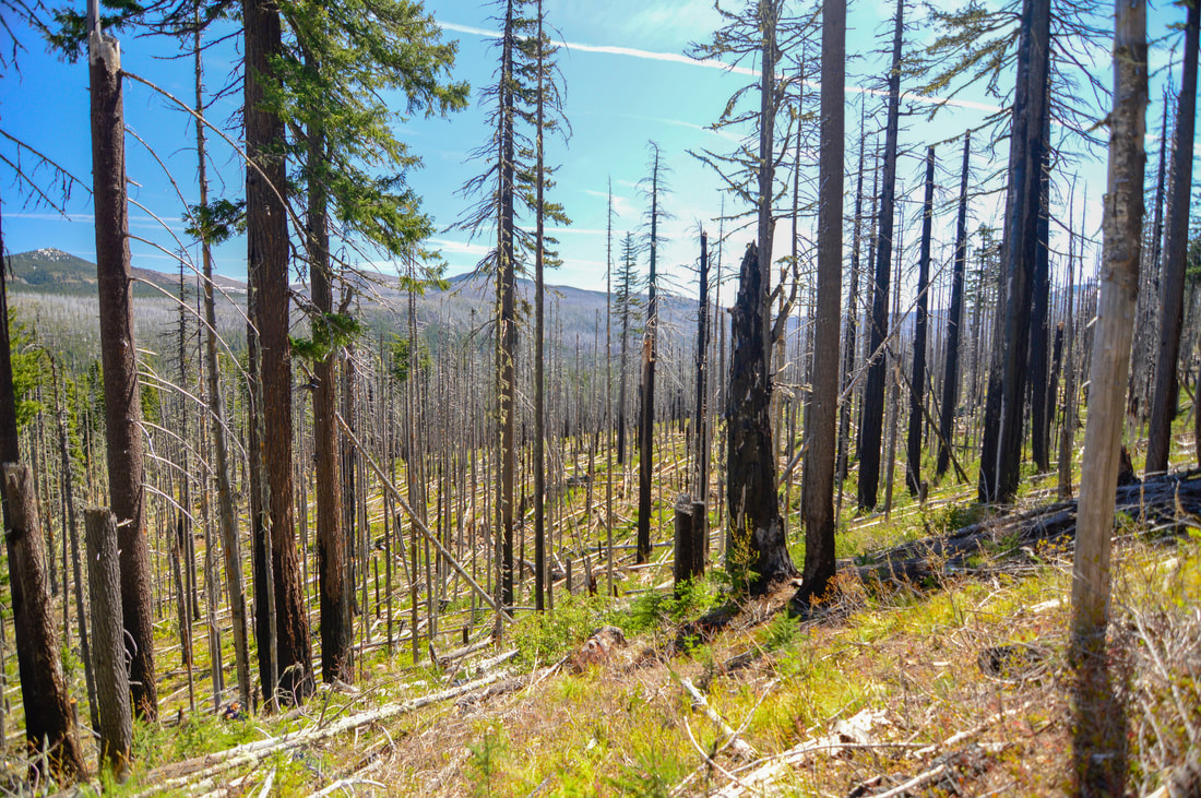
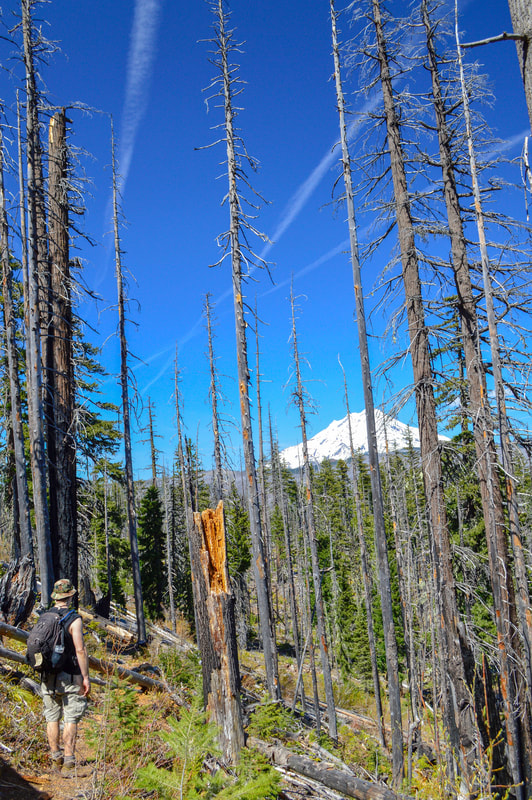
From here on the trail becomes steep, and from this burned ridge trail you can start to see views of not only Marion Lake, but also Mt. Jefferson. If you are hiking this trail after the 2015 Marion Lake fire, this area will most likely look newly burned and there may still be some trees down from the winter season. The trails down by the lake get cleared every spring, but the trails farther up are less maintained or maintained later in the season, so be prepared to step over some down trees.
|
|
|
|
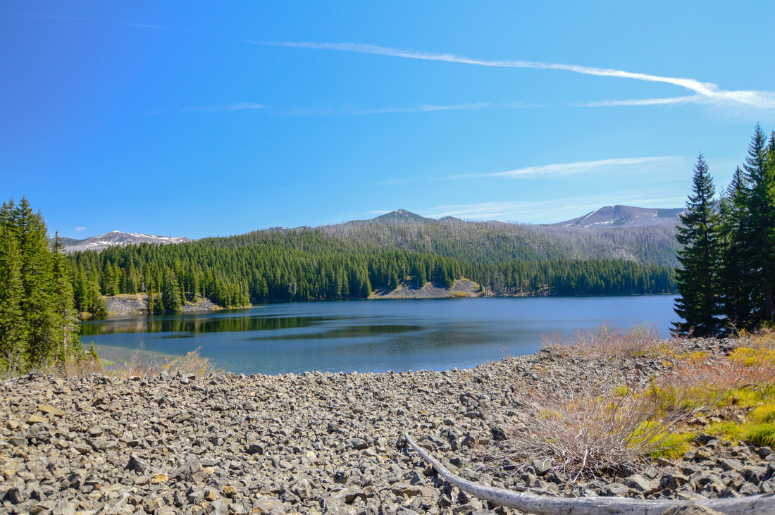
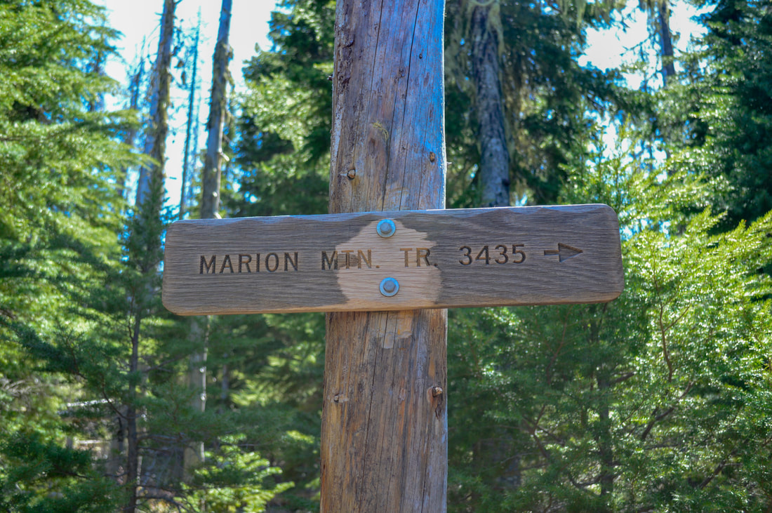
After hiking 0.6 miles on the Pine Ridge trail, you will come to your last trail split. This split is more obvious because the Pine Ridge trail continues to the right and you will take the trail sign pointing to the left to Marion Mountain Trail #3435. From here there are about 9 steep switchbacks leading up another 0.8 miles to the summit of Marion Mountain. The top of Marion Mountain is a rocky precipice with 360 degree views spanning the Cascade Mountain range with close-up views of Mt. Jefferson and Three Finger Jack and the lakes in between. The hike down is spectacular, because you will continue seeing Mt. Jefferson almost the entire way back to Marion Lake.
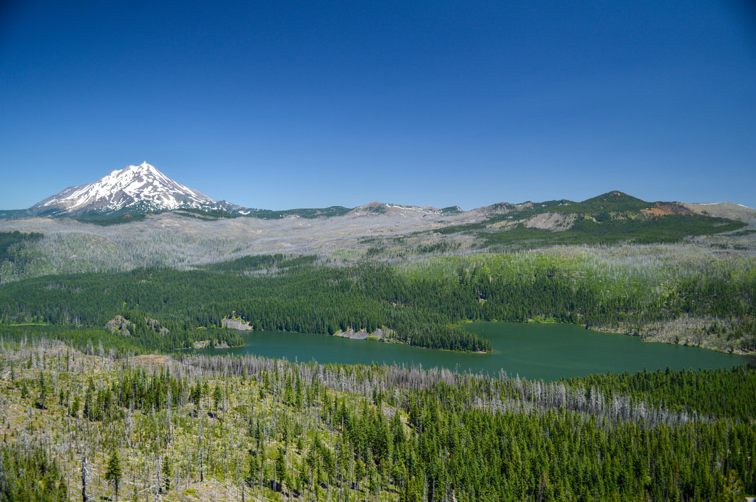
(Marion Lake & Mount Jefferson from the summit of Marion Mountain)
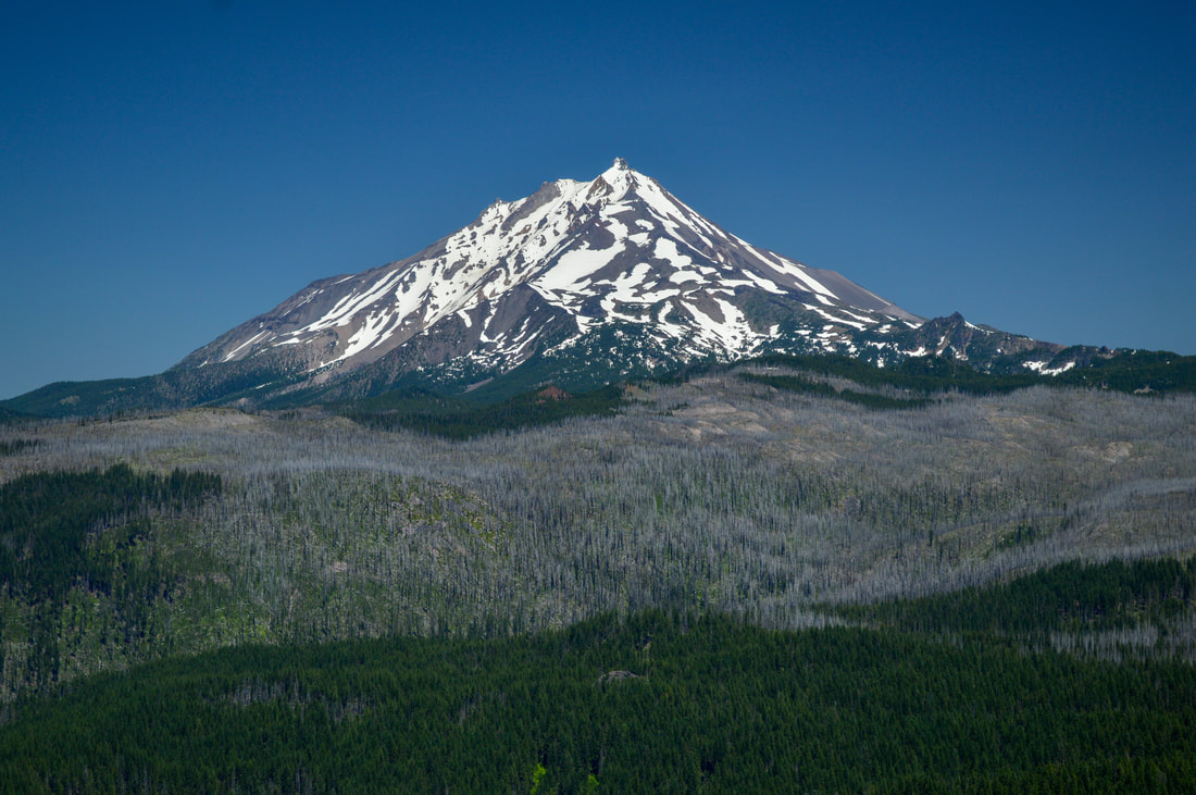
(Mount Jefferson)
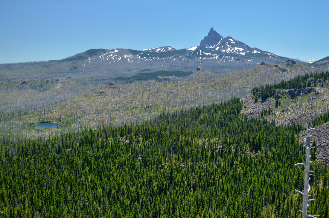
(Three Fingered Jack)
|
Once you get back to the bridge, you will take the Marion Outlet Trail and walk 0.7 miles along the Marion Lake shore. From the shore you can see great views of Three Fingered Jack across the lake. The lakeshore has some lovely spots to sit and have a picnic and take a swim. After 0.7 miles you hook over onto Marion Lake trail for 0.2 miles and then you're back on the main trail to the car.
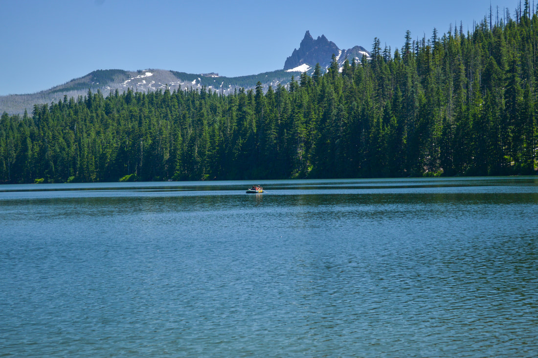
(Three Fingered Jack from across Marion Lake)
|
|
The Marion Lake and Marion Mountain hikes are an absolutely amazing gem in the Oregon Cascades, and you can see why this area attracts folks from all over Oregon. If you are with small children, it is suggested that you just do the easier lower 5.8 mile Marion Lake loop and then take the day to enjoy the lake. If you are hiking later in the summer season and are up for a challenge, and are ok climbing over blowdowns, then Marion Mountain summit is highly recommended. This is a wonderful area, and it is definitely worth trying to get a limited entry permit for this one!
|
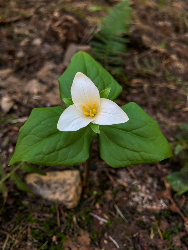
(Trillium flower blooming in May)
|
Directions:
From Salem
- Drive 66 miles E of Salem on OR-22. At the "town" of Marion Forks between milepost 66 and 67 turn east onto Marion Creek Road 2255. Drive on this road for 5.4 miles to the parking area at its end. (Total of 72.9 miles)
- Drive E on US-20 to Santiam Junction. Fork right at the junction and drive 16 miles N on OR-22. At the "town" of Marion Forks between milepost 66 and 67 turn east onto Marion Creek Road 2255. Drive on this road for 5.4 miles to the parking area at its end. (Total of 68.8 miles)
- Drive E on OR-126 for 75 miles, then merge right onto US-20 for 3 miles to Santiam Junction. Here take a left onto OR-22 W towards Detroit. At the "town" of Marion Forks between milepost 66 and 67 turn east onto Marion Creek Road 2255. Drive on this road for 5.4 miles to the parking area at its end. (Total of 99.7 miles)
- It is a total of 118 miles via Salem.
- It is a total of 263 miles via Eugene.
|
To get a more in-depth and personal view of this hike, watch the YouTube video.
|
-This trail write-up was last updated May 2022-
*All pictures are taken by Franziska Weinheimer *Disclaimer: The trail descriptions, mileage, GPS tracks and difficulty ratings depicted on this website are never 100% accurate. Always hike at your own risk, using your own knowledge, equipment and common sense. Franziska Weinheimer/Hike Oregon are not responsible if you or anyone in your party gets injured or lost while attempting one of these or any other hikes.
|