Moon Falls
Hike details:
Mileage: 1.1 miles round trip w/ 80 ft. elevation gain
Approximate hike time: 28 minutes w/ an average pace of 2.3 mph
Difficulty: Easy
Trail usage: Low
Highest elevation: 3,060 ft. Lowest elevation: 2,933 ft.
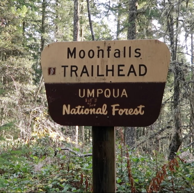
General location: 31 miles east of Cottage Grove - Umpqua National Forest
Accessible: Year-round
(Best time to go is March through June when the waterfall has the highest flow).
Permits required: N/A
Pit toilet at trailhead: No
Trail allows: Dogs
Possible dangers: N/A
Approximate hike time: 28 minutes w/ an average pace of 2.3 mph
Difficulty: Easy
Trail usage: Low
Highest elevation: 3,060 ft. Lowest elevation: 2,933 ft.
General location: 31 miles east of Cottage Grove - Umpqua National Forest
Accessible: Year-round
(Best time to go is March through June when the waterfall has the highest flow).
Permits required: N/A
Pit toilet at trailhead: No
Trail allows: Dogs
Possible dangers: N/A
|
Description:Moon Falls is a wonderful short and easy waterfall hike and can be done in conjunction with Spirit Falls and Pinard Falls which are both nearby and make for the perfect day of waterfall hunting.
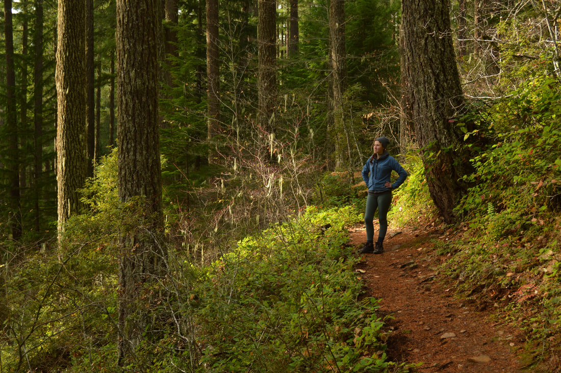
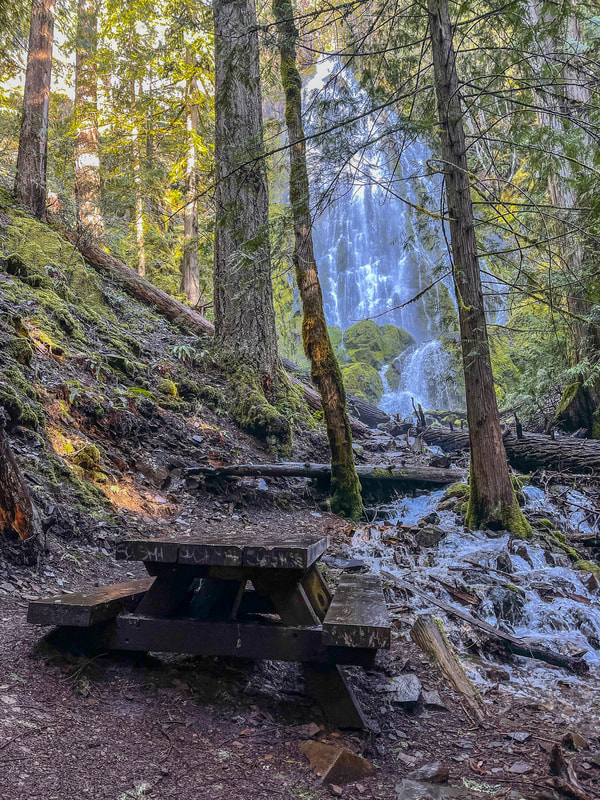
At the trailhead there is a picnic table, where you can have lunch or a snack, however there is no pit toilet. Please remember that when going to the bathroom in the woods, please always follow the Leave No Trace Principles. The trail starts out pretty level and is very well maintained, even after the devastating winter storm of 2019. You will see some trees that have come down but have been cut through. The beginning of the trail can oftentimes get pretty muddy in the winter and early spring, so wear appropriate shoes when hiking here. As you get closer to the waterfall, there are some smaller rocks and roots to watch out for but for the most part it is a very easy going trail. There are no trail splits or anything you have to worry about, so after cruising through the forest for 0.55 miles, you will arrive at the bottom of Moon Falls. |
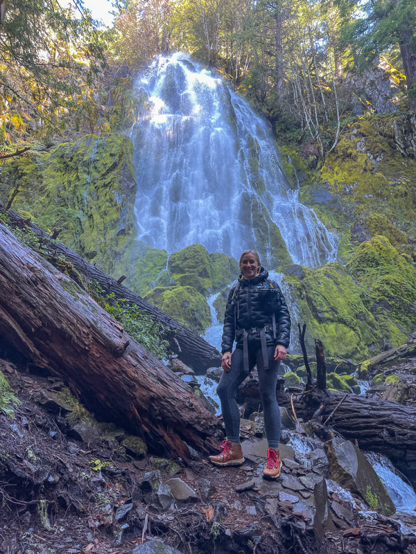
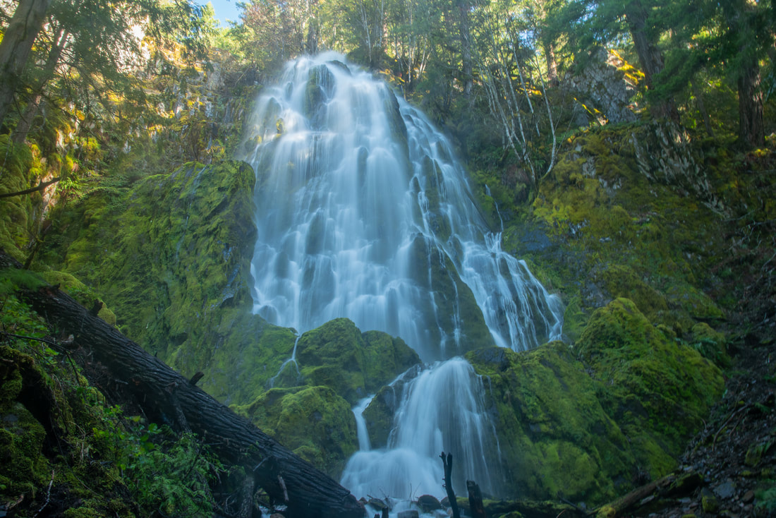
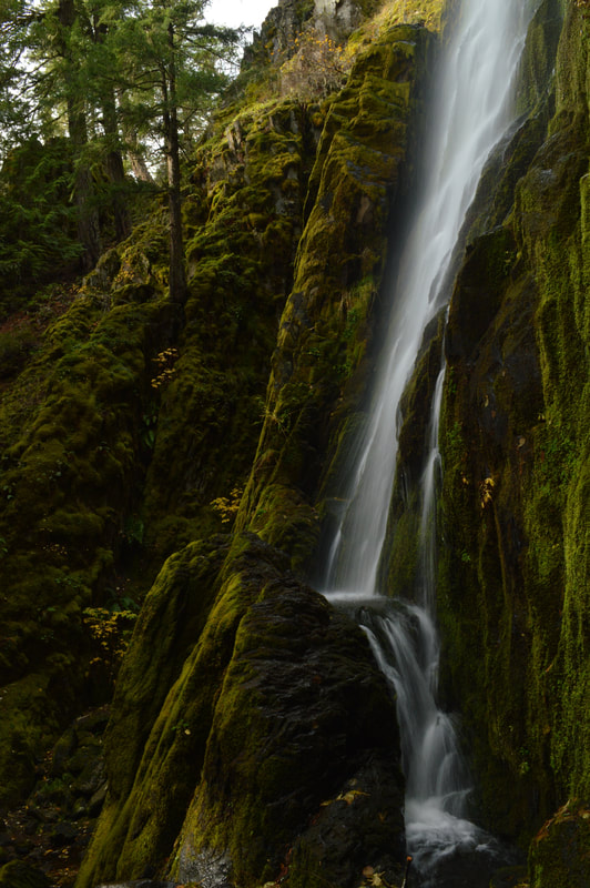
The trail rounds a corner and you will see 100-foot tall Moon Falls cascading down mossy rocks. This waterfall is part of Alex Creek, which tumbles along rocks and the roots of cedar trees, past a picnic table. Unless it is a 90+ degree day, it is not very likely that anyone will enjoy this picnic table location because it is almost always 10-15 degrees cooler by the waterfall than anywhere else, and it is very damp, making it a bit unpleasant to sit and enjoy a snack.
The base of Moon Falls is very rocky and getting up close to the waterfall is quite difficult because of the large loose rocks. In the trio of Moon, Spirit and Pinard Falls, Moon Falls is definitely Hike Oregon's favorite. This waterfall very much resembles Proxy Falls and if you see the two side-by-side in pictures it is easy to confuse the two, although Proxy Falls is much taller than Moon Falls. After enjoying the cool spray and the immense beauty of Moon Falls and its mossy home, head back the way you came. |
|
(Moon Falls 100 ft. tall in the early spring)
|
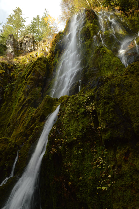
(Moon Falls in the late fall)
|
|
The hike to Moon Falls is extremely easy and doable for any age and fitness level. The trail is well maintained and very flat. With this hike being so close to Eugene, Cottage Grove and Oakridge, you would think it would be more popular than it is, but it is very underrated and likely not traveled to much because the roads to the falls can be a bit rough due to potholes. The waterfall and the hike are so beautiful and this would definitely be the perfect place to go for an after work evening picnic, or a quick Sunday family outing. This would also be an epic spot to propose!
Before you head home for the day, make sure to check out nearby Spirit Falls (0.75 miles round trip) and Pinard Falls (1 mile round trip). |
Directions:
From Eugene
- **(If you use Google directions, it will take you via Oakridge which is technically shorter mileage and drive time to the trailhead. However, if you are going to the falls in the winter, avoid the directions via Highway 58 because it will take you to 4,000 feet elevation, which in the winter will have snow). Drive I-5 S for a total of 19.2 miles, then take exit 174 toward Dorena. Take a left onto E Cottage Grove/Row River Rd. and stay on this road for 18.6 miles. Turn left onto Laying Rd. for 4.9 miles, then at a Y split turn right onto NF-17 for 3.8 miles. Turn right onto NF-1702 for 3.3 miles and then turn right at a sign for Moon Falls. There is room for about 3-4 cars in the parking area. (Total of 52 miles)
- Drive US-97 S for a total of 46.9 miles then turn right onto Crescent Road/Crescent Cutoff Road and continue for 12 miles until you T into OR-58. Take a right and drive OR-58 W for 43.7 miles. Turn right onto Patterson Mountain Road 5840 for 5.1 miles. At the saddle turn right onto FS-17 towards Rujada Campground for 4.4 miles. Once you get to the pavement take NF-1702 for 2.8 miles then turn right onto spur road 1702-203 and continue to the trailhead at the road's end. There is room for about 3-4 cars in the parking area. (Total of 115 miles)
- Drive I-55 N a total of 145 miles to Cottage Grove. Take exit 174 and follow signs to Dorena Lake. Stay on Row River Rd. for 18.6 miles, then turn left onto Laying Rd. for 4.9 miles, then at a Y split turn right onto NF-17 for 3.8 miles. Turn right onto NF-1702 for 3.3 miles and then turn right at a sign for Moon Falls. There is room for about 3-4 cars in the parking area. (Total of 177 miles)
- Total of 113 miles via Eugene.
- Total of 153 miles via Eugene.
|
To get a more in-depth and personal view of this hike, watch the YouTube video.
|
-This trail write-up was last updated in 2020-
*All pictures are taken by Franziska Weinheimer *Disclaimer: The trail descriptions, mileage, GPS tracks and difficulty ratings depicted on this website are never 100% accurate. Always hike at your own risk, using your own knowledge, equipment and common sense. Franziska Weinheimer/Hike Oregon are not responsible if you or anyone in your party gets injured or lost while attempting one of these or any other hikes.
|