Hike Oregon
  • Home
  • *Store*
  • About the author
  • How to use this site
  • Resources
    • Wildflowers
    • Videos
  • Best Oregon Hikes
    • Top Fall Foliage Hikes In Oregon
    • Top 10 Oregon Fall Hikes
    • 20 Best Oregon Waterfall Hikes
    • Top 10 Oregon Hikes for Kids
    • Sno-Parks In Central Oregon
    • Top 10 Oregon Winter Hikes
    • Top Low Elevation Winter Hikes
    • 9 Amazing Oregon Summit Hikes
    • 20 Central Oregon Day Hikes
    • 20 Epic Oregon Wildflower Hikes
    • 5 Weekend Backpacking Trips in Oregon
    • Top One Night Backpacking Trips in Oregon
    • Top 10 Oregon Summer Hikes
    • Top 10 Swimming Spots In Oregon
    • Top 10 Oregon Spring Hikes
  • Oregon Sno-Parks
    • Maxwell Sno-Park
    • Potato Hill Sno-Park
    • Ray Benson Sno-Park
      • Brandenburg Shelter
    • Santiam Sno-Park
    • Three Creek Sno-Park
    • Virginia Meissner Sno-Park
      • Meissner Shelter Loop
      • Nordeen Shelter
    • Gold Lake Sno-Park
      • Westview Shelter to Eagle Rock Overlook
      • Marilyn Lakes Loop
  • Southern Washington
    • Hamilton Mountain
    • Dog Mountain
    • Coyote Wall
    • Mount St. Helens
  • Portland
    • Powell Butte
    • Forest Park
    • Latourell Falls
    • Multnomah/Wahkeena Falls
    • Eagle Creek
    • Mitchell Point
    • Table Rock
    • Tamanawas Falls
    • Trillium Lake
    • East Zigzag Mountain (members only)
  • Salem
    • Abiqua Falls
    • Silver Falls State Park
    • Dome Rock
    • Marion Lake to Marion Mountain
    • Jefferson Park
  • Corvallis
    • Marys Peak East Ridge
    • Marys Peak North Ridge
    • Alsea Falls and Green Peak Falls
    • Corvallis to Sea Trail - Sugarbowl Creek segment (members only)
  • Sweet Home
    • Crescent Mountain
    • Iron Mountain
    • McDowell Creek Falls
    • Middle Santiam River (members only)
    • Lower Soda Creek Falls (members only)
    • Rooster Rock (members only)
  • McKenzie Bridge/Blue River
    • Macduff Mountain
    • Proxy Falls
    • Clear Lake
    • Sahalie/Koosah Falls
    • Blue Pool
    • Erma Bell Lakes
    • Olallie Mountain
    • Horsepasture Mountain
    • Tidbits Mountain
    • Castle Rock
    • Lowder Mountain (members only)
    • East Fork Trail (members only)
    • Rainbow Falls Overlook (members only)
    • Frissell Point (members only)
    • Chucksney Mountain (members only)
    • Substitute Point (members only)
  • Sisters/Santiam Pass
    • Coffin Mountain
    • Trappers Butte and Scar Mountain
    • Maxwell Butte
    • Black Butte
    • Whychus Creek Trail
    • Tam McArthur Rim
    • Black Crater
    • Scott Mountain
    • Obsidian Trail
    • Metolius Preserve
    • Three Fingered Jack Loop
    • Square Lake
    • Canyon Creek Meadows
    • Patjens Lakes
    • Craig Lake (members only)
    • Chush Falls (members only)
    • Rockpile Lake (members only)
    • Santiam Lake (members only)
    • Camp Lake (members only)
    • Park Meadow to Golden Lake (members only)
  • Bend/Redmond/LaPine
    • Steins Pillar
    • Chimney Rock
    • Steelhead Falls
    • Tumalo State Park
    • Tumalo Falls
    • Tumalo Mountain
    • No Name Lake
    • Green Lakes
    • Moraine Lake
    • South Sister Summit
    • Horse Lake
    • Muskrat Lake
    • Paulina Peak
    • Peter Skene Ogden Trail (members only)
  • Eugene
    • Ridgeline Trail
    • Mount Pisgah Summit
    • Mount Pisgah Arboretum
    • Shotgun Creek
    • Mount June
    • Lawler
    • Tire Mountain
    • Goodman Creek
    • Brice Creek
    • Trestle Creek Falls
    • Moon Falls
    • Elijah Bristow State Park
    • South Willamette Trail (members only)
    • Eula Ridge (members only)
    • Eagle's Rest (members only)
  • Oakridge
    • Deception Creek
    • North Salmon Creek
    • Grasshopper Ridge
    • Larison Creek
    • Bunchgrass Ridge
    • Salt Creek Falls
    • Waldo Lake Loop
    • South Waldo Loop
    • The Twins
    • Rosary Lakes
    • Yoran Lake
    • Fawn Lake
    • Windy Lakes
    • Divide Lake
    • Diamond Peak Summit
    • Cowhorn Mountain
    • Wall Creek Warm Springs (members only)
    • Moon Point (members only)
    • Bobby Lake (members only)
    • Lillian Falls (members only)
    • Middle Fork Willamette Trail (members only)
    • Pool Creek Falls (members only)
    • Dead Mountain (members only)
    • Larison Rock (members only)
    • Quinn Lakes & Eddeeleo Lakes (members only)
    • Waldo Mountain Lookout (members only)
    • Blair Lake to Spring Prairie (members only)
    • Rigdon Lakes loop (members only)
  • Oregon Coast
    • Cascade Head
    • Drift Creek Falls
    • Sweet Creek Falls
    • Beaver Creek Falls
    • Kentucky Falls
    • Hobbit Trail to Heceta Head
    • Valley Trail to China Creek
    • North Fork Smith River (members only)
    • Cummins Ridge (member's only)
    • Horse Creek (members only)
    • Siltcoos Lake (members only)
  • Southern Oregon
    • Fall Creek Falls
    • Watson Falls
    • Wild Rogue Loop
    • Mt. Thielsen
    • Crater Lake National Park
      • The Watchman
      • Mount Scott
      • The Pinnacles
    • Lower Table Rock
    • Pilot Rock
    • Wagner Butte
    • Mt. McLoughlin
    • Lemolo Falls (members only)
    • Fern Falls (members only)
  • Eastern Oregon
    • Painted Cove
    • Anthony Lake Loop
    • Mount Howard
    • Eagle Cap summit
    • Schneider Cabin (members only)
    • Strawberry Lake & Strawberry Falls (members only)
  • Oregon PCT sections
  • Tips & Tricks
    • Leave No Trace
    • How To Pick The Right Backpacking Tent
    • Top Tips For Hiking With Infants And Toddlers
    • Poison Oak, Ivy and Sumac
    • How to dress for cold weather hikes
    • Outdoorsy Holiday Gift Guide 2022
    • Hiker Holiday Gift Guide 2019
    • Outdoor Holiday Gift Guide 2018
    • Hiking Holiday Gift Guide 2017
  • Reviews/Gear
    • Stay Kühl This Summer
    • Outdoor Herbivore Backpacking Food Review
    • Osprey Aura AG 65 Backpack review
    • Big Agnes Fly Creek UL2 review
    • REI Quarter Dome 1 review
  • Adventure Stories
    • Hiking The Rae Lakes Loop
    • 110 Miles on the PCT
    • Three Fingered Jack Adventures
    • Jefferson Wilderness

South Waldo Loop

​
Get the printable version of this hike

Hike details:

​Mileage: 3.4 miles round trip w/ 230 ft. elevation gain (to South Waldo Shelter and back)
8.7 mile lollipop loop w/ 1,300 ft. elevation gain (the full loop)
Approximate hike time: 1 hour 28 minutes w/ an average pace of 2.3 mph (to South Waldo Shelter and back)
3 hours 46 minutes w/ an average pace of 2.3 mph (the full loop)
Difficulty: Easy to moderate
Trail usage: Low for the loop, low to medium to the shelter
Highest elevation: 6,133 ft. Lowest elevation: 5,312 ft.
General location: 33 miles east of Oakridge - Willamette National Forest - Waldo Lake Wilderness
Accessible: Mid-June to the end of November
(Best time to go is mid-August for prime huckleberries and through November for minimal people. Avoid the months of June and July at all cost due to horrendous mosquitoes). 
Permits required: Northwest Forest Pass for parking
Pit toilet at trailhead: Yes
Trail allows: Dogs, horses, mountain biking, camping
Possible dangers: Getting lost on the obscure trail near the meadows
Swimming cove at Waldo Lake
(swimming cove)

Description​:

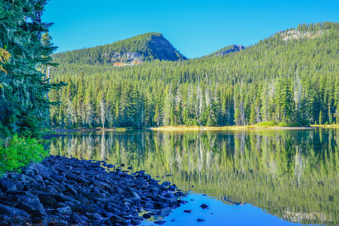
The Waldo Lake Wilderness offers a plethora of hiking trails, and the South Waldo Loop is just one of the many hidden gems that one can explore there. This loop will offer adventure deep in the heart of the Waldo Lake wilderness and is perfect for those seeking solitude past the busy shores of Waldo Lake. Waldo Lake is Oregon's second largest natural lake. It covers 10 square miles and has a depth of 417 feet! This lake has no inlet, leaving its waters extremely pure and clear and almost entirely devoid of plant life. The lake was named after a devotee of the Oregon Cascades Judge John B. Waldo, who trekked all the way from Willamette Pass to Mt. Shasta in 1888! 
Three Sisters across Waldo Lake
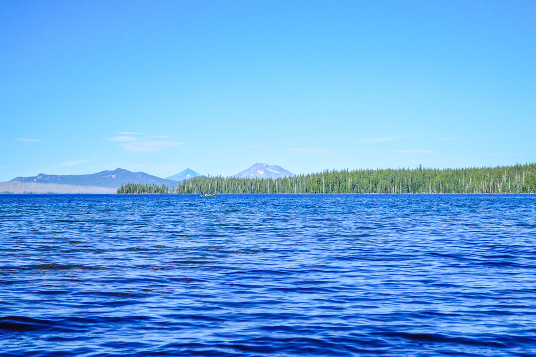
(Three Sisters across Waldo Lake)
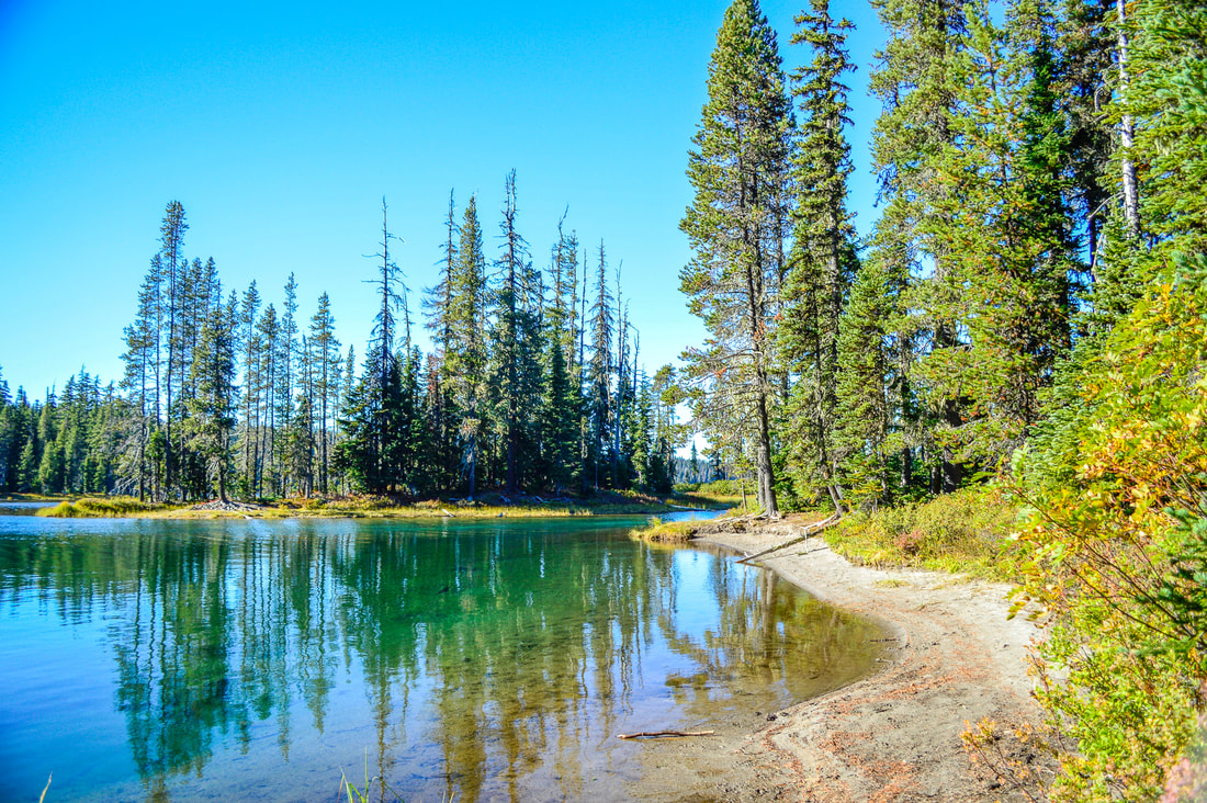
​The trailhead is found just past Shadow Bay campground at the boat ramp parking area. Due to the boat ramp being there, this parking lot can get quite busy in the height of summer, however most of those people are boating or they are just hiking along the shoreline to a nice swimming spot. From the boat ramp, take the connector trail 0.4 miles to where it connects with the Jim Weaver Trail #3590 (this trail goes all the way around the lake) and continue south for 0.75 miles to a right a beautiful beach area to the right of the trail. This quiet sandy shore offers great swimming, and in this small nook on the south side of the lake, you are tucked away from the wind that tends to whip across the north side of Waldo Lake.
South Waldo Shelter
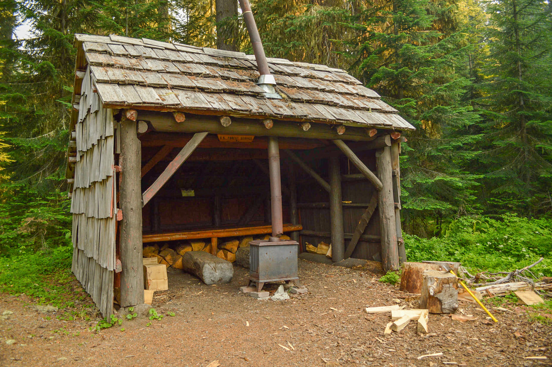
(South Waldo shelter)
South Waldo Trail Waldo Lake Wilderness
South Waldo trail sign
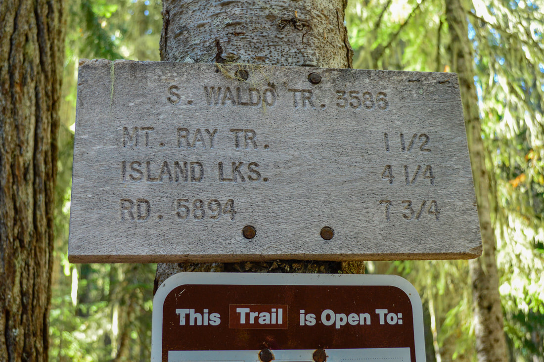
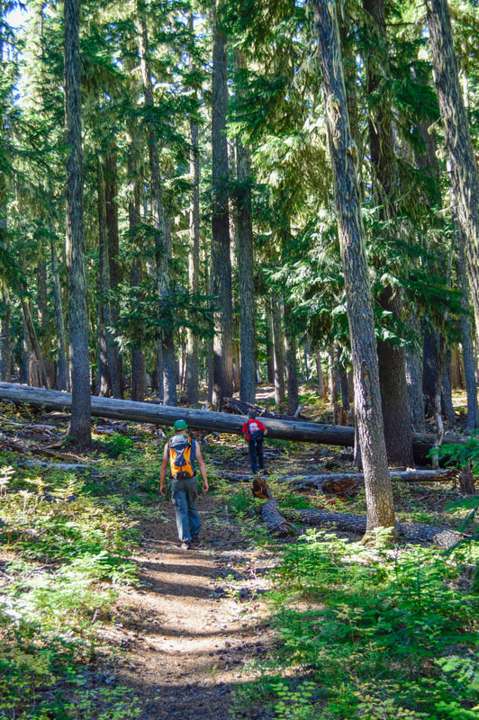
Just 0.25 miles down the trail you will find South Waldo shelter, which is a three sided shelter that has a wooden bench for sleeping or sitting, as well as a stove inside. The shelter sits at the edge of a beautiful meadow where wildflowers bloom in mid to late June. About 250 feet from the shelter, you will see a trail split and this is where the loop portion of the hike begins. You will take a left onto the South Waldo Trail #3586 for 1.4 gentle uphill miles through the woods until you reach another junction. At this 4-way junction you will turn right onto the Mt. Ray Trail #3682, climb to another wooded pass, then the trail dips into a smaller saddle and then it descends steeply for 0.75 miles to Black Meadows. The upper end of the meadow is beautiful with marigolds and a small seasonal pond that reflects Fuji Mountain. 
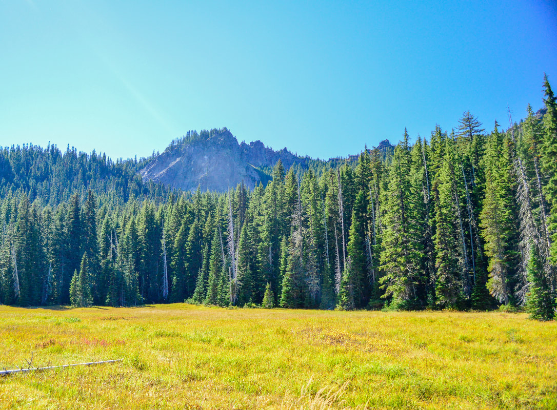
Black Meadows on the South Waldo loop
(Black Meadow)
Hiking through High Divide meadows
(trying to find the trail at the High Divide Trail junction)
High Divide trail
(High Divide Trail)
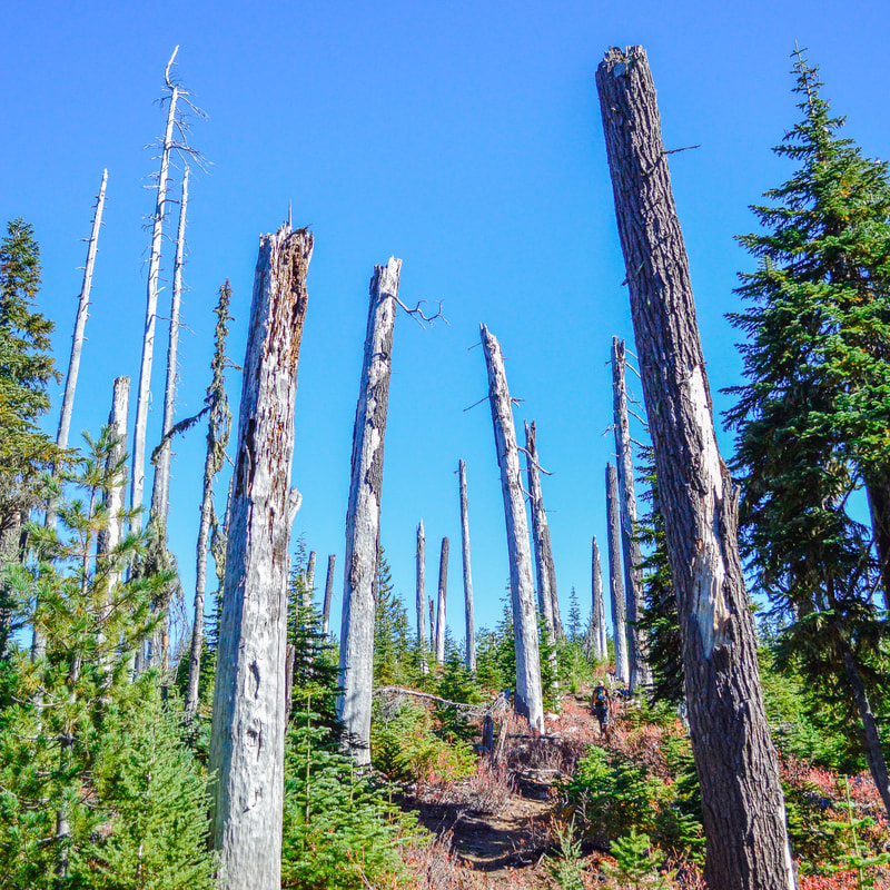
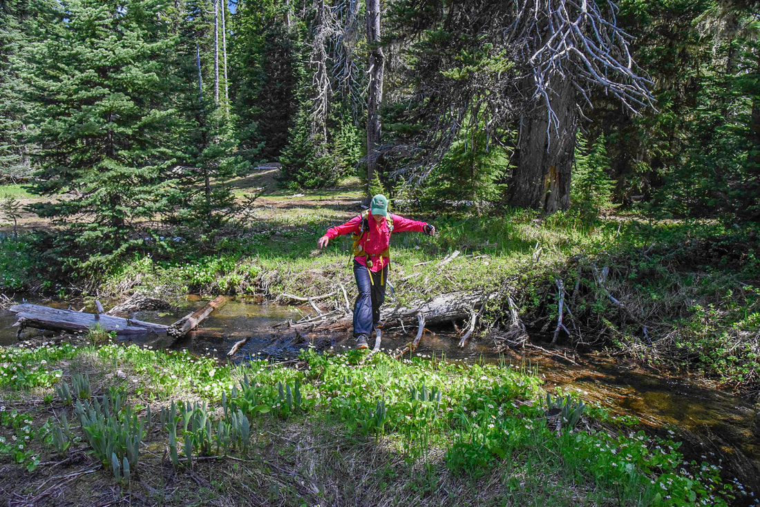
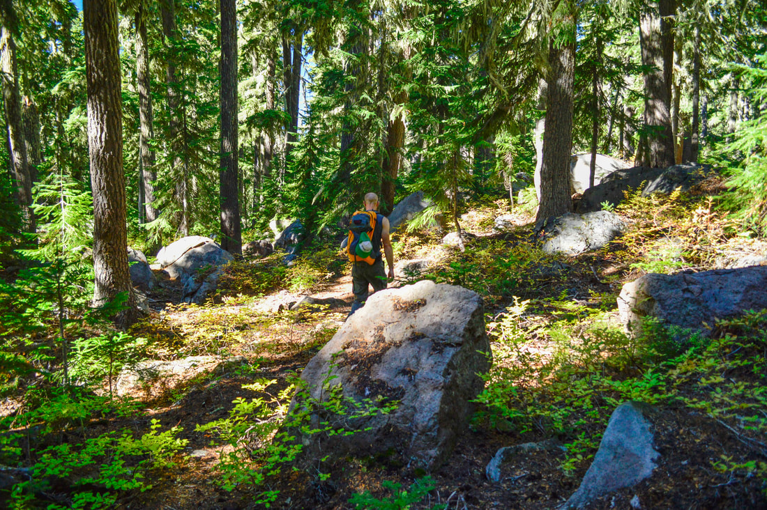
0.3 miles after Black Meadows you will come to another trail junction. This is also a meadow area and if you are here early in the season, it can be quite difficult to see the trails and if the signs haven't been repaired since 2020, a few of them are down on the ground, so it can be a bit tricky to navigate. Turn right onto the High Divide Trail #3572, following occasional trail blazes shaped like exclamation points that have been etched into the trees. Some of the trees during this hike are absolutely enormous. 
Enormous old growth tree along the High Divide Trail South Waldo Loop
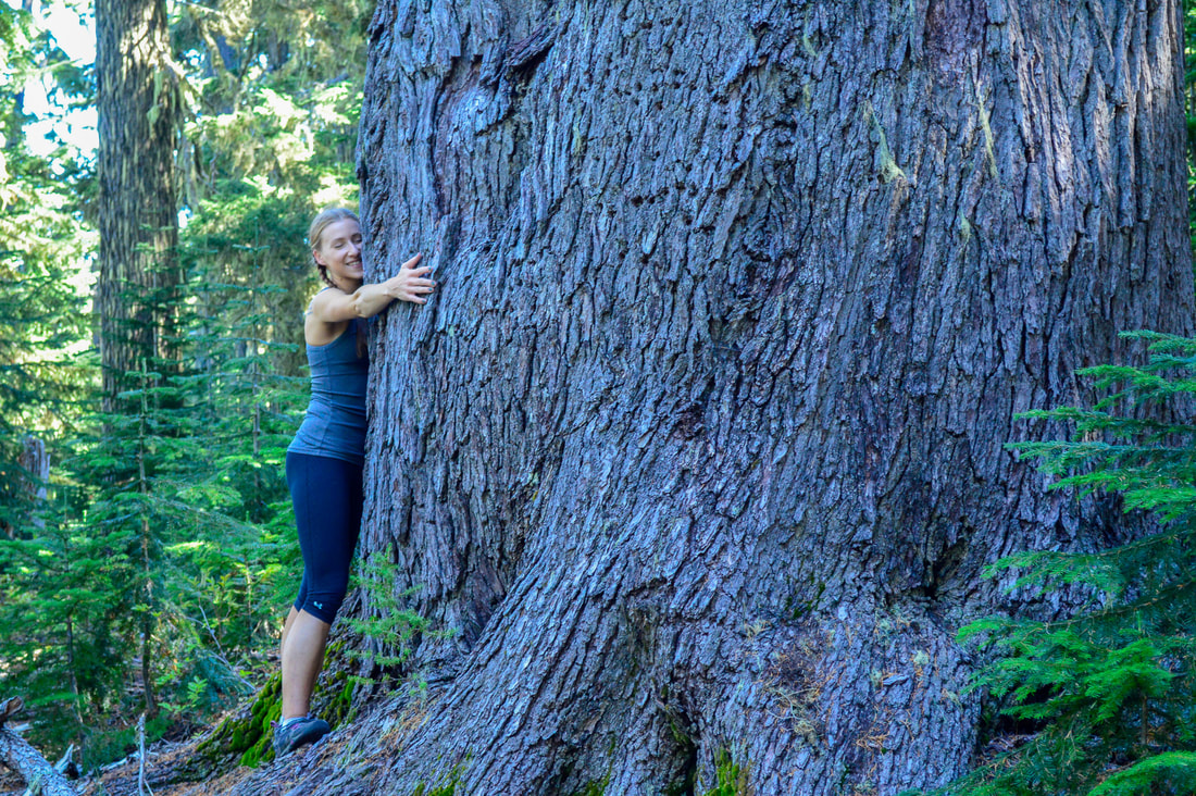
(huge old growth tree)
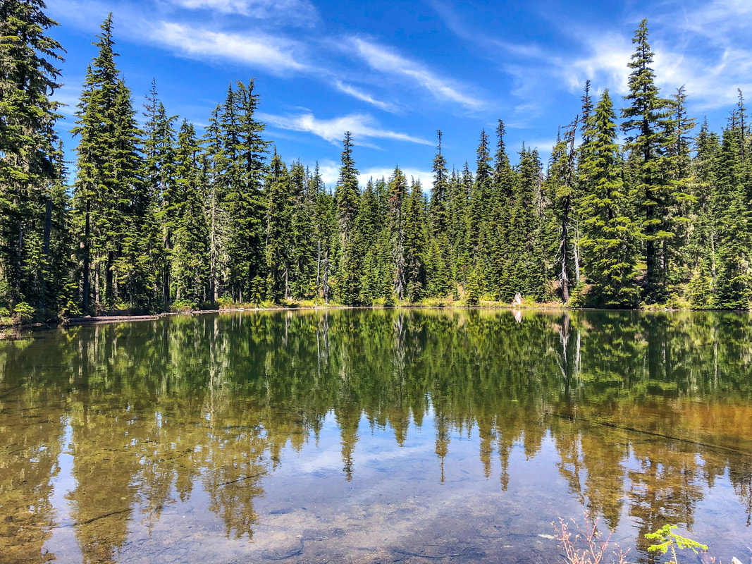
Bingo Lake Waldo Lake Wilderness
(Bingo Lake)
​After 2.25 miles of crossing multiple meadows, passing Bingo Lake and many delicious huckleberry patches (usually berries are ripe in early August), you will come to a T junction with the Jim Weaver Trail. Turn right here to complete the loop. It is only 0.6 miles back to the shelter and just past there is the beautiful swimming beach, so make sure not to forget a towel, because after a hot August day of hiking, you will want to take a dip in that refreshingly cold water!

​The South Waldo Loop is a definitely a special hidden gem. The terrain of the trail is moderate, with occasional blowdowns if there hasn't been any trail maintenance yet that year (most trails don't receive maintenance every year). Over the entire 8.7 miles there is only 1,300 ft. of elevation gain, which is not very noticeable and there are no sections that are very steep. As mentioned before, this is a more remote area, especially if you come at the end of summer/early fall, you will most likely not see anyone else on the trail after leaving the Jim Weaver Trail. This hike is perfect for those seeking solitude. If you are hiking in late June or during the month of July, make sure to bring a bug net and lots of spray, as the mosquitoes in the Waldo Lake Wilderness are known for their large size and their tenacity! 
Jim Weaver Trail South Waldo Loop
Waldo Lake lakeshore
(Waldo Lake lakeshore)

Directions:

​From Oakridge
  • Drive on OR-58 E for a total of 23.4 miles, then turn left onto NF-5897 at a sign for Waldo Lake. Drive on this road for 6.7 miles, then turn left onto NF-5897 at a sign for Shadow Bay Campground/Boatramp and stay on this road for 2.1 miles to the boat ramp/day use area. (Total of 33 miles)
From Bend
  • Drive on US-97 S for a total of 46.9 miles, then turn right onto Crescent Cutoff Rd. for 12 miles. At the stop sign turn right onto OR-58 W for 14 miles, then turn right onto NF-5897 at a sign for Waldo Lake. Drive on this road for 6.7 miles, then turn left onto NF-5897 at a sign for Shadow Bay Campground/Boatramp and stay on this road for 2.1 miles to the boat ramp/day use area. (Total of 82 miles)
From Medford
  • Take OR-62 E towards Crater Lake for 49.5 miles then take a slight left onto OR-230 N for 23.8 miles. Near Diamond Lake turn right onto OR-138 east for 17.7 miles until it T’s into highway 97. Turn left onto US-97 N for 17.8 miles then use the left lane to take the OR-58 W exit toward Eugene. Continue on OR-58 for 27.1 miles, then turn right onto NF-5897 at a sign for Waldo Lake. Drive on this road for 6.7 miles, then turn left onto NF-5897 at a sign for Shadow Bay Campground/Boatramp and stay on this road for 2.1 miles to the boat ramp/day use area. (Total of 152 miles)
From Salem
  • Total of 136 miles via Oakridge.
From Portland
  • Total of 180 miles via Oakridge.
*All pictures are taken by Franziska Weinheimer
*Disclaimer:  the trail descriptions, mileage, GPS tracks and difficulty ratings depicted on this website are never 100% accurate. Always hike at your own risk, using your own knowledge, equipment and common sense. Franziska Weinheimer/Hike Oregon are not responsible if you or anyone in your party gets injured or lost while attempting one of these or any other hikes. ​​​​​​​​

HIKED HERE RECENTLY? PLEASE LEAVE A TRIP REPORT BELOW:

© Hike Oregon 2023
P.O. Box 41911
​Eugene, OR 97404
Proudly powered by Weebly
  • Home
  • *Store*
  • About the author
  • How to use this site
  • Resources
    • Wildflowers
    • Videos
  • Best Oregon Hikes
    • Top Fall Foliage Hikes In Oregon
    • Top 10 Oregon Fall Hikes
    • 20 Best Oregon Waterfall Hikes
    • Top 10 Oregon Hikes for Kids
    • Sno-Parks In Central Oregon
    • Top 10 Oregon Winter Hikes
    • Top Low Elevation Winter Hikes
    • 9 Amazing Oregon Summit Hikes
    • 20 Central Oregon Day Hikes
    • 20 Epic Oregon Wildflower Hikes
    • 5 Weekend Backpacking Trips in Oregon
    • Top One Night Backpacking Trips in Oregon
    • Top 10 Oregon Summer Hikes
    • Top 10 Swimming Spots In Oregon
    • Top 10 Oregon Spring Hikes
  • Oregon Sno-Parks
    • Maxwell Sno-Park
    • Potato Hill Sno-Park
    • Ray Benson Sno-Park
      • Brandenburg Shelter
    • Santiam Sno-Park
    • Three Creek Sno-Park
    • Virginia Meissner Sno-Park
      • Meissner Shelter Loop
      • Nordeen Shelter
    • Gold Lake Sno-Park
      • Westview Shelter to Eagle Rock Overlook
      • Marilyn Lakes Loop
  • Southern Washington
    • Hamilton Mountain
    • Dog Mountain
    • Coyote Wall
    • Mount St. Helens
  • Portland
    • Powell Butte
    • Forest Park
    • Latourell Falls
    • Multnomah/Wahkeena Falls
    • Eagle Creek
    • Mitchell Point
    • Table Rock
    • Tamanawas Falls
    • Trillium Lake
    • East Zigzag Mountain (members only)
  • Salem
    • Abiqua Falls
    • Silver Falls State Park
    • Dome Rock
    • Marion Lake to Marion Mountain
    • Jefferson Park
  • Corvallis
    • Marys Peak East Ridge
    • Marys Peak North Ridge
    • Alsea Falls and Green Peak Falls
    • Corvallis to Sea Trail - Sugarbowl Creek segment (members only)
  • Sweet Home
    • Crescent Mountain
    • Iron Mountain
    • McDowell Creek Falls
    • Middle Santiam River (members only)
    • Lower Soda Creek Falls (members only)
    • Rooster Rock (members only)
  • McKenzie Bridge/Blue River
    • Macduff Mountain
    • Proxy Falls
    • Clear Lake
    • Sahalie/Koosah Falls
    • Blue Pool
    • Erma Bell Lakes
    • Olallie Mountain
    • Horsepasture Mountain
    • Tidbits Mountain
    • Castle Rock
    • Lowder Mountain (members only)
    • East Fork Trail (members only)
    • Rainbow Falls Overlook (members only)
    • Frissell Point (members only)
    • Chucksney Mountain (members only)
    • Substitute Point (members only)
  • Sisters/Santiam Pass
    • Coffin Mountain
    • Trappers Butte and Scar Mountain
    • Maxwell Butte
    • Black Butte
    • Whychus Creek Trail
    • Tam McArthur Rim
    • Black Crater
    • Scott Mountain
    • Obsidian Trail
    • Metolius Preserve
    • Three Fingered Jack Loop
    • Square Lake
    • Canyon Creek Meadows
    • Patjens Lakes
    • Craig Lake (members only)
    • Chush Falls (members only)
    • Rockpile Lake (members only)
    • Santiam Lake (members only)
    • Camp Lake (members only)
    • Park Meadow to Golden Lake (members only)
  • Bend/Redmond/LaPine
    • Steins Pillar
    • Chimney Rock
    • Steelhead Falls
    • Tumalo State Park
    • Tumalo Falls
    • Tumalo Mountain
    • No Name Lake
    • Green Lakes
    • Moraine Lake
    • South Sister Summit
    • Horse Lake
    • Muskrat Lake
    • Paulina Peak
    • Peter Skene Ogden Trail (members only)
  • Eugene
    • Ridgeline Trail
    • Mount Pisgah Summit
    • Mount Pisgah Arboretum
    • Shotgun Creek
    • Mount June
    • Lawler
    • Tire Mountain
    • Goodman Creek
    • Brice Creek
    • Trestle Creek Falls
    • Moon Falls
    • Elijah Bristow State Park
    • South Willamette Trail (members only)
    • Eula Ridge (members only)
    • Eagle's Rest (members only)
  • Oakridge
    • Deception Creek
    • North Salmon Creek
    • Grasshopper Ridge
    • Larison Creek
    • Bunchgrass Ridge
    • Salt Creek Falls
    • Waldo Lake Loop
    • South Waldo Loop
    • The Twins
    • Rosary Lakes
    • Yoran Lake
    • Fawn Lake
    • Windy Lakes
    • Divide Lake
    • Diamond Peak Summit
    • Cowhorn Mountain
    • Wall Creek Warm Springs (members only)
    • Moon Point (members only)
    • Bobby Lake (members only)
    • Lillian Falls (members only)
    • Middle Fork Willamette Trail (members only)
    • Pool Creek Falls (members only)
    • Dead Mountain (members only)
    • Larison Rock (members only)
    • Quinn Lakes & Eddeeleo Lakes (members only)
    • Waldo Mountain Lookout (members only)
    • Blair Lake to Spring Prairie (members only)
    • Rigdon Lakes loop (members only)
  • Oregon Coast
    • Cascade Head
    • Drift Creek Falls
    • Sweet Creek Falls
    • Beaver Creek Falls
    • Kentucky Falls
    • Hobbit Trail to Heceta Head
    • Valley Trail to China Creek
    • North Fork Smith River (members only)
    • Cummins Ridge (member's only)
    • Horse Creek (members only)
    • Siltcoos Lake (members only)
  • Southern Oregon
    • Fall Creek Falls
    • Watson Falls
    • Wild Rogue Loop
    • Mt. Thielsen
    • Crater Lake National Park
      • The Watchman
      • Mount Scott
      • The Pinnacles
    • Lower Table Rock
    • Pilot Rock
    • Wagner Butte
    • Mt. McLoughlin
    • Lemolo Falls (members only)
    • Fern Falls (members only)
  • Eastern Oregon
    • Painted Cove
    • Anthony Lake Loop
    • Mount Howard
    • Eagle Cap summit
    • Schneider Cabin (members only)
    • Strawberry Lake & Strawberry Falls (members only)
  • Oregon PCT sections
  • Tips & Tricks
    • Leave No Trace
    • How To Pick The Right Backpacking Tent
    • Top Tips For Hiking With Infants And Toddlers
    • Poison Oak, Ivy and Sumac
    • How to dress for cold weather hikes
    • Outdoorsy Holiday Gift Guide 2022
    • Hiker Holiday Gift Guide 2019
    • Outdoor Holiday Gift Guide 2018
    • Hiking Holiday Gift Guide 2017
  • Reviews/Gear
    • Stay Kühl This Summer
    • Outdoor Herbivore Backpacking Food Review
    • Osprey Aura AG 65 Backpack review
    • Big Agnes Fly Creek UL2 review
    • REI Quarter Dome 1 review
  • Adventure Stories
    • Hiking The Rae Lakes Loop
    • 110 Miles on the PCT
    • Three Fingered Jack Adventures
    • Jefferson Wilderness