Mount McLoughlin
Hike details:
Mileage: 9.7 miles out and back w/ 3,650 ft. elevation gain
Approximate hike time: 5 hours w/ an average pace of 1.9 mph (it is slow going up and downhill)
Difficulty: Very difficult
Trail usage: High on summer weekends, medium on summer weekdays
Highest elevation: 9,502 ft. Lowest elevation: 5,575 ft.
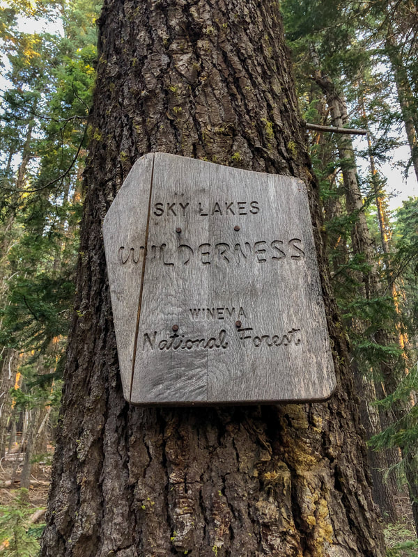
General location: 42 miles east of Medford - Sky Lakes Wilderness - Wenema National Forest
Suggested seasons: Summer, early fall
(Best time to go is September and early October after the bugs and the heat have died down).
Permits required: Annual Northwest Forest Pass for parking
Pit toilet at trailhead: Yes
Trail allows: Dogs, camping
Possible dangers: Losing the trail
Approximate hike time: 5 hours w/ an average pace of 1.9 mph (it is slow going up and downhill)
Difficulty: Very difficult
Trail usage: High on summer weekends, medium on summer weekdays
Highest elevation: 9,502 ft. Lowest elevation: 5,575 ft.
General location: 42 miles east of Medford - Sky Lakes Wilderness - Wenema National Forest
Suggested seasons: Summer, early fall
(Best time to go is September and early October after the bugs and the heat have died down).
Permits required: Annual Northwest Forest Pass for parking
Pit toilet at trailhead: Yes
Trail allows: Dogs, camping
Possible dangers: Losing the trail
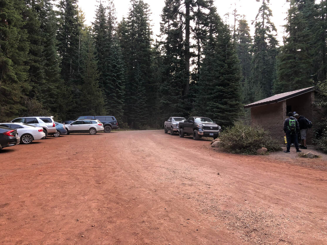
(Mount McLoughlin trailhead)
|
Description:Mount McLoughlin is a 9,495 ft. volcano that is located in the southern part of the Cascade Mountain Range and is one of the more popular volcanos to climb in Oregon. The trail gets quite busy in the summer, even when the air quality is smokey.
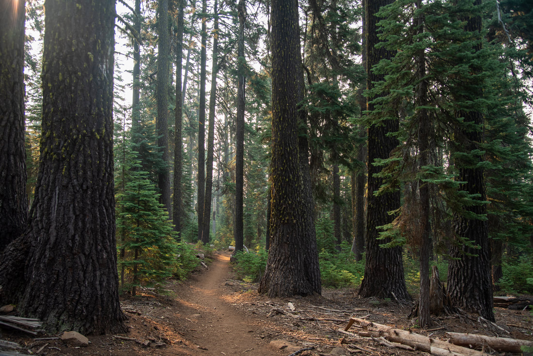
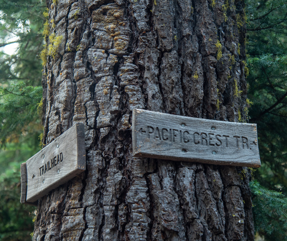
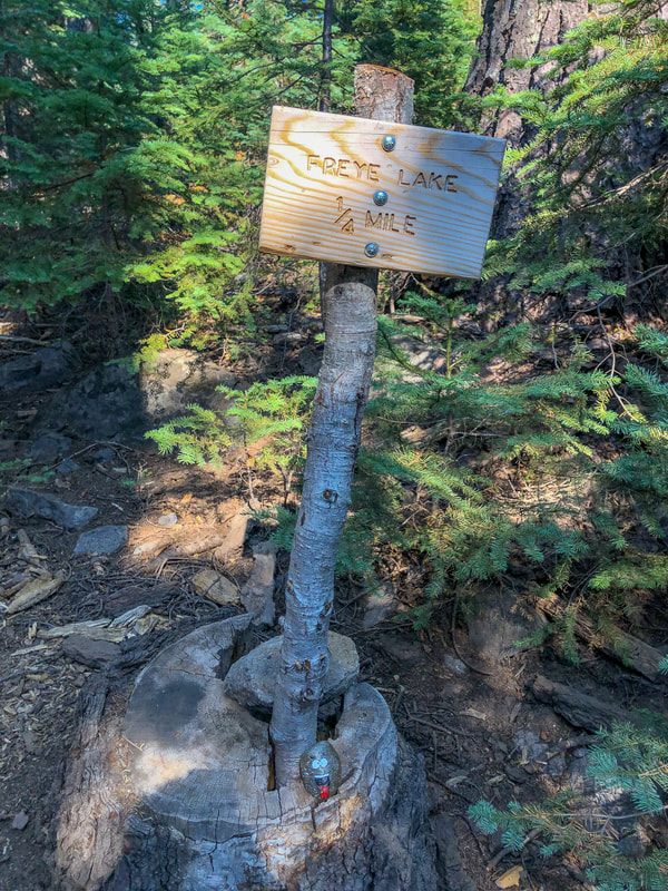
The climber trail starts off through the forest at a slight incline for 1 mile until you reach the Pacific Crest Trail. You will continue northbound on the PCT for 0.6 miles. Along the way you will pass a sign indicating a short side trail to Freye Lake where you can camp. Then you will come to another trail fork where you will see a sign for Mount McLoughlin and you will take the left fork and continue on trail #3716. |
|
|
|
|
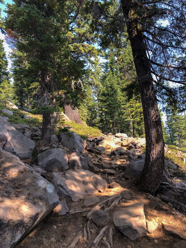
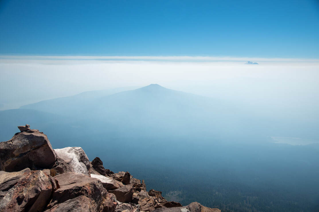
After this second junction, the incline of the trail starts getting steeper and rockier. The trees start to get smaller and smaller as you approach tree line, and soon the trail doesn't much resemble a trail anymore as much as it does a rocky slope. Close to the 8,600 ft. mark you will come to a nice viewpoint where you can see the summit of McLoughlin for the first time. You will also start to catch views of Mount Shasta to the south and Crater Lake in the distance to the north.
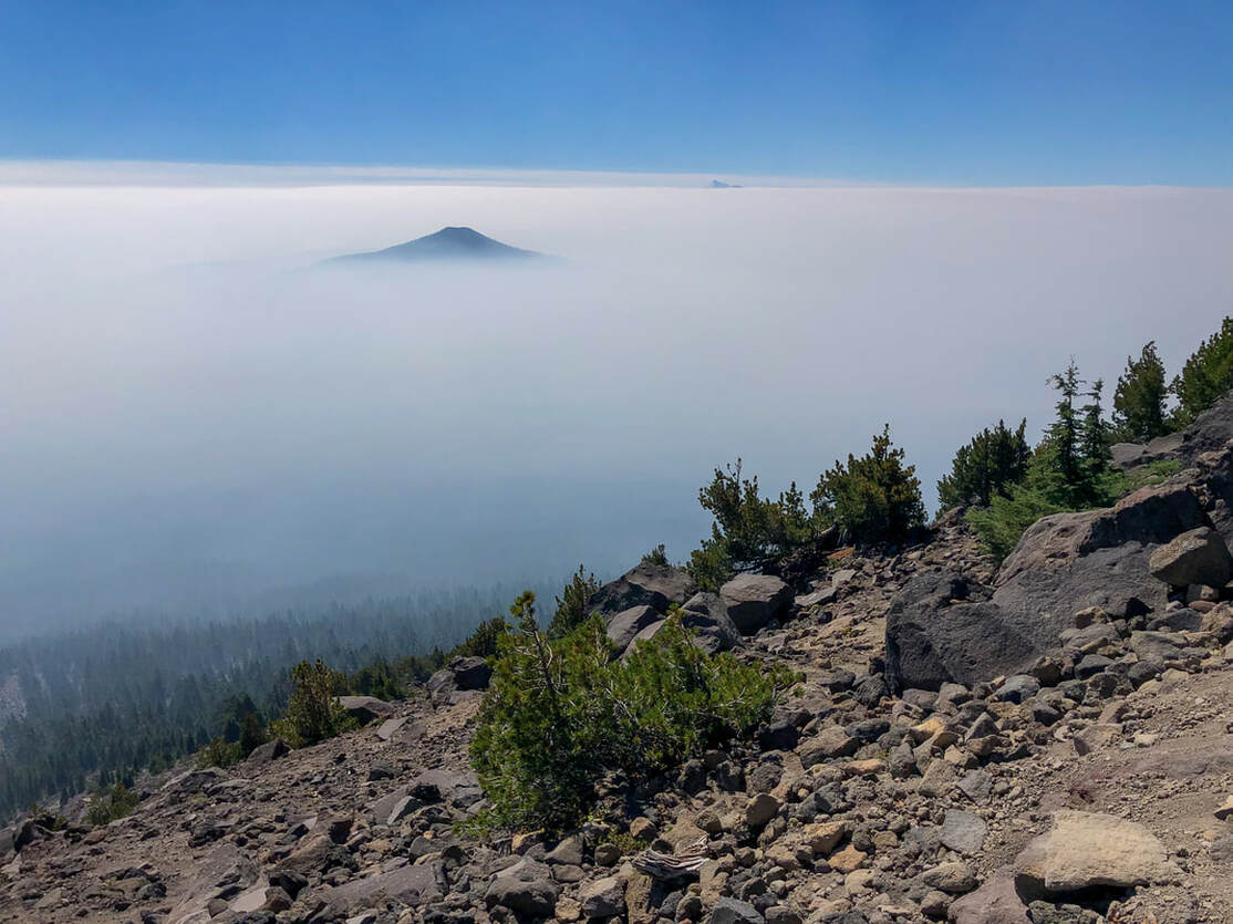
(Brown Mountain & Mount Shasta through a layer of smoke)
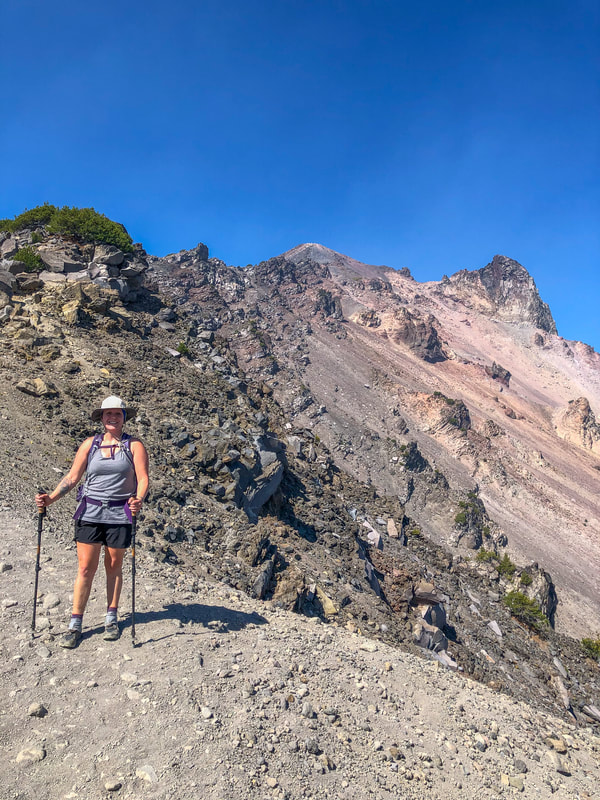
(first summit viewpoint)
|
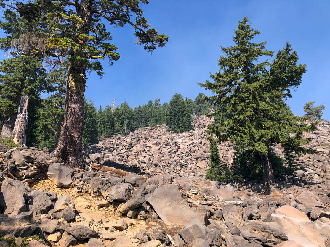
From here on out the trail is not very clear. Do your best to follow the white splotches of paint on the rocks, but honestly they tend to look like bird poop and they're small and few and far between, so they're easy to miss.
Pro tip: Because so much of this hike is climbing over rocks, if you take gardening gloves with rubber palms, they really help with gripping the rocks and you won't shred your hands. Right before the summit the rocks get really loose and there is a bunch of scree that is tedious to walk through. After you have climbed that last little bit you will arrive at the summit. There used to be a fire lookout up there, which is pretty unbelievable, and you will see remnants of it. It was destroyed in 1955 after a lot of vandalism and misuse left the lookout in disrepair. |
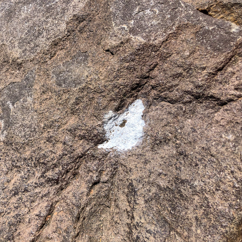
(white paint blazes to guide the way through the rocks)
|
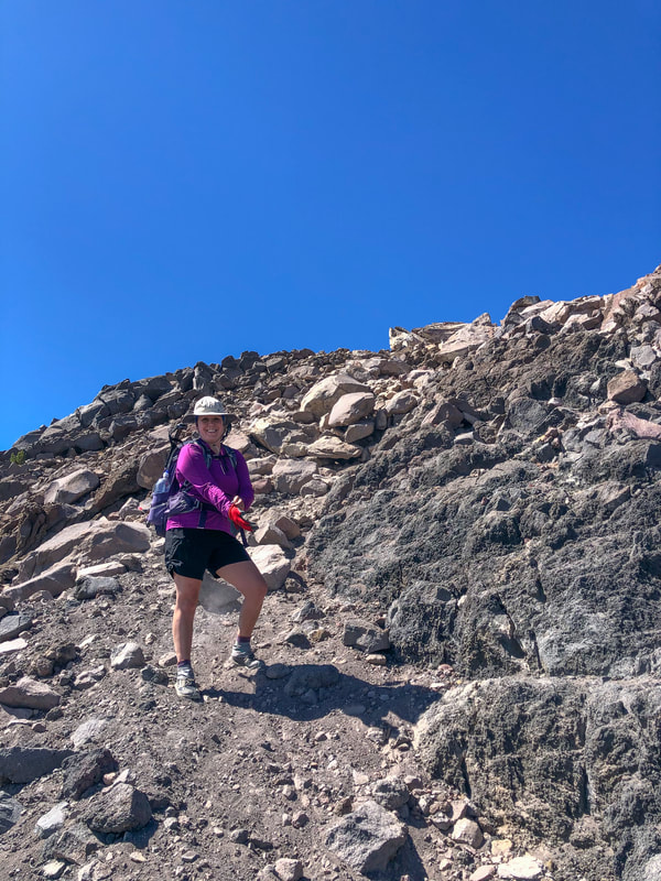
(the final push to the summit)
|
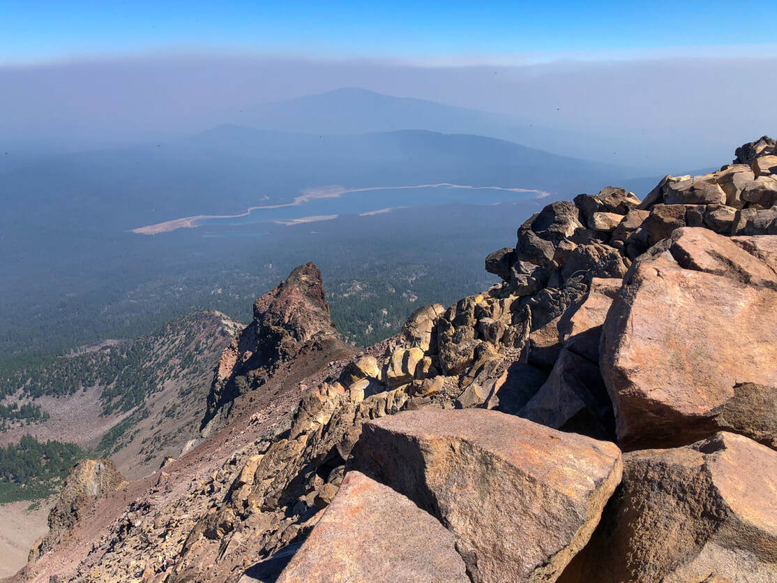
From the summit you can see 360 degree views! You will see all of the lakes that are part of the Sky Lakes Wilderness, Brown Mountain, Mount Shasta and of course Crater Lake, Mount Thielsen and Mount Bailey. During August and the beginning of September it can often be smokey in Southern Oregon due to the many wildfires that occur yearly in Oregon and California, but on a clear day the view from the summit is one of a kind in this area! If you have brought a dog to the summit, please keep them on leash at the top. This is not only for their safety, since there are sheer drop offs on all sides of the summit, but also for other's safety.
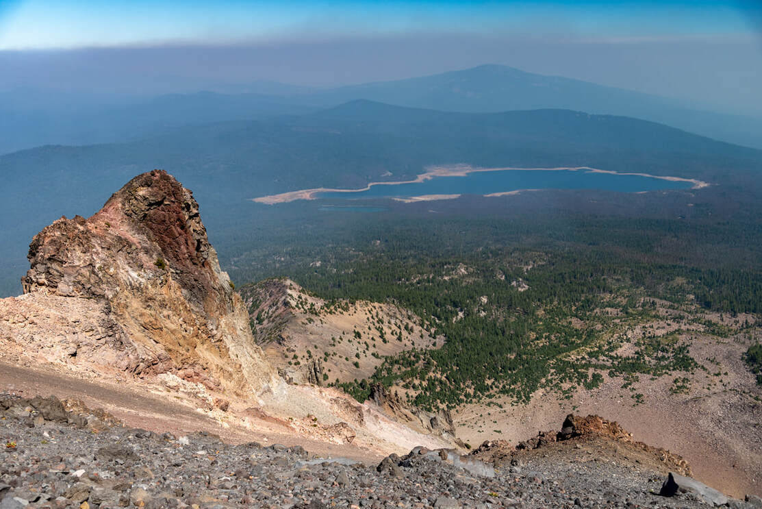
(Four Mile Lake)
When coming down from the summit, remember to follow the ridge all the way down until you connect with the trail again. Many folks veer too much to the right and go through the boulders and end up in a total different watershed. The Forest Service gets 2-3 SOS calls from the mountain per week during the summer climbing months. They always know exactly where the people who take the wrong way will end up. Some folks even make it all the way down to OR-140!
The Mount McLoughlin climber trail is an amazing trek, but definitely not for the faint of heart. It is considered Very Difficult because there are some dangerous spots and because you definitely have to do some route finding and bouldering. It is extremely steep with loose rocks, scree and exposure. It is definitely recommended to take trekking poles, lots of water, sun protection and of course the other 10 essentials.
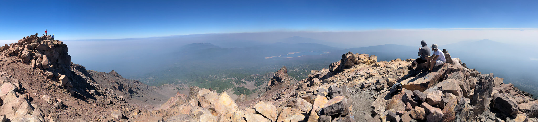
(panorama from the summit)
Directions:
From Medford
- Drive OR-140 east for a total of 32.4 miles, then turn left onto NF-3650 and continue on for 2.4 miles to the trailhead on your left. (Total of 42.5 miles)
- Drive US-97 south for 109 miles, then take exit 247 for OR-422 toward Crater Lake and turn right onto OR-422 W for 3 miles. Turn right onto OR-62 W for 5.3 miles, then turn left onto Loosley Rd. for 1.5 miles. Turn right onto Weed Rd E for 0.5 miles, then turn right onto OR-140 W for 7.9 miles. Turn right onto Fourmile Lake Rd. for a total of 2.9 gravel miles, and then turn left onto NF-3650 for 0.2 miles to the trailhead on your right. (Total of 152 miles)
- Drive on OR-58 east for 86.2 miles, then merge onto US-97 S and continue on for 52.3 miles. Take exit 247 for OR-422 toward Crater Lake and turn right onto OR-422 W for 3 miles. Turn right onto OR-62 W for 5.3 miles, then turn left onto Loosley Rd. for 1.5 miles. Turn right onto Weed Rd E for 0.5 miles, then turn right onto OR-140 W for 7.9 miles. Turn right onto Fourmile Lake Rd. for a total of 2.9 gravel miles, and then turn left onto NF-3650 for 0.2 miles to the trailhead on your right. (Total of 189 miles)
- It is a total of 250 miles via Eugene.
- It is a total of 293 miles via Eugene.
-This trail write-up was last updated June, 2022-
*All pictures are taken by Franziska Weinheimer
*All pictures are taken by Franziska Weinheimer
*Disclaimer: The trail descriptions, mileage, GPS tracks and difficulty ratings depicted on this website are never 100% accurate. Always hike at your own risk, using your own knowledge, equipment and common sense. Franziska Weinheimer/Hike Oregon are not responsible if you or anyone in your party gets injured or lost while attempting one of these or any other hikes.