Trestle Creek Falls
Hike details:
Mileage: 3.75 mile loop w/ 1,600 ft. elevation gain
Approximate hike time: 1 hour 37 minutes w/ an average pace of 2.3 mph
Difficulty: Moderate (only because it is very steep in some sections)
Trail usage: High on nice weather weekends, low on weekdays
Highest elevation: 2,665 ft. Lowest elevation: 1,917 ft.
General location: 27 miles southeast of Cottage Grove - Umpqua National Forest
Accessible: Year-round
(Best time to go is March through June when everything is lush and green and the waterfalls are flowing well).
Permits required: N/A
Pit toilet at trailhead: Yes
Trail allows: Dogs, mountain bikes on the Brice Creek section
Possible dangers: Slippery trail near the upper waterfall
|
Description:Trestle Creek Falls loop is the perfect hike to do in any season! There are two wonderful waterfalls and that lush green Oregon forest that everyone loves. This is one of those hikes that is perfect for the whole family, and it can get pretty busy on nice weather weekend days.
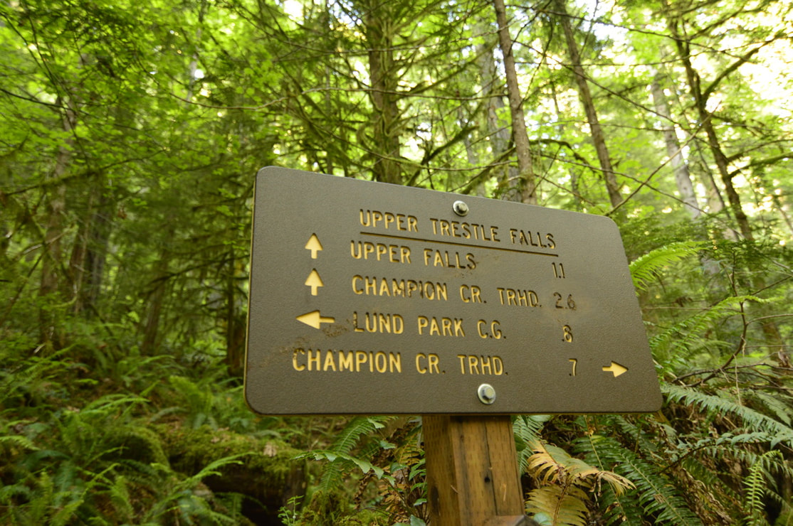
There is a gravel parking area on the left side of the road, right before the bridge crosses over Brice Creek. In this head-in designated parking area there is room for about 10 cars, along with a pit toilet. You will cross the bridge and see two trail signs. Here you can decide if you want to do the loop clockwise or counter-clockwise. The writeup below describes it clockwise. |
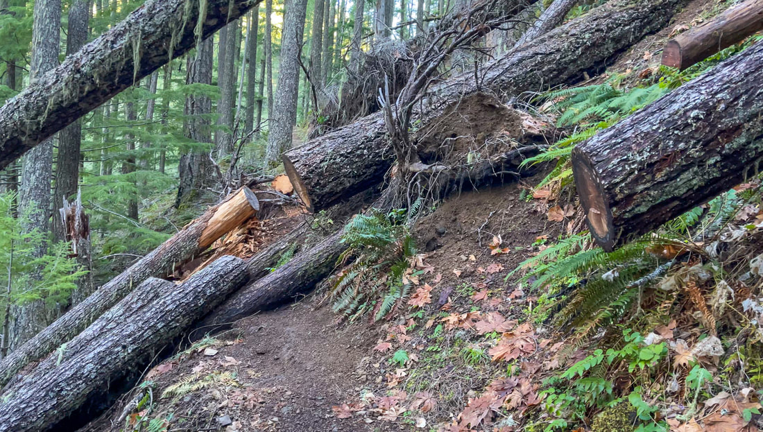
In 2019 there was a gnarly winter storm that badly damaged this forest and the trail. This trail has mostly been repaired since then but you can still see some damage along the way (see picture above).
You will begin your hike on the Brice Creek Trail for 0.3 miles until you see a sign that marks the Lower Trestle Creek Falls junction. Take the trail to the right as it takes you uphill through a narrow canyon for 0.25 miles until you come to Lower Trestle Creek Falls. Late in the season like August and September, the water flow can be very minimal, and since the winter storm in 2019, the waterfall has accumulated a lot of debris in the canyon and it doesn't look quite a pretty as it used to. After viewing Lower Trestle Creek Falls, hike back down to the Brice Creek Trail and continue for another 0.3 miles until you see a sign for Upper Trestle Creek Falls. This is where you will turn right onto the Upper Trestle Creek Trail #1403D.
You will begin your hike on the Brice Creek Trail for 0.3 miles until you see a sign that marks the Lower Trestle Creek Falls junction. Take the trail to the right as it takes you uphill through a narrow canyon for 0.25 miles until you come to Lower Trestle Creek Falls. Late in the season like August and September, the water flow can be very minimal, and since the winter storm in 2019, the waterfall has accumulated a lot of debris in the canyon and it doesn't look quite a pretty as it used to. After viewing Lower Trestle Creek Falls, hike back down to the Brice Creek Trail and continue for another 0.3 miles until you see a sign for Upper Trestle Creek Falls. This is where you will turn right onto the Upper Trestle Creek Trail #1403D.
(45-foot tall Lower Trestle Creek Falls before the big winter storm of 2019)
|
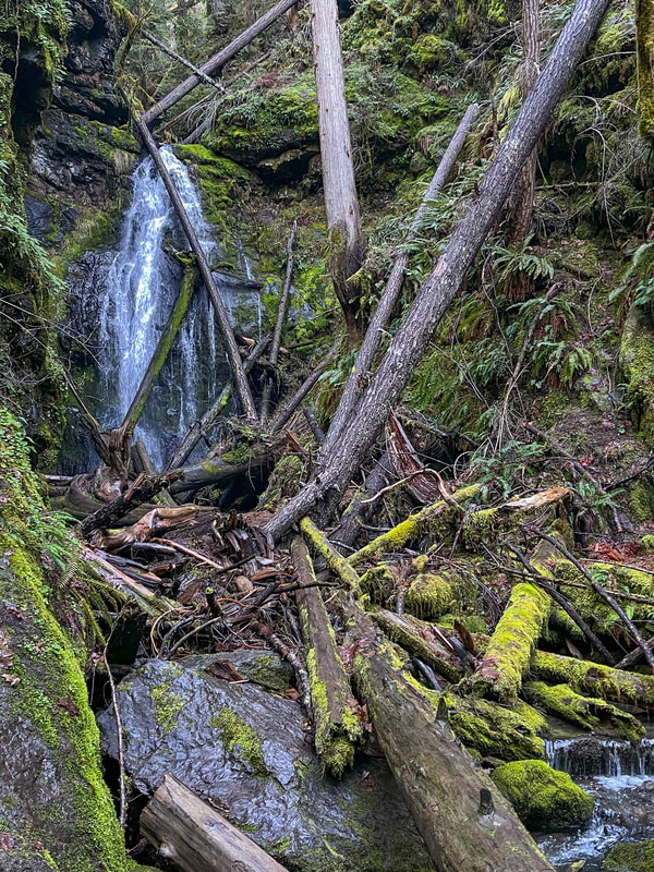
(Lower Trestle Creek Falls after the big winter storm of 2019)
|
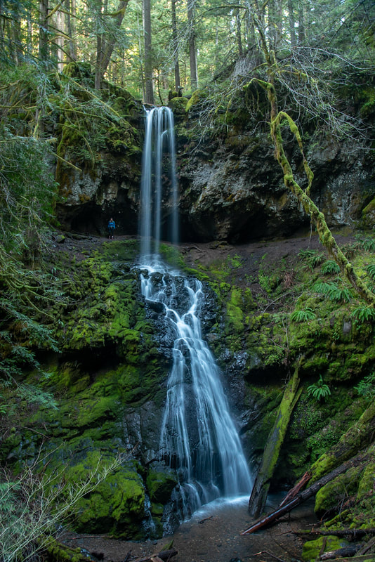
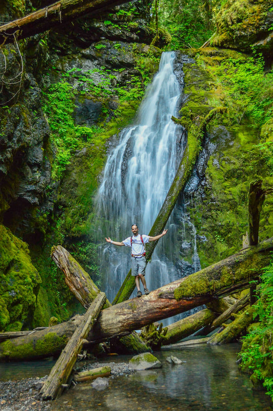
(Upper Trestle Creek Falls 100 ft.)
|
This is where you will gain the majority of the hike's elevation, as the trail takes you 1.1 miles uphill, gaining a total of 836 feet of elevation. In the wet winter season, this section of trail can get a bit muddy and slippery. As you hike high above the creek, the canyon starts to narrow and then you will see Upper Trestle Creek Falls, a stunning two-tier waterfall that is 100 feet tall.
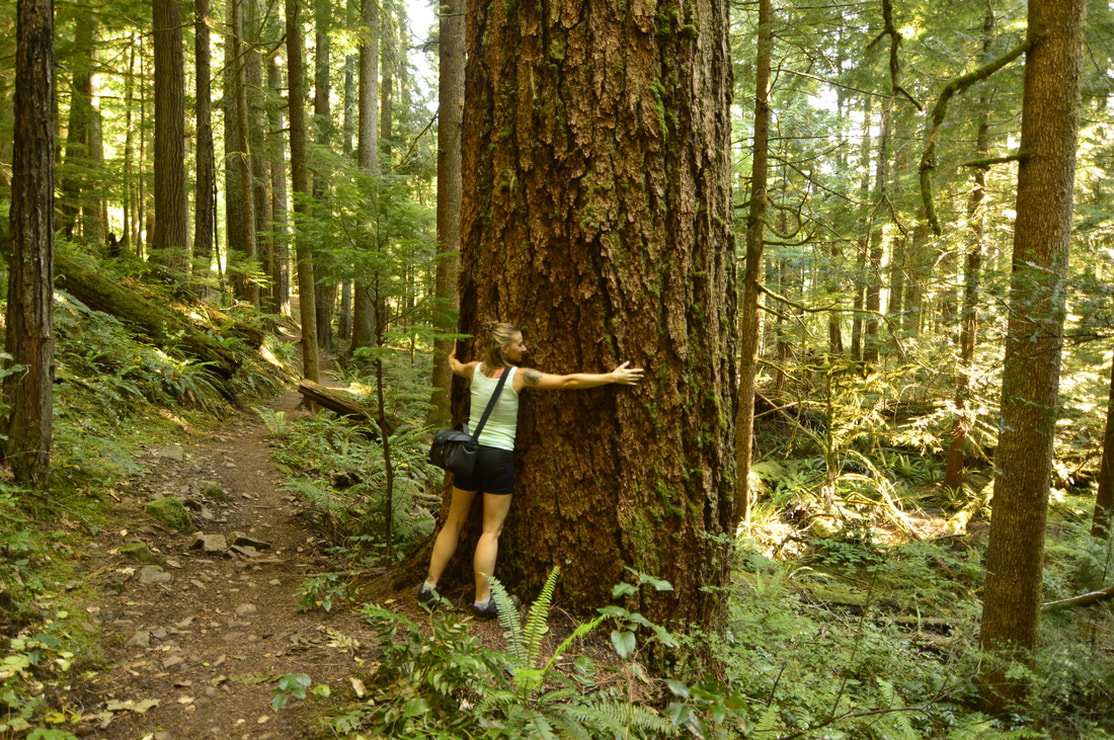
The trail goes behind the waterfall and here you have reached the highest point of the hike. You can see the entire waterfall from the other side of the canyon, and this is where you can get really good pictures of it crashing down into a beautiful clear pool below. The entire canyon is lush and green even in the height of summer. As the trail takes you downhill and away from the creek, the forest is a sea of large ferns, moss and Oregon grape, and you will see some huge old growth trees that weathered the massive storm in 2019. (See picture below). Trestle Creek Falls Loop is one of the best hikes near Eugene. This trail is dog friendly and kid friendly. It is rated as 'moderate' because the trail can be a bit slippery when it's muddy, as well as near the falls since that area is always damp, and it is steep going up to Upper Trestle. This is a great close-to-town hike that you can do during all seasons. |
Directions:
From Eugene
- Drive I-5 south a total of 20 miles to Cottage Grove. Take exit 174 and follow signs to Dorena Lake. Stay on Row River Rd. for 18.4 miles, then at the junction with Laying Creek Rd. the road you're on turns into Brice Creek Rd. Stay on this road for another 8.1 miles until you see the trailhead on your left. (Total of 48 miles)
- Drive US-97 S for a total of 46.9 miles then turn right onto Crescent Road/Crescent Cutoff Road and continue for 12 miles until you T into OR-58. Take a right and drive OR-58 W for 35.6 miles. At a sign for Hills Creek Reservoir turn left and then turn right onto Road 21 and almost right away turn left onto NF-21 for 5.7 miles. Turn right onto NF-2110 for 10.2 miles then continue straight on NF-22 for 0.6 miles then stay right on NF-22 for 3.4 miles. Turn right onto NF-22 and stay on this road for 8.1 miles until you see the parking for the Brice Creek trailhead on your left. (Total of 120 miles)
- Drive I-55 N a total of 145 miles to Cottage Grove. Take exit 174 and follow signs to Dorena Lake. Stay on Row River Rd. for 18.4 miles, then at the junction with Laying Creek Rd. the road you're on turns into Brice Creek Rd. Stay on this road for another 8.1 miles until you see the trailhead on your left. (Total of 173 miles)
- Total of 109 miles via Eugene.
- Total of 153 miles via Eugene.
|
-This trail write-up was last updated in April 2023-
*All pictures are taken by Franziska Weinheimer *Disclaimer: The trail descriptions, mileage, GPS tracks and difficulty ratings depicted on this website are never 100% accurate. Always hike at your own risk, using your own knowledge, equipment and common sense. Franziska Weinheimer/Hike Oregon are not responsible if you or anyone in your party gets injured or lost while attempting one of these or any other hikes.
|
To get a more in-depth and personal view of this hike, watch the YouTube video.
|