Top 10 Oregon Winter Hikes
Just because the days are shorter and the weather might sometimes be not so great, doesn't mean that you have to forgo enjoying the great outdoors. For the winter hiker who doesn't own cross country skis or snowshoes, the choice of trails can be limited. Here are the 10 best Oregon winter hikes for you to enjoy this season! Before heading out on a winter hike, don't forget to check out the 10 Gear Essentials for Winter Hiking post, to make sure you have the appropriate winter hiking gear and clothing.
*If some of these hikes are under snow, try checking out the Top 8 Low Elevation Winter Hikes page where all of the hikes listed are under 3,000 ft.
*If some of these hikes are under snow, try checking out the Top 8 Low Elevation Winter Hikes page where all of the hikes listed are under 3,000 ft.
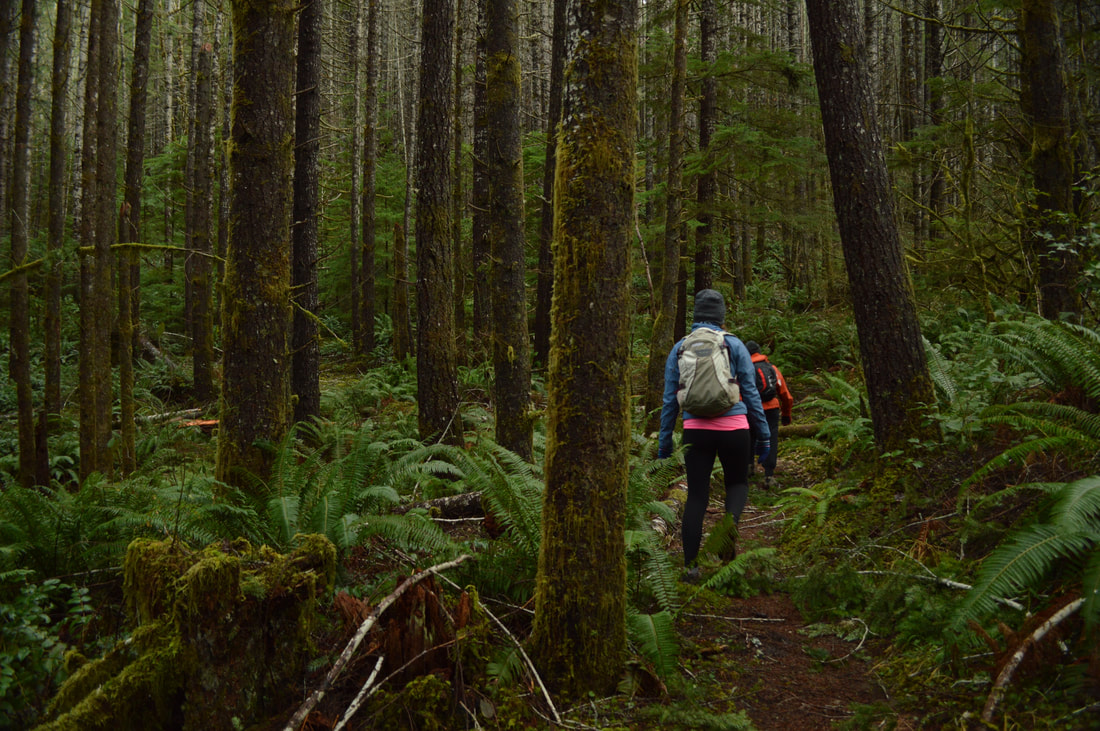
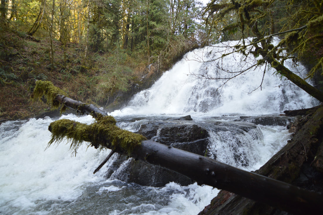
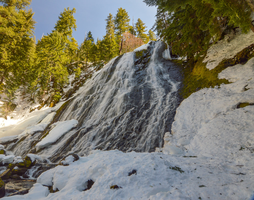
1) Alsea & Green Peak Falls
|
|
Closest town: Corvallis
Trail type: Round trip and small loop
Mileage: 4.7 miles w/ 1,620 ft. elevation gain
Terrain difficulty: Easy
Trail usage: Low
About the hike: This hike is the perfect lollipop loop hike, and because it is short and not too far away from town, it makes for the perfect winter hike for those days where we don't get much daylight. Alsea Recreation Area is absolutely beautiful and you will get to see 30 ft. Alsea Falls as well as 45 ft. Green Peak Falls, which is generally roaring with rain water!
(Click here for more information and directions)
2) Rosary Lakes- snowshoeing
|
|
Closest town: Oakridge
Trail type: Round trip
Mileage: 7.5 miles w/ 1,000 ft. elevation gain
Terrain difficulty: Easy
Trail usage: Medium
About the hike: This hike is perfect for someone's first time snowshoeing. The trail is popular for cross-country skiers and snowshoers and the trail is generally maintained. After taking the Pacific Crest Trail 3 miles through the woods, you will reach the first of the three Rosary Lakes. In the winter they are frozen over, making pulpit rock stick out and shine its beauty in the starkness of the winter landscape. This hike is only 31 miles east of Oakridge off of OR-58.
(Click here for more information and directions)
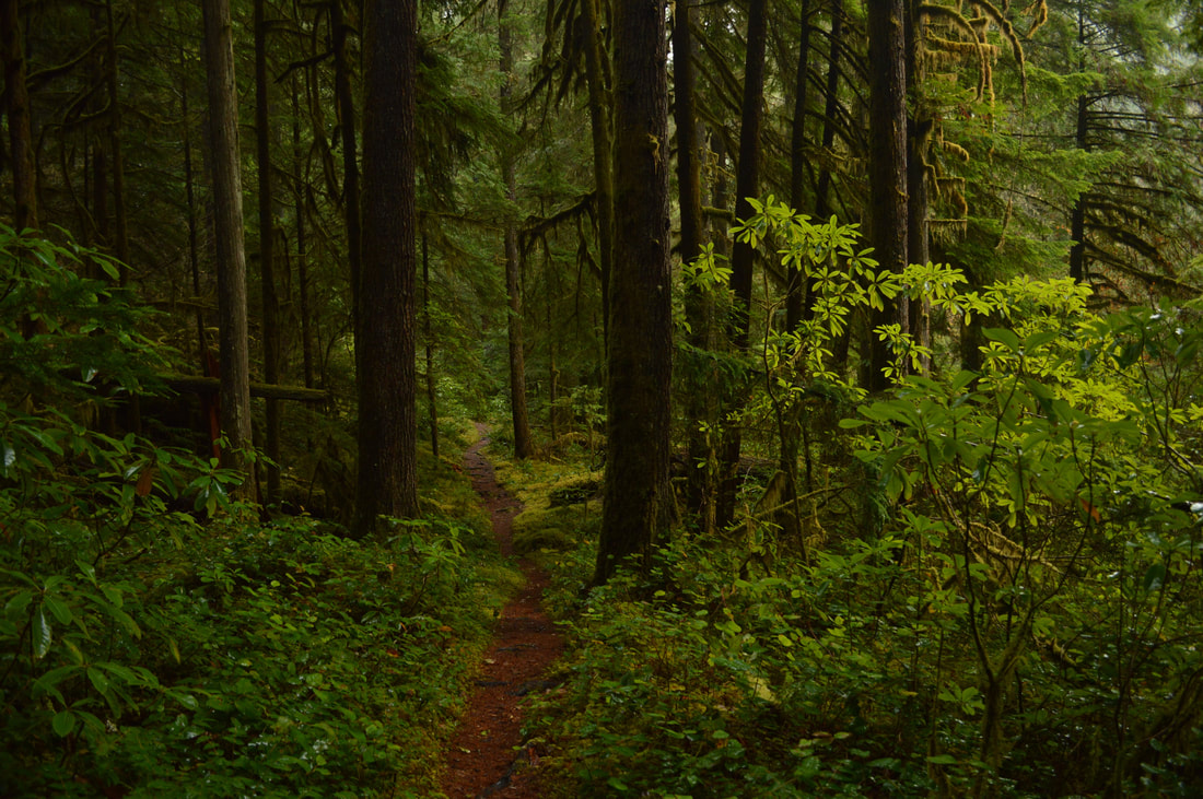
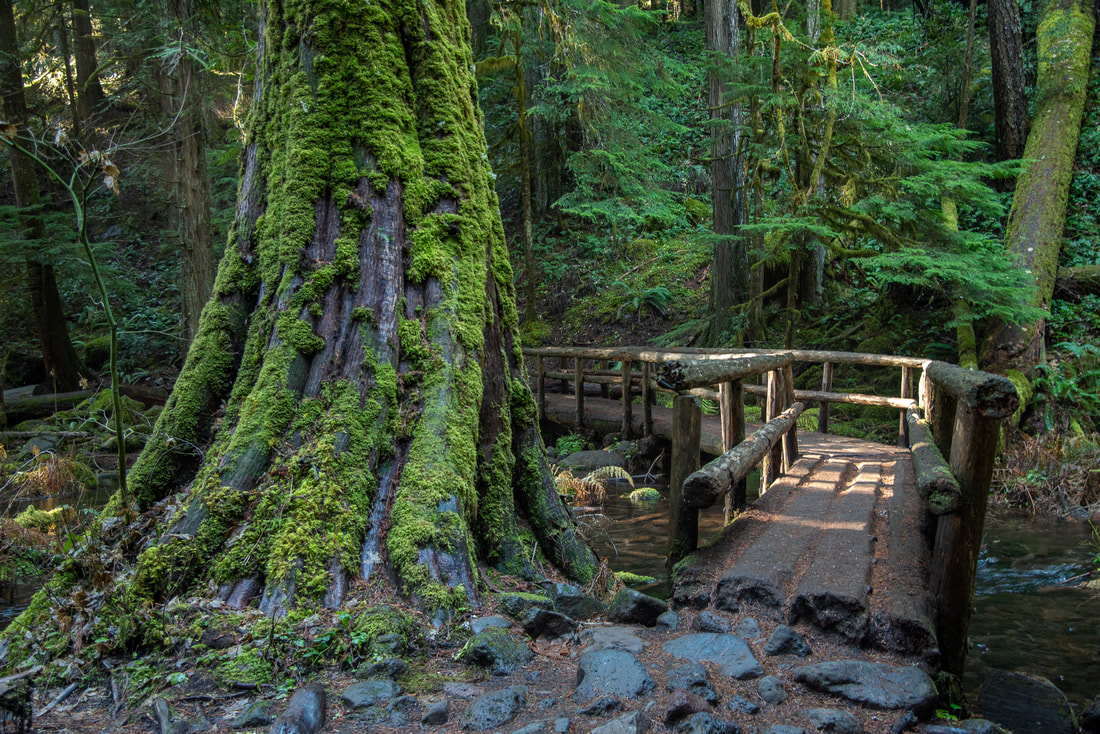
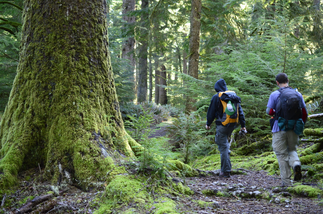
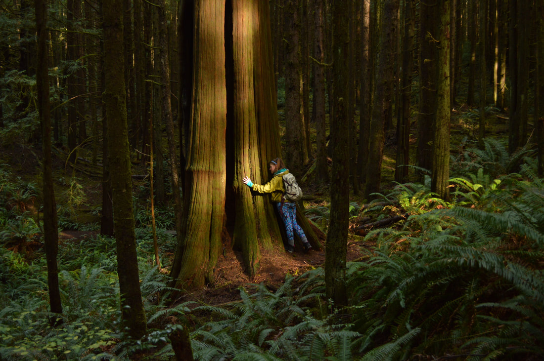
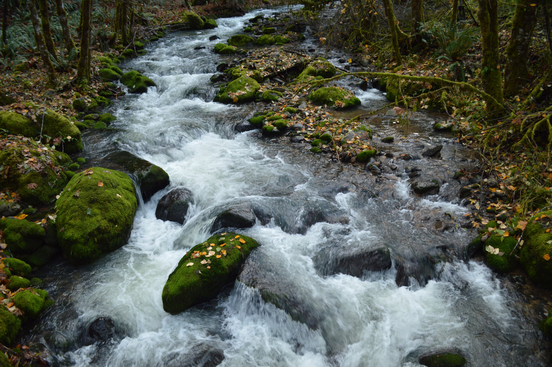
3) Larison Creek
|
|
Closest town: Oakridge
Trail type: Round trip
Mileage: 10 miles w/ 1,950 ft. elevation gain
Terrain difficulty: Easy
Trail usage: Low
About the hike: This is a very mild out and back hike along Larison Creek which is extremely beautiful especially in the winter when there is lots of water in the creek. There is a nice spot about 2.5 miles in, featuring a small flat meadow right by the river where you can sit on a log and enjoy some lunch. After the creek narrows, it and the trail narrows farther into the forest, highlighting thick moss covered old growth. The trailhead is only a few miles east of Oakridge near Hills Creek Dam off of Road 21. This road is accessible the majority of the winter.
(Click here to read more about this hike and to get directions- this post is for members only, you can purchase the seasonal membership for $9.99)
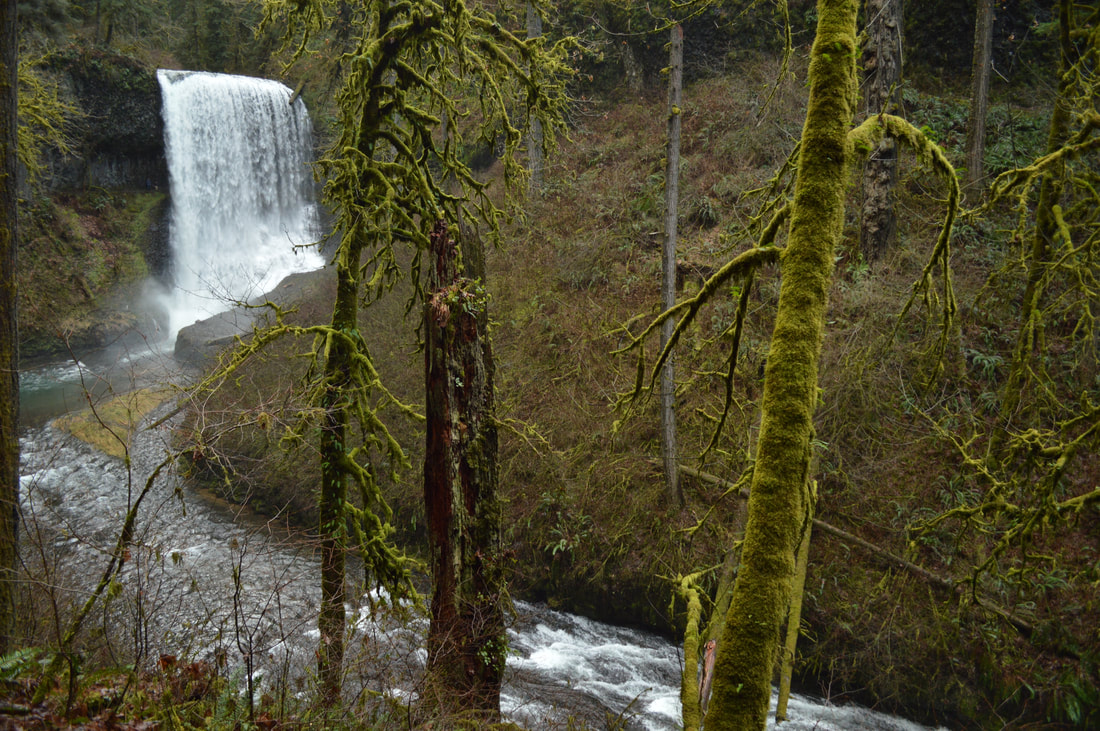
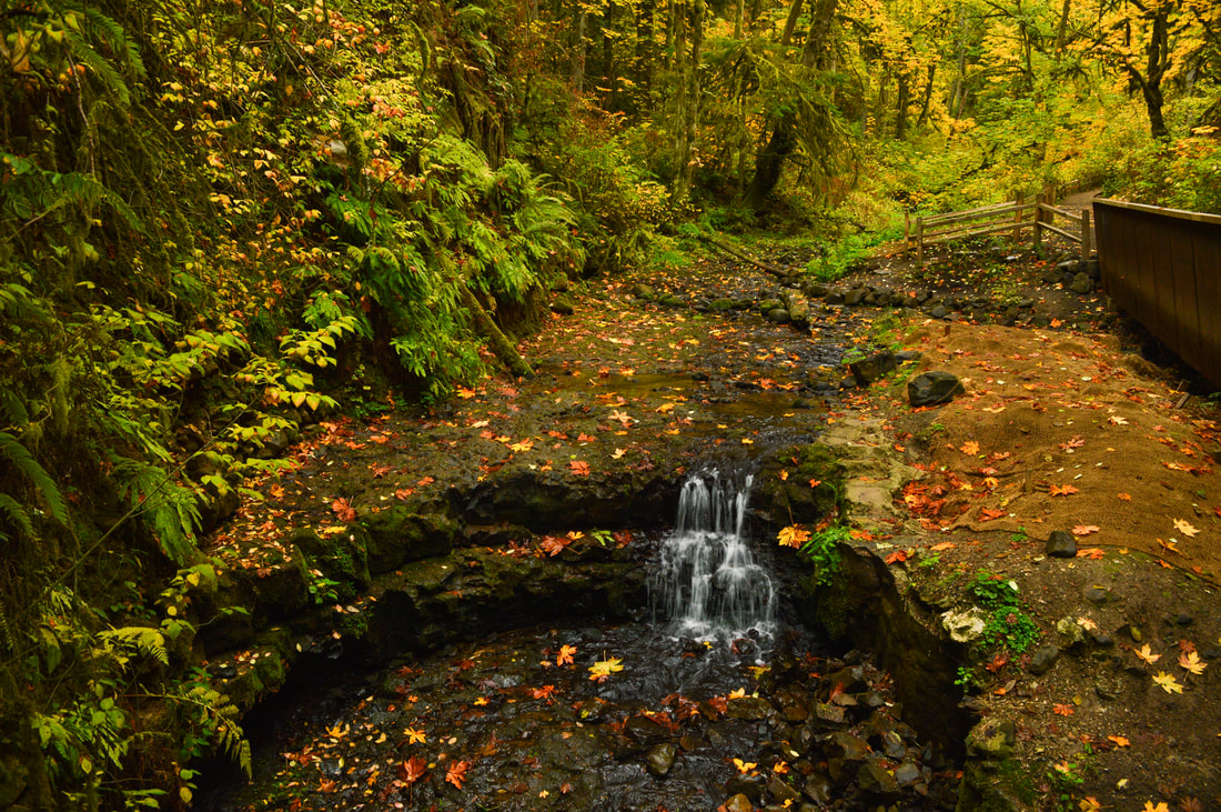
4) Silver Falls - Trail of 10 Falls
|

|
Closest town: Silverton and Salem
Trail type: Loop
Mileage: 8.6 miles w/ 1,480 ft. elevation gain
Terrain difficulty: Moderate (can be slippery when wet or icy)
Trail usage: Low to medium on week days, high on weekends
About the hike: This 8.6 mile loop is absolutely beautiful and a pretty easy hike as the trail is pretty much flat, with the exception of some stairs. Along the hike you see 9 waterfalls that are up to 200 feet tall! You can make the loop 2.6 miles shorter if you aren't into the longer hikes, and it only cuts out two of the waterfalls. Because of all the mist in the air from the waterfalls, this hike can get a bit icy if the temperature is below freezing, but other than that, it rarely snows in this area. Icicles here can get up to four feet tall!!! This well-known State Park is only 25 east of Salem.
(Click here for more information and directions)
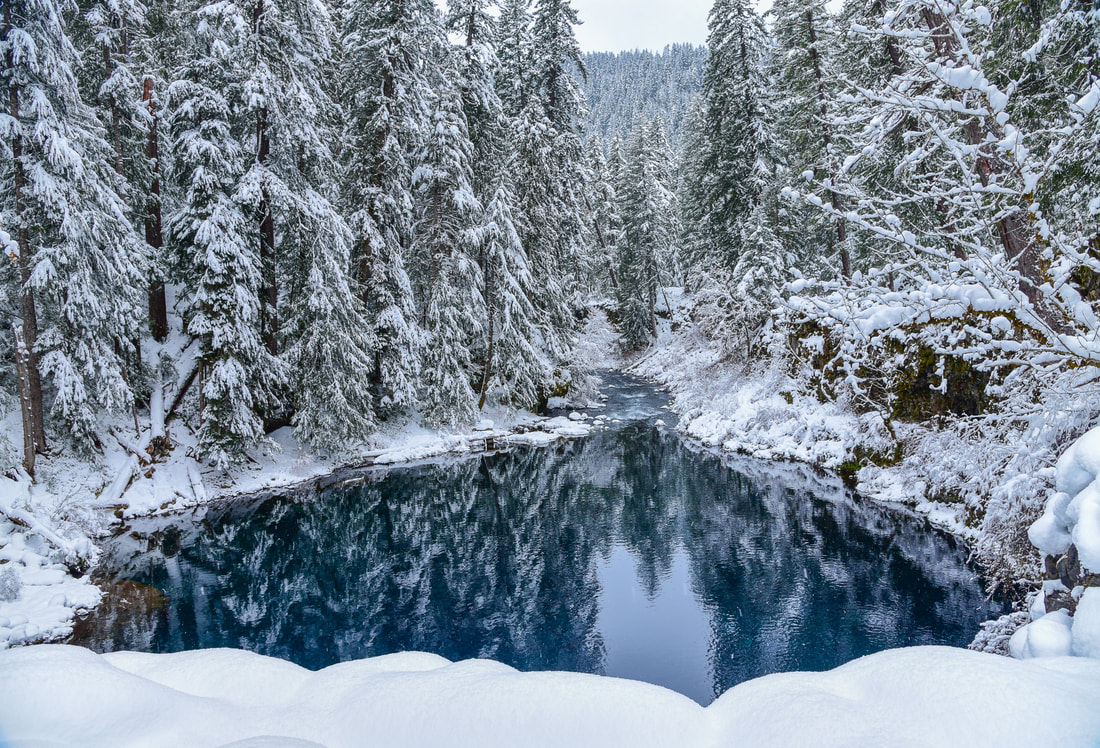
5) Blue Pool
|
|
Closest town: McKenzie Bridge
Trail type: Round trip
Mileage: 4.2 miles w/ 375 ft. elevation gain
Terrain difficulty: Easy to moderate
Trail usage: Medium
About the hike: This hike is perfect for the shorter days that we get during the winter. There can be snow in this area, but because this is part of the McKenzie River trail, it is pretty much always walked or biked on year round, making is easy to walk on even when there is snow. The end of this hike has a gorgeous view of Blue Pool/Tamolitch Pool which is stunningly blue. This hike is for any level of hiker! To get here drive 14 miles east of the town McKenzie River Bridge on Highway OR-126.
(Click here for more information and directions)
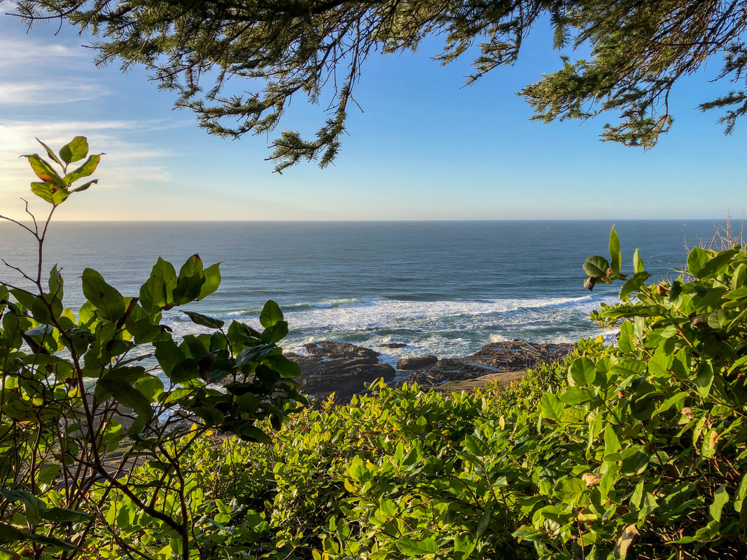
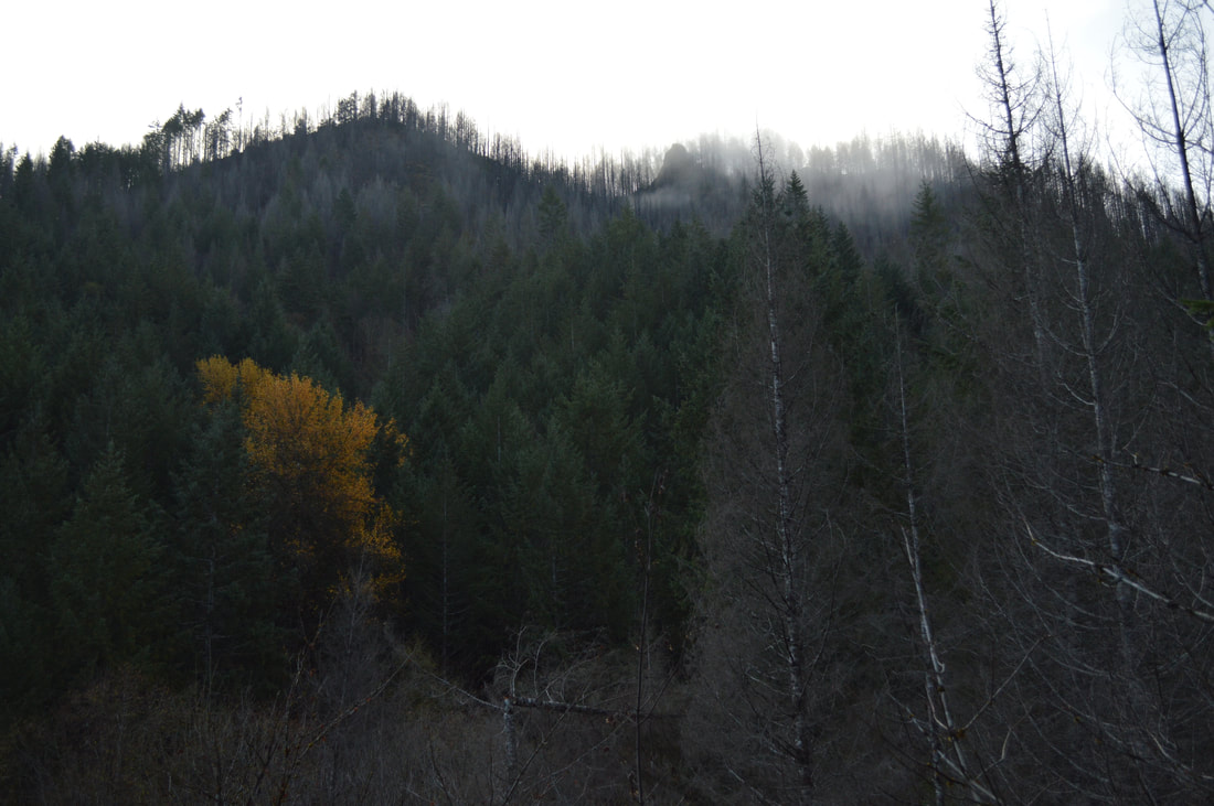
6) Cook's Ridge to Gwynn Creek Loop
|
|
Closest town: Florence
Trail type: Loop
Mileage: 5.9 miles w/ 1,050 ft. elevation gain
Terrain difficulty: Easy to moderate
Trail usage: Low
About the hike: This loop is fantastic for when the Willamette Valley is all socked in with fog, as it frequently is during the winter months. Escape to the coast and hike this awesome trail. The giant trees you will encounter along this hike are breathtaking and will make you think you are in the Red Woods, and on the drive there you will get some great Pacific Ocean views! This hike is not for the faint of heart, as it has quite a bit of elevation gain all in the first 2.3 miles, then the trail heads downhill again.
(Click here to read more about this hike and to get directions- this post is for members only, you can purchase the seasonal membership for $9.99)
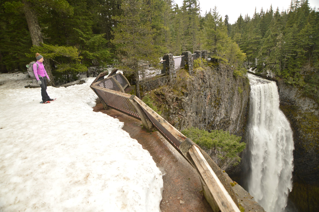
7) Salt Creek Falls- snowshoeing
|
|
Closest town: Oakridge
Trail type: Round trip or loop
Mileage: 3.5 miles w/ 900 ft. elevation gain
Terrain difficulty: Easy
Trail usage: Medium
About the hike: This hike is perfect to do in the winter because you get the entire area to yourself and don't have to deal with throngs of tourists the come to the observation deck and some who do the short loop in the summer season. This loop has little elevation gain and is perfect for the first time snowshoer. You will get to see beautiful 286 ft. Salt Creek Falls from the viewing platform, and 120 ft. Diamond Creek Falls from the trail. The gate to the main parking area is closed in the winter, however you can just park at the Sno-Park nearby. This hike is only 23 miles from the town of Oakridge off of Highway OR-58.
(Click here for more information and directions)
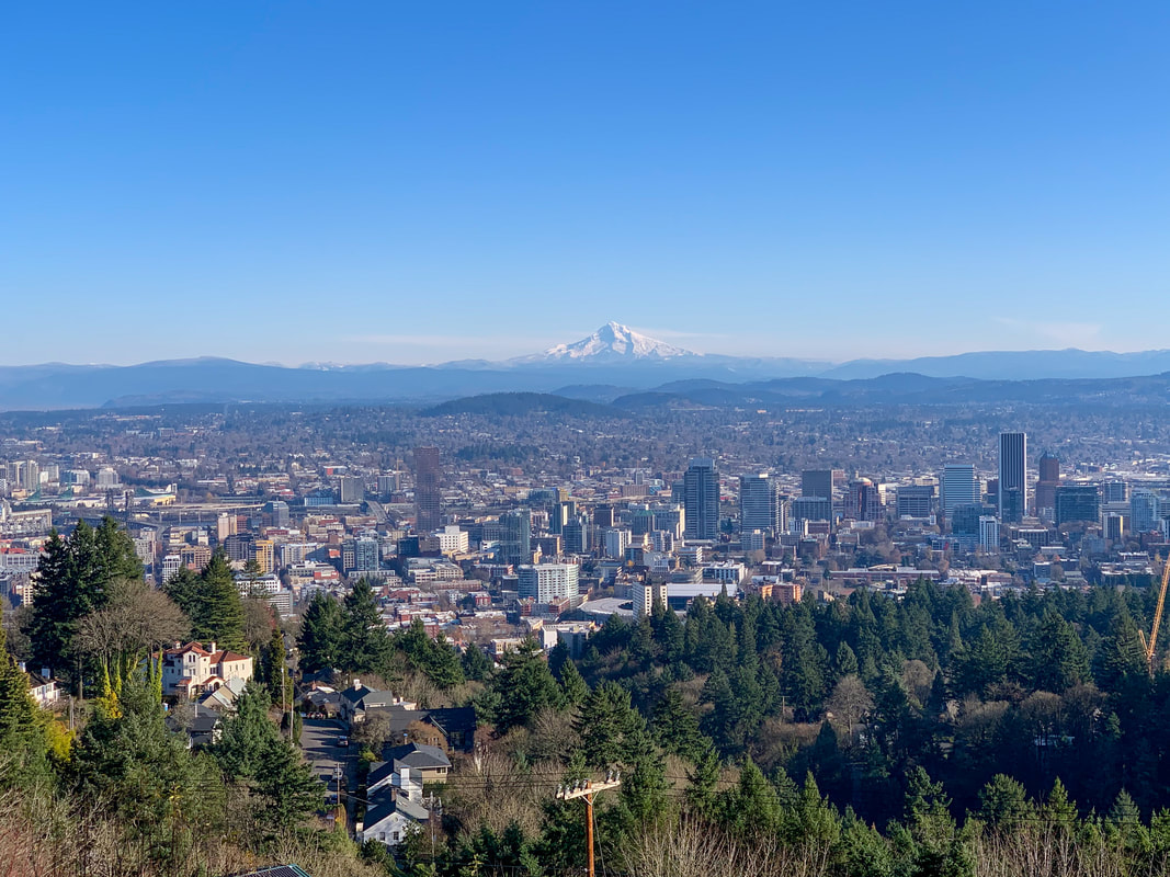
8) Forest Park - to Pittock Mansion
|
|
Closest town: Portland
Trail type: Out and back
Mileage: 4.8 miles w/ 915 ft. elevation gain
Terrain difficulty: Easy
Trail usage: High on weekends, medium on weekdays
About the hike: Located in the heart of Portland, Forest Park is a wonderful winter getaway for all hikers. The easy trail from Lower McLeay Trailhead up to Pittock Mansion takes you through a gorgeous forest and up to the amazing Pittock Mansion viewpoint where you can see all of Portland and Mt. Hood beyond. You can even choose to make this hike shorter or longer depending on what level of hiker you are or how much time you want to spend outside.
(Click here for more information and directions)
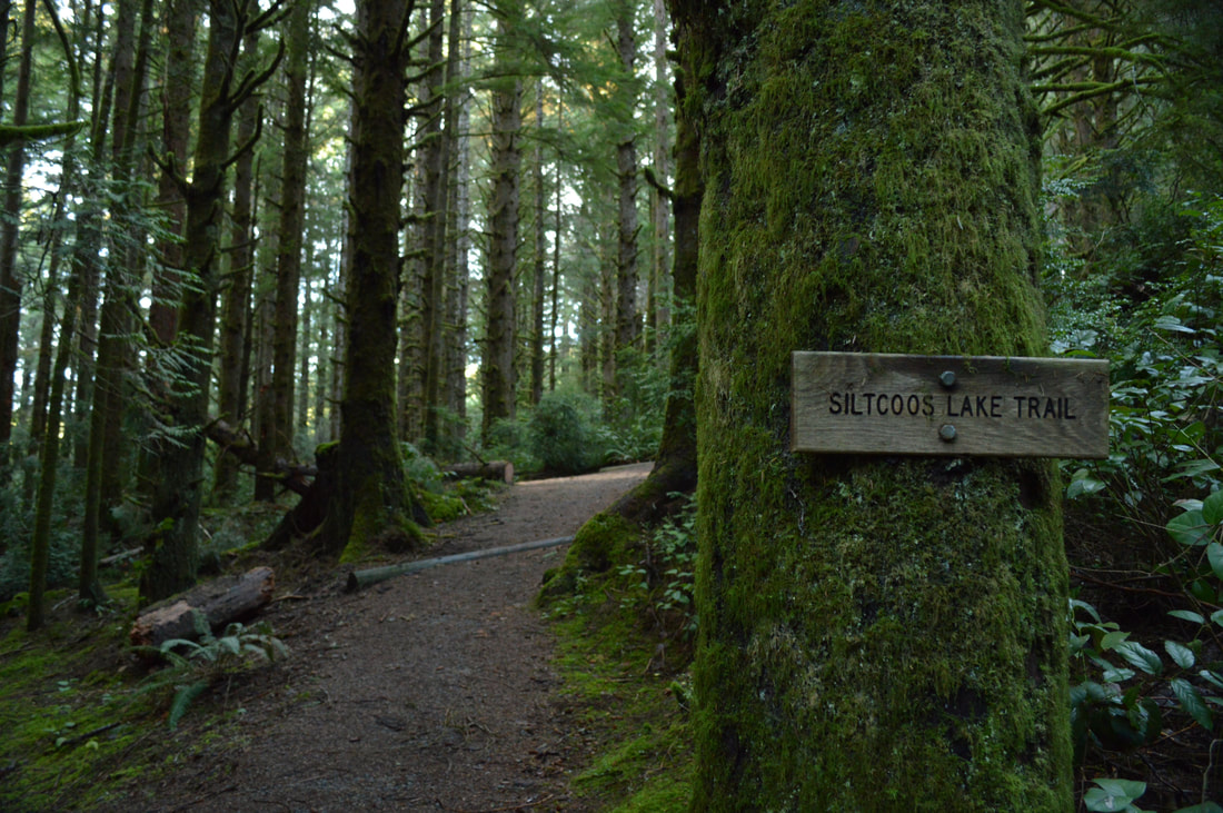
9) Siltcoos Lake
|
|
Closest town: Florence
Trail type: Loop
Mileage: 4.3 w/ 660 ft. elevation gain
Terrain difficulty: Easy
Trail usage: Low
About the hike: This loop is so magical it almost feels like there are going to be gnomes living in these woods. This hiking and mountain bike loop flows through ancient cedar trees and huge ferns until you get to two areas where you can actually camp right on the shores of Siltcoos Lake. These small campsites have picnic tables and even a privy. This easy hike is perfect for families with young children.
(Click here to read more about this hike and to get directions- this post is for members only, you can purchase the seasonal membership for $9.99)
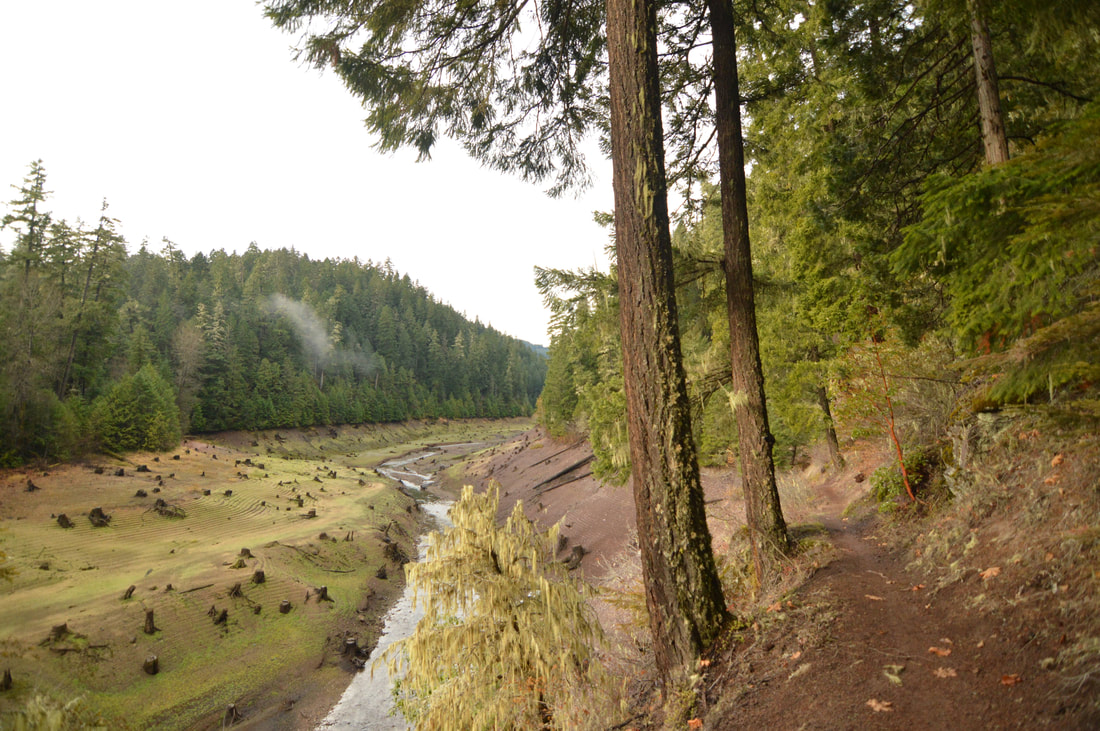
10) Deception Creek
|
|
Closest town: Oakridge
Trail type: Round trip
Mileage: 3.5 w/ 395 ft. elevation gain
Terrain difficulty: Easy
Trail usage: Low
About the hike: Deception Butte Trail burned in 2014 however a few miles of trail were spared and are more beautiful than ever! The 1.75 mile hike through beautiful woods and along Deception Creek are absolutely stunning and a perfect place to see wildlife in the winter time and to get out of the Willamette Valley fog. This trail is very easy with hardly any elevation gain, which makes it perfect for those with small children. You can see where the burn happened up on the hill, and you can also see an old car that tumbled down the slope and landed near the creek.
(Click here for more information and directions)
*All pictures are taken by Franziska Weinheimer
*Disclaimer: The trail descriptions, mileage, GPS tracks and difficulty ratings depicted on this website are never 100% accurate. Always hike at your own risk, using your own knowledge, equipment and common sense. Franziska Weinheimer/Hike Oregon are not responsible if you or anyone in your party gets injured or lost while attempting one of these or any other hikes.