Three Creek Sno-Park
Jeff View Shelter Loop
Hike details:
Mileage: 4.1 mile loop w/ 745 ft. elevation gain
Approximate hike time: 2 hours 16 minutes w/ an average pace of 1.8 mph
Difficulty: Easy
Trail usage: Low to medium on weekdays, high on sunny weekends
Highest elevation: 5,855 ft. Lowest elevation: 5,160 ft.
General location: 10 miles south of Sisters - Deschutes National Forest
Accessible: Year-round
(The sno-park trails are accessible for winter recreation as soon as about 2 feet of snow have accumulated, usually by mid-December. This one generally melts out completely some time around early May).
Permits required: Sno-park pass is required from November 1 - April 30
Pit toilet at trailhead: Yes
Trail allows: Dogs on leash, snowshoeing, cross-country skiing, camping
Possible dangers: N/A
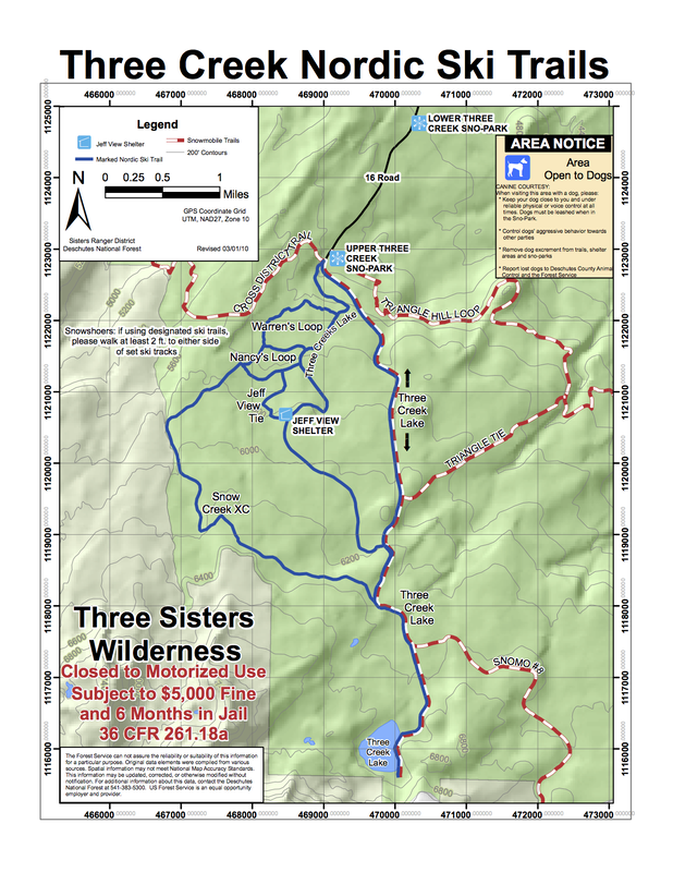
(map of the entire Three Creek Sno Park - click to enlarge)
Description:
Upper Three Creek Sno-Park is one of the most popular sno-parks near the town of Sisters and for good reason. The trails here are very easy and the views you get on a clear day are absolutely incredible! This is as close to the base of the Three Sisters as you can get on snowshoes without doing winter snow camping. Keep in mind that the road to Lower and Upper Three Creek Sno-Parks does not always get plowed, so you have to have a snow capable vehicle to be able to get up there. Upper Three Creek sno-park does have a pit toilet and a very spacious parking area, which can become very slushy and soupy on warm days.
|
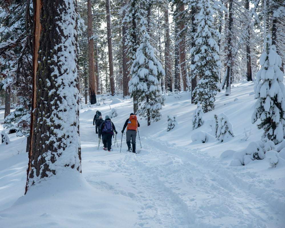
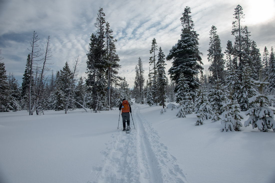
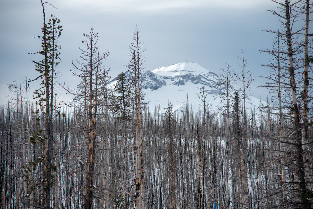
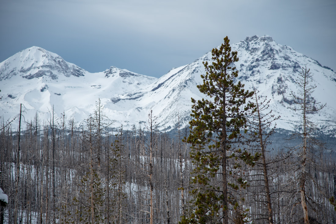
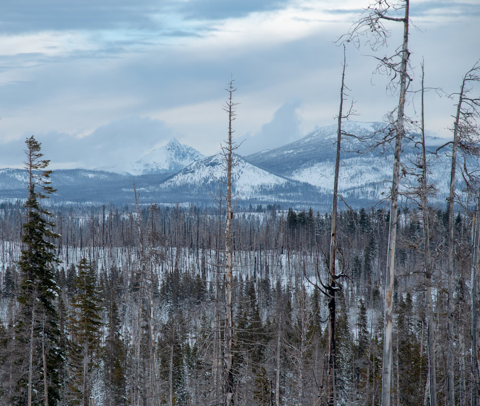
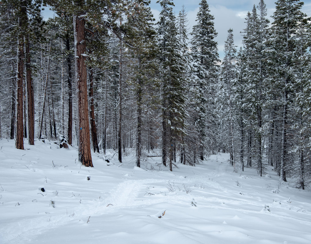
From the parking lot, cross over the road you drove in on and take the Three Creek Lake Trail. At the beginning the trail is wide and takes you through stately Ponderosa pines up to where you see remnants of the 2012 Pole Creek Fire. Here the views open up and you can see Middle and North Sister up close.
|
|
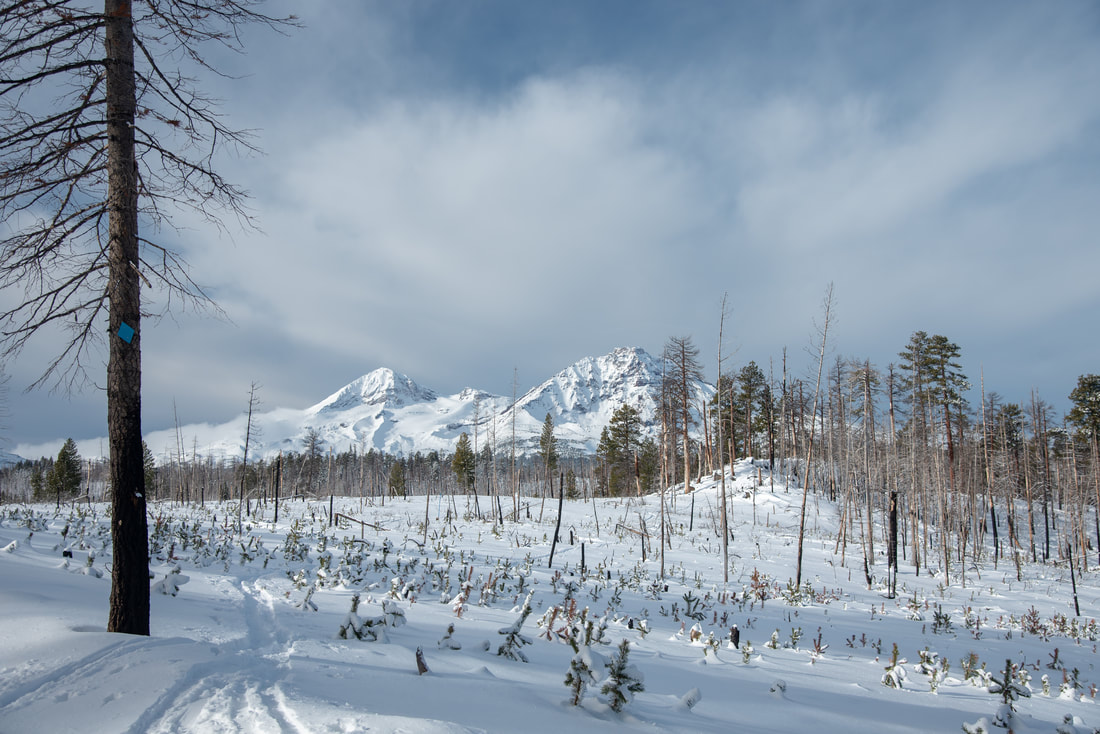
(Middle and North Sister)
|
|
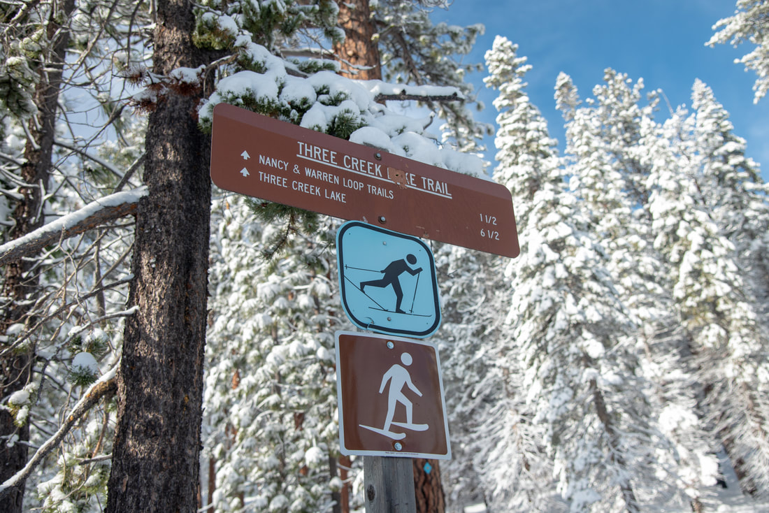
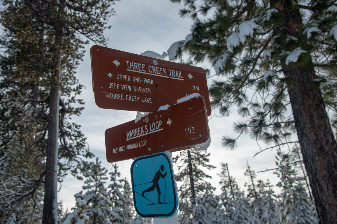
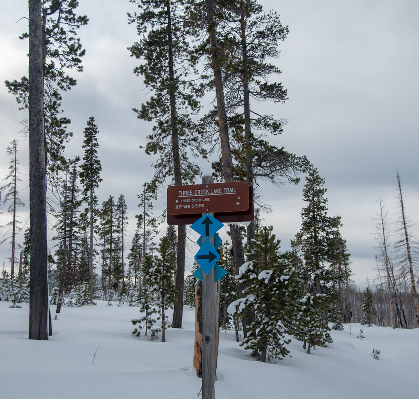
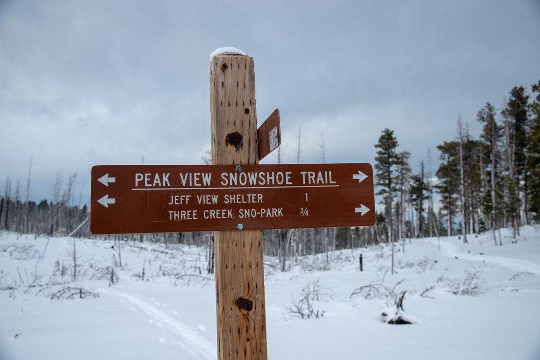
You will encounter a few trail junctions on the way to Jeff View Shelter. There aren't too many trails here at Upper Three Creek Sno-Park, the Three Creek Trail, Warren's Loop and Nancy's Loop and the Jeff View Tie Trail/Peak View Snowshoe Trail. There is also the Snow Creek Trail but that is a designated trail for cross country skiers only. Stay on the Three Creek Trail and follow signs to Jeff View Shelter.
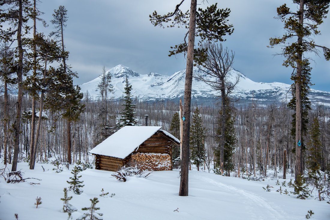
(Jeff View Shelter with Middle and North Sister in the background)
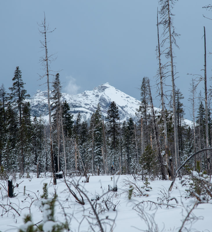
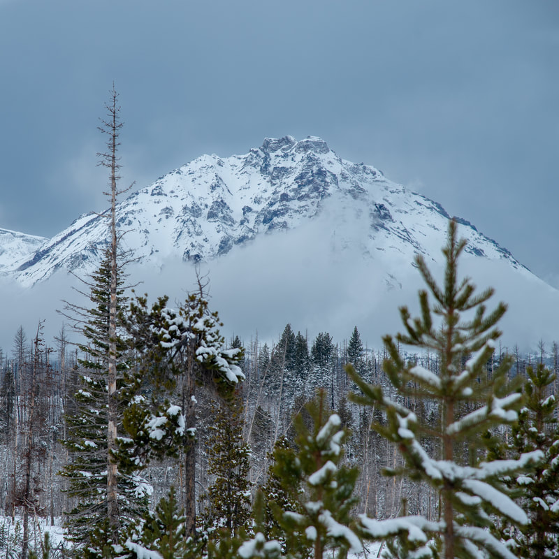
After 2.3 miles you will come to Jeff View Shelter, a 3-sided warming hut, stocked with fire wood and plenty of seating room. The shelter has spectacular views of South, Middle and North Sister and Mount Jefferson. This is the perfect place to warm up and have lunch. Unlike some other winter shelters, you are not allowed to sleep in this one, but if you are wanting to snow camp, you can easily find a place to set up your tent slightly away from the shelter.
(South Sister)
|
(Middle and North Sister)
|
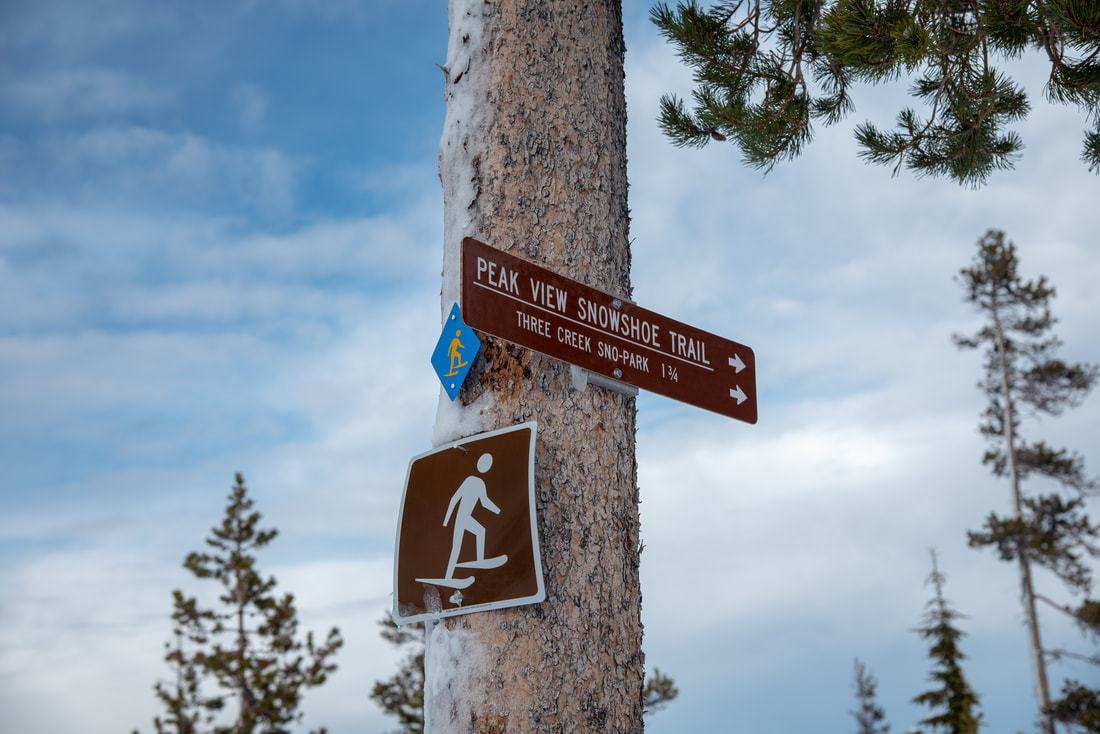
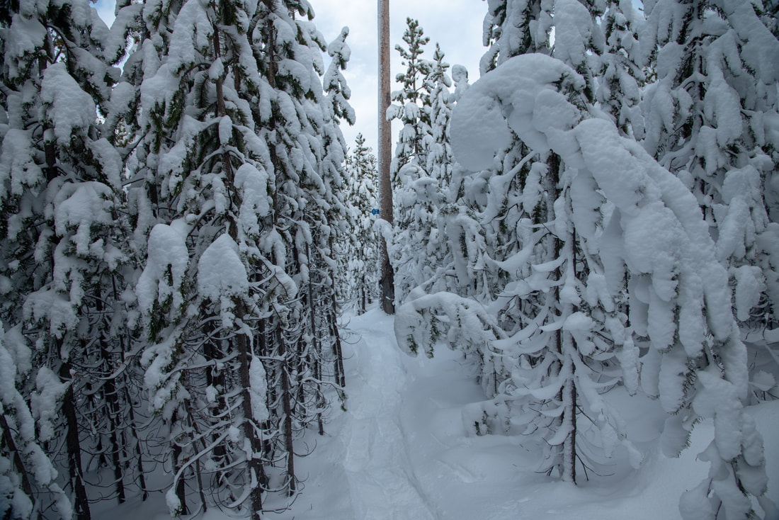
After lunch, you can opt to go back the way you came, or you can take the Jeff View Tie/Peak View Snowshoe Trail over to Nancy's Loop. This trail takes you through tight new-growth trees which look like Dr. Seuss trees when they're covered in snow. The trail is easy to follow and when you get out of the trees you will get the most beautiful view of Millican Crater, Black Crater and Mount Washington to the south.
(Mount Washington, Millican Crater and Black Crater)
(Broken Top)
|
(North Sister)
|
The Peak View Trail will intersect with Nancy's and Warren's Loop which you can do if you want to get some more miles in (the views do not change), or you can just continue on the Peak View Trail back to the sno-park. On that trail from the shelter it is a total of 1.75 miles back to the car.
This is an absolutely fabulous network of very easy nordic trails. The trails are very well marked and easy to navigate. This is the perfect area for beginner snowshoers and cross-country skiers, and the views are absolutely incredible! Because this sno-park is at a higher elevation than many others in the area, you can recreate here all winter long and well into spring.
Directions:
From Bend
- Drive US-97 north and take exit 135A to merge onto US-20 west toward Sisters. Drive on US-20 for a total of 19.5 miles to the town of Sisters. In Sisters turn left onto S. Elm St. This will become Three Creek Rd/NF-16 after about a mile. Then continue down this road for about 9.6 miles and turn left at a sign for Upper Three Creek Sno-Park. (Total of 33.4 miles)
- Take OR-126 east toward Springfield. At a traffic light use the two left lanes to turn left, following signs to continue on OR-126 for another 72.6 miles. Shortly after Clear Lake Resort, take a slight right onto US-20 east for 29 miles to the town of Sisters. In Sisters turn right onto S Elm St. This will become Three Creek Rd/NF-16 after about a mile. Then continue down this road for about 9.6 miles and turn left at a sign for Upper Three Creek Sno-Park. (Total of 117 miles)
- Drive OR-22 east toward Detroit Lake/Bend for 80.3 miles then take a slight left onto US-20 east to the town of Sisters for 25.5 miles. In Sisters turn right on S Elm St. This will become Three Creek Rd/NF-16 after about a mile. Then continue down this road for about 9.6 miles and turn left at a sign for Upper Three Creek Sno-Park. (Total of 120 miles)
- Drive I-5 south towards Salem then use the right 2 lanes to take exit 253 for OR-22 east toward Detroit Lake/Bend. Stay on OR-22 for 80.3 miles then take a slight left onto US-20 east to the town of Sisters for 25.5 miles. In Sisters turn right on S Elm St. This will become Three Creek Rd/NF-16 after about a mile. Then continue down this road for about 9.6 miles and turn left at a sign for Upper Three Creek Sno-Park. (Total of 163 miles)
- Take OR-62 east towards Crater Lake for 49.5 miles then take a slight left onto OR-230 north for 23.8 miles. Near Diamond Lake turn right onto OR-138 east for 17.7 miles until it T’s into highway 97. Turn left onto US-97 north for 77.3 miles then take exit 135A to merge onto US-20 west toward Sisters. Drive on US-20 for a total of 19.5 miles to the town of Sisters. In Sisters turn left onto S. Elm St. This will become Three Creek Rd/NF-16 after about a mile. Then continue down this road for about 9.6 miles and turn left at a sign for Upper Three Creek Sno-Park. (Total of 205 miles)
-This trail write-up was last updated in 2019-
*All pictures unless otherwise marked are taken by Franziska Weinheimer
*All pictures unless otherwise marked are taken by Franziska Weinheimer
*Disclaimer: The trail descriptions, mileage, GPS tracks and difficulty ratings depicted on this website are never 100% accurate. Always hike at your own risk, using your own knowledge, equipment and common sense. Franziska Weinheimer/Hike Oregon are not responsible if you or anyone in your party gets injured or lost while attempting one of these or any other hikes.