9 Amazing Oregon Summit Hikes
There are so many amazing summits to climb, viewpoints to hike up to and lookout points to see in Oregon. I have highlighted many of the best ones across the state in the guidebook 'Oregon's Best Views: 50 Breathtaking Viewpoint Hikes', but I also wanted to create a short list of 9 amazing summit climbs that are must-dos this summer!
1) Matterhorn Peak
Closest town: Joseph
Mileage: 19.1 miles round trip w/ 5,300 ft. elevation gain Terrain difficulty: Difficult - very steep, rocky, the last bit before the summit has no trail, you just climb up the granite rock. Trail usage: Medium to Ice Lake, low up to Matterhorn Summit Best time to hike this trail: End of July to mid-August for prime wildflowers, or September to early October for milder temperatures. About the hike: This hike is absolutely stunning as you head up through wildflower meadows to Ice Lake where there are lots of backcountry campsites. From Ice Lake the steep and rocky climbers trail takes you up to the granite summit of Matterhorn Peak, which is the second tallest peak in the Wallowa Mountain Range. (Info about this hike can be found in the guidebook 'Oregon's Best Views') |
|
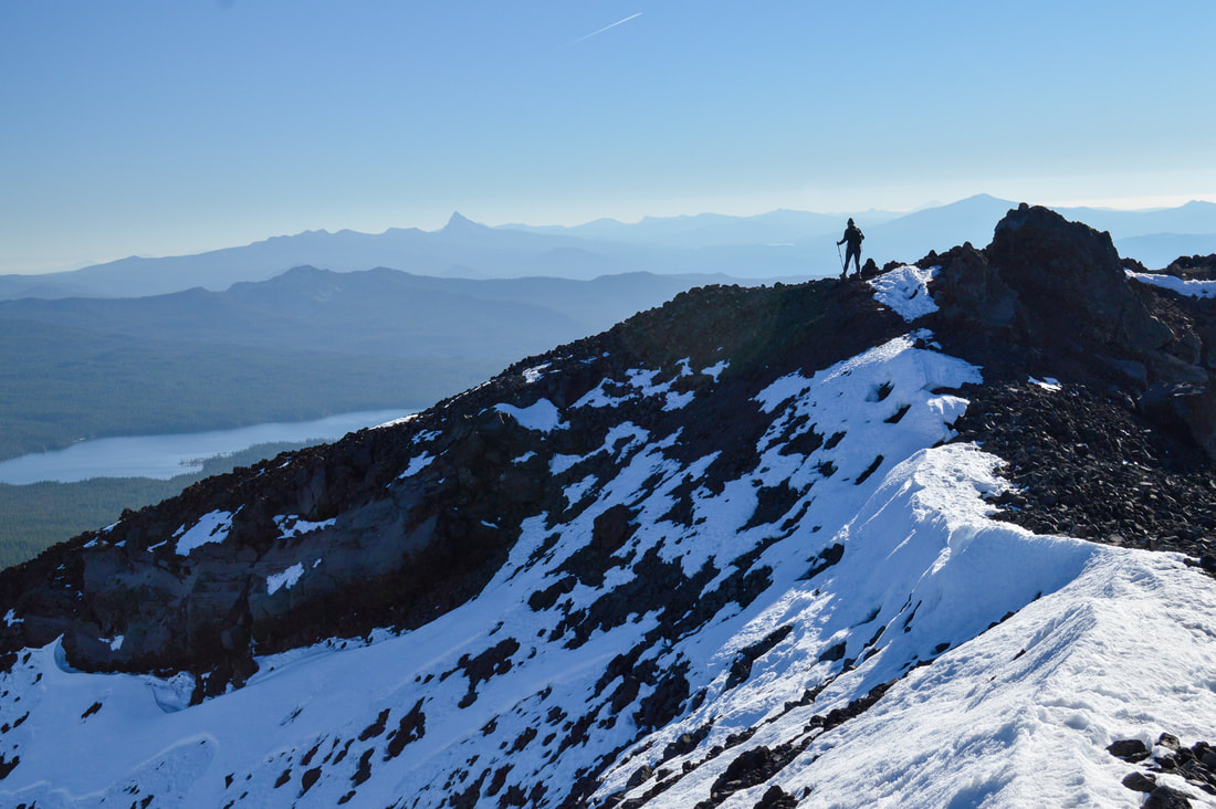
2) Eagle Cap
|
|
Closest town: Joseph
Mileage: 30.4 miles round trip w/ 7,250 ft. elevation gain
Terrain difficulty: Difficult - rocky, steep and there is 1 river crossing
Trail usage: Medium on summer weekdays, high on summer weekends
Best time to hike this trail: August and September for the best weather.
About the hike: This amazing backpacking trip takes you up the West Fork Wallowa River canyon, past pristine alpine lakes, to the base of Eagle Cap, another prominent peak in the Wallowa Mountains. You can camp at any of the nearby lakes and then easily summit the mountain, which is one of Oregon's easier summit hikes. The trail is very obvious, there is no route finding, and the summit is large and flat, making it the perfect spot to take in the spectacular views of the entire Eagle Cap Wilderness.
(Click here to read more about this hike and to get directions)
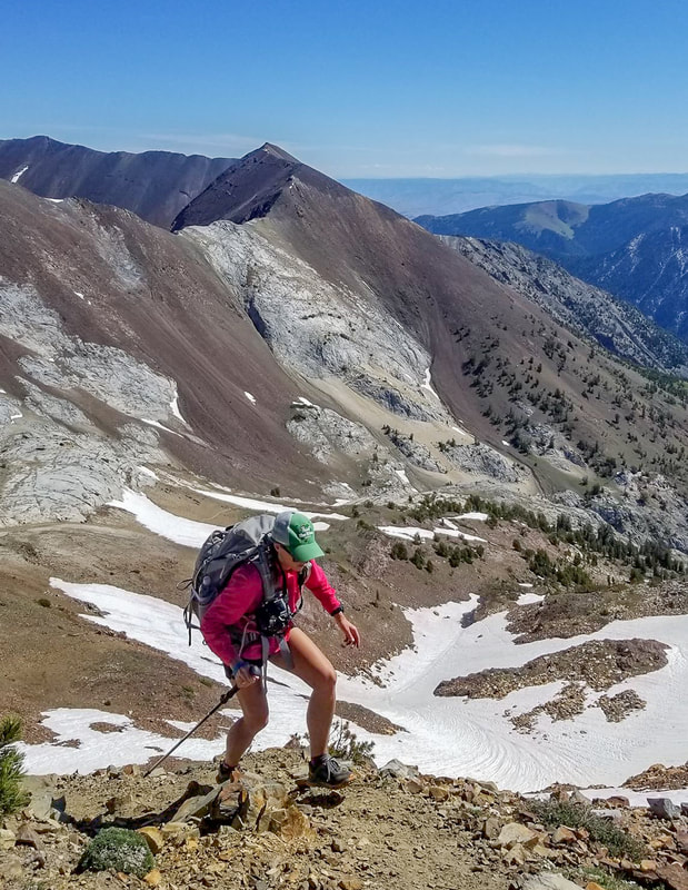
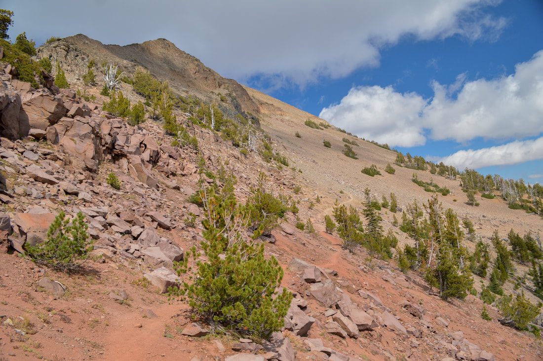
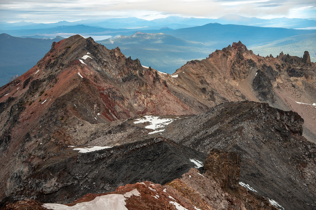
3) Strawberry Mountain
|
|
Closest town: John Day
Mileage: 12.5 miles w/ 3,400 ft. elevation gain
Terrain difficulty: Difficult - rocky and steep
Trail usage: Medium to Strawberry Lake, low foot traffic up to the summit of Strawberry Mountain
Best time to hike this trail: Early to mid-September for less people and milder temperatures.
About the hike: This underrated Oregon summit hike is in the heart of the Strawberry Wilderness and the trail takes you up to beautiful Strawberry Lake as well as Little Strawberry Lake where you will find lots of backcountry camping options. From there, summiting Strawberry Mountain is not very difficult as the trail is well marked. It is rocky and steep, as well as exposed since you are above tree line. The views from the 9,038 foot summit are spectacular and well worth the climb!
(Info about this hike can be found in the guidebook 'Oregon's Best Views')
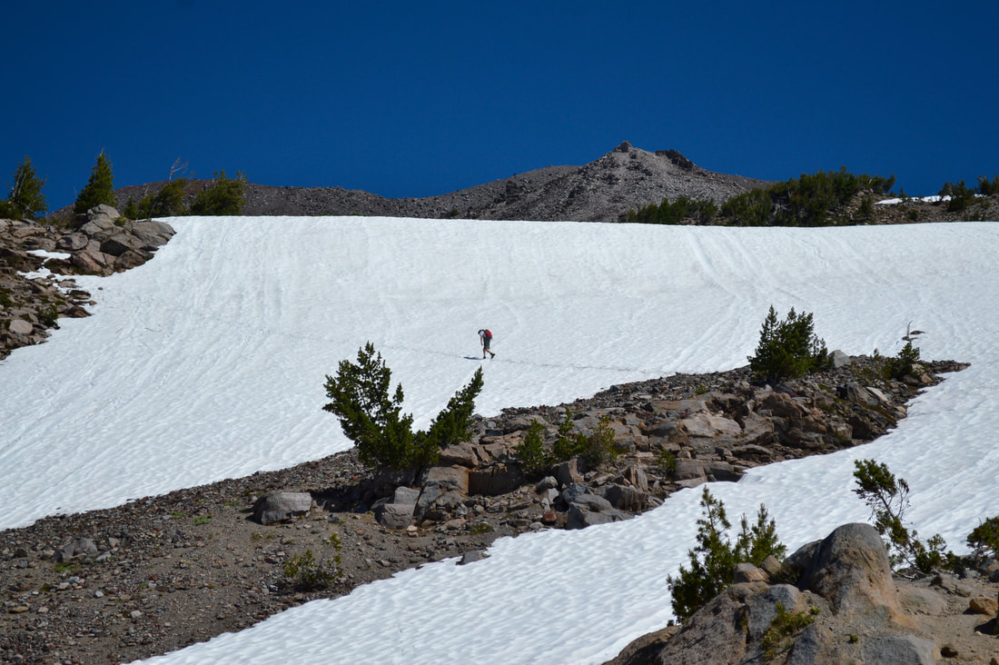
4) South Sister
|
|
Closest town: Bend
Mileage: 12.5 miles w/ 5,000 ft. elevation gain
Terrain difficulty: Difficult - extremely steep scree
Trail usage: High
Best time to hike this trail: July when there are still some snow fields which makes for easier hiking.
About the hike: South Sister is Oregon's most summited volcano and for good reason. Even though it is steep and the hike is not easy, it is one of the easiest summits to access due to its close proximity to Bend and the trailhead is off of a paved main road, unlike many other Oregon summits that require a lot of backroads driving. Summiting South Sister might take anywhere between 8-12 hours, but for most, it is doable as a day hike. The view from this 10,358 foot summit is one of the best in all of Oregon!
(Click here to read more about this hike and to get directions)
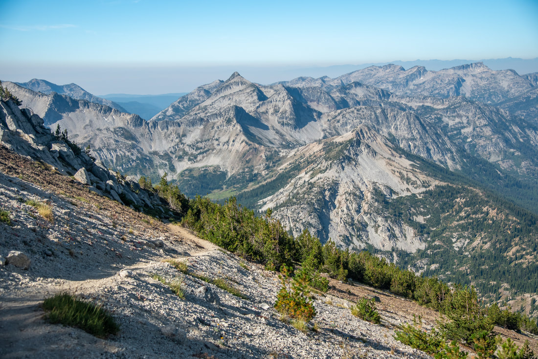
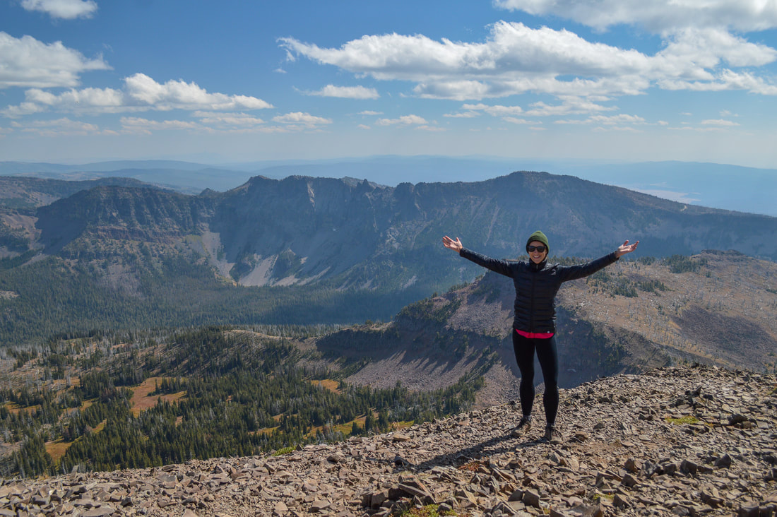
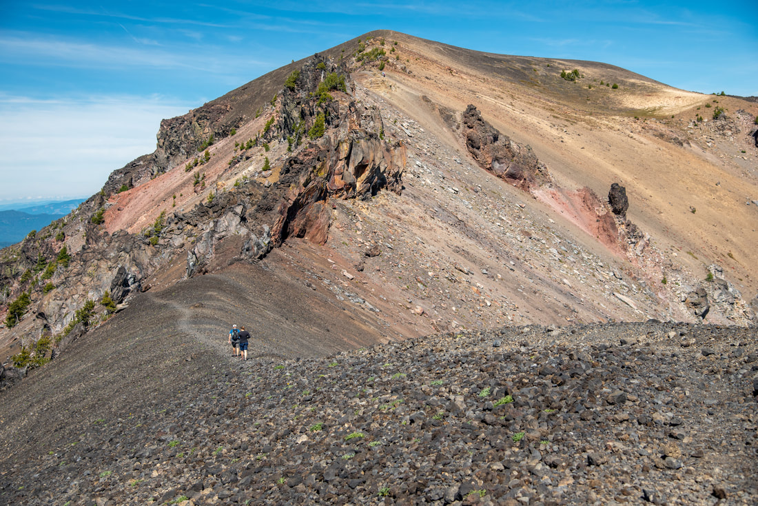
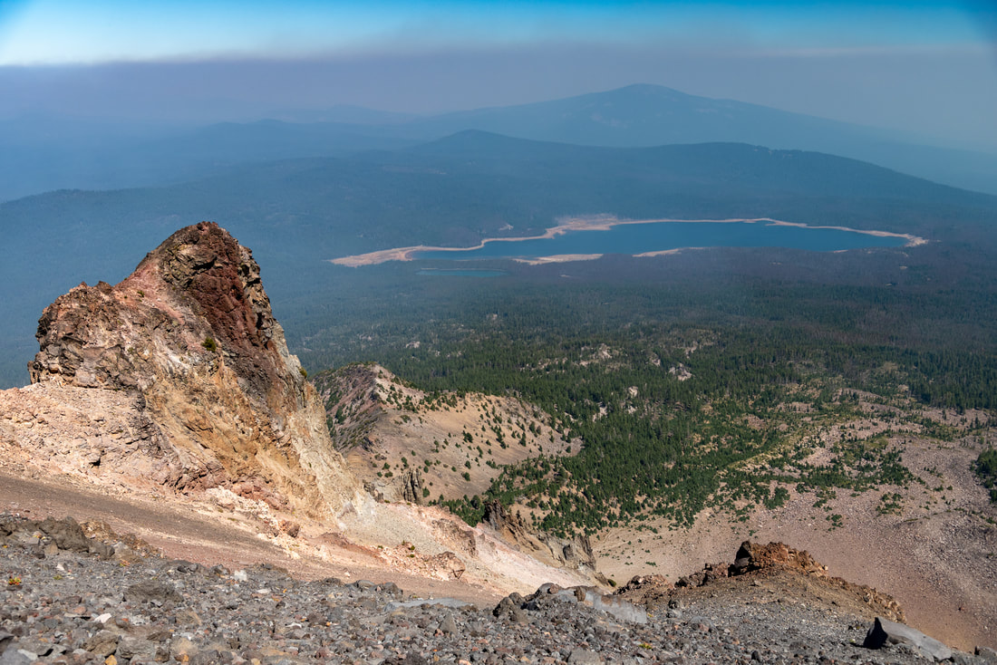
5) Diamond Peak
|
|
Closest town: Oakridge
Mileage: 11.25 miles out and back w/ 3,190 ft. elevation gain
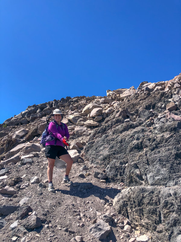
Terrain difficulty: Very difficult - most of the hike is easy, but the climber trail requires route finding on extremely rocky terrain.
Trail usage: Low
Best time to hike this trail: Late August and through the month of September to avoid terrible mosquitoes and hot temperatures.
About the hike: Diamond Peak is Hike Oregon's favorite summit. This mountain has a unique beauty to it, and can be summited from various trailheads and routes. The easiest route is via the Pacific Crest Trail which makes most of the hike extremely easy until you hit the climber trail. Route finding is required at a certain point when the trail disappears in the rocky terrain, but once you hit the false summit, following the ridgeline to the summit is pretty straightforward and you will be rewarded with grand views of the entire Diamond Peak Wilderness from this 8,743-foot high peak!
(Click here to read more about this hike and to get directions)
Mileage: 11.25 miles out and back w/ 3,190 ft. elevation gain
Terrain difficulty: Very difficult - most of the hike is easy, but the climber trail requires route finding on extremely rocky terrain.
Trail usage: Low
Best time to hike this trail: Late August and through the month of September to avoid terrible mosquitoes and hot temperatures.
About the hike: Diamond Peak is Hike Oregon's favorite summit. This mountain has a unique beauty to it, and can be summited from various trailheads and routes. The easiest route is via the Pacific Crest Trail which makes most of the hike extremely easy until you hit the climber trail. Route finding is required at a certain point when the trail disappears in the rocky terrain, but once you hit the false summit, following the ridgeline to the summit is pretty straightforward and you will be rewarded with grand views of the entire Diamond Peak Wilderness from this 8,743-foot high peak!
(Click here to read more about this hike and to get directions)
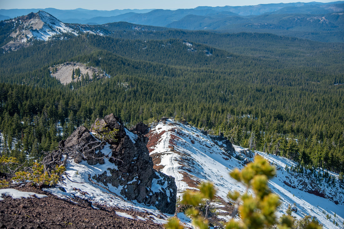
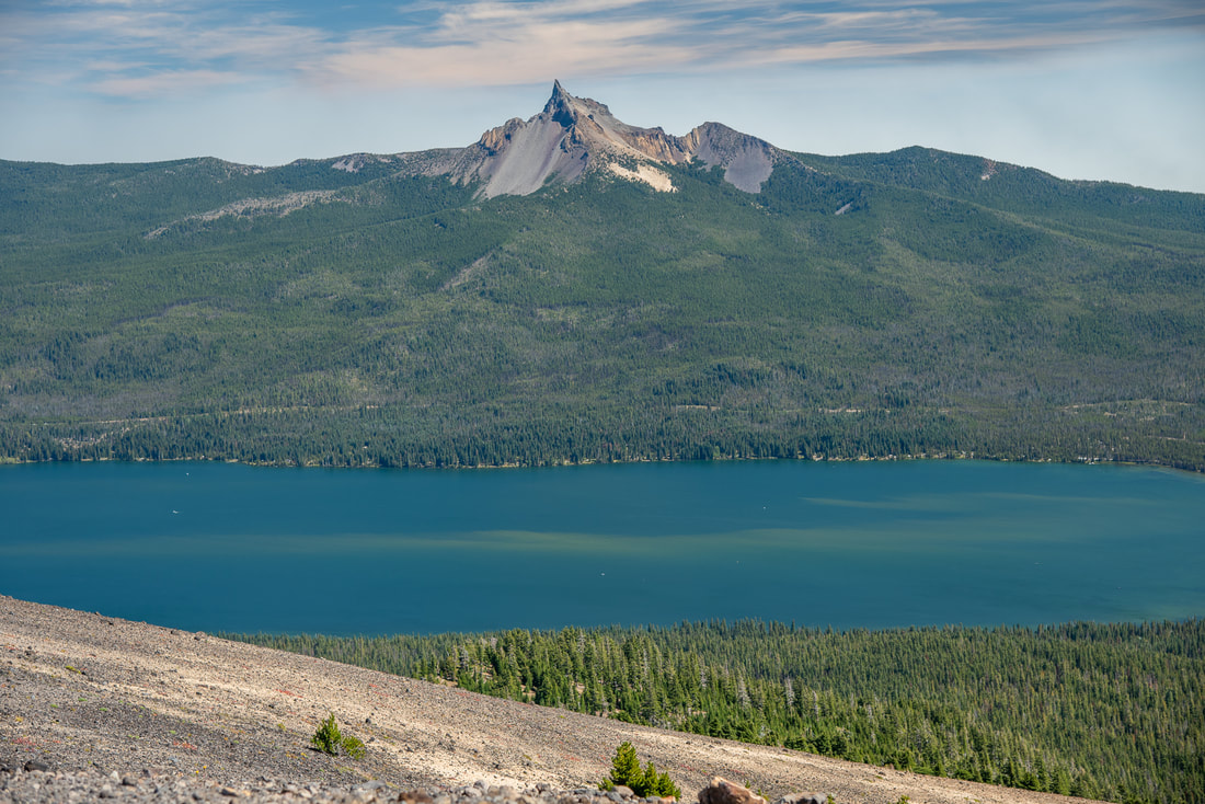
6) Cowhorn Mountain
|
|
Closest town: Oakridge
Mileage: 9.6 miles round trip w/ 2,260 ft. elevation gain (Timpanogas Lake to Cowhorn Mountain summit and back)
11.5 miles loop w/ 2,390 ft. elevation gain (Timpanogas Lake - Cowhorn Mountain loop hike)
Terrain difficulty: Difficult - rocky and very steep near the summit.
Trail usage: Low
Best time to hike this trail: August through October for great weather and no mosquitoes.
About the hike: Cowhorn Mountain is one of those extremely underrated summits, but the views are absolutely breathtaking! This is a walk-up summit with a clear trail that can be done between July and November. From the 7,592-foot peak, you get 360 degree views of the Diamond Peak Wilderness that is dotted with alpine lakes. In the distance to the south you can see Mount Thielsen and Mount Bailey, and to the north you can see Diamond Peak and the Three Sisters.
(Click here to read more about this hike and to get directions)
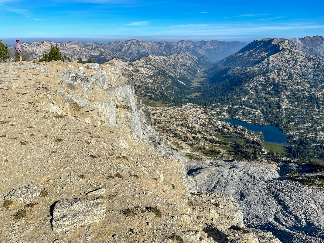
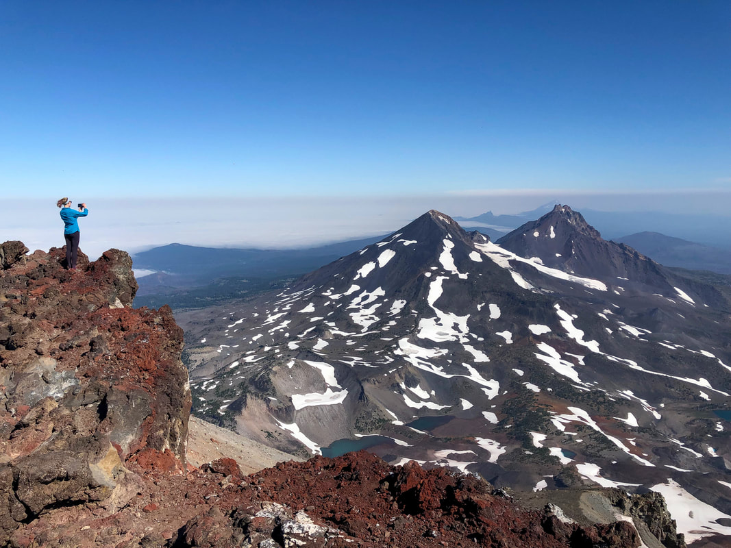
7) Mount Thielsen
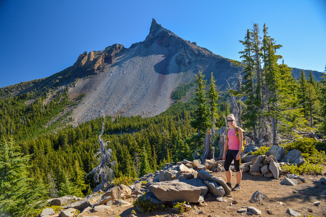
|
|
Closest town: Glide
Mileage: 9.5 miles round trip w/ 3,784 ft. elevation gain
Terrain difficulty: Very difficult - extremely steep and rocky terrain, route finding is required at points and to get to the summit it requires a class 4 rock climb.
Trail usage: Medium
Best time to hike this trail: Late August, September and October.
About the hike: This mountain is nicknamed 'the lightning rod of the Cascades' because the summit gets struck by lightning a lot in the summer, so watch out for brewing summer afternoon thunderstorms when doing this hike. You can easily hike up to the Pacific Crest Trail/climber trail junction where you get a really great view of Mount Thielsen. From there the climber trail heads steeply uphill until it eventually disappears among large rocks and boulders and you have to route find. Taking the correct route is imperative though, otherwise you could find yourself in a dangerous situation. Most people just make it to what is known as 'chicken's ledge' which is located right before the spire. Climbing the spire requires guts and preferably some rock climbing experience as it is a class 4-5.1 climb to the actual summit.
(Click here to read more about this hike and to get directions)
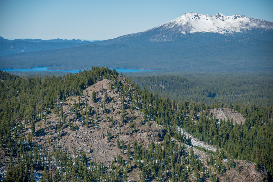
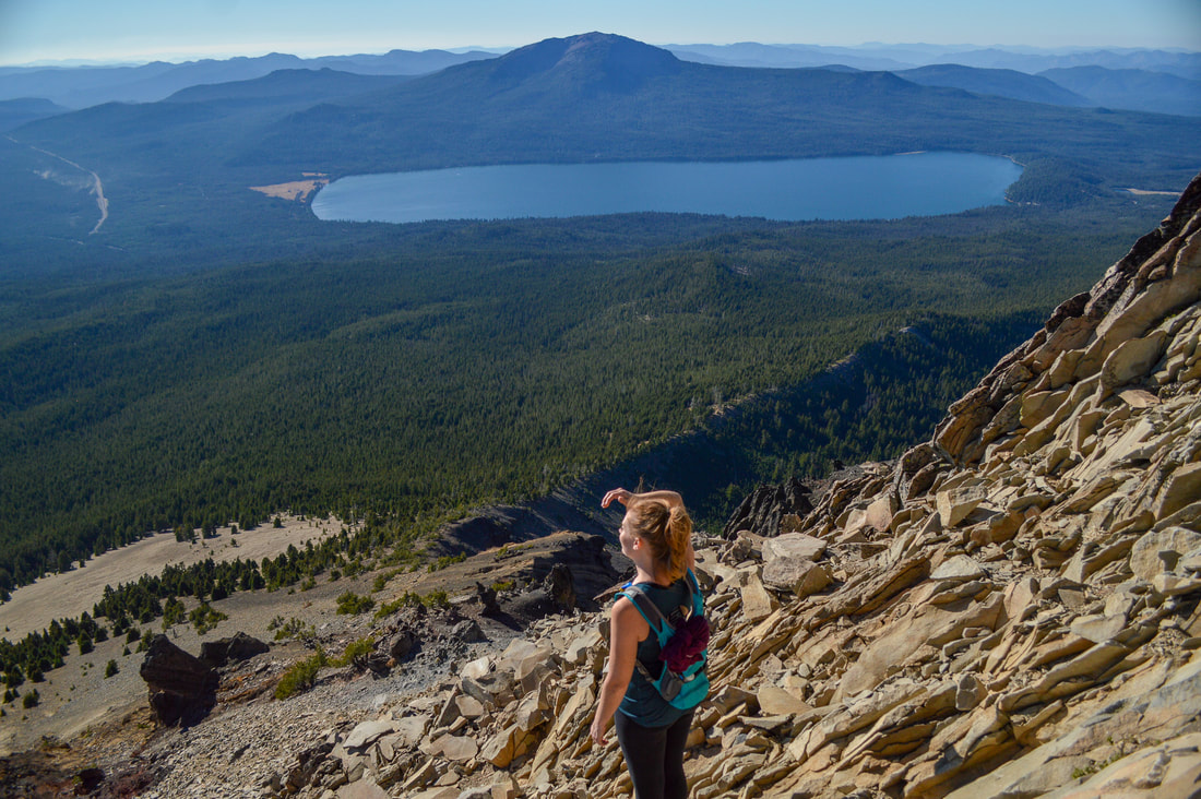
8) Mount Bailey
|
|
Closest town: Glide
Mileage: 9.8 miles round trip w/ 3,225 ft. elevation gain
Terrain difficulty: Difficult
Trail usage: Medium
Best time to hike this trail: Mid-August to early November when the mosquitoes are gone.
About the hike: Located right across from Mount Thielsen, Mount Bailey is a much easier climb. This walk-up summit is very similar to South Sister, in that it is very attainable for the average day hiker and doesn't require rock climbing or route finding or any sort, and the summit is also a fairly large open space, so folks who are afraid of heights will feel very safe up there. This is truly a very enjoyable Cascade summit and from 8,385-feet you can see Diamond Peak, Mount Thielsen, Diamond Lake and Crater Lake's Rim.
(Info about this hike can be found in the guidebook 'Oregon's Best Views')
9) Mount McLoughlin
Closest town: Klamath Falls
Mileage: 9.7 miles out and back w/ 3,650 ft. elevation gain Terrain difficulty: Difficult - large boulders and route finding. Trail usage: High on summer weekends, medium on summer weekdays Best time to hike this trail: September and early October after the bugs, heat and smoke died down. About the hike: Many people summit Mount McLoughlin, but it is not easy. It is of the harder climbs because of the large boulders you have to climb over. Making sure you stay on route, especially when you are coming back down the mountain is extremely important! There are weekly search and rescue missions on this mountain because so many climbers get lost! The 9,485-foot summit has epic 360 degree views of Southern Oregon and you can also see Mount Shasta, and on a really clear day, Mount Lassen in California. (Click here to read more about this hike and to get directions) |
|
*Disclaimer: The trail descriptions, mileage, GPS tracks and difficulty ratings depicted on this website are never 100% accurate. Always hike at your own risk, using your own knowledge, equipment and common sense. Franziska Weinheimer/Hike Oregon are not responsible if you or anyone in your party gets injured or lost while attempting one of these or any other hikes.