Steelhead Falls
Hike details:
Mileage: 2.5 miles round trip w/ 250 ft. elevation gain
Approximate hike time: 1 hour 5 minutes w/ an average pace of 2.3 mph
Difficulty: Easy
Trail usage: High on weekends, low to medium on weekdays
Highest elevation: 2,493 ft. Lowest elevation: 2,270 ft.
General location: 8 miles west of Terrebonne - Deschutes Canyon - Steelhead Falls Wilderness Study Area
Accessible: year-round
(Best time to go is April to December. The months of December - March can be icy if the weather is cold).
Permits required: N/A
Pit toilet at trailhead: Yes
Trail allows: Dogs on leash
Possible dangers: Slippery when icy
|
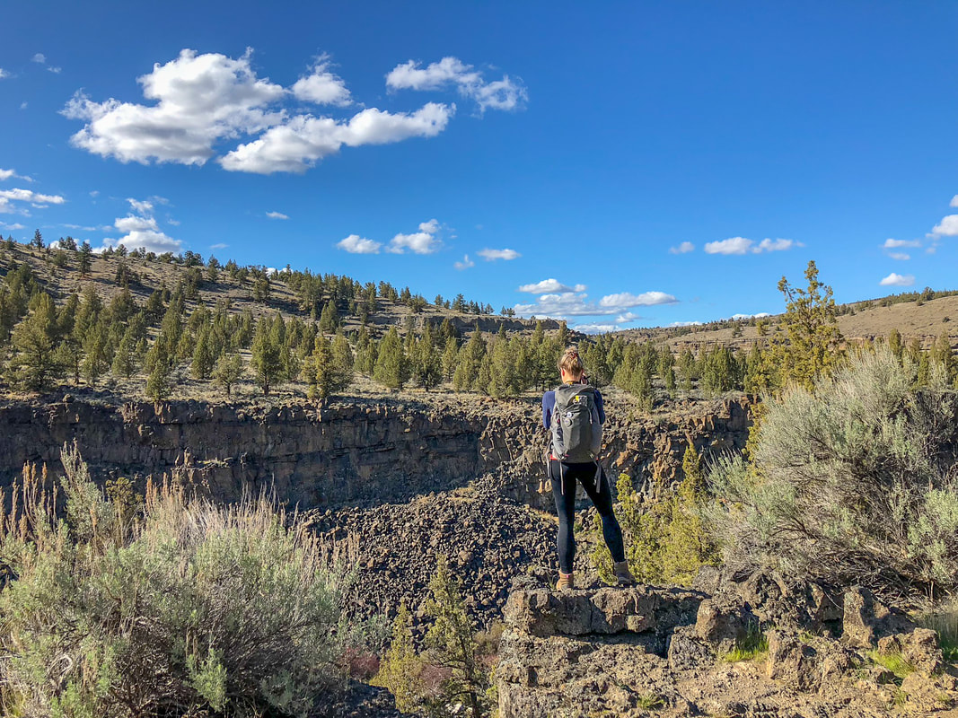
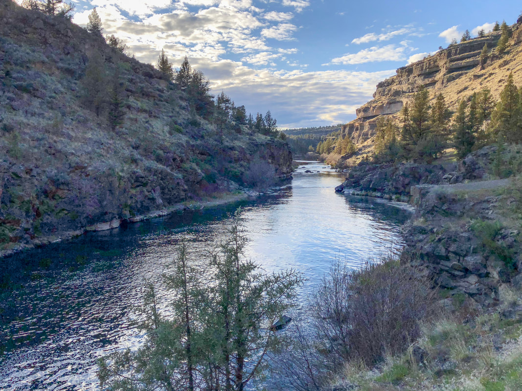
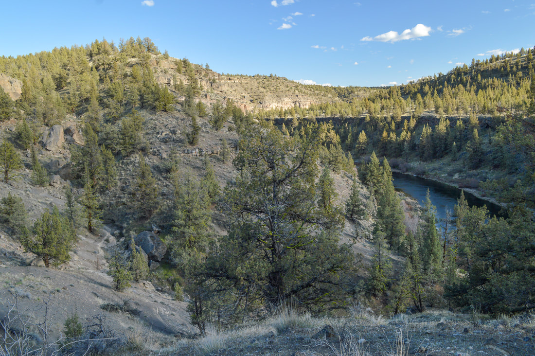
Description:Steelhead Falls is a popular destination, especially during the summer and on weekends. It is a very family friendly trail, perfect for little legs, and there is so much to look at along the way. You will see juniper trees, sagebrush, the Deschutes River canyon and even some monoliths.
You will start this hike from the trailhead parking area and head downstream on the Steelhead Falls Trail. You will come across a beautiful rocky bar, where dogs can have access to water. |
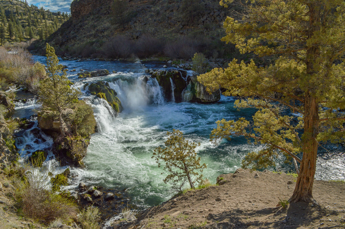
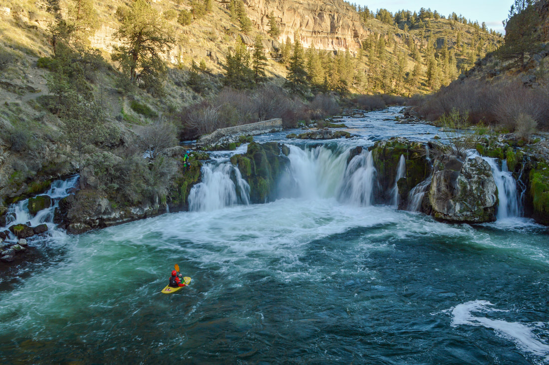
After only hiking half a mile, you will reach Steelhead Falls, a beautiful little 20-foot tall waterfall on the Descutes River. There is a lovely little flat rock viewpoint with an ancient juniper tree, that makes for the perfect spot to sit and observe the waterfall. In the summertime this place is very busy with brave souls who jump from these cliffs into the river.
|
|
|
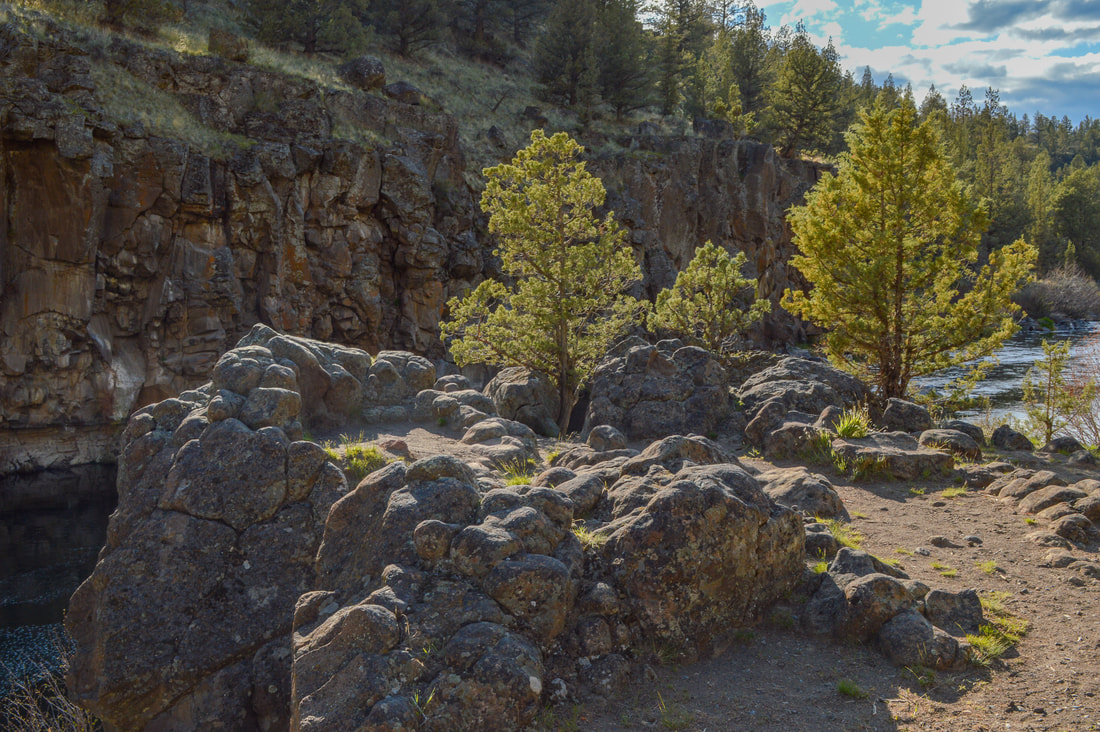
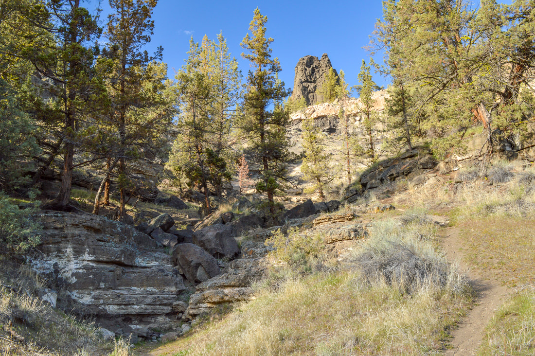
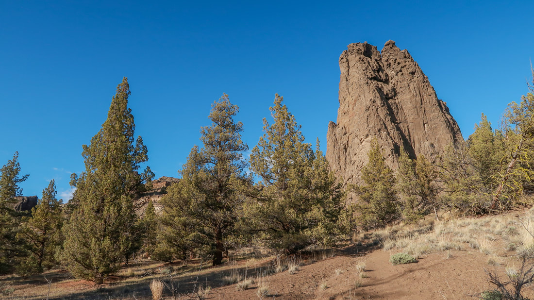
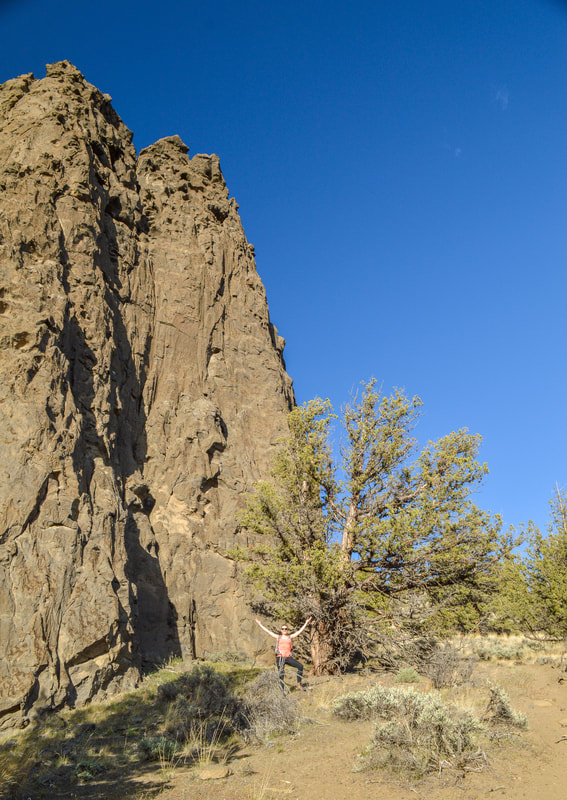
Technically the Steelhead Falls Trail ends at this viewpoint, but you can see that the trail continues downstream. Follow this trail for another half mile and you will see a little dry riverbed on your right and a footpath that goes up to some incredible monoliths.
|
|
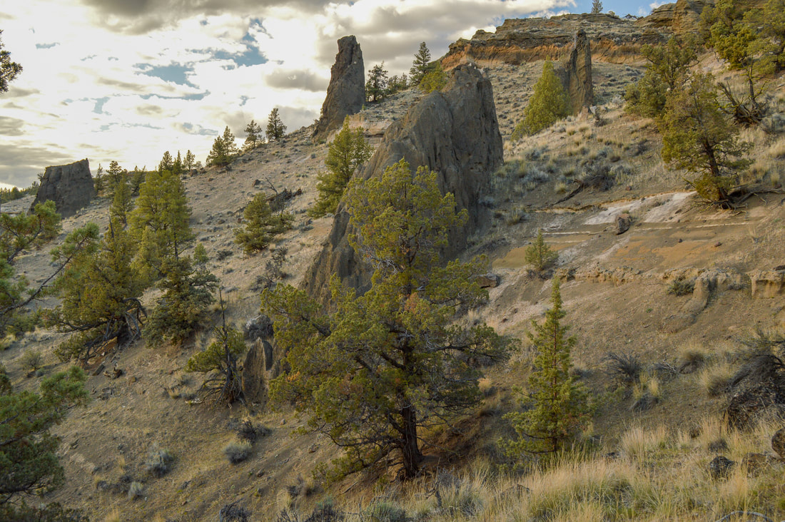
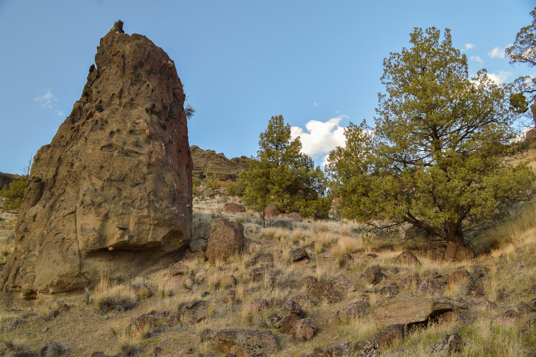
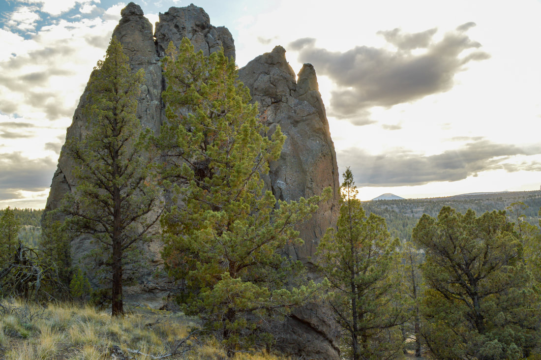
The trail goes steeply uphill for only 0.25 miles before it sort of just fizzles out into various game trails. From up here you can see over the canyon rim and to the west you can see Black Butte. The monoliths on the hillside range from 15 to 80 feet and are an incredible sight to see. Most people who hike to Steelhead Falls don't know that these amazing rocks exist just up the trail, so you likely won't see many people past the waterfall.
|
|
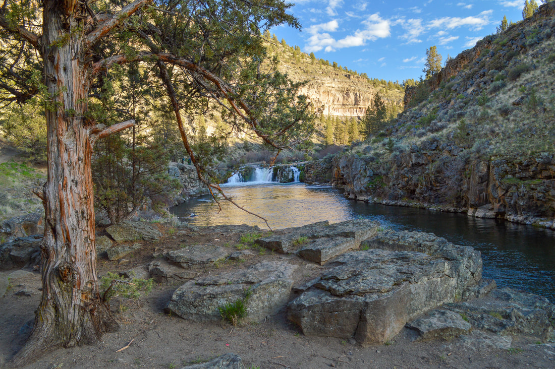
Return the way you came. On your way back, keep your eyes on the canyon walls, whose colorful layers tell the stories of time.
This hike is incredibly family friendly, and the perfect little excursion for those long summer afternoons, or short winter days. The trail is well maintained and the trail tread is compact dirt with occasional small rocks to look out for. In the spring you can catch the falls raging and full, and the smell of blooming juniper trees in the air. In the summer you will share the trail with lots of locals who come here for a swim to beat the Central Oregon heat. During the fall, the waterfall is at its lowest water volume, and during the winter you will see the least amount of people on the trail, but be prepared for a possible icy trail if it is very cold out.
This hike is incredibly family friendly, and the perfect little excursion for those long summer afternoons, or short winter days. The trail is well maintained and the trail tread is compact dirt with occasional small rocks to look out for. In the spring you can catch the falls raging and full, and the smell of blooming juniper trees in the air. In the summer you will share the trail with lots of locals who come here for a swim to beat the Central Oregon heat. During the fall, the waterfall is at its lowest water volume, and during the winter you will see the least amount of people on the trail, but be prepared for a possible icy trail if it is very cold out.
Directions:From Redmond
|
|
for 4.2 miles, then turn right onto NW Lower Bridge Way/Lower Bridge Market Rd. for 2.6 miles. Turn left onto NW Quail Rd. for 4.2 miles, then left
onto SW River Rd. for 1 mile and find the parking on your right and left. (Total of 129 miles)
From Salem
onto SW River Rd. for 1 mile and find the parking on your right and left. (Total of 129 miles)
From Salem
- Drive on OR-22 E for a total of 80.2 miles, then take a slight left onto US-20 E for 26.2 miles. Drive through the town of Sisters and then turn left onto OR-126 E for 10.6 miles. Turn left onto Buckhorn Dr. for 4.2 miles, then turn right onto NW Lower Bridge Way/Lower Bridge Market Rd. for 2.6 miles. Turn left onto NW Quail Rd. for 4.2 miles, then left onto SW River Rd. for 1 mile and find the parking on your right and left. (Total of 133 miles)
- Drive on US-26 E for around 103 miles to the town of Madras, then continue on US-97 S for another 17.9 miles. Turn right onto NW Lower Bridge Way/Lower Bridge Market Rd. for 2.2 miles. Turn right onto NW 43rd St. for 1.8 miles, then turn left onto NW Chinook Dr. for 1.1 miles. Turn left at the 2nd cross street onto SW Badger Rd. for 1.4 miles, then at a Y split, continue on SW Badger Rd. for another 0.4 miles. Turn right onto SW Quail Rd. for 1.4 miles, then turn left onto SW River Rd. for 1 mile and find the parking on your right and left. (Total of 148 miles)
- Total of 204 miles via Bend and Redmond.
|
To get a more in-depth and personal view of this hike, watch the YouTube video.
|
-This trail write-up was last updated May 2018-
*All pictures are taken by Franziska Weinheimer *Disclaimer: The trail descriptions, mileage, GPS tracks and difficulty ratings depicted on this website are never 100% accurate. Always hike at your own risk, using your own knowledge, equipment and common sense. Franziska Weinheimer/Hike Oregon are not responsible if you or anyone in your party gets injured or lost while attempting one of these or any other hikes.
|