Hike Oregon
  • Home
  • *Store*
  • About the author
  • How to use this site
  • Resources
    • Wildflowers
    • Videos
  • Best Oregon Hikes
    • Top Fall Foliage Hikes In Oregon
    • Top 10 Oregon Fall Hikes
    • 20 Best Oregon Waterfall Hikes
    • Top 10 Oregon Hikes for Kids
    • Sno-Parks In Central Oregon
    • Top 10 Oregon Winter Hikes
    • Top Low Elevation Winter Hikes
    • 9 Amazing Oregon Summit Hikes
    • 20 Central Oregon Day Hikes
    • 20 Epic Oregon Wildflower Hikes
    • 5 Weekend Backpacking Trips in Oregon
    • Top One Night Backpacking Trips in Oregon
    • Top 10 Oregon Summer Hikes
    • Top 10 Swimming Spots In Oregon
    • Top 10 Oregon Spring Hikes
  • Oregon Sno-Parks
    • Maxwell Sno-Park
    • Potato Hill Sno-Park
    • Ray Benson Sno-Park
      • Brandenburg Shelter
    • Santiam Sno-Park
    • Three Creek Sno-Park
    • Virginia Meissner Sno-Park
      • Meissner Shelter Loop
      • Nordeen Shelter
    • Gold Lake Sno-Park
      • Westview Shelter to Eagle Rock Overlook
      • Marilyn Lakes Loop
  • Southern Washington
    • Hamilton Mountain
    • Dog Mountain
    • Coyote Wall
    • Mount St. Helens
  • Portland
    • Powell Butte
    • Forest Park
    • Latourell Falls
    • Multnomah/Wahkeena Falls
    • Eagle Creek
    • Mitchell Point
    • Table Rock
    • Tamanawas Falls
    • Trillium Lake
    • East Zigzag Mountain (members only)
  • Salem
    • Abiqua Falls
    • Silver Falls State Park
    • Dome Rock
    • Marion Lake to Marion Mountain
    • Jefferson Park
  • Corvallis
    • Marys Peak East Ridge
    • Marys Peak North Ridge
    • Alsea Falls and Green Peak Falls
    • Corvallis to Sea Trail - Sugarbowl Creek segment (members only)
  • Sweet Home
    • Crescent Mountain
    • Iron Mountain
    • McDowell Creek Falls
    • Middle Santiam River (members only)
    • Lower Soda Creek Falls (members only)
    • Rooster Rock (members only)
  • McKenzie Bridge/Blue River
    • Macduff Mountain
    • Proxy Falls
    • Clear Lake
    • Sahalie/Koosah Falls
    • Blue Pool
    • Erma Bell Lakes
    • Olallie Mountain
    • Horsepasture Mountain
    • Tidbits Mountain
    • Castle Rock
    • Lowder Mountain (members only)
    • East Fork Trail (members only)
    • Rainbow Falls Overlook (members only)
    • Frissell Point (members only)
    • Chucksney Mountain (members only)
    • Substitute Point (members only)
  • Sisters/Santiam Pass
    • Coffin Mountain
    • Trappers Butte and Scar Mountain
    • Maxwell Butte
    • Black Butte
    • Whychus Creek Trail
    • Tam McArthur Rim
    • Black Crater
    • Scott Mountain
    • Obsidian Trail
    • Metolius Preserve
    • Three Fingered Jack Loop
    • Square Lake
    • Canyon Creek Meadows
    • Patjens Lakes
    • Craig Lake (members only)
    • Chush Falls (members only)
    • Rockpile Lake (members only)
    • Santiam Lake (members only)
    • Camp Lake (members only)
    • Park Meadow to Golden Lake (members only)
  • Bend/Redmond/LaPine
    • Steins Pillar
    • Chimney Rock
    • Steelhead Falls
    • Tumalo State Park
    • Tumalo Falls
    • Tumalo Mountain
    • No Name Lake
    • Green Lakes
    • Moraine Lake
    • South Sister Summit
    • Horse Lake
    • Muskrat Lake
    • Paulina Peak
    • Peter Skene Ogden Trail (members only)
  • Eugene
    • Ridgeline Trail
    • Mount Pisgah Summit
    • Mount Pisgah Arboretum
    • Shotgun Creek
    • Mount June
    • Lawler
    • Tire Mountain
    • Goodman Creek
    • Brice Creek
    • Trestle Creek Falls
    • Moon Falls
    • Elijah Bristow State Park
    • South Willamette Trail (members only)
    • Eula Ridge (members only)
    • Eagle's Rest (members only)
  • Oakridge
    • Deception Creek
    • North Salmon Creek
    • Grasshopper Ridge
    • Larison Creek
    • Bunchgrass Ridge
    • Salt Creek Falls
    • Waldo Lake Loop
    • South Waldo Loop
    • The Twins
    • Rosary Lakes
    • Yoran Lake
    • Fawn Lake
    • Windy Lakes
    • Divide Lake
    • Diamond Peak Summit
    • Cowhorn Mountain
    • Wall Creek Warm Springs (members only)
    • Moon Point (members only)
    • Bobby Lake (members only)
    • Lillian Falls (members only)
    • Middle Fork Willamette Trail (members only)
    • Pool Creek Falls (members only)
    • Dead Mountain (members only)
    • Larison Rock (members only)
    • Quinn Lakes & Eddeeleo Lakes (members only)
    • Waldo Mountain Lookout (members only)
    • Blair Lake to Spring Prairie (members only)
    • Rigdon Lakes loop (members only)
  • Oregon Coast
    • Cascade Head
    • Drift Creek Falls
    • Sweet Creek Falls
    • Beaver Creek Falls
    • Kentucky Falls
    • Hobbit Trail to Heceta Head
    • Valley Trail to China Creek
    • North Fork Smith River (members only)
    • Cummins Ridge (member's only)
    • Horse Creek (members only)
    • Siltcoos Lake (members only)
  • Southern Oregon
    • Fall Creek Falls
    • Watson Falls
    • Wild Rogue Loop
    • Mt. Thielsen
    • Crater Lake National Park
      • The Watchman
      • Mount Scott
      • The Pinnacles
    • Lower Table Rock
    • Pilot Rock
    • Wagner Butte
    • Mt. McLoughlin
    • Lemolo Falls (members only)
    • Fern Falls (members only)
  • Eastern Oregon
    • Painted Cove
    • Anthony Lake Loop
    • Mount Howard
    • Eagle Cap summit
    • Schneider Cabin (members only)
    • Strawberry Lake & Strawberry Falls (members only)
  • Oregon PCT sections
  • Tips & Tricks
    • Leave No Trace
    • How To Pick The Right Backpacking Tent
    • Top Tips For Hiking With Infants And Toddlers
    • Poison Oak, Ivy and Sumac
    • How to dress for cold weather hikes
    • Outdoorsy Holiday Gift Guide 2022
    • Hiker Holiday Gift Guide 2019
    • Outdoor Holiday Gift Guide 2018
    • Hiking Holiday Gift Guide 2017
  • Reviews/Gear
    • Stay Kühl This Summer
    • Outdoor Herbivore Backpacking Food Review
    • Osprey Aura AG 65 Backpack review
    • Big Agnes Fly Creek UL2 review
    • REI Quarter Dome 1 review
  • Adventure Stories
    • Hiking The Rae Lakes Loop
    • 110 Miles on the PCT
    • Three Fingered Jack Adventures
    • Jefferson Wilderness

Wagner Butte

​
Get the printable version of this hike
Wagner Butte Trail map

Hike details:

Mileage: 10 miles round trip w/ 2,200 ft. elevation gain
Approximate hike time: 4 hours 20 minutes w/ an average pace of 2.3 mph
Difficulty: Difficult
Trail usage: Medium to high on early summer weekends, low on weekdays
Highest elevation: 7,116 ft. Lowest elevation: 4,977 ft.
General location: 20 miles south of Medford - Rogue River-Siskiyou National Forest
Accessible: June through November
(Best time to go is June for prime wildflowers and late September through November for cooler temperatures).
Permits required: N/A
Pit toilet at trailhead: No
Trail allows: Dogs, horses
Possible dangers: ​Rattlesnakes, fall risk at the summit
Wagner Butte trailhead parking
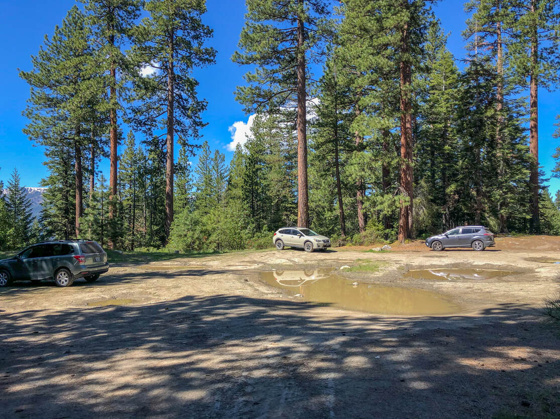
(Wagner Butte trailhead parking)
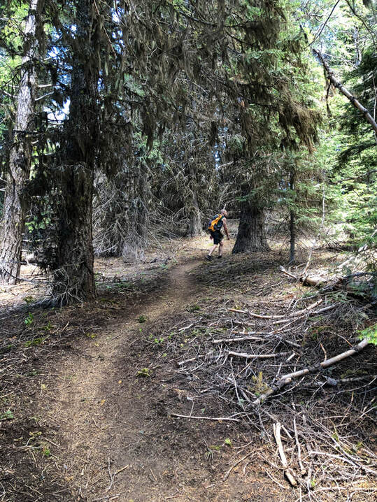
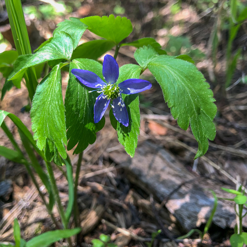
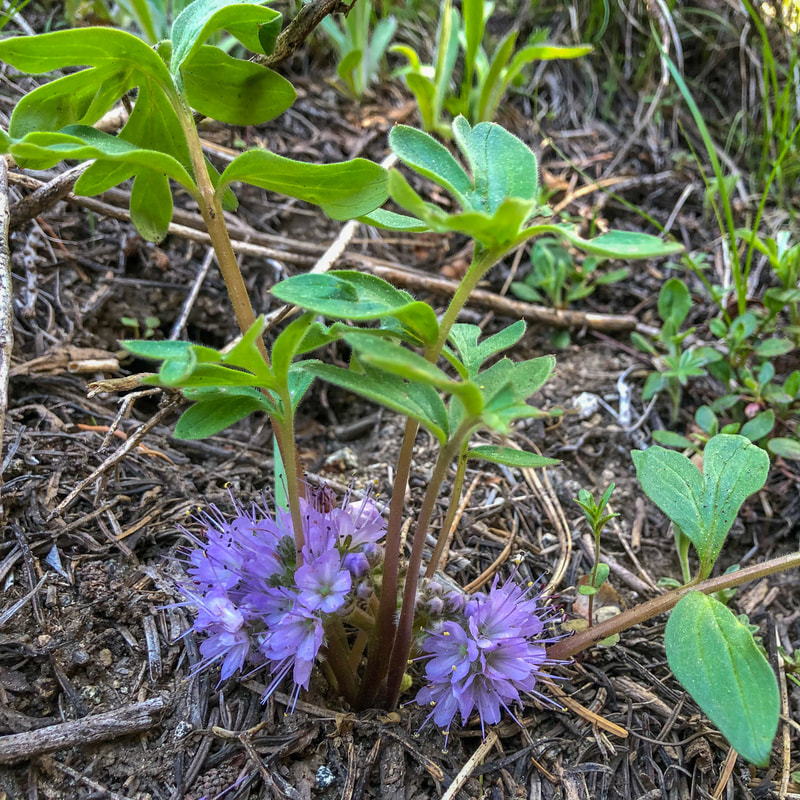
Description:

Even though Wagner Butte is on the outskirts of Ashland, it feels like you are in a very remote area. The drive to the trailhead is steep and dusty, as you climb to almost 5,000 feet elevation to start the hike. The circular parking lot is very large with plenty of space for cars and horse trailers. To start the hike, cross the road and the trail starts off pretty steep as the trail takes you through a very dry forest. During the beginning of June you will start to see wildflowers popping up already, such as Anemone and Ball-head waterleaf, and the bird song in these Southern Oregon forests is absolutely incredible!
Beginning of Wagner Butte Trail
First wildflower meadow along the Wagner Butte Trail
Anemone wildflower
(Anemone)
Ball-head waterleaf wildflower
(Ball-head waterleaf)
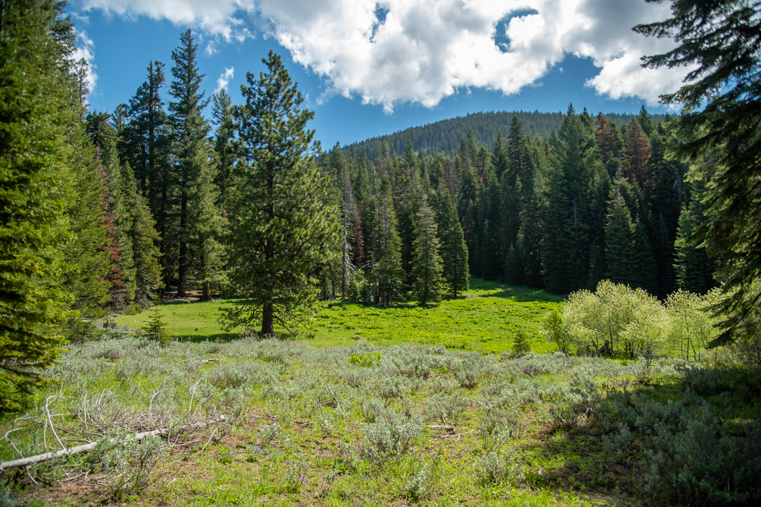
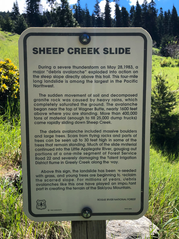
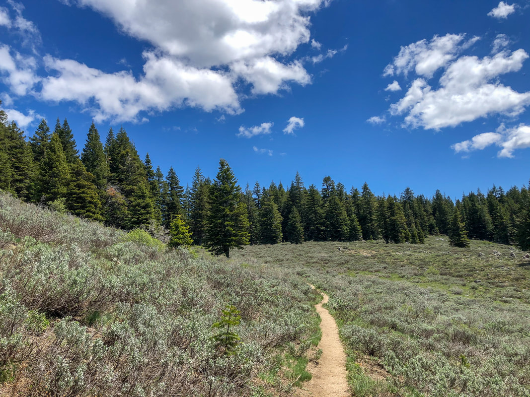
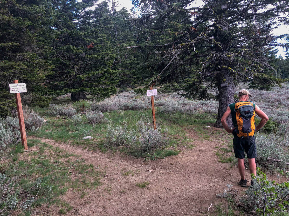
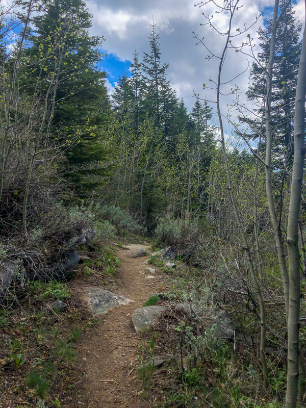
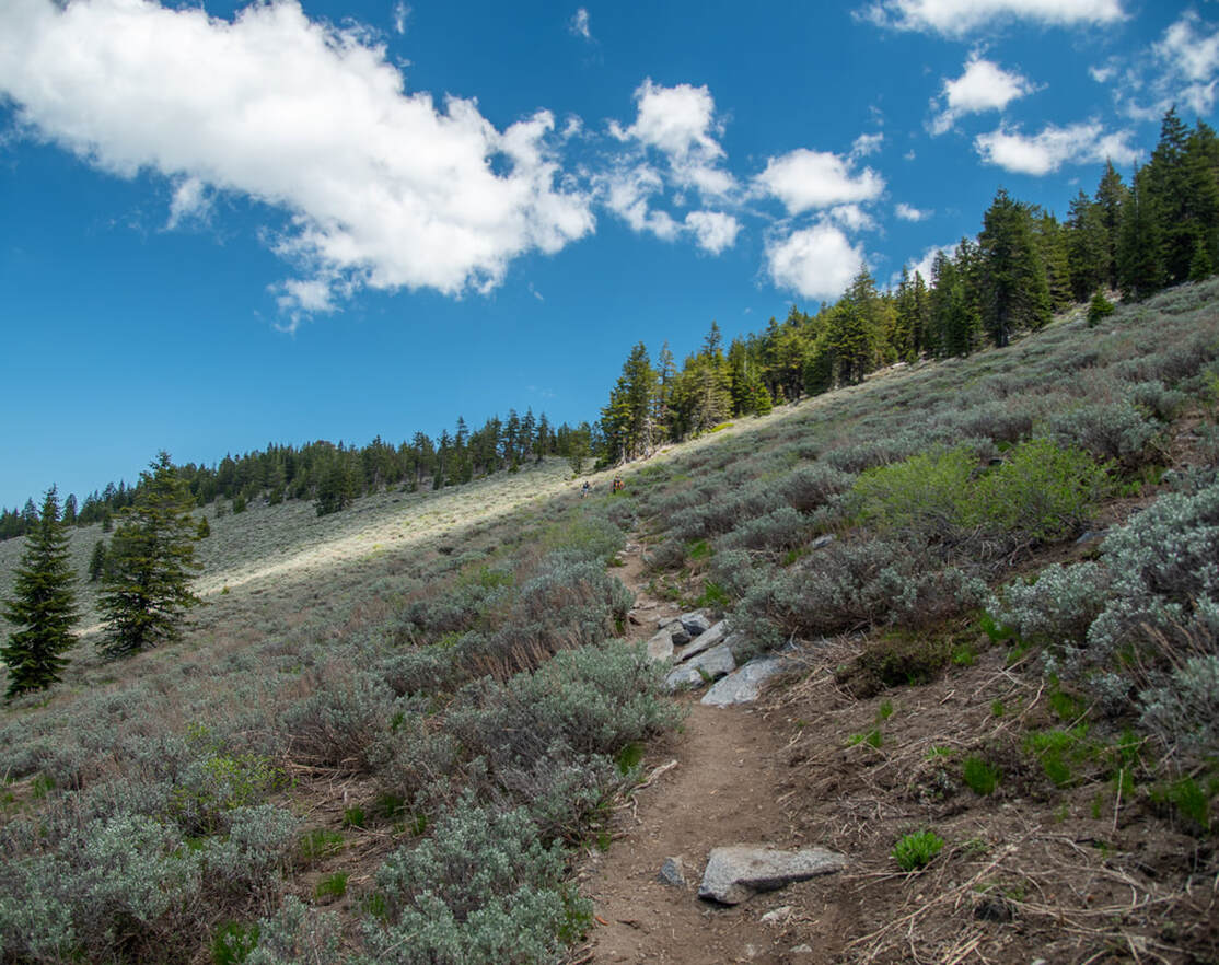
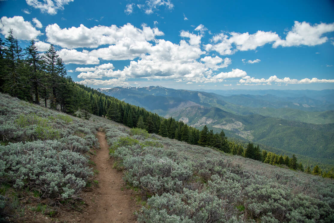
After 0.8 miles you will come to your first meadow where you will get views of Wagner Butte. The trail skirts the outer edge of the meadow, before cornering to the right and climbing up a steep side hill. This is where in 1983 an enormous landslide happened. You will see an informational sign about it along the way. The hillside has since been covered in grasses. For the next 1.4 miles, the trail goes in and out of the forest and occasionally crosses beautiful meadows and Corral Creek and Jim Creek. After 1.4 miles the trail starts to switchback up into a more arid terrain. There are a total of 10 short switchbacks through sagebrush meadows and the views to the west become more open.
Sheep creek slide information sign Wagner Butte
Wildflower meadow Wagner Butte Trail
Approaching Wagner Glade Gap
Wagner Glade Gap trail split
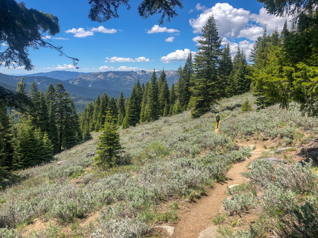
At the 3.3 mile mark you will arrive at a saddle called Wagner Glade Gap. Follow the trail to the left to continue going up to the Wagner Butte summit. Over the next 1.7 miles you will hike through a grove of mountain mahogany trees as well as a grove of quaking aspen trees. After being surrounded by Douglas fir trees, these are both a unique sight to see. You will hike the last little stretch through another sagebrush meadow as you continue to gain elevation. Wagner Butte actually has two summits, the taller summit is actually not the viewpoint summit and you will bypass it on the way to the lower summit where a fire lookout once stood. 
Wagner Butte Trail hike
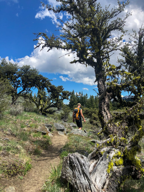
(Mountain Mahogany trees)
Aspen trees Wagner Butte
(quaking aspen trees)
Wagner Butte approach
(approach meadow to Wagner Butte viewpoint)
Rock formations Wagner Butte Trail
Wagner Butte summit approach
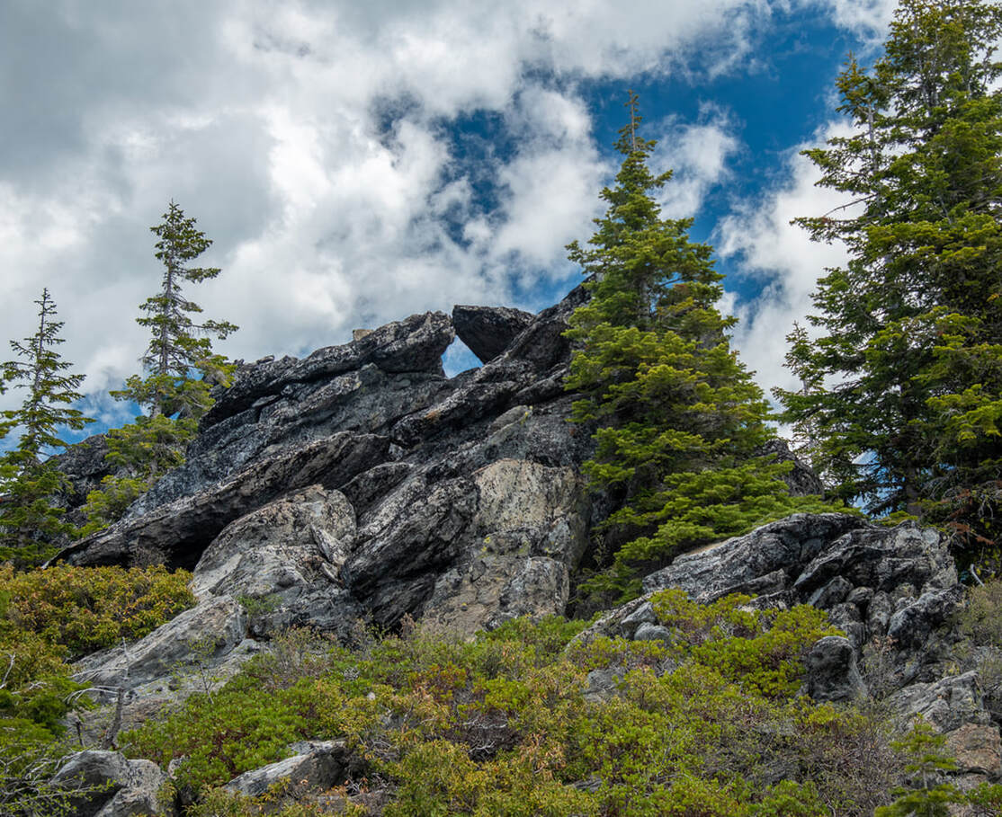
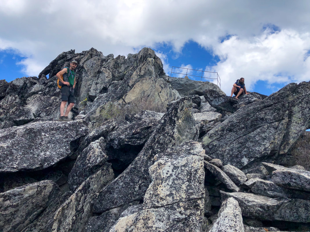
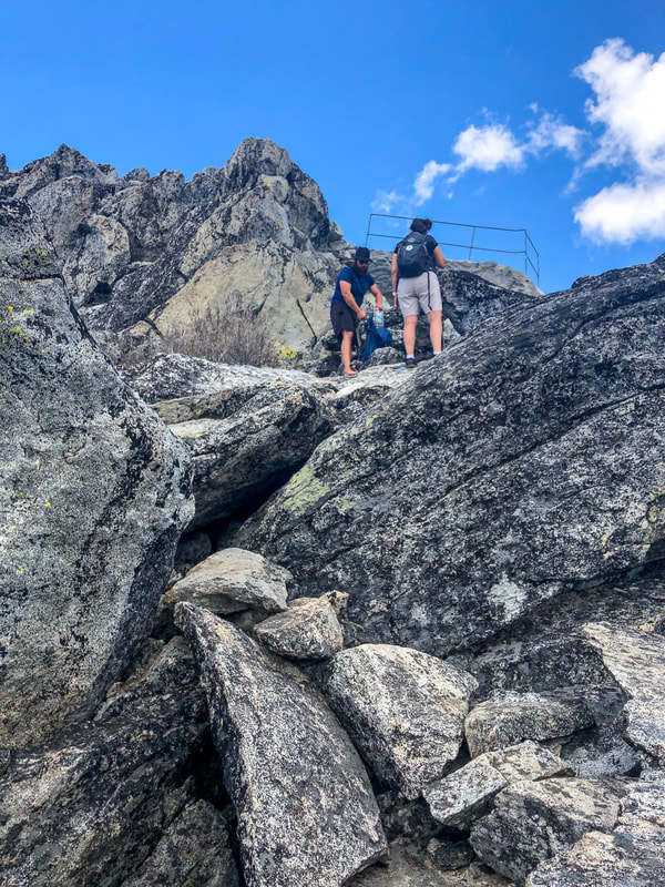
The final climb to the summit can be a little intimidating as you have to scramble up large granite rocks to get to the viewpoint. The climb is worth it and the view is outstanding! 
climbing up to the summit of Wagner Butte
Wagner Butte summit panorama
Wagner Butte summit looking northeast
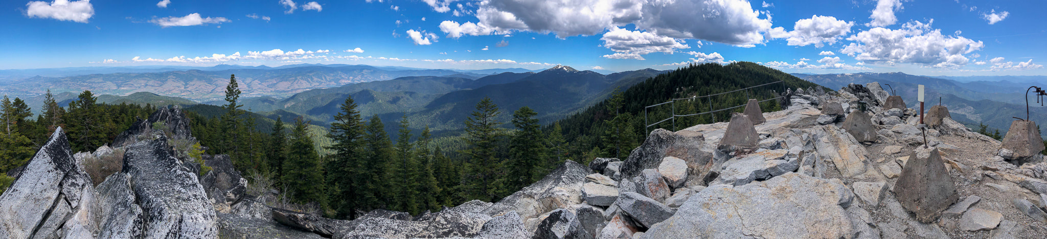
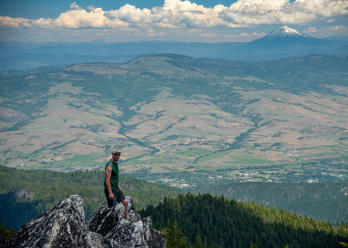
(Ashland below and Mount McLoughlin in the distance)
You can see the Rogue Valley below as well as the town of Ashland. Mount McLoughlin and Crater Lake's Rim to the east are very prominent, and to the south you can see Mount Ashland and Mount Shasta beyond. A fire lookout was built here at Wagner Butte in 1923. They flattened the top so that the lookout could be built easier, but two years later, a winter storm would almost blow the lookout off the mountain so they had to repair it the following spring. The use of the fire lookout was discontinued by 1964, and in 1971 they dismantled it completely. The only remnants of it that are still there are the cement feet that the lookout stood on. 
Wagner Butte summit looking southwest
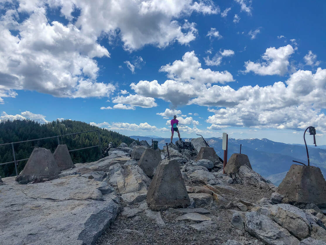
(Wagner Butte summit)
Mount Ashland and Mount Shasta from Wagner Butte summit
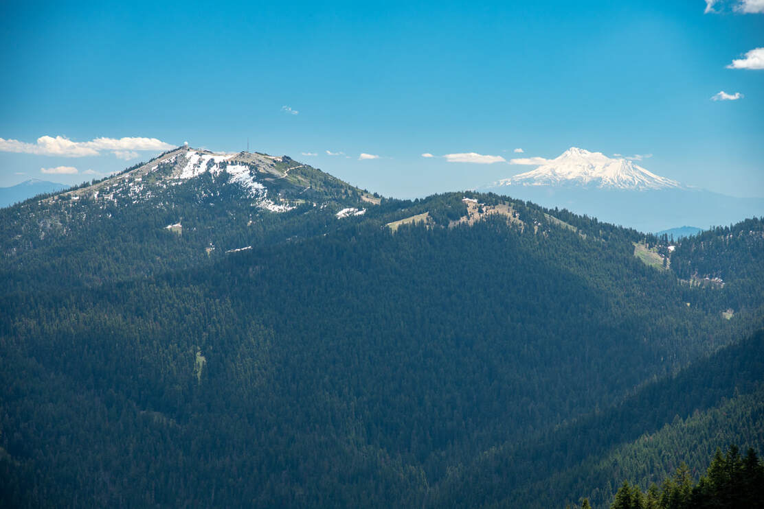
(Mount Ashland and Mount Shasta)
After enjoying the incredible views of Southern Oregon, reapply your sunscreen and go back down the way you came. Be careful coming down the granite rocks from the summit. It is oftentimes harder coming down than it is climbing up. On the way down you will get to enjoy views towards the southwest across the sagebrush meadows that you didn't get to see on the way up. 
The Wagner Butte hike is a wonderful excursion for those who want to do a longer day hike. It is rated as difficult because of the mileage and elevation gain. Be prepared for heat, and it may be wise to carry a water filter with you so that you can filter some nice cold water on the way back down at either Jim Creek or Corral Creek if you run out. Especially during the months of June, July, August and September, Southern Oregon can be extremely hot and dry. Wagner Butte is an excellent viewpoint hike, but it is also a really great place to see some wildflowers and some unique trees such as the quaking aspen and mountain mahogany, which you don't get to see every day. 
Wagner Butte trail view to the southwest

Directions:

​From Medford
  • ​Drive on I-5 S for a total of 5.5 miles, then take exit 21 towards Talent. Turn right onto W Valley View Rd. for 0.5 miles, then at the traffic circle, take the 1st exit onto E Main St. for 0.5 miles. Make a left onto Wagner Creek Rd. for 0.3 miles, then turn right to stay on Wagner Creek Rd. for another 7 miles. Turn left onto Brick Pile Rd/NF-22 for 3.6 miles to the trailhead parking on your right. (Total of 20.1 miles)
From Bend
  • Drive US-97 S for a total of 74.5 miles, then turn right onto OR-138 W for 17.8 miles. Turn left onto OR-230 S for 23.7 miles, then Turn right onto Rogue Valley Exp. for 4.3 miles. Make a slight right onto OR-62 W for 0.8 miles, then merge onto I-5 S for 8.9 miles. Take exit 21 towards Talent and then right onto W Valley View Rd. for 0.5 miles, then at the traffic circle, take the 1st exit onto E Main St. for 0.5 miles. Make a left onto Wagner Creek Rd. for 0.3 miles, then turn right to stay on Wagner Creek Rd. for another 7 miles. Turn left onto Brick Pile Rd/NF-22 for 3.6 miles to the trailhead parking on your right. (Total of 193 miles)
From Eugene
  • Total of 187 miles via Medford.
From Portland
  • ​Total of 292 miles via Medford.​
To get a more in-depth and personal view of this hike, watch the YouTube video.
-This trail write-up was last updated June, 2022-
​*All pictures are taken by Franziska Weinheimer
*Disclaimer: The trail descriptions, mileage, GPS tracks and difficulty ratings depicted on this website are never 100% accurate. Always hike at your own risk, using your own knowledge, equipment and common sense. Franziska Weinheimer/Hike Oregon are not responsible if you or anyone in your party gets injured or lost while attempting one of these or any other hikes.

HIKED HERE RECENTLY? PLEASE LEAVE A TRIP REPORT BELOW:

© Hike Oregon 2023
P.O. Box 41911
​Eugene, OR 97404
Proudly powered by Weebly
  • Home
  • *Store*
  • About the author
  • How to use this site
  • Resources
    • Wildflowers
    • Videos
  • Best Oregon Hikes
    • Top Fall Foliage Hikes In Oregon
    • Top 10 Oregon Fall Hikes
    • 20 Best Oregon Waterfall Hikes
    • Top 10 Oregon Hikes for Kids
    • Sno-Parks In Central Oregon
    • Top 10 Oregon Winter Hikes
    • Top Low Elevation Winter Hikes
    • 9 Amazing Oregon Summit Hikes
    • 20 Central Oregon Day Hikes
    • 20 Epic Oregon Wildflower Hikes
    • 5 Weekend Backpacking Trips in Oregon
    • Top One Night Backpacking Trips in Oregon
    • Top 10 Oregon Summer Hikes
    • Top 10 Swimming Spots In Oregon
    • Top 10 Oregon Spring Hikes
  • Oregon Sno-Parks
    • Maxwell Sno-Park
    • Potato Hill Sno-Park
    • Ray Benson Sno-Park
      • Brandenburg Shelter
    • Santiam Sno-Park
    • Three Creek Sno-Park
    • Virginia Meissner Sno-Park
      • Meissner Shelter Loop
      • Nordeen Shelter
    • Gold Lake Sno-Park
      • Westview Shelter to Eagle Rock Overlook
      • Marilyn Lakes Loop
  • Southern Washington
    • Hamilton Mountain
    • Dog Mountain
    • Coyote Wall
    • Mount St. Helens
  • Portland
    • Powell Butte
    • Forest Park
    • Latourell Falls
    • Multnomah/Wahkeena Falls
    • Eagle Creek
    • Mitchell Point
    • Table Rock
    • Tamanawas Falls
    • Trillium Lake
    • East Zigzag Mountain (members only)
  • Salem
    • Abiqua Falls
    • Silver Falls State Park
    • Dome Rock
    • Marion Lake to Marion Mountain
    • Jefferson Park
  • Corvallis
    • Marys Peak East Ridge
    • Marys Peak North Ridge
    • Alsea Falls and Green Peak Falls
    • Corvallis to Sea Trail - Sugarbowl Creek segment (members only)
  • Sweet Home
    • Crescent Mountain
    • Iron Mountain
    • McDowell Creek Falls
    • Middle Santiam River (members only)
    • Lower Soda Creek Falls (members only)
    • Rooster Rock (members only)
  • McKenzie Bridge/Blue River
    • Macduff Mountain
    • Proxy Falls
    • Clear Lake
    • Sahalie/Koosah Falls
    • Blue Pool
    • Erma Bell Lakes
    • Olallie Mountain
    • Horsepasture Mountain
    • Tidbits Mountain
    • Castle Rock
    • Lowder Mountain (members only)
    • East Fork Trail (members only)
    • Rainbow Falls Overlook (members only)
    • Frissell Point (members only)
    • Chucksney Mountain (members only)
    • Substitute Point (members only)
  • Sisters/Santiam Pass
    • Coffin Mountain
    • Trappers Butte and Scar Mountain
    • Maxwell Butte
    • Black Butte
    • Whychus Creek Trail
    • Tam McArthur Rim
    • Black Crater
    • Scott Mountain
    • Obsidian Trail
    • Metolius Preserve
    • Three Fingered Jack Loop
    • Square Lake
    • Canyon Creek Meadows
    • Patjens Lakes
    • Craig Lake (members only)
    • Chush Falls (members only)
    • Rockpile Lake (members only)
    • Santiam Lake (members only)
    • Camp Lake (members only)
    • Park Meadow to Golden Lake (members only)
  • Bend/Redmond/LaPine
    • Steins Pillar
    • Chimney Rock
    • Steelhead Falls
    • Tumalo State Park
    • Tumalo Falls
    • Tumalo Mountain
    • No Name Lake
    • Green Lakes
    • Moraine Lake
    • South Sister Summit
    • Horse Lake
    • Muskrat Lake
    • Paulina Peak
    • Peter Skene Ogden Trail (members only)
  • Eugene
    • Ridgeline Trail
    • Mount Pisgah Summit
    • Mount Pisgah Arboretum
    • Shotgun Creek
    • Mount June
    • Lawler
    • Tire Mountain
    • Goodman Creek
    • Brice Creek
    • Trestle Creek Falls
    • Moon Falls
    • Elijah Bristow State Park
    • South Willamette Trail (members only)
    • Eula Ridge (members only)
    • Eagle's Rest (members only)
  • Oakridge
    • Deception Creek
    • North Salmon Creek
    • Grasshopper Ridge
    • Larison Creek
    • Bunchgrass Ridge
    • Salt Creek Falls
    • Waldo Lake Loop
    • South Waldo Loop
    • The Twins
    • Rosary Lakes
    • Yoran Lake
    • Fawn Lake
    • Windy Lakes
    • Divide Lake
    • Diamond Peak Summit
    • Cowhorn Mountain
    • Wall Creek Warm Springs (members only)
    • Moon Point (members only)
    • Bobby Lake (members only)
    • Lillian Falls (members only)
    • Middle Fork Willamette Trail (members only)
    • Pool Creek Falls (members only)
    • Dead Mountain (members only)
    • Larison Rock (members only)
    • Quinn Lakes & Eddeeleo Lakes (members only)
    • Waldo Mountain Lookout (members only)
    • Blair Lake to Spring Prairie (members only)
    • Rigdon Lakes loop (members only)
  • Oregon Coast
    • Cascade Head
    • Drift Creek Falls
    • Sweet Creek Falls
    • Beaver Creek Falls
    • Kentucky Falls
    • Hobbit Trail to Heceta Head
    • Valley Trail to China Creek
    • North Fork Smith River (members only)
    • Cummins Ridge (member's only)
    • Horse Creek (members only)
    • Siltcoos Lake (members only)
  • Southern Oregon
    • Fall Creek Falls
    • Watson Falls
    • Wild Rogue Loop
    • Mt. Thielsen
    • Crater Lake National Park
      • The Watchman
      • Mount Scott
      • The Pinnacles
    • Lower Table Rock
    • Pilot Rock
    • Wagner Butte
    • Mt. McLoughlin
    • Lemolo Falls (members only)
    • Fern Falls (members only)
  • Eastern Oregon
    • Painted Cove
    • Anthony Lake Loop
    • Mount Howard
    • Eagle Cap summit
    • Schneider Cabin (members only)
    • Strawberry Lake & Strawberry Falls (members only)
  • Oregon PCT sections
  • Tips & Tricks
    • Leave No Trace
    • How To Pick The Right Backpacking Tent
    • Top Tips For Hiking With Infants And Toddlers
    • Poison Oak, Ivy and Sumac
    • How to dress for cold weather hikes
    • Outdoorsy Holiday Gift Guide 2022
    • Hiker Holiday Gift Guide 2019
    • Outdoor Holiday Gift Guide 2018
    • Hiking Holiday Gift Guide 2017
  • Reviews/Gear
    • Stay Kühl This Summer
    • Outdoor Herbivore Backpacking Food Review
    • Osprey Aura AG 65 Backpack review
    • Big Agnes Fly Creek UL2 review
    • REI Quarter Dome 1 review
  • Adventure Stories
    • Hiking The Rae Lakes Loop
    • 110 Miles on the PCT
    • Three Fingered Jack Adventures
    • Jefferson Wilderness