
Little North Santiam
Hike details:
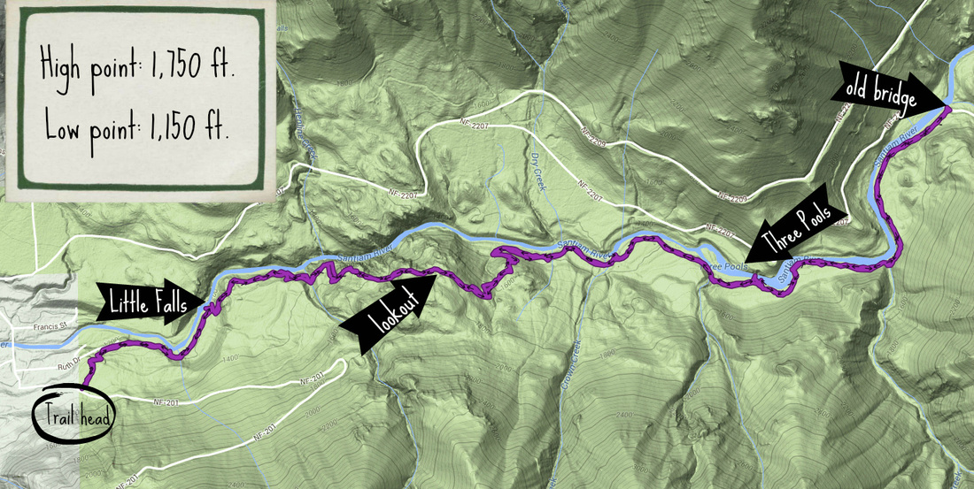
Mileage: 9 miles out and back w/ 2,260 ft. elevation gain
Approximate hike time: 4 hours 30 minutes w/ an average pace of 2 mph
Difficulty: Moderate
Trail usage: Low to medium on winter days, high on hot summer weekends
General location: 37 miles east of Salem off of North Santiam Hwy. 22 - Willamette National Forest
Suggested seasons: Spring, summer, fall, winter
(Best time to go is winter and early spring, because there might be a nice dusting of snow in the winter, and in early spring all of the leaves start popping making the trail extremely green. There are also less people during these seasons).
Permits required: Annual Northwest Forest Pass for parking
Pit toilet at trailhead: N/A
Trail allows: Dogs, camping
Description:
The Little North Santiam River is an extremely popular area, especially for Salem residents who flock here in the summer to swim and cool off. So if you are looking for a great hike where you will not see very many people, try the Little North Santiam Trail #3338 in the late fall, winter and early spring.
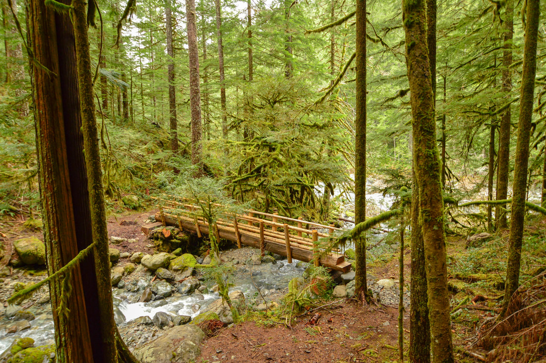
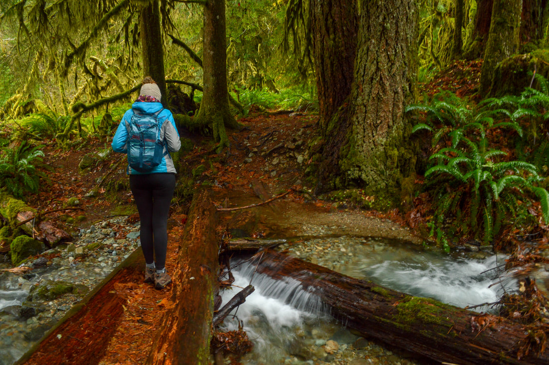
If you are looking at the map, you may notice that this hike crosses a total of 5 streams, which depending on the time of year can get quite big. However, there is nothing to worry about, the popularity of this hike makes it so that it is very well maintained and all of the creek crossings have sturdy well-kept bridges to cross. There is one creek where the bridge is down, but it is one of the smallest creeks of the hike and easy to cross even in the winter and spring.
If you are looking at the map, you may notice that this hike crosses a total of 5 streams, which depending on the time of year can get quite big. However, there is nothing to worry about, the popularity of this hike makes it so that it is very well maintained and all of the creek crossings have sturdy well-kept bridges to cross. There is one creek where the bridge is down, but it is one of the smallest creeks of the hike and easy to cross even in the winter and spring.
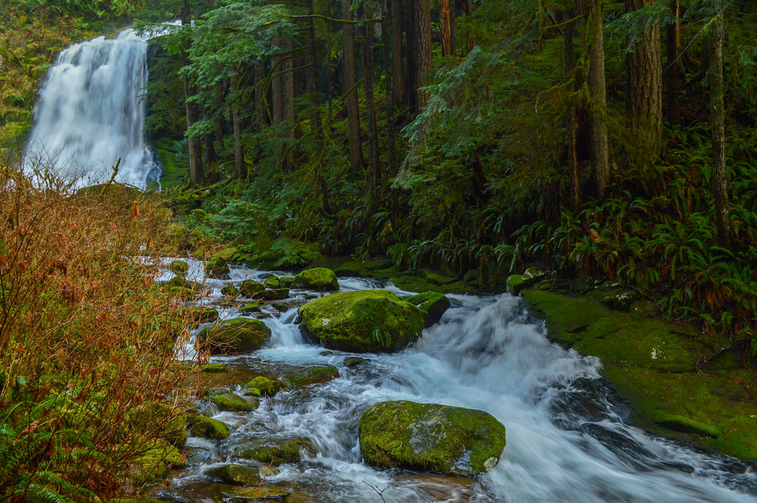
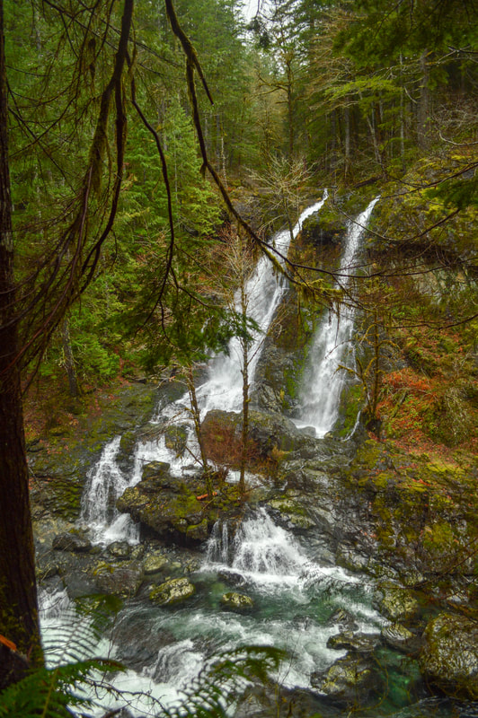
(Little Falls)
The first 0.7 miles of this hike are easy, as the trail traverses through thick Douglas fir forest. Here there is a small side trail that leads down to what is called Little Falls. This little detour is a must (you can walk out onto a rock that is in the middle of the river).
(view of Little Falls from the trail above)
|
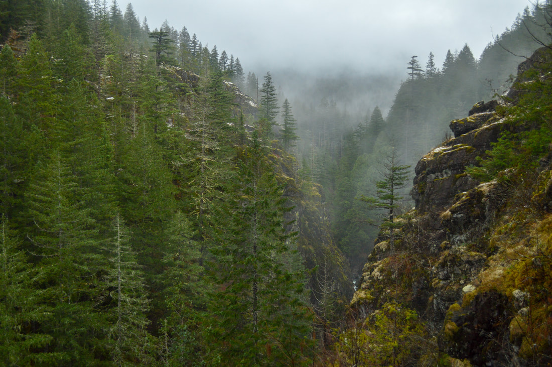
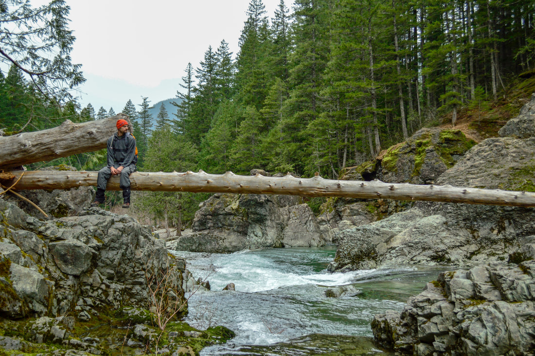
Shortly after Little Falls, the trail starts heading uphill. You will hear a waterfall and you can take a small side trail to see Henline Creek flow into the Little North Santiam River. This is a little-known gem along this trail that one should definitely keep an eye out for. During the next 1.3 miles, the trail gets pretty steep, with amazing views into the narrow river canyon. From a viewpoint you can see Henline Mountain. After the viewpoint, the switchbacks take you back down 1.3 miles to the river bank and to the next thing to marvel at along this hike. |
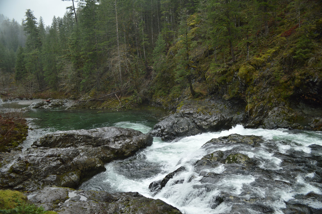
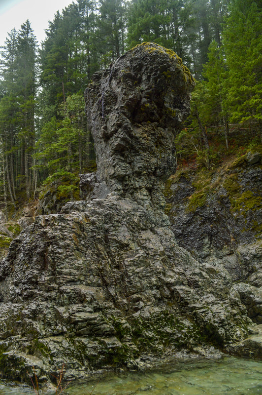
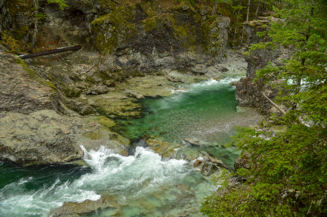
At around the 3.3 mile mark, you will see a large rock sculpture rise from the water. Although this rock does not have a name, this area of the river is well known as Three Pools, as there are three very beautiful deep turquoise pools within a half mile stretch of the river. Near the rock spire, there is a really cool cave which the river has formed from years of reaching high water levels and ripping around the bend.
|
|
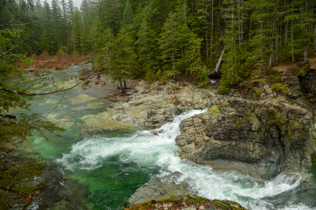
(Three Pools)
|
|
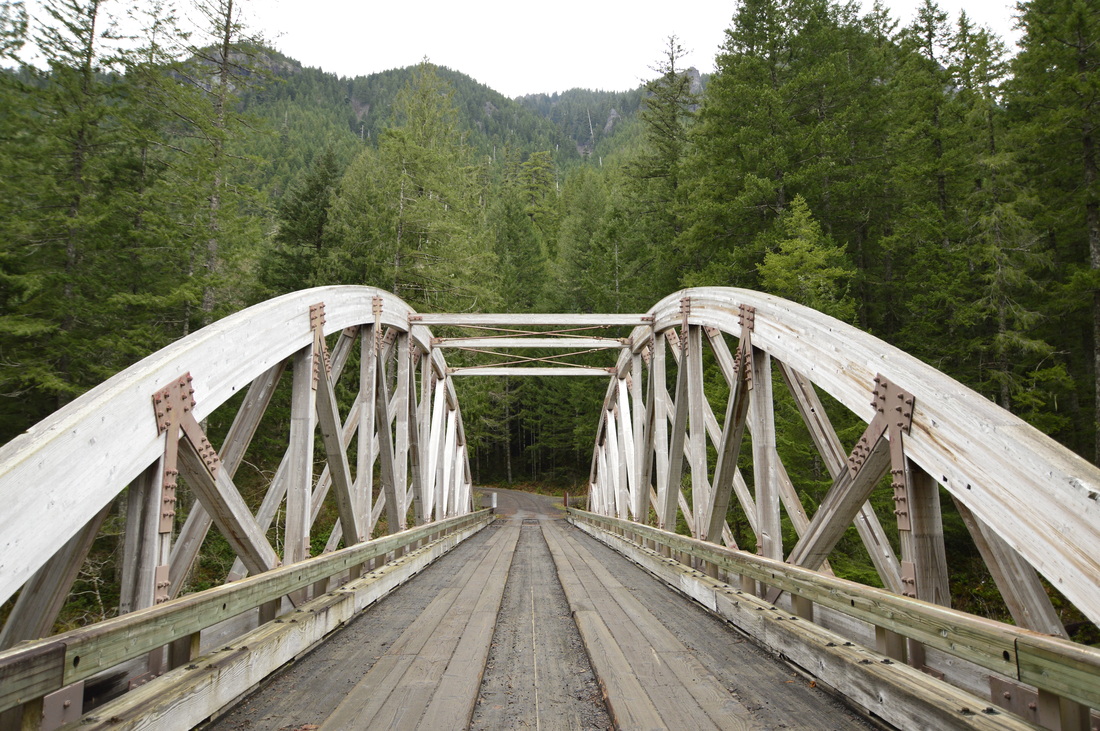
After another 1.2 miles through forest, the trail ends at Road 2207 where a historic wooden bridge was rebuilt in 1991 so cars could drive across the river. If you cross the bridge here you will come to beautiful Shady Cove Campground, in case you want to make this into an overnight trip. This campground is on a particular idyllic part of the river.
|
All of the beaches that you see on your way along this trail are gorgeous, and many of them look like tropical places because of the magical turquoise water. This place is definitely tempting to hike in warmer months when you could swim here, however be aware that there are hundreds of folks who flock here during the hot summer months.
|
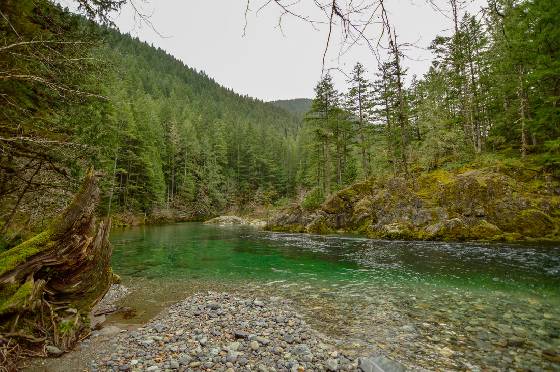
(Idyllic pebble beach lunch spot right before Three Pools)
Overall, this is a spectacular hike! The trail is very well maintained and the tread is easy to walk on. There is one 2.5 mile stretch where it does get a bit steep, but overall it is not too difficult. This hike is marked as 'moderate' because of its length and elevation gain. You can make this into a short and sweet backpacking trip by spending the night at Shady Cove Campground, or by continuing the extra mile down the trail past the bridge and camping. If you have smaller children but still want to experience this close to Salem gem, you can always drive to the campground and start there, doing the 1.2 easy miles to the Three Pools area.
*As of May 26, 2017 the US Forest Service has approved a new law which prohibits any fires at any of the primitive campsites along the trail and along Little North Santiam River.
*As of May 26, 2017 the US Forest Service has approved a new law which prohibits any fires at any of the primitive campsites along the trail and along Little North Santiam River.
Directions:
From Salem
- Drive 23 miles east of Salem on N. Santiam Hwy 22 until you reach the town of Mehema's second flashing yellow light. Turn left onto Little North Fork Rd. for 14.5 miles. Turn right onto Elkhorn Dr. SE which is gravel and looks like someone's driveway. Cross a bridge and continue .4 miles, then park at the turnout on your left. (Total of 40.2 miles)
- From Eugene drive north on I-5 and then take exit 233 for US-20 towards Albany/Lebanon. Turn left onto US-20 E/Santiam Hwy. SE for 5.4 miles and then stay left on OR-226 E. and stay on this road for 25.2 miles until you get to Hwy. 22 and turn right. until you reach the town of Mehema's second flashing yellow light. Turn left onto Little North Fork Rd. for 14.5 miles. Turn right onto Elkhorn Dr. SE which is gravel and looks like someone's driveway. Cross a bridge and continue .4 miles, then park at the turnout on your left. (Total of 88.6 miles)
- From Bend drive on Hwy. 97 north towards Redmond and then merge onto US-20 west towards Sisters. After driving through the town of Sisters continue on US-20 for another 25 miles and then take a slight right onto OR-22 west towards Detroit for 48.5 miles. In the town of Gates turn right onto Gates Hill Rd. for 3.7 miles and then turn right onto N. Fork Rd. for another 4.3 miles. Turn right onto Elkhorn Dr. SE which is gravel and looks like someone's driveway. Cross a bridge and continue 0.4 miles, then park at the turnout on your left. (Total of 106 miles)
- From Portland it is a total of 85.9 miles via Salem.
- From Medford it is a total of 252 miles via Eugene and Salem.
|
To get a more in-depth and personal view of this hike, watch the YouTube video.
|
*All pictures are taken by Franziska Weinheimer
*Disclaimer: the trail descriptions, mileage, GPS tracks and difficulty ratings depicted on this website are never 100% accurate. Always hike at your own risk, using your own knowledge, equipment and common sense. Franziska Weinheimer/Hike Oregon are not responsible if you or anyone in your party gets injured or lost while attempting one of these or any other hikes.
|